

Sawtooth Range (Idaho)
Encyclopedia
The Sawtooth Range is part of the Rocky Mountains
, located within a few miles south of Stanley
, Idaho
, in the Western
United States
. Much of mountain range is within the Sawtooth Wilderness
, part of the Sawtooth National Recreation Area
. The Sawtooth Wilderness includes parts of four counties: Custer
, Boise
, Blaine
, and Elmore
.
The mountains encompass an area of 678 square miles (1,756 km²) and the two highest peaks in the Sawtooths are the 10751 feet (3,277 m) Thompson Peak
and the 10716 feet (3,266 m) Mount Cramer
.
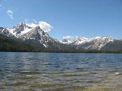
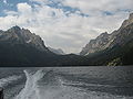
 There are hundreds of lakes in the Sawtooth Mountains that have been created by alpine glaciers. The largest lakes are Redfish Lake
, Alturas Lake
, Pettit Lake
, Yellow Belly Lake
, Stanley Lake
, and Sawtooth Lake
. There is a more complete list of lakes under Lakes of the Sawtooth Mountains.
area. Iron Creek is a smaller popular campsite located at the bottom of the range. There is a larger amount of camping available at the nearby Redfish Lake
and Little Redfish Lake
campgrounds. Camping is permitted anywhere in the wilderness, although it is recommended that people camp where others have camped previously. Restrictions on fires and animals apply in some areas.
mapped the recently-discovered Sawtooth Fault
near the base of the mountains and found that it could produce an earthquake
measuring up to magnitude 7.5 on the Richter scale. Two past large earthquakes likely took place on the fault around 7,000 and 4,000 years b.p
. The fault stretches 40 mi (64.4 km) long, and runs near Stanley, Idaho
and Redfish Lake
, and the potential future earthquake would also be felt in Boise.
Rocky Mountains
The Rocky Mountains are a major mountain range in western North America. The Rocky Mountains stretch more than from the northernmost part of British Columbia, in western Canada, to New Mexico, in the southwestern United States...
, located within a few miles south of Stanley
Stanley, Idaho
Stanley is a city in Custer County, Idaho, United States. The population was 100 at the 2000 census. The center of population of Idaho is located in Stanley.-Geography:...
, Idaho
Idaho
Idaho is a state in the Rocky Mountain area of the United States. The state's largest city and capital is Boise. Residents are called "Idahoans". Idaho was admitted to the Union on July 3, 1890, as the 43rd state....
, in the Western
Western United States
.The Western United States, commonly referred to as the American West or simply "the West," traditionally refers to the region comprising the westernmost states of the United States. Because the U.S. expanded westward after its founding, the meaning of the West has evolved over time...
United States
United States
The United States of America is a federal constitutional republic comprising fifty states and a federal district...
. Much of mountain range is within the Sawtooth Wilderness
Sawtooth Wilderness
The Sawtooth Wilderness is located in the U.S. state of Idaho. Managed by the U.S. Forest Service in the Sawtooth National Recreation Area. The Wilderness was upgraded in 1972 from "primitive area" status, affording greater protections of the habitat...
, part of the Sawtooth National Recreation Area
Sawtooth National Recreation Area
The Sawtooth National Recreation Area is a National Recreation Area located in central Idaho, within the Boise, Challis, and Sawtooth National Forests. The recreation area is managed by the U.S. Forest Service and includes the Sawtooth Wilderness...
. The Sawtooth Wilderness includes parts of four counties: Custer
Custer County, Idaho
Custer County is a rural mountain county located in the center of the U.S. state of Idaho. Established in 1881, it was named for the General Custer Mine, where gold was discovered five years earlier . The population was 4,342 at the 2000 census; it is estimated to have fallen to 4,166 by 2007...
, Boise
Boise County, Idaho
Boise County is a rural mountain county in the U.S. state of Idaho. The population was 6,670 at the 2000 census; it was estimated at 7,571 in 2007...
, Blaine
Blaine County, Idaho
Blaine County is a county located in the U.S. state of Idaho. As of the 2010 Census the county had a population of 21,376. The county seat and largest city is Hailey. The county is home to the Sun Valley ski resort....
, and Elmore
Elmore County, Idaho
Elmore County is a county located in the U.S. state of Idaho. As of the 2010 Census the county had a population of 27,038, down 7.2% from 29,130 in 2000. The largest city and county seat is Mountain Home....
.
The mountains encompass an area of 678 square miles (1,756 km²) and the two highest peaks in the Sawtooths are the 10751 feet (3,277 m) Thompson Peak
Thompson Peak (Idaho)
Thompson Peak, at high is the highest peak in the Sawtooth Range of Idaho. The top of Thompson Peak is located within Custer County, although some of the lower portion of the mountain is in Boise County. Thompson Peak is also located within the Sawtooth Wilderness portion of the Sawtooth...
and the 10716 feet (3,266 m) Mount Cramer
Mount Cramer
Mount Cramer, at high is the second highest peak in the Sawtooth Range of Idaho. The top of Mount Cramer is located on the border of Custer and Boise Counties. The peak is the highest point in Boise County. Mount Cramer is also located within the Sawtooth Wilderness portion of the Sawtooth...
.
Peaks
| Rank Ranking A ranking is a relationship between a set of items such that, for any two items, the first is either 'ranked higher than', 'ranked lower than' or 'ranked equal to' the second.... |
Mountain Peak Summit (topography) In topography, a summit is a point on a surface that is higher in elevation than all points immediately adjacent to it. Mathematically, a summit is a local maximum in elevation... |
Elevation | Prominence Topographic prominence In topography, prominence, also known as autonomous height, relative height, shoulder drop , or prime factor , categorizes the height of the mountain's or hill's summit by the elevation between it and the lowest contour line encircling it and no higher summit... |
Isolation Topographic isolation The topographic isolation of a summit is the minimum horizontal distance to the nearest point of higher elevation. Topographic isolation represents a radius of dominance in which the summit is the highest point. Topographic isolation can be calculated for small hills and islands as well as for... |
Location Geographic coordinate system A geographic coordinate system is a coordinate system that enables every location on the Earth to be specified by a set of numbers. The coordinates are often chosen such that one of the numbers represent vertical position, and two or three of the numbers represent horizontal position... |
Easiest Route Climbing route A climbing route is a path by which a climber reaches the top of a mountain, rock, or ice wall. Routes can vary dramatically in difficulty and, once committed to that ascent, can be difficult to stop or return. Choice of route can be critically important... |
|---|---|---|---|
| 1 | Thompson Peak Thompson Peak (Idaho) Thompson Peak, at high is the highest peak in the Sawtooth Range of Idaho. The top of Thompson Peak is located within Custer County, although some of the lower portion of the mountain is in Boise County. Thompson Peak is also located within the Sawtooth Wilderness portion of the Sawtooth... |
44.141534°N 115.010013°W | Class 3 Yosemite Decimal System The Yosemite Decimal System is a three-part system used for rating the difficulty of walks, hikes, and climbs. It is primarily used by mountaineers in the United States and Canada. The Class 5 portion of the Class scale is primarily a rock climbing classification system. Originally the system was... |
| 2 | Mount Cramer Mount Cramer Mount Cramer, at high is the second highest peak in the Sawtooth Range of Idaho. The top of Mount Cramer is located on the border of Custer and Boise Counties. The peak is the highest point in Boise County. Mount Cramer is also located within the Sawtooth Wilderness portion of the Sawtooth... |
44.011147°N 114.982491°W | Class 3 Yosemite Decimal System The Yosemite Decimal System is a three-part system used for rating the difficulty of walks, hikes, and climbs. It is primarily used by mountaineers in the United States and Canada. The Class 5 portion of the Class scale is primarily a rock climbing classification system. Originally the system was... |
| 3 | Decker Peak |
44.042773°N 114.967651°W | Class 3 Yosemite Decimal System The Yosemite Decimal System is a three-part system used for rating the difficulty of walks, hikes, and climbs. It is primarily used by mountaineers in the United States and Canada. The Class 5 portion of the Class scale is primarily a rock climbing classification system. Originally the system was... |
| 4 | Mickey’s Spire |
44.138368°N 115.012127°W | Class 4 Yosemite Decimal System The Yosemite Decimal System is a three-part system used for rating the difficulty of walks, hikes, and climbs. It is primarily used by mountaineers in the United States and Canada. The Class 5 portion of the Class scale is primarily a rock climbing classification system. Originally the system was... |
| 5 | Snowyside Peak |
43.938155°N 114.971267°W | Class 3 Yosemite Decimal System The Yosemite Decimal System is a three-part system used for rating the difficulty of walks, hikes, and climbs. It is primarily used by mountaineers in the United States and Canada. The Class 5 portion of the Class scale is primarily a rock climbing classification system. Originally the system was... |
| 6 | Williams Peak Williams Peak (Idaho) Williams Peak, at high is the 6th highest peak in the Sawtooth Mountains of Idaho and is located within the Sawtooth Wilderness portion of the Sawtooth National Recreation Area . The peak lies at 44.15240°N / 115.0057°W and is .75 miles north-northwest of Thompson Peak, the highest peak in the... |
44.152471°N 115.005751°W | Class 3 Yosemite Decimal System The Yosemite Decimal System is a three-part system used for rating the difficulty of walks, hikes, and climbs. It is primarily used by mountaineers in the United States and Canada. The Class 5 portion of the Class scale is primarily a rock climbing classification system. Originally the system was... |
| 7 | Mount Carter |
44.139835°N 115.018282°W | Class 2 Yosemite Decimal System The Yosemite Decimal System is a three-part system used for rating the difficulty of walks, hikes, and climbs. It is primarily used by mountaineers in the United States and Canada. The Class 5 portion of the Class scale is primarily a rock climbing classification system. Originally the system was... |
| 8 | Elk Peak |
44.024403°N 115.037317°W | Class 4 Yosemite Decimal System The Yosemite Decimal System is a three-part system used for rating the difficulty of walks, hikes, and climbs. It is primarily used by mountaineers in the United States and Canada. The Class 5 portion of the Class scale is primarily a rock climbing classification system. Originally the system was... |
| 9 | Dave’s Peak |
44.01933°N 114.97587°W | Class 4 Yosemite Decimal System The Yosemite Decimal System is a three-part system used for rating the difficulty of walks, hikes, and climbs. It is primarily used by mountaineers in the United States and Canada. The Class 5 portion of the Class scale is primarily a rock climbing classification system. Originally the system was... |
| 10 | Mount Sevy |
44.024622°N 114.973355°W | Class 5.4 Yosemite Decimal System The Yosemite Decimal System is a three-part system used for rating the difficulty of walks, hikes, and climbs. It is primarily used by mountaineers in the United States and Canada. The Class 5 portion of the Class scale is primarily a rock climbing classification system. Originally the system was... |
| 11 | Horstmann Peak |
44.112641°N 115.002095°W | Class 3 Yosemite Decimal System The Yosemite Decimal System is a three-part system used for rating the difficulty of walks, hikes, and climbs. It is primarily used by mountaineers in the United States and Canada. The Class 5 portion of the Class scale is primarily a rock climbing classification system. Originally the system was... |
| 12 | Mount Limbert |
44.133268°N 115.024098°W | Class 3 Yosemite Decimal System The Yosemite Decimal System is a three-part system used for rating the difficulty of walks, hikes, and climbs. It is primarily used by mountaineers in the United States and Canada. The Class 5 portion of the Class scale is primarily a rock climbing classification system. Originally the system was... |
| 13 | Peak 10,375 |
°N °W | Class 3 Yosemite Decimal System The Yosemite Decimal System is a three-part system used for rating the difficulty of walks, hikes, and climbs. It is primarily used by mountaineers in the United States and Canada. The Class 5 portion of the Class scale is primarily a rock climbing classification system. Originally the system was... |
| 14 | Braxon Peak |
44.093378°N 114.996857°W | Class 3 Yosemite Decimal System The Yosemite Decimal System is a three-part system used for rating the difficulty of walks, hikes, and climbs. It is primarily used by mountaineers in the United States and Canada. The Class 5 portion of the Class scale is primarily a rock climbing classification system. Originally the system was... |
| 15 | Peak 10,336 |
°N °W | Class 3 Yosemite Decimal System The Yosemite Decimal System is a three-part system used for rating the difficulty of walks, hikes, and climbs. It is primarily used by mountaineers in the United States and Canada. The Class 5 portion of the Class scale is primarily a rock climbing classification system. Originally the system was... |
| 16 | Moolack Mountain |
44.13012°N 115.05033°W | Class 3 Yosemite Decimal System The Yosemite Decimal System is a three-part system used for rating the difficulty of walks, hikes, and climbs. It is primarily used by mountaineers in the United States and Canada. The Class 5 portion of the Class scale is primarily a rock climbing classification system. Originally the system was... |
| 17 | Mount Iowa |
44.103632°N 114.998191°W | Class 3 Yosemite Decimal System The Yosemite Decimal System is a three-part system used for rating the difficulty of walks, hikes, and climbs. It is primarily used by mountaineers in the United States and Canada. The Class 5 portion of the Class scale is primarily a rock climbing classification system. Originally the system was... |
| 18 | Merritt Peak |
44.16160°N 115.02353°W | Class 4 Yosemite Decimal System The Yosemite Decimal System is a three-part system used for rating the difficulty of walks, hikes, and climbs. It is primarily used by mountaineers in the United States and Canada. The Class 5 portion of the Class scale is primarily a rock climbing classification system. Originally the system was... |
| 19 | Baron Peak |
44.123578°N 115.046409°W | Class 3 Yosemite Decimal System The Yosemite Decimal System is a three-part system used for rating the difficulty of walks, hikes, and climbs. It is primarily used by mountaineers in the United States and Canada. The Class 5 portion of the Class scale is primarily a rock climbing classification system. Originally the system was... |
| 20 | Red Bluff |
°N °W | Class 5.3 Yosemite Decimal System The Yosemite Decimal System is a three-part system used for rating the difficulty of walks, hikes, and climbs. It is primarily used by mountaineers in the United States and Canada. The Class 5 portion of the Class scale is primarily a rock climbing classification system. Originally the system was... |
| 21 | Perfect Peak |
43.91918°N 114.94718°W | Class 3 Yosemite Decimal System The Yosemite Decimal System is a three-part system used for rating the difficulty of walks, hikes, and climbs. It is primarily used by mountaineers in the United States and Canada. The Class 5 portion of the Class scale is primarily a rock climbing classification system. Originally the system was... |
| 22 | The Arrowhead |
44.019344°N 114.97611°W | Class 5.9 Yosemite Decimal System The Yosemite Decimal System is a three-part system used for rating the difficulty of walks, hikes, and climbs. It is primarily used by mountaineers in the United States and Canada. The Class 5 portion of the Class scale is primarily a rock climbing classification system. Originally the system was... |
| 23 | Packrat Peak |
44.058562°N 115.043519°W | Class 5.1 Yosemite Decimal System The Yosemite Decimal System is a three-part system used for rating the difficulty of walks, hikes, and climbs. It is primarily used by mountaineers in the United States and Canada. The Class 5 portion of the Class scale is primarily a rock climbing classification system. Originally the system was... |
| 24 | South Merritt Peak |
°N °W | Class 4 Yosemite Decimal System The Yosemite Decimal System is a three-part system used for rating the difficulty of walks, hikes, and climbs. It is primarily used by mountaineers in the United States and Canada. The Class 5 portion of the Class scale is primarily a rock climbing classification system. Originally the system was... |
| 25 | Mount Heyburn Mount Heyburn Mount Heyburn, at 10,299 feet is one of the many peaks in the Sawtooth Range of central Idaho. Mount Heyburn is located in Custer County and within the Sawtooth Wilderness portion of the Sawtooth National Recreation Area. The town of Stanley is located 8 miles north-northeast of Mount Heyburn... |
44.100979°N 114.978317°W | Class 5.5 Yosemite Decimal System The Yosemite Decimal System is a three-part system used for rating the difficulty of walks, hikes, and climbs. It is primarily used by mountaineers in the United States and Canada. The Class 5 portion of the Class scale is primarily a rock climbing classification system. Originally the system was... |
| 26 | Vienna Peak |
43.85080°N 114.85340°W | Class 3 Yosemite Decimal System The Yosemite Decimal System is a three-part system used for rating the difficulty of walks, hikes, and climbs. It is primarily used by mountaineers in the United States and Canada. The Class 5 portion of the Class scale is primarily a rock climbing classification system. Originally the system was... |
| 27 | Redfish Peak |
44.050203°N 114.990055°W | Class 3 Yosemite Decimal System The Yosemite Decimal System is a three-part system used for rating the difficulty of walks, hikes, and climbs. It is primarily used by mountaineers in the United States and Canada. The Class 5 portion of the Class scale is primarily a rock climbing classification system. Originally the system was... |
| 28 | Payette Peak |
43.99216°N 114.987318°W | Class 2 Yosemite Decimal System The Yosemite Decimal System is a three-part system used for rating the difficulty of walks, hikes, and climbs. It is primarily used by mountaineers in the United States and Canada. The Class 5 portion of the Class scale is primarily a rock climbing classification system. Originally the system was... |
| 29 | Cirque Lake Peak |
44.077949°N 115.050727°W | Class 4 Yosemite Decimal System The Yosemite Decimal System is a three-part system used for rating the difficulty of walks, hikes, and climbs. It is primarily used by mountaineers in the United States and Canada. The Class 5 portion of the Class scale is primarily a rock climbing classification system. Originally the system was... |
| 30 | Parks Peak |
43.96698°N 114.932446°W | Class 3 Yosemite Decimal System The Yosemite Decimal System is a three-part system used for rating the difficulty of walks, hikes, and climbs. It is primarily used by mountaineers in the United States and Canada. The Class 5 portion of the Class scale is primarily a rock climbing classification system. Originally the system was... |
| 31 | Peak 10,205 |
°N °W | Class 4 Yosemite Decimal System The Yosemite Decimal System is a three-part system used for rating the difficulty of walks, hikes, and climbs. It is primarily used by mountaineers in the United States and Canada. The Class 5 portion of the Class scale is primarily a rock climbing classification system. Originally the system was... |
| 32 | Warbonnet Peak |
44.078865°N 115.053889°W | Class 5.7 Yosemite Decimal System The Yosemite Decimal System is a three-part system used for rating the difficulty of walks, hikes, and climbs. It is primarily used by mountaineers in the United States and Canada. The Class 5 portion of the Class scale is primarily a rock climbing classification system. Originally the system was... |
| 33 | Mount Regan |
44.15978°N 115.061586°W | Class 4 Yosemite Decimal System The Yosemite Decimal System is a three-part system used for rating the difficulty of walks, hikes, and climbs. It is primarily used by mountaineers in the United States and Canada. The Class 5 portion of the Class scale is primarily a rock climbing classification system. Originally the system was... |
| 34 | Mount Underhill |
44.053144°N 115.046103°W | Class 4 Yosemite Decimal System The Yosemite Decimal System is a three-part system used for rating the difficulty of walks, hikes, and climbs. It is primarily used by mountaineers in the United States and Canada. The Class 5 portion of the Class scale is primarily a rock climbing classification system. Originally the system was... |
| 35 | Peak 10,160 |
°N °W | Class 3 Yosemite Decimal System The Yosemite Decimal System is a three-part system used for rating the difficulty of walks, hikes, and climbs. It is primarily used by mountaineers in the United States and Canada. The Class 5 portion of the Class scale is primarily a rock climbing classification system. Originally the system was... |
| 36 | Peak 10,129 |
°N °W | Class 2 Yosemite Decimal System The Yosemite Decimal System is a three-part system used for rating the difficulty of walks, hikes, and climbs. It is primarily used by mountaineers in the United States and Canada. The Class 5 portion of the Class scale is primarily a rock climbing classification system. Originally the system was... |
| 37 | Peak 10,127 |
°N °W | Class 2 Yosemite Decimal System The Yosemite Decimal System is a three-part system used for rating the difficulty of walks, hikes, and climbs. It is primarily used by mountaineers in the United States and Canada. The Class 5 portion of the Class scale is primarily a rock climbing classification system. Originally the system was... |
| 38 | Imogene Peak |
43.993476°N 114.935191°W | Class 3 Yosemite Decimal System The Yosemite Decimal System is a three-part system used for rating the difficulty of walks, hikes, and climbs. It is primarily used by mountaineers in the United States and Canada. The Class 5 portion of the Class scale is primarily a rock climbing classification system. Originally the system was... |
| 39 | The Coffin |
44.02891°N 114.97332°W | Class A1 Yosemite Decimal System The Yosemite Decimal System is a three-part system used for rating the difficulty of walks, hikes, and climbs. It is primarily used by mountaineers in the United States and Canada. The Class 5 portion of the Class scale is primarily a rock climbing classification system. Originally the system was... |
| 40 | Cirque Peak |
°N °W | Class 5.9 A1 Yosemite Decimal System The Yosemite Decimal System is a three-part system used for rating the difficulty of walks, hikes, and climbs. It is primarily used by mountaineers in the United States and Canada. The Class 5 portion of the Class scale is primarily a rock climbing classification system. Originally the system was... |
| 41 | Fishhook Spire |
44.098965°N 114.997938°W | Class 5.5 Yosemite Decimal System The Yosemite Decimal System is a three-part system used for rating the difficulty of walks, hikes, and climbs. It is primarily used by mountaineers in the United States and Canada. The Class 5 portion of the Class scale is primarily a rock climbing classification system. Originally the system was... |
| 42 | Monte Verita |
44.071629°N 115.043294°W | Class 4 Yosemite Decimal System The Yosemite Decimal System is a three-part system used for rating the difficulty of walks, hikes, and climbs. It is primarily used by mountaineers in the United States and Canada. The Class 5 portion of the Class scale is primarily a rock climbing classification system. Originally the system was... |
| 43 | Redfish Point |
44.055168°N 114.995154°W | Class 4 Yosemite Decimal System The Yosemite Decimal System is a three-part system used for rating the difficulty of walks, hikes, and climbs. It is primarily used by mountaineers in the United States and Canada. The Class 5 portion of the Class scale is primarily a rock climbing classification system. Originally the system was... |
| 44 | Crown Point |
44.16049°N 115.00728°W | Class 3 Yosemite Decimal System The Yosemite Decimal System is a three-part system used for rating the difficulty of walks, hikes, and climbs. It is primarily used by mountaineers in the United States and Canada. The Class 5 portion of the Class scale is primarily a rock climbing classification system. Originally the system was... |
| 45 | Perforated Pinnacle |
°N °W | Class 4 Yosemite Decimal System The Yosemite Decimal System is a three-part system used for rating the difficulty of walks, hikes, and climbs. It is primarily used by mountaineers in the United States and Canada. The Class 5 portion of the Class scale is primarily a rock climbing classification system. Originally the system was... |
| 46 | Goat Perch |
44.056921°N 114.982545°W | Class 5.7 Yosemite Decimal System The Yosemite Decimal System is a three-part system used for rating the difficulty of walks, hikes, and climbs. It is primarily used by mountaineers in the United States and Canada. The Class 5 portion of the Class scale is primarily a rock climbing classification system. Originally the system was... |
| 47 | Mayan Temple |
44.061053°N 115.04816°W | Class 4 Yosemite Decimal System The Yosemite Decimal System is a three-part system used for rating the difficulty of walks, hikes, and climbs. It is primarily used by mountaineers in the United States and Canada. The Class 5 portion of the Class scale is primarily a rock climbing classification system. Originally the system was... |
| 48 | Lions Head |
°N °W | Class 5.9 Yosemite Decimal System The Yosemite Decimal System is a three-part system used for rating the difficulty of walks, hikes, and climbs. It is primarily used by mountaineers in the United States and Canada. The Class 5 portion of the Class scale is primarily a rock climbing classification system. Originally the system was... |
| 49 | Reward Peak |
44.035156°N 115.047068°W | Class 2 Yosemite Decimal System The Yosemite Decimal System is a three-part system used for rating the difficulty of walks, hikes, and climbs. It is primarily used by mountaineers in the United States and Canada. The Class 5 portion of the Class scale is primarily a rock climbing classification system. Originally the system was... |
| 50 | McDonald Peak |
43.946195°N 114.906456°W | Class 3 Yosemite Decimal System The Yosemite Decimal System is a three-part system used for rating the difficulty of walks, hikes, and climbs. It is primarily used by mountaineers in the United States and Canada. The Class 5 portion of the Class scale is primarily a rock climbing classification system. Originally the system was... |
| 51 | Glens Peak |
43.949795°N 115.011625°W | Class 2 Yosemite Decimal System The Yosemite Decimal System is a three-part system used for rating the difficulty of walks, hikes, and climbs. It is primarily used by mountaineers in the United States and Canada. The Class 5 portion of the Class scale is primarily a rock climbing classification system. Originally the system was... |
| 52 | Peak 10,052 |
°N °W | Class 3 Yosemite Decimal System The Yosemite Decimal System is a three-part system used for rating the difficulty of walks, hikes, and climbs. It is primarily used by mountaineers in the United States and Canada. The Class 5 portion of the Class scale is primarily a rock climbing classification system. Originally the system was... |
| 53 | Tohobit Peak |
44.091591°N 115.067646°W | Class 4 Yosemite Decimal System The Yosemite Decimal System is a three-part system used for rating the difficulty of walks, hikes, and climbs. It is primarily used by mountaineers in the United States and Canada. The Class 5 portion of the Class scale is primarily a rock climbing classification system. Originally the system was... |
| 54 | Leaning Tower of Pisa |
°N °W | Class A1 Yosemite Decimal System The Yosemite Decimal System is a three-part system used for rating the difficulty of walks, hikes, and climbs. It is primarily used by mountaineers in the United States and Canada. The Class 5 portion of the Class scale is primarily a rock climbing classification system. Originally the system was... |
| 55 | Schwartz Pinnacle |
44.128709°N 115.019263°W | Class 4 Yosemite Decimal System The Yosemite Decimal System is a three-part system used for rating the difficulty of walks, hikes, and climbs. It is primarily used by mountaineers in the United States and Canada. The Class 5 portion of the Class scale is primarily a rock climbing classification system. Originally the system was... |
| 56 | Peak 10,027 |
°N °W | Class 2 Yosemite Decimal System The Yosemite Decimal System is a three-part system used for rating the difficulty of walks, hikes, and climbs. It is primarily used by mountaineers in the United States and Canada. The Class 5 portion of the Class scale is primarily a rock climbing classification system. Originally the system was... |
| 57 | Tilted Slab Pinnacle |
°N °W | Class 5.3 Yosemite Decimal System The Yosemite Decimal System is a three-part system used for rating the difficulty of walks, hikes, and climbs. It is primarily used by mountaineers in the United States and Canada. The Class 5 portion of the Class scale is primarily a rock climbing classification system. Originally the system was... |
| 58 | Harriets Pinnacle |
°N °W | Class 5.4 Yosemite Decimal System The Yosemite Decimal System is a three-part system used for rating the difficulty of walks, hikes, and climbs. It is primarily used by mountaineers in the United States and Canada. The Class 5 portion of the Class scale is primarily a rock climbing classification system. Originally the system was... |
| 59 | Red Sentinel |
°N °W | Class 5.4 A1 Yosemite Decimal System The Yosemite Decimal System is a three-part system used for rating the difficulty of walks, hikes, and climbs. It is primarily used by mountaineers in the United States and Canada. The Class 5 portion of the Class scale is primarily a rock climbing classification system. Originally the system was... |
| 60 | Twin 9,980 |
°N °W | Class 5 Yosemite Decimal System The Yosemite Decimal System is a three-part system used for rating the difficulty of walks, hikes, and climbs. It is primarily used by mountaineers in the United States and Canada. The Class 5 portion of the Class scale is primarily a rock climbing classification system. Originally the system was... |
| 61 | Plummer Peak |
43.945943°N 115.07645°W | Class 3 Yosemite Decimal System The Yosemite Decimal System is a three-part system used for rating the difficulty of walks, hikes, and climbs. It is primarily used by mountaineers in the United States and Canada. The Class 5 portion of the Class scale is primarily a rock climbing classification system. Originally the system was... |
| 62 | North Raker |
43.995288°N 115.105567°W | Class A2 Yosemite Decimal System The Yosemite Decimal System is a three-part system used for rating the difficulty of walks, hikes, and climbs. It is primarily used by mountaineers in the United States and Canada. The Class 5 portion of the Class scale is primarily a rock climbing classification system. Originally the system was... |
| 63 | Slide Peak |
°N °W | Class 3 Yosemite Decimal System The Yosemite Decimal System is a three-part system used for rating the difficulty of walks, hikes, and climbs. It is primarily used by mountaineers in the United States and Canada. The Class 5 portion of the Class scale is primarily a rock climbing classification system. Originally the system was... |
| 64 | Alpine Creek Lakes Peak |
43.92151°N 114.99070°W | Class 2 Yosemite Decimal System The Yosemite Decimal System is a three-part system used for rating the difficulty of walks, hikes, and climbs. It is primarily used by mountaineers in the United States and Canada. The Class 5 portion of the Class scale is primarily a rock climbing classification system. Originally the system was... |
| 64 | Twin 9,960 |
°N °W | Class 5 Yosemite Decimal System The Yosemite Decimal System is a three-part system used for rating the difficulty of walks, hikes, and climbs. It is primarily used by mountaineers in the United States and Canada. The Class 5 portion of the Class scale is primarily a rock climbing classification system. Originally the system was... |
| 65 | Abe’s Armchair |
43.86664°N 114.83448°W | Class 2 Yosemite Decimal System The Yosemite Decimal System is a three-part system used for rating the difficulty of walks, hikes, and climbs. It is primarily used by mountaineers in the United States and Canada. The Class 5 portion of the Class scale is primarily a rock climbing classification system. Originally the system was... |
| 66 | Benedict Peak |
43.97000°N 115.05040°W | Class 3 Yosemite Decimal System The Yosemite Decimal System is a three-part system used for rating the difficulty of walks, hikes, and climbs. It is primarily used by mountaineers in the United States and Canada. The Class 5 portion of the Class scale is primarily a rock climbing classification system. Originally the system was... |
| 67 | Mattlingly Peak |
43.89140°N 115.00380°W | Class 3 Yosemite Decimal System The Yosemite Decimal System is a three-part system used for rating the difficulty of walks, hikes, and climbs. It is primarily used by mountaineers in the United States and Canada. The Class 5 portion of the Class scale is primarily a rock climbing classification system. Originally the system was... |
| 68 | Lunch Tower |
°N °W | Class 4 Yosemite Decimal System The Yosemite Decimal System is a three-part system used for rating the difficulty of walks, hikes, and climbs. It is primarily used by mountaineers in the United States and Canada. The Class 5 portion of the Class scale is primarily a rock climbing classification system. Originally the system was... |
| 69 | Dinner Tower |
°N °W | Class 5.2 Yosemite Decimal System The Yosemite Decimal System is a three-part system used for rating the difficulty of walks, hikes, and climbs. It is primarily used by mountaineers in the United States and Canada. The Class 5 portion of the Class scale is primarily a rock climbing classification system. Originally the system was... |
| 70 | La Fiamma La fiamma La fiamma is an opera in three acts by Ottorino Respighi to a libretto by Claudio Guastalla based on Hans Wiers-Jenssen's 1908 play Anne Pedersdotter, The Witch. The plot is loosely based on the story of Anne Pedersdotter, a Norwegian woman who was accused of witchcraft and burnt at the stake in... |
°N °W | Class 5.6 Yosemite Decimal System The Yosemite Decimal System is a three-part system used for rating the difficulty of walks, hikes, and climbs. It is primarily used by mountaineers in the United States and Canada. The Class 5 portion of the Class scale is primarily a rock climbing classification system. Originally the system was... |
| 71 | El Capitan |
43.941089°N 114.933829°W | Class 3 Yosemite Decimal System The Yosemite Decimal System is a three-part system used for rating the difficulty of walks, hikes, and climbs. It is primarily used by mountaineers in the United States and Canada. The Class 5 portion of the Class scale is primarily a rock climbing classification system. Originally the system was... |
| 72 | Mount Ebert |
44.109065°N 115.0294°W | Class 5.4 Yosemite Decimal System The Yosemite Decimal System is a three-part system used for rating the difficulty of walks, hikes, and climbs. It is primarily used by mountaineers in the United States and Canada. The Class 5 portion of the Class scale is primarily a rock climbing classification system. Originally the system was... |
| 73 | South Raker |
43.99302°N 115.103474°W | Class 4 Yosemite Decimal System The Yosemite Decimal System is a three-part system used for rating the difficulty of walks, hikes, and climbs. It is primarily used by mountaineers in the United States and Canada. The Class 5 portion of the Class scale is primarily a rock climbing classification system. Originally the system was... |
| 74 | Mount Bruce |
44.12736°N 115.01052°W | Class 4 Yosemite Decimal System The Yosemite Decimal System is a three-part system used for rating the difficulty of walks, hikes, and climbs. It is primarily used by mountaineers in the United States and Canada. The Class 5 portion of the Class scale is primarily a rock climbing classification system. Originally the system was... |
| 75 | Little Decker |
°N °W | Class 3 Yosemite Decimal System The Yosemite Decimal System is a three-part system used for rating the difficulty of walks, hikes, and climbs. It is primarily used by mountaineers in the United States and Canada. The Class 5 portion of the Class scale is primarily a rock climbing classification system. Originally the system was... |
| 76 | Elephants Perch |
44.072733°N 114.968686°W | Class 3 Yosemite Decimal System The Yosemite Decimal System is a three-part system used for rating the difficulty of walks, hikes, and climbs. It is primarily used by mountaineers in the United States and Canada. The Class 5 portion of the Class scale is primarily a rock climbing classification system. Originally the system was... |
| 77 | Rotten Monolith |
°N °W | Class A3 Yosemite Decimal System The Yosemite Decimal System is a three-part system used for rating the difficulty of walks, hikes, and climbs. It is primarily used by mountaineers in the United States and Canada. The Class 5 portion of the Class scale is primarily a rock climbing classification system. Originally the system was... |
| 78 | Alpine Peak |
44.171406°N 115.049865°W | Class 2 Yosemite Decimal System The Yosemite Decimal System is a three-part system used for rating the difficulty of walks, hikes, and climbs. It is primarily used by mountaineers in the United States and Canada. The Class 5 portion of the Class scale is primarily a rock climbing classification system. Originally the system was... |
| 79 | McGown Peak |
44.212635°N 115.081547°W | Class 3 Yosemite Decimal System The Yosemite Decimal System is a three-part system used for rating the difficulty of walks, hikes, and climbs. It is primarily used by mountaineers in the United States and Canada. The Class 5 portion of the Class scale is primarily a rock climbing classification system. Originally the system was... |
| 80 | Mount Everly |
43.957951°N 115.092005°W | Class 3 Yosemite Decimal System The Yosemite Decimal System is a three-part system used for rating the difficulty of walks, hikes, and climbs. It is primarily used by mountaineers in the United States and Canada. The Class 5 portion of the Class scale is primarily a rock climbing classification system. Originally the system was... |
| 81 | Old Decker |
°N °W | Class 4 Yosemite Decimal System The Yosemite Decimal System is a three-part system used for rating the difficulty of walks, hikes, and climbs. It is primarily used by mountaineers in the United States and Canada. The Class 5 portion of the Class scale is primarily a rock climbing classification system. Originally the system was... |
| 82 | Chipmunk Perch |
°N °W | Class 5.9 Yosemite Decimal System The Yosemite Decimal System is a three-part system used for rating the difficulty of walks, hikes, and climbs. It is primarily used by mountaineers in the United States and Canada. The Class 5 portion of the Class scale is primarily a rock climbing classification system. Originally the system was... |
| 83 | El Pima |
44.084985°N 115.043538°W | Class A1 Yosemite Decimal System The Yosemite Decimal System is a three-part system used for rating the difficulty of walks, hikes, and climbs. It is primarily used by mountaineers in the United States and Canada. The Class 5 portion of the Class scale is primarily a rock climbing classification system. Originally the system was... |
| 84 | Mystery Mountain |
44.20582°N 115.06840°W | Class 2 Yosemite Decimal System The Yosemite Decimal System is a three-part system used for rating the difficulty of walks, hikes, and climbs. It is primarily used by mountaineers in the United States and Canada. The Class 5 portion of the Class scale is primarily a rock climbing classification system. Originally the system was... |
| 85 | Blacknose Mountain |
°N °W | Class 3 Yosemite Decimal System The Yosemite Decimal System is a three-part system used for rating the difficulty of walks, hikes, and climbs. It is primarily used by mountaineers in the United States and Canada. The Class 5 portion of the Class scale is primarily a rock climbing classification system. Originally the system was... |
| 86 | Damocles |
°N °W | Class 5.3 Yosemite Decimal System The Yosemite Decimal System is a three-part system used for rating the difficulty of walks, hikes, and climbs. It is primarily used by mountaineers in the United States and Canada. The Class 5 portion of the Class scale is primarily a rock climbing classification system. Originally the system was... |
| 87 | Peak 9,978 |
°N °W | Class 3 Yosemite Decimal System The Yosemite Decimal System is a three-part system used for rating the difficulty of walks, hikes, and climbs. It is primarily used by mountaineers in the United States and Canada. The Class 5 portion of the Class scale is primarily a rock climbing classification system. Originally the system was... |
| 88 | Monte Verita South |
44.067196°N 115.036897°W | Class 3 Yosemite Decimal System The Yosemite Decimal System is a three-part system used for rating the difficulty of walks, hikes, and climbs. It is primarily used by mountaineers in the United States and Canada. The Class 5 portion of the Class scale is primarily a rock climbing classification system. Originally the system was... |
| 89 | Garden Peak |
44.05486°N 115.08798°W | Class 3 Yosemite Decimal System The Yosemite Decimal System is a three-part system used for rating the difficulty of walks, hikes, and climbs. It is primarily used by mountaineers in the United States and Canada. The Class 5 portion of the Class scale is primarily a rock climbing classification system. Originally the system was... |
| 90 | Pyramid Peak |
°N °W | Class 5.8 Yosemite Decimal System The Yosemite Decimal System is a three-part system used for rating the difficulty of walks, hikes, and climbs. It is primarily used by mountaineers in the United States and Canada. The Class 5 portion of the Class scale is primarily a rock climbing classification system. Originally the system was... |
| 91 | Finger of Fate |
44.025561°N 114.962873°W | Class 5.7 Yosemite Decimal System The Yosemite Decimal System is a three-part system used for rating the difficulty of walks, hikes, and climbs. It is primarily used by mountaineers in the United States and Canada. The Class 5 portion of the Class scale is primarily a rock climbing classification system. Originally the system was... |
| 92 | Peak 9,737 |
°N °W | Class 5.8 Yosemite Decimal System The Yosemite Decimal System is a three-part system used for rating the difficulty of walks, hikes, and climbs. It is primarily used by mountaineers in the United States and Canada. The Class 5 portion of the Class scale is primarily a rock climbing classification system. Originally the system was... |
| 93 | Grand Mogul |
44.079759°N 114.960053°W | Class 3 Yosemite Decimal System The Yosemite Decimal System is a three-part system used for rating the difficulty of walks, hikes, and climbs. It is primarily used by mountaineers in the United States and Canada. The Class 5 portion of the Class scale is primarily a rock climbing classification system. Originally the system was... |
| 94 | Peak 9,730 |
°N °W | Class 5.8 Yosemite Decimal System The Yosemite Decimal System is a three-part system used for rating the difficulty of walks, hikes, and climbs. It is primarily used by mountaineers in the United States and Canada. The Class 5 portion of the Class scale is primarily a rock climbing classification system. Originally the system was... |
| 95 | Eagle’s Beak |
44.07683°N 115.01192°W | Class 5.3 Yosemite Decimal System The Yosemite Decimal System is a three-part system used for rating the difficulty of walks, hikes, and climbs. It is primarily used by mountaineers in the United States and Canada. The Class 5 portion of the Class scale is primarily a rock climbing classification system. Originally the system was... |
| 96 | Peak 9,722 |
°N °W | Class ? Yosemite Decimal System The Yosemite Decimal System is a three-part system used for rating the difficulty of walks, hikes, and climbs. It is primarily used by mountaineers in the United States and Canada. The Class 5 portion of the Class scale is primarily a rock climbing classification system. Originally the system was... |
| 97 | Peak 9,709 |
°N °W | Class 2 Yosemite Decimal System The Yosemite Decimal System is a three-part system used for rating the difficulty of walks, hikes, and climbs. It is primarily used by mountaineers in the United States and Canada. The Class 5 portion of the Class scale is primarily a rock climbing classification system. Originally the system was... |
| 98 | Browns Peak |
43.934238°N 115.134019°W | Class 3 Yosemite Decimal System The Yosemite Decimal System is a three-part system used for rating the difficulty of walks, hikes, and climbs. It is primarily used by mountaineers in the United States and Canada. The Class 5 portion of the Class scale is primarily a rock climbing classification system. Originally the system was... |
| 99 | Arvals Peak |
43.96510°N 115.11990°W | Class 3 Yosemite Decimal System The Yosemite Decimal System is a three-part system used for rating the difficulty of walks, hikes, and climbs. It is primarily used by mountaineers in the United States and Canada. The Class 5 portion of the Class scale is primarily a rock climbing classification system. Originally the system was... |
| 100 | Mount Alpen |
44.05919°N 115.03315°W | Class 3 Yosemite Decimal System The Yosemite Decimal System is a three-part system used for rating the difficulty of walks, hikes, and climbs. It is primarily used by mountaineers in the United States and Canada. The Class 5 portion of the Class scale is primarily a rock climbing classification system. Originally the system was... |
| 101 | Breakfast Tower |
°N °W | Class A2 Yosemite Decimal System The Yosemite Decimal System is a three-part system used for rating the difficulty of walks, hikes, and climbs. It is primarily used by mountaineers in the United States and Canada. The Class 5 portion of the Class scale is primarily a rock climbing classification system. Originally the system was... |
| 102 | Peak 9,704 |
°N °W | Class 3 Yosemite Decimal System The Yosemite Decimal System is a three-part system used for rating the difficulty of walks, hikes, and climbs. It is primarily used by mountaineers in the United States and Canada. The Class 5 portion of the Class scale is primarily a rock climbing classification system. Originally the system was... |
| 103 | Quartzite Peak |
°N °W | Class 4 Yosemite Decimal System The Yosemite Decimal System is a three-part system used for rating the difficulty of walks, hikes, and climbs. It is primarily used by mountaineers in the United States and Canada. The Class 5 portion of the Class scale is primarily a rock climbing classification system. Originally the system was... |
| 104 | Silicon Tower |
°N °W | Class 5.9 Yosemite Decimal System The Yosemite Decimal System is a three-part system used for rating the difficulty of walks, hikes, and climbs. It is primarily used by mountaineers in the United States and Canada. The Class 5 portion of the Class scale is primarily a rock climbing classification system. Originally the system was... |
| 105 | Flat Top Mountain |
43.91760°N 115.13480°W | Class 3 Yosemite Decimal System The Yosemite Decimal System is a three-part system used for rating the difficulty of walks, hikes, and climbs. It is primarily used by mountaineers in the United States and Canada. The Class 5 portion of the Class scale is primarily a rock climbing classification system. Originally the system was... |
| 106 | Peak 9,709 |
°N °W | Class 3 Yosemite Decimal System The Yosemite Decimal System is a three-part system used for rating the difficulty of walks, hikes, and climbs. It is primarily used by mountaineers in the United States and Canada. The Class 5 portion of the Class scale is primarily a rock climbing classification system. Originally the system was... |
| 107 | Blizzard Mountain |
43.87466°N 115.07845°W | Class 3 Yosemite Decimal System The Yosemite Decimal System is a three-part system used for rating the difficulty of walks, hikes, and climbs. It is primarily used by mountaineers in the United States and Canada. The Class 5 portion of the Class scale is primarily a rock climbing classification system. Originally the system was... |
| 108 | Cony Peak |
44.06309°N 115.08970°W | Class 3 Yosemite Decimal System The Yosemite Decimal System is a three-part system used for rating the difficulty of walks, hikes, and climbs. It is primarily used by mountaineers in the United States and Canada. The Class 5 portion of the Class scale is primarily a rock climbing classification system. Originally the system was... |
| 109 | Mount Bush |
44.127819°N 115.003591°W | Class 4 Yosemite Decimal System The Yosemite Decimal System is a three-part system used for rating the difficulty of walks, hikes, and climbs. It is primarily used by mountaineers in the United States and Canada. The Class 5 portion of the Class scale is primarily a rock climbing classification system. Originally the system was... |
| 110 | Cirque Lake Tower |
°N °W | Class 5.4 Yosemite Decimal System The Yosemite Decimal System is a three-part system used for rating the difficulty of walks, hikes, and climbs. It is primarily used by mountaineers in the United States and Canada. The Class 5 portion of the Class scale is primarily a rock climbing classification system. Originally the system was... |
| 111 | Nahneke Mountain |
43.89320°N 115.13340°W | Class 3 Yosemite Decimal System The Yosemite Decimal System is a three-part system used for rating the difficulty of walks, hikes, and climbs. It is primarily used by mountaineers in the United States and Canada. The Class 5 portion of the Class scale is primarily a rock climbing classification system. Originally the system was... |
| 112 | West Nahneke |
°N °W | Class ? Yosemite Decimal System The Yosemite Decimal System is a three-part system used for rating the difficulty of walks, hikes, and climbs. It is primarily used by mountaineers in the United States and Canada. The Class 5 portion of the Class scale is primarily a rock climbing classification system. Originally the system was... |
| 113 | Eagle Perch |
44.059701°N 114.983351°W | Class 5.3 Yosemite Decimal System The Yosemite Decimal System is a three-part system used for rating the difficulty of walks, hikes, and climbs. It is primarily used by mountaineers in the United States and Canada. The Class 5 portion of the Class scale is primarily a rock climbing classification system. Originally the system was... |
| 114 | Scenic Peak 9,554 |
°N °W | Class 3 Yosemite Decimal System The Yosemite Decimal System is a three-part system used for rating the difficulty of walks, hikes, and climbs. It is primarily used by mountaineers in the United States and Canada. The Class 5 portion of the Class scale is primarily a rock climbing classification system. Originally the system was... |
| 115 | Pinochot Mountain |
°N °W | Class 2 Yosemite Decimal System The Yosemite Decimal System is a three-part system used for rating the difficulty of walks, hikes, and climbs. It is primarily used by mountaineers in the United States and Canada. The Class 5 portion of the Class scale is primarily a rock climbing classification system. Originally the system was... |
| 116 | Dessert Tower |
°N °W | Class 4 Yosemite Decimal System The Yosemite Decimal System is a three-part system used for rating the difficulty of walks, hikes, and climbs. It is primarily used by mountaineers in the United States and Canada. The Class 5 portion of the Class scale is primarily a rock climbing classification system. Originally the system was... |
| 117 | South Alpine Peak |
°N °W | Class 2 Yosemite Decimal System The Yosemite Decimal System is a three-part system used for rating the difficulty of walks, hikes, and climbs. It is primarily used by mountaineers in the United States and Canada. The Class 5 portion of the Class scale is primarily a rock climbing classification system. Originally the system was... |
| 118 | Peak 9,482 |
°N °W | Class ? Yosemite Decimal System The Yosemite Decimal System is a three-part system used for rating the difficulty of walks, hikes, and climbs. It is primarily used by mountaineers in the United States and Canada. The Class 5 portion of the Class scale is primarily a rock climbing classification system. Originally the system was... |
| 119 | Stephens Spire |
°N °W | Class 5.1 Yosemite Decimal System The Yosemite Decimal System is a three-part system used for rating the difficulty of walks, hikes, and climbs. It is primarily used by mountaineers in the United States and Canada. The Class 5 portion of the Class scale is primarily a rock climbing classification system. Originally the system was... |
| 120 | Rothorn Spire |
°N °W | Class 5.7 Yosemite Decimal System The Yosemite Decimal System is a three-part system used for rating the difficulty of walks, hikes, and climbs. It is primarily used by mountaineers in the United States and Canada. The Class 5 portion of the Class scale is primarily a rock climbing classification system. Originally the system was... |
| 121 | Split Tooth |
°N °W | Class 5.7 Yosemite Decimal System The Yosemite Decimal System is a three-part system used for rating the difficulty of walks, hikes, and climbs. It is primarily used by mountaineers in the United States and Canada. The Class 5 portion of the Class scale is primarily a rock climbing classification system. Originally the system was... |
| 122 | Peak 9,367 |
43.85640°N 114.79320°W | Class 3 Yosemite Decimal System The Yosemite Decimal System is a three-part system used for rating the difficulty of walks, hikes, and climbs. It is primarily used by mountaineers in the United States and Canada. The Class 5 portion of the Class scale is primarily a rock climbing classification system. Originally the system was... |
| 123 | Greylock Mountain |
43.84411°N 115.09581°W | Class 3 Yosemite Decimal System The Yosemite Decimal System is a three-part system used for rating the difficulty of walks, hikes, and climbs. It is primarily used by mountaineers in the United States and Canada. The Class 5 portion of the Class scale is primarily a rock climbing classification system. Originally the system was... |
| 124 | Grand Aiguille |
°N °W | Class 5.4 Yosemite Decimal System The Yosemite Decimal System is a three-part system used for rating the difficulty of walks, hikes, and climbs. It is primarily used by mountaineers in the United States and Canada. The Class 5 portion of the Class scale is primarily a rock climbing classification system. Originally the system was... |
| 125 | Ed-Da-How Spire |
°N °W | Class 5.2 Yosemite Decimal System The Yosemite Decimal System is a three-part system used for rating the difficulty of walks, hikes, and climbs. It is primarily used by mountaineers in the United States and Canada. The Class 5 portion of the Class scale is primarily a rock climbing classification system. Originally the system was... |
| 126 | Kelly Point |
44.26487°N 115.16448°W | Class 2 Yosemite Decimal System The Yosemite Decimal System is a three-part system used for rating the difficulty of walks, hikes, and climbs. It is primarily used by mountaineers in the United States and Canada. The Class 5 portion of the Class scale is primarily a rock climbing classification system. Originally the system was... |
| 127 | Chockstone Peak |
°N °W | Class 4 Yosemite Decimal System The Yosemite Decimal System is a three-part system used for rating the difficulty of walks, hikes, and climbs. It is primarily used by mountaineers in the United States and Canada. The Class 5 portion of the Class scale is primarily a rock climbing classification system. Originally the system was... |
| 128 | Rainy Day Pinnacle |
°N °W | Class 5.10 Yosemite Decimal System The Yosemite Decimal System is a three-part system used for rating the difficulty of walks, hikes, and climbs. It is primarily used by mountaineers in the United States and Canada. The Class 5 portion of the Class scale is primarily a rock climbing classification system. Originally the system was... |
| 129 | Blue Rock Dome |
°N °W | Class 5.10 Yosemite Decimal System The Yosemite Decimal System is a three-part system used for rating the difficulty of walks, hikes, and climbs. It is primarily used by mountaineers in the United States and Canada. The Class 5 portion of the Class scale is primarily a rock climbing classification system. Originally the system was... |
| 130 | Baron Spire |
44.09270°N 115.03900°W | Class 5.9 A1 Yosemite Decimal System The Yosemite Decimal System is a three-part system used for rating the difficulty of walks, hikes, and climbs. It is primarily used by mountaineers in the United States and Canada. The Class 5 portion of the Class scale is primarily a rock climbing classification system. Originally the system was... |
| 131 | Black Aiguille |
°N °W | Class 5.2 Yosemite Decimal System The Yosemite Decimal System is a three-part system used for rating the difficulty of walks, hikes, and climbs. It is primarily used by mountaineers in the United States and Canada. The Class 5 portion of the Class scale is primarily a rock climbing classification system. Originally the system was... |
| 132 | Small Aiguille |
°N °W | Class 5.4 Yosemite Decimal System The Yosemite Decimal System is a three-part system used for rating the difficulty of walks, hikes, and climbs. It is primarily used by mountaineers in the United States and Canada. The Class 5 portion of the Class scale is primarily a rock climbing classification system. Originally the system was... |
| 133 | Observation Peak |
44.170929°N 115.109417°W | Class 1 Yosemite Decimal System The Yosemite Decimal System is a three-part system used for rating the difficulty of walks, hikes, and climbs. It is primarily used by mountaineers in the United States and Canada. The Class 5 portion of the Class scale is primarily a rock climbing classification system. Originally the system was... |
| 134 | Grandjean East |
44.11280°N 115.09690°W | Class 5.7 Yosemite Decimal System The Yosemite Decimal System is a three-part system used for rating the difficulty of walks, hikes, and climbs. It is primarily used by mountaineers in the United States and Canada. The Class 5 portion of the Class scale is primarily a rock climbing classification system. Originally the system was... |
| 135 | Grandjean West |
°N °W | Class 3 Yosemite Decimal System The Yosemite Decimal System is a three-part system used for rating the difficulty of walks, hikes, and climbs. It is primarily used by mountaineers in the United States and Canada. The Class 5 portion of the Class scale is primarily a rock climbing classification system. Originally the system was... |
| 136 | King Spire |
°N °W | Class 5.10R Yosemite Decimal System The Yosemite Decimal System is a three-part system used for rating the difficulty of walks, hikes, and climbs. It is primarily used by mountaineers in the United States and Canada. The Class 5 portion of the Class scale is primarily a rock climbing classification system. Originally the system was... |
| 137 | Copper Mountain |
44.33200°N 115.20100°W | Class 2 Yosemite Decimal System The Yosemite Decimal System is a three-part system used for rating the difficulty of walks, hikes, and climbs. It is primarily used by mountaineers in the United States and Canada. The Class 5 portion of the Class scale is primarily a rock climbing classification system. Originally the system was... |
| 138 | Baron Falls Tower |
°N °W | Class 5.10 Yosemite Decimal System The Yosemite Decimal System is a three-part system used for rating the difficulty of walks, hikes, and climbs. It is primarily used by mountaineers in the United States and Canada. The Class 5 portion of the Class scale is primarily a rock climbing classification system. Originally the system was... |
| 139 | Peak 8,952 |
°N °W | Class 5.? Yosemite Decimal System The Yosemite Decimal System is a three-part system used for rating the difficulty of walks, hikes, and climbs. It is primarily used by mountaineers in the United States and Canada. The Class 5 portion of the Class scale is primarily a rock climbing classification system. Originally the system was... |
| 140 | Peak 8,901 |
°N °W | Class ? Yosemite Decimal System The Yosemite Decimal System is a three-part system used for rating the difficulty of walks, hikes, and climbs. It is primarily used by mountaineers in the United States and Canada. The Class 5 portion of the Class scale is primarily a rock climbing classification system. Originally the system was... |
| 141 | Dark Knight Spire |
°N °W | Class 5.9+ Yosemite Decimal System The Yosemite Decimal System is a three-part system used for rating the difficulty of walks, hikes, and climbs. It is primarily used by mountaineers in the United States and Canada. The Class 5 portion of the Class scale is primarily a rock climbing classification system. Originally the system was... |
| 142 | Mount Zumwalt |
°N °W | Class 2 Yosemite Decimal System The Yosemite Decimal System is a three-part system used for rating the difficulty of walks, hikes, and climbs. It is primarily used by mountaineers in the United States and Canada. The Class 5 portion of the Class scale is primarily a rock climbing classification system. Originally the system was... |
| 143 | Serf Spire |
°N °W | Class 5.6 Yosemite Decimal System The Yosemite Decimal System is a three-part system used for rating the difficulty of walks, hikes, and climbs. It is primarily used by mountaineers in the United States and Canada. The Class 5 portion of the Class scale is primarily a rock climbing classification system. Originally the system was... |
| 144 | The Jester |
°N °W | Class 5.9 Yosemite Decimal System The Yosemite Decimal System is a three-part system used for rating the difficulty of walks, hikes, and climbs. It is primarily used by mountaineers in the United States and Canada. The Class 5 portion of the Class scale is primarily a rock climbing classification system. Originally the system was... |
| 145 | Queen Spire |
°N °W | Class 5.8 Yosemite Decimal System The Yosemite Decimal System is a three-part system used for rating the difficulty of walks, hikes, and climbs. It is primarily used by mountaineers in the United States and Canada. The Class 5 portion of the Class scale is primarily a rock climbing classification system. Originally the system was... |
| 146 | Super Slab |
44.08570°N 114.97990°W | Class 5.5 Yosemite Decimal System The Yosemite Decimal System is a three-part system used for rating the difficulty of walks, hikes, and climbs. It is primarily used by mountaineers in the United States and Canada. The Class 5 portion of the Class scale is primarily a rock climbing classification system. Originally the system was... |
| 147 | Payette Pinnacle |
°N °W | Class 5.5 Yosemite Decimal System The Yosemite Decimal System is a three-part system used for rating the difficulty of walks, hikes, and climbs. It is primarily used by mountaineers in the United States and Canada. The Class 5 portion of the Class scale is primarily a rock climbing classification system. Originally the system was... |
Lakes
Redfish Lake
Redfish Lake is an alpine lake in central Idaho, United States, located in the Sawtooth National Recreation Area, at the base of the Sawtooth Mountains in Custer County....
, Alturas Lake
Alturas Lake
Alturas Lake is an alpine lake in Blaine County, Idaho, United States, located in the Sawtooth Valley in the Sawtooth National Recreation Area. The lake is approximately south of Stanley and northwest of Ketchum...
, Pettit Lake
Pettit Lake
Pettit Lake is a large alpine lake in Blaine County, Idaho, United States, located in the Sawtooth Valley in the Sawtooth National Recreation Area. The lake is approximately south of Stanley and northwest of Ketchum. Pettit Lake can be accessed from State Highway 75 via Sawtooth National Forest...
, Yellow Belly Lake
Yellow Belly Lake
Yellow Belly Lake is an alpine lake in Custer County, Idaho, United States, located in the Sawtooth Valley in the Sawtooth National Recreation Area. The lake is approximately south of Stanley and northwest of Ketchum. Yellow Belly Lake can be accessed from State Highway 75 via Sawtooth National...
, Stanley Lake
Stanley Lake
Stanley Lake is an alpine lake in Custer County, Idaho, United States, located at the base of the Sawtooth Mountains in the Sawtooth National Recreation Area. The lake is approximately west of Stanley, readily accessed via a spur road from State Highway 21...
, and Sawtooth Lake
Sawtooth Lake
Sawtooth Lake is an alpine lake in Custer County, Idaho, United States, located high in the Sawtooth Mountains in the Sawtooth National Recreation Area. The lake is approximately southwest of Stanley. A trail from the Iron Creek trailhead and campground leads approximately 5 miles to Sawtooth Lake...
. There is a more complete list of lakes under Lakes of the Sawtooth Mountains.
Camping
Several campsites can be found below the peaks and in the Stanley, IdahoStanley, Idaho
Stanley is a city in Custer County, Idaho, United States. The population was 100 at the 2000 census. The center of population of Idaho is located in Stanley.-Geography:...
area. Iron Creek is a smaller popular campsite located at the bottom of the range. There is a larger amount of camping available at the nearby Redfish Lake
Redfish Lake
Redfish Lake is an alpine lake in central Idaho, United States, located in the Sawtooth National Recreation Area, at the base of the Sawtooth Mountains in Custer County....
and Little Redfish Lake
Little Redfish Lake
Little Redfish Lake is a name given to two different alpine lakes in central Idaho, both in the Sawtooth National Recreation Area and Custer County. This article refers to the lake on Redfish Lake Creek downstream of Redfish Lake and south of Stanley...
campgrounds. Camping is permitted anywhere in the wilderness, although it is recommended that people camp where others have camped previously. Restrictions on fires and animals apply in some areas.
Seismic risk
In 2010, scientists from the Idaho State UniversityIdaho State University
Idaho State University is a public university located in Pocatello, Idaho. It has outreach programs in Coeur d'Alene, Idaho Falls, Boise, and Twin Falls....
mapped the recently-discovered Sawtooth Fault
Sawtooth Fault
The Sawtooth Fault is an east-dipping normal fault which runs along the eastern base of the Sawtooth Mountains in the state of Idaho in the United States.-External links:* -References:*...
near the base of the mountains and found that it could produce an earthquake
Earthquake
An earthquake is the result of a sudden release of energy in the Earth's crust that creates seismic waves. The seismicity, seismism or seismic activity of an area refers to the frequency, type and size of earthquakes experienced over a period of time...
measuring up to magnitude 7.5 on the Richter scale. Two past large earthquakes likely took place on the fault around 7,000 and 4,000 years b.p
Before Present
Before Present years is a time scale used in archaeology, geology, and other scientific disciplines to specify when events in the past occurred. Because the "present" time changes, standard practice is to use AD 1950 as the origin of the age scale, reflecting the fact that radiocarbon...
. The fault stretches 40 mi (64.4 km) long, and runs near Stanley, Idaho
Stanley, Idaho
Stanley is a city in Custer County, Idaho, United States. The population was 100 at the 2000 census. The center of population of Idaho is located in Stanley.-Geography:...
and Redfish Lake
Redfish Lake
Redfish Lake is an alpine lake in central Idaho, United States, located in the Sawtooth National Recreation Area, at the base of the Sawtooth Mountains in Custer County....
, and the potential future earthquake would also be felt in Boise.
See Also
- Sawtooth National Recreation AreaSawtooth National Recreation AreaThe Sawtooth National Recreation Area is a National Recreation Area located in central Idaho, within the Boise, Challis, and Sawtooth National Forests. The recreation area is managed by the U.S. Forest Service and includes the Sawtooth Wilderness...
- Lakes of the Sawtooth Mountains (Idaho)
- Sawtooth National ForestSawtooth National ForestSawtooth National Forest is in Idaho and Utah was protected in 1905 by U.S. President Theodore Roosevelt as the Sawtooth Forest Reserve. Today the forest administers over 2.1 million acres of some of the most remote forestland in the lower 48 states, and there are over 1,000 lakes and 3,000...