Santa Rosa Sound
Encyclopedia
Santa Rosa Sound is a sound
connecting Pensacola Bay
and Choctawhatchee Bay
in Florida
. The northern shore consists of the Fairpoint Peninsula
and portions of the mainland in Santa Rosa County and Okaloosa County. It is bounded to the south by Santa Rosa Island
(also known as Okaloosa Island
in the easternmost region of the sound), separating it from the Gulf of Mexico
.
The Gulf Intracoastal Waterway
between Pensacola Beach
and Fort Walton Beach
is routed through the sound.
The Round The Island Race, an annual 100-mile race for multihull
sailboats that circumnavigates Santa Rosa Island, running half of its course through the sound.
During strong hurricanes, storm surge
elevates the Gulf of Mexico above the barrier islands to the south and increases the water level of the sound. Hurricane Opal
and Hurricane Ivan
caused extensive damage to waterfront structures on both sides of Santa Rosa Sound.
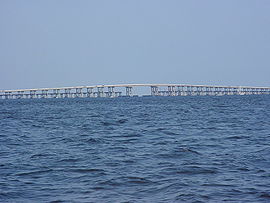
 Three bridges carry pedestrian and automobile traffic to the barrier islands on the south side of the sound. The first two bridges have the lowest clearance of any span over the Gulf Intracoastal Waterway
. For this reason, many sailboat
s with masts taller than 50 feet must "go outside" and bypass the protected sound using the unprotected waters of the Gulf of Mexico
.
The bridges crossing Santa Rosa Sound, including the names of communities on both sides of the bridge (mainland side, followed by island side) and center span clearances above mean sea level, are:
.
Sound (geography)
In geography a sound or seaway is a large sea or ocean inlet larger than a bay, deeper than a bight and wider than a fjord; or it may be defined as a narrow sea or ocean channel between two bodies of land ....
connecting Pensacola Bay
Pensacola Bay
Pensacola Bay is a bay located in the northwestern part of Florida, United States, known as the Florida Panhandle.The bay, an inlet of the Gulf of Mexico, is located in Escambia County and Santa Rosa County, adjacent to the city of Pensacola, Florida, and is about 13 miles long and 2.5 miles ...
and Choctawhatchee Bay
Choctawhatchee Bay
Choctawhatchee Bay is a bay in the Emerald Coast region of the Florida Panhandle. The bay, located within Okaloosa and Walton counties, has a surface area of 129 mi2...
in Florida
Florida
Florida is a state in the southeastern United States, located on the nation's Atlantic and Gulf coasts. It is bordered to the west by the Gulf of Mexico, to the north by Alabama and Georgia and to the east by the Atlantic Ocean. With a population of 18,801,310 as measured by the 2010 census, it...
. The northern shore consists of the Fairpoint Peninsula
Fairpoint Peninsula
The Fairpoint Peninsula is a peninsula located in the Florida Panhandle . It separates Santa Rosa Sound to the south from Pensacola Bay to the north. The Gulf Intracoastal Waterway is routed south of the peninsula through Santa Rosa Sound...
and portions of the mainland in Santa Rosa County and Okaloosa County. It is bounded to the south by Santa Rosa Island
Santa Rosa Island, Florida
Santa Rosa Island[p] is a 40-mile barrier island located in the U.S. state of Florida, thirty miles east of the Alabama state border...
(also known as Okaloosa Island
Okaloosa Island
Okaloosa Island is a regionally used term for a small section of larger Santa Rosa Island located in Okaloosa County, Florida. Okaloosa Island is home to hundreds of residential homes, high rise condominiums and major hotels and motels. The area is unincorporated and uses Fort Walton Beach as a...
in the easternmost region of the sound), separating it from the Gulf of Mexico
Gulf of Mexico
The Gulf of Mexico is a partially landlocked ocean basin largely surrounded by the North American continent and the island of Cuba. It is bounded on the northeast, north and northwest by the Gulf Coast of the United States, on the southwest and south by Mexico, and on the southeast by Cuba. In...
.
The Gulf Intracoastal Waterway
Gulf Intracoastal Waterway
The Gulf Intracoastal Waterway is the portion of the Intracoastal Waterway located along the Gulf Coast of the United States. It is a navigable inland waterway running approximately 1700 kilometers from Carrabelle, Florida, to Brownsville, Texas.The waterway provides a channel with a controlling...
between Pensacola Beach
Pensacola Beach, Florida
Pensacola Beach is an unincorporated community located on Santa Rosa Island, a barrier island, in Escambia County, Florida, United States. It is situated south of Pensacola, and Gulf Breeze connected via bridges spanning to the Fairpoint Peninsula and then to the island, on the Gulf of Mexico...
and Fort Walton Beach
Fort Walton Beach, Florida
Fort Walton Beach is a city in southern Okaloosa County, Florida, United States. As of 2005, the population estimate for Fort Walton Beach was 19,992, and as of 2010, the population estimate for Fort Walton Beach is 19,507 recorded by the U.S. Census Bureau...
is routed through the sound.
The Round The Island Race, an annual 100-mile race for multihull
Multihull
A multihull is a ship, vessel, craft or boat with more than one hull.-Description:Multihulls include: Proas, which have two differently shaped or sized hulls with lateral symmetry; catamarans, which have two hulls with longitudinal symmetry; and trimarans, which have a main hull in the center and...
sailboats that circumnavigates Santa Rosa Island, running half of its course through the sound.
During strong hurricanes, storm surge
Storm surge
A storm surge is an offshore rise of water associated with a low pressure weather system, typically tropical cyclones and strong extratropical cyclones. Storm surges are caused primarily by high winds pushing on the ocean's surface. The wind causes the water to pile up higher than the ordinary sea...
elevates the Gulf of Mexico above the barrier islands to the south and increases the water level of the sound. Hurricane Opal
Hurricane Opal
Hurricane Opal was a Category 4 hurricane that formed in the Gulf of Mexico in September 1995.Opal was the ninth hurricane and the strongest of the abnormally active 1995 Atlantic hurricane season...
and Hurricane Ivan
Hurricane Ivan
Hurricane Ivan was a large, long-lived, Cape Verde-type hurricane that caused widespread damage in the Caribbean and United States. The cyclone was the ninth named storm, the sixth hurricane and the fourth major hurricane of the active 2004 Atlantic hurricane season...
caused extensive damage to waterfront structures on both sides of Santa Rosa Sound.
Communities located along Santa Rosa Sound
- Gulf Breeze, FloridaGulf Breeze, FloridaGulf Breeze is a city located on the Fairpoint Peninsula in Santa Rosa County, Florida, United States and is a suburb of Pensacola which lies to the north, across Pensacola Bay. The population was 5,665 at the 2000 census. As of 2005, the population estimated by the U.S. Census Bureau is 6,455. ...
- Pensacola Beach, FloridaPensacola Beach, FloridaPensacola Beach is an unincorporated community located on Santa Rosa Island, a barrier island, in Escambia County, Florida, United States. It is situated south of Pensacola, and Gulf Breeze connected via bridges spanning to the Fairpoint Peninsula and then to the island, on the Gulf of Mexico...
- Navarre, FloridaNavarre, FloridaNavarre is an unincorporated community in Santa Rosa County in the Northwest Florida Panhandle. Navarre is about 25 miles east of Pensacola and about 15 miles west of Fort Walton Beach. The community is roughly centered on the junction of U.S. Route 98 and State Road 87...
- Navarre Beach, FloridaNavarre Beach, FloridaNavarre Beach, is an unincorporated community in Santa Rosa County in the U.S. state of Florida. It is on Santa Rosa Island, a barrier island in the Gulf of Mexico. The community is considered part of the Pensacola–Ferry Pass–Brent Metropolitan Statistical Area.Immediately to its east...
- Mary Esther, FloridaMary Esther, FloridaMary Esther is a city in Okaloosa County, Florida, United States. The population was 4,055 at the 2000 census. As of 2004, the population recorded by the U.S. Census Bureau is 4,115...
- Fort Walton Beach, FloridaFort Walton Beach, FloridaFort Walton Beach is a city in southern Okaloosa County, Florida, United States. As of 2005, the population estimate for Fort Walton Beach was 19,992, and as of 2010, the population estimate for Fort Walton Beach is 19,507 recorded by the U.S. Census Bureau...
Bridges crossing Santa Rosa Sound

Gulf Intracoastal Waterway
The Gulf Intracoastal Waterway is the portion of the Intracoastal Waterway located along the Gulf Coast of the United States. It is a navigable inland waterway running approximately 1700 kilometers from Carrabelle, Florida, to Brownsville, Texas.The waterway provides a channel with a controlling...
. For this reason, many sailboat
Sailboat
A sailboat or sailing boat is a boat propelled partly or entirely by sails. The term covers a variety of boats, larger than small vessels such as sailboards and smaller than sailing ships, but distinctions in the size are not strictly defined and what constitutes a sailing ship, sailboat, or a...
s with masts taller than 50 feet must "go outside" and bypass the protected sound using the unprotected waters of the Gulf of Mexico
Gulf of Mexico
The Gulf of Mexico is a partially landlocked ocean basin largely surrounded by the North American continent and the island of Cuba. It is bounded on the northeast, north and northwest by the Gulf Coast of the United States, on the southwest and south by Mexico, and on the southeast by Cuba. In...
.
The bridges crossing Santa Rosa Sound, including the names of communities on both sides of the bridge (mainland side, followed by island side) and center span clearances above mean sea level, are:
- Brooks Bridge: Fort Walton BeachFort Walton Beach, FloridaFort Walton Beach is a city in southern Okaloosa County, Florida, United States. As of 2005, the population estimate for Fort Walton Beach was 19,992, and as of 2010, the population estimate for Fort Walton Beach is 19,507 recorded by the U.S. Census Bureau...
(55 feet clearance) - Navarre Beach Bridge: NavarreNavarre, FloridaNavarre is an unincorporated community in Santa Rosa County in the Northwest Florida Panhandle. Navarre is about 25 miles east of Pensacola and about 15 miles west of Fort Walton Beach. The community is roughly centered on the junction of U.S. Route 98 and State Road 87...
to Navarre BeachNavarre Beach, FloridaNavarre Beach, is an unincorporated community in Santa Rosa County in the U.S. state of Florida. It is on Santa Rosa Island, a barrier island in the Gulf of Mexico. The community is considered part of the Pensacola–Ferry Pass–Brent Metropolitan Statistical Area.Immediately to its east...
(55 feet clearance) - Bob Sikes Bridge (commonly the "Pensacola Beach Bridge"): Gulf BreezeGulf Breeze, FloridaGulf Breeze is a city located on the Fairpoint Peninsula in Santa Rosa County, Florida, United States and is a suburb of Pensacola which lies to the north, across Pensacola Bay. The population was 5,665 at the 2000 census. As of 2005, the population estimated by the U.S. Census Bureau is 6,455. ...
to Pensacola BeachPensacola Beach, FloridaPensacola Beach is an unincorporated community located on Santa Rosa Island, a barrier island, in Escambia County, Florida, United States. It is situated south of Pensacola, and Gulf Breeze connected via bridges spanning to the Fairpoint Peninsula and then to the island, on the Gulf of Mexico...
(65 feet clearance)
External links
- SantaRosaSound.com Santa Rosa Sound information and map
.

