
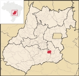
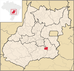
Santa Cruz de Goiás
Encyclopedia
| Santa Cruz de Goiás | |
|---|---|
| State | Goiás Goiás Goiás is a state of Brazil, located in the central part of the country. The name Goiás comes from the name of an indigenous community... |
| Coordinates: | 17°18′55"S 48°28′54"W |
| Area: | 1,108.9 km² |
| Population: | 3,542 (IBGE 2007) |
| Elevation: | 754m above sea level |
| Postcode (CEP): | 75220-000 |
| IBGE statistical microregion: | Pires do Rio Microregion Pires do Rio Microregion The Pires do Rio Microregion is a statistical region of south-central Goiás state, Brazil. The most important city is Pires do Rio. The area includes 10 cities with a population of 90,327 in an area of 9,449.80 km²... |
| Became a city: | 1947 |
| Distance to Goiânia Goiânia -Climate:The city has a tropical wet and dry climate with an average temperature of . There's a wet season, from October to April, and a dry one, from May to September. Annual rainfall is around 1,520 mm.... : |
121 km. |
| Website: | none |
Town
A town is a human settlement larger than a village but smaller than a city. The size a settlement must be in order to be called a "town" varies considerably in different parts of the world, so that, for example, many American "small towns" seem to British people to be no more than villages, while...
and municipality
Municipality
A municipality is essentially an urban administrative division having corporate status and usually powers of self-government. It can also be used to mean the governing body of a municipality. A municipality is a general-purpose administrative subdivision, as opposed to a special-purpose district...
in southeast Goiás
Goiás
Goiás is a state of Brazil, located in the central part of the country. The name Goiás comes from the name of an indigenous community...
state, Brazil
Brazil
Brazil , officially the Federative Republic of Brazil , is the largest country in South America. It is the world's fifth largest country, both by geographical area and by population with over 192 million people...
.
Geography
Santa Cruz is located in the southeastern part of the state, 33 km. west of regional center, Pires do RioPires do Rio
Pires do Rio is a small city and municipality in Goiás state, Brazil. It is a prosperous town and a major producer of poultry.-Location:It is located in the Pires do Rio Microregion. . It is located 144 kilometers from the state capital and is served by highways GO-020, 330 and 414, as well as...
. The Rio dos Bois, a tributary of the Corumbá River
Corumbá River
The Corumbá River is the most important river in the Central Plateau region of Brazil. Its source is in the Montes de Pireneus, near Pirenópolis, state of Goiás, near the boundary with the Federal District and its length ifs 567 km. It receives the waters of the Descoberto and São Bartolomeu,...
flows from north to south through the municipality.
It has boundaries with Pires do Rio
Pires do Rio
Pires do Rio is a small city and municipality in Goiás state, Brazil. It is a prosperous town and a major producer of poultry.-Location:It is located in the Pires do Rio Microregion. . It is located 144 kilometers from the state capital and is served by highways GO-020, 330 and 414, as well as...
, Palmelo
Palmelo
Palmelo is a small town in southeast Goiás state, Brazil. It is the smallest municipality in the state and the only town in Brazil where most of the inhabitants follow the religion called Spiritism.-Location:...
, Cristianópolis
Cristianópolis
This article is about Cristianópolis, Goiás. For Cristianópolis, Mato Grosso see Cristianópolis, Mato GrossoCristianópolis is a small town and municipality in south-eastern Goiás state, Brazil.-Geographical Information:...
, Caldas Novas
Caldas Novas
Caldas Novas is a Brazilian city and municipality in the state of Goiás. It is considered by many to be the largest hydro-thermal resort in the world.-Location:...
and Piracanjuba
Piracanjuba
Piracanjuba is a small city and municipality in southeastern Goiás state, Brazil. It is a big producer of orchids, milk products, and soybeans. Piracanjuba is also the name of a fish common to the waters of the Plata River basin....
. It is 121 kilometers from the state capital, Goiânia and is connected by BR-352 / Bela Vista de Goiás
Bela Vista de Goiás
Bela Vista de Goiás is a small city located in central Goiás state in Brazil.-Location:It is 45 kilometers from the state capital of Goiânia...
/ Cristianópolis
Cristianópolis
This article is about Cristianópolis, Goiás. For Cristianópolis, Mato Grosso see Cristianópolis, Mato GrossoCristianópolis is a small town and municipality in south-eastern Goiás state, Brazil.-Geographical Information:...
/ GO-020. See Distancias Rodoviarias Sepin for all the distances.
The municipality is bathed by the Rio dos Bois, Rio do Peixe, córregos Manoel Duarte, Muquém, Buriti, Pedra de Amolar, Brumadinho, Caiapó, Pirapitinga, Fundo, Mato Virgem, Água Suja, São Benedito, Córrego da Chuva, Sapé, Dantas, and by the Ribeirão Brumado. In topography there is the Serra do Rio do Peixe, the hills of Clemente, Queiroz, Cuscuzeiro, Dois Irmãos, Pertapé, Serra dos Macacos, Cabeça de Mel and Capão Bonito. The climate is tropical humid.
Political Information
- Mayor: Esley Augusto Damaso (January 2005)
- City council: 09
- Eligible voters: 2,898 (December/2007)
Demographics
Population distribution is characterized by the fact that the rural population outnumbered the urban by almost two to one.- Population density: 3.19 inhab/km² (2007)
- Urban population: 1,007 (2007)
- Rural population: 2,535 (2007)
- Population growth: a loss of about 500 people since 1980
The economy
The economy is based on agriculture, cattle raising, services, public administration, and small transformation industries.- Industrial units: 3 (2007)
- Commercial units: 18 (2007)
- Cattle herd: 65,000 head (15,000 milk cows)
- Main crops: rice, beans, manioc, coffee, bananas, soybeans (10,000 hectares) and corn
Agricultural data 2006
- Number of farms: 725
- Total area: 97,104 ha.
- Area of permanent crops: 92 ha.
- Area of perennial crops: 13,369 ha.
- Area of natural pasture: 55,190 ha.
- Area of woodland and forests: 26,435 ha.
- Persons dependent on farming: 1,500
- Farms with tractors: 161
- Number of tractors: 316
- Cattle herd: 65,000 head IBGE
Education (2006)
- Schools: 4
- Classrooms: 25
- Teachers: 40
- Students: 726
- Middle schools enrollment: 123
- Higher education: none
- Adult literacy rate: 87.5% (2000) (national average was 86.4%)
Health (2007)
- Hospitals: 1
- Hospital beds: 12
- Ambulatory clinics: 3
- Infant mortality rate: 14.0 (2000) (national average was 33.0)
Human Development Index
Human Development Index
The Human Development Index is a composite statistic used to rank countries by level of "human development" and separate "very high human development", "high human development", "medium human development", and "low human development" countries...
- MHDI: 0.782
- State ranking: 26 (out of 242 municipalities)
- National ranking: 1,006 (out of 5,507 municipalities) For the complete list see Frigoletto.com
History
Unlike many of the municipalities in Goiás, Santa Cruz has is origins in the 18th century, when mule drivers in 1721 on their way to the mines of CuiabáCuiabá
Under the Koppen climate classification, Cuiaba features a tropical wet and dry climate. Cuiabá is famous for its searing heat, although temperatures in winter can arrive sporadically at 10 degrees, indeed atypical, caused by cold fronts coming from the south, and that may only last one or two...
discovered gold in the region. A cross was raised and the arraial (village) of Santa Cruz was founded in 1729. Later when the territory was divided in two Santa Cruz was the center of a julgado, which was almost the size of Portugal. In 1833 it was raised to the status of a municipality. The first railroad arrived 28 kilometers away in 1914 and the station was called Pires do Rio, which later became the most important city of the region.
With attractive landscapes around the city, Santa Cruz has rivers and waterfalls that promise future touristic development.
See also
- List of municipalities in Goiás
- Microregions of Goiás