

Sandberg, California
Encyclopedia
Sandberg is the name of a post office and small surrounding community that was attached to Sandberg's lodge or inn on Southern California
's Ridge Route
highway, which linked the Los Angeles area to Central California
from 1919 through 1933.
The inn was destroyed by a fire in 1961, but the community lived on as a dot on northern L.A. County maps. Sandberg was later the site of a U.S. weather station
.
within the Antelope Valley. It is 69 miles (111 km) via Interstate 5
to downtown Los Angeles
. Sandberg is classed as a populated place
by the United States Geological Survey
, which means it is "a place or area with clustered or scattered buildings and a permanent human population." Its elevation above sea level is 4,163 feet (1,269 meters).
It is 19 miles (30.6 km) westerly by road from the top of Burnt Peak.
In December 1900 the brothers made news when they "captured a very large specimen of the California condor
on their mountain ranch at Neenach
, near Newhall
, last Saturday."
Harald built his lodge in 1914, just one year before the opening of the Ridge Route resulted in a parade of cars by his front door, seven days a week. "Sandberg's lodge at the top of the grade was a welcome sight to weary [Los Angeles] motorists still only halfway to Bakersfield
," the Los Angeles Times reported. A hotel, restaurant, and cabins were constructed on leased Forest Service
land immediately to the south of the homesteaded property.
When first opened in a one-story building, the business was named Sandberg's Summit Hotel. Some time after 1921 the owner turned it into a three-story log hostelry set amid a grove of California live oak
s. A crank telephone provided access to the outside world via the long-distance phone circuits that connected Los Angeles with Bakersfield. Cabins also provided shelter behind the hotel.
In 1918 Harald Sandberg was appointed postmaster of the settlement, which was thenceforth named Sandberg, with the post office inside the hotel itself.
"It was a small tourist community," Bakersfield resident Frank Kaufman told Interviewer Harrison Irving Scott (author of a history of the Ridge Route); it had a repair garage that advertised "Labor $2, after 6 p.m. $3; never closed." Motor Stages would stop at Sandberg's for meals, and motorists would hunger for Mrs. (Marion) Sandberg's apple pie.
In September 1929, attorney and real estate developer Ulysses S. Grant Jr., the son of the 18th American president, checked into Sandberg's with his wife and nephew for a visit. He died of a heart attack in his room.
In spring 1934, the lodge was put up for sale. A newspaper classified advertisement described it:
Sandberg died on July 9, 1939, and his wife on April 1, 1954.
But the hotel never regained its former popularity: An alternate to the Ridge Route was opened, an event that virtually stopped traffic through Sandberg. Nevertheless, J.H. Cox purchased both the lodge and the ranch and, according to Walter W. (Lucky) Stevens, a later owner, Cox tainted the hotel's reputation by allegedly "bringing in booze, slot machine
s and 'ladies of the night.' " Cox sold the operation to Lillian Grojean, who turned the hotel garage into a ceramics factory; her lease from the Forest Service amounted to $90 a year.
when he met Grojean. In 1950 or 1951 he paid her $15,000 for the dilapidated hotel, outbuildings, and lease.
 At first he had plans to install a swimming pool and a fishing pond and to reopen the property as a guest ranch. By that time, the lodge was in disrepair, with pigeons roosting among the rafters. Eight years later, he said he wanted to open the spread of 20 acres (80,937.2 m²) as a children's ranch, and he did succeed in acquiring money, furniture, and used clothing.
On April 29, 1961, fire destroyed the main lodge. Stevens was alone in the building. A district forest ranger said the blaze was apparently started by sparks from the chimney, and Stevens told an interviewer later that he had been burning trash when the flames began.
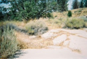
The Forest Service canceled Stevens' lease in 1963, and nothing remains on the site today but a historic marker, some stone steps, a bit of foundation, trees, and shrubbery.
, which straddles the boundary between the maritime climate
to the south and a drier climate to the north. In 1953 the weather observers had to visually check the instruments and manually transmit the information via teletype.
In 1978 the Weather Service switched to an automated station, explaining, in the words of Los Angeles Times staff writer Marika Gerrard, that "It was just too hard to find someone to live up in that remote region with nothing to do but record weather statistics every hour on the hour." Nevertheless, in May 1981 reporter Gerrard found two people living at the station — a college student-caretaker and a man experimenting with the prototype of a modular wind turbine
.
The other two people living in Sandberg in that month were Willard Sparks, captain of the Quail Lake Fire Station, and his wife, Shirley. Sparks was responsible for covering 300 square miles (777 km²) of forested land that included Sandberg, Gorman, Pyramid Lake
, part of the Angeles Forest, and a stretch of Interstate 5 known as "Blood Alley" because of the frequent accidents there.
Southern California
Southern California is a megaregion, or megapolitan area, in the southern area of the U.S. state of California. Large urban areas include Greater Los Angeles and Greater San Diego. The urban area stretches along the coast from Ventura through the Southland and Inland Empire to San Diego...
's Ridge Route
Ridge Route
The Ridge Route, officially the Castaic-Tejon Route, was a two-lane highway running between Los Angeles and Kern counties, California. Opened in 1915 and paved with concrete between 1917 and 1921, the road was the first paved highway directly linking the Los Angeles Basin with the San Joaquin...
highway, which linked the Los Angeles area to Central California
Central California
Central California, sometimes referenced as Mid-State, is an area of California south of the San Francisco Bay Area and north of Southern California...
from 1919 through 1933.
The inn was destroyed by a fire in 1961, but the community lived on as a dot on northern L.A. County maps. Sandberg was later the site of a U.S. weather station
Weather station
A weather station is a facility, either on land or sea, with instruments and equipment for observing atmospheric conditions to provide information for weather forecasts and to study the weather and climate. The measurements taken include temperature, barometric pressure, humidity, wind speed, wind...
.
Geography
Sandberg is 9.7 miles (16 km) southeast of the small town of NeenachNeenach, California
Neenach is an agricultural settlement in northwestern Los Angeles County, California, with a population of about 800. It is facing a massive change with the proposed construction of a 23,000-home planned community to its north called Centennial....
within the Antelope Valley. It is 69 miles (111 km) via Interstate 5
Interstate 5
Interstate 5 is the main Interstate Highway on the West Coast of the United States, running largely parallel to the Pacific Ocean coastline from Canada to Mexico . It serves some of the largest cities on the U.S...
to downtown Los Angeles
Downtown Los Angeles
Downtown Los Angeles is the central business district of Los Angeles, California, United States, located close to the geographic center of the metropolitan area...
. Sandberg is classed as a populated place
Populated place
A populated place is a place or area with clustered or scattered buildings and a permanent human population referenced with geographic coordinates...
by the United States Geological Survey
United States Geological Survey
The United States Geological Survey is a scientific agency of the United States government. The scientists of the USGS study the landscape of the United States, its natural resources, and the natural hazards that threaten it. The organization has four major science disciplines, concerning biology,...
, which means it is "a place or area with clustered or scattered buildings and a permanent human population." Its elevation above sea level is 4,163 feet (1,269 meters).
It is 19 miles (30.6 km) westerly by road from the top of Burnt Peak.
The Sandbergs
Harald Sandberg, a native of Norway, settled in the Antelope Valley with his brother, Albert, in 1882, and they developed large areas there. On April 2, 1897, Harald filed homestead papers on ranch property just north of the parcel that later housed his hotel and inn.In December 1900 the brothers made news when they "captured a very large specimen of the California condor
California Condor
The California Condor is a New World vulture, the largest North American land bird. Currently, this condor inhabits only the Grand Canyon area, Zion National Park, and coastal mountains of central and southern California and northern Baja California...
on their mountain ranch at Neenach
Neenach, California
Neenach is an agricultural settlement in northwestern Los Angeles County, California, with a population of about 800. It is facing a massive change with the proposed construction of a 23,000-home planned community to its north called Centennial....
, near Newhall
Newhall, California
Newhall is the southernmost and oldest district of Santa Clarita, California. Prior to the 1987 consolidation of Valencia, Canyon Country, Saugus, Newhall, and other geographically proximate settlements into the conglomerate city of Santa Clarita, it was an independent but unincorporated town...
, last Saturday."
The bird had gorged itself on a dead cow until unable to fly, and will now have to pay for being a blutton [sic] by a term of captivity. . . . The specimen captured measures about twelve feet from tip to tip of wing. . . . Few specimens of this condor have ever been captured, and this is regarded as a prize. If brought to the city it will probably be put in the park menagerie.
Harald built his lodge in 1914, just one year before the opening of the Ridge Route resulted in a parade of cars by his front door, seven days a week. "Sandberg's lodge at the top of the grade was a welcome sight to weary [Los Angeles] motorists still only halfway to Bakersfield
Bakersfield, California
Bakersfield is a city near the southern end of the San Joaquin Valley in Kern County, California. It is roughly equidistant between Fresno and Los Angeles, to the north and south respectively....
," the Los Angeles Times reported. A hotel, restaurant, and cabins were constructed on leased Forest Service
United States Forest Service
The United States Forest Service is an agency of the United States Department of Agriculture that administers the nation's 155 national forests and 20 national grasslands, which encompass...
land immediately to the south of the homesteaded property.
When first opened in a one-story building, the business was named Sandberg's Summit Hotel. Some time after 1921 the owner turned it into a three-story log hostelry set amid a grove of California live oak
Live oak
Live oak , also known as the southern live oak, is a normally evergreen oak tree native to the southeastern United States...
s. A crank telephone provided access to the outside world via the long-distance phone circuits that connected Los Angeles with Bakersfield. Cabins also provided shelter behind the hotel.
In 1918 Harald Sandberg was appointed postmaster of the settlement, which was thenceforth named Sandberg, with the post office inside the hotel itself.
"It was a small tourist community," Bakersfield resident Frank Kaufman told Interviewer Harrison Irving Scott (author of a history of the Ridge Route); it had a repair garage that advertised "Labor $2, after 6 p.m. $3; never closed." Motor Stages would stop at Sandberg's for meals, and motorists would hunger for Mrs. (Marion) Sandberg's apple pie.
In September 1929, attorney and real estate developer Ulysses S. Grant Jr., the son of the 18th American president, checked into Sandberg's with his wife and nephew for a visit. He died of a heart attack in his room.
In spring 1934, the lodge was put up for sale. A newspaper classified advertisement described it:
RESORT SANITARIUM DUDE RANCH SANDBERG'S INN. RIDGE ROUTE. 75 mi. from L.A. by highway. Ideal climate: natural beauty. 100 A. of tree covered level & rolling land. Secluded & quiet. 3-story bldg. with lobby, dining rm., hotel rms., etc. 7 other bldgs. Accommodate 35 guests. Own elec. & water plants. Fully equipt. & furn. to operate now. Sell or TRADE. Phone CRestview 7644 or Box M-285, Times.
Sandberg died on July 9, 1939, and his wife on April 1, 1954.
Interregnum
By the time of Harald Sandberg's death, there were new operators for the place, a newspaper advertisement having proclaimed:Grand Opening and Free Barbecue Sunday, May 28, 1939. Sandberg Lodge and Dude RanchDude RanchDude Ranch is the second studio album by American punk band Blink-182. Recorded at Big Fish Studios in Encinitas, California with producer Mark Trombino, the album was first released on June 17, 1997 in the United States on independent label Cargo Music...
, Larry Brock proprietor, Harry Moss Manager.
But the hotel never regained its former popularity: An alternate to the Ridge Route was opened, an event that virtually stopped traffic through Sandberg. Nevertheless, J.H. Cox purchased both the lodge and the ranch and, according to Walter W. (Lucky) Stevens, a later owner, Cox tainted the hotel's reputation by allegedly "bringing in booze, slot machine
Slot machine
A slot machine , informally fruit machine , the slots , poker machine or "pokies" or simply slot is a casino gambling machine with three or more reels which spin when a button is pushed...
s and 'ladies of the night.' " Cox sold the operation to Lillian Grojean, who turned the hotel garage into a ceramics factory; her lease from the Forest Service amounted to $90 a year.
Lucky Stevens
Stevens, a sometime film actor, was running a ceramics business in BurbankBurbank, California
Burbank is a city in Los Angeles County in Southern California, United States, north of downtown Los Angeles. The estimated population in 2010 was 103,340....
when he met Grojean. In 1950 or 1951 he paid her $15,000 for the dilapidated hotel, outbuildings, and lease.
On April 29, 1961, fire destroyed the main lodge. Stevens was alone in the building. A district forest ranger said the blaze was apparently started by sparks from the chimney, and Stevens told an interviewer later that he had been burning trash when the flames began.
The Forest Service canceled Stevens' lease in 1963, and nothing remains on the site today but a historic marker, some stone steps, a bit of foundation, trees, and shrubbery.
Weather observation and fire station
A four-man weather station was established in 1933 at the windy peak of nearby Bald MountainBald Mountain (California)
Bald Mountain is a name given to over fifty summits in California.* In Sugarloaf Ridge State Park there are two Bald Mountain summits, both located on the Sonoma-Napa County border:**The northern one, at , rises to an elevation of...
, which straddles the boundary between the maritime climate
Oceanic climate
An oceanic climate, also called marine west coast climate, maritime climate, Cascadian climate and British climate for Köppen climate classification Cfb and subtropical highland for Köppen Cfb or Cwb, is a type of climate typically found along the west coasts at the middle latitudes of some of the...
to the south and a drier climate to the north. In 1953 the weather observers had to visually check the instruments and manually transmit the information via teletype.
In 1978 the Weather Service switched to an automated station, explaining, in the words of Los Angeles Times staff writer Marika Gerrard, that "It was just too hard to find someone to live up in that remote region with nothing to do but record weather statistics every hour on the hour." Nevertheless, in May 1981 reporter Gerrard found two people living at the station — a college student-caretaker and a man experimenting with the prototype of a modular wind turbine
Wind turbine
A wind turbine is a device that converts kinetic energy from the wind into mechanical energy. If the mechanical energy is used to produce electricity, the device may be called a wind generator or wind charger. If the mechanical energy is used to drive machinery, such as for grinding grain or...
.
The other two people living in Sandberg in that month were Willard Sparks, captain of the Quail Lake Fire Station, and his wife, Shirley. Sparks was responsible for covering 300 square miles (777 km²) of forested land that included Sandberg, Gorman, Pyramid Lake
Pyramid Lake (California)
Pyramid Lake is an artificial lake formed by Pyramid Dam on Piru Creek, near Castaic, California. The reservoir lies on the border between the Angeles National Forest and the Los Padres National Forest in the northwestern portion of Los Angeles County....
, part of the Angeles Forest, and a stretch of Interstate 5 known as "Blood Alley" because of the frequent accidents there.