
San Juan Bautista Tuxtepec
Encyclopedia
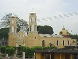
San Juan Bautista Tuxtepec (Nahuatl
: "on the hill of rabbits"), or simply referred to as Tuxtepec, is the head of the municipality
by the same name and is the second most populous city of the Mexican state of Oaxaca
.
It is part of the Tuxtepec District
of the Papaloapan Region
.
As of the 2005 census, the city is home to a population of 94,209 and 144,555 in the municipality (0.979% of the state population), though census data are often under reported for various reasons. The municipality resides in the region called La Cuenca (Spanish for “The Basin”), is located 36 feet above sea level, and occupies an area of approximately 580 mi2. The city itself is surrounded by the Papaloapan River
, and lies a few kilometers south of the Cerro de Oro Dam
on its tributary the Santo Domingo River
.
The municipality is bordered by the state of Veracruz
in the north and the town of Loma Bonita to the south. It is almost 100 miles to the port of Veracruz, 130 miles to Oaxaca City
, the state capital, and 310 miles to Mexico City
.
Adolfina Rangel Arceo, Agua Azul, Agua Escondida, Agua Fría Papaloapan, Agua Fría Piedra del Sol, Amapa, Arroyo Chiquito, Arroyo Cohapa, Arroyo Limón, Arroyo Zuzule, Atilano Cruz, Base Estrella, Benemérito Juárez, Bethania, Buenavista, Buenavista Gallardo, Buenavista Río Tonto, Buenos Aires el Apompo, California, Camalotal, Camarón Salsipuedes, Camelia Roja, Campo Nuevo, Canutillo, Caracol, Cándido Cuevas, Centro de Población Rosario Ibarra de Piedra, Cerro Bola, Claudio Vicente Justo, Colonia la Fe, Colonia Mancilla y Acevedo, Colonia Obrera (Ejido Benito Juárez), Colonia Obrera Benito Juárez, Colonia Ortega, Colonia Víctor Bravo Ahuja (Segunda Etapa), Conjunto Residencial Fapatux, Conjunto Residencial Sebastopol, Curva las Consuegras (Ejido las Ánimas), Desviación Piedra Quemada, Don Juan (San Antonio), Dos Caminos, El Azufre, El Basurero Municipal, El Cañaveral, El Caminante, El Cedral, El Chaparral, El Crucero, El Desengaño, El Encajonado, El Escobillal, El Esfuerzo, El Guayabo (Boca de Coapa), El Jimbal, El Mangal, El Milagro, El Mirador Mata de Caña (Lino Ramírez), El Naranjal, El Ojillal (Boca de Coapa), El Palmar, El Panalito, El Paraíso, El Paraíso Zacatal, El Peal, El Placer, El Porvenir, El Progreso 1, El Progreso 2, El Recreo 1, El Recreo 2, El Recreo 3, El Recuerdo, El Suspiro, El Tonto, El Triunfo, El Yagual, El Zapotal, Esperanza Arroyo la Gloria, Finca el Progreso, Francisco I. Madero (Los Cerritos), Francisco I. Madero de los Cerritos Río Tonto, Frente al Ingenio, Fuente Misteriosa, Fuente Villa, Galera de Soto, General Lázaro Cárdenas, Huerta San Gerardo, Ignacio Zaragoza, Jazmín, Jimaguas, La Aurora y Anexas, La Carlota, La Coconal (Desviación a Agua Fría), La Esmalta, La Esmeralda, La Esperanza, La Esperanza Agua Pescadito, La Gloria, La Huerta, La Hulera, La Mina, La Montaña, La Nueva Revolución, La Pequeña, La Pita (Efrén Garduño), La Pita (El Mexicanito), La Pochota, La Puerta del Recreo, La Redonda (Boca de Coapa), La Reforma, La Trinidad, La Unión, Las Delicias, Las Palmas, Las Palmas (El Nanche), Las Palomas, Lic. Ignacio Martínez Bautista, Los Anzures, Los Ávalos, Los Ávalos, Los Cocos, Los Juanes, Los Mangales (La Estopa), Los Mangos, Los Pinos, Los Reyes (Ampliación Santa Úrsula), Macín Chico, María Domínguez, Mata de Caña, Mixtancillo (Boca de Coapa), Mundo Nuevo, Nuevo Horizonte, Ojo de Agua, Palmilla, Pantoja, Papaloapan, Paso Canoa, Paso de Armadillo, Paso Rincón, Piedra Quemada, Pillo García (Buenavista), Pio V Becerra Ballesteros, Playa del Mono, Pueblo Nuevo Ojo de Agua, Pueblo Nuevo Papaloapan, Puente del Obispo (La Joya), Rancho de San Antonio 1, Rancho de San Antonio 2, Rancho Doña Mimí, Rancho el Águila, Rancho el Sábalo, Rancho Mis Abuelos, Rancho Nuevo Jonotal, Rincón Bonito, Roberto Figueroa, Rodeo Arroyo Pepesca, Sabino Pérez, San Bartolo, San Felipe de la Peña, San Fermín, San Francisco 1, San Francisco 2, San Francisco Salsipuedes, San Isidro las Piñas, San José, San Juan Bautista de Matamoros, San Juan Bautista Tuxtepec, San Lorenzo (El Zapotal), San Martín las Caobas, San Miguel Obispo, San Pedro, San Rafael 1, San Rafael 2, San Román, San Rosendo, San Silverio el Cedral, Santa Úrsula, Santa Catarina, Santa Elena, Santa Isabel Río Obispo, Santa María Amapa, Santa María Obispo, Santa Rosa Papaloapan, Santa Silvia, Santa Teresa (Boca de Coapa), Santa Teresa Papaloapan, Santo Tomás, Sebastopol, Silvano Reyes, Silverio la Arrocera, Soledad Macín Chico, Tacoteno el Consuelo, Tecoteno el Tular, Toro Bravo, Vista Hermosa, and Zacate Colorado
Together, the municipality covers an area of 933.9 km² (360.58 sq mi) and reported a census population of 144,555, which includes many small outlying communities.
pasadena
Nahuatl
Nahuatl is thought to mean "a good, clear sound" This language name has several spellings, among them náhuatl , Naoatl, Nauatl, Nahuatl, Nawatl. In a back formation from the name of the language, the ethnic group of Nahuatl speakers are called Nahua...
: "on the hill of rabbits"), or simply referred to as Tuxtepec, is the head of the municipality
Municipalities of Mexico
Municipalities are the second-level administrative division in Mexico . There are 2,438 municipalities in Mexico, making the average municipality population 45,616...
by the same name and is the second most populous city of the Mexican state of Oaxaca
Oaxaca
Oaxaca , , officially Estado Libre y Soberano de Oaxaca is one of the 31 states which, along with the Federal District, comprise the 32 federative entities of Mexico. It is divided into 571 municipalities; of which 418 are governed by the system of customs and traditions...
.
It is part of the Tuxtepec District
Tuxtepec District, Oaxaca
Tuxtepec District is located in the north of the Papaloapan Region of the State of Oaxaca, Mexico.-Municipalities:The district includes the following municipalities:*Acatlán de Pérez Figueroa*Ayotzintepec*Cosolapa*Loma Bonita*San Felipe Jalapa de Díaz...
of the Papaloapan Region
Papaloapan Region, Oaxaca
The Cuenca del Papaloapan Region is in the north of the state of Oaxaca, Mexico where the foothills of the Sierra Madre de Oaxaca meet the coastal plain of Veracruz.The principal city is San Juan Bautista Tuxtepec, the second largest in Oaxaca state....
.
As of the 2005 census, the city is home to a population of 94,209 and 144,555 in the municipality (0.979% of the state population), though census data are often under reported for various reasons. The municipality resides in the region called La Cuenca (Spanish for “The Basin”), is located 36 feet above sea level, and occupies an area of approximately 580 mi2. The city itself is surrounded by the Papaloapan River
Papaloapan River
The Papaloapan River is one of the main rivers of the Mexican state of Veracruz. Its name is derived from the Nahuatl papalotl and apan ....
, and lies a few kilometers south of the Cerro de Oro Dam
Cerro de Oro Dam
The Cerro de Oro Dam , also called the Miguel de la Madrid Hurtado Dam, is on the Santo Domingo River in the San Juan Bautista Tuxtepec municipality of the Papaloapan Region of Oaxaca state in southern Mexico....
on its tributary the Santo Domingo River
Santo Domingo River (Oaxaca)
The Santo Domingo River in Oaxaca state, Mexico is one of the main tributaries of the Papaloapan River, rising in the Sierra Madre de Oaxaca and flowing east towards San Juan Bautista Tuxtepec, above which it joins with the Valle Nacional River to form the Papaloapan.Carrying sediment from the...
.
The municipality is bordered by the state of Veracruz
Veracruz
Veracruz, formally Veracruz de Ignacio de la Llave officially Estado Libre y Soberano de Veracruz de Ignacio de la Llave , is one of the 31 states that, along with the Federal District, comprise the 32 federative entities of Mexico. It is divided in 212 municipalities and its capital city is...
in the north and the town of Loma Bonita to the south. It is almost 100 miles to the port of Veracruz, 130 miles to Oaxaca City
Oaxaca, Oaxaca
The city and municipality of Oaxaca de Juárez, or simply Oaxaca, is the capital and largest city of the Mexican state of the same name . It is located in the Centro District in the Central Valleys region of the state, in the foothills of the Sierra Madre at the base of the Cerro del Fortín...
, the state capital, and 310 miles to Mexico City
Mexico City
Mexico City is the Federal District , capital of Mexico and seat of the federal powers of the Mexican Union. It is a federal entity within Mexico which is not part of any one of the 31 Mexican states but belongs to the federation as a whole...
.
The municipality
The city serves as municipal seat of the municipality, having jurisdiction over the following communities:Adolfina Rangel Arceo, Agua Azul, Agua Escondida, Agua Fría Papaloapan, Agua Fría Piedra del Sol, Amapa, Arroyo Chiquito, Arroyo Cohapa, Arroyo Limón, Arroyo Zuzule, Atilano Cruz, Base Estrella, Benemérito Juárez, Bethania, Buenavista, Buenavista Gallardo, Buenavista Río Tonto, Buenos Aires el Apompo, California, Camalotal, Camarón Salsipuedes, Camelia Roja, Campo Nuevo, Canutillo, Caracol, Cándido Cuevas, Centro de Población Rosario Ibarra de Piedra, Cerro Bola, Claudio Vicente Justo, Colonia la Fe, Colonia Mancilla y Acevedo, Colonia Obrera (Ejido Benito Juárez), Colonia Obrera Benito Juárez, Colonia Ortega, Colonia Víctor Bravo Ahuja (Segunda Etapa), Conjunto Residencial Fapatux, Conjunto Residencial Sebastopol, Curva las Consuegras (Ejido las Ánimas), Desviación Piedra Quemada, Don Juan (San Antonio), Dos Caminos, El Azufre, El Basurero Municipal, El Cañaveral, El Caminante, El Cedral, El Chaparral, El Crucero, El Desengaño, El Encajonado, El Escobillal, El Esfuerzo, El Guayabo (Boca de Coapa), El Jimbal, El Mangal, El Milagro, El Mirador Mata de Caña (Lino Ramírez), El Naranjal, El Ojillal (Boca de Coapa), El Palmar, El Panalito, El Paraíso, El Paraíso Zacatal, El Peal, El Placer, El Porvenir, El Progreso 1, El Progreso 2, El Recreo 1, El Recreo 2, El Recreo 3, El Recuerdo, El Suspiro, El Tonto, El Triunfo, El Yagual, El Zapotal, Esperanza Arroyo la Gloria, Finca el Progreso, Francisco I. Madero (Los Cerritos), Francisco I. Madero de los Cerritos Río Tonto, Frente al Ingenio, Fuente Misteriosa, Fuente Villa, Galera de Soto, General Lázaro Cárdenas, Huerta San Gerardo, Ignacio Zaragoza, Jazmín, Jimaguas, La Aurora y Anexas, La Carlota, La Coconal (Desviación a Agua Fría), La Esmalta, La Esmeralda, La Esperanza, La Esperanza Agua Pescadito, La Gloria, La Huerta, La Hulera, La Mina, La Montaña, La Nueva Revolución, La Pequeña, La Pita (Efrén Garduño), La Pita (El Mexicanito), La Pochota, La Puerta del Recreo, La Redonda (Boca de Coapa), La Reforma, La Trinidad, La Unión, Las Delicias, Las Palmas, Las Palmas (El Nanche), Las Palomas, Lic. Ignacio Martínez Bautista, Los Anzures, Los Ávalos, Los Ávalos, Los Cocos, Los Juanes, Los Mangales (La Estopa), Los Mangos, Los Pinos, Los Reyes (Ampliación Santa Úrsula), Macín Chico, María Domínguez, Mata de Caña, Mixtancillo (Boca de Coapa), Mundo Nuevo, Nuevo Horizonte, Ojo de Agua, Palmilla, Pantoja, Papaloapan, Paso Canoa, Paso de Armadillo, Paso Rincón, Piedra Quemada, Pillo García (Buenavista), Pio V Becerra Ballesteros, Playa del Mono, Pueblo Nuevo Ojo de Agua, Pueblo Nuevo Papaloapan, Puente del Obispo (La Joya), Rancho de San Antonio 1, Rancho de San Antonio 2, Rancho Doña Mimí, Rancho el Águila, Rancho el Sábalo, Rancho Mis Abuelos, Rancho Nuevo Jonotal, Rincón Bonito, Roberto Figueroa, Rodeo Arroyo Pepesca, Sabino Pérez, San Bartolo, San Felipe de la Peña, San Fermín, San Francisco 1, San Francisco 2, San Francisco Salsipuedes, San Isidro las Piñas, San José, San Juan Bautista de Matamoros, San Juan Bautista Tuxtepec, San Lorenzo (El Zapotal), San Martín las Caobas, San Miguel Obispo, San Pedro, San Rafael 1, San Rafael 2, San Román, San Rosendo, San Silverio el Cedral, Santa Úrsula, Santa Catarina, Santa Elena, Santa Isabel Río Obispo, Santa María Amapa, Santa María Obispo, Santa Rosa Papaloapan, Santa Silvia, Santa Teresa (Boca de Coapa), Santa Teresa Papaloapan, Santo Tomás, Sebastopol, Silvano Reyes, Silverio la Arrocera, Soledad Macín Chico, Tacoteno el Consuelo, Tecoteno el Tular, Toro Bravo, Vista Hermosa, and Zacate Colorado
Together, the municipality covers an area of 933.9 km² (360.58 sq mi) and reported a census population of 144,555, which includes many small outlying communities.
pasadena
External links
- Gobierno Municipal de San Juan Bautista Tuxtepec Official website