
San Andres Mountains
Encyclopedia
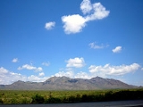
The San Andres Mountains are a mountain range
in the southwestern U.S.
state of New Mexico
, in the counties of Socorro
, Sierra
, and Doña Ana
. The range extends about 75 miles (120 km) north to south, but are only about 12 miles (19 km) wide at their widest. The highest peak in the San Andres Mountains is Salinas Peak
, at 8,965 feet (2,733 m).
.
of the Rio Grande
, and are made up of west-dipping fault blocks
made primarily of San Andres Formation limestone
, but also with extensive exposures of reddish Abo Formation sandstone
on the western side, and quartz monzonite
on the eastern side. Gypsum
deposits washed from these mountains are the main source of the dunes in White Sands National Monument
.
Significant summits include:
habitat in New Mexico is in the San Andres Mountains, which can host up to 400 bighorn. An area of 57215 acres (231.5 km²) in the southern portion of the San Andres Mountain range was set aside in 1941 as the San Andres National Wildlife Refuge
to help preserve the desert bighorn sheep, which at the time numbered 33. In the mid 1970s there were around 200 sheep in the refuge; however, in 1979, a scabies mite epizootic reduced the population from 200 to 75. Subsequent years brought further declines from scabies and other causes until the population consisted of one ewe in 1997. Reintroduction of desert bighorn sheep occurred in 2002 and the herd has now about 80 members.
Mountain range
A mountain range is a single, large mass consisting of a succession of mountains or narrowly spaced mountain ridges, with or without peaks, closely related in position, direction, formation, and age; a component part of a mountain system or of a mountain chain...
in the southwestern U.S.
United States
The United States of America is a federal constitutional republic comprising fifty states and a federal district...
state of New Mexico
New Mexico
New Mexico is a state located in the southwest and western regions of the United States. New Mexico is also usually considered one of the Mountain States. With a population density of 16 per square mile, New Mexico is the sixth-most sparsely inhabited U.S...
, in the counties of Socorro
Socorro County, New Mexico
-2010:Whereas according to the 2010 U.S. Census Bureau:*75.1% White*1.1% Black*11.7% Native American*1.2% Asian*0.0% Native Hawaiian or Pacific Islander*2.8% Two or more races*8.1% Other races*48.5% Hispanic or Latino -2000:...
, Sierra
Sierra County, New Mexico
-2010:Whereas according to the 2010 U.S. Census Bureau:*85.6% White*0.4% Black*1.7% Native American*0.4% Asian*0.0% Native Hawaiian or Pacific Islander*3.3% Two or more races*8.6% Other races*28.0% Hispanic or Latino -2000:...
, and Doña Ana
Doña Ana County, New Mexico
-2010:Whereas according to the 2010 U.S. Census Bureau:*74.1% White*1.7% Black*1.5% Native American*1.1% Asian*0.1% Native Hawaiian or Pacific Islander*3.0% Two or more races*18.5% Other races*65.7% Hispanic or Latino -2000:...
. The range extends about 75 miles (120 km) north to south, but are only about 12 miles (19 km) wide at their widest. The highest peak in the San Andres Mountains is Salinas Peak
Salinas Peak
Salinas Peak is the highest point in the San Andres Mountains of south-central New Mexico, in the United States. It lies near the northern end of the range, about 50 miles northwest of Alamogordo and 50 miles southeast of Socorro...
, at 8,965 feet (2,733 m).
Geography
Though nearly contiguous with the Organ Mountains to the south, the two are very distinct geologically and botanically. The Oscura Mountains to the north are separated from the San Andres Mountains by Mockingbird Gap and the much lower Little Burro Mountains. The San Andres Mountains are comparatively dry and do not support any extensive woodlands. They are inaccessible to the general public, lying almost entirely within the restricted White Sands Missile RangeWhite Sands Missile Range
White Sands Missile Range is a rocket range of almost in parts of five counties in southern New Mexico. The largest military installation in the United States, WSMR includes the and the WSMR Otera Mesa bombing range...
.
Geology
The San Andres Mountains form part of the eastern edge of the rift valleyRift valley
A rift valley is a linear-shaped lowland between highlands or mountain ranges created by the action of a geologic rift or fault. This action is manifest as crustal extension, a spreading apart of the surface which is subsequently further deepened by the forces of erosion...
of the Rio Grande
Rio Grande
The Rio Grande is a river that flows from southwestern Colorado in the United States to the Gulf of Mexico. Along the way it forms part of the Mexico – United States border. Its length varies as its course changes...
, and are made up of west-dipping fault blocks
Fault-block mountain
Fault-block landforms are formed when large areas of bedrock are widely broken up by faults creating large vertical displacements of continental crust....
made primarily of San Andres Formation limestone
Limestone
Limestone is a sedimentary rock composed largely of the minerals calcite and aragonite, which are different crystal forms of calcium carbonate . Many limestones are composed from skeletal fragments of marine organisms such as coral or foraminifera....
, but also with extensive exposures of reddish Abo Formation sandstone
Sandstone
Sandstone is a sedimentary rock composed mainly of sand-sized minerals or rock grains.Most sandstone is composed of quartz and/or feldspar because these are the most common minerals in the Earth's crust. Like sand, sandstone may be any colour, but the most common colours are tan, brown, yellow,...
on the western side, and quartz monzonite
Quartz monzonite
Quartz monzonite is an intrusive igneous rock that has an approximately equal proportion of orthoclase and plagioclase feldspars. The plagioclase is typically intermediate to sodic in composition, andesine to oligoclase. Quartz is present in significant amounts. Biotite and/or hornblende...
on the eastern side. Gypsum
Gypsum
Gypsum is a very soft sulfate mineral composed of calcium sulfate dihydrate, with the chemical formula CaSO4·2H2O. It is found in alabaster, a decorative stone used in Ancient Egypt. It is the second softest mineral on the Mohs Hardness Scale...
deposits washed from these mountains are the main source of the dunes in White Sands National Monument
White Sands National Monument
The White Sands National Monument is a U.S. National Monument located about southwest of Alamogordo in western Otero County and northeastern Dona Ana County in the state of New Mexico, at an elevation of 4235 feet...
.
Significant summits include:
| Mountain | Height (ft) | Height (m) | Coordinates | Prominence Topographic prominence In topography, prominence, also known as autonomous height, relative height, shoulder drop , or prime factor , categorizes the height of the mountain's or hill's summit by the elevation between it and the lowest contour line encircling it and no higher summit... (ft) |
|---|---|---|---|---|
| Salinas Peak Salinas Peak Salinas Peak is the highest point in the San Andres Mountains of south-central New Mexico, in the United States. It lies near the northern end of the range, about 50 miles northwest of Alamogordo and 50 miles southeast of Socorro... |
8,965 | 2,733 | 33.2986°N 106.5315°W | 3,625 |
| San Andres Peak | 8,235 | 2,510 | 32.6760°N 106.5369°W | 2,525 |
| Chalk Hills High Point | 7,988 | 2,435 | 33.1796°N 106.7226°W | 1,728 |
| Unnamed Peak | 7,646 | 2,331 | 32.9045°N 106.5803°W | 1,899 |
| Gardner Peak | 7,534 | 2,296 | 32.8242°N 106.5624°W | 2,052 |
| Black Brushy Mountain | 7,521 | 2,292 | 32.5976°N 106.5189°W | 1,701 |
| Capitol Peak | 7,098 | 2,163 | 33.4068°N 106.4249°W | 1,833 |
Desert bighorn sheep
The biggest and best desert bighorn sheepDesert Bighorn Sheep
The Desert Bighorn Sheep is a subspecies of Bighorn Sheep that occurs in the desert Southwest regions of the United States and in the northern regions of Mexico. The trinomial of this species commemorates the American naturalist Edward William Nelson...
habitat in New Mexico is in the San Andres Mountains, which can host up to 400 bighorn. An area of 57215 acres (231.5 km²) in the southern portion of the San Andres Mountain range was set aside in 1941 as the San Andres National Wildlife Refuge
San Andres National Wildlife Refuge
The San Andres National Wildlife Refuge is located in the southern San Andres Mountains of southcentral New Mexico, USA. The mountain range, which lies within the northernmost extension of the Chihuahuan Desert, rises to an elevation of 8,229 feet at San Andres peak...
to help preserve the desert bighorn sheep, which at the time numbered 33. In the mid 1970s there were around 200 sheep in the refuge; however, in 1979, a scabies mite epizootic reduced the population from 200 to 75. Subsequent years brought further declines from scabies and other causes until the population consisted of one ewe in 1997. Reintroduction of desert bighorn sheep occurred in 2002 and the herd has now about 80 members.