Saalfeld-Rudolstadt
Encyclopedia
Saalfeld-Rudolstadt is a Kreis (district
) in the south of Thuringia
, Germany
. Neighboring districts are (from the north clockwise) the districts Weimarer Land
, Saale-Holzland
, Saale-Orla, the district Kronach
in Bavaria
, and the districts Sonneberg
, Hildburghausen
and Ilm-Kreis
.
. The highest elevation is 827 m above sea level near Piesau, the lowest with 169 m is in the Saale river valley near Niederkrossen.
District
Districts are a type of administrative division, in some countries managed by a local government. They vary greatly in size, spanning entire regions or counties, several municipalities, or subdivisions of municipalities.-Austria:...
) in the south of Thuringia
Thuringia
The Free State of Thuringia is a state of Germany, located in the central part of the country.It has an area of and 2.29 million inhabitants, making it the sixth smallest by area and the fifth smallest by population of Germany's sixteen states....
, Germany
Germany
Germany , officially the Federal Republic of Germany , is a federal parliamentary republic in Europe. The country consists of 16 states while the capital and largest city is Berlin. Germany covers an area of 357,021 km2 and has a largely temperate seasonal climate...
. Neighboring districts are (from the north clockwise) the districts Weimarer Land
Weimarer Land
Weimarer Land is a Kreis in the east of Thuringia, Germany. Neighboring districts are the district Burgenlandkreis in Saxony-Anhalt, the district Saale-Holzland and the district-free city Jena, the district Saalfeld-Rudolstadt, Ilm-Kreis, and the district-free city Erfurt...
, Saale-Holzland
Saale-Holzland
Saale-Holzland is a Kreis in the east of Thuringia, Germany. Neighboring districts are the district Burgenlandkreis in Saxony-Anhalt, the district-free city Gera, the districts Greiz, Saale-Orla, Saalfeld-Rudolstadt, Weimarer Land and the district-free city Jena.-History:The district was created...
, Saale-Orla, the district Kronach
Kronach (district)
Kronach is a district in Bavaria, Germany. It is bounded by the districts of Hof, Kulmbach, Lichtenfels and Coburg, and the state of Thuringia .-History:...
in Bavaria
Bavaria
Bavaria, formally the Free State of Bavaria is a state of Germany, located in the southeast of Germany. With an area of , it is the largest state by area, forming almost 20% of the total land area of Germany...
, and the districts Sonneberg
Sonneberg (district)
Sonneberg is a Kreis in the south of Thuringia, Germany. Neighboring districts are the districts Hildburghausen, Saalfeld-Rudolstadt, and the Bavarian districts Kronach and Coburg.-History:...
, Hildburghausen
Hildburghausen (district)
Hildburghausen is a district in Thuringia, Germany. It is bounded by the district of Schmalkalden-Meiningen, the city of Suhl, the districts of Ilm-Kreis, Saalfeld-Rudolstadt and Sonneberg, and the state of Bavaria...
and Ilm-Kreis
Ilm-Kreis
Ilm-Kreis is a district in Thuringia, Germany. It is bounded by the city of Erfurt, the districts of Weimarer Land, Saalfeld-Rudolstadt and Hildburghausen, the city of Suhl, and the districts of Schmalkalden-Meiningen and Gotha...
.
History
The district dates back to the Landratsamt Saalfeld, which was created in 1868, and in 1922 it was converted into the Landkreis. Also in 1922 the district Rudolstadt was created, the second historical root of the district as of today. Both districts were merged in the communal reform of 1994.Geography
The main rivers in the district is the SaaleSaale
The Saale, also known as the Saxon Saale and Thuringian Saale , is a river in Germany and a left-bank tributary of the Elbe. It is not to be confused with the smaller Franconian Saale, a right-bank tributary of the Main, or the Saale in Lower Saxony, a tributary of the Leine.-Course:The Saale...
. The highest elevation is 827 m above sea level near Piesau, the lowest with 169 m is in the Saale river valley near Niederkrossen.
Coat of arms
 |
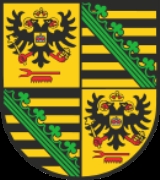
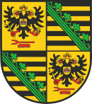
As Saalfeld was the capital of the duchy Saxony-Saalfeld, the Saxon coat of arms is displayed in the top-right and bottom-left quarter of the coat of arms. The other two quarters show the coat of arms of the Princes of Schwarzburg-Rudolstadt. The double-headed imperial eagle is the symbol for the title as imperial prince, the comb in bottom symbolizes the title of Imperial Stable Master held by the princes. |
Towns, municipalities and municipal associations
| Towns (of its own) and municipalities | ||
|---|---|---|
|
Altenbeuthen Altenbeuthen is a municipality in the district Saalfeld-Rudolstadt, in Thuringia, Germany.-References:... Arnsgereuth Arnsgereuth is a municipality in the district Saalfeld-Rudolstadt, in Thuringia, Germany.... Drognitz Drognitz is a municipality in the district Saalfeld-Rudolstadt, in Thuringia, Germany.... Hohenwarte Hohenwarte is a municipality in the district Saalfeld-Rudolstadt, in Thuringia, Germany.... Kamsdorf Kamsdorf is a municipality in the district Saalfeld-Rudolstadt, in Thuringia, Germany.... |
|
| Municipal associations (de. Verwaltungsgemeinschaften) | ||
|---|---|---|
1. Bergbahnregion/Schwarzatal Bergbahnregion/Schwarzatal Bergbahnregion/Schwarzatal is a Verwaltungsgemeinschaft in the district Saalfeld-Rudolstadt, in Thuringia, Germany. The seat of the Verwaltungsgemeinschaft is in Oberweißbach....
2. Lichtetal am Rennsteig Lichtetal am Rennsteig Lichtetal am Rennsteig is a municipal association in the district of Saalfeld-Rudolstadt, in Thuringia, Germany. The seat of government is in Lichte... Lichte thumb|220px|Wallendorfer Porcelain Manufacture, Oct. 2006thumb|220px|[[Leibis-Lichte Dam]], 102.5 m highLichte is a municipality in the district of Saalfeld-Rudolstadt in Thuringia, Germany, close to the Thuringian Rennsteig.- Geography :... 1 Piesau Piesau is a municipality in the district Saalfeld-Rudolstadt, in Thuringia, Germany close to the Thuringian Rennsteig.It has a glass-factory and is known as glass-maker-village. The first time glass was made in Piesau was in 1622. Up until today glass is the main reason of existence in Piesau. Carl... Reichmannsdorf Reichmannsdorf is a municipality in the district Saalfeld-Rudolstadt, in Thuringia, Germany.It belongs to the municipal association Lichtetal am Rennsteig, which consists of the municipalities Lichte, Piesau, Reichmannsdorf, and Schmiedefeld.-References:... Schmiedefeld Schmiedefeld is a municipality in the district Saalfeld-Rudolstadt, in Thuringia, Germany close to the Thuringian Rennsteig.... |
3. Mittleres Schwarzatal Mittleres Schwarzatal Mittleres Schwarzatal is a Verwaltungsgemeinschaft in the district Saalfeld-Rudolstadt, in Thuringia, Germany. The seat of the Verwaltungsgemeinschaft is in Sitzendorf....
|
4. Probstzella-Lehesten-Marktgölitz Probstzella-Lehesten-Marktgölitz Probstzella-Lehesten-Marktgölitz is a Verwaltungsgemeinschaft in the district Saalfeld-Rudolstadt, in Thuringia, Germany. The seat of the Verwaltungsgemeinschaft is in Probstzella....
Probstzella Probstzella is a municipality in the district Saalfeld-Rudolstadt, in Thuringia, Germany.-History:Between 1945 and 1990 Probstzella station served as East German inner German border crossing for rail transport... 1 |
| 1municipal association's residence 2town |
External links
- Official website (German)

