

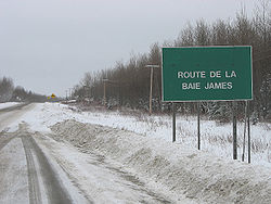
Route de la Baie James
Encyclopedia
Canadian Shield
The Canadian Shield, also called the Laurentian Plateau, or Bouclier Canadien , is a vast geological shield covered by a thin layer of soil that forms the nucleus of the North American or Laurentia craton. It is an area mostly composed of igneous rock which relates to its long volcanic history...
in northwestern Quebec
Quebec
Quebec or is a province in east-central Canada. It is the only Canadian province with a predominantly French-speaking population and the only one whose sole official language is French at the provincial level....
and reaches into the James Bay
James Bay
James Bay is a large body of water on the southern end of Hudson Bay in Canada. Both bodies of water extend from the Arctic Ocean. James Bay borders the provinces of Quebec and Ontario; islands within the bay are part of Nunavut...
region. It starts in Matagami
Matagami, Quebec
Matagami is a small town in Quebec, Canada. It is located north of Amos, on Matagami Lake, at the northern terminus of Route 109 and the start of the James Bay Road . The town had a population of 1,555 in the Canada 2006 Census.-History:Matagami was founded in 1963 with the development of mining...
as an extension of Route 109
Quebec route 109
Route 109 is a Quebec provincial highway that runs through the western regions of Abitibi-Témiscamingue and Nord-du-Québec. It begins at Route 117 in Rivière-Héva, proceeding north approximately to Amos. From there, the highway extends to Matagami, where the road continues northwards as James Bay...
and ends at Radisson
Radisson, Quebec
Radisson is a small village situated near the Robert-Bourassa hydroelectric power station on the La Grande River in the James Bay region of Quebec...
. The road is fully paved, well maintained, and plowed during the winter. As of 2002, it is no longer a provincial highway and is now administered by the Municipality of Baie-James
Baie-James, Quebec
The Municipality of Baie-James is in northern Quebec, Canada, to the east of James Bay. It covers 297,329.66 square kilometers of land, making it the largest incorporated municipality in Canada — only eight unorganized territories are larger...
. The road draws tourists interested in reaching James Bay
James Bay
James Bay is a large body of water on the southern end of Hudson Bay in Canada. Both bodies of water extend from the Arctic Ocean. James Bay borders the provinces of Quebec and Ontario; islands within the bay are part of Nunavut...
, which is a part of Hudson Bay
Hudson Bay
Hudson Bay , sometimes called Hudson's Bay, is a large body of saltwater in northeastern Canada. It drains a very large area, about , that includes parts of Ontario, Quebec, Saskatchewan, Alberta, most of Manitoba, southeastern Nunavut, as well as parts of North Dakota, South Dakota, Minnesota,...
and the Arctic Ocean
Arctic Ocean
The Arctic Ocean, located in the Northern Hemisphere and mostly in the Arctic north polar region, is the smallest and shallowest of the world's five major oceanic divisions...
.
There is currently a proposal supported by the region's Cree
Cree
The Cree are one of the largest groups of First Nations / Native Americans in North America, with 200,000 members living in Canada. In Canada, the major proportion of Cree live north and west of Lake Superior, in Ontario, Manitoba, Saskatchewan, Alberta and the Northwest Territories, although...
communities to build a gravel extension some 250 km further north to the twin communities on the Great Whale River
Great Whale River
The Great Whale River is a river in Nunavik, Quebec, Canada. It flows from Lac Saint-Luson through Lac Bienville west to Hudson Bay...
- the Cree
Cree
The Cree are one of the largest groups of First Nations / Native Americans in North America, with 200,000 members living in Canada. In Canada, the major proportion of Cree live north and west of Lake Superior, in Ontario, Manitoba, Saskatchewan, Alberta and the Northwest Territories, although...
village of Whapmagoostui
Whapmagoostui, Quebec
Whapmagoostui |beluga]]") is the northernmost Cree village in Quebec, located at the mouth of the Great Whale River on the coast of Hudson Bay in Nunavik, Quebec, Canada. About 500 people, mostly Inuit, live in the neighbouring northern village of Kuujjuarapik. The community is only accessible by...
and the northern (primarily Inuit
Inuit
The Inuit are a group of culturally similar indigenous peoples inhabiting the Arctic regions of Canada , Denmark , Russia and the United States . Inuit means “the people” in the Inuktitut language...
) village of Kuujjuarapik
Kuujjuarapik, Quebec
Kuujjuarapik is the southernmost Inuit village at the mouth of the Great Whale River on the coast of Hudson Bay in Nunavik, Quebec, Canada. About 800 people, mostly Cree, live in the adjacent village of Whapmagoostui. The community is only accessible by air and, in late summer, by boat...
, in the Nunavik
Nunavik
Nunavik comprises the northern third of the province of Quebec, Canada. Covering a land area of 443,684.71 km² north of the 55th parallel, it is the homeland of the Inuit of Quebec...
region.
History
James Bay Project
The James Bay Project is a series of hydroelectric development with a combined installed capacity of over 16,000 megawatts built since 1974 for Hydro-Québec by the on the La Grande and other rivers of Northern Quebec....
developed in the James Bay region in the 1970s and onwards. Construction began in 1971 and was completed in October, 1974. Gravel branch routes have since been built from the highway, including four roads west to Cree
Cree
The Cree are one of the largest groups of First Nations / Native Americans in North America, with 200,000 members living in Canada. In Canada, the major proportion of Cree live north and west of Lake Superior, in Ontario, Manitoba, Saskatchewan, Alberta and the Northwest Territories, although...
villages on or near James Bay (the one to Chisasibi
Chisasibi, Quebec
Chisasibi is a village on the eastern shore of James Bay, in the Eeyou Istchee territory in northern Quebec, Canada. It is situated on the south shore of La Grande River , less than from the river's mouth...
is paved for most of the way). The Trans-Taiga Road (French: Route Transtaïga) was built and reached Caniapiscau
Caniapiscau, Quebec
Caniapiscau is a vast unorganized territory in the Côte-Nord region of Quebec, Canada, part of Caniapiscau Regional County Municipality.The territory is home to the huge Caniapiscau Reservoir, the largest body of water in Quebec. The reservoir was named after Lake Caniapiscau that was flooded in...
in 1979. The 406-km long Route du Nord
Route du Nord
The Route du Nord is an isolated wilderness road in central Quebec, Canada, connecting Chibougamau with the James Bay Road at km 275. It is long, all of it unpaved...
(North Road), which also is not a numbered route, connects from km 275 (measured from Matagami) southeast to near Chibougamau, Quebec
Chibougamau, Quebec
Chibougamau is a town in central Quebec, Canada, located on Lake Gilman. It has a population of 7,563 people , which makes it the largest community in northern Quebec...
.
Description
There are no services and development along the full length of the James Bay Road, except for a full-service station at 381 kilometers from Matagami. The station at Km 381 is operational 24 hours per day, 7 days per week, and is complete with cafeteria and rudimentary lodging.In view of the remote nature of this road, there is a registration office along the side of the road for travellers to register just a few kilometers north from Matagami. It is staffed 24 hours per day, 7 days per week. This office also serves as a tourist office for all communities along or off the James Bay Road.
As further safety provisions, there are six roadside emergency telephones which connect with staff in the registration office.
Waypoints
| Km | Mi | |
|---|---|---|
| 0 | 0 | Matagami, km 0 marker for James Bay Road |
| 6 | 3.7 | Checkpoint for registration office |
| 135 | 83.9 | Emergency telephone |
| 201 | 125 | Emergency telephone |
| 232 | 144 | Bridge crossing the Broadback River Broadback River The Broadback River is a river in northern Quebec, Canada. It drains into Rupert Bay , just south of the Rupert River and Cree community Waskaganish... |
| 237 | 147 | Junction with road to Waskaganish Waskaganish, Quebec Waskaganish is a Cree village of about 2000 people at the mouth of the Rupert River on the south-east shore of James Bay in the Eeyou Istchee territory in Northern Quebec, Canada... , 102 km west |
| 247 | 153 | Emergency telephone |
| 257 | 160 | Bridge crossing the Rupert River Rupert River The Rupert River is one of the largest rivers in Quebec, Canada. From its headwaters in Lake Mistassini, the largest natural lake in Québec, it flows west into Rupert Bay on James Bay. The Rupert drains an area of . There is some extremely large whitewater on the river, but paddlers can avoid... |
| 275 | 171 | Junction with the North Road Route du Nord The Route du Nord is an isolated wilderness road in central Quebec, Canada, connecting Chibougamau with the James Bay Road at km 275. It is long, all of it unpaved... , highway through Nemaska (117 km east) to Chibougamau (440 km east) |
| 301 | 187 | Emergency telephone |
| 351 | 218 | Junction with road to Eastmain Eastmain, Quebec Eastmain is a Cree community located on James Bay at the mouth of the Eastmain River, Quebec, Canada. It is the smallest of the coastal Cree villages with a population of 606 people... , 103 km west |
| 381 | 236 | Relais 381, 24-hr service station |
| 395 | 245 | Bridge crossing the Eastmain River Eastmain River The Eastmain River is a river in northwestern Quebec which rises in north central Quebec and flows 800 km west to drain into James Bay. 'East Main' is an old name for the east side of James Bay. This river drains an area of 46,400 km²... |
| 411 | 255 | Bridge crossing the Opinaca River |
| 444 | 276 | Emergency telephone |
| 504 | 313 | Emergency telephone |
| 518 | 322 | Junction with road to Wemindji Wemindji, Quebec Wemindji is a small Cree community on Paint Hills Bay off James Bay at the mouth of the Maquatua River in Quebec, Canada. The community has a population of 1238 people .... , 96 km west |
| 544 | 338 | Junction with Trans-Taiga Road, 582 km east to Brisay Brisay generating station The Brisay hydroelectric power station is on the Caniapiscau Reservoir, in the Canadian province of Quebec. Part of Hydro-Québec's James Bay Project, the station can generate 469 MW and was commissioned in 1993. It generates electricity through the reservoir and dam system.- See also :* List of... , and an additional rough 84 km suitable only for four-wheel drive Four-wheel drive Four-wheel drive, 4WD, or 4×4 is a four-wheeled vehicle with a drivetrain that allows all four wheels to receive torque from the engine simultaneously... vehicles, no services; the road ends approximately 160 km (99.4 mi) west from Labrador Labrador Labrador is the distinct, northerly region of the Canadian province of Newfoundland and Labrador. It comprises the mainland portion of the province, separated from the island of Newfoundland by the Strait of Belle Isle... , near Schefferville, Quebec Schefferville, Quebec Schefferville is a town in the Canadian province of Quebec. Schefferville is in the heart of the Naskapi and Innu territory in northern Quebec, less than 2 km from the border with Labrador on the north shore of Knob Lake. The town has an incorporated area of . It is located within the... |
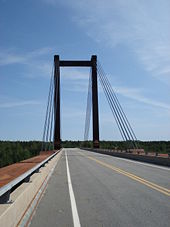
| 589 | 366 | La Grande Rivière Airport La Grande Rivière Airport La Grande Rivière Airport, , is an airfield about from Radisson, Quebec, Canada. It is used mostly to shuttle Hydro-Québec personnel between Radisson and the larger cities in Quebec, but it is also served by Air Creebec and Air Inuit.... , serving Radisson, Quebec Radisson, Quebec Radisson is a small village situated near the Robert-Bourassa hydroelectric power station on the La Grande River in the James Bay region of Quebec... |
| 600 | 373 | Junction with road to Chisasibi Chisasibi, Quebec Chisasibi is a village on the eastern shore of James Bay, in the Eeyou Istchee territory in northern Quebec, Canada. It is situated on the south shore of La Grande River , less than from the river's mouth... , 90 km west |
| 617 | 383 | Junction with access road to Radisson Radisson, Quebec Radisson is a small village situated near the Robert-Bourassa hydroelectric power station on the La Grande River in the James Bay region of Quebec... , 5 km |
| 620 | 385 | End of road - Hydro-Québec controlled-access roads from here |