
Robert Moses Causeway
Encyclopedia
The Robert Moses Causeway is an 8.1 miles (13.04 km) long parkway
in Suffolk County, New York
. The parkway, originally known as the Captree Causeway, connects West Islip
on Long Island
to the barrier beach islands, such as Captree Island, Jones Beach Island
, and the western tip of Fire Island, to the south. It is designated New York State Route 908J, an unsigned reference route. The road, like most parkways in New York State, is limited to non-commercial traffic, except south of NY 27A
.
 The Fire Island Inlet span
of the Robert Moses Causeway connects to Robert Moses State Park
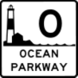
on the western tip of Fire Island. From here the road changes from a two-lane undivided highway into a four-lane undivided highway as it crosses over a cloverleaf interchange with Ocean Parkway, where it becomes a five-lane divided highway with three northbound lanes and two southbound lanes. The parkway then traverses the State Boat Channel Bridge
by way of a 665 feet (202.7 m)-long bascule bridge
modeled after the Mill Basin Drawbridge in Mill Basin, Brooklyn
. The north foot of the bridge contains an unnumbered interchange to a private road on Captree Island, where the rest of the road is surrounded by protected land. On the section that crosses over the Great South Bay
, via the Great South Bay Bridge
, the New York City skyline can be faintly seen—on a clear day. Originally a toll bridge, the remnants of the former toll plaza for the Great South Bay Bridge can be found at the north side in West Islip. At the cloverleaf interchange with New York State Route 27A
, the third northbound lane becomes the deceleration ramp, and from there the rest of the parkway is four lanes wide.
The parkway soon takes a slight northeastern turn and later rises to move over Union Boulevard (Suffolk CR 50)
the Montauk Branch
of the Long Island Rail Road
, and Orinoco Drive with no access to either roads. Instead, another cloverleaf interchange is available at New York State Route 27
, and the road remains elevated as it crosses over Muncey Road, and then runs along the west side of Casamento Park before approaching its northern terminus at the interchange with Southern State Parkway
. The north-to-eastbound ramp to the Southern State (Heckscher) Parkway contains an interchange of its own with Suffolk CR 57 (Bay Shore Road). The other ramps exist on a partial cloverleaf just west of Bay Shore Road's interchange with the Southern State.
crossing from West Islip
to Captree Island was completed in 1951. The structure is 3206.2 metres (2 mi) in length with a middle clearance for boats of 18.2 metres (59.7 ft). Originally, one lane was for southbound traffic and the other for northbound traffic. In 1967, a new span was built next to the original bridge, carrying three lanes of northbound traffic. The original bridge was reconfigured to carry southbound traffic.
The Fire Island Inlet span was completed in 1964 and by 1985 a dual span was supposed to be mimicked in order to alleviate traffic yet it was never done. When first proposed in 1938, the span was to be a vertical-lift span with a design similar to that of the Marine Parkway-Gil Hodges Memorial Bridge
. Later, the design of the Fire Island Bridge was changed to conform with that of the Great South Bay span, a 600 feet (182.9 m) steel-arch span with a 60 feet (18.3 m) clearance.
began studies on the Fire Island Inlet span due to flaws in the cement used for its construction. Currently repairs are being undertaken to extend the life and safety of the bridge; groundbreaking for a new bridge is expected in 2010. It is assumed that the new bridge will be built to the west of the current structure; the new span will be four lanes, two southbound and two northbound. The new bridge is thought to retain the look of the old one for aesthetic conformity with the other bridges of the bay. After the new bridge is constructed, the original span will be removed but implosion is not thought to be the method of deconstruction. Instead it is more likely the bridge will be disassembled and removed by crane.
|Fire Island
|0.00
|
|Robert Moses State Park
|Traffic circle
.
|-
|rowspan=2|Captree State Park
|1.03
|
|
|
|-
|
|
|Captree Island
|Exit contains ramps for reversing direction on the Causeway.
|-
|rowspan=5|West Islip
|5.25
|RM2 E-W
|
|
|-
|7.32
|RM1 W-E
|
|All trucks and buses must exit here going northbound.
|-
|8.10
|
|
|Northbound exit and southbound entrance
|-
|
|
|
|Northbound exit and entrance, from north to eastbound ramp to Heckscher and Sagtikos State Parkways
|-
|
|
|
|Northbound exit and southbound entrance
Parkway
The term parkway has several distinct principal meanings and numerous synonyms around the world, for either a type of landscaped area or a type of road.Type of landscaped area:...
in Suffolk County, New York
Suffolk County, New York
Suffolk County is a county located in the U.S. state of New York on the eastern portion of Long Island. As of the 2010 census, the population was 1,493,350. It was named for the county of Suffolk in England, from which its earliest settlers came...
. The parkway, originally known as the Captree Causeway, connects West Islip
West Islip, New York
West Islip is a hamlet and CDP, located in Suffolk County, New York, USA. Situated on the south shore of Long Island, the population of the CDP was 29,907 at the time of the 2000 census.-Geography:West Islip is located at ....
on Long Island
Long Island
Long Island is an island located in the southeast part of the U.S. state of New York, just east of Manhattan. Stretching northeast into the Atlantic Ocean, Long Island contains four counties, two of which are boroughs of New York City , and two of which are mainly suburban...
to the barrier beach islands, such as Captree Island, Jones Beach Island
Jones Beach Island
Jones Beach Island is one of the outer barrier islands off the southern coast of Long Island in the U.S. state of New York. It is named for the father of Thomas Jones. It is sometimes referred to as Oak Beach Island, and the former home of the infamous Oak Beach Inn. It is separated from Long...
, and the western tip of Fire Island, to the south. It is designated New York State Route 908J, an unsigned reference route. The road, like most parkways in New York State, is limited to non-commercial traffic, except south of NY 27A
New York State Route 27A
New York State Route 27A is a state highway extending from Massapequa in Nassau County to Oakdale in Suffolk County on Long Island, New York in the United States...
.
Route description
Fire Island Inlet Bridge
The Fire Island Inlet Bridge, an integral part of the Robert Moses Causeway, is a two-lane, steel arch span with a concrete deck that carries Route 908 over Fire Island Inlet....
of the Robert Moses Causeway connects to Robert Moses State Park
Robert Moses State Park (Long Island)
Robert Moses State Park - Long Island is a state park that is located in the state of New York.The park lies in southern Suffolk County on the western end of Fire Island, one of the central barrier Islands off the southern coast of Long Island...
on the western tip of Fire Island. From here the road changes from a two-lane undivided highway into a four-lane undivided highway as it crosses over a cloverleaf interchange with Ocean Parkway, where it becomes a five-lane divided highway with three northbound lanes and two southbound lanes. The parkway then traverses the State Boat Channel Bridge
State Boat Channel Bridge
State Boat Channel Bridge is a Suffolk County, New York Bascule bridge that crosses over the Long Island New York State Boat Channel connecting Captree Island and Jones Beach island on Robert Moses Causeway in Gilgo-Oak Beach-Captree, Babylon, NY.This 665-foot-long bascule bridge, meets the Ocean...
by way of a 665 feet (202.7 m)-long bascule bridge
Bascule bridge
A bascule bridge is a moveable bridge with a counterweight that continuously balances the span, or "leaf," throughout the entire upward swing in providing clearance for boat traffic....
modeled after the Mill Basin Drawbridge in Mill Basin, Brooklyn
Mill Basin, Brooklyn
Mill Basin is a neighborhood in New York City in the southern portion of the borough of Brooklyn lying along Jamaica Bay and bounded to the north by Avenue U, and to the east, south, and west by the Mill Basin/Mill Island Inlet...
. The north foot of the bridge contains an unnumbered interchange to a private road on Captree Island, where the rest of the road is surrounded by protected land. On the section that crosses over the Great South Bay
Great South Bay
Great South Bay is a lagoon situated between Long Island and Fire Island, in the State of New York. It is approximately long. It's protected from the Atlantic Ocean by Fire Island, a barrier island, as well as the eastern end of Jones Beach Island and Captree Island.Robert Moses Causeway adjoins...
, via the Great South Bay Bridge
Great South Bay Bridge
Great South Bay Bridge is a bridge connecting the Robert Moses Causeway from Long Island's mainland over the Great South Bay, connecting to both Captree and Jones Beach Islands on the southwest central side of Long Island New York....
, the New York City skyline can be faintly seen—on a clear day. Originally a toll bridge, the remnants of the former toll plaza for the Great South Bay Bridge can be found at the north side in West Islip. At the cloverleaf interchange with New York State Route 27A
New York State Route 27A
New York State Route 27A is a state highway extending from Massapequa in Nassau County to Oakdale in Suffolk County on Long Island, New York in the United States...
, the third northbound lane becomes the deceleration ramp, and from there the rest of the parkway is four lanes wide.
The parkway soon takes a slight northeastern turn and later rises to move over Union Boulevard (Suffolk CR 50)
County Route 50 (Suffolk County, New York)
Suffolk County Route 50 is a county road in Southwestern Suffolk County, New York. It runs east and west between Babylon and Great River, New York...
the Montauk Branch
Montauk Branch
The Montauk Branch is a rail line owned and operated by the Long Island Rail Road in the U.S. state of New York. The branch runs the length of Long Island, 115 miles from Long Island City on the west to Montauk on the east...
of the Long Island Rail Road
Long Island Rail Road
The Long Island Rail Road or LIRR is a commuter rail system serving the length of Long Island, New York. It is the busiest commuter railroad in North America, serving about 81.5 million passengers each year. Established in 1834 and having operated continuously since then, it is the oldest US...
, and Orinoco Drive with no access to either roads. Instead, another cloverleaf interchange is available at New York State Route 27
New York State Route 27
New York State Route 27 is an east–west long state highway extending from Interstate 278 in the New York City borough of Brooklyn to Montauk Point State Park on Long Island, New York, United States...
, and the road remains elevated as it crosses over Muncey Road, and then runs along the west side of Casamento Park before approaching its northern terminus at the interchange with Southern State Parkway
Southern State Parkway
The Southern State Parkway is a long limited-access highway on Long Island, in the U.S. state of New York...
. The north-to-eastbound ramp to the Southern State (Heckscher) Parkway contains an interchange of its own with Suffolk CR 57 (Bay Shore Road). The other ramps exist on a partial cloverleaf just west of Bay Shore Road's interchange with the Southern State.
History
The first sprawling trestleTrestle
A trestle is a rigid frame used as a support, especially referring to a bridge composed of a number of short spans supported by such frames. In the context of trestle bridges, each supporting frame is generally referred to as a bent...
crossing from West Islip
West Islip, New York
West Islip is a hamlet and CDP, located in Suffolk County, New York, USA. Situated on the south shore of Long Island, the population of the CDP was 29,907 at the time of the 2000 census.-Geography:West Islip is located at ....
to Captree Island was completed in 1951. The structure is 3206.2 metres (2 mi) in length with a middle clearance for boats of 18.2 metres (59.7 ft). Originally, one lane was for southbound traffic and the other for northbound traffic. In 1967, a new span was built next to the original bridge, carrying three lanes of northbound traffic. The original bridge was reconfigured to carry southbound traffic.
The Fire Island Inlet span was completed in 1964 and by 1985 a dual span was supposed to be mimicked in order to alleviate traffic yet it was never done. When first proposed in 1938, the span was to be a vertical-lift span with a design similar to that of the Marine Parkway-Gil Hodges Memorial Bridge
Marine Parkway-Gil Hodges Memorial Bridge
The Marine Parkway-Gil Hodges Memorial Bridge in New York City is a vertical lift bridge that crosses Rockaway Inlet and connects the Rockaway Peninsula in Queens, with Marine Parkway to Floyd Bennett Field, Flatbush Avenue, and the Marine Park neighborhood in Brooklyn...
. Later, the design of the Fire Island Bridge was changed to conform with that of the Great South Bay span, a 600 feet (182.9 m) steel-arch span with a 60 feet (18.3 m) clearance.
Future
In 2004, the New York State Department of TransportationNew York State Department of Transportation
The New York State Department of Transportation is responsible for the development and operation of highways, railroads, mass transit systems, ports, waterways and aviation facilities in the U.S...
began studies on the Fire Island Inlet span due to flaws in the cement used for its construction. Currently repairs are being undertaken to extend the life and safety of the bridge; groundbreaking for a new bridge is expected in 2010. It is assumed that the new bridge will be built to the west of the current structure; the new span will be four lanes, two southbound and two northbound. The new bridge is thought to retain the look of the old one for aesthetic conformity with the other bridges of the bay. After the new bridge is constructed, the original span will be removed but implosion is not thought to be the method of deconstruction. Instead it is more likely the bridge will be disassembled and removed by crane.
Exit list
|-|Fire Island
|0.00
|
|Robert Moses State Park
Robert Moses State Park (Long Island)
Robert Moses State Park - Long Island is a state park that is located in the state of New York.The park lies in southern Suffolk County on the western end of Fire Island, one of the central barrier Islands off the southern coast of Long Island...
|Traffic circle
Traffic circle
A traffic circle or rotary is a type of circular intersection in which traffic must travel in one direction around a central island. In some countries, traffic entering the circle has the right-of-way and drivers in the circle must yield. In many other countries, traffic entering the circle must...
.
|-
|rowspan=2|Captree State Park
Captree State Park
Captree State Park is a state park in Suffolk County, New York in the USA.The park is located on the easternmost end of Jones Island , and overlooks the Fire Island Inlet and the westernmost section of Fire Island, partly in the Town of Babylon.The park offers a marina and boat launch, fishing,...
|1.03
|
|
|
|-
|
|
|Captree Island
|Exit contains ramps for reversing direction on the Causeway.
|-
|rowspan=5|West Islip
West Islip, New York
West Islip is a hamlet and CDP, located in Suffolk County, New York, USA. Situated on the south shore of Long Island, the population of the CDP was 29,907 at the time of the 2000 census.-Geography:West Islip is located at ....
|5.25
|RM2 E-W
|
|
|-
|7.32
|RM1 W-E
|
|All trucks and buses must exit here going northbound.
|-
|8.10
|
|
|Northbound exit and southbound entrance
|-
|
|
|
|Northbound exit and entrance, from north to eastbound ramp to Heckscher and Sagtikos State Parkways
|-
|
|
|
|Northbound exit and southbound entrance