
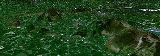
Ring of Gullion AONB
Encyclopedia
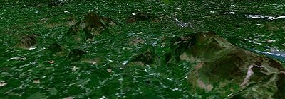
Area of Outstanding Natural Beauty
An Area of Outstanding Natural Beauty is an area of countryside considered to have significant landscape value in England, Wales or Northern Ireland, that has been specially designated by the Countryside Agency on behalf of the United Kingdom government; the Countryside Council for Wales on...
(AONB). It is located in County Armagh
County Armagh
-History:Ancient Armagh was the territory of the Ulaid before the fourth century AD. It was ruled by the Red Branch, whose capital was Emain Macha near Armagh. The site, and subsequently the city, were named after the goddess Macha...
, Northern Ireland
Northern Ireland
Northern Ireland is one of the four countries of the United Kingdom. Situated in the north-east of the island of Ireland, it shares a border with the Republic of Ireland to the south and west...
, measures roughly 42 by 18 kilometres (26 by 11 mi) and comprises some 150 km² defined topographically by the hills of the Ring Dyke.
This structure was the first Ring dike
Ring dike
A ring dike or ring dyke in geology refers to an intrusive igneous body. Their chemistry, petrology and field appearance precisely match those of dikes or sill, but their concentric or radial geometric distribution around a centre of volcanic activity indicates their subvolcanic origins.-Notable...
to be mapped, although its significance was not understood until similar structures had been described from Scotland. It was emplaced during the Tertiary
Tertiary
The Tertiary is a deprecated term for a geologic period 65 million to 2.6 million years ago. The Tertiary covered the time span between the superseded Secondary period and the Quaternary...
opening of the Atlantic Ocean during the formation of the Tertiary Igneous Province
North Atlantic Igneous Province
The North Atlantic Igneous Province is a large igneous province estimated to be at least 1.3 km2 in area and 6.6 km3 in volume. Geographically, the NAIP makes up all of the North Atlantic Ocean as well as the Paleocene and Eocene basalts of Greenland, Iceland, the United Kingdom, Denmark, Norway...
.
Formation
The Ring Dyke's structure was produced when the active volcano's calderaCaldera
A caldera is a cauldron-like volcanic feature usually formed by the collapse of land following a volcanic eruption, such as the one at Yellowstone National Park in the US. They are sometimes confused with volcanic craters...
underwent collapse producing a concentric suite of faults providing space into which magma was able to intrude. The ring dyke is composite with both porphyritic
Porphyry (geology)
Porphyry is a variety of igneous rock consisting of large-grained crystals, such as feldspar or quartz, dispersed in a fine-grained feldspathic matrix or groundmass. The larger crystals are called phenocrysts...
granophyre
Granophyre
Granophyre is a subvolcanic rock that contains quartz and alkali feldspar in characteristic angular intergrowths such as those in the accompanying image....
and porphyritic felsite
Felsite
Felsite is a very fine grained volcanic rock that may or may not contain larger crystals. Felsite is a field term for a light colored rock that typically requires petrographic examination or chemical analysis for more precise definition...
components. The composition of the remainder of the volcano today is dominated by Gabbro
Gabbro
Gabbro refers to a large group of dark, coarse-grained, intrusive mafic igneous rocks chemically equivalent to basalt. The rocks are plutonic, formed when molten magma is trapped beneath the Earth's surface and cools into a crystalline mass....
and granophyre
Granophyre
Granophyre is a subvolcanic rock that contains quartz and alkali feldspar in characteristic angular intergrowths such as those in the accompanying image....
and is also so site of a noted PGE occurrence.
AONB
The AONB area of the Ring of Gullion includes the Mountain Ring and its various slopes, but also there is a deviation to the west to include the famous Dorsey Enclosure. In the west it also includes the valley of the Cully Water and the Umeracam River which separate the hills of the ring dyke from the rolling drumlinDrumlin
A drumlin, from the Irish word droimnín , first recorded in 1833, is an elongated whale-shaped hill formed by glacial ice acting on underlying unconsolidated till or ground moraine.-Drumlin formation:...
landscape extending towards Crossmaglen
Crossmaglen
Crossmaglen or Crosmaglen is a village and townland in south County Armagh, Northern Ireland. It had a population of 1,459 people in the 2001 Census and is the largest village in south Armagh...
and Cullyhanna
Cullyhanna
Cullyhanna is a small village and townland in County Armagh, Northern Ireland. It lies on the main road between Newtownhamilton and Crossmaglen. It had a population of 306 in the 2001 Census...
. In the north-west the ring dyke runs through the higher ground of the Fews where it is picked out by sharp rocky hills with distinctive heath vegetation (which is the derivation of The Fews name). To the east its boundary is the Newry Canal
Newry Canal
The Newry Canal, located in Northern Ireland, was built to link the Tyrone coalfields to the Irish Sea at Carlingford Lough near Newry.-History:...
and the Newry River
Newry River
Newry River and River Clanrye are names for one of the rivers of Ireland; it passes through the city of Newry and empties into Carlingford Lough near Warrenpoint...
flowing towards Carlingford Lough
Carlingford Lough
Carlingford Lough is a glacial fjord or sea inlet that forms part of the border between Northern Ireland to the north and the Republic of Ireland to the south. On its northern shore is County Down and on its southern shore is County Louth...
under the brow of Anglesey and Flagstaff Mountains.