
Richmond County, Georgia
Encyclopedia
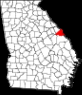
Richmond County is a county
located in the U.S. state of Georgia. It is one of the original counties of Georgia, created February 5, 1777. As of 2010, the population was 200,549. The 2007 Census Estimate showed a population of 199,486.
Following an election in 1995, the city of Augusta
(the county seat
) consolidated governments with Richmond County. The consolidated entity is known as Augusta-Richmond County, or simply Augusta. The cities of Hephzibah
and Blythe
in southern Richmond County voted to remain separate and not consolidate.
The county is part of the Augusta, Georgia metropolitan area of Georgia and South Carolina
.
, a British politician and office-holder sympathetic to the cause of the American colonies. Richmond was also a first cousin to King George III
.
Richmond County was established in 1777 by the first Constitution of the (newly independent) State of Georgia. As such, it is one of the original counties of the state. It was formed out of a portion of the colonial Parish of St. Paul, after the Revolution disestablished the Church of England in the (former) Royal Province of Georgia.
of 2000, there were 199,775 people, 73,920 households, and 49,526 families residing in the county. The population density
was 616 people per square mile (238/km²). There were 82,312 housing units at an average density of 254 per square mile (98/km²). The racial makeup of the county was 49.75% Black
or African American
, 45.55% White
, 0.28% Native American
, 1.50% Asian
, 0.12% Pacific Islander
, 1.01% from other races
, and 1.78% from two or more races. 2.78% of the population were Hispanic
or Latino
of any race.
There were 73,920 households out of which 33.60% had children under the age of 18 living with them, 41.80% were married couples
living together, 20.80% had a female householder with no husband present, and 33.00% were non-families. 27.70% of all households were made up of individuals and 8.50% had someone living alone who was 65 years of age or older. The average household size was 2.55 and the average family size was 3.13.
In the county the population was spread out with 26.80% under the age of 18, 12.00% from 18 to 24, 29.90% from 25 to 44, 20.50% from 45 to 64, and 10.80% who were 65 years of age or older. The median age was 32 years. For every 100 females there were 93.20 males. For every 100 females age 18 and over, there were 89.80 males.
The median income for a household in the county was $38,004, and the median income for a family was $52,892. Males had a median income of $30,028 versus $23,512 for females. The per capita income
for the county was $18,133. About 16.20% of families and 19.60% of the population were below the poverty line, including 27.20% of those under age 18 and 14.10% of those age 65 or over.
County (United States)
In the United States, a county is a geographic subdivision of a state , usually assigned some governmental authority. The term "county" is used in 48 of the 50 states; Louisiana is divided into parishes and Alaska into boroughs. Parishes and boroughs are called "county-equivalents" by the U.S...
located in the U.S. state of Georgia. It is one of the original counties of Georgia, created February 5, 1777. As of 2010, the population was 200,549. The 2007 Census Estimate showed a population of 199,486.
Following an election in 1995, the city of Augusta
Augusta, Georgia
Augusta is a consolidated city in the U.S. state of Georgia, located along the Savannah River. As of the 2010 census, the Augusta–Richmond County population was 195,844 not counting the unconsolidated cities of Hephzibah and Blythe.Augusta is the principal city of the Augusta-Richmond County...
(the county seat
County seat
A county seat is an administrative center, or seat of government, for a county or civil parish. The term is primarily used in the United States....
) consolidated governments with Richmond County. The consolidated entity is known as Augusta-Richmond County, or simply Augusta. The cities of Hephzibah
Hephzibah, Georgia
Hephzibah is a city in south Richmond County, in the U.S. state of Georgia. It is part of the Augusta – Richmond County Metropolitan Statistical Area. The population was 3,880 at the 2000 census....
and Blythe
Blythe, Georgia
Blythe is a city in Burke and Richmond Counties in the U.S. state of Georgia. The population was 718 at the 2000 census. It is part of the Augusta, Georgia metropolitan area.-Geography:Blythe is located at ....
in southern Richmond County voted to remain separate and not consolidate.
The county is part of the Augusta, Georgia metropolitan area of Georgia and South Carolina
South Carolina
South Carolina is a state in the Deep South of the United States that borders Georgia to the south, North Carolina to the north, and the Atlantic Ocean to the east. Originally part of the Province of Carolina, the Province of South Carolina was one of the 13 colonies that declared independence...
.
History
The county is named for Charles Lennox, 3rd Duke of RichmondCharles Lennox, 3rd Duke of Richmond
Field Marshal Charles Lennox, 3rd Duke of Richmond, 3rd Duke of Lennox, 3rd Duke of Aubigny, KG, PC, FRS , styled Earl of March until 1750, was a British politician and office holder noteworthy for his advanced views on the issue of parliamentary reform...
, a British politician and office-holder sympathetic to the cause of the American colonies. Richmond was also a first cousin to King George III
George III of the United Kingdom
George III was King of Great Britain and King of Ireland from 25 October 1760 until the union of these two countries on 1 January 1801, after which he was King of the United Kingdom of Great Britain and Ireland until his death...
.
Richmond County was established in 1777 by the first Constitution of the (newly independent) State of Georgia. As such, it is one of the original counties of the state. It was formed out of a portion of the colonial Parish of St. Paul, after the Revolution disestablished the Church of England in the (former) Royal Province of Georgia.
Geography
According to the 2000 census, the county has a total area of 328.45 square miles (850.7 km²), of which 324.04 square miles (839.3 km²) (or 98.66%) is land and 4.41 square miles (11.4 km²) (or 1.34%) is water.Major highways
|
.svg.png)
 (
( ) U.S. Highway 1 (Georgia State Route 4) — Deans Bridge Rd. (from county line to Gordon Hwy.), Gordon Hwy. (from Deans Bridge Rd. to state line)
 U.S. Highway 25 — Peach Orchard Rd. (entire length), Gordon Hwy. (from Peach Orchard Rd. to state line)
 U.S. Highway 78 /
  U.S. Highway 278 /
  State Route 10 — Gordon Hwy.


Adjacent counties
- Edgefield County, South CarolinaSouth CarolinaSouth Carolina is a state in the Deep South of the United States that borders Georgia to the south, North Carolina to the north, and the Atlantic Ocean to the east. Originally part of the Province of Carolina, the Province of South Carolina was one of the 13 colonies that declared independence...
(north) - Aiken CountyAiken County, South CarolinaAiken County is a county located in the U.S. state of South Carolina. In 2000, its population was 142,552; in 2010, the U.S. Census Bureau estimated that its population had reached 160,099...
, South CarolinaSouth CarolinaSouth Carolina is a state in the Deep South of the United States that borders Georgia to the south, North Carolina to the north, and the Atlantic Ocean to the east. Originally part of the Province of Carolina, the Province of South Carolina was one of the 13 colonies that declared independence...
(northeast) - Burke CountyBurke County, GeorgiaBurke County is a county located in the U.S. state of Georgia. As of 2000, the population was 22,243. The 2007 Census Estimate showed a population of 22,754...
(south)
- Jefferson CountyJefferson County, GeorgiaJefferson County is a county located in the U.S. state of Georgia. It was created on February 20, 1796. As of 2000, the population was 17,266. The 2007 Census Estimate shows a population of 16,454...
(southwest) - McDuffie CountyMcDuffie County, GeorgiaMcDuffie County is a county located in the U.S. state of Georgia. It was created on October 18, 1870. As of 2000, the population was 21,231. The 2007 Census Estimate showed a population of 21,551. The county seat is Thomson....
(west) - Columbia CountyColumbia County, GeorgiaColumbia County is a county located in the US state of Georgia along the Savannah River. As of 2010 the population was 124,054 a growth of 39% from the 2000 census figure of 89,288. The de jure county seat is Appling. Appling is an unincorporated area, making Columbia one of only three counties...
(northwest)
Demographics
As of the censusCensus
A census is the procedure of systematically acquiring and recording information about the members of a given population. It is a regularly occurring and official count of a particular population. The term is used mostly in connection with national population and housing censuses; other common...
of 2000, there were 199,775 people, 73,920 households, and 49,526 families residing in the county. The population density
Population density
Population density is a measurement of population per unit area or unit volume. It is frequently applied to living organisms, and particularly to humans...
was 616 people per square mile (238/km²). There were 82,312 housing units at an average density of 254 per square mile (98/km²). The racial makeup of the county was 49.75% Black
Race (United States Census)
Race and ethnicity in the United States Census, as defined by the Federal Office of Management and Budget and the United States Census Bureau, are self-identification data items in which residents choose the race or races with which they most closely identify, and indicate whether or not they are...
or African American
Race (United States Census)
Race and ethnicity in the United States Census, as defined by the Federal Office of Management and Budget and the United States Census Bureau, are self-identification data items in which residents choose the race or races with which they most closely identify, and indicate whether or not they are...
, 45.55% White
Race (United States Census)
Race and ethnicity in the United States Census, as defined by the Federal Office of Management and Budget and the United States Census Bureau, are self-identification data items in which residents choose the race or races with which they most closely identify, and indicate whether or not they are...
, 0.28% Native American
Race (United States Census)
Race and ethnicity in the United States Census, as defined by the Federal Office of Management and Budget and the United States Census Bureau, are self-identification data items in which residents choose the race or races with which they most closely identify, and indicate whether or not they are...
, 1.50% Asian
Race (United States Census)
Race and ethnicity in the United States Census, as defined by the Federal Office of Management and Budget and the United States Census Bureau, are self-identification data items in which residents choose the race or races with which they most closely identify, and indicate whether or not they are...
, 0.12% Pacific Islander
Race (United States Census)
Race and ethnicity in the United States Census, as defined by the Federal Office of Management and Budget and the United States Census Bureau, are self-identification data items in which residents choose the race or races with which they most closely identify, and indicate whether or not they are...
, 1.01% from other races
Race (United States Census)
Race and ethnicity in the United States Census, as defined by the Federal Office of Management and Budget and the United States Census Bureau, are self-identification data items in which residents choose the race or races with which they most closely identify, and indicate whether or not they are...
, and 1.78% from two or more races. 2.78% of the population were Hispanic
Race (United States Census)
Race and ethnicity in the United States Census, as defined by the Federal Office of Management and Budget and the United States Census Bureau, are self-identification data items in which residents choose the race or races with which they most closely identify, and indicate whether or not they are...
or Latino
Race (United States Census)
Race and ethnicity in the United States Census, as defined by the Federal Office of Management and Budget and the United States Census Bureau, are self-identification data items in which residents choose the race or races with which they most closely identify, and indicate whether or not they are...
of any race.
There were 73,920 households out of which 33.60% had children under the age of 18 living with them, 41.80% were married couples
Marriage
Marriage is a social union or legal contract between people that creates kinship. It is an institution in which interpersonal relationships, usually intimate and sexual, are acknowledged in a variety of ways, depending on the culture or subculture in which it is found...
living together, 20.80% had a female householder with no husband present, and 33.00% were non-families. 27.70% of all households were made up of individuals and 8.50% had someone living alone who was 65 years of age or older. The average household size was 2.55 and the average family size was 3.13.
In the county the population was spread out with 26.80% under the age of 18, 12.00% from 18 to 24, 29.90% from 25 to 44, 20.50% from 45 to 64, and 10.80% who were 65 years of age or older. The median age was 32 years. For every 100 females there were 93.20 males. For every 100 females age 18 and over, there were 89.80 males.
The median income for a household in the county was $38,004, and the median income for a family was $52,892. Males had a median income of $30,028 versus $23,512 for females. The per capita income
Per capita income
Per capita income or income per person is a measure of mean income within an economic aggregate, such as a country or city. It is calculated by taking a measure of all sources of income in the aggregate and dividing it by the total population...
for the county was $18,133. About 16.20% of families and 19.60% of the population were below the poverty line, including 27.20% of those under age 18 and 14.10% of those age 65 or over.
Cities
- AugustaAugusta, GeorgiaAugusta is a consolidated city in the U.S. state of Georgia, located along the Savannah River. As of the 2010 census, the Augusta–Richmond County population was 195,844 not counting the unconsolidated cities of Hephzibah and Blythe.Augusta is the principal city of the Augusta-Richmond County...
- BlytheBlythe, GeorgiaBlythe is a city in Burke and Richmond Counties in the U.S. state of Georgia. The population was 718 at the 2000 census. It is part of the Augusta, Georgia metropolitan area.-Geography:Blythe is located at ....
- HephzibahHephzibah, GeorgiaHephzibah is a city in south Richmond County, in the U.S. state of Georgia. It is part of the Augusta – Richmond County Metropolitan Statistical Area. The population was 3,880 at the 2000 census....
- Fort Gordon
See also
- National Register of Historic Places listings in Richmond County, Georgia
- Richmond County School System
- New Savannah, GeorgiaNew Savannah, GeorgiaThe dead town of New Savannah, Georgia began about 1740 as a Chickasaw village on the Savannah River, at the mouth of Butler Creek below Augusta. Stories as to the circumstances vary, but in any case some portion of the Horse Creek Chickasaws under Squirrel King moved across the river and founded...
External links
- Official website of Augusta-Richmond County consolidated government
- Documents from Richmond County in the Digital Library of Georgia
- Georgia Department of Transportation map of Richmond County (Note: map uses pre-consolidation city boundaries)