

Ranchos of California
Encyclopedia
The Spanish, and later the Méxican
government encouraged settlement of territory now known as California
by the establishment of large land grants called ranchos, from which the English ranch is derived. Devoted to raising cattle and sheep, the owners of the ranchos attempted to pattern themselves after the landed gentry of Spain. Their workers included Californian Native Americans
who had learned to speak Spanish, many of them former Mission
residents. Of the 800-plus grants, Spain made about 30 between 1784 and 1821. The remainder were granted by Mexico between 1833 and 1846. The ranchos established land-use patterns that are recognizable in the California of today. Rancho boundaries became the basis for California's land survey system, and can still be found on modern maps and land titles.
, permitting settlement and granting grazing rights on specific tracts of land, while the crown retained the title. The ranchos, that is, the settlement by individuals of tracts of land outside presidio, mission, and pueblo
boundaries, began in 1784, when Juan Jose Dominguez got permission from Spanish Governor Pedro Fages
to put his cattle on the 48000 acres (194.2 km²) Rancho San Pedro
. The land concessions were usually measured in leagues
. A league of land would encompass a square that is one Spanish league on each side – approximately 4428 acres (18 km²).
 It was not until the Mexican era (1821–1846) that the titles to the plots of land were granted to individuals. In 1821, Mexico achieved its independence
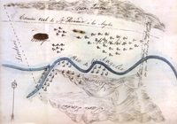
from Spain, and California came under control of the Mexican government. The 1824 Mexican Colony Law established rules for petitioning for land grants in California; and by 1828, the rules for establishing land grants were codified in the Mexican Reglamento (Regulation). The Acts sought to break the monopoly of the missions and also paved the way for additional settlers to California by making land grants easier to obtain. The procedure included a 'diseño' – a hand-drawn topological map - to define the area. The Mexican Governors of Alta California gained the power to grant state lands, and many of the Spanish concessions were subsequently patented under Mexican law.
Through the Secularization Act of 1833, the Mexican government repossessed most of the lands provided to the missions
by the Spanish crown. Secularization
was implemented between 1834 and 1836. The government allowed the padres to keep only the church, priest's quarters and priest's garden. A commissioner would oversee the crops and herds, while the land was divided up as communal pasture, a town plot, and individual plots for each Indian family.
The number of Mexican land grants greatly increased after the secularization of the missions in 1834. Although the original intent of the secularization legislation was to have the property divided among former mission Indians, most of the grants were made to influential Californios of Spanish background.
The Mexican grants were provisional. The boundaries had to be officially surveyed and marked. The grantee could not subdivide or rent out the land. The land had to be used and cultivated. A residential house had to be built within a year. Public roads crossing through the property could not be closed. If the provisional conditions were not met, the land grant could be 'denounced' by another party who could claim the land.
, the capital of California, and terminated the authority and jurisdiction of Mexican officials that day. Armed resistance ended in California with the Treaty of Cahuenga
signed on January 13, 1847. The Treaty of Guadalupe Hidalgo
, ending the war, was signed February 2, 1848 and California became a Territory of the United States. Between 1847–1849, California was run by the U.S. military. A constitutional convention met in Monterey in September 1849, and set up a state government. It operated for 10 months before California was admitted to the Union as the 31st State by Congress
, as part of the Compromise of 1850
, enacted on September 9, 1850.
, as thousands of miners and other fortune seekers flooded into northern California. These newcomers needed meat, and cattle prices soared with demand. The rancheros enjoyed the halcyon days of Hispanic California.
Sponsored by California Senator William M. Gwin
,in 1851 the United States Congress
passed "An Act to Ascertain and Settle Private Land Claims in the State of California". The Act required all holders of Spanish and Mexican land grant
s to present their titles for confirmation before the Board of California Land Commissioners
. Contrary to the Treaty of Guadalupe Hidalgo, this Act placed the burden of proof of title on landholders. In many cases, the land grants had been made without clearly defining the exact boundaries. Even in cases where the boundaries were more specific, many markers had been destroyed before accurate surveys could be made. Aside from indefinite survey lines, the Land Commission had to determine whether the grantees had fulfilled the requirements of the Mexican colonization laws. While the Land Commission confirmed 604 of the 813 claims it reviewed, most decisions were appealed to US District Court and some to the Supreme Court. The confirmation process required lawyers, translators, and surveyors, and took an average of 17 years (with American Civil War
, 1861–1865) to resolve. It proved expensive for landholders to defend their titles through the court system. In many cases, they had to sell their land to pay for defense fees or gave attorneys land in lieu of payment.
Land from titles not confirmed became part of the public domain, and available for homesteaders, who could claim up to 160 acre (0.6474976 km²) plots in accordance with federal homestead law
. Rejected land claims resulted in claimants, squatters, and settlers pressing Congress
to change the rules. Under the Pre-emption Act of 1841, owners were able to "pre-empt" their portions of the grant, and acquire title for $1.25 an acre up to a maximum of 160 acre (0.6474976 km²). Beginning with Rancho Suscol in 1863, special acts of Congress were passed that allowed certain claimants to pre-empt their land – without regard to acreage. By 1866 this privilege was extended to all owners of rejected claims.
A shift in the economic dominance of grain farming over cattle raising was marked by the passage of the California "No-Fence Law" in 1874. This repealed the Trespass Act of 1850, which had required farmers to protect their planted fields from free-ranging cattle. The repeal of the Trespass Act required that ranchers fence stock in, rather than farmers fencing cattle out. The ranchers were faced with either the high expense of fencing large grazing tracts or selling their cattle at ruinous prices.
History of Mexico
The history of Mexico, a country located in the southern portion of North America, covers a period of more than two millennia. First populated more than 13,000 years ago, the country produced complex indigenous civilizations before being conquered by the Spanish in the 16th Century.Since the...
government encouraged settlement of territory now known as California
California
California is a state located on the West Coast of the United States. It is by far the most populous U.S. state, and the third-largest by land area...
by the establishment of large land grants called ranchos, from which the English ranch is derived. Devoted to raising cattle and sheep, the owners of the ranchos attempted to pattern themselves after the landed gentry of Spain. Their workers included Californian Native Americans
Population of Native California
Estimates of the Native Californian population have varied substantially, both with respect to California's pre-contact count and for changes during subsequent periods. Pre-contact estimates range from 133,000 to 705,000 with some recent scholars concluding that these estimates are low...
who had learned to speak Spanish, many of them former Mission
Spanish missions in California
The Spanish missions in California comprise a series of religious and military outposts established by Spanish Catholics of the Franciscan Order between 1769 and 1823 to spread the Christian faith among the local Native Americans. The missions represented the first major effort by Europeans to...
residents. Of the 800-plus grants, Spain made about 30 between 1784 and 1821. The remainder were granted by Mexico between 1833 and 1846. The ranchos established land-use patterns that are recognizable in the California of today. Rancho boundaries became the basis for California's land survey system, and can still be found on modern maps and land titles.
Spanish era
During Spanish rule (1769–1821), the ranchos were concessions from the Spanish crownCrown of Castile
The Crown of Castile was a medieval and modern state in the Iberian Peninsula that formed in 1230 as a result of the third and definitive union of the crowns and parliaments of the kingdoms of Castile and León upon the accession of the then King Ferdinand III of Castile to the vacant Leonese throne...
, permitting settlement and granting grazing rights on specific tracts of land, while the crown retained the title. The ranchos, that is, the settlement by individuals of tracts of land outside presidio, mission, and pueblo
Cabildo (council)
For a discussion of the contemporary Spanish and Latin American cabildo, see Ayuntamiento.A cabildo or ayuntamiento was a former Spanish, colonial administrative council that governed a municipality. Cabildos were sometimes appointed, sometimes elected, but were considered to be representative of...
boundaries, began in 1784, when Juan Jose Dominguez got permission from Spanish Governor Pedro Fages
Pedro Fages
Pere Fages Beleta , nicknamed L'Ós , was a soldier, explorer, and the second Spanish military Governor of Las Californias Province of New Spain from 1770 to 1774, and the Governor of Las Californias from 1782 to 1791.-Life:...
to put his cattle on the 48000 acres (194.2 km²) Rancho San Pedro
Rancho San Pedro
Rancho San Pedro was one of the first California land grants, and the first to win a patent from the United States. The land grant was validated by the Mexican government at in 1828, and a US patent validating was issued in 1858...
. The land concessions were usually measured in leagues
League (unit)
A league is a unit of length . It was long common in Europe and Latin America, but it is no longer an official unit in any nation. The league originally referred to the distance a person or a horse could walk in an hour...
. A league of land would encompass a square that is one Spanish league on each side – approximately 4428 acres (18 km²).
List of Spanish era concessions
(Listed chronologically by date of concession)| Concession | Date | Grantor | Grantee | Size | Location | County |
|---|---|---|---|---|---|---|
| San Pedro Rancho San Pedro Rancho San Pedro was one of the first California land grants, and the first to win a patent from the United States. The land grant was validated by the Mexican government at in 1828, and a US patent validating was issued in 1858... |
1784 | Pedro Fages Pedro Fages Pere Fages Beleta , nicknamed L'Ós , was a soldier, explorer, and the second Spanish military Governor of Las Californias Province of New Spain from 1770 to 1774, and the Governor of Las Californias from 1782 to 1791.-Life:... |
Juan Jose Dominguez | 48000 acres (194 km²) | San Pedro San Pedro, Los Angeles, California San Pedro is a port district of the city of Los Angeles, California, United States. It was annexed in 1909 and is a major seaport of the area... , Torrance Torrance, California Torrance is a city incorporated in 1921 and located in the South Bay region of Los Angeles County, California, United States. Torrance has of shore-front beaches on the Pacific Ocean, quieter and less well-known by tourists than others on the Santa Monica Bay, such as those of neighboring... , Redondo Beach Redondo Beach, California Redondo Beach is one of the three Beach Cities located in Los Angeles County, California, United States. The population was 66,748 at the 2010 census, up from 63,261 at the 2000 census. The city is located in the South Bay region of the greater Los Angeles area.Redondo Beach was originally part of... , Hermosa Beach Hermosa Beach, California Hermosa Beach is a beachfront city in Los Angeles County, California, United States. Its population was 19,506 at the 2010 census, up from 18,566 at the 2000 census.... , Manhattan Beach Manhattan Beach, California Manhattan Beach is the wealthiest beachfront city located in southwestern Los Angeles County, California, USA. The city is on the Pacific coast, south of El Segundo, and north of Hermosa Beach. Manhattan Beach is the home of both beach and indoor volleyball, and surfing. During the winter, the... , Lomita Lomita, California Lomita is a city in Los Angeles County, California, United States. The population was 20,256 at the 2010 census, up from 20,046 at the 2000 census... , Gardena Gardena, California Gardena is a city in Los Angeles County, California, United States. The population was 58,829 at the 2010 census, up from 57,746 at the 2000 census.-Geography:Gardena is located at .... , Harbor City Harbor City, Los Angeles, California Harbor City is a community within Los Angeles, California, United States. As of the 2000 census, the community had a total population of 24,640. The ZIP Code which serves Harbor City Post is 90710.-Geography:... , Wilmington Wilmington, Los Angeles, California Wilmington is a district of Los Angeles, with industry as its primary economic activity. It lies adjacent to the Port of Los Angeles, San Pedro, and Harbor City. Wilmington is the site of Banning House and Drum Barracks, or Camp Drum, the only major American Civil War landmark in California. The... , Carson Carson, California Carson is a city in Los Angeles County, California. As of the 2010 census, Carson had a total population of 91,714. Located south of downtown Los Angeles and approximately 14 miles away from the Los Angeles International Airport, it is known as a suburb of the city.... , Compton Compton, California Compton is a city in southern Los Angeles County, California, United States, southeast of downtown Los Angeles. The city of Compton is one of the oldest cities in the county and on May 11, 1888, was the eighth city to incorporate. The city is considered part of the South side by residents of Los... |
Los Angeles Los Angeles County, California Los Angeles County is a county in the U.S. state of California. As of 2010 U.S. Census, the county had a population of 9,818,605, making it the most populous county in the United States. Los Angeles County alone is more populous than 42 individual U.S. states... |
| Los Nietos Rancho Los Nietos Rancho Los Nietos was one of the first, and the largest, Spanish land concession in Alta California. Located in present day Los Angeles County and Orange County, California. Rancho Los Nietos was awarded to Manuel Nieto in 1784... |
1784 | Pedro Fages Pedro Fages Pere Fages Beleta , nicknamed L'Ós , was a soldier, explorer, and the second Spanish military Governor of Las Californias Province of New Spain from 1770 to 1774, and the Governor of Las Californias from 1782 to 1791.-Life:... |
Manuel Nieto Manuel Nieto Jose Manuel Nieto was a soldier from the Presidio of San Diego who was assigned to the Mission San Gabriel at the time his land was granted by the Spanish Empire in 1784.-Spanish soldier:... |
167000 acres (676 km²) | Long Beach Long Beach, California Long Beach is a city situated in Los Angeles County in Southern California, on the Pacific coast of the United States. The city is the 36th-largest city in the nation and the seventh-largest in California. As of 2010, its population was 462,257... , Lakewood Lakewood, California Lakewood is a city in Los Angeles County, California, United States. The population was 80,048 at the 2010 census. It is bordered by Long Beach on the west and south, Bellflower on the north, Cerritos on the northeast, Cypress on the east, and Hawaiian Gardens on the southeast. Major thoroughfares... , Downey Downey, California Downey is a city located in southeast Los Angeles County, California, United States, southeast of downtown Los Angeles. The city is best known as the birthplace of the Apollo space program, and is the city where folk singer Karen Carpenter lived and died... , Norwalk Norwalk, California Norwalk is a suburban city in Los Angeles County, California, United States. The population was 105,549 at the 2010 census, up from 103,298 at the 2000 census, making it the 58th most populous city in California and the 255th nationally.... , Santa Fe Springs Santa Fe Springs, California Santa Fe Springs is a city in Los Angeles County, California, United States. It is one of the Gateway Cities of southeast Los Angeles County. The population was 16,223 at the 2010 census, down from 17,438 at the 2000 census.... , Whittier Whittier, California Whittier is a city in Los Angeles County, California about southeast of Los Angeles. The city had a population of 85,331 at the 2010 census, up from 83,680 as of the 2000 census, and encompasses 14.7 square miles . Like nearby Montebello, the city constitutes part of the Gateway Cities... , Fullerton Fullerton, California Fullerton is a city located in northern Orange County, California. As of the 2010 census, the city had a total population of 135,161.It was founded in 1887 by George and Edward Amerige and named for George H. Fullerton, who secured the land on behalf of the Atchison, Topeka and Santa Fe Railway... , Huntington Beach Huntington Beach, California Huntington Beach is a seaside city in Orange County in Southern California. According to the 2010 census, the city population was 189,992; making it the largest beach city in Orange County in terms of population... , Seal Beach Seal Beach, California -Neighborhoods:Seal Beach encompasses the Leisure World retirement gated community with roughly 9,000 residents. This was the first major planned retirement community of its type in the U.S... , Anaheim Anaheim, California Anaheim is a city in Orange County, California. As of the 2010 United States Census, the city population was about 365,463, making it the most populated city in Orange County, the 10th most-populated city in California, and ranked 54th in the United States... , Buena Park Buena Park, California Buena Park is a city in northwestern Orange County, California. As of Census 2010 the population was 80,530. The city is adjacent to the city of Anaheim and is 12 miles northwest of downtown Santa Ana. The Current OMB metropolitan designation for Buena Park and the Orange County Area is "Santa... , Garden Grove Garden Grove, California Garden Grove is a city located in northern Orange County, California. The population was 170,883 at the 2010 census. State Route 22, also known as the Garden Grove Freeway, passes through the city running east-west. The city is known outside the Southern California area for being the home of Robert H... , Artesia Artesia, California Artesia is a city in southeast Los Angeles County, California. Artesia was incorporated on May 29, 1959 and is one of Los Angeles County's Gateway Cities. The city has a 2010 census population of 16,522... , Cerritos Cerritos, California Cerritos is a city in Los Angeles County, California, United States, and is one of several cities that constitute the Gateway Cities of southeast Los Angeles County. It was incorporated on April 24, 1956... |
Orange Orange County, California Orange County is a county in the U.S. state of California. Its county seat is Santa Ana. As of the 2010 census, its population was 3,010,232, up from 2,846,293 at the 2000 census, making it the third most populous county in California, behind Los Angeles County and San Diego County... |
| San Rafael Rancho San Rafael Rancho San Rafael was a Spanish land grant bordering the Los Angeles River and the Arroyo Seco in present day Los Angeles County, California, given in 1784 to Jose Maria Verdugo. The rancho includes the present day cities of Glendale, Eagle Rock, La Cañada, Montrose, and Verdugo City... |
1784 | Pedro Fages Pedro Fages Pere Fages Beleta , nicknamed L'Ós , was a soldier, explorer, and the second Spanish military Governor of Las Californias Province of New Spain from 1770 to 1774, and the Governor of Las Californias from 1782 to 1791.-Life:... |
José María Verdugo Jose Maria Verdugo José María Verdugo was a soldier from the Presidio of San Diego who was assigned to the Mission San Gabriel Arcángel at the time his land was granted by the Spanish Empire in 1784.-Spanish soldier:... |
36403 acres (147 km²) | Atwater Village Atwater Village, Los Angeles, California Atwater Village is a neighborhood in northeast Los Angeles, California. It lies at an elevation of 404 feet .-Geography:Atwater Village lies between the Los Angeles River to the west and Glendale to the north and east... , Eagle Rock Eagle Rock, Los Angeles, California In 1909, Hill Avenue, now Hill Drive, was one of Eagle Rock's most beautiful streets. Other streets were Royal Drive , Acacia Street , Kenilworth Avenue , Highland Avenue , and Fairmont Avenue... , Glassell Park Glassell Park, Los Angeles, California Glassell Park is a neighborhood in northeast Los Angeles, California.-Geography:Glassell Park borders Atwater Village and the Los Angeles River on the west, the city of Glendale on the northwest, Eagle Rock on the northeast, Mount Washington on the southeast and Cypress Park on the south... , Glendale Glendale, California Glendale is a city in Los Angeles County, California, United States. As of the 2010 Census, the city population is 191,719, down from 194,973 at the 2000 census. making it the third largest city in Los Angeles County and the 22nd largest city in the state of California... , Highland Park Highland Park, Los Angeles, California Highland Park is a neighborhood in Northeast Los Angeles.-Geography:Highland Park is located along the Arroyo Seco. It is situated within what was once Rancho San Rafael of the Spanish / Mexican era... |
Los Angeles Los Angeles County, California Los Angeles County is a county in the U.S. state of California. As of 2010 U.S. Census, the county had a population of 9,818,605, making it the most populous county in the United States. Los Angeles County alone is more populous than 42 individual U.S. states... |
| Nuestra Señora del Refugio | 1794 | José Francisco Ortega José Francisco Ortega José Francisco Ortega was soldier and early settler of California.-Early life:Ortega was born in 1734 at Zelaya, Guanajuanto, Mexico, where he worked as a warehouse clerk. In 1755, he enlisted and served at the Presidio at Misión Nuestra Señora de Loreto. In 1759 Ortega married María Antonia... |
26529 acres (107 km²) | Refugio State Beach Refugio State Beach Refugio State Beach is a protected state beach park located west of Santa Barbara, California.It is west of El Capitán State Beach.-External links:*... |
Santa Barbara | |
| Los Feliz Rancho Los Feliz Rancho Los Feliz was a Spanish land concession in present day Los Angeles County, California given in 1795 by Spanish Governor Pedro Fages to Jose Vicente Feliz. The land of the grant includes Los Feliz and Griffith Park, and was bounded on the east by the Los Angeles River.-History:Given to Jose... |
1795 | Pedro Fages Pedro Fages Pere Fages Beleta , nicknamed L'Ós , was a soldier, explorer, and the second Spanish military Governor of Las Californias Province of New Spain from 1770 to 1774, and the Governor of Las Californias from 1782 to 1791.-Life:... |
Jose Vicente Feliz | 6647 acres (27 km²) | Los Angeles Los Ángeles Los Ángeles is the capital of the province of Biobío, in the commune of the same name, in Region VIII , in the center-south of Chile. It is located between the Laja and Biobío rivers. The population is 123,445 inhabitants... , Los Feliz Los Feliz, Los Angeles, California Los Feliz, also Rancho Los Feliz is an affluent, hilly neighborhood in the Hollywood district of Los Angeles, California, named after its land grantee José Vicente Feliz.... |
Los Angeles Los Angeles County, California Los Angeles County is a county in the U.S. state of California. As of 2010 U.S. Census, the county had a population of 9,818,605, making it the most populous county in the United States. Los Angeles County alone is more populous than 42 individual U.S. states... |
| Simi Rancho Simi Rancho Simi, also known as Rancho San José de Nuestra Senora de Altagarcia y Simi, was a Spanish land grant in eastern Ventura and western Los Angeles counties given in 1795 to Francisco Javier Pico and his two brothers, Patricio Pico and Miguel Pico by Governor Diego de Borica... |
1795 | Diego de Borica Diego de Borica Diego de Borica was a Spanish explorer and the seventh Governor of Las Californias from 1794 to 1800, and is credited with defining Alta- and Baja-California's official borders.-Biography:... |
Patrico, Miguel, and Francisco Javier Pico | 113009 acres (457 km²) | Simi Valley Simi Valley, California -2010:The 2010 United States Census reported that Simi Valley had a population of 124,237. The population density was 2,940.8 people per square mile... , Moorpark Moorpark, California Moorpark is a city in Southern California. It was founded in 1900 by Robert Poindexter, presumably named after the moorpark apricots that grew in the area. The city has experienced a great amount of growth since the late 1970s... |
Ventura Ventura County, California Ventura County is a county in the southern part of the U.S. state of California. It is located on California's Pacific coast. It is often referred to as the Gold Coast, and has a reputation of being one of the safest populated places and one of the most affluent places in the country... |
| Buena Vista Rancho Buena Vista (Soberanes) Rancho Buena Vista was a Spanish land concession in the Salinas Valley, in present day Monterey County, California given in 1795 to Jose Maria Soberanes and Joaquin Castro. The grant was just south of Spreckels.-History:... |
1795 | Jose Maria Soberanes & Joaquin Castro | 8446 acres (34 km²) | Spreckels Spreckels, California Spreckels is a census-designated place located in the Salinas Valley of Monterey County, California, United States. Spreckels is located south of Salinas, at an elevation of 62 feet . The population was 673 at the 2010 census, up from 485 at the 2000 census.Spreckels is one of the best-preserved... |
Monterey Monterey County, California Monterey County is a county located on the Pacific coast of the U.S. state of California, its northwestern section forming the southern half of Monterey Bay. The northern half of the bay is in Santa Cruz County. As of 2010, the population was 415,057. The county seat and largest city is Salinas... |
|
| Las Salinas Rancho Las Salinas Rancho Las Salinas also called El Tucho was a Spanish land concession in present day Monterey County, California given in 1795 to Antonio Aceves and Antonio Romero. A Mexican land grant was made to Gabriel Espinosa by Mexican governor Nicolás Gutiérrez in 1839... |
1795 | Antonio Aceves and Antonio Romero | 17712 acres (72 km²) | Monterey Monterey, California The City of Monterey in Monterey County is located on Monterey Bay along the Pacific coast in Central California. Monterey lies at an elevation of 26 feet above sea level. As of the 2010 census, the city population was 27,810. Monterey is of historical importance because it was the capital of... , Salinas Salinas, California Salinas is the county seat and the largest municipality of Monterey County, California. Salinas is located east-southeast of the mouth of the Salinas River, at an elevation of about 52 feet above sea level. The population was 150,441 at the 2010 census... |
Monterey Monterey County, California Monterey County is a county located on the Pacific coast of the U.S. state of California, its northwestern section forming the southern half of Monterey Bay. The northern half of the bay is in Santa Cruz County. As of 2010, the population was 415,057. The county seat and largest city is Salinas... |
|
| Las Pulgas Rancho de las Pulgas Rancho de las Pulgas was a 1795 Spanish land grant in present day San Mateo County, California to José Darío Argüello. The name means "Ranch of the Fleas". The grant was bounded by San Mateo Creek on the north and San Francisquito Creek on the south, and extended about one league from San... |
1795 | Diego de Borica Diego de Borica Diego de Borica was a Spanish explorer and the seventh Governor of Las Californias from 1794 to 1800, and is credited with defining Alta- and Baja-California's official borders.-Biography:... |
José Dario Argüello José Darío Argüello José Darío Argüello was a Spanish soldier and California pioneer, and twice governor of California.-Biography:José Darío Argüello was born in Santiago de Querétaro, New Spain .... |
35000 acres (142 km²) | San Mateo San Mateo, California San Mateo is a city in San Mateo County, California, United States, in the San Francisco Bay Area. With a population of approximately 100,000 , it is one of the larger suburbs on the San Francisco Peninsula, located between Burlingame to the north, Foster City to the east, Belmont to the south,... , Belmont Belmont, California Belmont is a city in San Mateo County, California, United States. It is in the San Francisco Bay Area, located half-way down the San Francisco Peninsula between San Mateo and San Carlos. It was originally part of the Rancho de las Pulgas, for which one of its main roads, the Alameda de las Pulgas,... , San Carlos San Carlos, California San Carlos is a city in San Mateo County, California, USA on the San Francisco Peninsula, about halfway between San Francisco and San Jose. It is an affluent small residential suburb located between Belmont to the north and Redwood City to the south. San Carlos' ZIP code is 94070, and it is within... , Redwood City Redwood City, California Redwood City is a California charter city located on the San Francisco Peninsula in Northern California, approximately 27 miles south of San Francisco, and 24 miles north of San Jose. Redwood City's history spans from its earliest inhabitation by the Ohlone people, to its tradition as a port for... , Atherton Atherton, California Atherton is an incorporated town in San Mateo County, California, United States. Its population was 6,914 at the 2010 census. In September 2010, Forbes magazine placed Atherton's zip code of 94027 at #2 on its annual list of America's most expensive zip codes, with a median home price of $4,010,200... , Menlo Park Menlo Park, California Menlo Park, California is a city at the eastern edge of San Mateo County, in the San Francisco Bay Area of California, in the United States. It is bordered by San Francisco Bay on the north and east; East Palo Alto, Palo Alto, and Stanford to the south; Atherton, North Fair Oaks, and Redwood City... |
San Mateo San Mateo County, California San Mateo County is a county located in the San Francisco Bay Area of the U.S. state of California. It covers most of the San Francisco Peninsula just south of San Francisco, and north of Santa Clara County. San Francisco International Airport is located at the northern end of the county, and... |
| Las Virgenes Rancho Las Virgenes Rancho Las Vírgenes was a land grant in present day Los Angeles County, California given in 1802 by Spanish Governor José Joaquín de Arrillaga to Miguel Ortega but was abandoned after his death in 1809. Nemecio Domínguez and Domingo Carrillo received a Mexican grant in 1834. Nuestra Señora la... |
1802 | José Joaquín de Arrillaga José Joaquín de Arrillaga José Joaquín de Arrillaga was interim governor of Las Californias from 1792 to 1794, governor of Las Californias from 1800 to 1804 and governor of Alta California from 1804 to 1814.-Death:... |
Miguel Ortega | 17760 acres (72 km²) | Agoura Hills Agoura Hills, California Agoura Hills is a city in Los Angeles County, California, and has the ZIP code 91301. The population was 20,330 at the 2010 census, down from 20,537 at the 2000 census. It is located in the eastern Conejo Valley between the Simi Hills and the Santa Monica Mountains. This city on the Ventura... , Oak Park Oak Park, California Oak Park is a census-designated place located in the Simi Hills, in Ventura County, California. As of the 2010 census, Oak Park had a population of 14,266, up from 14,225 at the 2000 census... , Westlake Village Westlake Village, California Westlake Village is a planned community that straddles the Los Angeles and Ventura county line. The eastern portion is the incorporated city Westlake Village, located on the western edge of Los Angeles County, California. The city, located in the region known as the Conejo Valley, encompasses half... |
Los Angeles Los Angeles County, California Los Angeles County is a county in the U.S. state of California. As of 2010 U.S. Census, the county had a population of 9,818,605, making it the most populous county in the United States. Los Angeles County alone is more populous than 42 individual U.S. states... |
| El Conejo Rancho El Conejo Rancho El Conejo was a Spanish land grant in California given in 1803 to Jose Polanco and Ygnacio Rodriguez that encompassed the area now known as the Conejo Valley in southeastern Ventura and northwestern Los Angeles Counties. El Conejo means "The Rabbit" in Spanish, and refers to the many... |
1802 | Ygnacio Rodriguez and Jose Polanco | 48672 acres (197 km²) | Newbury Park Newbury Park, California The community of Newbury Park, California is located in the western portion of the city of Thousand Oaks and Casa Conejo, an unincorporated area of southeastern Ventura County's Conejo Valley, which is also in the northwestern Greater Los Angeles Area... , Thousand Oaks Thousand Oaks, California Thousand Oaks is a city in southeastern Ventura County, California, in the United States. It was named after the many oak trees that grace the area, and the city seal is adorned with an oak.... , Lake Sherwood Lake Sherwood, California Lake Sherwood is a unincorporated community and a census-designated place in the Santa Monica Mountains, in Ventura County, California overlooking the lake of the same name. It is south of the city of Thousand Oaks, and west of Westlake Village. The ZIP Code is 91361, and the community is inside... , Westlake Village Westlake Village, California Westlake Village is a planned community that straddles the Los Angeles and Ventura county line. The eastern portion is the incorporated city Westlake Village, located on the western edge of Los Angeles County, California. The city, located in the region known as the Conejo Valley, encompasses half... , Oak Park Oak Park, California Oak Park is a census-designated place located in the Simi Hills, in Ventura County, California. As of the 2010 census, Oak Park had a population of 14,266, up from 14,225 at the 2000 census... |
Ventura Ventura County, California Ventura County is a county in the southern part of the U.S. state of California. It is located on California's Pacific coast. It is often referred to as the Gold Coast, and has a reputation of being one of the safest populated places and one of the most affluent places in the country... |
|
| Topanga Malibu Sequit Rancho Topanga Malibu Sequit Rancho Topanga Malibu Sequit was a Spanish land grant in present day Los Angeles County, California given by Spanish Governor José Joaquín de Arrillaga in 1804 to José Bartolomé Tapia.-History:... |
1802 | José Bartolomé Tapia | 13300 acres (54 km²) | Malibu | Los Angeles Los Angeles County, California Los Angeles County is a county in the U.S. state of California. As of 2010 U.S. Census, the county had a population of 9,818,605, making it the most populous county in the United States. Los Angeles County alone is more populous than 42 individual U.S. states... |
|
| Las Animas Rancho Las Animas Rancho Las Animas was a Spanish land concession in present day Santa Clara County given in 1802 by Viceroy Félix Berenguer de Marquina to José Mariano Castro. The rancho was regranted in 1835 to Castro's widow Josefa Romero de Castro by Mexican Governor José Figueroa... |
1803 | Feliz Berenguer Félix Berenguer de Marquina Félix Berenguer de Marquina was a Spanish naval officer, colonial official and, from April 30, 1800 to January 4, 1803, viceroy of New Spain.-Origins and early career:... |
Mariano Castro | 24066 acres (97 km²) | Gilroy Gilroy, California Gilroy is the southernmost city in Santa Clara County, California, United States. The population was 48,821 at the 2010 census. Gilroy is well-known for its garlic crop and for the annual Gilroy Garlic Festival, featuring various garlicky foods, including garlic ice cream. Gilroy also produces... |
Santa Clara Santa Clara County, California Santa Clara County is a county located at the southern end of the San Francisco Bay Area in the U.S. state of California. As of 2010 it had a population of 1,781,642. The county seat is San Jose. The highly urbanized Santa Clara Valley within Santa Clara County is also known as Silicon Valley... |
| Los Palos Verdes Rancho de los Palos Verdes Rancho de los Palos Verdes was a Mexican land grant in present day Los Angeles County, California given in 1846 by Governor Pío Pico to José Loreto and Juan Capistrano Sepulveda. The name means "range of green trees"... |
1809 | José Dolores Sepúlveda | 31629 acres (128 km²) | Part of Rancho San Pedro Rancho San Pedro Rancho San Pedro was one of the first California land grants, and the first to win a patent from the United States. The land grant was validated by the Mexican government at in 1828, and a US patent validating was issued in 1858... |
Los Angeles Los Angeles County, California Los Angeles County is a county in the U.S. state of California. As of 2010 U.S. Census, the county had a population of 9,818,605, making it the most populous county in the United States. Los Angeles County alone is more populous than 42 individual U.S. states... |
|
| San Ysidro Rancho San Ysidro Rancho San Ysidro was a Spanish land concession in present day Santa Clara County, California given in 1809 by Governor José Joaquín de Arrillaga to Ygnacio Ortega. After his death the lands were divided among his three children by Mexican Governor José Figueroa in 1833... |
1809 | José Joaquín de Arrillaga José Joaquín de Arrillaga José Joaquín de Arrillaga was interim governor of Las Californias from 1792 to 1794, governor of Las Californias from 1800 to 1804 and governor of Alta California from 1804 to 1814.-Death:... |
Ygnacio Ortega | 13066 acres (53 km²) | Gilroy Gilroy, California Gilroy is the southernmost city in Santa Clara County, California, United States. The population was 48,821 at the 2010 census. Gilroy is well-known for its garlic crop and for the annual Gilroy Garlic Festival, featuring various garlicky foods, including garlic ice cream. Gilroy also produces... |
Santa Clara Santa Clara County, California Santa Clara County is a county located at the southern end of the San Francisco Bay Area in the U.S. state of California. As of 2010 it had a population of 1,781,642. The county seat is San Jose. The highly urbanized Santa Clara Valley within Santa Clara County is also known as Silicon Valley... |
| San Antonio | 1810 | Antonio María Lugo | 29513 acres (119 km²) | Bell Bell, California Bell is a city in Los Angeles County, California. Its population was 35,477 at the 2010 census, down from 36,664 in the 2000 census. Bell is located on the west bank of the Los Angeles River and is a suburb of the city of Los Angeles... , Bell Gardens Bell Gardens, California Bell Gardens is a city in Los Angeles County, California. The population was 42,072 at the 2010 census, down from 44,054 at the 2000 census.Bell Gardens is notable for being one of only five Los Angeles County cities to permit casino gambling... , Commerce Commerce, California Commerce is a city located in southeast Los Angeles County, California, United States. The population was 12,823 at the 2010 census, up from 12,568 at the 2000 census. It is bordered by Vernon on the west, Los Angeles on the northwest, East Los Angeles on the north, Montebello on the east, Downey... , Cudahy Cudahy, California Cudahy is a city located in southeastern Los Angeles County, California. In terms of area, Cudahy is the second smallest city in Los Angeles County, after Hawaiian Gardens. with one of the highest population densities of any incorporated city in the United States... , East Los Angeles East Los Angeles, California East Los Angeles is an unincorporated area and census-designated place in Los Angeles County, California, United States... , Lynwood Lynwood, California Lynwood is a city in Los Angeles County, California, United States of America. As of the 2010 census, the city had a total population of 69,772, down from 69,845 at the 2000 census. Lynwood is located near South Gate and Compton in the southern portion of the Los Angeles Basin. Incorporated in... , Montebello Montebello, California Montebello is a city in Los Angeles County, California, United States, in the southwestern part of the San Gabriel Valley. It is located on of land just east of downtown Los Angeles. It is considered part of the Gateway Cities, and the city is a member of the Gateway Cities Council of... , South Gate South Gate, California South Gate is a city in Los Angeles County, California, United States. The sixteenth largest city in Los Angeles County, it encompasses . South Gate is located just southeast of downtown Los Angeles It is part of the Gateway Cities region of southeastern Los Angeles County... , Vernon Vernon, California Vernon is a city five miles south of downtown Los Angeles, California. The population was 112 at the 2010 United States Census, the smallest of any incorporated city in the state.... |
Los Angeles Los Angeles County, California Los Angeles County is a county in the U.S. state of California. As of 2010 U.S. Census, the county had a population of 9,818,605, making it the most populous county in the United States. Los Angeles County alone is more populous than 42 individual U.S. states... |
|
| Santiago de Santa Ana Rancho Santiago de Santa Ana Rancho Santiago de Santa Ana was a Spanish land concession in present day Orange County, California given by Governor José Joaquín de Arrillaga in 1810 to Jose Antonio Yorba and his nephew Pablo Peralta... |
1810 | José Antonio Yorba José Antonio Yorba José Antonio Yorba , also known as Don José Antonio Yorba I, was a Spanish soldier and early settler of Spanish California.-Spanish Soldier:... & Juan Pablo Peralta (Nephew) |
63414 acres (257 km²) | Santa Ana Santa Ana, California Santa Ana is the county seat and second most populous city in Orange County, California, and with a population of 324,528 at the 2010 census, Santa Ana is the 57th-most populous city in the United States.... , El Modena El Modena, California El Modena is an area around El Modena High School in the city of Orange, California. It is located near and east of the intersection of Hewes Street and Chapman Avenue... , Orange Orange, California Southern California is well-known for year-round pleasant weather: - On average, the warmest month is August. - The highest recorded temperature was in 1985. - On average, the coolest month is December. - The lowest recorded temperature was in 1950... , Irvine Irvine, California Irvine is a suburban incorporated city in Orange County, California, United States. It is a planned city, mainly developed by the Irvine Company since the 1960s. Formally incorporated on December 28, 1971, the city has a population of 212,375 as of the 2010 census. However, the California... , Costa Mesa Costa Mesa, California Costa Mesa is a city in Orange County, California. The population was 109,960 at the 2010 census. Since its incorporation in 1953, the city has grown from a semi-rural farming community of 16,840 to a primarily suburban and "edge" city with an economy based on retail, commerce, and light... , Tustin Tustin, California -Top employers:According to the City's 2010 Comprehensive Annual Financial Report, the top employers in the city are:-2010:The 2010 United States Census reported that Tustin had a population of 75,540. The population density was 6,816.7 people per square mile... , Olive. |
Orange Orange County, California Orange County is a county in the U.S. state of California. Its county seat is Santa Ana. As of the 2010 census, its population was 3,010,232, up from 2,846,293 at the 2000 census, making it the third most populous county in California, behind Los Angeles County and San Diego County... |
|
| La Ballona Rancho la Ballona Rancho La Ballona was a Mexican land grant in present day Los Angeles County, California confirmed by governor Juan Alvarado in 1839 to Ygnacio and Augustin Machado and Felipe and Tomas Talamantes... |
1819 | Machado and Talamantes families | 13920 acres (56 km²) | Culver City Culver City, California Culver City is a city in western Los Angeles County, California. As of the 2010 census, the city had a population of 38,883, up from 38,816 at the 2000 census. It is mostly surrounded by the city of Los Angeles, but also shares a border with unincorporated areas of Los Angeles County. Culver... , Inglewood Inglewood, California Inglewood is a city in southwestern Los Angeles County, California, southwest of downtown Los Angeles. It was incorporated on February 14, 1908. Its population stood at 109,673 as of the 2010 Census... , Marina del Rey Marina del Rey, California -Demographics:-2010:The 2010 United States Census reported that Marina del Rey had a population of 8,866. The population density was 6,094.6 people per square mile... , Palms Palms, Los Angeles, California Palms is a community founded in 1886 in West Los Angeles, California, and was the oldest neighborhood annexed to the city of Los Angeles, in 1915. The 1886 tract was marketed as an agricultural and vacation community... , Playa del Rey Playa del Rey, Los Angeles, California Playa del Rey is a beachside community within the city of Los Angeles, California. It has a ZIP code of 90293 and area codes of 310 and 424... , Santa Monica Santa Monica, California Santa Monica is a beachfront city in western Los Angeles County, California, US. Situated on Santa Monica Bay, it is surrounded on three sides by the city of Los Angeles — Pacific Palisades on the northwest, Brentwood on the north, West Los Angeles on the northeast, Mar Vista on the east, and... (Ocean Park Dist), Venice Venice, Los Angeles, California Venice is a beachfront district on the Westside of Los Angeles, California, United States. It is known for its canals, beaches and circus-like Ocean Front Walk, a two-and-a-half mile pedestrian-only promenade that features performers, fortune-tellers, artists, and vendors... |
Los Angeles Los Angeles County, California Los Angeles County is a county in the U.S. state of California. As of 2010 U.S. Census, the county had a population of 9,818,605, making it the most populous county in the United States. Los Angeles County alone is more populous than 42 individual U.S. states... |
|
| San Antonio | 1820 | Pablo Vicente de Solá Pablo Vicente de Solá Pablo Vicente de Solá , the last Spanish governor of Alta California from 1815-1822.... |
Luís María Peralta Luís María Peralta Luis María Peralta was a soldier in the Spanish Army, who received one of the largest of the Spanish land grants, Rancho San Antonio, a plot that encompassed most of the East Bay region of California.-Biography:... |
44800 acres (181 km²) | Albany Albany, California Albany is a city in Alameda County, California, United States. The population was 18,539 at the 2010 census.-History:In 1908, a group of local women protested the dumping of Berkeley garbage in their community... , Alameda Alameda, California Alameda is a city in Alameda County, California, United States. It is located on Alameda Island and Bay Farm Island, and is adjacent to Oakland in the San Francisco Bay. The Bay Farm Island portion of the city is adjacent to the Oakland International Airport. At the 2010 census, the city had a... , Berkeley Berkeley, California Berkeley is a city on the east shore of the San Francisco Bay in Northern California, United States. Its neighbors to the south are the cities of Oakland and Emeryville. To the north is the city of Albany and the unincorporated community of Kensington... , Emeryville Emeryville, California Emeryville is a small city located in Alameda County, California, in the United States. It is located in a corridor between the cities of Berkeley and Oakland, extending to the shore of San Francisco Bay. Its proximity to San Francisco, the Bay Bridge, the University of California, Berkeley, and... , Oakland Oakland, California Oakland is a major West Coast port city on San Francisco Bay in the U.S. state of California. It is the eighth-largest city in the state with a 2010 population of 390,724... , Piedmont Piedmont, California Piedmont is a small, affluent city in Alameda County, California, United States. It is surrounded by the city of Oakland. The population was 10,667 at the 2010 census. Piedmont was incorporated in 1907 and was developed significantly in the 1920s and 1930s... , San Leandro San Leandro, California San Leandro is a city in Alameda County, California, United States. It is considered a suburb of Oakland and San Francisco. The population was 84,950 as of 2010 census. The climate of the city is mild throughout the year.-Geography and water resources:... |
Alameda |
| Rincon de los Bueyes Rancho Rincon de los Bueyes Rancho Rincon de los Bueyes was a land grant in present day Los Angeles County, California given in 1821 to Bernardo Higuera and Cornelio Lopez by Pablo Vicente de Sola, the Spanish Governor of Alta California. In 1843, this Spanish grant was confirmed by Mexican Governor Manuel Micheltorena... |
1821 | Pablo Vicente de Solá Pablo Vicente de Solá Pablo Vicente de Solá , the last Spanish governor of Alta California from 1815-1822.... |
Bernardo Higuera and Cornelio Lopez | 3127 acres (13 km²) | Cheviot Hills Cheviot Hills, Los Angeles, California Cheviot Hills is a small residential district on the West Side of Los Angeles, California. It served as the location for the Three's Company spin-off The Ropers.-Geography:... , Rancho Park Rancho Park, Los Angeles, California Rancho Park is a small residential neighborhood in West Los Angeles, California with mostly single family homes and tree lined streets. The community is nestled between Westwood and Cheviot Hills. This enclave draws young professionals and families and is home to residents working in a variety of... , Culver City Culver City, California Culver City is a city in western Los Angeles County, California. As of the 2010 census, the city had a population of 38,883, up from 38,816 at the 2000 census. It is mostly surrounded by the city of Los Angeles, but also shares a border with unincorporated areas of Los Angeles County. Culver... , Baldwin Hills Baldwin Hills, Los Angeles, California Baldwin Hills is a community and neighborhood in the South Los Angeles area of Los Angeles, within southwestern Los Angeles County, California... |
Los Angeles |
| Vega del Rio del Pajaro Rancho Vega del Rio del Pajaro Rancho Vega del Rio del Pajaro was a Spanish land concession in present day Monterey County, California given in 1821 by Pablo Vicente de Solá to Antonio Maria Castro. The grant was confirmed by Mexican Governor José Figueroa in 1833. The name means "a meadow along the Pajaro River"... |
1821 | Pablo Vicente de Solá Pablo Vicente de Solá Pablo Vicente de Solá , the last Spanish governor of Alta California from 1815-1822.... |
Antonio Maria Castro | 4310 acres (17 km²) | Monterey Monterey, California The City of Monterey in Monterey County is located on Monterey Bay along the Pacific coast in Central California. Monterey lies at an elevation of 26 feet above sea level. As of the 2010 census, the city population was 27,810. Monterey is of historical importance because it was the capital of... , Watsonville Watsonville, California Watsonville is a city in Santa Cruz County, California, United States. The population was 51,199 according to the 2010 census.Located on the central coast of California, the economy centers predominantly around the farming industry. It is known for growing strawberries, apples, lettuce and a host... |
Monterey Monterey County, California Monterey County is a county located on the Pacific coast of the U.S. state of California, its northwestern section forming the southern half of Monterey Bay. The northern half of the bay is in Santa Cruz County. As of 2010, the population was 415,057. The county seat and largest city is Salinas... |
| Los Tularcitos Rancho Los Tularcitos Rancho Los Tularcitos was a Spanish land concession in present day Santa Clara County, California given in 1821 to José Loreto Higuera by the last Spanish governor of Alta California, Pablo Vicente de Solá. The land grant was confirmed by Mexican Governor Juan Alvarado in 1839. The name means... |
1821 | Pablo Vicente de Solá Pablo Vicente de Solá Pablo Vicente de Solá , the last Spanish governor of Alta California from 1815-1822.... |
José Higuera | 4394 acres (18 km²) | Milpitas Milpitas, California Milpitas is a city in Santa Clara County, California. It is a suburb of the major city of San Jose, California. It is located with San Jose to its south and Fremont to its north, at the eastern end of State Route 237 and generally between Interstates 680 and 880 which run roughly north/south... |
Santa Clara |
| Sausal Redondo Rancho Sausal Redondo Rancho Sausal Redondo was a Mexican land grant in present day Los Angeles County, California given in 1837 to Antonio Ygnacio Avila by Juan Alvarado Governor of Alta California. The Spanish words, Rancho Sausal Redondo, mean a large circular ranch of pasture with a grove of willows on it... |
1821 | Antonio Ygnacio Avila | 22458 acres (91 km²) | Manhattan Beach Manhattan Beach, California Manhattan Beach is the wealthiest beachfront city located in southwestern Los Angeles County, California, USA. The city is on the Pacific coast, south of El Segundo, and north of Hermosa Beach. Manhattan Beach is the home of both beach and indoor volleyball, and surfing. During the winter, the... , Lawndale Beach Lawndale, California Lawndale is a city in Los Angeles County, California, United States. The population was 32,769 at the 2010 census, up from 31,711 according to the 2000 census... , Hermosa Beach Hermosa Beach, California Hermosa Beach is a beachfront city in Los Angeles County, California, United States. Its population was 19,506 at the 2010 census, up from 18,566 at the 2000 census.... |
Los Angeles Los Angeles County, California Los Angeles County is a county in the U.S. state of California. As of 2010 U.S. Census, the county had a population of 9,818,605, making it the most populous county in the United States. Los Angeles County alone is more populous than 42 individual U.S. states... |
Mexican era
Mexican War of Independence
The Mexican War of Independence was an armed conflict between the people of Mexico and the Spanish colonial authorities which started on 16 September 1810. The movement, which became known as the Mexican War of Independence, was led by Mexican-born Spaniards, Mestizos and Amerindians who sought...
from Spain, and California came under control of the Mexican government. The 1824 Mexican Colony Law established rules for petitioning for land grants in California; and by 1828, the rules for establishing land grants were codified in the Mexican Reglamento (Regulation). The Acts sought to break the monopoly of the missions and also paved the way for additional settlers to California by making land grants easier to obtain. The procedure included a 'diseño' – a hand-drawn topological map - to define the area. The Mexican Governors of Alta California gained the power to grant state lands, and many of the Spanish concessions were subsequently patented under Mexican law.
Through the Secularization Act of 1833, the Mexican government repossessed most of the lands provided to the missions
Spanish missions in California
The Spanish missions in California comprise a series of religious and military outposts established by Spanish Catholics of the Franciscan Order between 1769 and 1823 to spread the Christian faith among the local Native Americans. The missions represented the first major effort by Europeans to...
by the Spanish crown. Secularization
Secularization
Secularization is the transformation of a society from close identification with religious values and institutions toward non-religious values and secular institutions...
was implemented between 1834 and 1836. The government allowed the padres to keep only the church, priest's quarters and priest's garden. A commissioner would oversee the crops and herds, while the land was divided up as communal pasture, a town plot, and individual plots for each Indian family.
The number of Mexican land grants greatly increased after the secularization of the missions in 1834. Although the original intent of the secularization legislation was to have the property divided among former mission Indians, most of the grants were made to influential Californios of Spanish background.
The Mexican grants were provisional. The boundaries had to be officially surveyed and marked. The grantee could not subdivide or rent out the land. The land had to be used and cultivated. A residential house had to be built within a year. Public roads crossing through the property could not be closed. If the provisional conditions were not met, the land grant could be 'denounced' by another party who could claim the land.
American era
The United States (US) declared war against Mexico on May 13, 1846. Action in California began with the Bear Flag Revolt on June 15, 1846. On July 7, 1846, US forces took possession of MontereyMonterey, California
The City of Monterey in Monterey County is located on Monterey Bay along the Pacific coast in Central California. Monterey lies at an elevation of 26 feet above sea level. As of the 2010 census, the city population was 27,810. Monterey is of historical importance because it was the capital of...
, the capital of California, and terminated the authority and jurisdiction of Mexican officials that day. Armed resistance ended in California with the Treaty of Cahuenga
Treaty of Cahuenga
The Treaty of Cahuenga, also called the "Capitulation of Cahuenga," ended the fighting of the Mexican-American War in Alta California in 1847. It was not a formal treaty between nations but an informal agreement between rival military forces in which the Californios gave up fighting...
signed on January 13, 1847. The Treaty of Guadalupe Hidalgo
Treaty of Guadalupe Hidalgo
The Treaty of Guadalupe Hidalgo is the peace treaty, largely dictated by the United States to the interim government of a militarily occupied Mexico City, that ended the Mexican-American War on February 2, 1848...
, ending the war, was signed February 2, 1848 and California became a Territory of the United States. Between 1847–1849, California was run by the U.S. military. A constitutional convention met in Monterey in September 1849, and set up a state government. It operated for 10 months before California was admitted to the Union as the 31st State by Congress
United States Congress
The United States Congress is the bicameral legislature of the federal government of the United States, consisting of the Senate and the House of Representatives. The Congress meets in the United States Capitol in Washington, D.C....
, as part of the Compromise of 1850
Compromise of 1850
The Compromise of 1850 was a package of five bills, passed in September 1850, which defused a four-year confrontation between the slave states of the South and the free states of the North regarding the status of territories acquired during the Mexican-American War...
, enacted on September 9, 1850.
California Gold Rush
While the end of the 1840s saw the close of Mexican control over Alta California, this period also marked the beginning of the rancheros’ greatest prosperity. Cattle had been raised primarily for their hides and for the tallow, as there was no market for large quantities of beef. This dramatically changed with the onset of the Gold RushCalifornia Gold Rush
The California Gold Rush began on January 24, 1848, when gold was found by James W. Marshall at Sutter's Mill in Coloma, California. The first to hear confirmed information of the gold rush were the people in Oregon, the Sandwich Islands , and Latin America, who were the first to start flocking to...
, as thousands of miners and other fortune seekers flooded into northern California. These newcomers needed meat, and cattle prices soared with demand. The rancheros enjoyed the halcyon days of Hispanic California.
Land claims
The Treaty of Guadalupe Hidalgo provided that the Mexican land grants would be honored. In order to investigate and confirm titles in California, American officials acquired the provincial records of the Spanish and Mexican governments in Monterey.Sponsored by California Senator William M. Gwin
William M. Gwin
William McKendree Gwin was an American medical doctor and politician.Born near Gallatin, Tennessee, his father, the Reverend James Gwin, was a pioneer Methodist minister under the Rev. William McKendree, his son's namesake. Rev. James Gwin also served as a soldier on the frontier under General...
,in 1851 the United States Congress
United States Congress
The United States Congress is the bicameral legislature of the federal government of the United States, consisting of the Senate and the House of Representatives. The Congress meets in the United States Capitol in Washington, D.C....
passed "An Act to Ascertain and Settle Private Land Claims in the State of California". The Act required all holders of Spanish and Mexican land grant
Land grant
A land grant is a gift of real estate – land or its privileges – made by a government or other authority as a reward for services to an individual, especially in return for military service...
s to present their titles for confirmation before the Board of California Land Commissioners
Public Land Commission
The Public Land Commission, a former agency of the United States government, was created following the admission of California as a state in 1850 . The Commission's purpose was to determine the validity of prior Spanish and Mexican land grants in California.California Senator William M...
. Contrary to the Treaty of Guadalupe Hidalgo, this Act placed the burden of proof of title on landholders. In many cases, the land grants had been made without clearly defining the exact boundaries. Even in cases where the boundaries were more specific, many markers had been destroyed before accurate surveys could be made. Aside from indefinite survey lines, the Land Commission had to determine whether the grantees had fulfilled the requirements of the Mexican colonization laws. While the Land Commission confirmed 604 of the 813 claims it reviewed, most decisions were appealed to US District Court and some to the Supreme Court. The confirmation process required lawyers, translators, and surveyors, and took an average of 17 years (with American Civil War
American Civil War
The American Civil War was a civil war fought in the United States of America. In response to the election of Abraham Lincoln as President of the United States, 11 southern slave states declared their secession from the United States and formed the Confederate States of America ; the other 25...
, 1861–1865) to resolve. It proved expensive for landholders to defend their titles through the court system. In many cases, they had to sell their land to pay for defense fees or gave attorneys land in lieu of payment.
Land from titles not confirmed became part of the public domain, and available for homesteaders, who could claim up to 160 acre (0.6474976 km²) plots in accordance with federal homestead law
Homestead Act
A homestead act is one of three United States federal laws that gave an applicant freehold title to an area called a "homestead" – typically 160 acres of undeveloped federal land west of the Mississippi River....
. Rejected land claims resulted in claimants, squatters, and settlers pressing Congress
United States Congress
The United States Congress is the bicameral legislature of the federal government of the United States, consisting of the Senate and the House of Representatives. The Congress meets in the United States Capitol in Washington, D.C....
to change the rules. Under the Pre-emption Act of 1841, owners were able to "pre-empt" their portions of the grant, and acquire title for $1.25 an acre up to a maximum of 160 acre (0.6474976 km²). Beginning with Rancho Suscol in 1863, special acts of Congress were passed that allowed certain claimants to pre-empt their land – without regard to acreage. By 1866 this privilege was extended to all owners of rejected claims.
Disintegration
The rancheros became land rich and cash poor, and the burden of attempting to defend their claims was often financially overwhelming. Grantees lost their lands as a result of mortgage default, payment of attorney fees, or payment of other personal debts. Land was also lost as a result of fraud. A sharp decline in cattle prices, the floods of 1861–1862, and droughts of 1863–1864, also forced many of the overextended rancheros to sell their properties to Americans. They often quickly subdivided the land and sold it to new settlers, who began farming individual plots.A shift in the economic dominance of grain farming over cattle raising was marked by the passage of the California "No-Fence Law" in 1874. This repealed the Trespass Act of 1850, which had required farmers to protect their planted fields from free-ranging cattle. The repeal of the Trespass Act required that ranchers fence stock in, rather than farmers fencing cattle out. The ranchers were faced with either the high expense of fencing large grazing tracts or selling their cattle at ruinous prices.
Legacy
The ranchos established land-use patterns that are still recognizable in contemporary California.See also
- California hide trade
- History of California to 1899History of California to 1899Human history in California begins with indigenous Americans first arriving in California some 13,000-15,000 years ago. Exploration and settlement by Europeans along the coasts and in the inland valleys began in the 16th century...
- Spanish missions in CaliforniaSpanish missions in CaliforniaThe Spanish missions in California comprise a series of religious and military outposts established by Spanish Catholics of the Franciscan Order between 1769 and 1823 to spread the Christian faith among the local Native Americans. The missions represented the first major effort by Europeans to...
- United States Court of Private Land ClaimsUnited States Court of Private Land ClaimsThe United States Court of Private Land Claims , was a United States court created to decide land claims guaranteed by the Treaty of Guadalupe Hidalgo, in the territories of New Mexico, Arizona, and Utah, and in the states of Nevada, Colorado, and Wyoming.-Origins:During Spanish and Mexican rule...
Further reading
- Avina, Rose H. (1976). Spanish and Mexican Land Grants in California, Arno Press, New York.
- Baker, Charles C. (1914). Mexican Land Grants in California, Historical Society of Southern California, Vol IX, pp. 236–243
- Becker, Robert H. (1969). Designs on the land : disenos of California ranchos and their makers. San Francisco, Book Club of California.
External links
- Alameda County Mexican Land Grants
- Contra Costa County Mexican Land Grants
- Los Angeles County Spanish and Mexican ranchos
- Marin County Mexican Land Grants
- Marin County's Original Ranchos
- Monterey County Mexican Land Grants
- Napa County Mexican Land Grants
- Orange County Spanish and Mexican Ranchos
- San Benito County Mexican Land Grants
- San Francisco County Mexican Land Grants
- San Mateo County Mexican Land Grants
- Santa Barbara County Rancho Map
- Santa Clara County Mexican Land Grants
- Santa Clara Ranchos, Grants, Patents and Maps
- Santa Cruz CountyMexican Land Grants
- Sonoma County Mexican Land Grants
- Sonoma County Mexican Land Grants
- Tehama County Mexican Land Grants
- Ventura County Spanish and Mexican Land Grants