
Primeval Beech Forests of the Carpathians
Encyclopedia
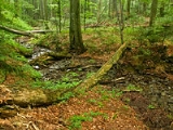
Primeval Beech Forests of the Carpathians and the Ancient Beech Forests of Germany is a transnational composite nature site. The Primeval Beech Forests of the Carpathians include 10 separate massifs located along the 185 km (115 mi) long axis from the Rakhiv
mountains and Chornohora
ridge in Ukraine
over the Poloniny Ridge (Slovakia) to the Vihorlat Mountains
in Slovakia
. The Ancient Beech Forests of Germany include five locations in various parts of Germany
The carpathian site covers a total area of 77971.6 ha (192,671.8 acre), out of which only 29278.9 ha (72,349.7 acre) are part of the actual preserved area, while the rest is considered a "buffer zone". Primeval Beech Forests of the Carpathians cover areas of Zakarpattia
and Presov Region
s. Over 70% of the site is located in Ukraine
. The area includes two national park
s, a biosphere reserve
, and few habitat controlled areas (mostly in Slovakia). The both national parks along with the neighboring Poland
compose a separate biosphere reserve
, the East Carpathian Biosphere Reserve
.
Besides Havešová, Rožok, and Stužica
(all of them being located in Bukovské vrchy) there is a fourth component situated in Slovakia, namely Kyjovský prales of Vihorlat.
Ukrainian locations include Chornohora
, Kuziy-Trybushany, Maramarosh, Stuzhytsia–Uzhok, Svydovets, and Uholka–Shyrikyi Luh. However, only few of ten components are accessible for visitors. Stužica is for example the only one of three locations in Bukovske vrchy (Slovakia) with available hiking trails.
The Five German forests cover 4,391 hectares and were added in 2011.
Most of the Slovak components of the world heritage site are situated in the Poloniny National Park
at the easternmost and also the least populated part of the country. National Park was created on 1 October 1997 with a protected area of 298.05 km² and a buffer zone of 109.73 km².
Rakhiv
Rakhiv is a city located in the Zakarpattia Oblast in western Ukraine. It is the administrative center of the Rakhiv Raion .- Demographics :As of 2001, the city population was 15,241 inhabitants which included: * 83.8% Ukrainians...
mountains and Chornohora
Chornohora
Chornohora is the highest mountain range in Western Ukraine in the Eastern Beskids and the Ukrainian Carpathians group, which in turn is part of the Outer Eastern Carpathians....
ridge in Ukraine
Ukraine
Ukraine is a country in Eastern Europe. It has an area of 603,628 km², making it the second largest contiguous country on the European continent, after Russia...
over the Poloniny Ridge (Slovakia) to the Vihorlat Mountains
Vihorlat Mountains
Vihorlat Mountains or colloquially Vihorlat is a volcanic mountain range in eastern Slovakia and western Ukraine. A part of the range is listed as a World Heritage Site.-Vihorlat Mountains in Slovakia:...
in Slovakia
Slovakia
The Slovak Republic is a landlocked state in Central Europe. It has a population of over five million and an area of about . Slovakia is bordered by the Czech Republic and Austria to the west, Poland to the north, Ukraine to the east and Hungary to the south...
. The Ancient Beech Forests of Germany include five locations in various parts of Germany
The carpathian site covers a total area of 77971.6 ha (192,671.8 acre), out of which only 29278.9 ha (72,349.7 acre) are part of the actual preserved area, while the rest is considered a "buffer zone". Primeval Beech Forests of the Carpathians cover areas of Zakarpattia
Zakarpattia Oblast
The Zakarpattia Oblast is an administrative oblast located in southwestern Ukraine. Its administrative center is the city of Uzhhorod...
and Presov Region
Prešov Region
The Prešov Region is one of the eight Slovak administrative regions. It consists of 13 districts.-Geography:It is located in north-eastern Slovakia and has an area of 8,975 km². The region has diverse types of landscapes occurring in Slovakia, but mostly highlands and hilly lands dominate the...
s. Over 70% of the site is located in Ukraine
Ukraine
Ukraine is a country in Eastern Europe. It has an area of 603,628 km², making it the second largest contiguous country on the European continent, after Russia...
. The area includes two national park
National park
A national park is a reserve of natural, semi-natural, or developed land that a sovereign state declares or owns. Although individual nations designate their own national parks differently A national park is a reserve of natural, semi-natural, or developed land that a sovereign state declares or...
s, a biosphere reserve
Biosphere reserve
The Man and the Biosphere Programme of UNESCO was established in 1971 to promote interdisciplinary approaches to management, research and education in ecosystem conservation and sustainable use of natural resources.-Development:...
, and few habitat controlled areas (mostly in Slovakia). The both national parks along with the neighboring Poland
Poland
Poland , officially the Republic of Poland , is a country in Central Europe bordered by Germany to the west; the Czech Republic and Slovakia to the south; Ukraine, Belarus and Lithuania to the east; and the Baltic Sea and Kaliningrad Oblast, a Russian exclave, to the north...
compose a separate biosphere reserve
Biosphere reserve
The Man and the Biosphere Programme of UNESCO was established in 1971 to promote interdisciplinary approaches to management, research and education in ecosystem conservation and sustainable use of natural resources.-Development:...
, the East Carpathian Biosphere Reserve
East Carpathian Biosphere Reserve
The East Carpathian Biosphere Reserve is a transboundary protected area, designated as an area of global importance under UNESCO's Programme on Man and the Biosphere. It is located in the Eastern Carpathians and includes parts of three countries: Poland, Slovakia and Ukraine...
.
Besides Havešová, Rožok, and Stužica
Stužica
Stužica is a uniquely preserved and undisturbed primeval beech forest of the Eastern Carpathians range. It is located in Slovakia and borders with Poland and Ukraine. The forest has been protected since 1908 and in 1993 the area was upgraded to a National Nature Reserve. In 2007 Stužica and several...
(all of them being located in Bukovské vrchy) there is a fourth component situated in Slovakia, namely Kyjovský prales of Vihorlat.
Ukrainian locations include Chornohora
Chornohora
Chornohora is the highest mountain range in Western Ukraine in the Eastern Beskids and the Ukrainian Carpathians group, which in turn is part of the Outer Eastern Carpathians....
, Kuziy-Trybushany, Maramarosh, Stuzhytsia–Uzhok, Svydovets, and Uholka–Shyrikyi Luh. However, only few of ten components are accessible for visitors. Stužica is for example the only one of three locations in Bukovske vrchy (Slovakia) with available hiking trails.
The Five German forests cover 4,391 hectares and were added in 2011.
| # | Massif | Region | Type of nature reserve | Preserved area | Buffer zone |
|---|---|---|---|---|---|
| 1 | Chornohora Chornohora Chornohora is the highest mountain range in Western Ukraine in the Eastern Beskids and the Ukrainian Carpathians group, which in turn is part of the Outer Eastern Carpathians.... |
Zakarpattia Zakarpattia Oblast The Zakarpattia Oblast is an administrative oblast located in southwestern Ukraine. Its administrative center is the city of Uzhhorod... |
Carpathian Biosphere Reserve | 2476.8 ha Hectare The hectare is a metric unit of area defined as 10,000 square metres , and primarily used in the measurement of land. In 1795, when the metric system was introduced, the are was defined as being 100 square metres and the hectare was thus 100 ares or 1/100 km2... |
12925 ha |
| 2 | Uholka / Wide Meadow | 11860 ha Hectare The hectare is a metric unit of area defined as 10,000 square metres , and primarily used in the measurement of land. In 1795, when the metric system was introduced, the are was defined as being 100 square metres and the hectare was thus 100 ares or 1/100 km2... |
3301 ha | ||
| 3 | Svydovets Svydovets The Svydovets is a mountain range in western Ukraine, one range among the Eastern Beskids and the Ukrainian Carpathians, itself part of the Outer Eastern Carpathians.Svydovets hosts one of the ten units of the Primeval Beech Forests of the... |
3030.5 ha Hectare The hectare is a metric unit of area defined as 10,000 square metres , and primarily used in the measurement of land. In 1795, when the metric system was introduced, the are was defined as being 100 square metres and the hectare was thus 100 ares or 1/100 km2... |
5639.5 ha | ||
| 4 | Maramoros | 2243.6 ha Hectare The hectare is a metric unit of area defined as 10,000 square metres , and primarily used in the measurement of land. In 1795, when the metric system was introduced, the are was defined as being 100 square metres and the hectare was thus 100 ares or 1/100 km2... |
6230.4 ha | ||
| 5 | Kuziy / Trybushany | 1369.6 ha Hectare The hectare is a metric unit of area defined as 10,000 square metres , and primarily used in the measurement of land. In 1795, when the metric system was introduced, the are was defined as being 100 square metres and the hectare was thus 100 ares or 1/100 km2... |
3163.4 ha | ||
| 6 | Stuzhytsia / Uzhok | Uzh National Nature Park | 2532 ha Hectare The hectare is a metric unit of area defined as 10,000 square metres , and primarily used in the measurement of land. In 1795, when the metric system was introduced, the are was defined as being 100 square metres and the hectare was thus 100 ares or 1/100 km2... |
3615 ha | |
| 7 | Stužica Stužica Stužica is a uniquely preserved and undisturbed primeval beech forest of the Eastern Carpathians range. It is located in Slovakia and borders with Poland and Ukraine. The forest has been protected since 1908 and in 1993 the area was upgraded to a National Nature Reserve. In 2007 Stužica and several... / Bukovské vrchy |
Presov Prešov Region The Prešov Region is one of the eight Slovak administrative regions. It consists of 13 districts.-Geography:It is located in north-eastern Slovakia and has an area of 8,975 km². The region has diverse types of landscapes occurring in Slovakia, but mostly highlands and hilly lands dominate the... |
Poloniny National Park Poloniny National Park Poloniny National Park is a national park in north eastern Slovakia at the Polish and Ukrainian borders, in the Bukovské vrchy mountain range, which belongs to the Eastern Carpathians. It was created on 1 October 1997 with a protected area of 298.05 km² and a buffer zone of 109.73 km²... |
2950 ha Hectare The hectare is a metric unit of area defined as 10,000 square metres , and primarily used in the measurement of land. In 1795, when the metric system was introduced, the are was defined as being 100 square metres and the hectare was thus 100 ares or 1/100 km2... |
11300 ha |
| 8 | Rožok | Presov Preserved areas | 67.1 ha Hectare The hectare is a metric unit of area defined as 10,000 square metres , and primarily used in the measurement of land. In 1795, when the metric system was introduced, the are was defined as being 100 square metres and the hectare was thus 100 ares or 1/100 km2... |
41.4 ha | |
| 9 | Vihorlat | 2578 ha Hectare The hectare is a metric unit of area defined as 10,000 square metres , and primarily used in the measurement of land. In 1795, when the metric system was introduced, the are was defined as being 100 square metres and the hectare was thus 100 ares or 1/100 km2... |
2413 ha | ||
| 10 | Havešová | 171.3 ha Hectare The hectare is a metric unit of area defined as 10,000 square metres , and primarily used in the measurement of land. In 1795, when the metric system was introduced, the are was defined as being 100 square metres and the hectare was thus 100 ares or 1/100 km2... |
63.9 ha |
Most of the Slovak components of the world heritage site are situated in the Poloniny National Park
Poloniny National Park
Poloniny National Park is a national park in north eastern Slovakia at the Polish and Ukrainian borders, in the Bukovské vrchy mountain range, which belongs to the Eastern Carpathians. It was created on 1 October 1997 with a protected area of 298.05 km² and a buffer zone of 109.73 km²...
at the easternmost and also the least populated part of the country. National Park was created on 1 October 1997 with a protected area of 298.05 km² and a buffer zone of 109.73 km².
See also
- East Carpathian Biosphere ReserveEast Carpathian Biosphere ReserveThe East Carpathian Biosphere Reserve is a transboundary protected area, designated as an area of global importance under UNESCO's Programme on Man and the Biosphere. It is located in the Eastern Carpathians and includes parts of three countries: Poland, Slovakia and Ukraine...
- List of national parks of Slovakia
- Nearby villages
- Nová Sedlica
- RuninaRuninaRunina is a village and municipality in Snina District in the Prešov Region of north-eastern Slovakia. The first written reference of the village dates back to 1569. The municipality lies at an altitude of 550 metres and covers an area of 22.198 km²...
- TopoľaTopolaTopola is a town and municipality situated in the Šumadija region of Serbia. It was the place where Karađorđe, a Serbian revolutionary, was chosen as the leader of the First Serbian Uprising against the Ottoman Empire in 1804. The local St...
- Ruský PotokRuský PotokRuský Potok is a village and municipality in Snina District in the Prešov Region of north-eastern Slovakia. In historical records the village was first mentioned in 1635...
- Uličské KrivéUlicské KrivéUličské Krivé is a village and municipality in Snina District in the Prešov Region of north-eastern Slovakia. In historical records the village was first mentioned in 1478. The municipality lies at an altitude of 285 metres and covers an area of 19.132km²...