

Porlier Bay
Encyclopedia
Ioannes Paulus II Peninsula
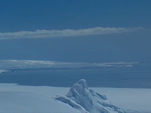
Ioannes Paulus II Peninsula is an ice-covered peninsula on the north coast of Livingston Island in the South Shetland Islands, Antarctica that is bounded by Hero Bay to the east and Barclay Bay to the west. It extends 13 km in length in north-south direction and is 8 km wide...
on Livingston Island in the South Shetland Islands
South Shetland Islands
The South Shetland Islands are a group of Antarctic islands, lying about north of the Antarctic Peninsula, with a total area of . By the Antarctic Treaty of 1959, the Islands' sovereignty is neither recognized nor disputed by the signatories and they are free for use by any signatory for...
, Antarctica. Entered between Punta del Medio and Black Point
Black Point (Antarctica)
Black Point is a rocky promontory of projecting 800 m northwards from the northeast coast of Ioannes Paulus II Peninsula into Hero Bay, Livingston Island in the South Shetland Islands, Antarctica to form the east side of the entrance to Porlier Bay...
. The area was visited by early 19th century sealers
Seal hunting
Seal hunting, or sealing, is the personal or commercial hunting of seals. The hunt is currently practiced in five countries: Canada, where most of the world's seal hunting takes place, Namibia, the Danish region of Greenland, Norway and Russia...
.
The feature is named after Captain Rosendo Porlier, commander of the Spanish
Spain
Spain , officially the Kingdom of Spain languages]] under the European Charter for Regional or Minority Languages. In each of these, Spain's official name is as follows:;;;;;;), is a country and member state of the European Union located in southwestern Europe on the Iberian Peninsula...
ship San Telmo
San Telmo (ship)
San Telmo was a Spanish 74-gun ship of the line, launched in 1788.In 1819 the San Telmo commanded by Captain Rosendo Porlier was the flagship of a Spanish naval squadron bound for Callao to reinforce colonial forces there fighting the independence movements in Spanish America...
that sunk off the island in 1819, and whose wreckage was found subsequently at the bay.
Location
Porlier Bay is located at 62°29′10"S 60°45′00"W. British mapping in 1968, Spanish in 1991, and Bulgarian in 2005 and 2009.Map
- L.L. Ivanov. Antarctica: Livingston Island and Greenwich, Robert, Snow and Smith Islands. Scale 1:120000 topographic map. Troyan: Manfred Wörner Foundation, 2009. ISBN 978-954-92032-6-4