

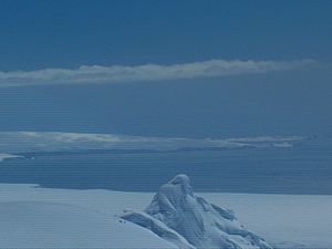
Black Point (Antarctica)
Encyclopedia
Ioannes Paulus II Peninsula
Ioannes Paulus II Peninsula is an ice-covered peninsula on the north coast of Livingston Island in the South Shetland Islands, Antarctica that is bounded by Hero Bay to the east and Barclay Bay to the west. It extends 13 km in length in north-south direction and is 8 km wide...
into Hero Bay
Hero Bay
Hero Bay is a 17 mi wide bay, which indents for 6 mi the north side of Livingston Island between Cape Shirreff and Williams Point, in the South Shetland Islands. The name ‘Blythe Bay’, originally applied to a small bay on the southeast side of Desolation Island on Powell's chart of 1822...
, Livingston Island in the South Shetland Islands
South Shetland Islands
The South Shetland Islands are a group of Antarctic islands, lying about north of the Antarctic Peninsula, with a total area of . By the Antarctic Treaty of 1959, the Islands' sovereignty is neither recognized nor disputed by the signatories and they are free for use by any signatory for...
, Antarctica to form the east side of the entrance to Porlier Bay
Porlier Bay
Porlier Bay is the 3 km wide bay indenting for 1.6 km the north coast of Ioannes Paulus II Peninsula on Livingston Island in the South Shetland Islands, Antarctica. Entered between Punta del Medio and Black Point...
. The area was visited by early 19th century sealers
Seal hunting
Seal hunting, or sealing, is the personal or commercial hunting of seals. The hunt is currently practiced in five countries: Canada, where most of the world's seal hunting takes place, Namibia, the Danish region of Greenland, Norway and Russia...
.
The name of the point is a descriptive one.
Location
The point is located at 62°29′09.7"S 60°42′57.6"W which is 4.8 km southeast of Cape ShirreffCape Shirreff
Cape Shirreff is a prominent cape at the north end of the rocky peninsula which separates Hero Bay and Barclay Bay on the north coast of Livingston Island, in the South Shetland Islands...
, 18.3 km west-southwest of Desolation Island
Desolation Island (South Shetland Islands)
Desolation Island is one of the minor islands in the South Shetlands archipelago, Antarctica situated at the entrance to Hero Bay, Livingston Island. The island is V-shaped with its northern coast indented by Kozma Cove. Surface area ....
, 15.88 km west-northwest of Siddons Point
Siddons Point
Siddons Point is a point projecting into the middle of the head of Hero Bay on the north coast of Livingston Island in the South Shetland Islands, Antarctica...
, 10 km north-northwest of Avitohol Point
Avitohol Point
Avitohol Point is a point on the north coast of Livingston Island, Antarctica projecting 1.15 km into Hero Bay to form the west side of the entrance to Skravena Cove and the southeast side of the entrance to Prisoe Cove...
, 6.3 km north by west of Agüero Point
Agüero Point
Agüero Point is a trapezoid-shaped and mostly ice-covered point projecting 900 m east-northeastwards from the east coast of Ioannes Paulus II Peninsula into Hero Bay, Livingston Island in the South Shetland Islands, Antarctica...
and 3 km north by wast of Sandanski Point
Sandanski Point
Sandanski Point is the point forming the north side of the entrance to Stoyanov Cove on the east coast of Ioannes Paulus II Peninsula, Livingston Island in the South Shetland Islands, Antarctica, projecting 600 m into Hero Bay and formed by an offshoot of Oryahovo Heights.The point is named after...
. British mapping in 1968, Chilean in 1971, Argentine in 1980, Spanish in 1991, and Bulgarian in 2005 and 2009.
Map
- L.L. Ivanov et al. Antarctica: Livingston Island and Greenwich Island, South Shetland Islands. Scale 1:100000 topographic map. Sofia: Antarctic Place-names Commission of Bulgaria, 2005.