

Pennsylvania Route 332
Encyclopedia
Pennsylvania Route 332 is a state highway in the U.S. state
of Pennsylvania
. The route runs from Pennsylvania Route 263
in Hatboro
, Montgomery County
east to Pennsylvania Route 32
in Yardley
, Bucks County
.
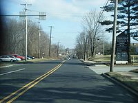 Pennsylvania Route 332 heads east from Pennsylvania Route 263 on Montgomery Avenue. Immediately after crossing the SEPTA Warminster Line
tracks, the route turns north on Jacksonville Road. Pennsylvania Route 332 intersects County Line Road, and it enters Warminster Township
in Bucks County. The route intersects Pennsylvania Route 132
and continues north, passing along the eastern edge of the borough of Ivyland
before entering Northampton Township
. Pennsylvania Route 332 continues in a northeasterly direction, eventually turning east on Almshouse Road.
 Almshouse Road carries Pennsylvania Route 332 east to Richboro
, where it intersects Pennsylvania Route 232
. Upon crossing PA 232, Pennsylvania Route 332 changes its name to Newtown Richboro Road. Pennsylvania Route 332 then forms the southern boundary of Tyler State Park and crosses the Neshaminy Creek
into Newtown Township
. Pennsylvania Route 332 continues east to the Newtown Bypass, a road that provides a bypass of the borough of Newtown
for Pennsylvania Route 332, along with Pennsylvania Route 413
and 532
.
Pennsylvania Route 332 turns south on the Newtown Bypass, forming a concurrency with Routes 413 and 532, which bypass Newtown to the west. Eventually, both routes depart the Newtown Bypass, with Pennsylvania Route 532 first turning south to Holland
, then Pennsylvania Route 413, which heads south towards Langhorne
. Pennsylvania Route 332 continues east by itself, with the road name changing to Newtown Yardley Road to the east of Newtown. The road enters Lower Makefield Township
, where it features an interchange with Interstate 95
. The route continues east to Yardley, where it is known as Afton Avenue. Pennsylvania Route 332 continues east toward Pennsylvania Route 32, which runs along the Delaware River
.
U.S. state
A U.S. state is any one of the 50 federated states of the United States of America that share sovereignty with the federal government. Because of this shared sovereignty, an American is a citizen both of the federal entity and of his or her state of domicile. Four states use the official title of...
of Pennsylvania
Pennsylvania
The Commonwealth of Pennsylvania is a U.S. state that is located in the Northeastern and Mid-Atlantic regions of the United States. The state borders Delaware and Maryland to the south, West Virginia to the southwest, Ohio to the west, New York and Ontario, Canada, to the north, and New Jersey to...
. The route runs from Pennsylvania Route 263
Pennsylvania Route 263
Pennsylvania Route 263 is a north–south state highway located in southeast Pennsylvania. The southern terminus of the route is at PA 611 in Willow Grove, Montgomery County. The northern terminus is at PA 32 in Centre Bridge, Bucks County on the banks of the Delaware River near the Centre...
in Hatboro
Hatboro, Pennsylvania
Hatboro is a borough in Montgomery County, Pennsylvania, United States. The population was 7,360 at the 2010 census.-Geography:Hatboro is located at ....
, Montgomery County
Montgomery County, Pennsylvania
Montgomery County is a county located in the U.S. state of Pennsylvania, in the United States. As of 2010, the population was 799,874, making it the third most populous county in Pennsylvania . The county seat is Norristown.The county was created on September 10, 1784, out of land originally part...
east to Pennsylvania Route 32
Pennsylvania Route 32
Pennsylvania Route 32 is a scenic two-lane highway that runs along the side of the Delaware River in Bucks County, Pennsylvania. It begins at U.S. 1 in Falls Township and ends at Pennsylvania Route 611 near the village of Kintnersville...
in Yardley
Yardley, Pennsylvania
Yardley is a borough in Bucks County, Pennsylvania, United States. The small community of Yardley is bordered by the Delaware River and Ewing, New Jersey on the east, and by Lower Makefield Township on the north, west, and south...
, Bucks County
Bucks County, Pennsylvania
- Industry and commerce :The boroughs of Bristol and Morrisville were prominent industrial centers along the Northeast Corridor during World War II. Suburban development accelerated in Lower Bucks in the 1950s with the opening of Levittown, Pennsylvania, the second such "Levittown" designed by...
.
Route description
Warminster Line
The Warminster Line is a route of the SEPTA Regional Rail commuter rail. It serves stations between its namesake town, Warminster, and Center City, Philadelphia...
tracks, the route turns north on Jacksonville Road. Pennsylvania Route 332 intersects County Line Road, and it enters Warminster Township
Warminster Township, Pennsylvania
Warminster Township is a township in Bucks County, Pennsylvania, United States. The population was 32,682 at the 2010 census.The town was named for the town of Warminster in Wiltshire, England.-Geography:...
in Bucks County. The route intersects Pennsylvania Route 132
Pennsylvania Route 132
Pennsylvania Route 132 is a state highway in southeast Pennsylvania. It runs northwest to southeast through Bucks County in suburban Philadelphia from PA 611 in Warrington Township to Interstate 95 in Bensalem Township. It is a commercial route lined with shopping centers throughout much of its...
and continues north, passing along the eastern edge of the borough of Ivyland
Ivyland, Pennsylvania
Ivyland is a borough in Bucks County, Pennsylvania, United States. It is known as one of the finest collections of Victorian Buildings in the state and most of it is on the National Register of Historic Places...
before entering Northampton Township
Northampton Township, Bucks County, Pennsylvania
Northampton Township is a township in Bucks County, Pennsylvania, United States, about 12 miles northeast of Philadelphia. The population was 39,726 at the 2010 census.-History:...
. Pennsylvania Route 332 continues in a northeasterly direction, eventually turning east on Almshouse Road.
Richboro, Pennsylvania
Richboro is a census-designated place in Northampton Township, Bucks County, Pennsylvania, United States. The population was 6,563 at the 2010 census.-Geography:Richboro is located at ....
, where it intersects Pennsylvania Route 232
Pennsylvania Route 232
Pennsylvania Route 232 is a long state highway located in southeastern Pennsylvania. The southern terminus of the route is at U.S. Route 1 and US 13 at the Oxford Circle in Philadelphia. The northern terminus is at PA 32 in the borough of New Hope, Bucks County, on the banks of the Delaware River...
. Upon crossing PA 232, Pennsylvania Route 332 changes its name to Newtown Richboro Road. Pennsylvania Route 332 then forms the southern boundary of Tyler State Park and crosses the Neshaminy Creek
Neshaminy Creek
Neshaminy Creek is a stream that runs southeast through Bucks County, Pennsylvania. Neshaminy Creek proper rises south of the borough of Chalfont, where North Branch Neshaminy Creek and West Branch Neshaminy Creek meet. Neshaminy Creek flows lastly between Bristol Township and Bensalem Township...
into Newtown Township
Newtown Township, Bucks County, Pennsylvania
Newtown Township is a township in Bucks County, Pennsylvania, United States. The population was 19,299 at the 2010 census.-History:Newtown Township traces its roots back to William Penn, who purchased from the Lenni Lenape Indians in 1683. He named this land my "New Township", which gradually...
. Pennsylvania Route 332 continues east to the Newtown Bypass, a road that provides a bypass of the borough of Newtown
Newtown, Bucks County, Pennsylvania
Newtown is a borough in Bucks County, Pennsylvania, United States. The population was 2,248 at the 2010 census. It is located just west of the Trenton, New Jersey metropolitan area, and is part of the larger Philadelphia metropolitan area. It is entirely surrounded by Newtown Township, from which...
for Pennsylvania Route 332, along with Pennsylvania Route 413
Pennsylvania Route 413
Pennsylvania Route 413 is a long, north–south state highway running from the PA/NJ state line on the Burlington-Bristol Bridge to PA 611 in Bedminster Township in Bucks County...
and 532
Pennsylvania Route 532
Pennsylvania Route 532 is a state route located in the Philadelphia, Pennsylvania area.-Philadelphia:PA 532 begins as Welsh Road, where it intersects with Roosevelt Boulevard in Northeast Philadelphia. After less than a mile, PA 532 leaves Welsh Road and follows Bustleton Avenue...
.
Pennsylvania Route 332 turns south on the Newtown Bypass, forming a concurrency with Routes 413 and 532, which bypass Newtown to the west. Eventually, both routes depart the Newtown Bypass, with Pennsylvania Route 532 first turning south to Holland
Holland, Pennsylvania
Holland is an unincorporated community in Northampton Township, Bucks County, Pennsylvania, United States. It is located next to Newtown, Richboro, and Churchville. One of its communities is Village Shires, which has approximately 4,000 residents.-History:...
, then Pennsylvania Route 413, which heads south towards Langhorne
Langhorne, Pennsylvania
Langhorne is a borough in Bucks County, Pennsylvania, United States. The population was 1,622 at the 2010 census.The name "Langhorne" is used broadly to describe the majority of surrounding Middletown Township, which for the most part uses Langhorne's zip code of 19047...
. Pennsylvania Route 332 continues east by itself, with the road name changing to Newtown Yardley Road to the east of Newtown. The road enters Lower Makefield Township
Lower Makefield Township, Pennsylvania
Lower Makefield Township is a township in Bucks County, Pennsylvania, USA and usually referred to as "Yardley" due to the prominence of Yardley Borough in that area...
, where it features an interchange with Interstate 95
Interstate 95 in Pennsylvania
Interstate 95 is an Interstate highway running from Miami, Florida north to Houlton, Maine. In the U.S. state of Pennsylvania, the route is known by many as the Delaware Expressway, but is officially named The Vietnam Veterans Memorial Highway. and locally known as "95"...
. The route continues east to Yardley, where it is known as Afton Avenue. Pennsylvania Route 332 continues east toward Pennsylvania Route 32, which runs along the Delaware River
Delaware River
The Delaware River is a major river on the Atlantic coast of the United States.A Dutch expedition led by Henry Hudson in 1609 first mapped the river. The river was christened the South River in the New Netherland colony that followed, in contrast to the North River, as the Hudson River was then...
.