

Pennsylvania Route 532
Encyclopedia
Pennsylvania Route 532 is a state route located in the Philadelphia, Pennsylvania
area.
 PA 532 begins as Welsh Road, where it intersects with Roosevelt Boulevard
(U.S. Route 1) in Northeast Philadelphia
. After less than a mile, PA 532 leaves Welsh Road and follows Bustleton Avenue. The road follows the path of a former turnpike
, named for the former town of Bustleton (now the neighborhood of Bustleton
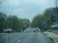
in the city of Philadelphia,) and is an ordinary surface road with two lanes in each direction.
Crossing Red Lion Road (Pennsylvania Route 63
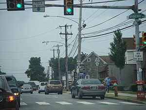
), the road enters the Somerton
neighborhood of Philadelphia. It is the main street for businesses here, and throughout its passage through Northeast Philadelphia, Bustleton Avenue is densely populated with houses, businesses and apartments. The Somerton train station
is nearby, at Philmont Avenue.
 Crossing County Line Road, PA 532 enters Bucks County
in Lower Southampton
township, where the name of the road changes to Bustleton Pike. In Feasterville
, PA 532 crosses over the Pennsylvania Turnpike
and intersects Street Road (Pennsylvania Route 132
). Shortly thereafter, at an intersection, Bustleton Pike continues to the northwest, but PA 532 follows Buck Road to the northeast. As the surroundings grow more suburban, Buck Road enters Northampton
township. After intersecting Holland Road and Old Bristol Road, Buck Road continues to the northeast past Council Rock
's Holland Middle School and the Village Shires Shopping Center.
PA 532 then crosses the Neshaminy Creek
and enters Newtown
township. The road does not enter the town of Newtown
, but rather diverts onto the Newtown By-Pass, where it is co-signed with Pennsylvania Route 332
and Pennsylvania Route 413
. At the end of the bypass, PA 532 emerges on the other side of Newtown as Washington Crossing Road. Passing briefly into Lower Makefield
, then into Upper Makefield
township, the road continues through the rural countryside, and passes over the Delaware Canal
before terminating in Washington Crossing
at an intersection with River Road (Pennsylvania Route 32
) just before the Washington Crossing Bridge
, while the road continues on into New Jersey.
Pennsylvania
The Commonwealth of Pennsylvania is a U.S. state that is located in the Northeastern and Mid-Atlantic regions of the United States. The state borders Delaware and Maryland to the south, West Virginia to the southwest, Ohio to the west, New York and Ontario, Canada, to the north, and New Jersey to...
area.
Philadelphia
Roosevelt Boulevard (Philadelphia)
Roosevelt Boulevard , often referred to simply as "the Boulevard," is a major traffic artery through North and Northeast Philadelphia...
(U.S. Route 1) in Northeast Philadelphia
Northeast Philadelphia
Northeast Philadelphia, nicknamed Northeast Philly, the Northeast and the Great Northeast, is a section of the city of Philadelphia, Pennsylvania. According to the 2000 Census, the Northeast has a sizable percentage of the city's 1.547 million people — a population of between 300,000 and 450,000,...
. After less than a mile, PA 532 leaves Welsh Road and follows Bustleton Avenue. The road follows the path of a former turnpike
Toll road
A toll road is a privately or publicly built road for which a driver pays a toll for use. Structures for which tolls are charged include toll bridges and toll tunnels. Non-toll roads are financed using other sources of revenue, most typically fuel tax or general tax funds...
, named for the former town of Bustleton (now the neighborhood of Bustleton
Bustleton, Philadelphia, Pennsylvania
The Bustleton section of Northeast Philadelphia is located in the Far Northeast, north of Rhawnhurst and Fox Chase and south of Somerton; sitting between Roosevelt Boulevard to the east, the city boundary to the west, Red Lion Road to the north, and Pennypack Park to the south, it is centered at...
in the city of Philadelphia,) and is an ordinary surface road with two lanes in each direction.
Crossing Red Lion Road (Pennsylvania Route 63
Pennsylvania Route 63
Pennsylvania Route 63 is a long state highway located in the Philadelphia, Pennsylvania area. The western terminus of the route is at PA 29 in Green Lane, Montgomery County. The eastern terminus is at Interstate 95 in Bensalem Township, Bucks County...
), the road enters the Somerton
Somerton, Philadelphia, Pennsylvania
Somerton is located in the Far Northeast section of Philadelphia, Pennsylvania, United States. The neighborhood is generally bound by Red Lion Road to the south, Roosevelt Boulevard to the east, East County Line Road and Poquessing Creek to the north, and the Philadelphia County / Montgomery County...
neighborhood of Philadelphia. It is the main street for businesses here, and throughout its passage through Northeast Philadelphia, Bustleton Avenue is densely populated with houses, businesses and apartments. The Somerton train station
Somerton (SEPTA station)
Somerton is a station along the SEPTA West Trenton Line to Ewing, New Jersey. It is located at Bustleton and Philmont Avenues in the Somerton neighborhood of Philadelphia, Pennsylvania. The station has off-street parking and a ticket office. There is also a handicapped-accessible platform.-External...
is nearby, at Philmont Avenue.
Bucks County
Bucks County, Pennsylvania
- Industry and commerce :The boroughs of Bristol and Morrisville were prominent industrial centers along the Northeast Corridor during World War II. Suburban development accelerated in Lower Bucks in the 1950s with the opening of Levittown, Pennsylvania, the second such "Levittown" designed by...
in Lower Southampton
Lower Southampton Township, Pennsylvania
Lower Southampton Township is a township in Bucks County, Pennsylvania, United States. The population was 18,909 at the 2010 census.-Geography:...
township, where the name of the road changes to Bustleton Pike. In Feasterville
Feasterville-Trevose, Pennsylvania
Feasterville-Trevose is a former census-designated place in Lower Southampton Township in Bucks County, Pennsylvania. The population was 6,525 at the 2000 census. The ZIP code is 19053. The area has been separated into two CDPs in the 2010 census....
, PA 532 crosses over the Pennsylvania Turnpike
Pennsylvania Turnpike
The Pennsylvania Turnpike is a toll highway system operated by the Pennsylvania Turnpike Commission in the Commonwealth of Pennsylvania, United States. The three sections of the turnpike system total . The main section extends from Ohio to New Jersey and is long...
and intersects Street Road (Pennsylvania Route 132
Pennsylvania Route 132
Pennsylvania Route 132 is a state highway in southeast Pennsylvania. It runs northwest to southeast through Bucks County in suburban Philadelphia from PA 611 in Warrington Township to Interstate 95 in Bensalem Township. It is a commercial route lined with shopping centers throughout much of its...
). Shortly thereafter, at an intersection, Bustleton Pike continues to the northwest, but PA 532 follows Buck Road to the northeast. As the surroundings grow more suburban, Buck Road enters Northampton
Northampton Township, Bucks County, Pennsylvania
Northampton Township is a township in Bucks County, Pennsylvania, United States, about 12 miles northeast of Philadelphia. The population was 39,726 at the 2010 census.-History:...
township. After intersecting Holland Road and Old Bristol Road, Buck Road continues to the northeast past Council Rock
Council Rock School District
The Council Rock School District also known as CRSD is located in lower Bucks County, in southeastern Pennsylvania. Its administrative offices are located in the Borough of Newtown. It spends over US$ 9,000 per secondary student per year...
's Holland Middle School and the Village Shires Shopping Center.
PA 532 then crosses the Neshaminy Creek
Neshaminy Creek
Neshaminy Creek is a stream that runs southeast through Bucks County, Pennsylvania. Neshaminy Creek proper rises south of the borough of Chalfont, where North Branch Neshaminy Creek and West Branch Neshaminy Creek meet. Neshaminy Creek flows lastly between Bristol Township and Bensalem Township...
and enters Newtown
Newtown Township, Bucks County, Pennsylvania
Newtown Township is a township in Bucks County, Pennsylvania, United States. The population was 19,299 at the 2010 census.-History:Newtown Township traces its roots back to William Penn, who purchased from the Lenni Lenape Indians in 1683. He named this land my "New Township", which gradually...
township. The road does not enter the town of Newtown
Newtown, Bucks County, Pennsylvania
Newtown is a borough in Bucks County, Pennsylvania, United States. The population was 2,248 at the 2010 census. It is located just west of the Trenton, New Jersey metropolitan area, and is part of the larger Philadelphia metropolitan area. It is entirely surrounded by Newtown Township, from which...
, but rather diverts onto the Newtown By-Pass, where it is co-signed with Pennsylvania Route 332
Pennsylvania Route 332
Pennsylvania Route 332 is a state highway in the U.S. state of Pennsylvania. The route runs from Pennsylvania Route 263 in Hatboro, Montgomery County east to Pennsylvania Route 32 in Yardley, Bucks County.-Route description:...
and Pennsylvania Route 413
Pennsylvania Route 413
Pennsylvania Route 413 is a long, north–south state highway running from the PA/NJ state line on the Burlington-Bristol Bridge to PA 611 in Bedminster Township in Bucks County...
. At the end of the bypass, PA 532 emerges on the other side of Newtown as Washington Crossing Road. Passing briefly into Lower Makefield
Lower Makefield Township, Pennsylvania
Lower Makefield Township is a township in Bucks County, Pennsylvania, USA and usually referred to as "Yardley" due to the prominence of Yardley Borough in that area...
, then into Upper Makefield
Upper Makefield Township, Pennsylvania
Upper Makefield Township is a township in Bucks County, Pennsylvania, United States. The population was 8,190 at the 2010 census.-Geography:...
township, the road continues through the rural countryside, and passes over the Delaware Canal
Pennsylvania Canal (Delaware Division)
The Delaware Division of the Pennsylvania Canal, more commonly called the Delaware Canal, runs from the Lehigh River at Easton south to Bristol...
before terminating in Washington Crossing
Washington Crossing, Pennsylvania
Washington Crossing, Pennsylvania, is a small unincorporated village located in Upper Makefield Township, Bucks County, Pennsylvania, with a zip code of 18977. Formerly known as "Taylorsville," it is most famous for Washington's crossing of the Delaware River on Christmas of 1776 during the...
at an intersection with River Road (Pennsylvania Route 32
Pennsylvania Route 32
Pennsylvania Route 32 is a scenic two-lane highway that runs along the side of the Delaware River in Bucks County, Pennsylvania. It begins at U.S. 1 in Falls Township and ends at Pennsylvania Route 611 near the village of Kintnersville...
) just before the Washington Crossing Bridge
Washington Crossing Bridge
Washington Crossing Bridge is a truss bridge spanning the Delaware River that connects Titusville, Hopewell Township in Mercer County, New Jersey with Washington Crossing, Upper Makefield Township in Bucks County, Pennsylvania. It was built in 1904 by the Taylorsville Delaware Bridge Company...
, while the road continues on into New Jersey.