

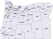
Oregon census statistical areas
Encyclopedia
United States Census Bureau
The United States Census Bureau is the government agency that is responsible for the United States Census. It also gathers other national demographic and economic data...
has defined 2 Combined Statistical Area
Combined Statistical Area
The United States Office of Management and Budget defines micropolitan and metropolitan statistical areas. Metropolitan and micropolitan statistical areas consist of one or more counties...
s (CSAs), 6 Metropolitan Statistical Areas (MSAs), and 13 Micropolitan Statistical Areas (μSAs) in the State of Oregon. The following table describes these areas with the following information:
- The name of the Combined Statistical Area (CSA), if any.
- The population of the CSA as of 2006-07-01, as estimated by the United States Census Bureau.
- The name of the Core Based Statistical AreaCore based statistical areaA Core Based Statistical Area is a U.S. geographic area defined by the Office of Management and Budget based around an urban center of at least 10,000 people and adjacent areas that are socioeconomically tied to the urban center by commuting. Areas defined on the basis of these standards applied...
(CBSA). - The population of the CBSA as of 2006-07-01, as estimated by the United States Census Bureau.
- The name of the countyCounty (United States)In the United States, a county is a geographic subdivision of a state , usually assigned some governmental authority. The term "county" is used in 48 of the 50 states; Louisiana is divided into parishes and Alaska into boroughs. Parishes and boroughs are called "county-equivalents" by the U.S...
. - The population of the county as of 2006-07-01, as estimated by the United States Census Bureau.
| Combined Statistical Area | 2010 Pop | Core Based Statistical Area | 2010 Pop | County | 2010 Pop |
|---|---|---|---|---|---|
| primary census statistical area | 2,226,009 1,789,580 |
Portland-Vancouver-Hillsboro, OR-WA MSA | 2,226,009 1,789,580 |
Multnomah County, Oregon Multnomah County, Oregon Multnomah County is one of 36 counties in the U.S. state of Oregon. Though smallest in area, it is the most populous as its county seat, Portland, is the state's largest city... |
735,334 |
| Washington County, Oregon Washington County, Oregon - Major highways :* Interstate 5* Interstate 205* U.S. Route 26* Oregon Route 6* Oregon Route 8* Oregon Route 10* Oregon Route 47* Oregon Route 99W* Oregon Route 210* Oregon Route 217* Oregon Route 219-Demographics:... |
529,710 | ||||
| Clark County, Washington Clark County, Washington Clark County is a county located in the southwestern part of the U.S. state of Washington, across the Columbia River from Portland, Oregon.Clark County was the first county of Washington, named after William Clark of the Lewis and Clark Expedition... |
425,363 | ||||
| Clackamas County, Oregon Clackamas County, Oregon Clackamas County is a county located in the U.S. state of Oregon. The county was named after the Native Americans living in the area, the Clackamas Indians, who were part of the Chinookan people. As of 2010, the population was 375,992... |
375,992 | ||||
| Yamhill County, Oregon Yamhill County, Oregon -National protected areas:*Siuslaw National Forest *Tualatin River National Wildlife Refuge -Demographics:As of the census of 2000, there were 84,992 people, 28,732 households, and 21,376 families residing in the county. The population density was 119 people per square mile . There were 30,270... |
99,193 | ||||
| Columbia County, Oregon Columbia County, Oregon Columbia County is a county located in the U.S. state of Oregon. It was named for the Columbia River, which forms its eastern and northern borders. As of 2010, its population was 49,351. The county seat is St. Helens.-Economy:... |
49,351 | ||||
| Skamania County, Washington | 11,066 | ||||
| primary census statistical area | 390,738 | Salem, OR MSA | 390,738 | Marion County, Oregon Marion County, Oregon Marion County is a county located in the U.S. state of Oregon. It was originally named the Champooick District, after Champoeg, a meeting place on the Willamette River. On September 3, 1849, the territorial legislature renamed it in honor of Francis Marion, a Continental Army general of the... |
315,335 |
| Polk County, Oregon Polk County, Oregon Polk County is a county located in the U.S. state of Oregon. The county is named for James Knox Polk, the 11th president of the United States. In 2010, its population was 75,403. The seat of the county is Dallas.... |
75,403 | ||||
| primary census statistical area | 351,715 | Eugene-Springfield, OR MSA | 351,715 | Lane County, Oregon Lane County, Oregon -National protected areas:*Oregon Islands National Wildlife Refuge *Siuslaw National Forest *Umpqua National Forest *Willamette National Forest -Government:... |
351,715 |
| primary census statistical area | 203,206 | Medford, OR MSA | 203,206 | Jackson County, Oregon Jackson County, Oregon -National protected areas:* Cascade–Siskiyou National Monument* Crater Lake National Park * Klamath National Forest * Rogue River-Siskiyou National Forest * Umpqua National Forest -Demographics:... |
203,206 |
| Albany-Corvallis-Lebanon, OR CSA | 202,251 | Albany-Lebanon, OR μSA | 116,672 | Linn County, Oregon Linn County, Oregon Linn County is a county located in the U.S. state of Oregon. It is named in honor of Lewis F. Linn, a U.S. Senator from Missouri who advocated the American occupation of the Oregon Country. By the 2010 US census the population of Linn county was 116,672 showing a 13.2% growth since the 2000 census... |
116,672 |
| Corvallis, OR MSA | 85,579 | Benton County, Oregon Benton County, Oregon -National protected areas:*Siuslaw National Forest *William L. Finley National Wildlife Refuge-Demographics:As of the census of 2000, there were 78,153 people, 30,145 households, and 18,237 families residing in the county. The population density was 116 people per square mile . There were 31,980... |
85,579 | ||
| Bend-Prineville, OR CSA | 178,711 | Bend, OR MSA | 157,733 | Deschutes County, Oregon Deschutes County, Oregon -National protected areas:* Deschutes National Forest * Newberry National Volcanic Monument-Demographics:As of the census of 2000, there were 115,367 people, 45,595 households, and 31,962 families residing in the county. The population density was 38 people per square mile . There were 54,583... |
157,733 |
| Prineville, OR μSA | 20,978 | Crook County, Oregon Crook County, Oregon -Demographics:As of the census of 2000, there were 19,182 people, 7,354 households, and 5,427 families residing in the county. The population density was 6 people per square mile . There were 8,264 housing units at an average density of 3 per square mile... |
20,978 | ||
| primary census statistical area | 107,667 | Roseburg, OR μSA | 107,667 | Douglas County, Oregon Douglas County, Oregon -National protected areas:* Crater Lake National Park * Rogue River-Siskiyou National Forest * Siuslaw National Forest * Umpqua National Forest * Willamette National Forest -Adjacent counties:* Lane County, Oregon -... |
107,667 |
| primary census statistical area | 87,062 | Pendleton-Hermiston, OR μSA | 87,062 | Umatilla County, Oregon Umatilla County, Oregon Umatilla County is a county located in the U.S. state of Oregon. It is included in the 8 county definition of Eastern Oregon. The county is named for the Umatilla River. In 2010, its population was 75,889... |
75,889 |
| Morrow County, Oregon Morrow County, Oregon Morrow County is a county located in the U.S. state of Oregon, on the south side of the Columbia River. It is included in the 8 county definition of Eastern Oregon. The county is named for one of its first white settlers, Jackson L. Morrow, who was a member of the state legislature when the county... |
11,173 | ||||
| primary census statistical area | 82,713 | Grants Pass, OR μSA | 82,713 | Josephine County, Oregon Josephine County, Oregon Josephine County is a county located in the U.S. state of Oregon. According to Oregon Geographic Names, the county is probably named after a stream in the area called Josephine Creek, which in turn is probably named after Virginia Josephine Rollins Ort. In 2010, its population was 82,713... |
82,713 |
| primary census statistical area | 66,380 | Klamath Falls, OR μSA | 66,380 | Klamath County, Oregon Klamath County, Oregon -National protected areas:* Bear Valley National Wildlife Refuge* Crater Lake National Park * Deschutes National Forest * Fremont National Forest * Klamath Marsh National Wildlife Refuge* Lower Klamath National Wildlife Refuge... |
66,380 |
| primary census statistical area | 63,043 | Coos Bay, OR μSA | 63,043 | Coos County, Oregon Coos County, Oregon -National protected areas:*Bandon Marsh National Wildlife Refuge*Oregon Islands National Wildlife Refuge *Siskiyou National Forest *Siuslaw National Forest - Incorporated cities:- Unincorporated communities and CDPs:-See also:... |
63,043 |
| primary census statistical area | 37,039 | Astoria, OR μSA | 37,039 | Clatsop County, Oregon Clatsop County, Oregon Clatsop County is a county located in the U.S. state of Oregon. The county is named for the Clatsop tribe of Native Americans, who lived along the coast of the Pacific Ocean prior to European settlement. As of 2010, the population was 37,039. The county seat is Astoria.-Economy:The principal... |
37,039 |
| primary census statistical area | 53,936 31,313 |
Ontario, OR-ID μSA | 53,936 31,313 |
Malheur County, Oregon Malheur County, Oregon Malheur County is a county located in the southeast corner of the U.S. state of Oregon. It is included in the eight-county definition of Eastern Oregon. Most of the county observes the Mountain Time Zone, although the southern quarter of the county observes the Pacific Time Zone along with the... |
31,313 |
| Payette County, Idaho Payette County, Idaho Payette County is a county located in the U.S. state of Idaho. The county was established in 1917, and at the 2000 Census the county had a population of 20,578 . The county seat is Payette.... |
22,623 | ||||
| primary census statistical area | 25,748 | La Grande, OR μSA | 25,748 | Union County, Oregon Union County, Oregon Union County is a county located in the U.S. state of Oregon. It is included in the 8 county definition of Eastern Oregon. The county is named for the town of Union, which is located within its boundaries; in 2010, the county population was 25,748. The county seat is La Grande.-History:Union County... |
25,748 |
| primary census statistical area | 25,213 | City of The Dalles, OR μSA | 25,213 | Wasco County, Oregon Wasco County, Oregon Wasco County is a county located in the U.S. state of Oregon. The county is named for a local tribe of Native Americans, the Wasco, a Chinook tribe who lived on the south side of the Columbia River. In 2010, its population was 25,213... |
25,213 |
| primary census statistical area | 22,364 | Brookings, OR μSA | 22,364 | Curry County, Oregon Curry County, Oregon Curry County is a county located in the U.S. state of Oregon. In 2010, its population was 22,364. The county is named for George Law Curry, a governor of the Oregon Territory. The seat of the county is Gold Beach.-Economy:... |
22,364 |
| primary census statistical area | 22,346 | Hood River, OR μSA | 22,346 | Hood River County, Oregon Hood River County, Oregon -Demographics:As of the census of 2000, there were 20,411 people, 7,248 households, and 5,175 families residing in the county. The population density was 39 people per square mile . There were 7,818 housing units at an average density of 15 per square mile... |
22,346 |
| none | Lincoln County, Oregon Lincoln County, Oregon -National protected areas:*Oregon Islands National Wildlife Refuge *Siletz Bay National Wildlife Refuge*Siuslaw National Forest -Demographics:... |
46,034 | |||
| Tillamook County, Oregon Tillamook County, Oregon Tillamook County is a county located in the U.S. state of Oregon. The county is named for the Tillamook, a Native American tribe who were living in the area in the early 19th century at the time of European American settlement. In 2010, the county's population was 25,250... |
25,250 | ||||
| Jefferson County, Oregon Jefferson County, Oregon Jefferson County is a county located in the U.S. state of Oregon. In 2010, its population was 21,720. It is named after Mount Jefferson. The seat of the county is Madras.-History:... |
21,720 | ||||
| Baker County, Oregon Baker County, Oregon Baker County is a county located in the U.S. state of Oregon. It is included in the 8 county definition of Eastern Oregon. It is named for Edward Dickinson Baker, a senator from Oregon who was killed at Ball's Bluff, a battle of the Civil War in Virginia in 1861. It was split from the eastern part... |
16,134 | ||||
| Lake County, Oregon Lake County, Oregon Lake County is a county in the high desert south central region of the U.S. state of Oregon, so named for the many lakes found within its boundaries, including Lake Abert, Hart Lake Reservoir, and Goose Lake. While Lake is among Oregon's largest counties, it is sparsely populated with 7,895... |
7,895 | ||||
| Grant County, Oregon Grant County, Oregon Grant County is a county located in the U.S. state of Oregon. It is included in the 8 county definition of Eastern Oregon. In 2010, its population was 7,445. It is named for President Ulysses S. Grant, who served as an army officer in the Oregon Territory, and at the time of the county's creation... |
7,445 | ||||
| Harney County, Oregon Harney County, Oregon -National protected areas:*Malheur National Forest *Malheur National Wildlife Refuge*Ochoco National Forest -Demographics:As of the census of 2000, there were 7,609 people, 3,036 households, and 2,094 families residing in the county. The population density was 1 people per square mile... |
7,422 | ||||
| Wallowa County, Oregon Wallowa County, Oregon Wallowa County is a county located in the U.S. state of Oregon. It is included in the 8 county definition of Eastern Oregon. According to Oregon Geographic Names, the origins of the county's name are uncertain, with the most likely explanation being that it is derived from the Nez Perce term for a... |
7,008 | ||||
| Gilliam County, Oregon Gilliam County, Oregon -Demographics:As of the census of 2000, there were 1,915 people, 819 households, and 543 families residing in the county. The population density was 2 people per square mile . There were 1,043 housing units at an average density of 1 per square mile... |
1,871 | ||||
| Sherman County, Oregon Sherman County, Oregon Sherman County is a county located in the U.S. state of Oregon. The county is named for William Tecumseh Sherman, a Union general in the American Civil War. In 2010, its population was 1,765. The seat of the county is Moro. The largest city is Wasco.... |
1,765 | ||||
| Wheeler County, Oregon Wheeler County, Oregon As of the census of 2000, there were 1,547 people, 653 households, and 444 families residing in the county. The population density was 1 people per square mile . There were 842 housing units at an average density of 0 per square mile... |
1,441 | ||||
See also
- State of Oregon
- Demographics of Oregon
- Geography of Oregon
- Lists of Oregon-related topics
- United StatesUnited StatesThe United States of America is a federal constitutional republic comprising fifty states and a federal district...
- United States Census BureauUnited States Census BureauThe United States Census Bureau is the government agency that is responsible for the United States Census. It also gathers other national demographic and economic data...
- Table of United States Combined Statistical AreasTable of United States Combined Statistical Areasthumb|An enlargeable map of the 125 [[Combined Statistical Area]]s of the [[United States]]The United States Office of Management and Budget has defined 125 Combined Statistical Areas for the United States of America...
(CSA) - Table of United States Core Based Statistical Areas (CBSA)
- Table of United States Metropolitan Statistical AreasTable of United States Metropolitan Statistical Areasthumb|An enlargeable map of the 942 [[Core Based Statistical Area]]s of the [[United States]]. The 367 [[Metropolitan Statistical Area]]s are shown in red....
(MSA) - Table of United States Micropolitan Statistical AreasTable of United States Micropolitan Statistical Areasthumb|An enlargeable map of the 942 [[Core Based Statistical Area]]s of the [[United States]]. The 576 [[Micropolitan Statistical Area]]s are shown in blue....
(μSA) - Table of United States primary census statistical areas (PCSA)
- Table of United States Combined Statistical Areas
- United States Census Bureau