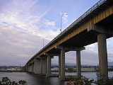
Oak Street Bridge
Encyclopedia
The Oak Street Bridge is a four-lane bridge
crossing the Fraser River
connecting Vancouver
to Richmond
in British Columbia
. The main spans are heavy steel deck plate girders continuous over three spans of 60.9, 91.4 and 60.9 metres. The bridge is a part of Highway 99.
made barges for constructing the foundations of the Oak Street Bridge.
After the bridge opened, traffic began to move several blocks to the east. The business districts along Hudson Street and Marine Drive went into a swift decline.
Tolls were charged for two years and $1 million was collected in the last year. Tolls were removed from all of the bridges in the Lower Mainland in the 1960s, although the recently opened Golden Ears Bridge
utilises an electronic tolling system.
The Oak Street Bridge was meant to partially replace the Marpole
Bridge, just to the west, connecting Vancouver to Sea Island
, on which the Vancouver International Airport
is located. The Marpole Bridge was dismantled the same year the Oak Street Bridge opened.
In 1995 two lanes of the bridge were closed alternately for resurfacing the concrete deck. A median barrier and higher curbs were also installed, and its earthquake resistance was enhanced
.
Bridge
A bridge is a structure built to span physical obstacles such as a body of water, valley, or road, for the purpose of providing passage over the obstacle...
crossing the Fraser River
Fraser River
The Fraser River is the longest river within British Columbia, Canada, rising at Fraser Pass near Mount Robson in the Rocky Mountains and flowing for , into the Strait of Georgia at the city of Vancouver. It is the tenth longest river in Canada...
connecting Vancouver
Vancouver
Vancouver is a coastal seaport city on the mainland of British Columbia, Canada. It is the hub of Greater Vancouver, which, with over 2.3 million residents, is the third most populous metropolitan area in the country,...
to Richmond
Richmond, British Columbia
Richmond is a coastal city, incorporated in the Canadian province of British Columbia. Part of Metro Vancouver, its neighbouring communities are Vancouver and Burnaby to the north, New Westminster to the east, and Delta to the south, while the Strait of Georgia forms its western border...
in British Columbia
British Columbia
British Columbia is the westernmost of Canada's provinces and is known for its natural beauty, as reflected in its Latin motto, Splendor sine occasu . Its name was chosen by Queen Victoria in 1858...
. The main spans are heavy steel deck plate girders continuous over three spans of 60.9, 91.4 and 60.9 metres. The bridge is a part of Highway 99.
History
The Oak Street Bridge opened in June 1957. During the planning, it was the "New Marpole Bridge" and steel plate girders salvaged from the second Granville Street BridgeGranville Street Bridge
The Granville Street Bridge is an eight lane bridge in Vancouver, British Columbia. It spans False Creek and is 27.4 metres above Granville Island. It is part of Highway 99.-History:...
made barges for constructing the foundations of the Oak Street Bridge.
After the bridge opened, traffic began to move several blocks to the east. The business districts along Hudson Street and Marine Drive went into a swift decline.
Tolls were charged for two years and $1 million was collected in the last year. Tolls were removed from all of the bridges in the Lower Mainland in the 1960s, although the recently opened Golden Ears Bridge
Golden Ears Bridge
The Golden Ears Bridge is a six-lane extradosed bridge in Metro Vancouver, British Columbia. It spans the Fraser River, connecting Langley on the south side with Pitt Meadows and Maple Ridge on the north side. The All Electronic Toll bridge, owned by TransLink, has a clearance of , and a total...
utilises an electronic tolling system.
The Oak Street Bridge was meant to partially replace the Marpole
Marpole
Marpole is a mostly residential neighbourhood of 22,400 located on the southern edge of the city of Vancouver, British Columbia, immediately northeast of Vancouver International Airport. It is approximately bordered by Angus Drive to the west, 57th Avenue to the north, Main Street to the east and...
Bridge, just to the west, connecting Vancouver to Sea Island
Sea Island, British Columbia
Sea Island is located in the city of Richmond, British Columbia, directly across the river from Vancouver and fifteen kilometres from Vancouver's downtown core. The island is in the estuary of the Fraser River, giving it a unique ecological environment...
, on which the Vancouver International Airport
Vancouver International Airport
Vancouver International Airport is located on Sea Island in Richmond, British Columbia, Canada, about from Downtown Vancouver. In 2010 it was the second busiest airport in Canada by aircraft movements and passengers , behind Toronto Pearson International Airport, with non-stop flights daily to...
is located. The Marpole Bridge was dismantled the same year the Oak Street Bridge opened.
In 1995 two lanes of the bridge were closed alternately for resurfacing the concrete deck. A median barrier and higher curbs were also installed, and its earthquake resistance was enhanced
Seismic retrofit
Seismic retrofitting is the modification of existing structures to make them more resistant to seismic activity, ground motion, or soil failure due to earthquakes. With better understanding of seismic demand on structures and with our recent experiences with large earthquakes near urban centers,...
.

