
Notice to Mariners
Encyclopedia
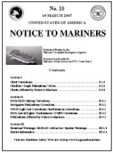
 The front cover of a Notice to Mariners. |
|
| Purpose: | Provide corrections to navigational publications and nautical charts. |
|---|---|
| Publication Frequency: | Weekly |
| Published by: | National Geospatial-Intelligence Agency National Geospatial-Intelligence Agency The National Geospatial-Intelligence Agency is an agency of the federal government of the United States with the primary mission of collecting, analyzing and distributing geospatial intelligence in support of national security. NGA was formerly known as the National Imagery and Mapping Agency ... |
| Available Online: | Yes http://www.nga.mil/portal/site/maritime/ |
A notice to mariners advises mariners of important matters affecting navigational safety, including new hydrographic information
Hydrography
Hydrography is the measurement of the depths, the tides and currents of a body of water and establishment of the sea, river or lake bed topography and morphology. Normally and historically for the purpose of charting a body of water for the safe navigation of shipping...
, changes in channel
Channel (geography)
In physical geography, a channel is the physical confine of a river, slough or ocean strait consisting of a bed and banks.A channel is also the natural or human-made deeper course through a reef, sand bar, bay, or any shallow body of water...
s and aids to navigation
Navigation
Navigation is the process of monitoring and controlling the movement of a craft or vehicle from one place to another. It is also the term of art used for the specialized knowledge used by navigators to perform navigation tasks...
, and other important data.
Over 60 countries which produce nautical charts also
produce a notice to mariners. About one third of these are
weekly, another third are bi-monthly or monthly, and the
rest irregularly issued according to need. For example, the United Kingdom Hydrographic Office
United Kingdom Hydrographic Office
The United Kingdom Hydrographic Office is an organisation within the UK government responsible for providing navigational and other hydrographic information for national, civil and defence requirements...
issues weekly updates.
United States
The U.S. Notice to Mariners made available weekly by the National Geospatial-Intelligence AgencyNational Geospatial-Intelligence Agency
The National Geospatial-Intelligence Agency is an agency of the federal government of the United States with the primary mission of collecting, analyzing and distributing geospatial intelligence in support of national security. NGA was formerly known as the National Imagery and Mapping Agency ...
(NGA), prepared jointly with the National Ocean Service
National Ocean Service
The National Ocean Service , an office within the U.S. Department of Commerce National Oceanic and Atmospheric Administration, is responsible for preserving and enhancing the nation’s coastal resources and ecosystems along of shoreline bordering of coastal, Great Lakes, and ocean waters...
(NOS) and the U.S. Coast Guard. The information in the Notice to Mariners is formatted to simplify the correction of paper charts
Nautical chart
A nautical chart is a graphic representation of a maritime area and adjacent coastal regions. Depending on the scale of the chart, it may show depths of water and heights of land , natural features of the seabed, details of the coastline, navigational hazards, locations of natural and man-made aids...
, Sailing Directions
Sailing Directions
Sailing Directions is a 42-volume American navigation publication published by the National Geospatial-Intelligence Agency . Sailing Directions consists of 37 Enroute volumes, 4 Planning Guide volumes, and 1 volume combining both types...
, Light List
Light List
The United States Coast Guard Light List is an American navigation publication in 7 volumes made available yearly by the U.S. Coast Guard which gives information on lighted navigation aids, unlighted buoys, radiobeacons, radio direction finder calibration stations, daybeacons, racons, and LORAN...
s, and other publications produced by NGA, NOS, and the U.S. Coast Guard.
Information for the Notice to Mariners is contributed
by: the National Geospatial-Intelligence Agency (Department of Defense) for waters
outside the territorial limits of the United States; National
Ocean Service (National Oceanic and Atmospheric Administration
National Oceanic and Atmospheric Administration
The National Oceanic and Atmospheric Administration , pronounced , like "noah", is a scientific agency within the United States Department of Commerce focused on the conditions of the oceans and the atmosphere...
,
Department of Commerce), which is charged
with surveying and charting the coasts and harbors of the
United States and its territories; the U.S. Coast Guard (Department of Transportation
United States Department of Transportation
The United States Department of Transportation is a federal Cabinet department of the United States government concerned with transportation. It was established by an act of Congress on October 15, 1966, and began operation on April 1, 1967...
) which is responsible for the safety of life at sea and the establishment and operation of aids to navigation; and the Army Corps of Engineers (Department of Defense
United States Department of Defense
The United States Department of Defense is the U.S...
), which is charged with the
improvement of rivers and harbors of the United States. In
addition, important contributions are made by foreign hydrographic
offices and cooperating observers of all
nationalities.
The Notice consists of a page of Hydrograms listing
important items in the notice, a chart correction
section organized by ascending chart number, a publications
correction section, and a summary of broadcast
navigation warnings and miscellaneous information. It is the responsibility of users to decide which of their
charts and publications require correction.
Mariners are requested to cooperate in the correction of
charts and publications by reporting all discrepancies between
published information and conditions actually
observed and by recommending appropriate improvements. A reporting form is provided in the back of each
Notice to Mariners.
Number 1 of each year contains important
information on a variety of subjects which supplements
information not usually found on charts and in navigational
publications. This information is published as Special Notice
to Mariners Paragraphs. Additional items considered
of interest to the mariner are also included in this Notice.
Much of the data
in the U.S. Notice to Mariners is obtained from foreign
notices.
Canadian Notices to Mariners
In Canada, the Canadian Coast Guard (CCG) Notice to Mariners publication informs mariners of important navigational safety matters affecting Canadian Waters. This electronic publication is published on a monthly basis and can be downloaded from the Notices to Mariners (NOTMAR) Web site. The information in the Notice to Mariners is formatted to simplify the correction of paper charts and navigational publications.The NOTMAR.gc.ca site is a free 24/7 service providing mariners with up-to-date safety advisories. It provides mariners with a quick and easy to use interface to access Notices to Mariners information. This system also generates weekly and monthly notification mailers, for its registered users. These on-line mail services provides the monthly Notices to Mariners publications as well as the weekly(section II - chart corrections) notices that advise the mariner of the notices that have been issued against their chart selections. These mail services simplify the process for our registered clients to update their publications and charts as required under the Canada Shipping Act.
The NOTMAR web site also includes the historical Chart corrections and historical Sailing Direction corrections; as well, it provides access to downloadable Chart Patches, contains links to CHS’s Chart Number 1, instructions for applying Notices to mariners to manually update your paper charts and other useful information.
Summary of Corrections
A close companion to the Notice to Mariners is the Summary of Corrections. The Summary is published in five volumes. Each volume covers a major portion of the earth including several chart regions and many subregions. Volume 5 also includes special charts and publications correctedby the Notice to Mariners. Since the Summaries contain cumulative corrections, any chart, regardless of its print date, can be corrected with the proper volume of the Summary and all subsequent Notice to Mariners.
Source
The text of this article originated from sections 419 and 420 of The American Practical Navigator, a document produced by the government of the United States of AmericaUnited States
The United States of America is a federal constitutional republic comprising fifty states and a federal district...
.
See also
- American Practical Navigator
- BuoyBuoyA buoy is a floating device that can have many different purposes. It can be anchored or allowed to drift. The word, of Old French or Middle Dutch origin, is now most commonly in UK English, although some orthoepists have traditionally prescribed the pronunciation...
- Coast PilotsCoast PilotsUnited States Coast Pilots is a nine-volume American navigation publication distributed yearly by the National Oceanic and Atmospheric Administration's Office of Coast Survey. The purpose of the publication is to supplement nautical charts of United States of America waters. Information comes...
- Light ListLight ListThe United States Coast Guard Light List is an American navigation publication in 7 volumes made available yearly by the U.S. Coast Guard which gives information on lighted navigation aids, unlighted buoys, radiobeacons, radio direction finder calibration stations, daybeacons, racons, and LORAN...
- List of Lights
- Local Notice to MarinersLocal Notice to MarinersA Local Notice to Mariners is an authoritative instruction issued by a designated official, typically the harbormaster.-United States:In the United States, notices are issued by each U.S. Coast Guard District to disseminate important information affecting navigational safety within that District...
- Sailing DirectionsSailing DirectionsSailing Directions is a 42-volume American navigation publication published by the National Geospatial-Intelligence Agency . Sailing Directions consists of 37 Enroute volumes, 4 Planning Guide volumes, and 1 volume combining both types...
External links
- Chapter 4: Nautical Publications - from the online edition of Nathaniel BowditchNathaniel BowditchNathaniel Bowditch was an early American mathematician remembered for his work on ocean navigation. He is often credited as the founder of modern maritime navigation; his book The New American Practical Navigator, first published in 1802, is still carried on board every commissioned U.S...
's American Practical Navigator - Notice to Mariners Online