
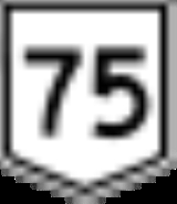
Northern Highway
Encyclopedia


Calder Highway
Calder Highway is a Highway linking Ravenswood South in Victoria, to Mildura. North of the Victoria/New South Wales border, the highway continues north to Broken Hill, Tibooburra and the New South Wales/Queensland border as the Silver City Highway, under the standard national route shield as far...
(Melbourne to Mildura) and the M/A39 Goulburn Valley Highway
Goulburn Valley Highway
The Goulburn Valley Highway / is a highway located in Victoria, Australia. The section north beyond the Hume Freeway is part of the Melbourne to Brisbane National Highway and is the main link between these two cities as well as a major link between Victoria and inland New South Wales...
(Melbourne to Tocumwal), it provides primary arterial links in the region. In
conjunction with the B280 McIvor Highway
McIvor Highway
McIvor Highway is a short Victorian highway linking Bendigo and Heathcote. Together with Hume Freeway and Northern Highway , it provides an alternative route between Melbourne and Bendigo. Previously assigned State Route 141, it was later designated B280...
, the B75 Northern Highway provides an important link
between Melbourne
Melbourne
Melbourne is the capital and most populous city in the state of Victoria, and the second most populous city in Australia. The Melbourne City Centre is the hub of the greater metropolitan area and the Census statistical division—of which "Melbourne" is the common name. As of June 2009, the greater...
and Bendigo
Bendigo, Victoria
Bendigo is a major regional city in the state of Victoria, Australia, located very close to the geographical centre of the state and approximately north west of the state capital Melbourne. It is the second largest inland city and fourth most populous city in the state. The estimated urban...
.
It runs from the M31 Hume Freeway south of Wallan to the New South Wales Border at Echuca, on the banks of the Murray River
Murray River
The Murray River is Australia's longest river. At in length, the Murray rises in the Australian Alps, draining the western side of Australia's highest mountains and, for most of its length, meanders across Australia's inland plains, forming the border between New South Wales and Victoria as it...
, a distance of 164 kilometres. The highway traverses moderately hilly terrain from Wallan to Toolleen, then flat open country to the border at Echuca. Beyond Echuca across the NSW border it continues as Cobb Highway
Cobb Highway
The Cobb Highway is a State highway in western New South Wales, Australia. From north to south the Cobb Highway begins at its junction with the Barrier Highway near Wilcannia and runs south through the townships of Ivanhoe, Booligal, Hay and Deniliquin. It ends at Moama where the...
. The section between the Hume Highway south of Wallan and the intersection of the highway and the Kilmore-Broadford Rd was, in fact, the Hume Highway until 1976, when the Hume Freeway replaced the old highway and bypassed Wallan, Kilmore and Broadford.
The Northern Highway and the beginning of the McIvor Highway form a junction at Heathcote
Heathcote, Victoria
Heathcote is a town in central Victoria, Australia, situated on the Northern Highway 110 kilometres north of Melbourne and 40 kilometres south-east of Bendigo via the McIvor Highway. Heathcote's local government area is the City of Greater Bendigo and it is part of the federal electorate of...
. The McIvor Highway leads to Bendigo and the Northern Highway continues to Echuca.
The B75 Northern Highway is a significant freight route providing access to markets, airport and port in Melbourne and the rural primary production areas of the Murray Valley and southern New South Wales. It serves a number of agricultural and tourism-related industries along its length.
Major intersections and towns
| Northern Highway |
|||
| Northbound | Distance to Echuca (km) |
Distance to Melbourne (km) |
Southbound |
| End Northern Highway continues as Cobb Highway Cobb Highway The Cobb Highway is a State highway in western New South Wales, Australia. From north to south the Cobb Highway begins at its junction with the Barrier Highway near Wilcannia and runs south through the townships of Ivanhoe, Booligal, Hay and Deniliquin. It ends at Moama where the...  to Deniliquin / Hay Hay, New South Wales Hay is a town in the western Riverina region of south western New South Wales , Australia. It is the administrative centre of Hay Shire Local Government Area and the centre of a prosperous and productive agricultural district on the wide Hay Plains.... / Wilcannia Wilcannia, New South Wales Wilcannia is a small town located within the Central Darling Shire in north western New South Wales, Australia. This was the third largest inland port in the country during the great river boat era of the mid-19th century. At the 2006 census, Wilcannia had a population of 596.- Geography... |
-- | 221 | Start Northern Highway from Cobb Highway Cobb Highway The Cobb Highway is a State highway in western New South Wales, Australia. From north to south the Cobb Highway begins at its junction with the Barrier Highway near Wilcannia and runs south through the townships of Ivanhoe, Booligal, Hay and Deniliquin. It ends at Moama where the... |
| MURRAY RIVER Murray River The Murray River is Australia's longest river. At in length, the Murray rises in the Australian Alps, draining the western side of Australia's highest mountains and, for most of its length, meanders across Australia's inland plains, forming the border between New South Wales and Victoria as it... |
MURRAY RIVER Murray River The Murray River is Australia's longest river. At in length, the Murray rises in the Australian Alps, draining the western side of Australia's highest mountains and, for most of its length, meanders across Australia's inland plains, forming the border between New South Wales and Victoria as it... |
||
| NEW SOUTH WALES STATE BORDER VICTORIA |
|||
To  Cohuna CohunaCohuna, Victoria Cohuna is a town situated north of Melbourne, on the Murray Valley Highway, in northern Victoria, Australia. At the 2006 census, Cohuna had a population of 1,893.-History:... , Kerang Kerang, Victoria Kerang is a rural town on the Loddon River in northern Victoria in Australia. It is the commercial centre to an irrigation district based on livestock, horticulture, lucerne and grain. It is located north-west of Melbourne on the Murray Valley Highway a few kilometres north of its intersection... High Street .svg.png) |
-- | 220.5 | To Cohuna Cohuna, Victoria Cohuna is a town situated north of Melbourne, on the Murray Valley Highway, in northern Victoria, Australia. At the 2006 census, Cohuna had a population of 1,893.-History:... , Kerang Kerang, Victoria Kerang is a rural town on the Loddon River in northern Victoria in Australia. It is the commercial centre to an irrigation district based on livestock, horticulture, lucerne and grain. It is located north-west of Melbourne on the Murray Valley Highway a few kilometres north of its intersection... High Street |
| Echuca Echuca, Victoria Echuca is a town located on the banks of the Murray River and Campaspe river in Victoria, Australia. The Border town Moama is on the northern side of the Murray river in New South Wales. It is the administrative centre and largest settlement in the Shire of Campaspe... |
0 | 220 | Echuca Echuca, Victoria Echuca is a town located on the banks of the Murray River and Campaspe river in Victoria, Australia. The Border town Moama is on the northern side of the Murray river in New South Wales. It is the administrative centre and largest settlement in the Shire of Campaspe... |
| continues as |
1 | 219 | Nathalia Nathalia, Victoria Nathalia is a town in northern Victoria, Australia. The town is located within the Shire of Moira Local government area on the banks of Broken Creek and on the Murray Valley Highway. At the 2006 census, Nathalia had a population of 1,431.... , Yarrawonga Yarrawonga, Victoria Yarrawonga is a town in the Shire of Moira Local Government Area in the Australian state of Victoria. The town is situated on the south bank of the Murray River, the border between Victoria and New South Wales and is located approximately north-east of the state capital, Melbourne. Yarrawonga's... , Wodonga Wodonga, Victoria Wodonga is a small city on the Victorian side of the border with New South Wales, north-east of Melbourne, Australia. Adjacent to Wodonga across the border is the New South Wales city of Albury. Wodonga is located wholly within the boundaries of the City of Wodonga LGA... ; To Kyabram Kyabram, Victoria Kyabram is located in the centre of a rich irrigation district in the Goulburn River Valley, 200 kilometres north of Melbourne, Victoria, Australia. Kyabram, the second largest town in the Shire of Campaspe. is situated between the towns of Echuca and Shepparton and is close to the Murray River... Murray Valley Highway Murray Valley Highway The Murray Valley Highway is a popular tourist route, which follows the south side of the Murray River in Victoria, Australia. The route effectively acts as the northern-most highway in Victoria...  |
| Nathalia Nathalia, Victoria Nathalia is a town in northern Victoria, Australia. The town is located within the Shire of Moira Local government area on the banks of Broken Creek and on the Murray Valley Highway. At the 2006 census, Nathalia had a population of 1,431.... , Yarrawonga Yarrawonga, Victoria Yarrawonga is a town in the Shire of Moira Local Government Area in the Australian state of Victoria. The town is situated on the south bank of the Murray River, the border between Victoria and New South Wales and is located approximately north-east of the state capital, Melbourne. Yarrawonga's... , Wodonga Wodonga, Victoria Wodonga is a small city on the Victorian side of the border with New South Wales, north-east of Melbourne, Australia. Adjacent to Wodonga across the border is the New South Wales city of Albury. Wodonga is located wholly within the boundaries of the City of Wodonga LGA... Murray Valley Highway Murray Valley Highway The Murray Valley Highway is a popular tourist route, which follows the south side of the Murray River in Victoria, Australia. The route effectively acts as the northern-most highway in Victoria... |
duplexes with |
||
| duplexes with |
3 | 217 | Cohuna Cohuna, Victoria Cohuna is a town situated north of Melbourne, on the Murray Valley Highway, in northern Victoria, Australia. At the 2006 census, Cohuna had a population of 1,893.-History:... , Kerang Kerang, Victoria Kerang is a rural town on the Loddon River in northern Victoria in Australia. It is the commercial centre to an irrigation district based on livestock, horticulture, lucerne and grain. It is located north-west of Melbourne on the Murray Valley Highway a few kilometres north of its intersection... , Swan Hill Swan Hill, Victoria Swan Hill is a city in the northwest of Victoria, Australia. It is located on the Murray Valley Highway, on the south bank of the Murray River, downstream from the junction of the Loddon River. At the 2006 census, Swan Hill had a population of 9,684.-History:... Murray Valley Highway Murray Valley Highway The Murray Valley Highway is a popular tourist route, which follows the south side of the Murray River in Victoria, Australia. The route effectively acts as the northern-most highway in Victoria... |
| Cohuna Cohuna, Victoria Cohuna is a town situated north of Melbourne, on the Murray Valley Highway, in northern Victoria, Australia. At the 2006 census, Cohuna had a population of 1,893.-History:... , Kerang Kerang, Victoria Kerang is a rural town on the Loddon River in northern Victoria in Australia. It is the commercial centre to an irrigation district based on livestock, horticulture, lucerne and grain. It is located north-west of Melbourne on the Murray Valley Highway a few kilometres north of its intersection... , Swan Hill Swan Hill, Victoria Swan Hill is a city in the northwest of Victoria, Australia. It is located on the Murray Valley Highway, on the south bank of the Murray River, downstream from the junction of the Loddon River. At the 2006 census, Swan Hill had a population of 9,684.-History:... Murray Valley Highway Murray Valley Highway The Murray Valley Highway is a popular tourist route, which follows the south side of the Murray River in Victoria, Australia. The route effectively acts as the northern-most highway in Victoria... |
continues as |
||
| Mitiamo Mitiamo, Victoria Mitiamo is a town in northern Victoria, Australia. The town is located in the Shire of Loddon, north of the state capital, Melbourne. At the 2006 census, Mitiamo had a population of 76.... Echuca-Mitiamo Road .svg.png) |
8 | 212 | Mitiamo Mitiamo, Victoria Mitiamo is a town in northern Victoria, Australia. The town is located in the Shire of Loddon, north of the state capital, Melbourne. At the 2006 census, Mitiamo had a population of 76.... Echuca-Mitiamo Road |
| Prairie Prairie-Rochester Road |
22 | 198 | Prairie Prairie-Rochester Road |
ECHUCA RAIL LINE .svg.png) |
27.5 | 192.5 | ECHUCA RAIL LINE |
| Kyabram Kyabram, Victoria Kyabram is located in the centre of a rich irrigation district in the Goulburn River Valley, 200 kilometres north of Melbourne, Victoria, Australia. Kyabram, the second largest town in the Shire of Campaspe. is situated between the towns of Echuca and Shepparton and is close to the Murray River... Kyabram-Rochester Road |
28 | 192 | Rochester Rochester, Victoria Rochester is a small town in country Victoria, Australia. It is located 180 km north of Melbourne with a mixture of rural and semi-rural communities on the northern Campaspe River, between Bendigo and the Murray River port of Echuca... |
| Rochester Rochester, Victoria Rochester is a small town in country Victoria, Australia. It is located 180 km north of Melbourne with a mixture of rural and semi-rural communities on the northern Campaspe River, between Bendigo and the Murray River port of Echuca... |
Kyabram Kyabram, Victoria Kyabram is located in the centre of a rich irrigation district in the Goulburn River Valley, 200 kilometres north of Melbourne, Victoria, Australia. Kyabram, the second largest town in the Shire of Campaspe. is situated between the towns of Echuca and Shepparton and is close to the Murray River... ; To Rushworth Rushworth, Victoria Rushworth is a township in Victoria, Australia. It is located north of Melbourne and, at the 2006 census, had a population of 2066.-History:... Kyabram-Rochester Road |
||
| Raywood Raywood, Victoria Raywood is a town in northern Victoria, Australia. The town is located in the City of Greater Bendigo, north of the state capital, Melbourne. At the 2006 census, Raywood had a population of 291.Raywood Post Office opened on 4 January 1864... Elmore-Raywood Road |
45.5 | 174.5 | Raywood Raywood, Victoria Raywood is a town in northern Victoria, Australia. The town is located in the City of Greater Bendigo, north of the state capital, Melbourne. At the 2006 census, Raywood had a population of 291.Raywood Post Office opened on 4 January 1864... Elmore-Raywood Road |
| Elmore Elmore, Victoria Elmore is a small town in Victoria north-east of Bendigo on the Campaspe River. Elmore is close to the Whipstick State Park.At the 2006 census, Elmore had a population of 694.-History:... |
46 | 174 | Elmore Elmore, Victoria Elmore is a small town in Victoria north-east of Bendigo on the Campaspe River. Elmore is close to the Whipstick State Park.At the 2006 census, Elmore had a population of 694.-History:... |
| continues as |
Bendigo Bendigo, Victoria Bendigo is a major regional city in the state of Victoria, Australia, located very close to the geographical centre of the state and approximately north west of the state capital Melbourne. It is the second largest inland city and fourth most populous city in the state. The estimated urban... , Ballarat Ballarat, Victoria Ballarat is a city in the state of Victoria, Australia, approximately west-north-west of the state capital Melbourne situated on the lower plains of the Great Dividing Range and the Yarrowee River catchment. It is the largest inland centre and third most populous city in the state and the fifth... Midland Highway  |
||
| Bendigo Bendigo, Victoria Bendigo is a major regional city in the state of Victoria, Australia, located very close to the geographical centre of the state and approximately north west of the state capital Melbourne. It is the second largest inland city and fourth most populous city in the state. The estimated urban... Midland Highway |
duplexes with |
||
| duplexes with |
48 | 172 | Shepparton Shepparton, Victoria Shepparton is a city located on the floodplain of the Goulburn River in the north east of Victoria, Australia approximately north-east of Melbourne. It is the fifth largest city in Victoria, Australia. The estimated population of Shepparton's statistical area is 48,926.It began as a sheep station... , Benalla Benalla, Victoria Benalla is a city of just over 9,000 people located just off the Hume Freeway in north-eastern Victoria, Australia, about southwest of Wangaratta. Its Local Government Area is the Rural City of Benalla.- Overview :... Midland Highway |
| Shepparton Shepparton, Victoria Shepparton is a city located on the floodplain of the Goulburn River in the north east of Victoria, Australia approximately north-east of Melbourne. It is the fifth largest city in Victoria, Australia. The estimated population of Shepparton's statistical area is 48,926.It began as a sheep station... , Benalla Benalla, Victoria Benalla is a city of just over 9,000 people located just off the Hume Freeway in north-eastern Victoria, Australia, about southwest of Wangaratta. Its Local Government Area is the Rural City of Benalla.- Overview :... Midland Highway |
continues as |
||
| Bendigo Bendigo, Victoria Bendigo is a major regional city in the state of Victoria, Australia, located very close to the geographical centre of the state and approximately north west of the state capital Melbourne. It is the second largest inland city and fourth most populous city in the state. The estimated urban... , Rushworth Rushworth, Victoria Rushworth is a township in Victoria, Australia. It is located north of Melbourne and, at the 2006 census, had a population of 2066.-History:... , Murchison Murchison, Victoria Murchison is a small rural village located on the Goulburn River in Victoria, Australia. Murchison is located 167 kilometres from Melbourne and is just to the west of the Goulburn Valley Highway between Shepparton and Nagambie. The surrounding countryside contains orchards, vineyards and dairy... Bendigo-Murchison Road  |
59 | 161 | Rushworth Rushworth, Victoria Rushworth is a township in Victoria, Australia. It is located north of Melbourne and, at the 2006 census, had a population of 2066.-History:... , Murchison Murchison, Victoria Murchison is a small rural village located on the Goulburn River in Victoria, Australia. Murchison is located 167 kilometres from Melbourne and is just to the west of the Goulburn Valley Highway between Shepparton and Nagambie. The surrounding countryside contains orchards, vineyards and dairy... , Bendigo Bendigo, Victoria Bendigo is a major regional city in the state of Victoria, Australia, located very close to the geographical centre of the state and approximately north west of the state capital Melbourne. It is the second largest inland city and fourth most populous city in the state. The estimated urban... Bendigo-Murchison Road |
| Rushworth Rushworth, Victoria Rushworth is a township in Victoria, Australia. It is located north of Melbourne and, at the 2006 census, had a population of 2066.-History:... , Murchison Murchison, Victoria Murchison is a small rural village located on the Goulburn River in Victoria, Australia. Murchison is located 167 kilometres from Melbourne and is just to the west of the Goulburn Valley Highway between Shepparton and Nagambie. The surrounding countryside contains orchards, vineyards and dairy... Heathcote-Rochester Road |
84 | 136 | Rushworth Rushworth, Victoria Rushworth is a township in Victoria, Australia. It is located north of Melbourne and, at the 2006 census, had a population of 2066.-History:... Heathcote-Rochester Road |
| Bendigo Bendigo, Victoria Bendigo is a major regional city in the state of Victoria, Australia, located very close to the geographical centre of the state and approximately north west of the state capital Melbourne. It is the second largest inland city and fourth most populous city in the state. The estimated urban... McIvor Highway McIvor Highway McIvor Highway is a short Victorian highway linking Bendigo and Heathcote. Together with Hume Freeway and Northern Highway , it provides an alternative route between Melbourne and Bendigo. Previously assigned State Route 141, it was later designated B280...  |
95 | 125 | Bendigo Bendigo, Victoria Bendigo is a major regional city in the state of Victoria, Australia, located very close to the geographical centre of the state and approximately north west of the state capital Melbourne. It is the second largest inland city and fourth most populous city in the state. The estimated urban... McIvor Highway McIvor Highway McIvor Highway is a short Victorian highway linking Bendigo and Heathcote. Together with Hume Freeway and Northern Highway , it provides an alternative route between Melbourne and Bendigo. Previously assigned State Route 141, it was later designated B280... |
| Redesdale Redesdale, Victoria Redesdale is a town in central Victoria, Australia., north west of the state capital, Melbourne. It is located partly in the City of Greater Bendigo Local Government Area and partly in the Shire of Mount Alexander... , Kyneton Kyneton, Victoria Kyneton is a town on the Calder Highway in the Macedon Ranges of Victoria, Australia. The Calder Freeway bypasses Kyneton to the north and east. The town was named after the English village of Kineton, Warwickshire. The town has three main streets: Mollison Street, Piper Street and High Street... Heathcote-Kyneton Road  |
96 | 124 | Redesdale Redesdale, Victoria Redesdale is a town in central Victoria, Australia., north west of the state capital, Melbourne. It is located partly in the City of Greater Bendigo Local Government Area and partly in the Shire of Mount Alexander... , Kyneton Kyneton, Victoria Kyneton is a town on the Calder Highway in the Macedon Ranges of Victoria, Australia. The Calder Freeway bypasses Kyneton to the north and east. The town was named after the English village of Kineton, Warwickshire. The town has three main streets: Mollison Street, Piper Street and High Street... Heathcote-Kyneton Road |
| Heathcote Heathcote, Victoria Heathcote is a town in central Victoria, Australia, situated on the Northern Highway 110 kilometres north of Melbourne and 40 kilometres south-east of Bendigo via the McIvor Highway. Heathcote's local government area is the City of Greater Bendigo and it is part of the federal electorate of... |
97 | 123 | Heathcote Heathcote, Victoria Heathcote is a town in central Victoria, Australia, situated on the Northern Highway 110 kilometres north of Melbourne and 40 kilometres south-east of Bendigo via the McIvor Highway. Heathcote's local government area is the City of Greater Bendigo and it is part of the federal electorate of... |
| Nagambie Nagambie, Victoria Nagambie is a town in Victoria, Australia, located on the Goulburn Valley Highway, north of Seymour, in the Shire of Strathbogie. At the 2006 census, Nagambie had a population of 1,383.-History:... Heathcote-Nagambie Road |
101 | 119 | Nagambie Nagambie, Victoria Nagambie is a town in Victoria, Australia, located on the Goulburn Valley Highway, north of Seymour, in the Shire of Strathbogie. At the 2006 census, Nagambie had a population of 1,383.-History:... Heathcote-Nagambie Road |
| Puckapunyal, Seymour Seymour, Victoria Seymour is a township in the Shire of Mitchell in the state of Victoria, Australia and is located north of Melbourne. At the 2006 census, Seymour had a population of 6,063... Seymour-Tooborac Road  |
112.5 | 107.5 | Puckapunyal, Seymour Seymour, Victoria Seymour is a township in the Shire of Mitchell in the state of Victoria, Australia and is located north of Melbourne. At the 2006 census, Seymour had a population of 6,063... Seymour-Tooborac Road |
| Tooborac Tooborac, Victoria Tooborac is a town in Victoria, Australia. The town is located north of the state capital, Melbourne. At the 2006 census, Tooborac and the surrounding area had a population of 277.Tooborac Post Office opened on 1 January 1872.... |
113 | 107 | Tooborac Tooborac, Victoria Tooborac is a town in Victoria, Australia. The town is located north of the state capital, Melbourne. At the 2006 census, Tooborac and the surrounding area had a population of 277.Tooborac Post Office opened on 1 January 1872.... |
| Lancefield Lancefield, Victoria Lancefield is a town in the Shire of Macedon Ranges Local government area in Victoria, Australia. The town is located north of the state capital, Melbourne and had a population of 1,184 at the 2006 census.-History:... , Sunbury Sunbury, Victoria Sunbury is a regional city, located north-west of Melbourne's central business district, in the state of Victoria, Australia. Its Local Government Area is the City of Hume. At the 2006 Census, Sunbury had a population of 31,000... Lancefield-Tooborac Road  |
114 | 106 | Lancefield Lancefield, Victoria Lancefield is a town in the Shire of Macedon Ranges Local government area in Victoria, Australia. The town is located north of the state capital, Melbourne and had a population of 1,184 at the 2006 census.-History:... , Romsey Romsey, Victoria Romsey is a town in the Local Government Area of the Shire of Macedon Ranges in the state of Victoria, Australia. The town is located north of Melbourne. At the 2006 census, Romsey had a population of 4490.-History:... , Sunbury Sunbury, Victoria Sunbury is a regional city, located north-west of Melbourne's central business district, in the state of Victoria, Australia. Its Local Government Area is the City of Hume. At the 2006 Census, Sunbury had a population of 31,000... Lancefield-Tooborac Road |
| Broadford Broadford, Victoria Broadford is a small town in central Victoria, Australia. At the 2006 census, Broadford had a population of 3,054. The town is the headquarters of the Shire of Mitchell Local Government Area and is approximately north of the state capital, Melbourne.... , Seymour Seymour, Victoria Seymour is a township in the Shire of Mitchell in the state of Victoria, Australia and is located north of Melbourne. At the 2006 census, Seymour had a population of 6,063... Broadford-Kilmore Road  |
144 | 76 | Broadford Broadford, Victoria Broadford is a small town in central Victoria, Australia. At the 2006 census, Broadford had a population of 3,054. The town is the headquarters of the Shire of Mitchell Local Government Area and is approximately north of the state capital, Melbourne.... Broadford-Kilmore Road |
| Kilmore Kilmore, Victoria Kilmore is a town in the Australian state of Victoria. Located north of Melbourne, it is contentiously claimed as Victoria's oldest inland settled town... |
146 | 74 | Kilmore Kilmore, Victoria Kilmore is a town in the Australian state of Victoria. Located north of Melbourne, it is contentiously claimed as Victoria's oldest inland settled town... |
| Lancefield Lancefield, Victoria Lancefield is a town in the Shire of Macedon Ranges Local government area in Victoria, Australia. The town is located north of the state capital, Melbourne and had a population of 1,184 at the 2006 census.-History:... , Woodend Woodend, Victoria Woodend is a small town in Victoria, Australia. The town is in the Shire of Macedon Ranges Local government area. It is bypassed to the east and north by the Calder Freeway and is located about halfway between Melbourne and Bendigo... Kilmore-Lancefield Road  |
147 | 73 | Lancefield Lancefield, Victoria Lancefield is a town in the Shire of Macedon Ranges Local government area in Victoria, Australia. The town is located north of the state capital, Melbourne and had a population of 1,184 at the 2006 census.-History:... , Woodend Woodend, Victoria Woodend is a small town in Victoria, Australia. The town is in the Shire of Macedon Ranges Local government area. It is bypassed to the east and north by the Calder Freeway and is located about halfway between Melbourne and Bendigo... Kilmore-Lancefield Road |
| Wandong Wandong, Victoria Wandong is a town in Victoria, Australia. The town is about north of the state capital, Melbourne, on the Hume Highway. It is located right next to the town of Heathcote Junction, and at the 2006 census, the two towns had a population of 1,490.. The main centre nearest Wandong is Kilmore.Wandong... , Epping Epping, Victoria Epping is a suburb in Melbourne, Victoria, Australia, 22 km north from Melbourne's central business district. Its Local Government Area is the City of Whittlesea... Epping-Kilmore Road  |
150 | 70 | Wandong Wandong, Victoria Wandong is a town in Victoria, Australia. The town is about north of the state capital, Melbourne, on the Hume Highway. It is located right next to the town of Heathcote Junction, and at the 2006 census, the two towns had a population of 1,490.. The main centre nearest Wandong is Kilmore.Wandong... , Whittlesea Whittlesea, Victoria Whittlesea is a town in Melbourne, Victoria, Australia, north-east from Melbourne's central business district. Its Local Government Area is the City of Whittlesea. At the 2006 Census, Whittlesea had a population of 4,563.-History:... , Epping Epping, Victoria Epping is a suburb in Melbourne, Victoria, Australia, 22 km north from Melbourne's central business district. Its Local Government Area is the City of Whittlesea... Epping-Kilmore Road |
| Wallan Wallan, Victoria Wallan or Wallan Wallan is a town in Victoria, from Melbourne on the Northern Highway in Australia.The town sits at the southern end of the large and diverse Shire of Mitchell which extends from the northern fringes of Melbourne into the farming country of north-central Victoria and the lower... |
159 | 61 | Wallan Wallan, Victoria Wallan or Wallan Wallan is a town in Victoria, from Melbourne on the Northern Highway in Australia.The town sits at the southern end of the large and diverse Shire of Mitchell which extends from the northern fringes of Melbourne into the farming country of north-central Victoria and the lower... |
| Seymour Seymour, Victoria Seymour is a township in the Shire of Mitchell in the state of Victoria, Australia and is located north of Melbourne. At the 2006 census, Seymour had a population of 6,063... , Sydney Sydney Sydney is the most populous city in Australia and the state capital of New South Wales. Sydney is located on Australia's south-east coast of the Tasman Sea. As of June 2010, the greater metropolitan area had an approximate population of 4.6 million people... via  Freeway; Freeway;Whittlesea Whittlesea, Victoria Whittlesea is a town in Melbourne, Victoria, Australia, north-east from Melbourne's central business district. Its Local Government Area is the City of Whittlesea. At the 2006 Census, Whittlesea had a population of 4,563.-History:... , Kinglake Kinglake, Victoria Kinglake is a town in Victoria, Australia situated in the Shire of Murrindindi local government area. At the 2006 Census, Kinglake had a population of 1482... Wallan-Whittlesea Road  |
160 | 60 | Seymour Seymour, Victoria Seymour is a township in the Shire of Mitchell in the state of Victoria, Australia and is located north of Melbourne. At the 2006 census, Seymour had a population of 6,063... , Sydney Sydney Sydney is the most populous city in Australia and the state capital of New South Wales. Sydney is located on Australia's south-east coast of the Tasman Sea. As of June 2010, the greater metropolitan area had an approximate population of 4.6 million people... via Freeway;Whittlesea Whittlesea, Victoria Whittlesea is a town in Melbourne, Victoria, Australia, north-east from Melbourne's central business district. Its Local Government Area is the City of Whittlesea. At the 2006 Census, Whittlesea had a population of 4,563.-History:... , Kinglake Kinglake, Victoria Kinglake is a town in Victoria, Australia situated in the Shire of Murrindindi local government area. At the 2006 Census, Kinglake had a population of 1482... Wallan-Whittlesea Road |
| Start Northern Highway from Hume Freeway |
164 | 56 | End Northern Highway continues as Hume Freeway to Melbourne Melbourne Melbourne is the capital and most populous city in the state of Victoria, and the second most populous city in Australia. The Melbourne City Centre is the hub of the greater metropolitan area and the Census statistical division—of which "Melbourne" is the common name. As of June 2009, the greater... |