

North Ryde, New South Wales
Encyclopedia
North Ryde is a suburb
of Sydney
, in the state of New South Wales
, Australia
. North Ryde is located 15 kilometres north-west of the Sydney central business district
, in the local government area of the City of Ryde
. North Ryde is in the Northern Suburbs
region of Sydney.
One of Australia's major business districts, North Ryde is home to many computer corporations such as Microsoft, Hewlett Packard, and Sun Microsystems. The suburb is the site of Macquarie University
and its residents include those from the university academe and the research sector.
North Ryde shares the postcode of 2113 with adjacent suburbs Macquarie Park
and East Ryde. These suburbs were once part of North Ryde and many businesses and residences in these suburbs still advertise their address as being in North Ryde. Adjacent Macquarie University was issued with its own postcode by Australia Post
, 2109, in the late 1980s.
which was named after the 'Ryde Store', a business run by G.M. Pope. He adopted the name from his birthplace of Ryde
on the Isle of Wight
, UK. Ryde was the name used from the 1840s and adopted as the name of the municipality in 1870.
turpentine-ironbark forests on Wianamatta shale
soil in Sydney. See Sydney Turpentine-Ironbark Forest
.
is the third oldest settlement in Australia, after Sydney and Parramatta. The area between Parramatta and Lane Cove Rivers was originally known by white settlers as the Field of Mars
and then the Eastern Farms. North Ryde was established in the mid 19th century as a farming district, in what was a heavily vegetated area, next to the already established district of Ryde. The Field of Mars Common was considered dangerous, as escaped convicts and bushrangers were known to frequent the area.
Thompson's Shop (1904) in Coxs Road was the general store and post office for many years, and apart from the schoolhouse is the only remaining original building still standing from those early years. Three gas street lamps were installed in Coxs Road in the 1920s. One has been restored and is in front of the schoolhouse. The Coxs Road Shopping Centre was destroyed by a suspicious fire around 1990 and a new shopping mall was built with improved amenities.
when the state government purchased and subdivided much of the land for Defence Homes and public housing
. The rapid development of North Ryde in the 1950s and 1960s saw many of the older dwellings and buildings demolished.
A migrant hostel was located on the south side of Blenheim Road. During WWII the 3rd Australian Ordnance Army Vehicle Park was located in North Ryde, bounded by Epping, Wicks, Coxs and Blenheim Roads. Farming activity included orchards, market garden
s and poultry
. A pig farm was located in Wicks Road and was operational until the late 1960s. The House of David operated for many years on Lane Cove Road, and included a general store, picnic grounds, tennis courts, a miniature train ride, and a small zoo, later adding a VW car dealership to the complex. A Volkswagen
car assembly plant was located behind the House of David in Waterloo Road before being moved to Mexico. The North Ryde Skyline Drive-In Theatre was opened in 1956 on the southern corner of Waterloo and Lane Cove Roads, adjoining the newly built North Ryde High School, and operated until the mid-1980s.
at Goulburn Correctional Centre
.
In addition, there have been several other horrendous murders in the North Ryde area. The "body in the bathroom" and others have horrified members of the community.
that features a supermarket, the post office, and specialty shops. The Public School, Community Centre, Library and School of Arts are all located nearby. Another commercial development is located opposite featuring a number of cafes, and eateries. Another row of shops is located in Blenheim Road, including the Adwill Place Arcade.
The mid 1960s saw the combined establishment of the North Ryde Industrial Area and Macquarie University to emulate the industrial areas surrounding and associated with Stanford University near San Francisco, California. Industries were originally limited to being "light", science related, and include research activities. The area has seen massive growth since the 1960s with the precincts in Macquarie Park and the Riverside Corporate Park now having the reputation as the leading high-tech industrial areas in Australia, attracting major information technology, communication, electronic, computing, scientific, medical, and pharmaceutical companies [5].
The neighbouring suburb of Macquarie Park
, still considered a part of North Ryde, includes the regional shopping centre
Macquarie Centre
, Macquarie University
, ARN
(WSFM and The Edge 96.1 studios), Sony
, Foxtel
, Optus
, CA, Rexel Group Australia and many corporate headquarters.
A second primary school, Truscott Street Public School, opened on 21 May 1958; in 1988 the Truscott Street school incorporated a "Special Unit" for children with special needs.
A large and modern senior school, North Ryde High School, was built on land between Epping and Waterloo Roads and opened in January 1962. It was later re-named Peter Board High School, which many residents felt took away its local identity. The school was subsequently phased out and closed in December 1998, demographics being used as justification for the decision. This move left North Ryde without a high school; Ryde Secondary College
being the nearest alternative.
A Catholic school, Holy Spirit Primary School, is located in Coxs Road, slightly further down from North Ryde Public School, on the opposite side of the road. Ryde East Primary School is located on Twin Road, with 350 students.
Arndell Special School
is located in Badajoz Road on the Macquarie Hospital campus.
There are no emergency services at Macquarie Hospital. The nearest Emergency Departments are at Ryde Hospital, Concord Hospital, or Royal North Shore Hospital
.
, is a specialist private hospital that opened on 15 June 2010 located on the Campus of Macquarie University
in Macquarie Park, North Ryde. It is now the primary teaching hospital affiliated with the University's Australian School of Advanced Medicine
. The Hospital features some of the most advanced medical facilities in Australia, including the first gamma knife in Australia.
There are no emergency services at Macquarie University Hospital. The nearest emergency departments are at Ryde Hospital, Concord Hospital. or Royal North Shore Hospital.
passes through North Ryde en route to the Lane Cove Tunnel
motorway, and then the Gore Hill/Warringah Freeway
, Sydney Harbour Bridge
, and Sydney CBD. Lane Cove Road
(Metroad 3
), traverses North Ryde from north to south, linking Sydney's North Shore
to Homebush Bay
and Sydney Olympic Park
. Epping Road
runs west to east and crosses the Lane Cove River Bridge to link the City of Ryde
to the Municipality of Lane Cove
. North Ryde is serviced by public buses, primarily the Routes 285-297, 506, and 534-535 which criss-cross the district. Private shuttle buses provide local and Airport services.
North Ryde railway station is an underground railway station on the Epping to Chatswood railway line that opened in 2009. It is located close to the intersection of Epping Road and Delhi Road, near the M2 Motorway. During the steam era, there was a proposal to build a railway station in North Ryde near the intersection of Coxs Road and Wicks Road, but the Epping-St Leonards Railway was never built.
The intersection of Epping and Pittwater Road was once destined to be a major junction of part of "Sydney's Missing Roads" until the cancellation of the North Western and Lane Cove Valley Expressways in the late 1970s. The Eastwood County Road (also referred to as Silverwater-North Ryde route or the Ermington-Epping Rd link) was also proposed, with the corridor remaining reserved today.
The intersection of Epping Road and Lane Cove Road was originally planned to be Australia's first "clover leaf" intersection. Land on all four corner of the intersection had been acquired for the flyover loops. However, as construction of the Epping Road main bridge deck progressed, the loops were dropped, leaving it as a traffic light–controlled intersection under the overpass. The land on the four corners has since been re-utilised, one being a Medical Center, another an office building. This is now one of the most congested roads in Sydney.
 North Ryde has many beautiful parks and reserves, including North Ryde Common, and the adjacent Lane Cove National Park
, the Field of Mars Reserve, and access to the Great North Walk
and the Lane Cove River
, once home to the famous Fairyland picnic grounds, when boatloads of people would come up the river from Sydney for the regular Saturday Dances. Today very little remains of Fairyland and it is almost completely overgrown.
North Ryde Park received a major upgrade in 2009 with fully refurbished amenities block and a new children's play area.
Blenheim Park features an off-leash area for dogs.
and Ryde
, and the Federal electorate of Division of Bennelong
.
Suburb
The word suburb mostly refers to a residential area, either existing as part of a city or as a separate residential community within commuting distance of a city . Some suburbs have a degree of administrative autonomy, and most have lower population density than inner city neighborhoods...
of Sydney
Sydney
Sydney is the most populous city in Australia and the state capital of New South Wales. Sydney is located on Australia's south-east coast of the Tasman Sea. As of June 2010, the greater metropolitan area had an approximate population of 4.6 million people...
, in the state of New South Wales
New South Wales
New South Wales is a state of :Australia, located in the east of the country. It is bordered by Queensland, Victoria and South Australia to the north, south and west respectively. To the east, the state is bordered by the Tasman Sea, which forms part of the Pacific Ocean. New South Wales...
, Australia
Australia
Australia , officially the Commonwealth of Australia, is a country in the Southern Hemisphere comprising the mainland of the Australian continent, the island of Tasmania, and numerous smaller islands in the Indian and Pacific Oceans. It is the world's sixth-largest country by total area...
. North Ryde is located 15 kilometres north-west of the Sydney central business district
Sydney central business district
The Sydney central business district is the main commercial centre of Sydney, New South Wales, Australia. It extends southwards for about 3 kilometres from Sydney Cove, the point of first European settlement. Its north–south axis runs from Circular Quay in the north to Central railway station in...
, in the local government area of the City of Ryde
City of Ryde
The City of Ryde is a Local Government Area in Sydney, New South Wales, Australia, on the Lower North Shore and Greater Western Sydney over West Ryde and Eastwood District....
. North Ryde is in the Northern Suburbs
Northern Suburbs (Sydney)
The Northern Suburbs is a general term used to describe the metropolitan area on the northern bank of the Parramatta River in Sydney, New South Wales, Australia east of West Pennant Hills and west of the Lane Cove National Park, south of Hornsby...
region of Sydney.
One of Australia's major business districts, North Ryde is home to many computer corporations such as Microsoft, Hewlett Packard, and Sun Microsystems. The suburb is the site of Macquarie University
Macquarie University
Macquarie University is an Australian public teaching and research university located in Sydney, with its main campus situated in Macquarie Park. Founded in 1964 by the New South Wales Government, it was the third university to be established in the metropolitan area of Sydney...
and its residents include those from the university academe and the research sector.
North Ryde shares the postcode of 2113 with adjacent suburbs Macquarie Park
Macquarie Park, New South Wales
Macquarie Park is a suburb in northern Sydney, in the state of New South Wales, Australia. Macquarie Park is located 12 kilometres north-west of the Sydney central business district in the local government area of the City of Ryde...
and East Ryde. These suburbs were once part of North Ryde and many businesses and residences in these suburbs still advertise their address as being in North Ryde. Adjacent Macquarie University was issued with its own postcode by Australia Post
Australia Post
Australia Post is the trading name of the Australian Government-owned Australian Postal Corporation .-History:...
, 2109, in the late 1980s.
History
The earliest reference to the area being known as North Ryde appears to be after the district's first public school (which opened on 25 January 1876) changed its name from City View Public School to North Ryde Public School in 1877. North Ryde is an extension of the adjacent suburb of RydeRyde, New South Wales
Ryde is a suburb of Sydney, New South Wales, Australia. Ryde is located 13 km north-west of the Sydney central business district and 8 km east of Parramatta. Ryde is the administrative centre of the local government area of the City of Ryde and part of the Northern Suburbs area...
which was named after the 'Ryde Store', a business run by G.M. Pope. He adopted the name from his birthplace of Ryde
Ryde
Ryde is a British seaside town, civil parish and the most populous town and urban area on the Isle of Wight, with a population of approximately 30,000. It is situated on the north-east coast. The town grew in size as a seaside resort following the joining of the villages of Upper Ryde and Lower...
on the Isle of Wight
Isle of Wight
The Isle of Wight is a county and the largest island of England, located in the English Channel, on average about 2–4 miles off the south coast of the county of Hampshire, separated from the mainland by a strait called the Solent...
, UK. Ryde was the name used from the 1840s and adopted as the name of the municipality in 1870.
Aboriginal culture
The whole area between Parramatta and Lane Cove Rivers was originally known by its Aboriginal name Wallumatta. The Aboriginal name survives in a local park, the Wallumatta Nature Reserve, located at the corner of Twin and Cressy roads, North Ryde. The reserve is one of the last remnants of the remaining 0.5% (as at 2007) of original and endangeredEndangered species
An endangered species is a population of organisms which is at risk of becoming extinct because it is either few in numbers, or threatened by changing environmental or predation parameters...
turpentine-ironbark forests on Wianamatta shale
Wianamatta shale
Wianamatta Shale is the uppermost outcropping unit in the Sydney Basin in New South Wales, Australia. It dates from the Triassic Period and generally comprises fine grained sedimentary rocks such as shales and laminites with less common sandstone units...
soil in Sydney. See Sydney Turpentine-Ironbark Forest
Sydney Turpentine-Ironbark Forest
The Sydney Turpentine-Ironbark Forest is one of six main indigenous forest communities of Sydney, New South Wales, Australia. It is also among the three of these plant communities which have been classified as Endangered, under the New South Wales government's Threatened Species Conservation Act...
.
European settlement
RydeRyde, New South Wales
Ryde is a suburb of Sydney, New South Wales, Australia. Ryde is located 13 km north-west of the Sydney central business district and 8 km east of Parramatta. Ryde is the administrative centre of the local government area of the City of Ryde and part of the Northern Suburbs area...
is the third oldest settlement in Australia, after Sydney and Parramatta. The area between Parramatta and Lane Cove Rivers was originally known by white settlers as the Field of Mars
Field of Mars Reserve, New South Wales
Field of Mars Reserve is a remnant of bushland between the Lane Cove and Parramatta Rivers in New South Wales, Australia. It is within the suburb of East Ryde and near Gladesville, Hunters Hill and Ryde, to the northwest of Sydney....
and then the Eastern Farms. North Ryde was established in the mid 19th century as a farming district, in what was a heavily vegetated area, next to the already established district of Ryde. The Field of Mars Common was considered dangerous, as escaped convicts and bushrangers were known to frequent the area.
Coxs Road
North Ryde's main street is Coxs Road, which was originally sandstone-lined to make it easier to haul goods up from the wharf on the Lane Cove River to the top of the hill. Coxs Road was spelt with an apostrophe (Cox's) until recent times. The original North Ryde Post Office on Lane Cove Road was opened in 1885 and in 1908 was moved to Coxs Road, and has since relocated premises within the Coxs Road Shopping precinct at least six times. The North Ryde School of Arts and Literary Institute, built in 1901 on land donated by William Cox of Pomona, became the venue for the annual ball, community meetings, fetes, art exhibitions, dances and culture. Extensions were built in 1907 with the North Ryde Library Branch located here. The original building was demolished in 1980 and a new Community Centre, School of Arts and Library complex was built.Thompson's Shop (1904) in Coxs Road was the general store and post office for many years, and apart from the schoolhouse is the only remaining original building still standing from those early years. Three gas street lamps were installed in Coxs Road in the 1920s. One has been restored and is in front of the schoolhouse. The Coxs Road Shopping Centre was destroyed by a suspicious fire around 1990 and a new shopping mall was built with improved amenities.
Motorcycling
In 1928 the Chatswood Motorcycle Club built a course in the area now known as the Commandment Rock Picnic Area of Lane Cove National Park. The North Ryde circuit was an early version of off-road speedway. The first North Ryde meetings were held in May and October 1928. It was reported that the October meeting attracted 7000 spectators. The Commandment Rock course was closed and another circuit known as the North Ryde Speedway was developed on what is now part of North Ryde Golf Course (then known as Cox’s Paddock), opposite from the present day School of Arts in Coxs Road. The track was located in a natural amphitheatre giving spectators an excellent view of the events. A typical meeting comprised 30 events of ten laps each. It closed in about 1935 when the golf course development began and the Chatswood Club merged with Willoughby Motor Cycle Club.Post-war
North Ryde remained rural until after World War IIWorld War II
World War II, or the Second World War , was a global conflict lasting from 1939 to 1945, involving most of the world's nations—including all of the great powers—eventually forming two opposing military alliances: the Allies and the Axis...
when the state government purchased and subdivided much of the land for Defence Homes and public housing
Public housing
Public housing is a form of housing tenure in which the property is owned by a government authority, which may be central or local. Social housing is an umbrella term referring to rental housing which may be owned and managed by the state, by non-profit organizations, or by a combination of the...
. The rapid development of North Ryde in the 1950s and 1960s saw many of the older dwellings and buildings demolished.
A migrant hostel was located on the south side of Blenheim Road. During WWII the 3rd Australian Ordnance Army Vehicle Park was located in North Ryde, bounded by Epping, Wicks, Coxs and Blenheim Roads. Farming activity included orchards, market garden
Market gardening
A market garden is the relatively small-scale production of fruits, vegetables and flowers as cash crops, frequently sold directly to consumers and restaurants. It is distinguishable from other types of farming by the diversity of crops grown on a small area of land, typically, from under one acre ...
s and poultry
Poultry
Poultry are domesticated birds kept by humans for the purpose of producing eggs, meat, and/or feathers. These most typically are members of the superorder Galloanserae , especially the order Galliformes and the family Anatidae , commonly known as "waterfowl"...
. A pig farm was located in Wicks Road and was operational until the late 1960s. The House of David operated for many years on Lane Cove Road, and included a general store, picnic grounds, tennis courts, a miniature train ride, and a small zoo, later adding a VW car dealership to the complex. A Volkswagen
Volkswagen
Volkswagen is a German automobile manufacturer and is the original and biggest-selling marque of the Volkswagen Group, which now also owns the Audi, Bentley, Bugatti, Lamborghini, SEAT, and Škoda marques and the truck manufacturer Scania.Volkswagen means "people's car" in German, where it is...
car assembly plant was located behind the House of David in Waterloo Road before being moved to Mexico. The North Ryde Skyline Drive-In Theatre was opened in 1956 on the southern corner of Waterloo and Lane Cove Roads, adjoining the newly built North Ryde High School, and operated until the mid-1980s.
Murders: Sef Gonzales
In July 2001, Sef Gonzales murdered his entire family at their home on Collins Street, North Ryde. After being found guilty of the murders of his parents and sister in 2004 he was sentenced to life imprisonmentLife imprisonment
Life imprisonment is a sentence of imprisonment for a serious crime under which the convicted person is to remain in jail for the rest of his or her life...
at Goulburn Correctional Centre
Goulburn Correctional Centre
The Goulburn Correctional Centre is an Australian maximum and 'Super Maximum' security male prison located in Goulburn, New South Wales, Australia....
.
In addition, there have been several other horrendous murders in the North Ryde area. The "body in the bathroom" and others have horrified members of the community.
Commercial areas
North Ryde features many commercial and industrial developments. The Coxs Road Shopping Centre is a small shopping mallShopping mall
A shopping mall, shopping centre, shopping arcade, shopping precinct or simply mall is one or more buildings forming a complex of shops representing merchandisers, with interconnecting walkways enabling visitors to easily walk from unit to unit, along with a parking area — a modern, indoor version...
that features a supermarket, the post office, and specialty shops. The Public School, Community Centre, Library and School of Arts are all located nearby. Another commercial development is located opposite featuring a number of cafes, and eateries. Another row of shops is located in Blenheim Road, including the Adwill Place Arcade.
The mid 1960s saw the combined establishment of the North Ryde Industrial Area and Macquarie University to emulate the industrial areas surrounding and associated with Stanford University near San Francisco, California. Industries were originally limited to being "light", science related, and include research activities. The area has seen massive growth since the 1960s with the precincts in Macquarie Park and the Riverside Corporate Park now having the reputation as the leading high-tech industrial areas in Australia, attracting major information technology, communication, electronic, computing, scientific, medical, and pharmaceutical companies [5].
The neighbouring suburb of Macquarie Park
Macquarie Park, New South Wales
Macquarie Park is a suburb in northern Sydney, in the state of New South Wales, Australia. Macquarie Park is located 12 kilometres north-west of the Sydney central business district in the local government area of the City of Ryde...
, still considered a part of North Ryde, includes the regional shopping centre
Shopping mall
A shopping mall, shopping centre, shopping arcade, shopping precinct or simply mall is one or more buildings forming a complex of shops representing merchandisers, with interconnecting walkways enabling visitors to easily walk from unit to unit, along with a parking area — a modern, indoor version...
Macquarie Centre
Macquarie Centre
Macquarie Centre is a regional sized shopping centre located between Herring, Waterloo and Talevera Roads in the suburb of Macquarie Park in Sydney, New South Wales, Australia and opposite Macquarie University's main campus....
, Macquarie University
Macquarie University
Macquarie University is an Australian public teaching and research university located in Sydney, with its main campus situated in Macquarie Park. Founded in 1964 by the New South Wales Government, it was the third university to be established in the metropolitan area of Sydney...
, ARN
Australian Radio Network
The Australian Radio Network is a group of commercial radio stations around Australia and New Zealand. A joint venture of Australian media conglomerate APN News & Media and United States radio company Clear Channel Communications, the group is the largest radio company in Australasia...
(WSFM and The Edge 96.1 studios), Sony
Sony
, commonly referred to as Sony, is a Japanese multinational conglomerate corporation headquartered in Minato, Tokyo, Japan and the world's fifth largest media conglomerate measured by revenues....
, Foxtel
Foxtel
Foxtel is an Australian pay television company, operating cable, direct broadcast satellite television and IPTV services. It was formed in 1995 through a joint venture established between Telstra and News Corporation....
, Optus
Optus
SingTel Optus Pty Limited is the second largest telecommunications company in Australia, and is a wholly owned subsidiary of Singapore Telecommunications...
, CA, Rexel Group Australia and many corporate headquarters.
Schools
The district's first public school, City View Public School, opened on 25 January 1876 but changed its name to North Ryde Public School in 1877, which is the earliest reference to the name North Ryde. It was originally called City View as the city of Sydney was visible from the roof. The original building in Coxs Road was a brick and sandstone building which now houses the NSW Schoolhouse Museum of Public Education. It is one of the oldest school buildings in New South Wales.A second primary school, Truscott Street Public School, opened on 21 May 1958; in 1988 the Truscott Street school incorporated a "Special Unit" for children with special needs.
A large and modern senior school, North Ryde High School, was built on land between Epping and Waterloo Roads and opened in January 1962. It was later re-named Peter Board High School, which many residents felt took away its local identity. The school was subsequently phased out and closed in December 1998, demographics being used as justification for the decision. This move left North Ryde without a high school; Ryde Secondary College
Ryde Secondary College
Ryde Secondary College is a co-educational public high school in Ryde, Sydney, Australia. It is a partial selective school with unique features. Ryde Secondary College is one of the few schools in New South Wales which takes enrolments for selective students, mainstream students as well as those...
being the nearest alternative.
A Catholic school, Holy Spirit Primary School, is located in Coxs Road, slightly further down from North Ryde Public School, on the opposite side of the road. Ryde East Primary School is located on Twin Road, with 350 students.
Arndell Special School
Arndell Special School
Arndell School is a specialised school funded by the NSW Department of Education and Training for students with emotional and behavioural difficulties...
is located in Badajoz Road on the Macquarie Hospital campus.
Macquarie Hospital
The Macquarie Hospital is bounded by Coxs, Wicks, Twin and Badajoz Roads. It was originally known as the North Ryde Mental Asylum but has undergone several other name changes from North Ryde Psychiatric Centre to Gladesville-Macquarie Hospital, following an amalgamation of services with Gladesville Hospital, and finally just Macquarie Hospital after Gladesville Hospital closed. It is an important 195 bed specialist mental health facility offering acute admission, non-acute recovery and extended care programs for adults with a mental illness/disorder who reside within the Northern Sydney Central Coast Health catchment area. The hospital works collaboratively with a range of community mental health and specialist non-government organisations and has a catchment population of approximately 1,110,000 residents. The hospital is gazetted under the New South Wales Mental Health Act 1990. Macquarie Hospital is involved in a major planning project to develop an evidence-based service model for the future delivery of mental health services involving Northern Sydney and Central Coast catchment areas for the next ten years. This includes the development of a Procurement Feasibility Plan for a proposed Psychiatric Intensive Care Unit which may be developed on the Macquarie campus. New Horizons Enterprises, part of the Macquarie Hospital North Ryde Auxiliary, operates an acute aged care facility in Badajoz Road, on the site of the former New Horizons Service Station, with sheltered workhops and Head Office in Twin Road. Arndell Special School (Disturbed Children's Ward) is located in the Macquarie Hospital campus, along with other specialist providers and an Education Centre for training and evaluation.There are no emergency services at Macquarie Hospital. The nearest Emergency Departments are at Ryde Hospital, Concord Hospital, or Royal North Shore Hospital
Royal North Shore Hospital
The Royal North Shore Hospital is a major public teaching hospital in Sydney, Australia, located in St Leonards. It serves as a teaching hospital for Sydney Medical School at the University of Sydney and has approximately 740 beds. It is the referral hospital for Northern Sydney and the Central...
.
Macquarie University Hospital
The Macquarie University HospitalMacquarie University Hospital
The Macquarie University Hospital is a private teaching hospital. Macquarie University Hospital, together with ASAM, Australian School of Advanced Medicine of Macquarie University, will integrate the three essential components of an academic health science centre: clinical care, education and...
, is a specialist private hospital that opened on 15 June 2010 located on the Campus of Macquarie University
Macquarie University
Macquarie University is an Australian public teaching and research university located in Sydney, with its main campus situated in Macquarie Park. Founded in 1964 by the New South Wales Government, it was the third university to be established in the metropolitan area of Sydney...
in Macquarie Park, North Ryde. It is now the primary teaching hospital affiliated with the University's Australian School of Advanced Medicine
Australian School of Advanced Medicine
The Australian School of Advanced Medicine is the first and only medical school in Australia to award degrees for sub-specialties in surgery in addition to PhD research opportunities for doctors....
. The Hospital features some of the most advanced medical facilities in Australia, including the first gamma knife in Australia.
There are no emergency services at Macquarie University Hospital. The nearest emergency departments are at Ryde Hospital, Concord Hospital. or Royal North Shore Hospital.
Transport
The M2 Hills MotorwayM2 Hills Motorway
The M2 Hills Motorway is a motorway in north-western Sydney, New South Wales, Australia. It forms part of Sydney Metroad 2 and the 110 km Sydney Orbital Network. West of Pennant Hills Road, the M2 is also part of the National Highway.-History:Previously, Sydney's western suburbs were poorly served...
passes through North Ryde en route to the Lane Cove Tunnel
Lane Cove Tunnel
The Lane Cove Tunnel is a A$1.1 billion, 3.6 km twin tunnel tollway in Sydney, Australia, connecting the M2 Motorway at North Ryde with the Gore Hill Freeway at Artarmon. It forms part of Sydney Metroad 2 and the 110 km Sydney Orbital Network...
motorway, and then the Gore Hill/Warringah Freeway
Warringah Freeway
The Warringah Freeway is a major road in Sydney, New South Wales, Australia. This freeway forms part of the Sydney Orbital Network to provide access to most of the suburbs in Sydney and is also a major route to the north, south, east and west of the metropolis.-History:Planning began in 1951...
, Sydney Harbour Bridge
Sydney Harbour Bridge
The Sydney Harbour Bridge is a steel through arch bridge across Sydney Harbour that carries rail, vehicular, bicycle and pedestrian traffic between the Sydney central business district and the North Shore. The dramatic view of the bridge, the harbour, and the nearby Sydney Opera House is an iconic...
, and Sydney CBD. Lane Cove Road
Lane Cove Road
Lane Cove Road is a major suburban arterial road in Sydney, Australia. It forms part of Metroad 3 and is located in the Ryde local government area....
(Metroad 3
Metroad 3
Metroad 3 is a Metroad in Sydney, New South Wales Australia. It replaced State Route 33 in April 1993, from Metroad 10 in Mona Vale to Metroad 1 in Blakehurst. It has many names as it goes through different suburbs. Some of these are Mona Vale Road, Ryde Road, Lane Cove Road, Concord Road and...
), traverses North Ryde from north to south, linking Sydney's North Shore
North Shore (Sydney)
The North Shore is an informal term used to describe the primarily residential area of northern metropolitan Sydney, in the state of New South Wales, Australia. The term usually refers to the suburbs located on the north shore of Sydney Harbour between Middle Harbour and the Lane Cove River, up to...
to Homebush Bay
Homebush Bay, New South Wales
Homebush Bay was the former name of a suburb of western Sydney, in the state of New South Wales, Australia that took in the suburbs of Sydney Olympic Park, Wentworth Point and part of the neighbouring suburb of Lidcombe. Homebush Bay is located 16 kilometres west of the Sydney central business...
and Sydney Olympic Park
Sydney Olympic Park
Sydney Olympic Park is a suburb in western Sydney, in the state of New South Wales, Australia. Sydney Olympic Park is located 16 kilometres west of the Sydney central business district, in the local government area of Auburn Council....
. Epping Road
Epping Road
Epping Road , NSW Main Road 28, is an important arterial road in suburban Sydney. Epping Road is 9 kilometres long, and is a major route linking the lower North Shore and Sydney CBD to the north western suburbs and Hills District of metropolitan Sydney...
runs west to east and crosses the Lane Cove River Bridge to link the City of Ryde
City of Ryde
The City of Ryde is a Local Government Area in Sydney, New South Wales, Australia, on the Lower North Shore and Greater Western Sydney over West Ryde and Eastwood District....
to the Municipality of Lane Cove
Municipality of Lane Cove
The Municipality of Lane Cove is a Local Government Area located about 10km north-west of the central business district of Sydney, Australia, in the south-west corner of the North Shore. The Lane Cove River borders its south, with the eastern part of Hunter's Hill just across that river...
. North Ryde is serviced by public buses, primarily the Routes 285-297, 506, and 534-535 which criss-cross the district. Private shuttle buses provide local and Airport services.
North Ryde railway station is an underground railway station on the Epping to Chatswood railway line that opened in 2009. It is located close to the intersection of Epping Road and Delhi Road, near the M2 Motorway. During the steam era, there was a proposal to build a railway station in North Ryde near the intersection of Coxs Road and Wicks Road, but the Epping-St Leonards Railway was never built.
The intersection of Epping and Pittwater Road was once destined to be a major junction of part of "Sydney's Missing Roads" until the cancellation of the North Western and Lane Cove Valley Expressways in the late 1970s. The Eastwood County Road (also referred to as Silverwater-North Ryde route or the Ermington-Epping Rd link) was also proposed, with the corridor remaining reserved today.
The intersection of Epping Road and Lane Cove Road was originally planned to be Australia's first "clover leaf" intersection. Land on all four corner of the intersection had been acquired for the flyover loops. However, as construction of the Epping Road main bridge deck progressed, the loops were dropped, leaving it as a traffic light–controlled intersection under the overpass. The land on the four corners has since been re-utilised, one being a Medical Center, another an office building. This is now one of the most congested roads in Sydney.
Parks and reserves
Lane Cove National Park
Lane Cove National Park is a small national park located within metropolitan Sydney. The park islocated about ten kilometres north-west of the Sydney CBD...
, the Field of Mars Reserve, and access to the Great North Walk
Great North Walk
The Great North Walk is a walking track which runs from Sydney to Newcastle in New South Wales, Australia. The main track, in length, runs between the Obelisk in Macquarie Place in Sydney to Queens Wharf Tower in Bicentennial Park in Newcastle and is well sign-posted. There are many "side tracks"...
and the Lane Cove River
Lane Cove River
The Lane Cove River is a tributary of the Parramatta River, Sydney, Australia. Its lower reaches form an arm of Sydney Harbour.-Description:...
, once home to the famous Fairyland picnic grounds, when boatloads of people would come up the river from Sydney for the regular Saturday Dances. Today very little remains of Fairyland and it is almost completely overgrown.
North Ryde Park received a major upgrade in 2009 with fully refurbished amenities block and a new children's play area.
Blenheim Park features an off-leash area for dogs.
Sport and recreation
- Macquarie University Theatre has winter programs of Classical Concerts and other performances. Classical concerts and such other performances are by invitation from the University Vice-Chancellor.
- North Ryde Golf Club is a par 69 golf course, which was previously a site for motorcycle racing in the late 1920s.
- North Ryde RSLReturned and Services League of AustraliaThe Returned and Services League of Australia is a support organisation for men and women who have served or are serving in the Australian Defence Force ....
Community Club - Australia DayAustralia DayAustralia Day is the official national day of Australia...
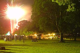
Concerts and Carols by CandlelightCarols by CandlelightCarols by Candlelight is an Australian Christmas tradition that originated in southeastern Australia in the 19th century and was popularised in Melbourne in the 1930s. The tradition has since spread around the world. It involves people gathering, usually outdoors in a park, to sing carols by...
are held each year at North Ryde Common, adjacent to Macquarie Hospital. The grounds are open now after the removal of the original hospitals gates and fences, leased to Ryde Council for 99-years. - Ryde Hunters Hill Hockey Club is on the grounds of the former Peter Board High School has over a 50 year history in the area poviding Field Hockey for Juniors, Women's and Men's.
Politics
North Ryde is in the State of New South Wales electorates of Lane CoveElectoral district of Lane Cove
Lane Cove is an electoral district of the Legislative Assembly in the Australian state of New South Wales. It is represented by Anthony Roberts of the Liberal Party of Australia...
and Ryde
Electoral district of Ryde
Ryde is an electoral district of the Legislative Assembly in the Australian state of New South Wales. It includes the suburbs and localities of Denistone, Denistone East, Denistone West, Macquarie Park, Marsfield, Meadowbank, Melrose Park, Ryde, North Ryde, West Ryde; and part of Eastwood.It is...
, and the Federal electorate of Division of Bennelong
Division of Bennelong
The Division of Bennelong is an Australian electorate in New South Wales. The division was created in 1949 and is named for Bennelong, an Aboriginal man befriended by the first Governor of New South Wales, Arthur Phillip...
.
External links
- City of Ryde - Council site
- Sydney Turpentine-Ironbark Forest (Ryde Council website, with list of local endangered plant species that residents should give preference to when making new plantings in their gardens).
- North Ryde by Margaret Farlow