

North Cornwall
Encyclopedia
Non-metropolitan district
Non-metropolitan districts, or colloquially shire districts, are a type of local government district in England. As created, they are sub-divisions of non-metropolitan counties in a so-called "two-tier" arrangement...
of Cornwall
Cornwall
Cornwall is a unitary authority and ceremonial county of England, within the United Kingdom. It is bordered to the north and west by the Celtic Sea, to the south by the English Channel, and to the east by the county of Devon, over the River Tamar. Cornwall has a population of , and covers an area of...
, United Kingdom
United Kingdom
The United Kingdom of Great Britain and Northern IrelandIn the United Kingdom and Dependencies, other languages have been officially recognised as legitimate autochthonous languages under the European Charter for Regional or Minority Languages...
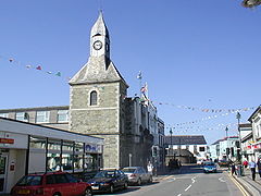
. Its council was based in Wadebridge
Wadebridge
Wadebridge is a civil parish and town in north Cornwall, England, United Kingdom. The town straddles the River Camel five miles upstream from Padstow....
50.516°N 4.835°W. Other towns in the district included Bude
Bude
Bude is a small seaside resort town in North Cornwall, England, at the mouth of the River Neet . It lies just south of Flexbury, north of Widemouth Bay and west of Stratton and is located along the A3073 road off the A39. Bude is twinned with Ergué-Gabéric in Brittany, France...
, Bodmin
Bodmin
Bodmin is a civil parish and major town in Cornwall, England, United Kingdom. It is situated in the centre of the county southwest of Bodmin Moor.The extent of the civil parish corresponds fairly closely to that of the town so is mostly urban in character...
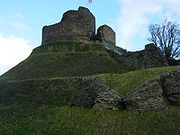
, Launceston, Padstow
Padstow
Padstow is a town, civil parish and fishing port on the north coast of Cornwall, England, United Kingdom. The town is situated on the west bank of the River Camel estuary approximately five miles northwest of Wadebridge, ten miles northwest of Bodmin and ten miles northeast of Newquay...
, and Camelford
Camelford
Camelford is a town and civil parish in north Cornwall, United Kingdom, situated in the River Camel valley northwest of Bodmin Moor. The town is approximately ten miles north of Bodmin and is governed by Camelford Town Council....
.
The district was formed on 1 April 1974 by a merger of the boroughs of Bodmin and Launceston, along with Bude-Stratton
Bude-Stratton
Bude-Stratton is a coastal civil parish with a town council in Cornwall, United Kingdom. According to the 2001 census it had a population of 9,242....
urban district and Camelford Rural District
Camelford Rural District
Camelford Rural District was a local government division of north Cornwall between 1894 and 1974. The district council offices were at Camelford, Cornwall, England, UK, latterly in the former grammar school...
, Launceston Rural District, Stratton Rural District and Wadebridge and Padstow Rural District. However it was abolished as part of the 2009 structural changes to local government in England
2009 structural changes to local government in England
Structural changes to local government in England were effected on 1 April 2009, whereby a number of new unitary authorities were created in parts of the country which previously operated a 'two-tier' system of counties and districts...
on 1 April (succeeded by Cornwall unitary authority).
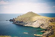
North Cornwall is an area of outstanding natural beauty that is of important geological and scientific interest. It includes the only part of Cornwall
Cornwall
Cornwall is a unitary authority and ceremonial county of England, within the United Kingdom. It is bordered to the north and west by the Celtic Sea, to the south by the English Channel, and to the east by the county of Devon, over the River Tamar. Cornwall has a population of , and covers an area of...
that is formed of carboniferous
Carboniferous
The Carboniferous is a geologic period and system that extends from the end of the Devonian Period, about 359.2 ± 2.5 Mya , to the beginning of the Permian Period, about 299.0 ± 0.8 Mya . The name is derived from the Latin word for coal, carbo. Carboniferous means "coal-bearing"...
rocks, the northern area of North Cornwall District. The rest of the district lies on Devonian sedimentary strata and the granite of Bodmin Moor. A similar area is covered by the North Cornwall parliamentary constituency
North Cornwall (UK Parliament constituency)
North Cornwall is a county constituency represented in the House of Commons of the Parliament of the United Kingdom. It elects one Member of Parliament by the first past the post system of election.- Boundaries :...
.
Parishes of North Cornwall
|
Lewannick Lewannick is a civil parish and village in Cornwall, United Kingdom. The village is situated approximately five miles southwest of Launceston. The civil parish has a population of 884.... Lezant Lezant is a civil parish and village in east Cornwall, United Kingdom. Lezant village is situated approximately five miles south of Launceston. The population of the parish in the 2001 census was 751.-Geography:... Marhamchurch Marhamchurch is a civil parish and village in north Cornwall, United Kingdom.Marhamchurch village is situated 1½ miles south of Bude off the A39 road.-History:... Michaelstow Michaelstow is a civil parish and village in north Cornwall, United Kingdom. The village is situated approximately three miles south of Camelford.The civil parish of Michaelstow is in the deanery of Trigg Minor and Hundred of Lesnewth. It... Morwenstow thumb|Parish Church of St Morwenna and St John the Baptist, MorwenstowMorwenstow is a civil parish and hamlet in north Cornwall, United Kingdom. The hamlet is situated near the coast approximately six miles north of Bude.... North Hill, Cornwall North Hill is a civil parish and village in Cornwall, United Kingdom. The village is situated on the east side of the River Lynher approximately six miles southwest of Launceston.... North Petherwin North Petherwin is a civil parish and village in east Cornwall, United Kingdom. The village is situated five miles northwest of Launceston on a ridge above the River Ottery valley.... North Tamerton North Tamerton is a civil parish and village in east Cornwall, United Kingdom. The village is situated approximately eight miles southeast of Bude and eight miles north of Launceston.... Otterham Otterham is a village and a civil parish in north Cornwall, United Kingdom. The village is situated approximately ten miles south of Bude and six miles north of Camelford.... Padstow Padstow is a town, civil parish and fishing port on the north coast of Cornwall, England, United Kingdom. The town is situated on the west bank of the River Camel estuary approximately five miles northwest of Wadebridge, ten miles northwest of Bodmin and ten miles northeast of Newquay... Poundstock Poundstock is a civil parish and a hamlet on the north coast of Cornwall, United Kingdom. The hamlet is situated four miles south of Bude half-a-mile west of the A39 trunk road about one mile from the coast.... St Breock (parish) St Breock is a village and a civil parish in north Cornwall, United Kingdom. St Breock village is 1 mile west of Wadebridge immediately to the south of the Royal Cornwall Showground. The village lies on the eastern slope of the wooded Nansent valley... St Breward St Breward is a civil parish and village in Cornwall, England, United Kingdom. It is situated on the western side of Bodmin Moor approximately 6 miles north of Bodmin.The parish name derives from Saint Branwalader... St Clether St Clether is a civil parish and village in Cornwall, United Kingdom. The village is situated on the east flank of Bodmin Moor approximately eight miles west of Launceston in the valley of the River Inny.... St Endellion St Endellion is a civil parish and village in north Cornwall, England, United Kingdom. The village and parish church are situated four miles north of Wadebridge.... St Ervan St Ervan is a rural civil parish and hamlet in Cornwall, United Kingdom. The hamlet is situated three miles southwest of Padstow. Notable features in St Ervan are the Anglican church, the village hall and the Nonconformist cemetery,... St Eval St Eval is a civil parish and hamlet in north Cornwall, United Kingdom. The hamlet is situated approximately four miles southwest of Padstow.... St Gennys St Gennys is a coastal civil parish and small settlement in north Cornwall, United Kingdom.The hamlet of St Gennys is situated approximately seven miles southwest of Bude. It is on high ground half-a-mile north of the coastal village of Crackington Haven, the major settlement in the parish... St Issey St Issey is a civil parish and village in Cornwall, United Kingdom. It is situated approximately two miles south of Padstow. The parish covers an area of approximately .-History:... St Juliot St Juliot is a civil parish in north-east Cornwall, United Kingdom. The parish is entirely rural and the only settlements are the hamlets of Beeny and Tresparrett.-Parish Church:... St Mabyn St Mabyn is a civil parish and village in Cornwall, England, United Kingdom. The village is situated three miles east of Wadebridge.... |
St Merryn St Merryn is a civil parish and village in north Cornwall, United Kingdom approximately three and a half miles south of the fishing port of Padstow and approximately 11 miles northeast of the coastal resort of Newquay.... St Teath St Teath is civil parish and village in north Cornwall, United Kingdom. The village is situated approximately three miles southwest of Camelford and seven miles northeast of Wadebridge. The hamlet of Whitewell lies to the west.... St Thomas the Apostle Rural St Thomas the Apostle Rural, also known as St Thomas-by-Launceston is a civil parish in east Cornwall, United Kingdom. It is centred on the village of Tregadillett and is in the Registration District of Launceston.... St Tudy St Tudy is a civil parish and village in north Cornwall, United Kingdom. The village is situated in the River Camel valley approximately five miles northeast of Wadebridge.-Parish church:... South Petherwin South Petherwin is a village and civil parish in east Cornwall, United Kingdom. It is in the Registration District of Launceston. The civil parish is bounded to the north by the Launceston parishes of St Thomas and St Mary Magdalene, to the east by Lawhitton and Lezant parishes and to the west by... Stoke Climsland Stoke Climsland is a village in the River Tamar Valley, Cornwall, United Kingdom within the civil parish of Stokeclimsland.The manor of Climsland was one of the 17 Antiqua maneria of the Duchy of Cornwall.-Notable buildings:... Tintagel Tintagel is a civil parish and village situated on the Atlantic coast of Cornwall, United Kingdom. The population of the parish is 1,820 people, and the area of the parish is .... Tremaine, Cornwall Tremaine is a small village and a rural civil parish in east Cornwall, United Kingdom. It is in the Registration District of Launceston and the population in the 2001 census was 87.... Treneglos Treneglos is a hamlet and a civil parish in north-east Cornwall, United Kingdom. It is in the Registration District of Launceston.The civil parish is bounded to the north by Warbstow parish, to the east by Tremaine and Tresmere parishes, and to the west by Davidstow parish... Tresmeer Tresmeer is a hamlet and a civil parish in north-east Cornwall, United Kingdom. The hamlet is situated approximately seven miles north-west of Launceston.... Trevalga Trevalga is a coastal civil parish and village in north Cornwall, United Kingdom. The parish is bounded on the north by the Atlantic Ocean, on the south-east by Forrabury and Minster parish and on the west by Tintagel parish.... Trewen Trewen is a hamlet and a civil parish in east Cornwall, United Kingdom. The parish is just east of Bodmin Moor in the River Inny valley and lies in the Registration District of Launceston.... Wadebridge Wadebridge is a civil parish and town in north Cornwall, England, United Kingdom. The town straddles the River Camel five miles upstream from Padstow.... Warbstow Warbstow is a village and civil parish in Cornwall, England, United Kingdom. The parish has a population of 439 according to the 2001 census.The parish is one of the few left in England to still have an exclave... Week St Mary Week St Mary is a civil parish and village in northeast Cornwall, United Kingdom. It is situated south of Bude close to the River Tamar and the border between Cornwall and Devon in the Hundred of Stratton.... Werrington, Cornwall Werrington is a civil parish in Cornwall, England, United Kingdom. It was formerly in Devon.In Werrington Park is a substantial house built by Sir Francis Drake about 1620. A larger mansion was built next to it on the site of old parish church in the early 18th century... Whitstone Whitstone is a village and civil parish in east Cornwall, United Kingdom. It is roughly halfway between the towns of Bude and Launceston.-History:... Withiel Withiel is a civil parish and village in Cornwall, United Kingdom. The name Withiel is derived from the Cornish word Gwydhyel, meaning wooded place... |
Geography
Celtic Sea
The Celtic Sea is the area of the Atlantic Ocean off the south coast of Ireland bounded to the east by Saint George's Channel; other limits include the Bristol Channel, the English Channel, and the Bay of Biscay, as well as adjacent portions of Wales, Cornwall, Devon, and Brittany...
to the north. The Carboniferous
Carboniferous
The Carboniferous is a geologic period and system that extends from the end of the Devonian Period, about 359.2 ± 2.5 Mya , to the beginning of the Permian Period, about 299.0 ± 0.8 Mya . The name is derived from the Latin word for coal, carbo. Carboniferous means "coal-bearing"...
sandstone
Sandstone
Sandstone is a sedimentary rock composed mainly of sand-sized minerals or rock grains.Most sandstone is composed of quartz and/or feldspar because these are the most common minerals in the Earth's crust. Like sand, sandstone may be any colour, but the most common colours are tan, brown, yellow,...
cliffs that surround Bude
Bude
Bude is a small seaside resort town in North Cornwall, England, at the mouth of the River Neet . It lies just south of Flexbury, north of Widemouth Bay and west of Stratton and is located along the A3073 road off the A39. Bude is twinned with Ergué-Gabéric in Brittany, France...
(and stretch down as far south as Crackington Haven
Crackington Haven
Crackington Haven is a coastal village in Cornwall, United Kingdom. It is located in the civil parish of St Gennys at at the head of a cove on the Atlantic coast. The village is seven miles south-southwest of Bude and four miles north-northeast of Boscastle.Middle Crackington and Higher...
) were formed during the Carboniferous period, around 300 million years ago. They are part of what are known to geologists as the Culm Measures
Culm Measures
The Culm Measures are a geological formation of the Carboniferous period that occur in south-west England, principally in Devon and Cornwall. They are so called because of the occasional presence of a soft, sooty coal, which is known in Devon as culm....
which continue eastwards across north Devon. The folded and contorted stratification of shale and sandstone is unique in southern England. During the Variscan Orogeny
Variscan orogeny
The Variscan orogeny is a geologic mountain-building event caused by Late Paleozoic continental collision between Euramerica and Gondwana to form the supercontinent of Pangaea.-Naming:...
, which affected the entire Cornish coast, the cliffs were pushed up from underneath the sea, creating the overlapping strata. As the sands and cliffs around Bude contain calcium carbonate (a natural fertiliser), farmers used to take sand from the beach, for spreading on their fields. The cliffs around Bude are the only ones in Cornwall that are made of Carboniferous sandstone, as most of the Cornish coast is geologically formed of Devonian
Devonian
The Devonian is a geologic period and system of the Paleozoic Era spanning from the end of the Silurian Period, about 416.0 ± 2.8 Mya , to the beginning of the Carboniferous Period, about 359.2 ± 2.5 Mya...
slate
Slate
Slate is a fine-grained, foliated, homogeneous metamorphic rock derived from an original shale-type sedimentary rock composed of clay or volcanic ash through low-grade regional metamorphism. The result is a foliated rock in which the foliation may not correspond to the original sedimentary layering...
, granite
Granite
Granite is a common and widely occurring type of intrusive, felsic, igneous rock. Granite usually has a medium- to coarse-grained texture. Occasionally some individual crystals are larger than the groundmass, in which case the texture is known as porphyritic. A granitic rock with a porphyritic...
and Precambrian
Precambrian
The Precambrian is the name which describes the large span of time in Earth's history before the current Phanerozoic Eon, and is a Supereon divided into several eons of the geologic time scale...
metamorphic rock
Metamorphic rock
Metamorphic rock is the transformation of an existing rock type, the protolith, in a process called metamorphism, which means "change in form". The protolith is subjected to heat and pressure causing profound physical and/or chemical change...
s). The stratified cliffs of Bude gave their name to a geological event called the Bude Formation. Many formations can be viewed from the South West Coast Path
South West Coast Path
The South West Coast Path is Britain's longest waymarked long-distance footpath and a National Trail. It stretches for , running from Minehead in Somerset, along the coasts of Devon and Cornwall, to Poole Harbour in Dorset. Since it rises and falls with every river mouth, it is also one of the more...
which passes through the town.
The larger harbours are at Padstow and Bude and on the intervening coast Port Isaac, Port Gaverne, Port Quin, Port William, Tintagel, Bossiney and Boscastle have all been used either for fishing
Fishing in Cornwall
Fishing in Cornwall has traditionally been one of the main elements of the economy. Pilchard fishing and processing was a thriving industry in Cornwall from around 1750 to around 1880, after which it went into an almost terminal decline. During the 20th century the varieties of fish taken became...
or the export of slate. There are good beaches at Polzeath, Trebarwith Strand and Bude. At Delabole the large Delabole Quarry has been works for many centuries and there were once in the parish of Tintagel many other slate quarries. Granite and elvan have also been important minerals: there are major granite quarries in the parish of St Breward and also some china clay works on the edges of Bodmin Moor e.g. at Stannon near Camelford.
Most of the lowland areas have good agricultural land used either for mixed or dairy farming. At Davidstow much of the milk is processed into Davidstow cheese.
External links
- North Cornwall Guide and Directory
- North Cornwall Focus and Forum
- North Cornwall Town and Village Guide
- North Cornwall District Council
- Postcards of North East Cornwall
- Online Catalogue for North Cornwall District Council at the Cornwall Record OfficeCornwall Record OfficeCornwall Record Office , part of Cornwall Council, is situated at Old County Hall in Truro and is the main repository for the historical archives of Cornwall....