

New Brunswick Route 102
Encyclopedia
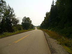
Route 102 is a highway
that follows the west bank of the Saint John River for 157 kilometres from Pokiok
to Westfield
. Most of the route is colloquially (but not officially) known as the Old River Road, as it was the original road connecting Fredericton
and Saint John
.
 The section from Pokiok to Fredericton, a former alignment of the Trans-Canada Highway
(Route 2
), became part of Route 102 in stages between 2000 and 2006, as sections of the new 4-lane Trans-Canada Highway were opened. This section begins at the interchange of Route 2 and Route 102 in Pokiok, following a newly-built access road for a short distance to an interchange with the Pokiok Road (formerly part of Route 2). The highway then progresses along the Saint John River, passing Kings Landing and an interchange with Route 3
, following the river past Woolastook Park and the Mactaquac Dam
through Kingsclear
. The route enters Fredericton on the Woodstock Road, then follows Brunswick Street or a riverfront parkway known as St. Anne's Point Drive
(depending on direction) through the downtown area, leaving on Waterloo Row. Route 102 continues to follow the river along Lincoln
Road, passing the Fredericton International Airport and reaching the town of Oromocto
.
 Route 102 continues along the river through Burton
, Gagetown
, Hampstead
, Evandale
, Oak Point and Browns Flat
, then crosses the Nerepis River
to reach Westfield on the west side. An extension of the route was built in the 1980s to meet with Route 7
. The Gagetown
, Hampstead
and Evandale
ferries, small, toll-free, cable ferries
connect Route 102 to the other side of the river.
As the River Road, the present-day Route 102 (then a part of Route 2) was the first road connecting Fredericton and Saint John to be paved, ahead of the Broad Road (the present-day Route 7). With the alignment of the Trans-Canada Highway bypassing Saint John, and the upgrades of the Broad Road in the 1950s taking most traffic off the River Road, its importance as a major traffic route diminished. The River Road became Route 102 in 1965.
Highway
A highway is any public road. In American English, the term is common and almost always designates major roads. In British English, the term designates any road open to the public. Any interconnected set of highways can be variously referred to as a "highway system", a "highway network", or a...
that follows the west bank of the Saint John River for 157 kilometres from Pokiok
Pokiok, New Brunswick
Pokiok is a Canadian rural community in York County, New Brunswick.Situated on the west bank of the Saint John River, west of Fredericton, and west of Nackawic, the community is home to the Pokiok Falls, which were created by the Pokiok Stream emptying over a ledge into the Saint John River...
to Westfield
Grand Bay-Westfield, New Brunswick
Grand Bay-Westfield is a Canadian suburban town in the western part of Kings County, New Brunswick.The town is an amalgamation of the original town of Grand Bay and the neighbouring village of Westfield immediately to the north....
. Most of the route is colloquially (but not officially) known as the Old River Road, as it was the original road connecting Fredericton
Fredericton, New Brunswick
Fredericton is the capital of the Canadian province of New Brunswick, by virtue of the provincial parliament which sits there. An important cultural, artistic, and educational centre for the province, Fredericton is home to two universities and cultural institutions such as the Beaverbrook Art...
and Saint John
Saint John, New Brunswick
City of Saint John , or commonly Saint John, is the largest city in the province of New Brunswick, and the first incorporated city in Canada. The city is situated along the north shore of the Bay of Fundy at the mouth of the Saint John River. In 2006 the city proper had a population of 74,043...
.
Trans-Canada Highway
The Trans-Canada Highway is a federal-provincial highway system that joins the ten provinces of Canada. It is, along with the Trans-Siberian Highway and Australia's Highway 1, one of the world's longest national highways, with the main route spanning 8,030 km...
(Route 2
New Brunswick Route 2
Route 2 is a major provincial highway in the Canadian province of New Brunswick, carrying the main route of the Trans-Canada Highway in the province...
), became part of Route 102 in stages between 2000 and 2006, as sections of the new 4-lane Trans-Canada Highway were opened. This section begins at the interchange of Route 2 and Route 102 in Pokiok, following a newly-built access road for a short distance to an interchange with the Pokiok Road (formerly part of Route 2). The highway then progresses along the Saint John River, passing Kings Landing and an interchange with Route 3
New Brunswick Route 3
Route 3 is 92 kilometres long and goes from Route 1 in St. Stephen to Route 2 at Longs Creek, near Fredericton.From St. Stephen, Route 3 goes north along the west bank of Dennis Stream, through the community of Moores Mills. The road turns northeast through Lawrence Station and mostly uninhabited...
, following the river past Woolastook Park and the Mactaquac Dam
Mactaquac Dam
The Mactaquac Dam is an embankment dam used to generate hydroelectricity in the Canadian province of New Brunswick. It dams the waters of the Saint John River and is operated by NB Power with a capacity to generate 653 megawatts of electricity from 6 turbines; this represents 20 percent of New...
through Kingsclear
Kingsclear, New Brunswick
Kingsclear is a Canadian rural community in York County, New Brunswick.Located on the west bank of the Saint John River, 20 kilometres west of the city of Fredericton and opposite Keswick Ridge, the community includes several cottage areas along the Mactaquac Headpond and a residential subdivision...
. The route enters Fredericton on the Woodstock Road, then follows Brunswick Street or a riverfront parkway known as St. Anne's Point Drive
Westmorland Street Bridge
The Westmorland Street Bridge is a bridge crossing the Saint John River in Fredericton, New Brunswick, Canada.-Structure:Opened in 1981, the Westmorland Street Bridge is an extension of Westmorland Street in Fredericton's central business district and connects with Route 105 in Nashwaaksis, a...
(depending on direction) through the downtown area, leaving on Waterloo Row. Route 102 continues to follow the river along Lincoln
Lincoln, New Brunswick
Lincoln is a Canadian suburban community in Sunbury County, New Brunswick.Located on the west bank of the Saint John River between Fredericton and Oromocto, Lincoln was one of the original United Empire Loyalist settlements established in the province following the American Revolution.The current...
Road, passing the Fredericton International Airport and reaching the town of Oromocto
Oromocto, New Brunswick
Oromocto is a Canadian town in Sunbury County, New Brunswick.The town is located on the west bank of the St. John River at the mouth of the Oromocto River, approximately 20 kilometres southeast of Fredericton...
.
Burton, New Brunswick
Burton is a Canadian rural community in Sunbury County, New Brunswick.Located on the Saint John River immediately downstream of Oromocto on New Brunswick Route 102, Burton is the shire town of the county and is the location of the Sunbury County court house.It is also located at one end of the...
, Gagetown
Gagetown, New Brunswick
Gagetown is a Canadian village in Queens County, New Brunswick. It is situated on the west bank of the Saint John River and is the county's shire town.-Acadians:...
, Hampstead
Hampstead, New Brunswick
Hampstead is a Canadian parish in Queens County, New Brunswick.Its population in the 2006 Census was 278.-Delineation:Hampstead Parish is defined in the Territorial Division Act as:...
, Evandale
Evandale, New Brunswick
Evandale is a community in Canada, in the province of New Brunswick. It is situated on the west bank of the Saint John River, and on New Brunswick Route 102.The Evandale Ferry, a cable ferry, carries Route 124 across the river from Kars on the east bank....
, Oak Point and Browns Flat
Browns Flat, New Brunswick
Browns Flat is a Canadian rural community in Kings County, New Brunswick.Located within the Greenwich Local Service District, Browns Flat is situated along a stretch of the Long Reach section of the Saint John River and is accessed by Highway 102. From Moncton/Sussex, Browns Flat can allow be...
, then crosses the Nerepis River
Nerepis River
The Nerepis River is a river approximately 25 miles long, located in New Brunswick. A popular river for canoeists and anglers, it is a tributary of the Saint John River. The river has been subjected to significant environmental stress over many years....
to reach Westfield on the west side. An extension of the route was built in the 1980s to meet with Route 7
New Brunswick Route 7
Route 7 is 97 kilometres long and runs from Fredericton, near an interchange with Route 8, to an interchange with Route 1 in Saint John. Most of the highway is either a divided expressway or has limited access....
. The Gagetown
Gagetown Ferry
The Gagetown Ferry is a cable ferry in the Canadian province of New Brunswick. The ferry crosses the Saint John River, linking Gagetown on the west bank with Lower Jemseg on the east bank....
, Hampstead
Hampstead Ferry
The Hampstead Ferry was a cable ferry in the Canadian province of New Brunswick. The ferry crossed the Saint John River, linking Hampstead on the west bank with Wickham on the east bank.The crossing was in length, taking 5 minutes, and was free of tolls...
and Evandale
Evandale Ferry
The Evandale Ferry is a cable ferry in the Canadian province of New Brunswick. The ferry carries New Brunswick Route 124 across the Saint John River, linking Kars on the east bank to Evandale on the west bank....
ferries, small, toll-free, cable ferries
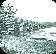
Cable ferry
A cable ferry is guided and in many cases propelled across a river or other larger body of water by cables connected to both shores. They are also called chain ferries, floating bridges, or punts....
connect Route 102 to the other side of the river.
As the River Road, the present-day Route 102 (then a part of Route 2) was the first road connecting Fredericton and Saint John to be paved, ahead of the Broad Road (the present-day Route 7). With the alignment of the Trans-Canada Highway bypassing Saint John, and the upgrades of the Broad Road in the 1950s taking most traffic off the River Road, its importance as a major traffic route diminished. The River Road became Route 102 in 1965.