

Nautical publications
Encyclopedia
Nautical publications is a technical term used in maritime circles describing a set of publications, generally published by national governments, for use in safe navigation of ships, boats, and similar vessels.
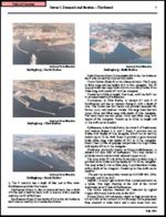
The nature of waterways described by any given nautical publication changes regularly, and a mariner navigating by use of an old or uncorrected publication is courting disaster. Every producer of nautical publications also provides a system to inform mariners of changes that effect the chart. In the United States, corrections and notifications of new editions are provided by various governmental agencies by way of Notice to Mariners
, Local Notice to Mariners
, Summary of Corrections, and Broadcast Notice to Mariners. Radio broadcasts give advance notice of urgent corrections.
A convenient way to keep track of corrections is with a Chart and Publication Correction Record Card system. Using this system, the navigator does not immediately update every publication in the library when a new Notice to Mariners arrives, instead creating a card for every chart and noting the correction on this card. When the time comes to use the publication, he pulls the publication and its card, and makes the indicated corrections to the publication. This system ensures that every publication is properly corrected prior to use.
Various and diverse methods exist for the correction of electronic nautical publications.
The nature of waterways described by any given nautical publication changes regularly, and a mariner navigating by use of an old or uncorrected publication is courting disaster. Every producer of nautical publications also provides a system to inform mariners of changes that effect the chart. In the United States, corrections and notifications of new editions are provided by various governmental agencies by way of Notice to Mariners
Notice to Mariners
A notice to mariners advises mariners of important matters affecting navigational safety, including new hydrographic information, changes in channels and aids to navigation, and other important data.Over 60 countries which produce nautical charts also...
, Local Notice to Mariners
Local Notice to Mariners
A Local Notice to Mariners is an authoritative instruction issued by a designated official, typically the harbormaster.-United States:In the United States, notices are issued by each U.S. Coast Guard District to disseminate important information affecting navigational safety within that District...
, Summary of Corrections, and Broadcast Notice to Mariners. Radio broadcasts give advance notice of urgent corrections.
A convenient way to keep track of corrections is with a Chart and Publication Correction Record Card system. Using this system, the navigator does not immediately update every publication in the library when a new Notice to Mariners arrives, instead creating a card for every chart and noting the correction on this card. When the time comes to use the publication, he pulls the publication and its card, and makes the indicated corrections to the publication. This system ensures that every publication is properly corrected prior to use.
Various and diverse methods exist for the correction of electronic nautical publications.
| Image | Description |
|---|---|
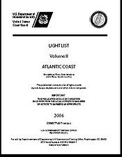 |
The United States Coast Guard Light List Light List The United States Coast Guard Light List is an American navigation publication in 7 volumes made available yearly by the U.S. Coast Guard which gives information on lighted navigation aids, unlighted buoys, radiobeacons, radio direction finder calibration stations, daybeacons, racons, and LORAN... is an American navigation Navigation Navigation is the process of monitoring and controlling the movement of a craft or vehicle from one place to another. It is also the term of art used for the specialized knowledge used by navigators to perform navigation tasks... publication in 7 volumes made available yearly by the U.S. Coast Guard which gives information on lighted navigation aids, unlighted buoys, radiobeacons, radio direction finder calibration stations, daybeacons, racons, and LORAN LORAN LORAN is a terrestrial radio navigation system using low frequency radio transmitters in multiple deployment to determine the location and speed of the receiver.... stations. |
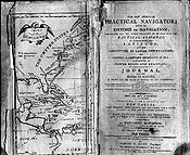 |
The American Practical Navigator , written by Nathaniel Bowditch Nathaniel Bowditch Nathaniel Bowditch was an early American mathematician remembered for his work on ocean navigation. He is often credited as the founder of modern maritime navigation; his book The New American Practical Navigator, first published in 1802, is still carried on board every commissioned U.S... , is an encyclopedia of navigation Navigation Navigation is the process of monitoring and controlling the movement of a craft or vehicle from one place to another. It is also the term of art used for the specialized knowledge used by navigators to perform navigation tasks... , valuable handbook on oceanography Oceanography Oceanography , also called oceanology or marine science, is the branch of Earth science that studies the ocean... and meteorology Meteorology Meteorology is the interdisciplinary scientific study of the atmosphere. Studies in the field stretch back millennia, though significant progress in meteorology did not occur until the 18th century. The 19th century saw breakthroughs occur after observing networks developed across several countries... , and contains useful tables and a maritime glossary. In 1866 the copyright Copyright Copyright is a legal concept, enacted by most governments, giving the creator of an original work exclusive rights to it, usually for a limited time... and plates Lithography Lithography is a method for printing using a stone or a metal plate with a completely smooth surface... were bought by the Hydrographic Office of the United States Navy United States Navy The United States Navy is the naval warfare service branch of the United States Armed Forces and one of the seven uniformed services of the United States. The U.S. Navy is the largest in the world; its battle fleet tonnage is greater than that of the next 13 largest navies combined. The U.S... , and as a U.S. Government publication, it is now available for free online. It is not only a notable book but is considered one of America's nautical institutions. |
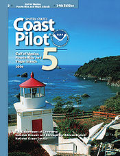 |
United States Coast Pilots Coast Pilots United States Coast Pilots is a nine-volume American navigation publication distributed yearly by the National Oceanic and Atmospheric Administration's Office of Coast Survey. The purpose of the publication is to supplement nautical charts of United States of America waters. Information comes... is a nine-volume American navigation Navigation Navigation is the process of monitoring and controlling the movement of a craft or vehicle from one place to another. It is also the term of art used for the specialized knowledge used by navigators to perform navigation tasks... publication distributed yearly by the National Ocean Service National Ocean Service The National Ocean Service , an office within the U.S. Department of Commerce National Oceanic and Atmospheric Administration, is responsible for preserving and enhancing the nation’s coastal resources and ecosystems along of shoreline bordering of coastal, Great Lakes, and ocean waters... . The purpose of the publication is to supplement nautical charts of U.S. waters. Information comes from field inspections, survey vessels, and various harbor authorities. Maritime officials and pilotage associations provide additional information. Coast Pilots provide more detailed information than Sailing Directions Sailing Directions Sailing Directions is a 42-volume American navigation publication published by the National Geospatial-Intelligence Agency . Sailing Directions consists of 37 Enroute volumes, 4 Planning Guide volumes, and 1 volume combining both types... because Sailing Directions are intended exclusively for the oceangoing mariner. Each volume of Coast Pilots must be regularly corrected using Notice to Mariners Notice to Mariners A notice to mariners advises mariners of important matters affecting navigational safety, including new hydrographic information, changes in channels and aids to navigation, and other important data.Over 60 countries which produce nautical charts also... . |
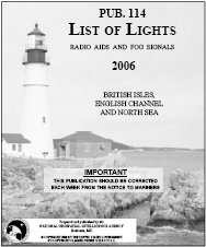 |
The List of Lights, Radio Aids, and Fog Signals is a navigation publication produced by the United States Defense Mapping Agency Hydrographic/Topographic Center. The book is usually referred to as the List of Lights, and should not be confused with the U.S. Coast Guard's Light List. The List of Lights is published in seven volumes, as Publication numbers 110 through 116. Each volume contains lights and other aids to navigation that are maintained by or under the authority of other governments. |
 |
Sailing Directions Sailing Directions Sailing Directions is a 42-volume American navigation publication published by the National Geospatial-Intelligence Agency . Sailing Directions consists of 37 Enroute volumes, 4 Planning Guide volumes, and 1 volume combining both types... is a 47-volume American navigation Navigation Navigation is the process of monitoring and controlling the movement of a craft or vehicle from one place to another. It is also the term of art used for the specialized knowledge used by navigators to perform navigation tasks... publication published by the Defense Mapping Agency Hydrographic/Topographic Center. Sailing Directions consists of 37 Enroute volumes and 10 Planning Guides. Planning Guides describe general features of ocean basins; Enroutes describe features of coastlines, ports, and harbors. Sailing Directions are updated when new data requires extensive revision of an existing text. These data are obtained from several sources, including pilots and Sailing Directions from other countries. |
 |
The World Port Index World Port Index The World Port Index contains a tabular listing of thousands of ports throughout the world, describing their location, characteristics, known facilities, and available services. Of particular interest are the applicable volume of Sailing Directions and the number of the harbor chart... (PUB 150) contains a tabular listing of thousands of ports throughout the world, describing their location, characteristics, known facilities, and available services. Of particular interest are the applicable volume of Sailing Directions Sailing Directions Sailing Directions is a 42-volume American navigation publication published by the National Geospatial-Intelligence Agency . Sailing Directions consists of 37 Enroute volumes, 4 Planning Guide volumes, and 1 volume combining both types... and the number of the harbor chart Nautical chart A nautical chart is a graphic representation of a maritime area and adjacent coastal regions. Depending on the scale of the chart, it may show depths of water and heights of land , natural features of the seabed, details of the coastline, navigational hazards, locations of natural and man-made aids... . The table is arranged geographically, with an alphabetical index. |
 |
Distances Between Ports Distances Between Ports Distances Between Ports is a publication that lists the distances between major ports. Reciprocal distances between two ports may differ due to different routes chosen because of currents and climatic conditions... (PUB 151) is a publication that lists the distances between major ports. Reciprocal distances between two ports may differ due to different routes chosen because of currents and climatic conditions. To reduce the number of listings needed, junction points along major routes are used to consolidate routes converging from different directions. |