Distances Between Ports
Encyclopedia
{| class="infobox bordered" style="width: 17em; text-align: left; font-size: 95%;"
|+ style="font-size: larger;" | Distances Between Ports
|-
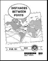
| colspan="2" style="text-align:center;" | The front cover of Distances Between Ports.
|-
! Purpose:
| Provide distances between major ports.
|-
! Publication Frequency:
| Irregular
|-
! Published by:
| Defense Mapping Agency Hydrographic Topographic Center
|-
! Available Online:
| Yes
|-
| colspan="2" style="font-size: smaller;" |
|}
Distances Between Ports (PUB 151) is a publication that lists the distances between major ports. Reciprocal distances between two ports may differ due to different routes chosen because of currents and climatic conditions. To reduce the number of listings
needed, junction points along major routes are used to consolidate routes converging from different directions.
This book can be most effectively used for voyage planning
in conjunction with the proper volume(s) of the Sailing Directions (Planning Guide)
. It is corrected via the Notice to Mariners
.
The positions listed for ports are central positions that most represent each port. The distances are between positions shown for each port and are generally over routes that afford the safest passage. Most of the distances represent the shortest navigable routes, but in some cases, longer routes, that take advantage of favorable currents, have been used. In other cases, increased distances result from routes selected to avoid ice or other dangers to navigation, or to follow required separation schemes.
.
|+ style="font-size: larger;" | Distances Between Ports
|-
| colspan="2" style="text-align:center;" |

|-
! Purpose:
| Provide distances between major ports.
|-
! Publication Frequency:
| Irregular
|-
! Published by:
| Defense Mapping Agency Hydrographic Topographic Center
|-
! Available Online:
| Yes
|-
| colspan="2" style="font-size: smaller;" |
|}
Distances Between Ports (PUB 151) is a publication that lists the distances between major ports. Reciprocal distances between two ports may differ due to different routes chosen because of currents and climatic conditions. To reduce the number of listings
needed, junction points along major routes are used to consolidate routes converging from different directions.
This book can be most effectively used for voyage planning
Passage planning
Passage planning or voyage planning is a procedure to develop a complete description of a vessel's voyage from start to finish. The plan includes leaving the dock and harbor area, the en-route portion of a voyage, approaching the destination, and mooring, the industry term for this is 'berth to...
in conjunction with the proper volume(s) of the Sailing Directions (Planning Guide)
Sailing Directions
Sailing Directions is a 42-volume American navigation publication published by the National Geospatial-Intelligence Agency . Sailing Directions consists of 37 Enroute volumes, 4 Planning Guide volumes, and 1 volume combining both types...
. It is corrected via the Notice to Mariners
Notice to Mariners
A notice to mariners advises mariners of important matters affecting navigational safety, including new hydrographic information, changes in channels and aids to navigation, and other important data.Over 60 countries which produce nautical charts also...
.
The positions listed for ports are central positions that most represent each port. The distances are between positions shown for each port and are generally over routes that afford the safest passage. Most of the distances represent the shortest navigable routes, but in some cases, longer routes, that take advantage of favorable currents, have been used. In other cases, increased distances result from routes selected to avoid ice or other dangers to navigation, or to follow required separation schemes.
Source
The text of this article originated from section 414 of The American Practical Navigator, a document produced by the government of the United States of AmericaUnited States
The United States of America is a federal constitutional republic comprising fifty states and a federal district...
.
See also
- American Practical Navigator
- Coast PilotsCoast PilotsUnited States Coast Pilots is a nine-volume American navigation publication distributed yearly by the National Oceanic and Atmospheric Administration's Office of Coast Survey. The purpose of the publication is to supplement nautical charts of United States of America waters. Information comes...
- List of Lights
- Local Notice to MarinersLocal Notice to MarinersA Local Notice to Mariners is an authoritative instruction issued by a designated official, typically the harbormaster.-United States:In the United States, notices are issued by each U.S. Coast Guard District to disseminate important information affecting navigational safety within that District...
- Notice to MarinersNotice to MarinersA notice to mariners advises mariners of important matters affecting navigational safety, including new hydrographic information, changes in channels and aids to navigation, and other important data.Over 60 countries which produce nautical charts also...
- Sailing DirectionsSailing DirectionsSailing Directions is a 42-volume American navigation publication published by the National Geospatial-Intelligence Agency . Sailing Directions consists of 37 Enroute volumes, 4 Planning Guide volumes, and 1 volume combining both types...
External links
- Chapter 4: Nautical Publications – from the online edition of Nathaniel BowditchNathaniel BowditchNathaniel Bowditch was an early American mathematician remembered for his work on ocean navigation. He is often credited as the founder of modern maritime navigation; his book The New American Practical Navigator, first published in 1802, is still carried on board every commissioned U.S...
's American Practical Navigator - Distances Between Ports Online
- Distances Between U.S. Ports
- Port to port distances calculation

