

Nagasaki Kaido
Encyclopedia
Kyushu
is the third largest island of Japan and most southwesterly of its four main islands. Its alternate ancient names include , , and . The historical regional name is referred to Kyushu and its surrounding islands....
from Kokura
Kokura
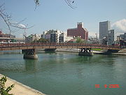
is an ancient castle town and the center of Kitakyūshū, Japan, guarding, via its suburb Moji, the Straits of Shimonoseki between Honshū and Kyūshū. Kokura is also the name of the penultimate station on the southbound Sanyo Shinkansen line, which is owned by JR Kyūshū and an important part of the...
to Nagasaki, used by daimyo
Daimyo
is a generic term referring to the powerful territorial lords in pre-modern Japan who ruled most of the country from their vast, hereditary land holdings...
for the sankin kotai
Sankin kotai
was a policy of the shogunate during most of the Edo period of Japanese history. The purpose was to control the daimyo. In adopting the policy, the shogunate was continuing and refining similar policies of Toyotomi Hideyoshi. In 1635, a law required sankin kōtai, which was already an established...
, and also by the Dutch traders at Nagasaki on whom a similar obligation of visiting the Shogun
Shogun
A was one of the hereditary military dictators of Japan from 1192 to 1867. In this period, the shoguns, or their shikken regents , were the de facto rulers of Japan though they were nominally appointed by the emperor...
was imposed. The route stretched 228 km and took travelers approximately one week.
Stations of the Nagasaki Kaidō
The Nagasaki Kaidō's 25 post stationsShukuba
were post stations during the Edo period in Japan, generally located on one of the Edo Five Routes or one of its sub-routes. They were also called shukueki . These post stations were places where travelers could rest on their journey around the nation...
, as listed in 1705, are listed below with their modern-day municipalities indicated beside them. Travelers visiting Naruse-shuku and Shiota-shuku would avoid Kitagata-shuku and Tsukasaki-shuku.
Fukuoka PrefectureFukuoka Prefectureis a prefecture of Japan located on Kyūshū Island. The capital is the city of Fukuoka.- History :Fukuoka Prefecture includes the former provinces of Chikugo, Chikuzen, and Buzen....
- Starting Location: Tokiwabashi (常盤橋) (Kokura Kita-kuKokura Kita-ku, Kitakyushuis a ward of Kitakyūshū, Fukuoka, Japan. It is the north part of what used to be Kokura City before the merger of five cities to create the new city of Kitakyūshū in 1963...
, Kitakyūshū) - 1. Kurosaki-shuku (黒崎宿) (Yahata Nishi-kuYahata Nishi-ku, Kitakyushuis a ward of Kitakyūshū, Fukuoka, Japan. It covers 83.04 square kilometres, and had a population of 260,318 at January 1, 2005. The ward contains JR Kurosaki Station, and JR Orio Station on the Kagoshima Main Line, with several schools and universities nearby...
, Kitakyūshū) - 2. Koyanose-shuku (木屋瀬宿) (Yahata Nishi-ku, Kitakyūshū)
- 3. Iizuka-shuku (飯塚宿) (IizukaIizuka, Fukuokais a city located at the confluence of the Honami and Onga rivers in central Fukuoka Prefecture, Japan.Iizuka was an important post-station on the Nagasaki Kaidō during the Edo Era. As Japan industrialised, Iizuka became the center of the most productive coal fields in Japan located throughout the...
) - 4. Uchino-shuku (内野宿) (Iizuka)
- 5. Yamae-shuku (山家宿) (ChikushinoChikushino, Fukuokais a city located in Fukuoka, Japan.Bordering on Dazaifu, Chikushino is essentially a southern suburb of Fukuoka City. As of 2010, the city has an estimated population of 100,397. The total area is 87.78 km². The Tenjin Ōmuta Line runs through Chikushino at Murasaki Station and Asakuragaidō...
) - 6. Haruda-shuku (原田宿) (Chikushino)
Saga PrefectureSaga Prefectureis located in the northwest part of the island of Kyūshū, Japan. It touches both the Sea of Japan and the Ariake Sea. The western part of the prefecture is a region famous for producing ceramics and porcelain, particularly the towns of Karatsu, Imari, and Arita...
- 7. Tashiro-shuku (田代宿) (TosuTosu, Sagais a city located in the east part of Saga Prefecture on the island of Kyūshū, Japan.-Overview:Tosu is one of the major transportation hubs of Kyūshū. Its main train station is Tosu Station which connects the Nagasaki Main Line and the Kagoshima Main Line. There is also a junction connecting the...
) - 8. Todoroki-shuku (轟木宿) (Tosu)
- 9. Nakabaru-shuku (中原宿) (MiyakiMiyaki, Sagais a town in Miyaki District, Saga Prefecture, Japan. It is the first town in Saga to have its name spelled in hiragana rather than kanji. It is named after the district it is located in.-Geography:...
, Miyaki DistrictMiyaki District, Sagais a district located in Saga Prefecture, Japan.In February 2009, the district had an estimated population of 54,233 and a density of 625 per km²...
) - 10. Kanzaki-shuku (神埼宿) (KanzakiKanzaki, Sagais a city located in Saga Prefecture, Japan. The city was created on March 20, 2006 by the merger of the towns of Kanzaki and Chiyoda, and the village of Sefuri, all from Kanzaki District...
) - 11. Sakaibaru-shuku (境原宿) (Kanzaki)
- 12. Saga-shuku (佐賀宿) (SagaSaga, Sagais the capital of Saga Prefecture, located on the island of Kyūshū, Japan.Saga was the capital of Saga Domain in the Edo period, and largest city of former Hizen Province....
) - 13. Ushizu-shuku (牛津宿) (OgiOgi, Sagais a city located in the central part of Saga on the island of Kyūshū, Japan.On March 3, 2005 Ogi District was dissolved when the old town of Ogi absorbed the towns of Ashikari, Mikatsuki and Ushizu, all from Ogi District, to become Ogi City...
) - 14. Oda-shuku (小田宿) (KōhokuKōhoku, Sagais a town located in Kishima District, Saga Prefecture, Japan. It is known as a crossroads for railways and national highways, and as such has dubbed itself "the navel of Saga".-Geography:*Mountains: The northern part of the city is gradually mountainous....
, Kishima DistrictKishima District, Sagais a district located in Saga Prefecture, Japan.As of February 1, 2009, the district has an estimated population of 45,085 and a density of 318 persons per km²...
) - 15. Kitagata-shuku (北方宿) or Naruse-shuku (鳴瀬宿) (TakeoTakeo, Sagais a city located in Saga Prefecture on the island of Kyūshū, Japan.-Geography:Takeo is located in the western part of Saga Prefecture. It is approximately west of Saga City and approximately east of Sasebo. Takeo has a complex topography including mountains, mountain basins and riverside...
) - 16. Tsukasaki-shuku (塚崎宿) or Shiota-shuku (塩田宿) (Takeo)
- 17. Ureshino-shuku (嬉野宿) (UreshinoUreshino, Sagais a city located in the western part of Saga Prefecture on the island of Kyūshū, Japan. The city was formed on January 1, 2006 by the merger of the towns of Ureshino and Shiota...
)
Nagasaki PrefectureNagasaki Prefectureis a prefecture of Japan located on the island of Kyūshū. The capital is the city of Nagasaki.- History :Nagasaki Prefecture was created by merging of the western half of the former province of Hizen with the island provinces of Tsushima and Iki...
- 18. Sonogi-shuku (彼杵宿) (HigashisonogiHigashisonogi, Nagasakiis a town located in Higashisonogi District, Nagasaki, Japan.As of January 1, 2009, the town has an estimated population of 9,219 and a density of 124 persons per km². The total area is 74.25 km². There is one convenience store, four gas stations, a park, a boat pier, a hospital, 5 clinics, 2...
, Higashisonogi DistrictHigashisonogi District, Nagasakiis a district located in Nagasaki, Japan.As of January 1, 2009, the district has an estimated population of 39,012 and a density of 233 persons per km². The total area is 167.47 km².-Towns and villages:*Hasami*Higashisonogi*Kawatana...
) - 19. Matsubara-shuku (松原宿) (ŌmuraOmura, Nagasakiis a city located in Nagasaki Prefecture, Japan. As of January 1, 2009, the city has an estimated population of 89,891. The total area is 126.33 km², and includes Nagasaki Airport.-History:...
) - 20. Ōmura-shuku (大村宿) (Ōmura)
- 21. Eishō-shuku (永昌宿) (IsahayaIsahaya, Nagasakiis a city located in Nagasaki Prefecture, Japan.The city was founded on September 1, 1940. On March 1, 2005, the city expanded through a merger with the surrounding towns of Tarami, Moriyama, Iimori, Takaki and Konagai merged to form the new city of Isahaya...
) - 22. Yagami-shuku (矢上宿) (Nagasaki)
- 23. Himi-shuku (日見宿) (Nagasaki)
- Ending Location: Nagasaki