

NCR 4
Encyclopedia
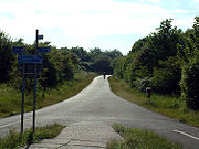
Between London and Fishguard, the route runs through Reading
, Bath, Bristol
, Newport
, Swansea
, Llanelli
and St David's
. Within Wales, NCR 4 forms one of the branches of the Celtic Trail cycle route
.
| Staines
| Eton
| Maidenhead
The London to Reading section of the route starts at Greenwich
. It then follows the River Thames
closely to Putney Bridge
. This section of the route has not been finalised. From Putney Bridge to Reading, the route follows the Thames Valley Cycle Route.
| Hungerford
| Devizes
| Bradford on Avon
The Reading to Bath section follows the Kennet and Avon Canal
. Some sections use the canal towpath, while others are on low traffic roads.
There is a proposed link from the NCR 4 to the National Cycle Route 24, linking to the planned Two Tunnels Greenway
. This would provide an alternate route, providing a quicker way around Bath.
 Saltford
| Bitton
| Warmley
| Mangotsfield
The Bath to Bristol section of the route follows the Bristol & Bath Railway Path, a dedicated cycle path on a disused railway line. This is entirely off road.
, and over the Severn Bridge
. Passing through Chepstow
, it then goes south, passing through Caldicot
before arriving in Newport
. The route passes to the north of the Newport Wetlands Reserve
and across Newport Transporter Bridge
in the south of the city.
| Pontypridd
| Port Talbot
| Swansea
After Newport, the route heads west to Caerphilly, then north towards Pontypridd during which it crosses the Taff Trail
. It then heads west towards Port Talbot
. Near Briton Ferry
, it crosses the A48 bridge and then follows the A483 road
(Fabian Way) into Swansea and passes through the Maritime Quarter
. Just before the Maritime Quarter, it crosses National Cycle Route 43
. It then follows the seafront promenade along Swansea Bay
to Blackpill
where it turns north up the Clyne Valley
cycle track passing the village of Dunvant
until it reaches Gowerton
. In Gowerton, the trail follows public roads to the south of Loughor
towards the Loughor bridge
. Once over the Loughor bridge
it continues along the Millennium Coastal Path
to the south of Llanelli
.
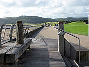 Burry Port
| Pembrey
| Carmarthen
| Tenby
| Pembroke
| Haverfordwest
| St. David's
NCR 4 follows the Millennium Coastal Path
along the south Carmarthenshire
coast. Between Pembroke and Haverfordwest, NCR follows the route of a disused railway called the Brunel Trail and crosses over the Cleddau Bridge
.
Reading, Berkshire
Reading is a large town and unitary authority area in England. It is located in the Thames Valley at the confluence of the River Thames and River Kennet, and on both the Great Western Main Line railway and the M4 motorway, some west of London....
, Bath, Bristol
Bristol
Bristol is a city, unitary authority area and ceremonial county in South West England, with an estimated population of 433,100 for the unitary authority in 2009, and a surrounding Larger Urban Zone with an estimated 1,070,000 residents in 2007...
, Newport
Newport
Newport is a city and unitary authority area in Wales. Standing on the banks of the River Usk, it is located about east of Cardiff and is the largest urban area within the historic county boundaries of Monmouthshire and the preserved county of Gwent...
, Swansea
Swansea
Swansea is a coastal city and county in Wales. Swansea is in the historic county boundaries of Glamorgan. Situated on the sandy South West Wales coast, the county area includes the Gower Peninsula and the Lliw uplands...
, Llanelli
Llanelli
Llanelli , the largest town in both the county of Carmarthenshire and the preserved county of Dyfed , Wales, sits on the Loughor estuary on the West Wales coast, approximately west-north-west of Swansea and south-east of the county town, Carmarthen. The town is famous for its proud rugby...
and St David's
St David's
St Davids , is a city and community in Pembrokeshire, Wales. Lying on the River Alun on St David's Peninsula, it is Britain's smallest city in terms of both size and population, the final resting place of Saint David, the country's patron saint, and the de facto ecclesiastical capital of...
. Within Wales, NCR 4 forms one of the branches of the Celtic Trail cycle route
Celtic Trail cycle route
The Celtic Trail is a network of dedicated cycle routes in the National Cycle Network, crossing West, South and Mid Wales, and covering 377 miles in total. It is divided into east and west sections. The west section links Pembroke and Fishguard on the west coast to Swansea, and the east section...
.
London to Reading
ChertseyChertsey
Chertsey is a town in Surrey, England, on the River Thames and its tributary rivers such as the River Bourne. It can be accessed by road from junction 11 of the M25 London orbital motorway. It shares borders with Staines, Laleham, Shepperton, Addlestone, Woking, Thorpe and Egham...
| Staines
Staines
Staines is a Thames-side town in the Spelthorne borough of Surrey and Greater London Urban Area, as well as the London Commuter Belt of South East England. It is a suburban development within the western bounds of the M25 motorway and located 17 miles west south-west of Charing Cross in...
| Eton
Eton, Berkshire
Eton is a town and civil parish in Berkshire, England, lying on the opposite bank of the River Thames to Windsor and connected to it by Windsor Bridge. The parish also includes the large village of Eton Wick, 2 miles west of the town, and has a population of 4,980. Eton was in Buckinghamshire until...
| Maidenhead
Maidenhead
Maidenhead is a town and unparished area within the Royal Borough of Windsor and Maidenhead, in Berkshire, England. It lies on the River Thames and is situated west of Charing Cross in London.-History:...
The London to Reading section of the route starts at Greenwich
Greenwich
Greenwich is a district of south London, England, located in the London Borough of Greenwich.Greenwich is best known for its maritime history and for giving its name to the Greenwich Meridian and Greenwich Mean Time...
. It then follows the River Thames
River Thames
The River Thames flows through southern England. It is the longest river entirely in England and the second longest in the United Kingdom. While it is best known because its lower reaches flow through central London, the river flows alongside several other towns and cities, including Oxford,...
closely to Putney Bridge
Putney Bridge
Putney Bridge is a bridge crossing of the River Thames in west London, linking Putney on the south side with Fulham to the north. Putney Bridge tube station is located near the north side of the bridge.-History:...
. This section of the route has not been finalised. From Putney Bridge to Reading, the route follows the Thames Valley Cycle Route.
Reading to Bath
NewburyNewbury, Berkshire
Newbury is a civil parish and the principal town in the west of the county of Berkshire in England. It is situated on the River Kennet and the Kennet and Avon Canal, and has a town centre containing many 17th century buildings. Newbury is best known for its racecourse and the adjoining former USAF...
| Hungerford
Hungerford
Hungerford is a market town and civil parish in Berkshire, England, 9 miles west of Newbury. It covers an area of and, according to the 2001 census, has a population of 5,559 .- Geography :...
| Devizes
Devizes
Devizes is a market town and civil parish in Wiltshire, England. The town is about southeast of Chippenham and about east of Trowbridge.Devizes serves as a centre for banks, solicitors and shops, with a large open market place where a market is held once a week...
| Bradford on Avon
Bradford on Avon
Bradford on Avon is a town in west Wiltshire, England with a population of about 9,326. The town's canal, historic buildings, shops, pubs and restaurants make it popular with tourists....
The Reading to Bath section follows the Kennet and Avon Canal
Kennet and Avon Canal
The Kennet and Avon Canal is a waterway in southern England with an overall length of , made up of two lengths of navigable river linked by a canal. The name is commonly used to refer to the entire length of the navigation rather than solely to the central canal section...
. Some sections use the canal towpath, while others are on low traffic roads.
There is a proposed link from the NCR 4 to the National Cycle Route 24, linking to the planned Two Tunnels Greenway
Two Tunnels Greenway
The Two Tunnels Greenway is a shared use path for walking and cycling under construction in Bath, Somerset, England.-Route:The route will follow the disused railway trackbed of the Somerset and Dorset Joint Railway from East Twerton through the Bath suburb of Oldfield Park to the Devonshire Tunnel...
. This would provide an alternate route, providing a quicker way around Bath.
Bath to Bristol
Saltford
Saltford is a large village and civil parish in the Bath and North East Somerset unitary authority, Somerset, England. It lies between the cities of Bristol and Bath....
| Bitton
Bitton
Bitton is a village and civil parish in South Gloucestershire, England, in the Greater Bristol area on the River Boyd.It is in the far south of the South Gloucestershire district, near the border with Bath and North East Somerset...
| Warmley
Warmley
Warmley is a village in South Gloucestershire, England, to the east of Kingswood on the outskirts of Bristol.In the mid 18th century it contained the Warmley Works of William Champion...
| Mangotsfield
Mangotsfield
Mangotsfield is a village in South Gloucestershire, England, situated north of the Bristol suburb of Kingswood, bounded to the north by the M4 motorway and to the east by the Emersons Green housing estate....
The Bath to Bristol section of the route follows the Bristol & Bath Railway Path, a dedicated cycle path on a disused railway line. This is entirely off road.
Bristol to Newport
After passing through Bristol city centre, the route heads north into South GloucestershireSouth Gloucestershire
South Gloucestershire is a unitary district in the ceremonial county of Gloucestershire, in South West England.-History:The district was created in 1996, when the county of Avon was abolished, by the merger of former area of the districts of Kingswood and Northavon...
, and over the Severn Bridge
Severn Bridge
The Severn Bridge is a suspension bridge spanning the River Severn between South Gloucestershire, just north of Bristol, England, and Monmouthshire in South Wales, via Beachley, a peninsula between the River Severn and River Wye estuary. It is the original Severn road crossing between England and...
. Passing through Chepstow
Chepstow
Chepstow is a town in Monmouthshire, Wales, adjoining the border with Gloucestershire, England. It is located on the River Wye, close to its confluence with the River Severn, and close to the western end of the Severn Bridge on the M48 motorway...
, it then goes south, passing through Caldicot
Caldicot, Monmouthshire
Caldicot is a small town in Monmouthshire, southeast Wales, located between Chepstow and Newport, just off the busy M4 / M48 motorway corridor. The site adjoins the Caldicot Levels, on the north side of the Severn estuary. Caldicot has easy access by motorway and rail to Cardiff, and across the...
before arriving in Newport
Newport
Newport is a city and unitary authority area in Wales. Standing on the banks of the River Usk, it is located about east of Cardiff and is the largest urban area within the historic county boundaries of Monmouthshire and the preserved county of Gwent...
. The route passes to the north of the Newport Wetlands Reserve
Newport Wetlands Reserve
Newport Wetlands Reserve is a wildlife reserve between Uskmouth, Nash and Goldcliff, in the south-east of the city of Newport, South Wales.- History :...
and across Newport Transporter Bridge
Newport Transporter Bridge
The Newport Transporter Bridge is a transporter bridge that crosses the River Usk in Newport, South Wales. It is a Grade I listed structure. Designed by French engineer Ferdinand Arnodin, it was built in 1906 and opened by Godfrey Charles Morgan, 1st Viscount Tredegar on 12 September 1906...
in the south of the city.
Newport to Llanelli
CaerphillyCaerphilly
Caerphilly is a town in the county borough of Caerphilly, south Wales, located at the southern end of the Rhymney Valley, with a population of approximately 31,000. It is a commuter town of Cardiff and Newport, which are located some 7.5 miles and 12 miles away, respectively...
| Pontypridd
Pontypridd
Pontypridd is both a community and a principal town of Rhondda Cynon Taf, Wales and is situated 12 miles/19 km north of the Welsh capital city of Cardiff...
| Port Talbot
Port Talbot
Port Talbot is a town in Neath Port Talbot, Wales. It had a population of 35,633 in 2001.-History:Port Talbot grew out of the original small port and market town of Aberafan , which belonged to the medieval Lords of Afan. The area of the parish of Margam lying on the west bank of the lower Afan...
| Swansea
Swansea
Swansea is a coastal city and county in Wales. Swansea is in the historic county boundaries of Glamorgan. Situated on the sandy South West Wales coast, the county area includes the Gower Peninsula and the Lliw uplands...
After Newport, the route heads west to Caerphilly, then north towards Pontypridd during which it crosses the Taff Trail
Taff Trail
The Taff Trail is a popular walking and cycle path that runs for between Cardiff Bay and Brecon in Wales. It is named so because it follows the course of the River Taff...
. It then heads west towards Port Talbot
Port Talbot
Port Talbot is a town in Neath Port Talbot, Wales. It had a population of 35,633 in 2001.-History:Port Talbot grew out of the original small port and market town of Aberafan , which belonged to the medieval Lords of Afan. The area of the parish of Margam lying on the west bank of the lower Afan...
. Near Briton Ferry
Briton Ferry
Briton Ferry is a town and community in the county borough of Neath Port Talbot, Wales. The town encompasses the electoral wards of Briton Ferry East and Briton Ferry West....
, it crosses the A48 bridge and then follows the A483 road
A483 road
The A483 is a major road in the United Kingdom, running from Swansea in Wales to Chester in England, although the official title is the Swansea to Manchester Trunk Road.-Swansea:...
(Fabian Way) into Swansea and passes through the Maritime Quarter
Maritime Quarter
The Maritime Quarter, or Swansea Marina, is a residential area of Swansea, Wales, UK located immediately south of the city centre shopping core. It falls within Swansea's Castle ward...
. Just before the Maritime Quarter, it crosses National Cycle Route 43
National Cycle Route 43
National Cycle Network, Route 43 is part of the National Cycle Network and the Celtic Trail, which connects Swansea with Builth Wells. Most of the route is still awaiting development...
. It then follows the seafront promenade along Swansea Bay
Swansea Bay
Swansea Bay is a bay on the Bristol Channel on the South Wales coast. Places on the bay include Mumbles, Swansea and Port Talbot. The River Neath, River Tawe, River Afan and Blackpill stream flow into the bay....
to Blackpill
Blackpill
Blackpill is a suburban area of Swansea, Wales. It is located beside Swansea Bay, about south west of the city centre.Blackpill falls into the Mayals ward....
where it turns north up the Clyne Valley
Clyne Valley Country Park
The Clyne Valley Country Park is an area of parkland in Britain, at Swansea in south Wales. It lies on either side of the valley of the Clyne River and comprises an area of over 700 acres of land running from the sea at Blackpill, Swansea, inland to Gowerton...
cycle track passing the village of Dunvant
Dunvant
Dunvant is a suburban district in the City and County of Swansea, Wales, and falls within the Dunvant ward. It is situated in a valley some 4.5 miles west of Swansea city centre.-History:...
until it reaches Gowerton
Gowerton
The village of Gowerton is situated about 4 miles north west of Swansea city centre, Wales. Gowerton is often known as the gateway to Gower. Gowerton's original name was Ffosfelin...
. In Gowerton, the trail follows public roads to the south of Loughor
Loughor
Loughor is a town in the City and County of Swansea, Wales, within the historic county boundaries of Glamorgan, Wales. It lies on the estuary of the River Loughor. The town has a community council called Llwchwr....
towards the Loughor bridge
Loughor bridge
The Loughor bridge is a road bridge crossing over the River Loughor, providing a convenient link between much of western Swansea and Llanelli, west Wales. The bridge is part of the A484 road. The road bridge is adjacent to the Loughor railway viaduct. A permanent bridge linking Loughor and...
. Once over the Loughor bridge
Loughor bridge
The Loughor bridge is a road bridge crossing over the River Loughor, providing a convenient link between much of western Swansea and Llanelli, west Wales. The bridge is part of the A484 road. The road bridge is adjacent to the Loughor railway viaduct. A permanent bridge linking Loughor and...
it continues along the Millennium Coastal Path
Millennium coastal path
The Millennium Coastal Path is a 22 km pedestrian walkway and cycleway along the south coast of Carmarthenshire, providing a link between Llanelli and Pembrey Country Park. The cycleway forms a section of both the Celtic Trail cycle route and the National Cycle Network NCN 4.The Millennium...
to the south of Llanelli
Llanelli
Llanelli , the largest town in both the county of Carmarthenshire and the preserved county of Dyfed , Wales, sits on the Loughor estuary on the West Wales coast, approximately west-north-west of Swansea and south-east of the county town, Carmarthen. The town is famous for its proud rugby...
.
Llanelli to Fishguard
Burry Port
Burry Port is a small town five miles outside the larger centre of Llanelli in Carmarthenshire, Wales, lying on the Loughor estuary. The town's population is roughly 8,000 although in the 2001 census there were 4209 residents....
| Pembrey
Pembrey
Pembrey is a village in Carmarthenshire Wales, situated between Burry Port and Kidwelly, overlooking Carmarthen Bay.-History:The name Pembrey is an Anglicisation of the Welsh, Pen-bre...
| Carmarthen
Carmarthen
Carmarthen is a community in, and the county town of, Carmarthenshire, Wales. It is sited on the River Towy north of its mouth at Carmarthen Bay. In 2001, the population was 14,648....
| Tenby
Tenby
Tenby is a walled seaside town in Pembrokeshire, South West Wales, lying on Carmarthen Bay.Notable features of Tenby include of sandy beaches; the 13th century medieval town walls, including the Five Arches barbican gatehouse ; 15th century St...
| Pembroke
Pembroke, Pembrokeshire
Pembroke is an historic settlement and former county town of Pembrokeshire in west Wales. The town and the county derive their name from that of the cantref of Penfro: Pen = "head" or "end", and bro = "region", "country", "land", and so it means essentially "Land's End".-History:The main point of...
| Haverfordwest
Haverfordwest
Haverfordwest is the county town of Pembrokeshire, Wales and serves as the County's principal commercial and administrative centre. Haverfordwest is the most populous urban area in Pembrokeshire, with a population of 13,367 in 2001; though its community boundaries make it the second most populous...
| St. David's
NCR 4 follows the Millennium Coastal Path
Millennium coastal path
The Millennium Coastal Path is a 22 km pedestrian walkway and cycleway along the south coast of Carmarthenshire, providing a link between Llanelli and Pembrey Country Park. The cycleway forms a section of both the Celtic Trail cycle route and the National Cycle Network NCN 4.The Millennium...
along the south Carmarthenshire
Carmarthenshire
Carmarthenshire is a unitary authority in the south west of Wales and one of thirteen historic counties. It is the 3rd largest in Wales. Its three largest towns are Llanelli, Carmarthen and Ammanford...
coast. Between Pembroke and Haverfordwest, NCR follows the route of a disused railway called the Brunel Trail and crosses over the Cleddau Bridge
Cleddau Bridge
The Cleddau Bridge is a toll bridge on the A477 road that spans the River Cleddau between Neyland and Pembroke Dock, Wales. It was originally called the Milford Haven Bridge, Due to errors in the box girder design it collapsed during construction in 1970 and did not become operational until...
.