

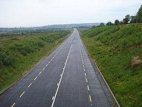
N21 road
Encyclopedia

National primary road
A national primary road is a road classification in the Republic of Ireland. National primary roads form the major routes between the major urban centres. There are over 2,700km of national primary roads. This category of road has the prefix "N" followed by one or two digits...
in Ireland
Republic of Ireland
Ireland , described as the Republic of Ireland , is a sovereign state in Europe occupying approximately five-sixths of the island of the same name. Its capital is Dublin. Ireland, which had a population of 4.58 million in 2011, is a constitutional republic governed as a parliamentary democracy,...
. The route runs from the M20 outside Limerick
Limerick
Limerick is the third largest city in the Republic of Ireland, and the principal city of County Limerick and Ireland's Mid-West Region. It is the fifth most populous city in all of Ireland. When taking the extra-municipal suburbs into account, Limerick is the third largest conurbation in the...
to Tralee with connecting roads to other parts of County Kerry
County Kerry
Kerry means the "people of Ciar" which was the name of the pre-Gaelic tribe who lived in part of the present county. The legendary founder of the tribe was Ciar, son of Fergus mac Róich. In Old Irish "Ciar" meant black or dark brown, and the word continues in use in modern Irish as an adjective...
. It is 93 km (57.8 mi) in length. It runs through the towns of Abbeyfeale
Abbeyfeale
Abbeyfeale is a historical market town in County Limerick, Ireland near the boundary with County Kerry. The town is in the midwest of Ireland, some from Newcastle West on the N21 – the main road from Limerick to Tralee.-Geography:...
, Newcastlewest, Adare
Adare
-General information:Adare's origin is as a settlement by a crossing point on the river Maigue. It is situated 16 km from Limerick City. Renowned as one of Ireland's prettiest villages, Adare is designated as a Heritage Town by the Irish government...
and the village of Templeglantine
Templeglantine
Templeglantine, officially Templeglentan , is a village in West County Limerick, Ireland between Newcastle West and Abbeyfeale on the N21 national primary route - the main road from Limerick to Tralee.- History :...
. Prior to October 2010 the N21 also ran through the town of Castleisland
Castleisland
Castleisland is a town and commercial centre in County Kerry in south west Ireland. The town is renowned for the width of its main street. Castleisland has a population of 2,170....
. The town has recently been bypassed. It is also home to one of the most dangerous stretchs of road in the country, known locally as Barnagh, between Newcastlewest and Templeglantine
Templeglantine
Templeglantine, officially Templeglentan , is a village in West County Limerick, Ireland between Newcastle West and Abbeyfeale on the N21 national primary route - the main road from Limerick to Tralee.- History :...
claiming 4 lives in 4 weeks, bringing the total deaths there to 5 already in 2010. This section of road is currently under severe scrutiny following a group known as the N21 Barnagh Road ReAlignment Petition putting pressure on the authorities, with strong public backing, to realign this section.
Details
The N21 route commences about 8 km (5 mi) southwest of Limerick city, just beyond PatrickswellPatrickswell
Patrickswell, historically known as Toberpatrick , is a small town in County Limerick, Ireland.-Etymology:The name refers to St. Patrick and there is a small hand pump/well in the main street; Microsoft mappoint and some other programs call the village St. Patrick's Well or St....
. At the junction, which is reached by the main M20 motorway, the M/N20 diverges south to Cork
Cork (city)
Cork is the second largest city in the Republic of Ireland and the island of Ireland's third most populous city. It is the principal city and administrative centre of County Cork and the largest city in the province of Munster. Cork has a population of 119,418, while the addition of the suburban...
and the main dual-carriageway becomes the N21 west.
Prior to the 2001 opening the new dual-carriageway, traffic to Kerry left the city on the old N20 in a southwest direction on the Ballinacurra Road through Raheen
Raheen
Raheen is a suburban district of southwestern Limerick City, Ireland. It houses the headquarters of the Mid-Western Region of the Health Service Executive so that a multitude of essential health services catering for the population of the region are dispensed from this suburban...
and then went through Patrickswell to the beginning of the N21.
The new 11 km (6.8 mi) M20/N21 dual-carriageway route begins at junction 1 on the Rosbrien Interchange as the M20 where it leaves the M7/N18 Limerick Southern Ring Road, and bypasses the Limerick suburbs of Dooradoyle
Dooradoyle
Dooradoyle is a suburb of Limerick city which is in County Limerick, Ireland built after the 1960s which remain in the Limerick County Council administrative area. Dooradoyle is in the Parish of St Paul, in the Diocese of Limerick...
, Raheen
Raheen
Raheen is a suburban district of southwestern Limerick City, Ireland. It houses the headquarters of the Mid-Western Region of the Health Service Executive so that a multitude of essential health services catering for the population of the region are dispensed from this suburban...
and Patrickswell
Patrickswell
Patrickswell, historically known as Toberpatrick , is a small town in County Limerick, Ireland.-Etymology:The name refers to St. Patrick and there is a small hand pump/well in the main street; Microsoft mappoint and some other programs call the village St. Patrick's Well or St....
, and continues, as the N21, almost to Adare
Adare
-General information:Adare's origin is as a settlement by a crossing point on the river Maigue. It is situated 16 km from Limerick City. Renowned as one of Ireland's prettiest villages, Adare is designated as a Heritage Town by the Irish government...
. At this point the N21 becomes a standard two-lane road and flows through the main street of the scenic village.
The N21 then runs by Croagh
Croagh
Croagh is a picturesque small village in County Limerick, Ireland. It is located on the road between Rathkeale and Adare which was part of the N21 national primary road before it was bypassed. It is 14 miles from Limerick City. "Croagh" is from the Irish word "cruach," which is a hill or mountain....
and Rathkeale
Rathkeale
Rathkeale is a town in west County Limerick, Ireland. It is located 30 km southwest of Limerick city on the N21 road to Tralee, and lies on the River Deel. Rathkeale has a significant Irish Traveller population....
, which were both bypassed in 1990, before entering Newcastle West
Newcastle West
Newcastle West is a town in west County Limerick, Ireland. The town is the largest town in the county, excluding Limerick city, and is sited on the River Arra which flows into the River Deel...
and filtering through the town. Further along the route the N21 passes through Templeglantine
Templeglantine
Templeglantine, officially Templeglentan , is a village in West County Limerick, Ireland between Newcastle West and Abbeyfeale on the N21 national primary route - the main road from Limerick to Tralee.- History :...
, before going through the major town of Abbeyfeale
Abbeyfeale
Abbeyfeale is a historical market town in County Limerick, Ireland near the boundary with County Kerry. The town is in the midwest of Ireland, some from Newcastle West on the N21 – the main road from Limerick to Tralee.-Geography:...
.
The road continues southwest, at the townland of Kilkinlea it crosses over the River Feale
River Feale
The River Feale rises near Rockchapel in the Mullaghareirk Mountains of County Cork in the southwest of Ireland and flows northwestwards through Abbeyfeale and Listowel in County Kerry before finally emptying into the Mouth of the Shannon by Ballyduff.-External links:*...
into County Kerry passing by Knocknagoshel
Knocknagoshel
Knocknagoshel, officially Knocknagashel , is a village in County Kerry, Ireland. According to the 2006 census, the population of the village was 760.-History:...
and heading towards Castleisland
Castleisland
Castleisland is a town and commercial centre in County Kerry in south west Ireland. The town is renowned for the width of its main street. Castleisland has a population of 2,170....
. A new 7 km (4.3 mi) roadway from Abbeyfeale to Knocknagoshel, bypassing the accident-prone Headleys bridge near Knocknagoshel opened in July 2006. The remainder of the road to Castleisland was realigned in the 1980s. A 6 km (3.7 mi) section north of Casleisland was overlayed and brought up to standard in 1999.
At Castleisland, the N21 heads west to Tralee. The short N23 continues southwest to Farranfore
Farranfore
Farranfore is a village in County Kerry, Ireland. It lies on the N22 road approximately midway between Tralee and Killarney and on the railway line connecting those two towns....
, allowing traffic to continue south along the N22 to Killarney
Killarney
Killarney is a town in County Kerry, southwestern Ireland. The town is located north of the MacGillicuddy Reeks, on the northeastern shore of the Lough Lein/Leane which are part of Killarney National Park. The town and its surrounding region are home to St...
. A new 11 km (6.8 mi) road from Castleisland to Ballycarty near Tralee was opened in early 2001. This was followed by a new 3 km (1.9 mi) section into Tralee, opened in April 2005.
Recent upgrades
The Castleisland Bypass was the only major national road project starting construction in 2009. Construction work completed in October 2010. The new road was officially opened on Friday, October 22nd 2010, by Minister for Defence Tony Killeen. The route consists of 5.3km of type 2 dual carriageway and connects the N21 to the N23 bypassing Castleisland to the west of the town.Future upgrades
The Adare bypass is in the design phase and when finished, will carry the N21 around the village of AdareAdare
-General information:Adare's origin is as a settlement by a crossing point on the river Maigue. It is situated 16 km from Limerick City. Renowned as one of Ireland's prettiest villages, Adare is designated as a Heritage Town by the Irish government...
, Limerick
County Limerick
It is thought that humans had established themselves in the Lough Gur area of the county as early as 3000 BC, while megalithic remains found at Duntryleague date back further to 3500 BC...
.
The road will be built as a dual carriageway
Dual carriageway
A dual carriageway is a class of highway with two carriageways for traffic travelling in opposite directions separated by a central reservation...
and will link up with the northern section of the future M20 motorway from Patrickswell to Cork. It will spur off before Croom and link to the N21 south of Adare.
A 33 km (20.5 mi) Rathkeale/Abbeyfeale road scheme, with a bypass of Newcastle West and Abbeyfeale was at the planning stage in 2006. As of October 2008 it has not advanced beyond planning stage.
See also
- Roads in IrelandRoads in IrelandThe island of Ireland, comprising Northern Ireland and the Republic of Ireland, has an extensive network of tens of thousands of kilometres of public roads, usually surfaced. These roads have been developed and modernised over centuries, from trackways suitable only for walkers and horses, to...
- Motorways in Ireland
- National secondary roadNational secondary roadA national secondary road is a category of road in Ireland. These roads form an important part of the national route network, but are secondary to the main arterial routes which are classified as national primary roads. National secondary roads are designated with route numbers higher than those...
- Regional roadRegional roadA regional road in Ireland is a class of road not forming a major route , but nevertheless forming a link in the national route network. There are over 11,600 kilometres of regional roads. Regional roads are numbered with three digit route numbers, prefixed by "R" A regional road in Ireland is a...