
Municipalities of Veracruz
Encyclopedia

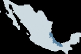
Mexico
The United Mexican States , commonly known as Mexico , is a federal constitutional republic in North America. It is bordered on the north by the United States; on the south and west by the Pacific Ocean; on the southeast by Guatemala, Belize, and the Caribbean Sea; and on the east by the Gulf of...
state of Veracruz is subdivided into 212 municipalities
Municipality
A municipality is essentially an urban administrative division having corporate status and usually powers of self-government. It can also be used to mean the governing body of a municipality. A municipality is a general-purpose administrative subdivision, as opposed to a special-purpose district...
(municipios):
|- style="text-align:center; background:#d8edff;"
!INEGI
National Institute of Statistics, Geography, and Data Processing
The National Institute of Statistic and Geography is an autonomous agency of the Mexican Government dedicated to coordinate the National System of Statistical and Geographical Information of the country...
code!!Municipality!!Municipal Seat
|-
|001|| Acajete
Acajete, Veracruz
Acajete is a municipality located in the central zone in the State of Veracruz, about 20 km from state capital Xalapa. It has a surface of 90.48 km2. It is located at . In the middle of 1586 this village was formed, on one of the adjoining old men of Tlacolulan's dominion...
|| Acajete
Acajete, Veracruz
Acajete is a municipality located in the central zone in the State of Veracruz, about 20 km from state capital Xalapa. It has a surface of 90.48 km2. It is located at . In the middle of 1586 this village was formed, on one of the adjoining old men of Tlacolulan's dominion...
|-
|002|| Acatlán
Acatlán, Veracruz
Acatlán is a municipality located in the montane central zone in the State of Veracruz, about 35 km from state capital Xalapa. It has a surface of 20.56 km2. It is located at . The villagers tell that there was once an individual that come from a place called Cerrillos, of origin authentic...
|| Acatlán
Acatlán, Veracruz
Acatlán is a municipality located in the montane central zone in the State of Veracruz, about 35 km from state capital Xalapa. It has a surface of 20.56 km2. It is located at . The villagers tell that there was once an individual that come from a place called Cerrillos, of origin authentic...
|-
|003|| Acayucan || Acayucan
Acayucan
Acayucan is one of the 212 municipalities of the Mexican state of Veracruz. It is located in the state's southeast, in the Olmeca region. The municipal seat is the city of Acayucan, Veracruz...
|-
|004|| Actopan
Actopan (municipality)
Actopan is a municipality located in the montane central zone in the State of Veracruz, about 50 km from state capital Xalapa. It has a surface of 822.54 km2. It is located at...
|| Actopan
Actopan (municipality)
Actopan is a municipality located in the montane central zone in the State of Veracruz, about 50 km from state capital Xalapa. It has a surface of 822.54 km2. It is located at...
|-
|005|| Acula || Acula
|-
|006|| Acultzingo
Acultzingo (municipality)
Acultzingo is a municipality in Veracruz, Mexico. It is located about 220 km from state capital Xalapa to the south-west.The municipality of Acultzingo is delimited to the east by the Soledad Atzompan, to the south and the west by the Puebla and to the north by Aquila. It produces maize, rice and...
|| Acultzingo
Acultzingo (municipality)
Acultzingo is a municipality in Veracruz, Mexico. It is located about 220 km from state capital Xalapa to the south-west.The municipality of Acultzingo is delimited to the east by the Soledad Atzompan, to the south and the west by the Puebla and to the north by Aquila. It produces maize, rice and...
|-
|007|| Agua Dulce
Agua Dulce, Veracruz
Agua Dulce is a municipality in Veracruz, Mexico. It is located about southeast from the state capital Xalapa. It has an area of .The municipality of Agua Dulce is delimited to the east by the State of Tabasco, to the south by the El Pesquero River, to the west by the Coatzacoalcos municipality...
|| Agua Dulce
Agua Dulce, Veracruz
Agua Dulce is a municipality in Veracruz, Mexico. It is located about southeast from the state capital Xalapa. It has an area of .The municipality of Agua Dulce is delimited to the east by the State of Tabasco, to the south by the El Pesquero River, to the west by the Coatzacoalcos municipality...
|-
|008|| Alpatlahuac || Alpatlahuac
Alpatlahuac
Alpatlahuac is a municipality in Veracruz, Mexico. It is located about 161 km from state capital Xalapa to the south-west. It has a surface of 75,7 km2. It is located at ....
|-
|009|| Alto Lucero de Gutiérrez Barrios || Alto Lucero
Alto Lucero
Alto Lucero is a city in the Mexican state of Veracruz. It is located at , some 35 km from state capital Xalapa...
|-
|010|| Altotonga
Altotonga (municipality)
Altotonga is a municipality in Veracruz, Mexico. It is located about 80 km from state capital Xalapa to the north-west. It has a surface of 375,1 km2. It is located in ....
|| Altotonga
|-
|011|| Alvarado
Alvarado (municipality)
Alvarado is one of the 212 municipalities of the Mexican state of Veracruz which municipal seat is established in the city of Alvarado.-History:...
|| Alvarado
Alvarado, Veracruz
Alvarado is a city in the Mexican state of Veracruz. The city also serves as the municipal seat for the surrounding municipality of the same name. It is located 64 km from the city of Veracruz, Veracruz, on Federal Highways 180 and 125...
|-
|012|| Amatitlán
Amatitlán (municipality)
Amatitlán is a municipality in Veracruz, Mexico. It is located about 231 km from state capital Xalapa to the south-east. It has a surface of 169.4 km2. It is located at ....
|| Amatitlán
Amatitlán
Amatitlán is a town in the Guatemala department of Guatemala. The main industry of the town during colonial times was the preparation of cochineal...
|-
|013|| Amatlán de los Reyes
Amatlán de los Reyes (municipality)
Amatlán de los Reyes is a municipality in Veracruz, Mexico. It is located about 105.63 mi from state capital Xalapa to the south. It has an area of 148.9 km2...
|| Amatlán de los Reyes
Amatlán de los Reyes (municipality)
Amatlán de los Reyes is a municipality in Veracruz, Mexico. It is located about 105.63 mi from state capital Xalapa to the south. It has an area of 148.9 km2...
|-
|014|| Ángel R. Cabada
Ángel R. Cabada (municipality)
Ángel R. Cabada is a municipality in Veracruz, Mexico. It is located about 207 km southeast from the state capital Xalapa, and is in the Papaloapan River region between Lerdo de Tejada and San Andrés Tuxtla on the Federal Highway. The municipality of Ángel R...
|| Ángel R. Cabada
Ángel R. Cabada
Ángel R. Cabada is a town in the Mexican state of Veracruz. Located in the state's Papaloapan River region, it serves as the municipal seat for the surrounding municipality of the same name....
|-
|015|| Apazapan || Apazapan
Apazapan
Apazapan is a municipality located in the central zone in the State of Veracruz, about 65 km from state capital Xalapa. It has a surface of 65.80 km2. It is located at...
|-
|016|| Aquila
Aquila, Veracruz
Aquila is a municipality in Veracruz, Mexico. It is located about 136 km from state capital Xalapa to the south-west. It has a surface of 35.37 km2. It is located at ....
|| Aquila
Aquila, Veracruz
Aquila is a municipality in Veracruz, Mexico. It is located about 136 km from state capital Xalapa to the south-west. It has a surface of 35.37 km2. It is located at ....
|-
|017|| Astacinga
Astacinga
Astacinga is a municipality in Veracruz, Mexico. It is located about 213 km from state capital Xalapa to the south. It has a surface of 69.09 km2...
|| Astacinga
Astacinga
Astacinga is a municipality in Veracruz, Mexico. It is located about 213 km from state capital Xalapa to the south. It has a surface of 69.09 km2...
|-
|018|| Atlahuilco
Atlahuilco
Atlahuilco is a municipality in Veracruz, Mexico. It is located about 131 km from state capital Xalapa. It has a surface of 64.98 km2. It is located at ....
|| Atlahuilco
Atlahuilco
Atlahuilco is a municipality in Veracruz, Mexico. It is located about 131 km from state capital Xalapa. It has a surface of 64.98 km2. It is located at ....
|-
|019|| Atoyac || Atoyac
Atoyac, Veracruz
Atoyac is a municipality in Veracruz, Mexico. It is located about 196 km from state capital Xalapa. It has a surface of 171.09 km2. It is located at ....
|-
|020|| Atzacan
Atzacan
Atzacan is a municipality in Veracruz, Mexico. It is located about 198 km from state capital Xalapa. It has a surface of 80.61 km2. It is located at ....
|| Atzacan
Atzacan
Atzacan is a municipality in Veracruz, Mexico. It is located about 198 km from state capital Xalapa. It has a surface of 80.61 km2. It is located at ....
|-
|021|| Atzalán || Atzalán
Atzalán
Atzalán is a city in the Mexican state of Veracruz, and the municipal seat of the municipality of the same name.It is located at , some 45 km northwest of the state capital Xalapa.- External links :...
|-
|022|| Ayahualulco
Ayahualulco
Ayahualulco is a municipality in Veracruz, Mexico. It is located about 80 km from state capital Xalapa. It has a surface of 148.06 km2. It is located at ....
|| Ayahualulco
Ayahualulco
Ayahualulco is a municipality in Veracruz, Mexico. It is located about 80 km from state capital Xalapa. It has a surface of 148.06 km2. It is located at ....
|-
|023|| Banderilla
Banderilla, Mexico
Banderilla is a municipality located in the montane central zone in the State of Veracruz, about 1 km from state capital Xalapa. It has a surface of 22.21 km2. It is located at...
|| Banderilla
Banderilla, Mexico
Banderilla is a municipality located in the montane central zone in the State of Veracruz, about 1 km from state capital Xalapa. It has a surface of 22.21 km2. It is located at...
|-
|024|| Benito Juárez
Benito Juárez (municipality of Veracruz)
Benito Juárez is one of the 212 municipalities of the Mexican state of Veracruz. It is located in the state's Huasteca Baja region. The municipal seat is the village of Benito Juárez, Veracruz....
|| Benito Juárez
Benito Juárez, Veracruz
Benito Juárez is a village in the Mexican state of Veracruz. Located in the state's Huasteca Baja region, it serves as the municipal seat for the surrounding municipality of the same name....
|-
|025|| Boca del Río
Boca del Río, Veracruz
Boca del Río is a city and municipality located in the center of the state of Veracruz. The small city of Boca del Río serves as the seat of the municipality. The municipality lies just south of Veracruz Municipality, and contains a part of the city and port of Veracruz, Mexico...
|| Boca del Río
Boca del Río, Veracruz
Boca del Río is a city and municipality located in the center of the state of Veracruz. The small city of Boca del Río serves as the seat of the municipality. The municipality lies just south of Veracruz Municipality, and contains a part of the city and port of Veracruz, Mexico...
|-
|026|| Calcahualco || Calcahualco
Calcahualco
Calcahualco is a city in the Mexican state of Veracruz.It serves as the municipal seat for the surrounding municipality of the same name.The coffee grown in Calcahualco is famous.- External links :...
|-
|027|| Camarón de Tejeda
Camarón de Tejeda (municipality)
Camarón de Tejeda is one of the 212 municipalities of the Mexican state of Veracruz. It is located in the state's southeast, in the Las Montañas region. The municipal seat is the city of Camarón de Tejeda...
|| Camarón de Tejeda
Camarón de Tejeda
Camarón de Tejeda is a town in the Mexican state of Veracruz.It serves as the municipal seat for the surrounding municipality of the same nameIt is most famous for the 1863 Battle of Camarón at the town's Hacienda Camarón....
|-
|028|| Camerino Z. Mendoza
Camerino Z. Mendoza (municipality)
Camerino Z. Mendoza is a municipality in Veracruz, Mexico. It is located about 85 km from state capital Xalapa. It has a surface of 37.84 km2. It is located at .In 1898 there is established the head-board of Necoxtla's Municipality, in Santa Rosa; for decree of 1910 in village of Santa Rosa,...
|| Ciudad Mendoza
|-
|029|| Carlos A. Carrillo
Carlos A. Carrillo, Veracruz
Carlos A. Carrillo is a municipality in Veracruz, Mexico. It is located about 245 km from state capital Xalapa. It has a surface of 239.59 km2. It is located at ....
|| Carlos A. Carrillo
Carlos A. Carrillo, Veracruz
Carlos A. Carrillo is a municipality in Veracruz, Mexico. It is located about 245 km from state capital Xalapa. It has a surface of 239.59 km2. It is located at ....
|-
|030|| Carrillo Puerto
Carrillo Puerto (municipality)
Carrillo Puerto is a municipality in Veracruz, Mexico. It is located in the middle of the State of Veracruz. It has a surface of 246.76 km2. It is located at ....
|| Tamarindo
|-
|031|| Castillo de Teayo
Castillo de Teayo (municipality)
Castillo de Teayo is one of the 212 municipalities of the Mexican state of Veracruz. It is located in the state's Huasteca Baja region. The municipal seat is the village of Castillo de Teayo....
|| Castillo de Teayo
Castillo de Teayo, Veracruz
Castillo de Teayo is a village in the Mexican state of Veracruz. Located in the state's Huasteca Baja region, it serves as the municipal seat for the surrounding municipality of the same name....
|-
|032|| Catemaco || Catemaco
Catemaco
Catemaco is a municipality and city in the southeast of Mexican state of Veracruz, in the Sierra de Los Tuxtlas volcanic mountain range, along the Gulf of Mexico...
|-
|033|| Cazones
Cazones de Herrera
Cazones de Herrera is a municipality in Veracruz, Mexico. It is located in the north of the State of Veracruz, about 321 km from state capital. It has a surface of 106.11 km2...
|| Cazones de Herrera
Cazones de Herrera
Cazones de Herrera is a municipality in Veracruz, Mexico. It is located in the north of the State of Veracruz, about 321 km from state capital. It has a surface of 106.11 km2...
|-
|034|| Cerro Azul
Cerro Azul (municipality)
Cerro Azul is one of the 212 municipalities of the Mexican state of Veracruz. It is located in the state's Huasteca Baja region. The municipal seat is the city of Cerro Azul, Veracruz....
|| Cerro Azul
Cerro Azul, Veracruz
Cerro Azul is a city in the Mexican state of Veracruz. Located in the state's Huasteca Baja region, it serves as the municipal seat for the surrounding municipality of the same name.In the 2005 INEGI Census, the city reported a total population of23,573....
|-
|035|| Chacaltianguis
Chacaltianguis
Chacaltianguis is a municipality in Veracruz, Mexico. It is located in the south of the state of Veracruz. It has a surface of 557.69 km2. It is located at ....
|| Chacaltianguis
Chacaltianguis
Chacaltianguis is a municipality in Veracruz, Mexico. It is located in the south of the state of Veracruz. It has a surface of 557.69 km2. It is located at ....
|-
|036|| Chalma
Chalma (municipality)
Chalma is one of the 212 municipalities of the Mexican state of Veracruz. It is located in the state's Huasteca Alta region. The municipal seat is the village of Chalma, Veracruz....
|| Chalma
Chalma, Veracruz
Chalma is a village in the Mexican state of Veracruz. It is located in the state's Huasteca Alta region. It serves as the municipal seat for the surrounding municipality of Chalma....
|-
|037|| Chiconamel || Chiconamel
Chiconamel
Chiconamel is a village in the Mexican state of Veracruz. It is located in the state's Huasteca Alta region. It serves as the municipal seat for the surrounding municipality of Chiconamel....
|-
|038|| Chiconquiaco
Chiconquiaco
Chiconquiaco is a municipality in Veracruz, Mexico. It is located in the middle of the State of Veracruz. It has a surface of 68.27 km2. It is located at ....
|| Chiconquiaco
Chiconquiaco
Chiconquiaco is a municipality in Veracruz, Mexico. It is located in the middle of the State of Veracruz. It has a surface of 68.27 km2. It is located at ....
|-
|039|| Chicontepec
Chicontepec de Tejeda
Chicontepec is a municipality in Veracruz, Mexico. It is located in the north of the State of Veracruz. It has a surface of 978 km2. It is located at ....
|| Chicontepec de Tejeda
Chicontepec de Tejeda
Chicontepec is a municipality in Veracruz, Mexico. It is located in the north of the State of Veracruz. It has a surface of 978 km2. It is located at ....
|-
|040|| Chinameca
Chinameca, Veracruz
Chinameca in Veracruz, Mexico. It is located in the south-east zone of the State of Veracruz, about 290 km from state capital Xalapa. It has a surface of 157.10 km2...
|| Chinameca
Chinameca, Veracruz
Chinameca in Veracruz, Mexico. It is located in the south-east zone of the State of Veracruz, about 290 km from state capital Xalapa. It has a surface of 157.10 km2...
|-
|041|| Chinampa de Gorostiza
Chinampa de Gorostiza
Chinampa de Gorostiza is in Veracruz, Mexico. It is located in the north of the State of Veracruz, about 220 km from state capital Xalapa. It has a surface of 152.99 km2...
|| Chinampa de Gorostiza
Chinampa de Gorostiza
Chinampa de Gorostiza is in Veracruz, Mexico. It is located in the north of the State of Veracruz, about 220 km from state capital Xalapa. It has a surface of 152.99 km2...
|-
|042|| Chocaman
Chocaman
Chocaman in Veracruz, Mexico. It is located in the middle of the State of Veracruz, about 146 km from state capital Xalapa. It has a surface of 41.13 km2. It is located at ....
|| Chocaman
Chocaman
Chocaman in Veracruz, Mexico. It is located in the middle of the State of Veracruz, about 146 km from state capital Xalapa. It has a surface of 41.13 km2. It is located at ....
|-
|043|| Chontla
Chontla
Chontla in Veracruz, Mexico. It is located in the north of the State of Veracruz, about 220 km from state capital Xalapa. It has a surface of 361.09 km2...
|| Chontla
Chontla
Chontla in Veracruz, Mexico. It is located in the north of the State of Veracruz, about 220 km from state capital Xalapa. It has a surface of 361.09 km2...
|-
|044|| Chumatlan
Chumatlan
Chumatlan in Veracruz, Mexico. It is located in the middle of the State of Veracruz, about 105 km from state capital Xalapa. It has a surface of 36.19 km2...
|| Chumatlan
Chumatlan
Chumatlan in Veracruz, Mexico. It is located in the middle of the State of Veracruz, about 105 km from state capital Xalapa. It has a surface of 36.19 km2...
|-
|045|| Citlaltepetl || Citlaltepec
|-
|046|| Coacoatzintla
Coacoatzintla
Coacoatzintla in Veracruz, Mexico. It is located in the mountainous central zone of the State of Veracruz, about 11.5 km from state capital Xalapa. It has a surface of 51.00 km2...
|| Coacoatzintla
Coacoatzintla
Coacoatzintla in Veracruz, Mexico. It is located in the mountainous central zone of the State of Veracruz, about 11.5 km from state capital Xalapa. It has a surface of 51.00 km2...
|-
|047|| Coahuitlan
Coahuitlan
Coahuitlán in Veracruz, Mexico. It is located in the north zone of the State of Veracruz, about 120 km from state capital Xalapa. It has a surface of 95.41 km2...
|| Progreso de Zaragoza
|-
|048|| Coatepec || Coatepec
|-
|049|| Coatzacoalcos || Coatzacoalcos
Coatzacoalcos
Coatzacoalcos is a major port city in the southern part of the Mexican state of Veracruz, on the Coatzacoalcos River. Coatzacoalcos comes from an indigenous word meaning "Site of the Snake" or "Where the snake hides"...
|-
|050|| Coatzintla
Coatzintla
Coatzintla is a municipality in Veracruz, Mexico. It is located in the north zone of the State of Veracruz, about from the state capital Xalapa. It covers an area of...
|| Coatzintla
Coatzintla
Coatzintla is a municipality in Veracruz, Mexico. It is located in the north zone of the State of Veracruz, about from the state capital Xalapa. It covers an area of...
|-
|051|| Coetzala
Coetzala
Coetzala in Veracruz, Mexico. It is located in the montane central zone of the State of Veracruz, about 90 km from state capital Xalapa. It has a surface of 26.32 km2...
|| Coetzala
Coetzala
Coetzala in Veracruz, Mexico. It is located in the montane central zone of the State of Veracruz, about 90 km from state capital Xalapa. It has a surface of 26.32 km2...
|-
|052|| Colipa || Colipa
Colipa
Colipa is a small town in the Mexican state of Veracruz. It has a population of about 3,000. The weather is generally hot and the rainy season runs from October through December.It is located at 19°55' N, 96°42' W, less than 20 km from the Gulf Coast....
|-
|053|| Comapa
Comapa
Comapa is a municipality in the Jutiapa department of Guatemala....
|| Comapa
Comapa
Comapa is a municipality in the Jutiapa department of Guatemala....
|-
|054|| Córdoba || Córdoba
Córdoba, Veracruz
Córdoba, officially known as Heroica Córdoba, is a city and the seat of the municipality of the same name in the Mexican state of Veracruz. It was founded in 1618....
|-
|055|| Cosamaloapan de Carpio || Cosamaloapan
Cosamaloapan
Cosamaloapan is a municipality located in the plains of the Sotavento zone in the central zone of the State of Veracruz, about 240 km from state capital Xalapa. It has a surface of 323.26 km2. It is located at ....
|-
|056|| Cosautlán de Carvajal
Cosautlán de Carvajal
Cosautlán in Veracruz, Mexico. It is located in the montane central zone of the State of Veracruz, about 23.5 km from state capital Xalapa. It has a surface of 72.38 km2...
|| Cosautlán de Carvajal
Cosautlán de Carvajal
Cosautlán in Veracruz, Mexico. It is located in the montane central zone of the State of Veracruz, about 23.5 km from state capital Xalapa. It has a surface of 72.38 km2...
|-
|057|| Coscomatepec
Coscomatepec de Bravo
Coscomatepec in Veracruz, Mexico. It is located in the montane central zone of the State of Veracruz, about 50 km from state capital Xalapa. It has a surface of 130.78 km2...
|| Coscomatepec de Bravo
Coscomatepec de Bravo
Coscomatepec in Veracruz, Mexico. It is located in the montane central zone of the State of Veracruz, about 50 km from state capital Xalapa. It has a surface of 130.78 km2...
|-
|058|| Cosoleacaque
Cosoleacaque
Cosoleacaque in Veracruz, Mexico. It is located in the south-east zone of the State of Veracruz, about 300 km from state capital Xalapa. It has a surface of 234.42 km2...
|| Cosoleacaque
Cosoleacaque
Cosoleacaque in Veracruz, Mexico. It is located in the south-east zone of the State of Veracruz, about 300 km from state capital Xalapa. It has a surface of 234.42 km2...
|-
|059|| Cotaxtla || Cotaxtla
Cotaxtla
Cotaxtla is a city in the Mexican state of Veracruz.It is located 45 km from the city of Veracruz on Federal Highway 180. Major products in Cotaxtla are corn, sugar, and fruits....
|-
|060|| Coxquihui
Coxquihui
Coxquihui in Veracruz, Mexico. It is located in montane central zone of the State of Veracruz, about 95 km from state capital Xalapa. It has a surface of 86.37 km2...
|| Coxquihui
Coxquihui
Coxquihui in Veracruz, Mexico. It is located in montane central zone of the State of Veracruz, about 95 km from state capital Xalapa. It has a surface of 86.37 km2...
|-
|061|| Coyutla
Coyutla
Coyutla in Veracruz, Mexico. It is located in central zone of the State of Veracruz, about 110 km from state capital Xalapa. It has a surface of 312.56 km2...
|| Coyutla
Coyutla
Coyutla in Veracruz, Mexico. It is located in central zone of the State of Veracruz, about 110 km from state capital Xalapa. It has a surface of 312.56 km2...
|-
|062|| Cuichapa
Cuichapa
Cuichapa in Veracruz, Mexico. It is located in central zone of the State of Veracruz, about 90 km from state capital Xalapa. It has a surface of 69.92 km2. It is located at . The municipality of Cuichapa is delimited to the north by Yanga, to the north-west by Amatlán de los Reyes, to the south by...
|| Cuichapa
Cuichapa
Cuichapa in Veracruz, Mexico. It is located in central zone of the State of Veracruz, about 90 km from state capital Xalapa. It has a surface of 69.92 km2. It is located at . The municipality of Cuichapa is delimited to the north by Yanga, to the north-west by Amatlán de los Reyes, to the south by...
|-
|063|| Cuitláhuac
Cuitláhuac, Veracruz
Cuitláhuac is a municipality in the Mexican state of Veracruz. It is named after Cuitláhuac, the 10th tlatoani of the Aztec city of Tenochtitlan for 80 days during the year Two Flint .- External links :...
|| Cuitláhuac
Cuitláhuac, Veracruz
Cuitláhuac is a municipality in the Mexican state of Veracruz. It is named after Cuitláhuac, the 10th tlatoani of the Aztec city of Tenochtitlan for 80 days during the year Two Flint .- External links :...
|-
|064|| El Higo
El Higo (municipality)
El Higo is one of the 212 municipalities of the Mexican state of Veracruz. It is located in the state's Huasteca Alta region. The municipal seat is the village of El Higo, Veracruz....
|| El Higo
El Higo
El Higo is a village and municipality in the Mexican state of Veracruz. It is located in the state's Huasteca Alta region.In the 2005 INEGI Census, the village of El Higo reported a total population of 7,844....
|-
|065|| Emiliano Zapata
Emiliano Zapata, Veracruz
Emiliano Zapata is a municipality in the Mexican state of Veracruz, located 2 km from Jalapa-Enríquez on Federal Highways 180 and 190. It named for the hero of the Mexican Revolution, Emiliano Zapata.- External links :...
|| Dos Ríos
|-
|066|| Espinal, Veracruz || Espinal, Veracruz
|-
|067|| Filomeno Mata
Filomeno Mata
Filomeno Mata in Veracruz, Mexico. It is located in central zone of the State of Veracruz, about 298 km from state capital Xalapa. It has a surface of 62.51 km2...
|| Filomeno Mata
Filomeno Mata
Filomeno Mata in Veracruz, Mexico. It is located in central zone of the State of Veracruz, about 298 km from state capital Xalapa. It has a surface of 62.51 km2...
|-
|068|| Fortín
Fortin
Fortin is a surname, and may refer to:* André-Gilles Fortin* Dan Fortin* Dean Fortin, Canadian mayor of Victoria* Dédé Fortin* Émile Fortin* Ernest Fortin* Gilles Fortin* Jean-Baptiste Fortin* Jean-François Fortin, hockey player...
|| Fortín de Las Flores
Fortín de las Flores
Fortín de las Flores is a city in the Mexican state of Veracruz. Fortín de las Flores is the municipal seat of Fortín municipality, which borders on the municipalities of Córdoba, Naranjal and Ixtaczoquitlán...
|-
|069|| Gutiérrez Zamora || Gutiérrez Zamora
Gutiérrez Zamora
Gutiérrez Zamora is a city in the Mexican state of Veracruz. Gutiérrez Zamora is bordered by Papantla, Tuxpan, Poza Rica and Coatzintla, and it is served by both the railway and Federal Highways 180 and 190....
|-
|070|| Hidalgotitlán || Hidalgotitlán
Hidalgotitlán
Hidalgotitlán is a town in the Mexican state of Veracruz, with a population of near 18,000 in 2000. Its name derives from two words: one Spanish and the other indigenous...
|-
|071|| Huatusco || Huatusco
Huatusco
Huatusco is the better known name of "Huatusco de Chicuellar", a city in the Mexican state of Veracruz, on the Xalapa–Mexico City railroad...
|-
|072|| Huayacocotla
Huayacocotla (municipality)
Huayacocotla is one of the 212 municipalities of the Mexican state of Veracruz. It is located in the state's Huasteca Baja region. The municipal seat is the town of Huayacocotla....
|| Huayacocotla
Huayacocotla
Huayacocotla is a town in the Mexican state of Veracruz. Located in the state's Huasteca Baja region, it serves as the municipal seat for the surrounding municipality of the same name....
|-
|073|| Hueyapan de Ocampo
Hueyapan de Ocampo
Hueyapan de Ocampo in Veracruz, Mexico. It is located in south zone of the State of Veracruz, about 245 km from state capital Xalapa. It has a surface of 824.18 km2...
|| Hueyapan de Ocampo
Hueyapan de Ocampo
Hueyapan de Ocampo in Veracruz, Mexico. It is located in south zone of the State of Veracruz, about 245 km from state capital Xalapa. It has a surface of 824.18 km2...
|-
|074|| Huiloapan
Huiloapan de Cuauhtémoc
Huiloapan de Cuauhtémoc in Veracruz, Mexico. It is located in central zone of the State of Veracruz, about 180 km from state capital Xalapa. It has a surface of 23.85 km2...
|| Huiloapan de Cuauhtémoc
Huiloapan de Cuauhtémoc
Huiloapan de Cuauhtémoc in Veracruz, Mexico. It is located in central zone of the State of Veracruz, about 180 km from state capital Xalapa. It has a surface of 23.85 km2...
|-
|075|| Ignacio de la Llave || Ignacio de la Llave
Ignacio de la Llave
Ignacio de la Llave y Segura Zevallos was a general and the governor of the Mexican state of Veracruz from 1861 to 1862. He was born in Orizaba, Veracruz, a nephew of Dr. Pablo de la Llave...
|-
|076|| Ilamatlán
Ilamatlán
Ilamatlán in Veracruz, Mexico. It is located in central zone of the State of Veracruz, about 210 km from state capital Xalapa. It has a surface of 188.63 km2...
|| Ilamatlán
Ilamatlán
Ilamatlán in Veracruz, Mexico. It is located in central zone of the State of Veracruz, about 210 km from state capital Xalapa. It has a surface of 188.63 km2...
|-
|077|| Isla
Isla, Veracruz
Isla in Veracruz, Mexico. It is located in south zone of the State of Veracruz, about 370 km from state capital Xalapa. It has a surface of 714.80 km2...
|| Isla
Isla, Veracruz
Isla in Veracruz, Mexico. It is located in south zone of the State of Veracruz, about 370 km from state capital Xalapa. It has a surface of 714.80 km2...
|-
|078|| Ixcatepec
Ixcatepec
Ixcatepec in Veracruz, Mexico. It is located in north zone of the State of Veracruz, about 220 km from state capital Xalapa. It has a surface of 229.49 km2...
|| Ixcatepec
Ixcatepec
Ixcatepec in Veracruz, Mexico. It is located in north zone of the State of Veracruz, about 220 km from state capital Xalapa. It has a surface of 229.49 km2...
|-
|079|| Ixhuacán de los Reyes || Ixhuacán de los Reyes
|-
|080|| Ixhuatlancillo
Ixhuatlancillo
Ixhuatlancillo in Veracruz, Mexico. It is located in central zone of the State of Veracruz, about 165 km from state capital Xalapa. It has a surface of 39.48 km2...
|| Ixhuatlancillo
Ixhuatlancillo
Ixhuatlancillo in Veracruz, Mexico. It is located in central zone of the State of Veracruz, about 165 km from state capital Xalapa. It has a surface of 39.48 km2...
|-
|081|| Ixhuatlán del Café || Ixhuatlán del Café
Ixhuatlán del Café
Ixhuatlán del Café is a city in the Mexican state of Veracruz. It serves as the municipal seat of the municipality of the same name.The municipality covers a total surface area of 134.07 km² and, in the 2000 census, reported a population of 19,945....
|-
|082|| Ixhuatlán del Sureste
Ixhuatlán del Sureste
Ixhuatlán del Sureste is a municipality of Veracruz, Mexico. It is located in south-east zone of Veracruz, about from Xalapa, the state capital. The total area of the municipality is ....
|| Ixhuatlán del Sureste
Ixhuatlán del Sureste
Ixhuatlán del Sureste is a municipality of Veracruz, Mexico. It is located in south-east zone of Veracruz, about from Xalapa, the state capital. The total area of the municipality is ....
|-
|083|| Ixhuatlán de Madero
Ixhuatlán de Madero
Ixhuatlán de Madero is a Municipality in Veracruz, Mexico. It is located in north zone of the State of Veracruz, about 376 km from state capital Xalapa. It has a surface of 598.81 km2...
|| Ixhuatlán de Madero
Ixhuatlán de Madero
Ixhuatlán de Madero is a Municipality in Veracruz, Mexico. It is located in north zone of the State of Veracruz, about 376 km from state capital Xalapa. It has a surface of 598.81 km2...
|-
|084|| Ixmatlahuacan
Ixmatlahuacan
Ixmatlahuacan is a Municipality in Veracruz, Mexico. It is located in south zone of the State of Veracruz, about 175 km from state capital Xalapa. It has a surface of 335.59 km2...
|| Ixmatlahuacan
Ixmatlahuacan
Ixmatlahuacan is a Municipality in Veracruz, Mexico. It is located in south zone of the State of Veracruz, about 175 km from state capital Xalapa. It has a surface of 335.59 km2...
|-
|085|| Ixtaczoquitlán || Ixtaczoquitlán
Ixtaczoquitlán
Ixtaczoquitlán is a city in the Mexican state of Veracruz. It is located 2 kilometres. from Orizaba. It is close to the Fortín–Orizaba railroad and stands on Federal Highways 180 & 190.....
|-
|086|| Jalacingo
Jalacingo
Jalacingo is a city in the Mexican state of Veracruz, bordered by Tlapacoyan, Perote and Atzalán and on Federal Highways 180 & 190. It was founded by Gonzalo de Sandoval.In Jalacingo the main indigenous language is Nahuatl.- External links :...
|| Jalacingo
Jalacingo
Jalacingo is a city in the Mexican state of Veracruz, bordered by Tlapacoyan, Perote and Atzalán and on Federal Highways 180 & 190. It was founded by Gonzalo de Sandoval.In Jalacingo the main indigenous language is Nahuatl.- External links :...
|-
|087|| Jalcomulco
Jalcomulco
Jalcomulco is a municipality in Veracruz, Mexico. It is located in central zone of the State of Veracruz, about , from State Capital, Xalapa and , from Mexico City. It has a surface of 58.40 km2...
|| Jalcomulco
Jalcomulco
Jalcomulco is a municipality in Veracruz, Mexico. It is located in central zone of the State of Veracruz, about , from State Capital, Xalapa and , from Mexico City. It has a surface of 58.40 km2...
|-
|088|| Jaltipan
Jaltipan de Morelos
Jáltipan is a municipality in Veracruz, Mexico. It is located in south zone of the State of Veracruz, about 380 km from state capital Xalapa. It has a surface of 331.48 km2...
|| Jaltipan de Morelos
Jaltipan de Morelos
Jáltipan is a municipality in Veracruz, Mexico. It is located in south zone of the State of Veracruz, about 380 km from state capital Xalapa. It has a surface of 331.48 km2...
|-
|089|| Jamapa || Jamapa
Jamapa
Jamapa is a city in the Mexican state of Veracruz. It stands on Federal Highway 137.Major products are corn, coffee, fruits, and sugar.- External links :*...
|-
|090|| Jesús Carranza || Jesús Carranza
Jesús Carranza, Veracruz
Jesus Carranza is a town and municipality located in the State of Veracruz, in Mexico. The town has an area of 486.32 kilometers squared. It represents about 0.67 percent of the State of Veracruz. Jesus Carranza borders the State of Oaxaca to its west. It is located 435 kilometers from the...
|-
|091|| Jilotepec || Jilotepec
|-
|092|| José Azueta
José Azueta, Veracruz
José Azueta is a Municipality in Veracruz, Mexico. It is located in south zone of the State of Veracruz, about 205 km from state capital Xalapa. It has a surface of 582.63 km2...
|| Villa Azueta
|-
|093|| Juan Rodríguez Clara
Juan Rodríguez Clara
Juan Rodríguez Clara is a Municipality in Veracruz, Mexico. It is located in south zone of the State of Veracruz, about 335 km from state capital Xalapa. It has a surface of 934.20 km2...
|| Juan Rodríguez Clara
Juan Rodríguez Clara
Juan Rodríguez Clara is a Municipality in Veracruz, Mexico. It is located in south zone of the State of Veracruz, about 335 km from state capital Xalapa. It has a surface of 934.20 km2...
|-
|094|| Juchique de Ferrer
Juchique de Ferrer
Juchique de Ferrer is a Municipality in Veracruz, Mexico. It is located in central zone of the State of Veracruz, about 259.10 km from state capital Xalapa. It has a surface of 934.20 km2...
|| Juchique de Ferrer
Juchique de Ferrer
Juchique de Ferrer is a Municipality in Veracruz, Mexico. It is located in central zone of the State of Veracruz, about 259.10 km from state capital Xalapa. It has a surface of 934.20 km2...
|-
|095|| Landero y Coss
Landero y Coss
Landero y Coss is a Municipality in Veracruz, Mexico. It is located in central zone of the State of Veracruz, about 33 km from state capital Xalapa. It has a surface of 21.39 km2...
|| Landero y Coss
Landero y Coss
Landero y Coss is a Municipality in Veracruz, Mexico. It is located in central zone of the State of Veracruz, about 33 km from state capital Xalapa. It has a surface of 21.39 km2...
|-
|096|| La Antigua || José Cardel
|-
|097|| La Perla
La Perla, Veracruz
La Perla is a Municipality in Veracruz, Mexico. It is located in central zone of the State of Veracruz, about 75 km from state capital Xalapa. It has a surface of 199.880 km2...
|| La Perla
La Perla, Veracruz
La Perla is a Municipality in Veracruz, Mexico. It is located in central zone of the State of Veracruz, about 75 km from state capital Xalapa. It has a surface of 199.880 km2...
|-
|098|| Las Choapas
Las Choapas
Las Choapas is a city and its surrounding municipality in the southeastern extremes of the state of Veracruz in Mexico. It is bordered by the municipalities of Uxpanapa, Minatitlán, Moloacán, and Agua Dulce in Veracruz, Huimanguillo in Tabasco, Cintalapa and Tecpatán in Chiapas, and Santa María...
|| Las Choapas
Las Choapas
Las Choapas is a city and its surrounding municipality in the southeastern extremes of the state of Veracruz in Mexico. It is bordered by the municipalities of Uxpanapa, Minatitlán, Moloacán, and Agua Dulce in Veracruz, Huimanguillo in Tabasco, Cintalapa and Tecpatán in Chiapas, and Santa María...
|-
|099|| Las Minas
Las Minas
- Sources :* – World-Gazetteer.com...
|| Las Minas
Las Minas
- Sources :* – World-Gazetteer.com...
|-
|100|| Las Vigas de Ramírez
Las Vigas de Ramírez
Las Vigas de Ramírez is a city in the Mexican state of Veracruz. It serves as the municipal seat for the surrounding municipality of the same name....
|| Las Vigas de Ramírez
Las Vigas de Ramírez
Las Vigas de Ramírez is a city in the Mexican state of Veracruz. It serves as the municipal seat for the surrounding municipality of the same name....
|-
|101|| Lerdo de Tejada || Lerdo de Tejada
|-
|102|| Los Reyes || Los Reyes
|-
|103|| Magdalena
Magdalena, Veracruz
Magdalena is a Municipality in Veracruz, Mexico. It is located in central zone of the State of Veracruz, about 125 km from state capital Xalapa. It has a surface of 28.79 km2...
|| Magdalena
Magdalena, Veracruz
Magdalena is a Municipality in Veracruz, Mexico. It is located in central zone of the State of Veracruz, about 125 km from state capital Xalapa. It has a surface of 28.79 km2...
|-
|104|| Maltrata
Maltrata
Maltrata is a Municipality in Veracruz, Mexico. It is located in central zone of the State of Veracruz, about 209 km from state capital Xalapa. It has a surface of 132.43 km2...
|| Maltrata
Maltrata
Maltrata is a Municipality in Veracruz, Mexico. It is located in central zone of the State of Veracruz, about 209 km from state capital Xalapa. It has a surface of 132.43 km2...
|-
|105|| Manlio Fabio Altamirano
Manlio Fabio Altamirano
Manlio Fabio Altamirano is a town in the Mexican state of Veracruz.It serves as the municipal seat for the surrounding municipality of the same name.- External links :...
|| Manlio Fabio Altamirano
Manlio Fabio Altamirano
Manlio Fabio Altamirano is a town in the Mexican state of Veracruz.It serves as the municipal seat for the surrounding municipality of the same name.- External links :...
|-
|106|| Mariano Escobedo
Mariano Escobedo, Veracruz
Mariano Escobedo is a Municipality in Veracruz, Mexico. It is located in central zone of the State of Veracruz, about 127 km from state capital Xalapa. It has a surface of 103.64 km2...
|| Mariano Escobedo
Mariano Escobedo, Veracruz
Mariano Escobedo is a Municipality in Veracruz, Mexico. It is located in central zone of the State of Veracruz, about 127 km from state capital Xalapa. It has a surface of 103.64 km2...
|-
|107|| Martínez de la Torre || Martínez de la Torre
|-
|108|| Mecatlán
Mecatlán
Mecatlán is a Municipality in Veracruz, Mexico. It is located in the north zone of the State of Veracruz, about 327 km from state capital Xalapa. It has a surface of 48.53 km2...
|| Mecatlán
Mecatlán
Mecatlán is a Municipality in Veracruz, Mexico. It is located in the north zone of the State of Veracruz, about 327 km from state capital Xalapa. It has a surface of 48.53 km2...
|-
|109|| Mecayapan
Mecayapan
Mecayapan is a municipality and city in Veracruz, Mexico. It is located in south-east zone of the State of Veracruz, about 428 km from state capital Xalapa. It has a surface of 523.96 km2...
|| Mecayapan
Mecayapan
Mecayapan is a municipality and city in Veracruz, Mexico. It is located in south-east zone of the State of Veracruz, about 428 km from state capital Xalapa. It has a surface of 523.96 km2...
|-
|110|| Medellín
Medellín, Veracruz
Medellín is a Municipality in Veracruz, Mexico. It is located in central zone of the State of Veracruz, about 100 km from state capital Xalapa. It has a surface of 370.14 km2....
|| Medellín
Medellín, Veracruz
Medellín is a Municipality in Veracruz, Mexico. It is located in central zone of the State of Veracruz, about 100 km from state capital Xalapa. It has a surface of 370.14 km2....
|-
|111|| Miahuatlán
Miahuatlán
Miahuatlán is a Municipality in Veracruz, Mexico. It is located in montane central zone of the State of Veracruz, about 28 km from state capital Xalapa. It has a surface of 20.56 km2. The municipality of Miahuatlán is delimited to the north by Landero y Coss, to the east by Acatlán, to the south...
|| Miahuatlán
Miahuatlán
Miahuatlán is a Municipality in Veracruz, Mexico. It is located in montane central zone of the State of Veracruz, about 28 km from state capital Xalapa. It has a surface of 20.56 km2. The municipality of Miahuatlán is delimited to the north by Landero y Coss, to the east by Acatlán, to the south...
|-
|112|| Minatitlán
Minatitlán, Veracruz
Minatitlán is a city in southeastern Mexican state of Veracruz in the Olmec region of the state and the north of the Isthmus of Tehuantepec.In 2010 the greater metropolitan area had a population of 356,020...
|| Minatitlán
Minatitlán, Veracruz
Minatitlán is a city in southeastern Mexican state of Veracruz in the Olmec region of the state and the north of the Isthmus of Tehuantepec.In 2010 the greater metropolitan area had a population of 356,020...
|-
|113|| Misantla || Misantla
Misantla
Misantla is a city in the Mexican state of Veracruz, the administrative seats of the municipality of the same name. The municipality is bordered by Martínez de la Torre, Colipa and Papantla....
|-
|114|| Mixtla de Altamirano
Mixtla de Altamirano
Mixtla de Altamirano is a Municipality in Veracruz, Mexico. It is located in central zone of the State of Veracruz, about 247 km from state capital Xalapa. It has a surface of 60.87 km2. The municipality of Mixtla de Altamirano is delimited to the north by Texhuacán, to the east by Zongolica, to...
|| Mixtla de Altamirano
Mixtla de Altamirano
Mixtla de Altamirano is a Municipality in Veracruz, Mexico. It is located in central zone of the State of Veracruz, about 247 km from state capital Xalapa. It has a surface of 60.87 km2. The municipality of Mixtla de Altamirano is delimited to the north by Texhuacán, to the east by Zongolica, to...
|-
|115|| Moloacán
Moloacán
Moloacán is a Municipality in Veracruz, Mexico. It is located in south-east zone of the State of Veracruz, about 456 km from state capital Xalapa. It has a surface of 261.57 km2...
|| Moloacán
Moloacán
Moloacán is a Municipality in Veracruz, Mexico. It is located in south-east zone of the State of Veracruz, about 456 km from state capital Xalapa. It has a surface of 261.57 km2...
|-
|116|| Nanchital
Nanchital
Nanchital is a Municipality in Veracruz, Mexico. It is located in south-east zone of the State of Veracruz, about 438 km from state capital Xalapa. It has a surface of 63.99 km2...
|| Nanchital
Nanchital
Nanchital is a Municipality in Veracruz, Mexico. It is located in south-east zone of the State of Veracruz, about 438 km from state capital Xalapa. It has a surface of 63.99 km2...
|-
|117|| Naolinco
Naolinco
Naolinco is a city in Veracruz, Mexico. It is named after Guadalupe Victoria, also known as Naolinco de Victoria. It is on Federal Highways 190 and 180. It has borders with Xalapa, Acatlán, Tepetlán, and Coacoatzintla.Naolinco is known for its leather-crafts....
|| Naolinco de Victoria
|-
|118|| Naranjal || Naranjal
|-
|119|| Naranjos Amatlán
Naranjos Amatlán
Naranjos Amatlán is a municipality in Veracruz, Mexico. It is located in north zone of the State of Veracruz, about 402 km from state capital Xalapa. It has an area of...
|| Naranjos
|-
|120|| Nautla
Nautla
Nautla is a settlement in the Mexican state of Veracruz.Nautla comes from the Nahuatl Naui, four; and from tlan, that means place; so it is known as Four Places....
|| Nautla
Nautla
Nautla is a settlement in the Mexican state of Veracruz.Nautla comes from the Nahuatl Naui, four; and from tlan, that means place; so it is known as Four Places....
|-
|121|| Nogales || Nogales
Nogales, Veracruz
Nogales is a municipality in the mountainous western region of the Mexican state of Veracruz. The municipal seat is the city of Nogales.It is situated at , at an altitude of 1280 m, and covers a total surface area of77.32 km²...
|-
|122|| Oluta
Oluta
Oluta is a Municipality in Veracruz, Mexico. It is located in south-east zone of the State of Veracruz, about 371 km from state capital Xalapa. It has a surface of 90.48 km2...
|| Oluta
Oluta
Oluta is a Municipality in Veracruz, Mexico. It is located in south-east zone of the State of Veracruz, about 371 km from state capital Xalapa. It has a surface of 90.48 km2...
|-
|123|| Omealca || Omealca
|-
|124|| Orizaba
Orizaba
Orizaba is a city and municipality in the Mexican state of Veracruz. It is located 20 km west of its sister city Córdoba, and is adjacent to Río Blanco and Ixtaczoquitlán, on Federal Highways 180 and 190. The city had a 2005 census population of 117,273 and is almost coextensive with its small...
|| Orizaba
Orizaba
Orizaba is a city and municipality in the Mexican state of Veracruz. It is located 20 km west of its sister city Córdoba, and is adjacent to Río Blanco and Ixtaczoquitlán, on Federal Highways 180 and 190. The city had a 2005 census population of 117,273 and is almost coextensive with its small...
|-
|125|| Otatitlán
Otatitlán
Otatitlán is a city in the state of Veracruz, Mexico.It stands at , just across the state border from Tuxtepec, Oaxaca.The city serves as the municipal seat for the surrounding municipality of the same name....
|| Otatitlán
Otatitlán
Otatitlán is a city in the state of Veracruz, Mexico.It stands at , just across the state border from Tuxtepec, Oaxaca.The city serves as the municipal seat for the surrounding municipality of the same name....
|-
|126|| Oteapan
Oteapan
Oteapan is a Municipality in Veracruz, Mexico. It is located in south-east zone of the State of Veracruz, about 394 km from state capital Xalapa. It has a surface of 27.97 km2...
|| Oteapan
Oteapan
Oteapan is a Municipality in Veracruz, Mexico. It is located in south-east zone of the State of Veracruz, about 394 km from state capital Xalapa. It has a surface of 27.97 km2...
|-
|127|| Ozuluama de Mascareñas
Ozuluama de Mascareñas (municipality)
Ozuluama de Mascareñas is one of the 212 municipalities of the Mexican state of Veracruz. It is located in the state's Huasteca Alta region. The municipal seat is the village of Ozuluama de Mascareñas, Veracruz....
|| Ozuluama (de Mascareñas)
Ozuluama
Ozuluama is a city in the Mexican state of Veracruz. It is located in the state's Huasteca Alta region. It serves as the municipal seat for the surrounding municipality of Ozuluama de Mascareñas...
|-
|128|| Pajapan
Pajapan
Pajapan is a municipality and city in Veracruz, Mexico. It is located in south zone of the State of Veracruz, about 496 km from state capital Xalapa. It has a surface of 305.98 km2...
|| Pajapan
Pajapan
Pajapan is a municipality and city in Veracruz, Mexico. It is located in south zone of the State of Veracruz, about 496 km from state capital Xalapa. It has a surface of 305.98 km2...
|-
|129|| Pánuco
Pánuco (municipality of Veracruz)
Pánuco is one of the 212 municipalities of the Mexican state of Veracruz. It is located in the Huasteca Alta region of Veracruz and shares borders with the states of San Luis Potosí and Tamaulipas...
|| Pánuco
Pánuco, Veracruz
Pánuco is a city in the Mexican state of Veracruz, located in the state's Huasteca Alta region. It serves as the municipal seat of the surrounding Pánuco Municipality...
|-
|130|| Papantla
Papantla
Papantla is a city and municipality located in the north of the state of Veracruz, Mexico, in the Sierra Papanteca range and on the Gulf of Mexico. The city was founded in the 13th century by the Totonacs and has dominated the Totonacapan region of the state since then...
|| Papantla (de Olarte)
Papantla
Papantla is a city and municipality located in the north of the state of Veracruz, Mexico, in the Sierra Papanteca range and on the Gulf of Mexico. The city was founded in the 13th century by the Totonacs and has dominated the Totonacapan region of the state since then...
|-
|131|| Paso de Ovejas
Paso de Ovejas
Paso de Ovejas is a city in the Mexican state of Veracruz.It serves as the municipal seat for the surrounding municipality of the same name.Paso de Ovejas is bordered byLa Antigua, Veracruz, and Puente Nacional.It is on the railroad and on...
|| Paso de Ovejas
Paso de Ovejas
Paso de Ovejas is a city in the Mexican state of Veracruz.It serves as the municipal seat for the surrounding municipality of the same name.Paso de Ovejas is bordered byLa Antigua, Veracruz, and Puente Nacional.It is on the railroad and on...
|-
|132|| Paso del Macho
Paso del Macho
This name comes for the fact that in this place was necessary to move with mules or males for injured of the area.Paso del Macho is a Municipality in Veracruz, Mexico. It is located in the montane central zone of the State of Veracruz, about 70 km from state capital Xalapa. It has a surface of...
|| Paso del Macho
Paso del Macho
This name comes for the fact that in this place was necessary to move with mules or males for injured of the area.Paso del Macho is a Municipality in Veracruz, Mexico. It is located in the montane central zone of the State of Veracruz, about 70 km from state capital Xalapa. It has a surface of...
|-
|133|| Perote || Perote
|-
|134|| Platón Sánchez || Platón Sánchez
Platón Sánchez
Platón Sánchez is one of the 212 municipalities of the Mexican state of Veracruz.It is located in the state's Huasteca Alta region.The municipal seat is the town of Platón Sánchez.-Geography:...
|-
|135|| Playa Vicente
Playa Vicente
Playa Vicente is a municipality located in the south zone of the State of Veracruz, about 220 km from state capital Xalapa. It has a surface of 2,122.14 km2. It is located at .-Geographic Limits:...
|| Playa Vicente
Playa Vicente
Playa Vicente is a municipality located in the south zone of the State of Veracruz, about 220 km from state capital Xalapa. It has a surface of 2,122.14 km2. It is located at .-Geographic Limits:...
|-
|136|| Poza Rica de Hidalgo
Poza Rica
Poza Rica is a city and its surrounding municipalityin the Mexican state of Veracruz. Its name means "rich pool", because it was a place known for its abundance of fish. In this century oil was discovered in the area. It has since been almost completely extracted...
|| Poza Rica (de Hidalgo)
Poza Rica
Poza Rica is a city and its surrounding municipalityin the Mexican state of Veracruz. Its name means "rich pool", because it was a place known for its abundance of fish. In this century oil was discovered in the area. It has since been almost completely extracted...
|-
|137|| Pueblo Viejo
Pueblo Viejo (municipality)
Pueblo Viejo is one of the 212 municipalities of the Mexican state of Veracruz.It is located in the state's Huasteca Alta region.The municipal seat is the city of Ciudad Cuauhtémoc, Veracruz.-Geography:...
|| Ciudad Cuauhtémoc
Ciudad Cuauhtémoc, Veracruz
Ciudad Cuauhtémoc is a city in the Huasteca Alta region of the Mexican state of Veracruz.It serves as the municipal seat of the surrounding municipality of Pueblo Viejo.The name honours Cuauhtémoc , last tlatoani of the Aztecs....
|-
|138|| Puente Nacional
Puente Nacional
Puente Nacional is a municipality in the Mexican state of Veracruz. Puente Nacional is bordered by Actopan, the port of Veracruz, and La Antigua. It stands on the railway and on Federal Highways 140 and 125...
|| Puente Nacional
Puente Nacional
Puente Nacional is a municipality in the Mexican state of Veracruz. Puente Nacional is bordered by Actopan, the port of Veracruz, and La Antigua. It stands on the railway and on Federal Highways 140 and 125...
|-
|139|| Rafael Delgado
Rafael Delgado
Rafael Delgado is a municipality located in the montane central zone of the State of Veracruz, about 140 km from state capital Xalapa. It has a surface of 39.48 km2.In 1831 the village of San Juan of the Rio constituted a municipality...
|| Rafael Delgado
Rafael Delgado
Rafael Delgado is a municipality located in the montane central zone of the State of Veracruz, about 140 km from state capital Xalapa. It has a surface of 39.48 km2.In 1831 the village of San Juan of the Rio constituted a municipality...
|-
|140|| Rafael Lucio
Rafael Lucio
Rafael Lucio is a municipality located in the montane central zone of the State of Veracruz, about 9 km from state capital Xalapa. It has a surface of 24.68 km2. It is located at...
|| Rafael Lucio
Rafael Lucio
Rafael Lucio is a municipality located in the montane central zone of the State of Veracruz, about 9 km from state capital Xalapa. It has a surface of 24.68 km2. It is located at...
|-
|141|| Río Blanco
Río Blanco, Veracruz
Río Blanco is a municipality located in the montane central zone of the State of Veracruz, about 140 km from the state capital Xalapa. It has an area of 24.68 km2. It is located at...
|| Río Blanco
Río Blanco, Veracruz
Río Blanco is a municipality located in the montane central zone of the State of Veracruz, about 140 km from the state capital Xalapa. It has an area of 24.68 km2. It is located at...
|-
|142|| Saltabarranca
Saltabarranca
Saltabarranca is a municipality located in the south zone of the State of Veracruz, Mexico, about from state capital Xalapa. It has an area of . It is located at...
|| Saltabarranca
Saltabarranca
Saltabarranca is a municipality located in the south zone of the State of Veracruz, Mexico, about from state capital Xalapa. It has an area of . It is located at...
|-
|143|| San Andrés Tenejapan
San Andrés Tenejapan
San Andrés Tenejapan is a municipality located in the montane central zone of the State of Veracruz, about 85 km from state capital Xalapa. It has a surface of 24.68 km2...
|| San Andrés Tenejapan
San Andrés Tenejapan
San Andrés Tenejapan is a municipality located in the montane central zone of the State of Veracruz, about 85 km from state capital Xalapa. It has a surface of 24.68 km2...
|-
|144|| San Andrés Tuxtla || San Andrés Tuxtla
San Andrés Tuxtla
The municipio of San Andrés Tuxtla is located in the south-central portion of the Mexican state of Veracruz. Its municipal seat is also called San Andrés Tuxtla, located 150 km from the city of Veracruz along Federal Highway 180 in the Sierra de Los Tuxtlas region.The municipality which...
|-
|145|| San Juan Evangelista
San Juan Evangelista
San Juan Evangelista is a municipality located in the plains of the Sotavento zone in the central zone of the State of Veracruz, about 260 km from state capital Xalapa. It has a surface of 968.94 km2...
|| San Juan Evangelista
San Juan Evangelista
San Juan Evangelista is a municipality located in the plains of the Sotavento zone in the central zone of the State of Veracruz, about 260 km from state capital Xalapa. It has a surface of 968.94 km2...
|-
|146|| Santiago Tuxtla || Santiago Tuxtla
Santiago Tuxtla
The municipality of Santiago Tuxtla, in the Mexican state of Veracruz, was founded in 1524.The municipality has approximately 51,000 inhabitants and occupies the northwestern slope of Volcano San Martin to the Rio San Juan...
|-
|147|| Sayula de Alemán
Sayula de Alemán
Sayula is a municipality located in the plains of the Sotavento zone in the central zone of the State of Veracruz in Mexico, about 382 km from state capital Xalapa. It has a surface of 640.76 km2...
|| Sayula de Alemán
Sayula de Alemán
Sayula is a municipality located in the plains of the Sotavento zone in the central zone of the State of Veracruz in Mexico, about 382 km from state capital Xalapa. It has a surface of 640.76 km2...
|-
|148|| Sochiapa
Sochiapa
Sochiapa is a municipality located in the central zone in the Mexican State of Veracruz, about 40 km from state capital Xalapa. It has a surface of 21.39 km2...
|| Sochiapa
Sochiapa
Sochiapa is a municipality located in the central zone in the Mexican State of Veracruz, about 40 km from state capital Xalapa. It has a surface of 21.39 km2...
|-
|149|| Soconusco
Soconusco, Veracruz
Soconusco is a municipality located to the south-east of the State in the Plains of the Sotavento of Veracruz, about from state capital Xalapa. It has an area of . It is located at .-Geographic Limits:...
|| Soconusco
Soconusco, Veracruz
Soconusco is a municipality located to the south-east of the State in the Plains of the Sotavento of Veracruz, about from state capital Xalapa. It has an area of . It is located at .-Geographic Limits:...
|-
|150|| Soledad Atzompa
Soledad Atzompa
Soledad Atzompa is a municipality located in the montane central zone in the State of Veracruz, about 90 km from state capital Xalapa. It has a surface of 65.80 km2. It is located at . To the consumarse the independence, the village of Soledad Atzompa formeda municipality, it was bordering in...
|| Soledad Atzompa
Soledad Atzompa
Soledad Atzompa is a municipality located in the montane central zone in the State of Veracruz, about 90 km from state capital Xalapa. It has a surface of 65.80 km2. It is located at . To the consumarse the independence, the village of Soledad Atzompa formeda municipality, it was bordering in...
|-
|151|| Soledad de Doblado
Soledad de Doblado
Soledad de Doblado is a municipality located in the semiarid zone of the center of the State, in the plains of the Sotavento of Veracruz, about 75 km from state capital Xalapa. It has a surface of 370.96 km2. It is located at...
|| Soledad de Doblado
Soledad de Doblado
Soledad de Doblado is a municipality located in the semiarid zone of the center of the State, in the plains of the Sotavento of Veracruz, about 75 km from state capital Xalapa. It has a surface of 370.96 km2. It is located at...
|-
|152|| Soteapan
Soteapan
Soteapan is a municipality and city located in the south-east zone in the State of Veracruz, about 260 km from state capital Xalapa. It has a surface of 528.07 km2...
|| Soteapan
Soteapan
Soteapan is a municipality and city located in the south-east zone in the State of Veracruz, about 260 km from state capital Xalapa. It has a surface of 528.07 km2...
|-
|153|| Tamalín
Tamalín
Tamalín is a municipality located in the north zone in the State of Veracruz. It has a surface of 417.85 km2. It is located at . By Decree of November 13, 1875 there was raised in municipality Tamalín's congregation that concerned to Tantima's municipality....
|| Tamalín
Tamalín
Tamalín is a municipality located in the north zone in the State of Veracruz. It has a surface of 417.85 km2. It is located at . By Decree of November 13, 1875 there was raised in municipality Tamalín's congregation that concerned to Tantima's municipality....
|-
|154|| Tamiahua
Tamiahua
Tamiahua is a municipality located in the north zone in the State of Veracruz. It has a surface of 985.4 km2. It is located at . The name comes from the náhuatl...
|| Tamiahua
Tamiahua
Tamiahua is a municipality located in the north zone in the State of Veracruz. It has a surface of 985.4 km2. It is located at . The name comes from the náhuatl...
|-
|155|| Tampico Alto
Tampico Alto (municipality)
Tampico Alto is one of the 212 municipalities of the Mexican state of Veracruz. It is located in the state's Huasteca Alta region. The municipal seat is Tampico Alto, Veracruz....
|| Tampico Alto
Tampico Alto
Tampico Alto is a town in the Mexican state of Veracruz. Located in the state's Huasteca Alta region, it serves as the municipal seat of the surrounding municipality of Tampico Alto.In the 2005 INEGI Census, Tampico Alto reported a population of 2,126....
|-
|156|| Tancoco
Tancoco
Tancoco is a municipality located in the north zone in the State of Veracruz, about 210 km from state capital Xalapa. It has a surface of 145.59 km2. It is located at . On the occasion of the development reached by the camp petroleum of Zacamixtle, the municipal head-board was moved to this...
|| Tancoco
Tancoco
Tancoco is a municipality located in the north zone in the State of Veracruz, about 210 km from state capital Xalapa. It has a surface of 145.59 km2. It is located at . On the occasion of the development reached by the camp petroleum of Zacamixtle, the municipal head-board was moved to this...
|-
|157|| Tantima
Tantima
Tantima is a municipality located in the montane central zone in the State of Veracruz, about 220 km from state capital Xalapa. It has a surface of 267.32 km2. It is located at . It is a village huasteco very ancient; the name is given of it steals of producing tree of a few fruits known also...
|| Tantima
Tantima
Tantima is a municipality located in the montane central zone in the State of Veracruz, about 220 km from state capital Xalapa. It has a surface of 267.32 km2. It is located at . It is a village huasteco very ancient; the name is given of it steals of producing tree of a few fruits known also...
|-
|158|| Tantoyuca
Tantoyuca (municipality)
Tantoyuca is one of the 212 municipalities of the Mexican state of Veracruz. It is located in the state's Huasteca Alta region. The municipal seat is Tantoyuca, Veracruz....
|| Tantoyuca
Tantoyuca
Tantoyuca is a city in the Mexican state of Veracruz. It is located in the state's Huasteca Alta region.It serves as the municipal seat of the surrounding municipality of Tantoyuca....
|-
|159|| Tatahuicapan de Juárez
Tatahuicapan
Tatahuicapan de Juárez or Tatahuicapan is a municipality located in the south-east of the state of Veracruz in Mexico at . It was created in 1997 with an area of 208.06 km2.-Geographic Limits:...
|| Tatahuicapan
Tatahuicapan
Tatahuicapan de Juárez or Tatahuicapan is a municipality located in the south-east of the state of Veracruz in Mexico at . It was created in 1997 with an area of 208.06 km2.-Geographic Limits:...
|-
|160|| Tatatila
Tatatila
Tatatila is a municipality located in the montane central zone in the State of Veracruz, about 26 km from state capital Xalapa. It has a surface of 82.25 km2...
|| Tatatila
Tatatila
Tatatila is a municipality located in the montane central zone in the State of Veracruz, about 26 km from state capital Xalapa. It has a surface of 82.25 km2...
|-
|161|| Tecolutla || Tecolutla
|-
|162|| Tehuipango
Tehuipango
Tehuipango is a municipality located in the montane central zone in the State of Veracruz, about 110 km from state capital Xalapa. It has a surface of 111.04 km2. It is located at...
|| Tehuipango
Tehuipango
Tehuipango is a municipality located in the montane central zone in the State of Veracruz, about 110 km from state capital Xalapa. It has a surface of 111.04 km2. It is located at...
|-
|163|| Temapache
Temapache
Temapache is a municipality located in the montane central zone in the State of Veracruz, about 90 km from state capital Xalapa. It has a surface of 65.80 km2. It is located at...
|| Alamo
Alamo, Veracruz
Álamo is a Mexican city in the state of Veracruz. It was elevated to city status in 1973, it has 24,159 inhabitants. The city's name is derived from the many Álamo trees growing along the Pantepec River...
|-
|164|| Tempoal || Tempoal de Sánchez
|-
|165|| Tenampa
Tenampa
Tenampa is a municipality located in the montane central zone in the State of Veracruz, about 30 km from state capital Xalapa. It has a surface of 69.92 km2. It is located at . In 1455 the war comes to the municipality by means of the emperor Moctezuma; in 1514, the conquest of the Spanish is...
|| Tenampa
Tenampa
Tenampa is a municipality located in the montane central zone in the State of Veracruz, about 30 km from state capital Xalapa. It has a surface of 69.92 km2. It is located at . In 1455 the war comes to the municipality by means of the emperor Moctezuma; in 1514, the conquest of the Spanish is...
|-
|166|| Tenochtitlán
Tenochtitlán, Veracruz
Tenochtitlán is a municipality in the Mexican State of Veracruz, southeastern Mexico, and the name of the main township which serves as the seat of the municipal government...
|| Tenochtitlán
Tenochtitlán, Veracruz
Tenochtitlán is a municipality in the Mexican State of Veracruz, southeastern Mexico, and the name of the main township which serves as the seat of the municipal government...
|-
|167|| Teocelo
Teocelo
Teocelo is a city in the Mexican state of Veracruz, located to 20 km from Jalapa-Enríquez on Federal Highway 180. It is bordered by: Ixhuacán, Xico, and Coatepec. The coffee of Teocelo is one of the better coffees produced in Mexico...
|| Teocelo
Teocelo
Teocelo is a city in the Mexican state of Veracruz, located to 20 km from Jalapa-Enríquez on Federal Highway 180. It is bordered by: Ixhuacán, Xico, and Coatepec. The coffee of Teocelo is one of the better coffees produced in Mexico...
|-
|168|| Tepatlaxco
Tepatlaxco
Tepatlaxco is a municipality located in the montane central zone in the State of Veracruz, about 55 km from state capital Xalapa. It has a surface of 99.53 km2. It is located at...
|| Tepatlaxco
Tepatlaxco
Tepatlaxco is a municipality located in the montane central zone in the State of Veracruz, about 55 km from state capital Xalapa. It has a surface of 99.53 km2. It is located at...
|-
|169|| Tepetlán
Tepetlán
Tepetlán is a municipality located in the montane central zone in the State of Veracruz. It has a surface of 83.90 km2. It is located at . During the Pre-Hispanic epoch he was a people Totonaca, the most ancient date in the one that one alludes as municipality in that of the 1 °...
|| Tepetlán
Tepetlán
Tepetlán is a municipality located in the montane central zone in the State of Veracruz. It has a surface of 83.90 km2. It is located at . During the Pre-Hispanic epoch he was a people Totonaca, the most ancient date in the one that one alludes as municipality in that of the 1 °...
|-
|170|| Tepetzintla || Tepetzintla
|-
|171|| Tequila
Tequila, Veracruz
Tequila is a municipality located in the montane central zone in the State of Veracruz, about from state capital Xalapa. It has an area of . It is located at...
|| Tequila
Tequila, Veracruz
Tequila is a municipality located in the montane central zone in the State of Veracruz, about from state capital Xalapa. It has an area of . It is located at...
|-
|172|| Texcatepec
Texcatepec
Texcatepec is a municipality located in the north zone in the State of Veracruz, about 190 km from state capital Xalapa. It has a surface of 153.61 km2. It is located at...
|| Texcatepec
Texcatepec
Texcatepec is a municipality located in the north zone in the State of Veracruz, about 190 km from state capital Xalapa. It has a surface of 153.61 km2. It is located at...
|-
|173|| Texhuacán
Texhuacán
Texhuacán is a municipality located in the montane central zone in the State of Veracruz, about 205 km from state capital Xalapa. It has a surface of 32.90 km2. It is located at .-Geographic Limits:...
|| Texhuacán
Texhuacán
Texhuacán is a municipality located in the montane central zone in the State of Veracruz, about 205 km from state capital Xalapa. It has a surface of 32.90 km2. It is located at .-Geographic Limits:...
|-
|174|| Texistepec
Texistepec
Texistepec is a municipality located in the south-east zone in the State of Veracruz, about 285 km from state capital Xalapa. It has a surface of 615.26 km2. It is located at . Texistepec in 1580 concerned to Coatzacoalcos's province...
|| Texistepec
Texistepec
Texistepec is a municipality located in the south-east zone in the State of Veracruz, about 285 km from state capital Xalapa. It has a surface of 615.26 km2. It is located at . Texistepec in 1580 concerned to Coatzacoalcos's province...
|-
|175|| Tezonapa
Tezonapa
Tezonapa is a municipality located in the montane central zone in the State of Veracruz in Mexico, about 219 km from state capital Xalapa. It has a surface of 351 km2. It is located at...
|| Tezonapa
Tezonapa
Tezonapa is a municipality located in the montane central zone in the State of Veracruz in Mexico, about 219 km from state capital Xalapa. It has a surface of 351 km2. It is located at...
|-
|176|| Tierra Blanca
Tierra Blanca, Veracruz
Tierra Blanca is a city and its surrounding municipality of the same name located in the south-central part of the state of Veracruz in Mexico. At the 2005 census the city had a population of 44,171 inhabitants. The city serves as the municipal seat of the municipality, which has an area of...
|| Tierra Blanca
Tierra Blanca, Veracruz
Tierra Blanca is a city and its surrounding municipality of the same name located in the south-central part of the state of Veracruz in Mexico. At the 2005 census the city had a population of 44,171 inhabitants. The city serves as the municipal seat of the municipality, which has an area of...
|-
|177|| Tihuatlán
Tihuatlán (municipality)
Tihuatlán is a municipality located in the north zone in the State of Veracruz, about 316 km from state capital Xalapa. It has a surface of 828.29 km2. It is located at...
|| Tihuatlán
|-
|178|| Tlachichilco
Tlachichilco
-References:...
|| Tlachichilco
Tlachichilco
-References:...
|-
|179|| Tlacojalpan
Tlacojalpan
Tlacojalpan is a municipality located in the south zone in the State of Veracruz, about 175 km from state capital Xalapa. It has a surface of 91.30 km2. It is located at...
|| Tlacojalpan
Tlacojalpan
Tlacojalpan is a municipality located in the south zone in the State of Veracruz, about 175 km from state capital Xalapa. It has a surface of 91.30 km2. It is located at...
|-
|180|| Tlacolulan
Tlacolulan
Tlacolulan is a municipality located in the montane central zone in the State of Veracruz, about 17 km from state capital Xalapa. It has a surface of 137.36 km2. It is located at . It was a people totonaca pre-Hispanic, of the former ones of Xalapa's region...
|| Tlacolulan
Tlacolulan
Tlacolulan is a municipality located in the montane central zone in the State of Veracruz, about 17 km from state capital Xalapa. It has a surface of 137.36 km2. It is located at . It was a people totonaca pre-Hispanic, of the former ones of Xalapa's region...
|-
|181|| Tlacotalpan
Tlacotalpan (municipality)
The municipality of Tlacotalpan is located in the eastern coastal region of the Mexican state of Veracruz. It covers a total surface area is , accounting for 0.89% of the state total....
|| Tlacotalpan
Tlacotalpan
The city of Tlacotalpan is located in the eastern coastal region of the Mexican state of Veracruz. Although the area had been inhabited since pre-Columbian times, the modern-day settlement was founded as a river port on the banks of the Río Papaloapan in the mid-16th century...
|-
|182|| Tlacotepec de Mejía
Tlacotepec de Mejía
Tlacotepec de Mejía is a municipality located in the montane central zone in the State of Veracruz, about 40 km from state capital Xalapa. It has a surface of 90.48 km2. It is located at...
|| Tlacotepec de Mejía
Tlacotepec de Mejía
Tlacotepec de Mejía is a municipality located in the montane central zone in the State of Veracruz, about 40 km from state capital Xalapa. It has a surface of 90.48 km2. It is located at...
|-
|183|| Tlalixcoyan
Tlalixcoyan
Tlalixcoyan is a municipality in Veracruz, Mexico.Tlalixcoyan is bordered by: Alvarado, Medellín, and Cotaxtla and is on Mexican Federal Highways 180 and 190....
|| Tlalixcoyan
Tlalixcoyan
Tlalixcoyan is a municipality in Veracruz, Mexico.Tlalixcoyan is bordered by: Alvarado, Medellín, and Cotaxtla and is on Mexican Federal Highways 180 and 190....
|-
|184|| Tlalnelhuayocan
Tlalnelhuayocan
Tlalnelhuayocan is a city in the Mexican state of Veracruz, located 2 kilometres from state capital Xalapa-Enríquez. It stands on the Mexico City–Veracruz railway and on Federal Highways 180 and 125. Its name was San Andrés Tlalnelhuayocan, who is the first name was used to the Nahuatl and...
|| Tlalnelhuayocan
Tlalnelhuayocan
Tlalnelhuayocan is a city in the Mexican state of Veracruz, located 2 kilometres from state capital Xalapa-Enríquez. It stands on the Mexico City–Veracruz railway and on Federal Highways 180 and 125. Its name was San Andrés Tlalnelhuayocan, who is the first name was used to the Nahuatl and...
|-
|185|| Tlaltetela
Tlaltetela
Tlaltetela is a municipality located in the montane central zone in the State of Veracruz, about 25 km from state capital Xalapa. It has a surface of 266.50 km2. It is located at . The name comes from the language Náhuatl, Atl-Xoxoc-Apan; that means “In the acid water"...
|| Tlaltetela
Tlaltetela
Tlaltetela is a municipality located in the montane central zone in the State of Veracruz, about 25 km from state capital Xalapa. It has a surface of 266.50 km2. It is located at . The name comes from the language Náhuatl, Atl-Xoxoc-Apan; that means “In the acid water"...
|-
|186|| Tlapacoyan
Tlapacoyan
Tlapacoyan is a city in Veracruz, Mexico. It is located about 3 hours car-drive away from state capital Xalapa-Enríquez.Tlapacoyan's population is around 100,000 people.FOOD...
|| Tlapacoyan
Tlapacoyan
Tlapacoyan is a city in Veracruz, Mexico. It is located about 3 hours car-drive away from state capital Xalapa-Enríquez.Tlapacoyan's population is around 100,000 people.FOOD...
|-
|187|| Tlaquilpa
Tlaquilpa
Tlaquilpa is a municipality located in the south zone in the State of Veracruz, about 105 km from the state capital of Xalapa. It has a surface of 58.40 km2. It is located at . The name comes from Náhuatl, and means “Bricklayers' place". Tlaquilpa is a very ancient village, which existed before...
|| Tlaquilpa
Tlaquilpa
Tlaquilpa is a municipality located in the south zone in the State of Veracruz, about 105 km from the state capital of Xalapa. It has a surface of 58.40 km2. It is located at . The name comes from Náhuatl, and means “Bricklayers' place". Tlaquilpa is a very ancient village, which existed before...
|-
|188|| Tlilapan
Tlilapan
Tlilapan is a municipality located in the central zone in the State of Veracruz, about 85 km from state capital Xalapa. It has a surface of 23.85 km2. It is located at . The name comes from the language Náhuatl, that means “Black creek "...
|| Tlilapan
Tlilapan
Tlilapan is a municipality located in the central zone in the State of Veracruz, about 85 km from state capital Xalapa. It has a surface of 23.85 km2. It is located at . The name comes from the language Náhuatl, that means “Black creek "...
|-
|189|| Tomatlán
Tomatlán
Tomatlán is a town and municipality, in Jalisco in central-western Mexico. The municipality covers an area of 153 km².As of 2005, the municipality had a total population of 142 294 people ....
|| Tomatlán
Tomatlán
Tomatlán is a town and municipality, in Jalisco in central-western Mexico. The municipality covers an area of 153 km².As of 2005, the municipality had a total population of 142 294 people ....
|-
|190|| Tonayan
Tonayan
Tonayan is a municipality located in the south zone in the State of Veracruz, about 20 km from state capital Xalapa. It has a surface of 74.03 km2. It is located at . The name comes from the language Náhuatl, Tonali-tona-yan; that means “Place where it dawns "...
|| Tonayan
Tonayan
Tonayan is a municipality located in the south zone in the State of Veracruz, about 20 km from state capital Xalapa. It has a surface of 74.03 km2. It is located at . The name comes from the language Náhuatl, Tonali-tona-yan; that means “Place where it dawns "...
|-
|191|| Totutla
Totutla
Totutla is a municipality located in the south zone in the State of Veracruz, about 40 km from state capital Xalapa. It has a surface of 80.61 km2. It is located at...
|| Totutla
Totutla
Totutla is a municipality located in the south zone in the State of Veracruz, about 40 km from state capital Xalapa. It has a surface of 80.61 km2. It is located at...
|-
|192|| Tres Valles
Tres Valles
Tres Valles is a town and municipality in the Mexican state of Veracruz, created as a free municipality by decree on November 25, 1988...
|| Tres Valles
Tres Valles
Tres Valles is a town and municipality in the Mexican state of Veracruz, created as a free municipality by decree on November 25, 1988...
|-
|193|| Tuxpam || Tuxpam de Rodríguez Cano
|-
|194|| Tuxtilla
Tuxtilla
Tuxtilla is a municipality located in the south zone in the State of Veracruz, about 175 km from state capital Xalapa. It has a surface of 168.62 km2. It is located at...
|| Tuxtilla
Tuxtilla
Tuxtilla is a municipality located in the south zone in the State of Veracruz, about 175 km from state capital Xalapa. It has a surface of 168.62 km2. It is located at...
|-
|195|| Úrsulo Galván
Úrsulo Galván, Veracruz
Úrsulo Galvan is a municipality located in the south zone in the State of Veracruz, about 76 km from state capital Xalapa. It has a surface of 149.70 km2. It is located at...
|| Úrsulo Galván
Úrsulo Galván, Veracruz
Úrsulo Galvan is a municipality located in the south zone in the State of Veracruz, about 76 km from state capital Xalapa. It has a surface of 149.70 km2. It is located at...
|-
|196|| Uxpanapa
Uxpanapa
Uxpanapa is a municipality lying in the southeastern part of the state of Veracruz , in Mexico. It is bordered by the municipalities of Jesús Carranza, Hidalgotitlán, Minatitlán, and Las Choapas in Veracruz, as well as Santa María Chimalapa in Oaxaca...
|| Poblado 10
|-
|197|| Vega de Alatorre
Vega de Alatorre
Vega de Alatorre is a municipality located in the central zone in the State of Veracruz, about 60 km from state capital Xalapa. It has a surface of 310.92 km2...
|| Vega de Alatorre
Vega de Alatorre
Vega de Alatorre is a municipality located in the central zone in the State of Veracruz, about 60 km from state capital Xalapa. It has a surface of 310.92 km2...
|-
|198|| Veracruz
Veracruz, Veracruz
Veracruz, officially known as Heroica Veracruz, is a major port city and municipality on the Gulf of Mexico in the Mexican state of Veracruz. The city is located in the central part of the state. It is located along Federal Highway 140 from the state capital Xalapa, and is the state's most...
|| Veracruz
Veracruz, Veracruz
Veracruz, officially known as Heroica Veracruz, is a major port city and municipality on the Gulf of Mexico in the Mexican state of Veracruz. The city is located in the central part of the state. It is located along Federal Highway 140 from the state capital Xalapa, and is the state's most...
|-
|199|| Villa Aldama
Villa Aldama
Villa Aldama is a municipality located in the central zone in the State of Veracruz, about 33 km from state capital Xalapa. It has a surface of 78.96 km2. It is located at...
|| Villa Aldama
Villa Aldama
Villa Aldama is a municipality located in the central zone in the State of Veracruz, about 33 km from state capital Xalapa. It has a surface of 78.96 km2. It is located at...
|-
|200|| Xalapa
Xalapa
Xalapa-Enríquez, commonly Xalapa or Jalapa, is the capital city of the Mexican state of Veracruz and the name of the surrounding municipality. In the year 2005 census the city reported a population of 387,879 and the municipality of which it serves as municipal seat reported a population of...
|| Xalapa
Xalapa
Xalapa-Enríquez, commonly Xalapa or Jalapa, is the capital city of the Mexican state of Veracruz and the name of the surrounding municipality. In the year 2005 census the city reported a population of 387,879 and the municipality of which it serves as municipal seat reported a population of...
|-
|201|| Xico
Xico, Veracruz
Xico is a city located in the central part of the state of Veracruz. It produces coffee, tropical fruit, wine, handicrafts, and other products. It is 25 km from state capital Xalapa....
|| Xico
Xico, Veracruz
Xico is a city located in the central part of the state of Veracruz. It produces coffee, tropical fruit, wine, handicrafts, and other products. It is 25 km from state capital Xalapa....
|-
|202|| Xoxocotla
Xoxocotla
Xoxocotla is a municipality located in the south zone in the State of Veracruz, about 100 km from state capital Xalapa. It has a surface of 63.34 km2. It is located at...
|| Xoxocotla
Xoxocotla
Xoxocotla is a municipality located in the south zone in the State of Veracruz, about 100 km from state capital Xalapa. It has a surface of 63.34 km2. It is located at...
|-
|203|| Yanga
Yanga, Veracruz
Yanga is a municipality located in the south zone in the State of Veracruz, about 80 km from state capital Xalapa. It has a surface of 102.82 km2. It is located at...
|| Yanga
Yanga, Veracruz
Yanga is a municipality located in the south zone in the State of Veracruz, about 80 km from state capital Xalapa. It has a surface of 102.82 km2. It is located at...
|-
|204|| Yecuatla
Yecuatla
Yecuatla is a municipality located in the north zone in the State of Veracruz, about 40 km from state capital Xalapa. It has a surface of 135.72 km2. It is located at...
|| Yecuatla
Yecuatla
Yecuatla is a municipality located in the north zone in the State of Veracruz, about 40 km from state capital Xalapa. It has a surface of 135.72 km2. It is located at...
|-
|205|| Zacualpan || Zacualpan
|-
|206|| Zaragoza || Zaragoza
|-
|207|| Zentla
Zentla
Zentla is a town located in the state of Veracruz, Mexico. It is the seat of the municipality of Zentla. It has an area of 241 km2. The city has a population of 12,339..It has an elevation of 950 meters above mean sea level....
|| Zentla
Zentla
Zentla is a town located in the state of Veracruz, Mexico. It is the seat of the municipality of Zentla. It has an area of 241 km2. The city has a population of 12,339..It has an elevation of 950 meters above mean sea level....
|-
|208|| Zongolica
Zongolica
Zongolica is a municipality located in the south zone in the State of Veracruz, about 100 km from state capital Xalapa. It has a surface of 63.34 km2. It is located at...
|| Zongolica
Zongolica
Zongolica is a municipality located in the south zone in the State of Veracruz, about 100 km from state capital Xalapa. It has a surface of 63.34 km2. It is located at...
|-
|209|| Zontecomatlán de López y Fuentes
Zontecomatlán de López y Fuentes
Zontecomatlán is a municipality located in the south zone in the State of Veracruz, about 19 km from state capital Xalapa. It has a surface of 216.33 km2. It is located at...
|| Zontecomatlán de López y Fuentes
Zontecomatlán de López y Fuentes
Zontecomatlán is a municipality located in the south zone in the State of Veracruz, about 19 km from state capital Xalapa. It has a surface of 216.33 km2. It is located at...
|-
|210|| Zozocolco de Hidalgo
Zozocolco de Hidalgo
Zozocolco de Hidalgo is a municipality located in southern Veracruz, about from state capital, Xalapa. It has a surface of and is located at...
|| Zozocolco de Hidalgo
Zozocolco de Hidalgo
Zozocolco de Hidalgo is a municipality located in southern Veracruz, about from state capital, Xalapa. It has a surface of and is located at...
|-
|211|| San Rafael
San Rafael, Veracruz
San Rafael is a municipality located in the north zone in the State of Veracruz, about 175 km from state capital Xalapa. It has a surface of 291.14 km2...
|| San Rafael
San Rafael, Veracruz
San Rafael is a municipality located in the north zone in the State of Veracruz, about 175 km from state capital Xalapa. It has a surface of 291.14 km2...
|-
|212|| Santiago Sochiapan
Santiago Sochiapan
Santiago Sochiapan is a municipality located in the south of the Papaloapan zone in the central zone of the State of Veracruz, about 240 km from state capital Xalapa. It has a surface of 40.04 km2. It is located at...
|| Xochiapan
|}