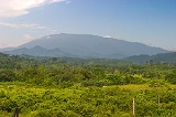
Mount Mantalingahan
Encyclopedia
Mount Mantalingajan is a mountain in southern Palawan
, Philippines
, that forms the highest part of the Mount Beaufort Ultramafics geological region, a series of ultramafic outcrops of Eocene
origin, of which Mount Victoria
forms the largest contiguous land area. The peak of the mountain is the highest point on Palawan.
The mountain forms the center of the Mt. Mantalingahan Protected Landscape (MMPL), a national park
park covering the entire Mantalingahan Mountain Range. The protected area
status of MMPL was proclaimed last June 23, 2009, by virtue of Proclamation No. 1815 by President Gloria Macapagal-Arroyo
. The protected area covers an area of 120,457 hectares.
Continuing discoveries of new species of plant and animal from the mountain highlight its tremendous ecological value and the importance of maintaining such protective zones in the face of constant logging
and mining
pressures. The pitcher plant
species, Nepenthes mantalingajanensis
, described in 2007, is named after the mountain itself.
on the south-west coast of Palawan. Three days hiking is required to reach the summit and two days to return to the jump-off, a total of five days, unless another day is wanted exploring the summit and surrounds. Highlights of the trail include encounters with the Tau't Bato tribe and the "Knife Edge" Canopy Walk that leads to the summit.
Palawan
Palawan is an island province of the Philippines located in the MIMAROPA region or Region 4. Its capital is Puerto Princesa City, and it is the largest province in the country in terms of total area of jurisdiction. The islands of Palawan stretch from Mindoro in the northeast to Borneo in the...
, Philippines
Philippines
The Philippines , officially known as the Republic of the Philippines , is a country in Southeast Asia in the western Pacific Ocean. To its north across the Luzon Strait lies Taiwan. West across the South China Sea sits Vietnam...
, that forms the highest part of the Mount Beaufort Ultramafics geological region, a series of ultramafic outcrops of Eocene
Eocene
The Eocene Epoch, lasting from about 56 to 34 million years ago , is a major division of the geologic timescale and the second epoch of the Paleogene Period in the Cenozoic Era. The Eocene spans the time from the end of the Palaeocene Epoch to the beginning of the Oligocene Epoch. The start of the...
origin, of which Mount Victoria
Mount Victoria, Palawan
Mount Victoria , or Victoria Peak, is a mountain in central Palawan, Philippines, that lies within the administrative Municipality of Narra...
forms the largest contiguous land area. The peak of the mountain is the highest point on Palawan.
The mountain forms the center of the Mt. Mantalingahan Protected Landscape (MMPL), a national park
National park
A national park is a reserve of natural, semi-natural, or developed land that a sovereign state declares or owns. Although individual nations designate their own national parks differently A national park is a reserve of natural, semi-natural, or developed land that a sovereign state declares or...
park covering the entire Mantalingahan Mountain Range. The protected area
Protected area
Protected areas are locations which receive protection because of their recognised natural, ecological and/or cultural values. There are several kinds of protected areas, which vary by level of protection depending on the enabling laws of each country or the regulations of the international...
status of MMPL was proclaimed last June 23, 2009, by virtue of Proclamation No. 1815 by President Gloria Macapagal-Arroyo
Gloria Macapagal-Arroyo
Gloria Macapagal-Arroyo is a Filipino politician who served as the 14th President of the Philippines from 2001 to 2010, as the 12th Vice President of the Philippines from 1998 to 2001, and is currently a member of the House of Representatives representing the 2nd District of Pampanga...
. The protected area covers an area of 120,457 hectares.
Continuing discoveries of new species of plant and animal from the mountain highlight its tremendous ecological value and the importance of maintaining such protective zones in the face of constant logging
Logging
Logging is the cutting, skidding, on-site processing, and loading of trees or logs onto trucks.In forestry, the term logging is sometimes used in a narrow sense concerning the logistics of moving wood from the stump to somewhere outside the forest, usually a sawmill or a lumber yard...
and mining
Mining
Mining is the extraction of valuable minerals or other geological materials from the earth, from an ore body, vein or seam. The term also includes the removal of soil. Materials recovered by mining include base metals, precious metals, iron, uranium, coal, diamonds, limestone, oil shale, rock...
pressures. The pitcher plant
Pitcher plant
Pitcher plants are carnivorous plants whose prey-trapping mechanism features a deep cavity filled with liquid known as a pitfall trap. It has been widely assumed that the various sorts of pitfall trap evolved from rolled leaves, with selection pressure favouring more deeply cupped leaves over...
species, Nepenthes mantalingajanensis
Nepenthes mantalingajanensis
Nepenthes mantalingajanensis is a tropical pitcher plant known only from the summit region of Mount Mantalingajan, the highest point on the Philippine island of Palawan, after which it is named.-Botanical history:...
, described in 2007, is named after the mountain itself.
Hiking activity
Mt. Mantalingajan is one of the most difficult climbs in the Philippines, being graded Difficulty 9/9 by local mountaineering website PinoyMountaineer.com. The usual route starts from Barangay Ransang in RizalRizal, Palawan
Rizal is a 2nd class municipality in the province of Palawan, Philippines. According to the 2000 census, it has a population of 31,745 people in 6,916 households.-Barangays:Rizal is politically subdivided into 11 barangays.* Bunog* Campong Ulay...
on the south-west coast of Palawan. Three days hiking is required to reach the summit and two days to return to the jump-off, a total of five days, unless another day is wanted exploring the summit and surrounds. Highlights of the trail include encounters with the Tau't Bato tribe and the "Knife Edge" Canopy Walk that leads to the summit.

