
Araguapaz
Encyclopedia
| Araguapaz | |
|---|---|
| State | Goiás Goiás Goiás is a state of Brazil, located in the central part of the country. The name Goiás comes from the name of an indigenous community... |
| Area: | 2,193.6 km² |
| Population: | 7,482 (IBGE 2007) |
| Elevation: | 304 m above sea level |
| Postcode (CEP): | 76720-000 |
| Became a city: | 1982 |
| Distance to Goiânia Goiânia -Climate:The city has a tropical wet and dry climate with an average temperature of . There's a wet season, from October to April, and a dry one, from May to September. Annual rainfall is around 1,520 mm.... : |
268 km. |
| IBGE statistical microregion: | Rio Vermelho Microregion Rio Vermelho Microregion The Rio Vermelho Microregion is a geographical region in central Goiás state, Brazil. The most important city is Goiás, also known as Goiás Velho. The Rio Vermelho, a tributary of the Araguaia River flows through the region... |
| Website: | n/a |
| Coordinates: | 15°05′24"S 50°37′38"W |
Municipality
A municipality is essentially an urban administrative division having corporate status and usually powers of self-government. It can also be used to mean the governing body of a municipality. A municipality is a general-purpose administrative subdivision, as opposed to a special-purpose district...
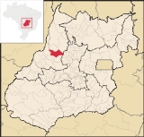
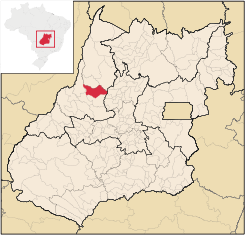
in north-western Goiás
Goiás
Goiás is a state of Brazil, located in the central part of the country. The name Goiás comes from the name of an indigenous community...
state, Brazil
Brazil
Brazil , officially the Federative Republic of Brazil , is the largest country in South America. It is the world's fifth largest country, both by geographical area and by population with over 192 million people...
. The population was 7,482 (2007) in a total area of 2,193.6 km². It is a major producer of cattle.
Location and Municipal Boundaries
Araguapaz is located 268 kilometers northwest of the state capital, Goiânia, in the Rio Vermelho MicroregionRio Vermelho Microregion
The Rio Vermelho Microregion is a geographical region in central Goiás state, Brazil. The most important city is Goiás, also known as Goiás Velho. The Rio Vermelho, a tributary of the Araguaia River flows through the region...
. Connections with Goiânia
Goiânia
-Climate:The city has a tropical wet and dry climate with an average temperature of . There's a wet season, from October to April, and a dry one, from May to September. Annual rainfall is around 1,520 mm....
are made by highways GO-070 / Goianira
Goianira
Goianira is a small city and municipality in central Goiás state, Brazil, located 32 kilometers northwest of the state capital, Goiânia. The population was 24,110 in a total area of 200.4 km² . Goianira is becoming a major producer of shoes.Goianira is four kilometers east of highway BR-457 /...
/ Itaberaí
Itaberaí
Itaberaí is a small city and municipality in central Goiás state, Brazil. Itaberaí is a large producer of agricultural products including corn, rice, soybeans, tomatoes, and sugarcane.-Location:...
/ Goiás
Goiás, Goiás
Goiás is a small city and municipality in the state of Goiás in Brazil. The population was 24,072 in a total area of 3,108 km² . It is the former capital of the state and preserves much of its colonial heritage...
/ GO-164 / Faina. Highway GO-530 continues northwest for 53 kilometers to Aruanã
Aruanã
Aruanã is a small town and municipality in north-western Goiás state, Brazil. It has a total area of 3,050.3 km², with a population of 6,476 in 2007. Aruanã is a tourist spot on the Araguaia River and is a major producer of cattle.-Location:...
on the Araguaia River
Araguaia River
The Araguaia River or, in Portuguese, Rio Araguaia is one of the major rivers of Brazil, and the principal tributary of the Tocantins. It has a total length of approximately 2,627 km. Araguaia means "river of macaws" in the Tupi language....
.
Municipal boundaries:
- North: MozarlândiaMozarlândiaMozarlândia is a small city and municipality in north-central Goiás state, Brazil.It is located in the Valley of the Araguaia River, 300 kilometers from the state capital, Goiânia, and is served by highways GO-164 and GO-334....
- South: Faina
- East: Morro Agudo de GoiásMorro Agudo de GoiásMorro Agudo de Goiás is a small town and municipality in northeastern Goiás state, Brazil.-Location:Monte Agudo de Goiás is located in the north-eastern region of the state near the source of the Rio Tesouras, which flows north into the Araguaia River....
- West: AruanãAruanãAruanã is a small town and municipality in north-western Goiás state, Brazil. It has a total area of 3,050.3 km², with a population of 6,476 in 2007. Aruanã is a tourist spot on the Araguaia River and is a major producer of cattle.-Location:...
and MatrinchãMatrinchãMatrinchã is a small town and municipality in west-central Goiás state, Brazil.-Location:*Statistical microregion: Rio Vermelho Microregion*Distance to the state capital: 261 km.*Distance to regional center : 106 km....
It is in the mini-basin of the Rio do Peixe, a tributary of the Araguaia River
Araguaia River
The Araguaia River or, in Portuguese, Rio Araguaia is one of the major rivers of Brazil, and the principal tributary of the Tocantins. It has a total length of approximately 2,627 km. Araguaia means "river of macaws" in the Tupi language....
. Another important river in the region is the Tesouras.
Demographic and Political Data
- Population density: 3.41 inhab/km² (2007)
- Population growth rate 2000/2007: 0.33.%
- Urban population: 5,218
- Rural population: 2,264
- Eligible voters: 5,676 (12/2007)
- City government in 2005: mayor (José Segundo Rezende Júnior), vice-mayor (Margareth Alves Irineu Luciano), and 09 councilmembers
Economic Information
The economy is practically dependent on the raising of cattle, especially fattening for the urban market. More than ninety percent of the landowners are from large urban areas like GoiâniaGoiânia
-Climate:The city has a tropical wet and dry climate with an average temperature of . There's a wet season, from October to April, and a dry one, from May to September. Annual rainfall is around 1,520 mm....
and São Paulo
São Paulo
São Paulo is the largest city in Brazil, the largest city in the southern hemisphere and South America, and the world's seventh largest city by population. The metropolis is anchor to the São Paulo metropolitan area, ranked as the second-most populous metropolitan area in the Americas and among...
. There were 164,640 cows in 2006, of which 7,100 were milk cows.
The main agricultural products were bananas, coconut, hearts of palm, pineapple, rice, manioc, corn (650 hectares), and soybeans.
- Financial institution in 2007: Brasdesco S.A.
Health and education
- Health establishments: 03 (2002)
- Hospitals: 01 with 07 beds
- Infant mortality rate (in 1,000 live births): 1990—31.02; 2000—21.09
- Schools: 09 with 2,036 students
- Higher education: none reporting
- Literacy rate: 1991—67.8; 2000—78.6
- MHDI: 0.729
- State ranking: 148 (out of 242 municipalities)
- National ranking: 2,453 (out of 5,507 municipalities)
History
Until the 1960s the region was uninhabited. In 1961 Dolzane de Paulo Bastos, from Orizona, Goiás, entered the area with his companions and settled along the banks of the Córrego Cambuí, in a region called Cavalo Queimado. Dolzane and his group offered lots to anyone willing to build a house, and soon other pioneers arrived. By 1962 there were 11 huts made of palm fronds and a dirt road—really a cow path—to the capital GoiásGoiás, Goiás
Goiás is a small city and municipality in the state of Goiás in Brazil. The population was 24,072 in a total area of 3,108 km² . It is the former capital of the state and preserves much of its colonial heritage...
, 120 kilometers away. By 1963 the settlement was raised to a district with the name Cavalo Queimado. Later the name was changed to São Joaquim do Araguaia, and later to Araguapaz, due to its proximity to the Rio Araguaia and the Córrego Isabel Paes. In 1970 the town began to grow with the construction of a road linking Goiás and São Miguel do Araguaia
São Miguel do Araguaia
São Miguel do Araguaia is city in northeastern Goiás state, Brazil. It is the northernmost municipality in Goiás, one of the largest too, and a major producer of cattle....
. This road was known as the Estrada dos Bois (the highway of the cows). Later a road was opened from Araguapaz to Aruanã
Aruanã
Aruanã is a small town and municipality in north-western Goiás state, Brazil. It has a total area of 3,050.3 km², with a population of 6,476 in 2007. Aruanã is a tourist spot on the Araguaia River and is a major producer of cattle.-Location:...
, opening up possibilities of tourism. In 1982 Araguapaz was elevated to a municipality.