
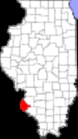
Monroe County, Illinois
Encyclopedia
Monroe County is a county located in the U.S. state
of Illinois
. According to the 2010 census, it has a population of 32,957, which is an increase of 19.3% from 27,619 in 2000. Its county seat
is Waterloo
. Its largest city is Columbia
.
The western part of the county on the Mississippi River
is part of the American Bottom
floodplain, while the eastern portion of the county is relatively flat and was originally prairie
. The transition zone between has high bluffs
of limestone
and dolomite
and has distinctive Karst
topography with numerous sinkholes, caves, and springs
.
lived along the Mississippi River and related waterways for thousands of years before European contact. French
Jesuit priests in the Illinois Country
encountered the Kaskaskia
and Cahokia
, bands of the Illiniwek
confederacy.
The first Europe
an settlement in this area was St. Philippe, founded in 1723 by Philip Francois Renault
, a French
courtier
, on his concession about three miles north of Fort de Chartres
, on the Mississippi River
. This early agricultural community quickly produced a surplus, and grains were sold to the lower Louisiana
colony for years.
After the American Revolution
, Monroe County was formed in 1816 out of Randolph
and St. Clair Counties
, as the 8th county created from the then Illinois Territory
.
It was named in honor of James Monroe
, who had just served as United States Secretary of War
and who was elected President
later that same year. Its first county seat was Harrisonville
named for William Henry Harrison
, former governor of the Northwest Territory
and future President. Harrison actually invested in several tracts of land in the American Bottoms above Harrisonville, mostly in the present precinct of Moredock, ownership of which he retained until his death.
Waterloo
assumed the mantle of county seat in 1825. The sites of the old towns of St. Philippe and Harrisonville were submerged by the Mississippi River
, in flooding caused by deforestation
of river banks during the steamboat
years. Crews cut so many trees that banks destabilized, making the river wider and more shallow from St. Louis to the confluence with the Ohio River
. It caused more severe flooding, as well as lateral channel changes, such as the one that cut off the village of Kaskaskia
from the Illinois mainland.
An unincorporated community of Harrisonville was re-established east of the original site. The bounds of Monroe County in 1816 did not include Precincts 1 and 6 (village of Hecker and Prairie du Long), Precinct 1 and most of 6 was added in 1825 from St. Clair County
. The strip of Precinct 6 from the survey township line east to the Kaskaskia was added, once again from St. Clair, two years later in 1827. Some minor adjustments and clarifications of the boundaries have taken place, but the borders have remained essentially static since 1827.
As of the census
of 2000, there were 27,619 people, 10,275 households, and 7,778 families residing in the county. The population density
was 71 people per square mile (27/km²). There were 10,749 housing units at an average density of 28 per square mile (11/km²). The racial makeup of the county was 98.77% White
, 0.05% Black
or African American
, 0.19% Native American
, 0.31% Asian
, 0.18% from other races
, and 0.50% from two or more races. 0.74% of the population were Hispanic
or Latino
of any race. 57.1% were of German
, 8.5% Irish
, 7.4% American
and 5.8% English
ancestry according to Census 2000.
There were 10,275 households out of which 37.70% had children under the age of 18 living with them, 65.30% were married couples
living together, 7.30% had a female householder with no husband present, and 24.30% were non-families. 21.30% of all households were made up of individuals and 9.60% had someone living alone who was 65 years of age or older. The average household size was 2.65 and the average family size was 3.09.
In the county the population was spread out with 26.40% under the age of 18, 7.40% from 18 to 24, 30.60% from 25 to 44, 22.20% from 45 to 64, and 13.40% who were 65 years of age or older. The median age was 38 years. For every 100 females there were 96.80 males. For every 100 females age 18 and over, there were 93.60 males.
The median income for a household in the county was $55,320, and the median income for a family was $62,397. Males had a median income of $41,243 versus $27,130 for females. The per capita income
for the county was $22,954. About 2.30% of families and 3.40% of the population were below the poverty line, including 2.80% of those under age 18 and 7.30% of those age 65 or over.
|
|
|}
|
|
|
|
|}
The closest access to and bridges over the Kaskaskia are downriver at Baldwin
in Randolph County and upriver at New Athens
in St. Clair County. South of Monroe County, there is a ferry across the Mississippi in Randolph County, providing access to Ste. Genevieve
, Missouri
and Pere Marquette State Park
, and a bridge at Chester
.
tracks run though the Bottoms from the intermodal
yard at Dupo in St. Clair County, running roughly parallel to Bluff Rd. which crosses them several times, through old Valmeyer and Fults on past Prairie du Rocher in Randolph County. The tracks are still in use, but carry only freight, and have no stops in Monroe County.
U.S. state
A U.S. state is any one of the 50 federated states of the United States of America that share sovereignty with the federal government. Because of this shared sovereignty, an American is a citizen both of the federal entity and of his or her state of domicile. Four states use the official title of...
of Illinois
Illinois
Illinois is the fifth-most populous state of the United States of America, and is often noted for being a microcosm of the entire country. With Chicago in the northeast, small industrial cities and great agricultural productivity in central and northern Illinois, and natural resources like coal,...
. According to the 2010 census, it has a population of 32,957, which is an increase of 19.3% from 27,619 in 2000. Its county seat
County seat
A county seat is an administrative center, or seat of government, for a county or civil parish. The term is primarily used in the United States....
is Waterloo
Waterloo, Illinois
Waterloo is a city in Monroe County, Illinois, United States. The population was 7,614 at the 2000 census. It is the county seat of Monroe County.-Geography:Waterloo is located at ....
. Its largest city is Columbia
Columbia, Illinois
Columbia is a city in Monroe and St. Clair County in the U.S. state of Illinois, about south of St. Louis, Missouri. The population was 7,922 at the 2000 census.-History:...
.
Geography
According to the 2010 census, the county has a total area of 398.04 square miles (1,030.9 km²), of which 385.01 square miles (997.2 km²) (or 96.73%) is land and 13.02 square miles (33.7 km²) (or 3.27%) is water.The western part of the county on the Mississippi River
Mississippi River
The Mississippi River is the largest river system in North America. Flowing entirely in the United States, this river rises in western Minnesota and meanders slowly southwards for to the Mississippi River Delta at the Gulf of Mexico. With its many tributaries, the Mississippi's watershed drains...
is part of the American Bottom
American Bottom
The American Bottom is the flood plain of the Mississippi River in the Metro-East region of Southern Illinois, extending from Alton, Illinois, to the Kaskaskia River. It is also sometimes called "American Bottoms". The area is about , mostly protected from flooding by a levee and drainage canal...
floodplain, while the eastern portion of the county is relatively flat and was originally prairie
Prairie
Prairies are considered part of the temperate grasslands, savannas, and shrublands biome by ecologists, based on similar temperate climates, moderate rainfall, and grasses, herbs, and shrubs, rather than trees, as the dominant vegetation type...
. The transition zone between has high bluffs
Cliff
In geography and geology, a cliff is a significant vertical, or near vertical, rock exposure. Cliffs are formed as erosion landforms due to the processes of erosion and weathering that produce them. Cliffs are common on coasts, in mountainous areas, escarpments and along rivers. Cliffs are usually...
of limestone
Limestone
Limestone is a sedimentary rock composed largely of the minerals calcite and aragonite, which are different crystal forms of calcium carbonate . Many limestones are composed from skeletal fragments of marine organisms such as coral or foraminifera....
and dolomite
Dolomite
Dolomite is a carbonate mineral composed of calcium magnesium carbonate CaMg2. The term is also used to describe the sedimentary carbonate rock dolostone....
and has distinctive Karst
KARST
Kilometer-square Area Radio Synthesis Telescope is a Chinese telescope project to which FAST is a forerunner. KARST is a set of large spherical reflectors on karst landforms, which are bowlshaped limestone sinkholes named after the Kras region in Slovenia and Northern Italy. It will consist of...
topography with numerous sinkholes, caves, and springs
Spring (hydrosphere)
A spring—also known as a rising or resurgence—is a component of the hydrosphere. Specifically, it is any natural situation where water flows to the surface of the earth from underground...
.
Major highways


Adjacent counties
- St. Clair CountySt. Clair County, IllinoisSt. Clair County is a county located in the U.S. state of Illinois. In 1970, the U.S. Census Bureau placed the mean center of U.S. population in St. Clair County. According to the 2010 census, it has a population of 270,056, which is an increase of 5.5% from 256,082 in 2000. Its county seat is...
- northeast - Randolph CountyRandolph County, IllinoisRandolph County is a county located in the U.S. state of Illinois. According to the 2010 census, it has a population of 33,476, which is a decrease of 1.2% from 33,893 in 2000. Its county seat is Chester....
- southeast - Ste. Genevieve County, MissouriMissouriMissouri is a US state located in the Midwestern United States, bordered by Iowa, Illinois, Kentucky, Tennessee, Arkansas, Oklahoma, Kansas and Nebraska. With a 2010 population of 5,988,927, Missouri is the 18th most populous state in the nation and the fifth most populous in the Midwest. It...
- south - Jefferson CountyJefferson County, MissouriJefferson County is a county located in East Central Missouri in the United States. The county was included as the mean center of U.S. population in 1980. It is the sixth most-populous county in Missouri. Census 2010 put the population at 218,733 Its county seat is Hillsboro. The county was...
, MissouriMissouriMissouri is a US state located in the Midwestern United States, bordered by Iowa, Illinois, Kentucky, Tennessee, Arkansas, Oklahoma, Kansas and Nebraska. With a 2010 population of 5,988,927, Missouri is the 18th most populous state in the nation and the fifth most populous in the Midwest. It...
- west - St. Louis CountySt. Louis County, MissouriSt. Louis County is a county located in the U.S. state of Missouri. Its county seat is Clayton. St. Louis County is part of the St. Louis Metro Area wherein the independent City of St. Louis and its suburbs in St. Louis County, as well as the surrounding counties in both Missouri and Illinois all...
, MissouriMissouriMissouri is a US state located in the Midwestern United States, bordered by Iowa, Illinois, Kentucky, Tennessee, Arkansas, Oklahoma, Kansas and Nebraska. With a 2010 population of 5,988,927, Missouri is the 18th most populous state in the nation and the fifth most populous in the Midwest. It...
- northwest
History
Indigenous peoplesIndigenous peoples
Indigenous peoples are ethnic groups that are defined as indigenous according to one of the various definitions of the term, there is no universally accepted definition but most of which carry connotations of being the "original inhabitants" of a territory....
lived along the Mississippi River and related waterways for thousands of years before European contact. French
French people
The French are a nation that share a common French culture and speak the French language as a mother tongue. Historically, the French population are descended from peoples of Celtic, Latin and Germanic origin, and are today a mixture of several ethnic groups...
Jesuit priests in the Illinois Country
Illinois Country
The Illinois Country , also known as Upper Louisiana, was a region in what is now the Midwestern United States that was explored and settled by the French during the 17th and 18th centuries. The terms referred to the entire Upper Mississippi River watershed, though settlement was concentrated in...
encountered the Kaskaskia
Kaskaskia
The Kaskaskia were one of about a dozen cognate tribes that made up the Illiniwek Confederation or Illinois Confederation. Their longstanding homeland was in the Great Lakes region...
and Cahokia
Cahokia
Cahokia Mounds State Historic Site is the area of an ancient indigenous city located in the American Bottom floodplain, between East Saint Louis and Collinsville in south-western Illinois, across the Mississippi River from St. Louis, Missouri. The site included 120 human-built earthwork mounds...
, bands of the Illiniwek
Illiniwek
The Illinois Confederation, sometimes referred to as the Illiniwek or Illini, were a group of twelve to thirteen Native American tribes in the upper Mississippi River valley of North America...
confederacy.
The first Europe
Europe
Europe is, by convention, one of the world's seven continents. Comprising the westernmost peninsula of Eurasia, Europe is generally 'divided' from Asia to its east by the watershed divides of the Ural and Caucasus Mountains, the Ural River, the Caspian and Black Seas, and the waterways connecting...
an settlement in this area was St. Philippe, founded in 1723 by Philip Francois Renault
Philip Francois Renault
Philip Francois Renault , a French explorer and favorite courtier of King Louis XV, left his native Picardy in 1719 for the Illinois Country. He was to lead efforts to develop mining in the Illinois Country. He was more successful with his concession of land fronting the Mississippi River on which...
, a French
French people
The French are a nation that share a common French culture and speak the French language as a mother tongue. Historically, the French population are descended from peoples of Celtic, Latin and Germanic origin, and are today a mixture of several ethnic groups...
courtier
Courtier
A courtier is a person who is often in attendance at the court of a king or other royal personage. Historically the court was the centre of government as well as the residence of the monarch, and social and political life were often completely mixed together...
, on his concession about three miles north of Fort de Chartres
Fort de Chartres
Fort de Chartres was a French fortification first built in 1720 on the east bank of the Mississippi River in present-day Illinois. The Fort de Chartres name was also applied to the two successive fortifications built nearby during the 18th century in the era of French colonial control over...
, on the Mississippi River
Mississippi River
The Mississippi River is the largest river system in North America. Flowing entirely in the United States, this river rises in western Minnesota and meanders slowly southwards for to the Mississippi River Delta at the Gulf of Mexico. With its many tributaries, the Mississippi's watershed drains...
. This early agricultural community quickly produced a surplus, and grains were sold to the lower Louisiana
Louisiana
Louisiana is a state located in the southern region of the United States of America. Its capital is Baton Rouge and largest city is New Orleans. Louisiana is the only state in the U.S. with political subdivisions termed parishes, which are local governments equivalent to counties...
colony for years.
After the American Revolution
American Revolution
The American Revolution was the political upheaval during the last half of the 18th century in which thirteen colonies in North America joined together to break free from the British Empire, combining to become the United States of America...
, Monroe County was formed in 1816 out of Randolph
Randolph County, Illinois
Randolph County is a county located in the U.S. state of Illinois. According to the 2010 census, it has a population of 33,476, which is a decrease of 1.2% from 33,893 in 2000. Its county seat is Chester....
and St. Clair Counties
St. Clair County, Illinois
St. Clair County is a county located in the U.S. state of Illinois. In 1970, the U.S. Census Bureau placed the mean center of U.S. population in St. Clair County. According to the 2010 census, it has a population of 270,056, which is an increase of 5.5% from 256,082 in 2000. Its county seat is...
, as the 8th county created from the then Illinois Territory
Illinois Territory
The Territory of Illinois was an organized incorporated territory of the United States that existed from March 1, 1809, until December 3, 1818, when the southern portion of the territory was admitted to the Union as the State of Illinois. The area was earlier known as "Illinois Country" while under...
.
Beginning on the Mississippi River where the base
line, which is about three-fourths of a mile below Judge Briggs's present
residence, strikes the said river; thence with the base line until it strikes
the first township line therefrom; thence southeast to the southeast corner
of township two south, range nine west; thence south to the southeast
corner of township four north, range nine west; thence southwestwardly
to the Mississippi, so as to include Alexander McNabb's farm, and thence
up the Mississippi to the beginning shall constitute a separate county, to
be called MONROE.
Illinois Territorial Laws 1815-16, p. 25
It was named in honor of James Monroe
James Monroe
James Monroe was the fifth President of the United States . Monroe was the last president who was a Founding Father of the United States, and the last president from the Virginia dynasty and the Republican Generation...
, who had just served as United States Secretary of War
United States Secretary of War
The Secretary of War was a member of the United States President's Cabinet, beginning with George Washington's administration. A similar position, called either "Secretary at War" or "Secretary of War," was appointed to serve the Congress of the Confederation under the Articles of Confederation...
and who was elected President
President of the United States
The President of the United States of America is the head of state and head of government of the United States. The president leads the executive branch of the federal government and is the commander-in-chief of the United States Armed Forces....
later that same year. Its first county seat was Harrisonville
Harrisonville, Illinois
Harrisonville, Illinois is a small unincorporated community in the historic Harrisonville Precinct of Monroe County, Illinois.-History:Harrisonville was the first county seat of Monroe County, and was originally called Carthage, or even earlier Brashear's Fort...
named for William Henry Harrison
William Henry Harrison
William Henry Harrison was the ninth President of the United States , an American military officer and politician, and the first president to die in office. He was 68 years, 23 days old when elected, the oldest president elected until Ronald Reagan in 1980, and last President to be born before the...
, former governor of the Northwest Territory
Northwest Territory
The Territory Northwest of the River Ohio, more commonly known as the Northwest Territory, was an organized incorporated territory of the United States that existed from July 13, 1787, until March 1, 1803, when the southeastern portion of the territory was admitted to the Union as the state of Ohio...
and future President. Harrison actually invested in several tracts of land in the American Bottoms above Harrisonville, mostly in the present precinct of Moredock, ownership of which he retained until his death.
Waterloo
Waterloo, Illinois
Waterloo is a city in Monroe County, Illinois, United States. The population was 7,614 at the 2000 census. It is the county seat of Monroe County.-Geography:Waterloo is located at ....
assumed the mantle of county seat in 1825. The sites of the old towns of St. Philippe and Harrisonville were submerged by the Mississippi River
Mississippi River
The Mississippi River is the largest river system in North America. Flowing entirely in the United States, this river rises in western Minnesota and meanders slowly southwards for to the Mississippi River Delta at the Gulf of Mexico. With its many tributaries, the Mississippi's watershed drains...
, in flooding caused by deforestation
Deforestation
Deforestation is the removal of a forest or stand of trees where the land is thereafter converted to a nonforest use. Examples of deforestation include conversion of forestland to farms, ranches, or urban use....
of river banks during the steamboat
Steamboat
A steamboat or steamship, sometimes called a steamer, is a ship in which the primary method of propulsion is steam power, typically driving propellers or paddlewheels...
years. Crews cut so many trees that banks destabilized, making the river wider and more shallow from St. Louis to the confluence with the Ohio River
Ohio River
The Ohio River is the largest tributary, by volume, of the Mississippi River. At the confluence, the Ohio is even bigger than the Mississippi and, thus, is hydrologically the main stream of the whole river system, including the Allegheny River further upstream...
. It caused more severe flooding, as well as lateral channel changes, such as the one that cut off the village of Kaskaskia
Kaskaskia
The Kaskaskia were one of about a dozen cognate tribes that made up the Illiniwek Confederation or Illinois Confederation. Their longstanding homeland was in the Great Lakes region...
from the Illinois mainland.
An unincorporated community of Harrisonville was re-established east of the original site. The bounds of Monroe County in 1816 did not include Precincts 1 and 6 (village of Hecker and Prairie du Long), Precinct 1 and most of 6 was added in 1825 from St. Clair County
St. Clair County, Illinois
St. Clair County is a county located in the U.S. state of Illinois. In 1970, the U.S. Census Bureau placed the mean center of U.S. population in St. Clair County. According to the 2010 census, it has a population of 270,056, which is an increase of 5.5% from 256,082 in 2000. Its county seat is...
. The strip of Precinct 6 from the survey township line east to the Kaskaskia was added, once again from St. Clair, two years later in 1827. Some minor adjustments and clarifications of the boundaries have taken place, but the borders have remained essentially static since 1827.
Demographics
As of the census
Census
A census is the procedure of systematically acquiring and recording information about the members of a given population. It is a regularly occurring and official count of a particular population. The term is used mostly in connection with national population and housing censuses; other common...
of 2000, there were 27,619 people, 10,275 households, and 7,778 families residing in the county. The population density
Population density
Population density is a measurement of population per unit area or unit volume. It is frequently applied to living organisms, and particularly to humans...
was 71 people per square mile (27/km²). There were 10,749 housing units at an average density of 28 per square mile (11/km²). The racial makeup of the county was 98.77% White
Race (United States Census)
Race and ethnicity in the United States Census, as defined by the Federal Office of Management and Budget and the United States Census Bureau, are self-identification data items in which residents choose the race or races with which they most closely identify, and indicate whether or not they are...
, 0.05% Black
Race (United States Census)
Race and ethnicity in the United States Census, as defined by the Federal Office of Management and Budget and the United States Census Bureau, are self-identification data items in which residents choose the race or races with which they most closely identify, and indicate whether or not they are...
or African American
Race (United States Census)
Race and ethnicity in the United States Census, as defined by the Federal Office of Management and Budget and the United States Census Bureau, are self-identification data items in which residents choose the race or races with which they most closely identify, and indicate whether or not they are...
, 0.19% Native American
Race (United States Census)
Race and ethnicity in the United States Census, as defined by the Federal Office of Management and Budget and the United States Census Bureau, are self-identification data items in which residents choose the race or races with which they most closely identify, and indicate whether or not they are...
, 0.31% Asian
Race (United States Census)
Race and ethnicity in the United States Census, as defined by the Federal Office of Management and Budget and the United States Census Bureau, are self-identification data items in which residents choose the race or races with which they most closely identify, and indicate whether or not they are...
, 0.18% from other races
Race (United States Census)
Race and ethnicity in the United States Census, as defined by the Federal Office of Management and Budget and the United States Census Bureau, are self-identification data items in which residents choose the race or races with which they most closely identify, and indicate whether or not they are...
, and 0.50% from two or more races. 0.74% of the population were Hispanic
Race (United States Census)
Race and ethnicity in the United States Census, as defined by the Federal Office of Management and Budget and the United States Census Bureau, are self-identification data items in which residents choose the race or races with which they most closely identify, and indicate whether or not they are...
or Latino
Race (United States Census)
Race and ethnicity in the United States Census, as defined by the Federal Office of Management and Budget and the United States Census Bureau, are self-identification data items in which residents choose the race or races with which they most closely identify, and indicate whether or not they are...
of any race. 57.1% were of German
Germans
The Germans are a Germanic ethnic group native to Central Europe. The English term Germans has referred to the German-speaking population of the Holy Roman Empire since the Late Middle Ages....
, 8.5% Irish
Irish people
The Irish people are an ethnic group who originate in Ireland, an island in northwestern Europe. Ireland has been populated for around 9,000 years , with the Irish people's earliest ancestors recorded having legends of being descended from groups such as the Nemedians, Fomorians, Fir Bolg, Tuatha...
, 7.4% American
United States
The United States of America is a federal constitutional republic comprising fifty states and a federal district...
and 5.8% English
English people
The English are a nation and ethnic group native to England, who speak English. The English identity is of early mediaeval origin, when they were known in Old English as the Anglecynn. England is now a country of the United Kingdom, and the majority of English people in England are British Citizens...
ancestry according to Census 2000.
There were 10,275 households out of which 37.70% had children under the age of 18 living with them, 65.30% were married couples
Marriage
Marriage is a social union or legal contract between people that creates kinship. It is an institution in which interpersonal relationships, usually intimate and sexual, are acknowledged in a variety of ways, depending on the culture or subculture in which it is found...
living together, 7.30% had a female householder with no husband present, and 24.30% were non-families. 21.30% of all households were made up of individuals and 9.60% had someone living alone who was 65 years of age or older. The average household size was 2.65 and the average family size was 3.09.
In the county the population was spread out with 26.40% under the age of 18, 7.40% from 18 to 24, 30.60% from 25 to 44, 22.20% from 45 to 64, and 13.40% who were 65 years of age or older. The median age was 38 years. For every 100 females there were 96.80 males. For every 100 females age 18 and over, there were 93.60 males.
The median income for a household in the county was $55,320, and the median income for a family was $62,397. Males had a median income of $41,243 versus $27,130 for females. The per capita income
Per capita income
Per capita income or income per person is a measure of mean income within an economic aggregate, such as a country or city. It is calculated by taking a measure of all sources of income in the aggregate and dividing it by the total population...
for the county was $22,954. About 2.30% of families and 3.40% of the population were below the poverty line, including 2.80% of those under age 18 and 7.30% of those age 65 or over.
Villages
|-valign="top"|
- FultsFults, IllinoisFults is a village in the Renault precinct of Monroe County, Illinois, United States. The population was 28 at the 2000 census. It is located entirely within the American Bottom floodplain.-Geography:Fults is located at ....
- HeckerHecker, IllinoisHecker is a village in Monroe County, Illinois, United States. The population was 475 at the 2000 census.- History :Hecker was originally named Freedom. The town was laid out on land of Theodore Hilgard. It was platted and surveyed by Thomas Singleton, county surveyor, December 18, 1840, the first...
|
- MaeystownMaeystown, IllinoisMaeystown is a village in Monroe County, Illinois, United States. The population was 148 at the 2000 census.-Geography:According to the United States Census Bureau, the village has a total area of , all of it land.-History:...
- ValmeyerValmeyer, IllinoisValmeyer is a village in Monroe County, Illinois, United States, on the Mississippi River. The population was 1200 at the 2006 census.-History:...
|}
Unincorporated communities
|-valign="top"|
- AmesAmes, IllinoisAmes is a small unincorporated community in the Renault Precinct of Monroe County, Illinois, United States....
- BurksvilleBurksville, IllinoisBurksville, Illinois is small unincorporated community in the historic New Design Precinct of Monroe County, Illinois, United States. Originally developed by John P. Brown, Burksville was named in 1857 after John G. Burkhardt, a resident of St. Louis, who opened a store there in 1851 It lies along...
- Burksville StationBurksville Station, IllinoisBurksville Station is a small unincorporated community in the New Design Precinct of Monroe County, Illinois, United States. It grew up around a station on the St. Louis and Cairo Railroad....
- Chaflin BridgeChaflin Bridge, IllinoisChalfin Bridge, Illinois is a small unincorporated community in the historic Mitchie Precinct of Monroe County, Illinois, United States. It lies on the old Bluff Road in the American Bottoms between Fults and the old site of Valmeyer and near Maeystown....
|
- Foster PondFoster Pond, IllinoisFoster Pond, Illinois is a small unincorporated community in the historic Bluff Precinct of Monroe County, Illinois, United States. It is located along the historic road, the present Illinois Route 156 which ran from the landings on the Mississippi River at the old county seat of Harrisonville to...
- FountainFountain, IllinoisFountain, Illinois is a small unincorporated community in the historic Moredock Precinct of Monroe County, Illinois, United States. It is located just off Bluff Road in the American Bottoms, situated next to the levees lining Fountain Creek as it makes its way west toward the Mississippi River....
- HarrisonvilleHarrisonville, IllinoisHarrisonville, Illinois is a small unincorporated community in the historic Harrisonville Precinct of Monroe County, Illinois.-History:Harrisonville was the first county seat of Monroe County, and was originally called Carthage, or even earlier Brashear's Fort...
- MadonnavilleMadonnaville, IllinoisMadonnaville, Illinois is a small unincorporated community in the historic Bluff Precinct of Monroe County, Illinois, United States. It was laid out by Joseph W. Ruebsam, who erected the first building and started a store there shortly thereafter. St. Mary’s Catholic Church was built in 1857....
|
- MerrimacMerrimac, IllinoisMerrimac, Illinois is a small unincorporated community in the historic Moredock Precinct of Monroe County, Illinois, United States. It is located in the American Bottoms, adjacent to the Mississippi River levee due south of that rivers confluence with the Meramec. It takes its name, from this river...
- Monroe CityMonroe City, IllinoisMonroe City, Illinois is a small unincorporated community in the historic Bluff Precinct of Monroe County, Illinois, United States. It had formerly been called James’ Mill, Nosers' Mill, and Monrovia. There was also a settlement a short distance away called Woodville; some sources equate the two. ...
- New HanoverNew Hanover, IllinoisNew Hanover, Illinois is a small unincorporated community in Monroe County, Illinois, United States. It derives its name from Hanover, Germany, of which many of the immediate area's settlers, including notably Henry B. Stehr, its founder, were natives. It was platted and surveyed by Hugo Ropiquet,...
- RenaultRenault, IllinoisRenault, Illinois is a small unincorporated community in the historic Renault Precinct of Monroe County, Illinois.-Philip Francois Renault:Renault and its surrounding precinct within Monroe County, bear the name of one of the most conspicuous men connected with the early French settlements of...
|
- St. JoeSt. Joe, IllinoisSt. Joe, Illinois is a small unincorporated community in the historic New Design Precinct of Monroe County, Illinois, United States. It is located along the historic road from Kaskaskia to St. Louis, between Renault and Burksville....
- Tipton
- WartburgWartburg, IllinoisWartburg, Illinois is a small unincorporated community in the historic New Design Precinct of Monroe County, Illinois, United States. Wartburg lies along the road from Waterloo to Mayestown, and Camp Wartburg, a Lutheran youth retreat, is nearby.-History:...
|}
Highways
- Interstate 255Interstate 255Interstate 255 is a bypass route of Interstate 55 near St. Louis, Missouri and with Interstate 270, it forms a loop around the city. Even though St. Louis is in Missouri, a majority of the route runs through Illinois. It shares its southern terminus with 270 at the junction with Interstate 55, 270...
From Jefferson Barracks Bridge and Missouri east to Route 3 north of Columbia, then north toward Dupo
- Provides access to the Interstate System, South Saint Louis County via the J.B. bridge as well as Downtown St. Louis and western St. Clair County
- Illinois Route 3Illinois Route 3Illinois Route 3 is a major north–south arterial state highway in southwestern Illinois. It has its southern terminus at Cairo Junction at the intersection of Interstate 57 and U.S. Route 51, and its northern terminus in Grafton at Illinois Route 100...
From Interstate 255 and Dupo south southeast through Columbia and Waterloo on turning west toward Red Bud
- Illinois Route 3
- Main north-south corridor and the backbone of Monroe County, it is the only major north-south route in Illinois not upgraded to Interstate standard
- Illinois Route 156Illinois Route 156Illinois Route 156 is an east–west state road in southwestern Illinois. It runs from South Meyer Avenue & C Road in Valmeyer to just west of New Athens. This is a distance of .- Route description :...
From western terminus at Valmeyer east through Waterloo to Hecker and on toward New Athens
- Illinois Route 156
- Also called the Valmeyer highway or Hecker highway, west and east of Waterloo, respectively, it runs from the bluffs of the Mississippi to the Kaskaskia
- Illinois Route 158Illinois Route 158Illinois Route 158 is an east–west state road in southwestern Illinois. Its western terminus is at Illinois Route 3 in Columbia and its eastern terminus is at U.S. Route 50, in O'Fallon. This is a distance of .- Route description :...
From western terminus south of Columbia at Route 3, east northeast toward Millstadt
- Illinois Route 158
- The area's main link with central and eastern St. Clair County for those not near Hecker
- Illinois Route 159Illinois Route 159Illinois Route 159 is a north–south state road in southwestern Illinois. Its southern terminus is at Illinois Route 3 and Illinois Route 154 in Red Bud and its northern terminus at Illinois Route 16 in Royal Lakes. This is a distance of ....
From southern terminus in Red Bud at Route 3, north through Prairie du Long to Hecker and on toward Smithton
- Illinois Route 159
- Significant eastern north-south corridor, provides alternate routes, and primary north-south link for Prairie Du Long and Hecker
County roads
- Bluff Road
- runs along the bluffs from Palmer Rd. northwest of Columbia, through old Valmeyer and Chalfin Bridge, past Fults to Prairie du Rocher in Randolph County
- Maeystown Road
- runs from Illinois Route 3 in Waterloo (as Lakeview Drive) through Wartburg and Maeystown to Bluff Rd. at Chalfin Bridge
- Kaskaskia Road
- historic route from Kaskaskia to St. Louis, leaves Illinois Route 3 south of Waterloo, passes through Burksville and St. Joe, descends into the Bottoms outside Renault, crosses Bluff Rd. and railroad tracks to Stringtown Rd.
- Hanover Road
- Runs from Route 3 west, past New Hanover down the Fountain Gap to Bluff Rd. at Miles Rd. and B Rd.. Marks approximate future border between Columbia and Waterloo.
- HH Road
- Runs from Gilmore Lakes Rd., north of Floraville Rd., west across Route 3 in Waterloo (as Country Club Ln.) to Bluff Rd. east of Fountain
- KK Road
- Runs from the Mississippi River levee opposite Crystal City, Missouri, west across Bluff Rd. up the bluffs at Monroe City, through Madonnaville, across Maeystown Rd., through Burksville and Burksville Station, across Route 3 to J Rd. south of Route 156
Public Transportation
- There is a regular MetroBusMetroBus (St. Louis)MetroBus is the public bus service for the Greater St. Louis Region connected with the MetroLink light rail system. It is managed by the Bi-State Development Agency and uses a shared fare system with the MetroLink rail.-Service:...
express bus, 502X Waterloo-Columbia, running from Waterloo, through Columbia, to the MetroLink station5th & Missouri (St. Louis MetroLink)5th & Missouri is a St. Louis MetroLink station located in East St. Louis, Illinois. The station features 322 Park-Ride spaces, including 25 long term spaces.-MetroBus:*1 Main Street-State St*2 Cahokia*4 Bond Ave-19th & Central...
in East St. Louis.
Rivers
- Mississippi River
- Bridges and ferries
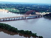
- Jefferson Barracks BridgeJefferson Barracks BridgeThe Jefferson Barracks Bridge, often called the J.B. Bridge, is a pair of bridges that span the Mississippi River on the south side of St. Louis, Missouri. Both bridges are long steel arch bridges. The first bridge was built in 1983, the south bridge opened in 1992...
- crosses the Mississippi northwest of Columbia, carries Interstate 255
- Jefferson Barracks Bridge
- Access
- none
- Kaskaskia River
- none
- Bridges and ferries
- none
- Access
- none
The closest access to and bridges over the Kaskaskia are downriver at Baldwin
Baldwin, Illinois
Baldwin is a village in Randolph County, Illinois, United States. The population was 434 at the 2000 census. Baldwin Lake State Fish and Wildlife Area is nearby.-Geography:Baldwin is located at ....
in Randolph County and upriver at New Athens
New Athens, Illinois
New Athens is a village in St. Clair County, Illinois, United States. Based upon common usage, the 'A' is always sounded with a long vowel, rather than a short vowel, by its residents, unlike the most commonly used English pronunciation of the city in Greece....
in St. Clair County. South of Monroe County, there is a ferry across the Mississippi in Randolph County, providing access to Ste. Genevieve
Ste. Genevieve, Missouri
Ste. Genevieve is a city in and the county seat of Ste. Genevieve County, Missouri, United States. The population was 11,654 at the 2000 census...
, Missouri
Missouri
Missouri is a US state located in the Midwestern United States, bordered by Iowa, Illinois, Kentucky, Tennessee, Arkansas, Oklahoma, Kansas and Nebraska. With a 2010 population of 5,988,927, Missouri is the 18th most populous state in the nation and the fifth most populous in the Midwest. It...
and Pere Marquette State Park
Pere Marquette State Park
Pere Marquette State Park is an 8,050-acre protected area in southwestern Jersey County, Illinois, United States. It is located near the city of Grafton, Illinois, at the confluence of the Mississippi River and the Illinois River...
, and a bridge at Chester
Chester Bridge
The Chester Bridge is a truss bridge connecting Missouri's Route 51 with Illinois Route 150 across the Mississippi River between Perryville, Missouri and Chester, Illinois...
.
Rail
While the railroad played a large part in the history and development of the county, the main line through the county, running along Illinois Route 3, has been abandoned and removed. However, Union PacificUnion Pacific Railroad
The Union Pacific Railroad , headquartered in Omaha, Nebraska, is the largest railroad network in the United States. James R. Young is president, CEO and Chairman....
tracks run though the Bottoms from the intermodal
Intermodal freight transport
Intermodal freight transport involves the transportation of freight in an intermodal container or vehicle, using multiple modes of transportation , without any handling of the freight itself when changing modes. The method reduces cargo handling, and so improves security, reduces damages and...
yard at Dupo in St. Clair County, running roughly parallel to Bluff Rd. which crosses them several times, through old Valmeyer and Fults on past Prairie du Rocher in Randolph County. The tracks are still in use, but carry only freight, and have no stops in Monroe County.
Precincts
For census and election purposes, Monroe County is currently divided into 26 numbered precincts (1-27, for some reason there is no Precinct 14). However, for geographical, genealogical, and historic purposes the older, named precincts are of greater utility.- Bluff Precinct
- named for the ubiqitous limestone cliffs it sits atop and which run along its western bounds.
- Columbia Precinct
- formerly Eagle Precinct from the original FrenchFrench languageFrench is a Romance language spoken as a first language in France, the Romandy region in Switzerland, Wallonia and Brussels in Belgium, Monaco, the regions of Quebec and Acadia in Canada, and by various communities elsewhere. Second-language speakers of French are distributed throughout many parts...
name for their settlement, L'Aigle- Harrisonville Precinct
- honors William Henry HarrisonWilliam Henry HarrisonWilliam Henry Harrison was the ninth President of the United States , an American military officer and politician, and the first president to die in office. He was 68 years, 23 days old when elected, the oldest president elected until Ronald Reagan in 1980, and last President to be born before the...
who also gave his name to a settlement- Mitchie Precinct
- so named for the Mitchegamie IndiansMitchigameaMitchigamea or Michigamea or Mitchigamie were a tribe in the Illinois Confederation. Not much is known about them and their origin is uncertain. Originally they were said to be from the Lake Michigan, perhaps the Chicago area...
who at one time inhabited the extreme southern part of the county- Moredock Precinct
- after John Moredock, territorial legislator, and Major commanding a battalion in the War of 1812War of 1812The War of 1812 was a military conflict fought between the forces of the United States of America and those of the British Empire. The Americans declared war in 1812 for several reasons, including trade restrictions because of Britain's ongoing war with France, impressment of American merchant...
- New Design Precinct
- named after the settlement began by James Lemen, a confidante of Thomas JeffersonThomas JeffersonThomas Jefferson was the principal author of the United States Declaration of Independence and the Statute of Virginia for Religious Freedom , the third President of the United States and founder of the University of Virginia...
, in 1786- New Hanover Precinct
- as with the settlement, its name recalls Hanover, Germany, hometown of the settlements founder
- Prairie Du Long Precinct
- from hybridHybrid wordA hybrid word is a word which etymologically has one part derived from one language and another part derived from a different language.-Common hybrids:The most common form of hybrid word in English is one which combines etymologically Latin and Greek parts...
French/English "Long Prairie", it was added in 1825, after the county's genesis, the strip along the river in 1827.- Renault Precinct
- also a settlement, for Philip Francois RenaultPhilip Francois RenaultPhilip Francois Renault , a French explorer and favorite courtier of King Louis XV, left his native Picardy in 1719 for the Illinois Country. He was to lead efforts to develop mining in the Illinois Country. He was more successful with his concession of land fronting the Mississippi River on which...
of the French Company of the Indies, an early exploiter of the area- Waterloo Precinct
- formerly Fountain Precinct, from Fountain Creek which runs though it on its way to the bluffs and down to the river
Climate and weather
In recent years, average temperatures in the county seat of Waterloo have ranged from a low of 20 °F (-6.7 °C) in January to a high of 89 °F (31.7 °C) in July, although a record low of -18 °F was recorded in December 1989 and a record high of 107 °F (41.7 °C) was recorded in August 1962. Average monthly precipitation ranged from 2.32 inches (5.9 cm) in January to 4.25 inches (10.8 cm) in July.See also
- Fountain Creek BridgeFountain Creek BridgeFountain Creek Bridge is a historic bridge near Waterloo in Monroe County, Illinois, USA. Built in 1849 and added to the NRHP on December 22, 1978....
- Illinois Caverns State Natural AreaIllinois Caverns State Natural AreaIllinois Caverns is a state natural area in the New Design Precinct of Monroe County, Illinois. It features Illinois Caverns which is alternatively known as Mammoth Cave of Illinois . Illinois Caverns is the second-largest cave in Illinois and has more than 9.6 km of passages...
- Kaskaskia River State Fish and Wildlife AreaKaskaskia River State Fish and Wildlife AreaKaskaskia River State Fish and Wildlife Area is an Illinois state park on in St. Clair, Monroe, and Randolph Counties, Illinois, United States. A focus of this conservation area is Baldwin Lake, a perched cooling pond managed by the Illinois Department of Natural Resources for fishing....
- National Register of Historic Places listings in Monroe County