

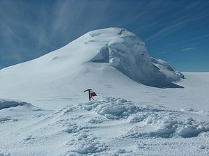
Miziya Peak
Encyclopedia
Vidin Heights
Vidin Heights are predominantly ice-covered heights rising to 604 m on Varna Peninsula, eastern Livingston Island in the South Shetland Islands, Antarctica. The feature is approximately 8 km long from the north end of Leslie Gap east-northeastwards to Inott Point and 9.6 km...
on Varna Peninsula
Varna Peninsula
Varna Peninsula is a roughly rectangular predominantly ice-covered peninsula forming the northeast extremity of Livingston Island in the South Shetland Islands, Antarctica...
, eastern Livingston Island in the South Shetland Islands
South Shetland Islands
The South Shetland Islands are a group of Antarctic islands, lying about north of the Antarctic Peninsula, with a total area of . By the Antarctic Treaty of 1959, the Islands' sovereignty is neither recognized nor disputed by the signatories and they are free for use by any signatory for...
, Antarctica. The peak overlooks Kaliakra Glacier
Kaliakra Glacier
Kaliakra Glacier is a glacier in northeastern Livingston Island, Antarctica extending 7 km in east-west direction and 8 km in north-south direction...
to the south, and Saedinenie Snowfield
Saedinenie Snowfield
Saedinenie Snowfield on Livingston Island in the South Shetland Islands, Antarctica, is bounded by Teres Ridge to the west, the glacial divide between the Drake Passage and Bransfield Strait to the south, Gleaner Heights, Elhovo Gap and Leslie Hill to the southeast, and Leslie Gap and Vidin...
to the northwest.
The peak is named after the Bulgarian town of Miziya
Miziya
Miziya is a town and municipality in Vratsa Province, northwestern Bulgaria near the Danube river. As of December 2009, the town has a population of 3,354 inhabitants....
in relation to the ancient Thracian
Thrace
Thrace is a historical and geographic area in southeast Europe. As a geographical concept, Thrace designates a region bounded by the Balkan Mountains on the north, Rhodope Mountains and the Aegean Sea on the south, and by the Black Sea and the Sea of Marmara on the east...
province of Miziya (Moesia)
Moesia
Moesia was an ancient region and later Roman province situated in the Balkans, along the south bank of the Danube River. It included territories of modern-day Southern Serbia , Northern Republic of Macedonia, Northern Bulgaria, Romanian Dobrudja, Southern Moldova, and Budjak .-History:In ancient...
.
First ascent by Lyubomir Ivanov from Camp Academia
Camp Academia
Camp Academia is a geographical locality in eastern Livingston Island, South Shetland Islands, Antarctica, named for the Bulgarian Academy of Sciences in appreciation of Academy’s contribution to the Antarctic exploration...
on 25 December 2004.
Location
The peak is located at 62°32′08"S 60°09′52.7"W which is 7.4 km north of Melnik PeakMelnik Peak
Melnik Peak is the 696 m summit of Melnik Ridge in eastern Livingston Island, South Shetland Islands in Antarctica. Surmounting Kaliakra Glacier to the north and west, and Struma Glacier to the southeast...
, 9.25 km north by east of Mount Bowles
Mount Bowles
Mount Bowles is an ice-covered mountain of elevation 822 m, the summit of Bowles Ridge in eastern Livingston Island, South Shetland Islands. Situated 3 mi north of Mount Friesland to which it is linked by Wörner Gap. Coordinates and elevation given according to 2003 Australian GPS survey...
, 4.24 km north-northeast of Leslie Hill
Leslie Hill, Livingston Island
Leslie Hill is a hill lying northward of Bowles Ridge and south of Vidin Heights in the eastern part of Livingston Island in the South Shetland Islands, Antarctica...
, 4.19 km north-northeast of Castra Martis Hill
Castra Martis Hill
Castra Martis Hill is a 453 m hill near Leslie Hill in Livingston Island. The peak was named after the Roman settlement of Castra Martis, ancestor of the present town of Kula in Northwestern Bulgaria....
, 5.4 km northeast of the summit of Gleaner Heights
Gleaner Heights
Gleaner Heights is a series of elevations extending southwest from Leslie Hill in the eastern part of Livingston Island in the South Shetland Islands, Antarctica...
, 4.55 km south-southeast of Kotis Point
Kotis Point
Kotis Point is a point on the northwest coast of Varna Peninsula on Livingston Island in the South Shetland Islands, Antarctica forming the south side of the entrance to Eliseyna Cove...
, 9.47 km south of Williams Point
Williams Point
Williams Point is the point forming both the north extremity of Varna Peninsula and the northeast tip of Livingston Island in the South Shetland Islands, Antarctica...
and 7.52 km west of Edinburgh Hill
Edinburgh Hill
Edinburgh Hill is a narrow point projecting 650 m from the east coast of Varna Peninsula, Livingston Island in the South Shetland Islands, Antarctica into McFarlane Strait and ending up in a conspicuous rocky hill of elevation 180 m. The point forms the northwest side of the entrance to Moon Bay...
(Bulgarian topographic survey Tangra 2004/05
Tangra 2004/05
The Tangra 2004/05 Expedition was commissioned by the Antarctic Place-names Commission at the Ministry of Foreign Affairs of Bulgaria, managed by the Manfred Wörner Foundation, and supported by the Bulgarian Antarctic Institute, the Institute of Mathematics and Informatics at the Bulgarian Academy...
, and mapping in 2005 and 2009).
Maps
- L.L. Ivanov et al. Antarctica: Livingston Island and Greenwich Island, South Shetland Islands. Scale 1:100000 topographic map. Sofia: Antarctic Place-names Commission of Bulgaria, 2005.
- L.L. Ivanov. Antarctica: Livingston Island and Greenwich, Robert, Snow and Smith Islands. Scale 1:120000 topographic map. Troyan: Manfred Wörner Foundation, 2009. ISBN 978-954-92032-6-4
External links
- Composite Antarctic Gazetteer.
- L.L. Ivanov, Livingston Island: Tangra Mountains, Komini Peak, west slope new rock route; Lyaskovets Peak, first ascent; Zograf Peak, first ascent; Vidin Heights, Melnik Peak, Melnik Ridge, first ascent, The American Alpine Journal, 2005, 312-315. ISSN 0065-6925