

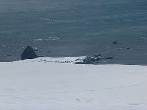
Kotis Point
Encyclopedia
Varna Peninsula
Varna Peninsula is a roughly rectangular predominantly ice-covered peninsula forming the northeast extremity of Livingston Island in the South Shetland Islands, Antarctica...
on Livingston Island in the South Shetland Islands
South Shetland Islands
The South Shetland Islands are a group of Antarctic islands, lying about north of the Antarctic Peninsula, with a total area of . By the Antarctic Treaty of 1959, the Islands' sovereignty is neither recognized nor disputed by the signatories and they are free for use by any signatory for...
, Antarctica forming the south side of the entrance to Eliseyna Cove
Eliseyna Cove
Eliseyna Cove is a 3 km wide cove indenting for 1.4 km in the northwest coast of Varna Peninsula between Slab Point to the north and Kotis Point to the south...
. The point is featuring a conspicuous rock at its tip, situated 3 km northeast of Bezmer Point
Bezmer Point
Bezmer Point is on the northwest coast of the Varna Peninsula on Livingston Island in the South Shetland Islands, Antarctica. The point is situated 9.6 km east-northeast of Siddons Point and 3 km southwest of Kotis Point and 4.9 km west-southwest of Miziya Peak...
, 6.6 km southwest of Williams Point
Williams Point
Williams Point is the point forming both the north extremity of Varna Peninsula and the northeast tip of Livingston Island in the South Shetland Islands, Antarctica...
and 12.6 km east-northeast of Siddons Point
Siddons Point
Siddons Point is a point projecting into the middle of the head of Hero Bay on the north coast of Livingston Island in the South Shetland Islands, Antarctica...
. It was named after the Thracian
Thrace
Thrace is a historical and geographic area in southeast Europe. As a geographical concept, Thrace designates a region bounded by the Balkan Mountains on the north, Rhodope Mountains and the Aegean Sea on the south, and by the Black Sea and the Sea of Marmara on the east...
King Kotis I, 384-359 BC.
Location
The point is located at 62°30′00"S 60°12′33"W (Bulgarian topographic survey Tangra 2004/05Tangra 2004/05
The Tangra 2004/05 Expedition was commissioned by the Antarctic Place-names Commission at the Ministry of Foreign Affairs of Bulgaria, managed by the Manfred Wörner Foundation, and supported by the Bulgarian Antarctic Institute, the Institute of Mathematics and Informatics at the Bulgarian Academy...
and mapping in 2005 and 2009).
Maps
- L.L. Ivanov et al. Antarctica: Livingston Island and Greenwich Island, South Shetland Islands. Scale 1:100000 topographic map. Sofia: Antarctic Place-names Commission of Bulgaria, 2005.
- L.L. Ivanov. Antarctica: Livingston Island and Greenwich, Robert, Snow and Smith Islands. Scale 1:120000 topographic map. Troyan: Manfred Wörner Foundation, 2009.