

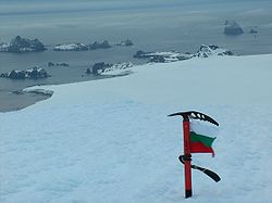
Williams Point
Encyclopedia
Varna Peninsula
Varna Peninsula is a roughly rectangular predominantly ice-covered peninsula forming the northeast extremity of Livingston Island in the South Shetland Islands, Antarctica...
and the northeast tip of Livingston Island in the South Shetland Islands
South Shetland Islands
The South Shetland Islands are a group of Antarctic islands, lying about north of the Antarctic Peninsula, with a total area of . By the Antarctic Treaty of 1959, the Islands' sovereignty is neither recognized nor disputed by the signatories and they are free for use by any signatory for...
, Antarctica. Separated from Zed Islands
Zed Islands
Zed Islands is a small group of islands, the westernmost rising to , lying off the northeast extremity of Livingston Island in the South Shetland Islands, Antarctica comprising four islands: Esperanto Island, Phanagoria Island, Lesidren Island and Koshava Island...
to the north by Iglika Passage
Iglika Passage
Iglika Passage is the passage between the Zed island group and Livingston Island in the South Shetland Islands, Antarctica, 1.53 km wide between Lesidren Island and Williams Point on Varna Peninsula, Livingston Island....
.
The discovery of the South Shetland Islands was first reported in 1819 by William Smith
William Smith (mariner)
William Smith was the English captain who discovered the South Shetland Islands, an archipelago off the Graham Land in Antarctica....
, Master of the brig Williams who had sighted the point on 19 February that year. An 1820 publication suggests that Smith gave the name ‘Williams’ to a point of land in this vicinity. In recent years the place name Williams Point has been established in international usage for the point described.
Location
The point is located at 62°27′08"S 60°08′11"W which is 9.47 km north of Miziya PeakMiziya Peak
Miziya Peak is the 604 m summit of Vidin Heights on Varna Peninsula, eastern Livingston Island in the South Shetland Islands, Antarctica...
in Vidin Heights
Vidin Heights
Vidin Heights are predominantly ice-covered heights rising to 604 m on Varna Peninsula, eastern Livingston Island in the South Shetland Islands, Antarctica. The feature is approximately 8 km long from the north end of Leslie Gap east-northeastwards to Inott Point and 9.6 km...
, 8.8 km east of Desolation Island
Desolation Island (South Shetland Islands)
Desolation Island is one of the minor islands in the South Shetlands archipelago, Antarctica situated at the entrance to Hero Bay, Livingston Island. The island is V-shaped with its northern coast indented by Kozma Cove. Surface area ....
, 1.5 km south of Zed Islands
Zed Islands
Zed Islands is a small group of islands, the westernmost rising to , lying off the northeast extremity of Livingston Island in the South Shetland Islands, Antarctica comprising four islands: Esperanto Island, Phanagoria Island, Lesidren Island and Koshava Island...
and 5.5 km west of Duff Point
Duff Point
Duff Point is a point forming the west extremity of Greenwich Island, in the South Shetland Islands, Antarctica. The name Duffs Straits was applied to McFarlane Strait by James Weddell in 1820-23, after Captain Norwich Duff under whom Weddell served in HMS Espoir in 1814...
on Greenwich Island
Greenwich Island (South Shetland Islands)
Greenwich Island is an island long and from wide, lying between Robert Island and Livingston Island in the South Shetland Islands. Surface area...
. British mapping in 1822, Chilean in 1971, Argentine in 1980, Spanish in 1991, and Bulgarian in 2005 and 2009.
Maps
- L.L. Ivanov et al., Antarctica: Livingston Island and Greenwich Island, South Shetland Islands (from English Strait to Morton Strait, with illustrations and ice-cover distribution), 1:100000 scale topographic map, Antarctic Place-names Commission of Bulgaria, Sofia, 2005
- L.L. Ivanov. Antarctica: Livingston Island and Greenwich, Robert, Snow and Smith Islands. Scale 1:120000 topographic map. Troyan: Manfred Wörner Foundation, 2009. ISBN 978-954-92032-6-4