
Miramichi River
Encyclopedia
The Miramichi River is a Canadian
river located in the east-central part of New Brunswick
. The river drains into Miramichi Bay
in the Gulf of St. Lawrence. The name may have been derived from the Montagnais words "Maissimeu Assi" (meaning Mi'kmaq Land), and it is today the namesake of the Miramichi Herald
at the Canadian Heraldic Authority
.
drains a territory comprising one-quarter of New Brunswick's territory, measuring approximately 13,000 km² of which 300 km² is an estuarine
environment on the inner part of Miramichi Bay
. The watershed
roughly corresponds to Northumberland County
, but also includes sections of Victoria County
, Carleton County, and York County
and smaller parts of Gloucester County
and Sunbury County.
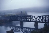
The Miramichi River meander length measures approximately 250 km and comprises two important branches, the Southwest Miramichi River
and the Northwest Miramichi River
, each having their respective tributaries. Nearly every bend in the river, from Push and Be Damned Rapids
to the Turnip Patch has a distinctive name, reflecting the importance of the river to fishermen, canoeists, and lumbermen. Tide
s reach upriver in the Miramichi system to Sunny Corner
on the Northwest Miramichi and to Quarryville
on the Southwest Miramichi — a distance of approximately 70 km inland from the Gulf of St. Lawrence. The two branches combine at Newcastle
where the river becomes navigable to ocean-going vessels.
The estuarine portion of the Miramichi River downriver from Newcastle in the city of Miramichi flows through a drowned river valley. Sea level rise in Miramichi Bay
has flooded the mouth of the Miramichi River with saltwater
. The estuary comprises the inner portion of Miramichi Bay and is protected from ocean storms in the Gulf of St. Lawrence by barrier island
s. The estuary is significant in that it is a highly productive ecosystem
, despite its relatively small size. The estuary receives the freshwater discharge from the Miramichi River and its tributaries, mixing with organic materials from the surrounding shorelines and the saltwater inundation from the Gulf of St. Lawrence, itself an estuary and the largest on the planet.
The estuary is a highly dynamic environment, ranging from the high outflows of freshwater during the spring freshet
, to the low outflow and rising saltwater content during the summer period, to fall ocean storms and nor'easter
s which reshape the barrier islands and the old river channel which forms the navigation channel for ocean-going ships heading to ports at Chatham
and Newcastle
, to the winter covering of sea ice
which encases the entire estuary. The inner bay measures only 4 m deep on average, with the navigation channel measuring only 6–10 m, resulting in significant warming of estuarine waters during the summer months. The diurnal
tide cycle ranges only 1 m on average.
Miramichi River
and Ordovician
rocks of the Miramichi Highlands, an extension of the Appalachian Mountains
, the tributaries of the Miramichi River flow eastward into the New Brunswick Lowland, which dominates the eastern and central part of the province along the Gulf of St. Lawrence.
Erosion has created the "Miramichi River valley" (also shortened to just "Miramichi Valley
"), through which the Northwest and Southwest Miramichi rivers flow. Throughout the course of both branches to Newcastle, New Brunswick, they are framed by heavily forested low hills. The highest peaks in the Miramichi River watershed, include Big Bald Mountain
and the Christmas Mountains
, extending to 750 m above sea level
.
Soils in the Miramichi River watershed are typically acidic with shallow topsoil, lending to poor suitability for agriculture. The shorelines of the estuarine portion of the Miramichi River exposes newer rocks belonging to the Carboniferous
period and underlay the sandy topsoil, however some coastal land is low lying and suffers poor drainage. Sandstone
rocks are visible along the river banks.
(Salmo salar) in North America. The Atlantic salmon is an anadromous fish, that is, one that is hatched and grows briefly in freshwater and then migrates to salt water while immature to grow to maturity, before returning to fresh water to spawn and complete their life cycle. The Miramichi River still maintains a reasonably healthy, self-sustaining run of Atlantic salmon, as well as lesser runs of other anadromous fish such as American Shad
, smelt, herring
and sea-run brook trout
. About one-half of the sport catch of Atlantic salmon in North America are landed on the Miramichi River and its tributaries currently.
Atlantic salmon fishing is restricted to fly fishing only and all large salmon caught must be released alive to protect the spawning population. Since this fishery is highly regulated, all anglers should contact the New Brunswick Dept. of Natural Resources to obtain the specific rules and regulations for each river and tributary in the Province of New Brunswick prior to fishing, as special licenses, salmon "tags" and permits are required, and certain sections of tributaries and the main river are closed to fishing from time to time to protect salmon brood stocks.
The annual salmon runs start in mid-June and continue through late October, when spawning commences in earnest. It is believed that distinct runs of salmon destined for specific tributaries occur at different times of the year, with those fish headed for the upper reaches of the watershed entering the river earlier than those that spawn in the lower tributaries.
Popular salmon flies on the Miramichi River include the Black Bear series, the Cosseboom series, Butterfly, Oriole, and the Blackville Special. Deerhair flies such as the "Buck Bug" are also successful. Major portions of the Miramichi River salmon
fishing waters are controlled by private clubs and outfitters, with "public water" that is available to all very limited. Further, all non-resident anglers must hire a registered guide to fish for Atlantic salmon in New Brunswick. Guides can be inquired for in the village of Doaktown and through Dept. of Natural Resources offices.
Canada
Canada is a North American country consisting of ten provinces and three territories. Located in the northern part of the continent, it extends from the Atlantic Ocean in the east to the Pacific Ocean in the west, and northward into the Arctic Ocean...
river located in the east-central part of New Brunswick
New Brunswick
New Brunswick is one of Canada's three Maritime provinces and is the only province in the federation that is constitutionally bilingual . The provincial capital is Fredericton and Saint John is the most populous city. Greater Moncton is the largest Census Metropolitan Area...
. The river drains into Miramichi Bay
Miramichi Bay
Miramichi Bay is an estuary located on the west coast of the Gulf of St. Lawrence in New Brunswick, at the mouth of the Miramichi River. Miramichi Bay is separated into the "inner bay" and the "outer bay", with the division being a line of uninhabited barrier islands which are continually reshaped...
in the Gulf of St. Lawrence. The name may have been derived from the Montagnais words "Maissimeu Assi" (meaning Mi'kmaq Land), and it is today the namesake of the Miramichi Herald
Miramichi Herald
Miramichi Herald of Arms is the title of one of the officers of arms at the Canadian Heraldic Authority in Ottawa. The office was created in 2003. Like the other heralds at the Authority, the name is derived from the Canadian river. The design of the badge of office of Miramichi Herald of Arms was...
at the Canadian Heraldic Authority
Canadian Heraldic Authority
The Canadian Heraldic Authority is part of the Canadian honours system under the Queen of Canada, whose authority is exercised by the Governor General. The Authority is responsible for the creation and granting of new coats of arms , flags and badges for Canadian citizens, permanent residents and...
.
Geography
The Miramichi River watershedDrainage basin
A drainage basin is an extent or an area of land where surface water from rain and melting snow or ice converges to a single point, usually the exit of the basin, where the waters join another waterbody, such as a river, lake, reservoir, estuary, wetland, sea, or ocean...
drains a territory comprising one-quarter of New Brunswick's territory, measuring approximately 13,000 km² of which 300 km² is an estuarine
Estuary
An estuary is a partly enclosed coastal body of water with one or more rivers or streams flowing into it, and with a free connection to the open sea....
environment on the inner part of Miramichi Bay
Miramichi Bay
Miramichi Bay is an estuary located on the west coast of the Gulf of St. Lawrence in New Brunswick, at the mouth of the Miramichi River. Miramichi Bay is separated into the "inner bay" and the "outer bay", with the division being a line of uninhabited barrier islands which are continually reshaped...
. The watershed
Drainage basin
A drainage basin is an extent or an area of land where surface water from rain and melting snow or ice converges to a single point, usually the exit of the basin, where the waters join another waterbody, such as a river, lake, reservoir, estuary, wetland, sea, or ocean...
roughly corresponds to Northumberland County
Northumberland County, New Brunswick
Northumberland County , having the largest area of any county in the province, is located in northeastern New Brunswick, Canada.-Geography:Northumberland County is covered by thick forests, whose products stimulate the economy...
, but also includes sections of Victoria County
Victoria County, New Brunswick
Victoria County is located in northwestern New Brunswick, Canada. Farming, especially of potatoes, is the major industry in the county.-Communities:...
, Carleton County, and York County
York County, New Brunswick
York County is located in west-central New Brunswick, Canada. The county contains the provincial capital, Fredericton. Outside the city, farming and forestry are two major industries in the county, which is bisected by the Saint John River...
and smaller parts of Gloucester County
Gloucester County, New Brunswick
Gloucester County is located in the northeastern corner of New Brunswick, Canada. Fishing, mining and forestry are the major industries in the county...
and Sunbury County.
The Miramichi River meander length measures approximately 250 km and comprises two important branches, the Southwest Miramichi River
Southwest Miramichi River
The Southwest Miramichi River is a Canadian river in New Brunswick.The river has its origin in Carleton County, at Miramichi Lake in the Miramichi Highlands . Its two branches join near the village of Juniper, NB...
and the Northwest Miramichi River
Northwest Miramichi River
The Northwest Miramichi River is a Canadian river in New Brunswick. The Mi'kmaq referred to the river as Elmunokun, possibly meaning "a beaver hole" in reference to a deep pool in the river, just below the mouth of the Big Sevogle River, its largest tributary.The Northwest Miramichi River has its...
, each having their respective tributaries. Nearly every bend in the river, from Push and Be Damned Rapids
Push and Be Damned Rapids
"Push and Be Damned Rapids" is the evocative name for rapids on the Southwest Miramichi River, one of the many tributaries of the Miramichi River, New Brunswick, Canada, near the village of Juniper....
to the Turnip Patch has a distinctive name, reflecting the importance of the river to fishermen, canoeists, and lumbermen. Tide
Tide
Tides are the rise and fall of sea levels caused by the combined effects of the gravitational forces exerted by the moon and the sun and the rotation of the Earth....
s reach upriver in the Miramichi system to Sunny Corner
Sunny Corner, New Brunswick
Sunny Corner, New Brunswick is a small rural community in Northumberland County, New Brunswick, Canada. It is located approximately 20 km west of Miramichi, New Brunswick, on the northeast bank of the Northwest Miramichi River, opposite its sister communities, Red Bank and Metepenagiag Mi'kmaq...
on the Northwest Miramichi and to Quarryville
Quarryville, New Brunswick
Quarryville is a community in the Canadian province of New Brunswick....
on the Southwest Miramichi — a distance of approximately 70 km inland from the Gulf of St. Lawrence. The two branches combine at Newcastle
Newcastle, New Brunswick
Newcastle is a Canadian urban neighbourhood in the city of Miramichi, New Brunswick.Prior to municipal amalgamation in 1995, it was an incorporated town and the shire town of Northumberland County....
where the river becomes navigable to ocean-going vessels.
The estuarine portion of the Miramichi River downriver from Newcastle in the city of Miramichi flows through a drowned river valley. Sea level rise in Miramichi Bay
Miramichi Bay
Miramichi Bay is an estuary located on the west coast of the Gulf of St. Lawrence in New Brunswick, at the mouth of the Miramichi River. Miramichi Bay is separated into the "inner bay" and the "outer bay", with the division being a line of uninhabited barrier islands which are continually reshaped...
has flooded the mouth of the Miramichi River with saltwater
Seawater
Seawater is water from a sea or ocean. On average, seawater in the world's oceans has a salinity of about 3.5% . This means that every kilogram of seawater has approximately of dissolved salts . The average density of seawater at the ocean surface is 1.025 g/ml...
. The estuary comprises the inner portion of Miramichi Bay and is protected from ocean storms in the Gulf of St. Lawrence by barrier island
Barrier island
Barrier islands, a coastal landform and a type of barrier system, are relatively narrow strips of sand that parallel the mainland coast. They usually occur in chains, consisting of anything from a few islands to more than a dozen...
s. The estuary is significant in that it is a highly productive ecosystem
Ecosystem
An ecosystem is a biological environment consisting of all the organisms living in a particular area, as well as all the nonliving , physical components of the environment with which the organisms interact, such as air, soil, water and sunlight....
, despite its relatively small size. The estuary receives the freshwater discharge from the Miramichi River and its tributaries, mixing with organic materials from the surrounding shorelines and the saltwater inundation from the Gulf of St. Lawrence, itself an estuary and the largest on the planet.
The estuary is a highly dynamic environment, ranging from the high outflows of freshwater during the spring freshet
Freshet
A freshet can refer to one of two things:* A flood resulting from heavy rain or a spring thaw. Whereas heavy rain often causes a flash flood, a spring thaw event is generally a more incremental process, depending upon local climate and topography...
, to the low outflow and rising saltwater content during the summer period, to fall ocean storms and nor'easter
Nor'easter
A nor'easter is a type of macro-scale storm along the East Coast of the United States and Atlantic Canada, so named because the storm travels to the northeast from the south and the winds come from the northeast, especially in the coastal areas of the Northeastern United States and Atlantic Canada...
s which reshape the barrier islands and the old river channel which forms the navigation channel for ocean-going ships heading to ports at Chatham
Chatham, New Brunswick
Chatham is a Canadian urban neighbourhood in the city of Miramichi, New Brunswick.Prior to municipal amalgamation in 1995, Chatham was an incorporated town in Northumberland County along the south bank of the Miramichi River opposite Douglastown...
and Newcastle
Newcastle, New Brunswick
Newcastle is a Canadian urban neighbourhood in the city of Miramichi, New Brunswick.Prior to municipal amalgamation in 1995, it was an incorporated town and the shire town of Northumberland County....
, to the winter covering of sea ice
Sea ice
Sea ice is largely formed from seawater that freezes. Because the oceans consist of saltwater, this occurs below the freezing point of pure water, at about -1.8 °C ....
which encases the entire estuary. The inner bay measures only 4 m deep on average, with the navigation channel measuring only 6–10 m, resulting in significant warming of estuarine waters during the summer months. The diurnal
Diel
People with the surname Diel:* Charles Diel, former head men’s tennis coach at Louisiana State University* Paul Diel , French psychologistDiel may also refer to:* Diel vertical migration, common among deep-sea fish...
tide cycle ranges only 1 m on average.
Tributaries
Important tributaries include:Miramichi River
- Bartibog RiverBartibog RiverThe Bartibog River is a tributary of the Miramichi River in New Brunswick, Canada.The Bartibog River rises in northeastern Northumberland County and flows east and south into the Miramichi River at the community of Bartibog Bridge.The Bartibog River watershed is entirely rural, dominated by...
- Napan RiverNapan RiverThe Napan River is a tributary of the Miramichi River in New Brunswick, Canada.The Napan River rises several kilometres southwest of Chatham in central Northumberland County and flows northeast into the Miramichi River at Napan Bay....
- Bay du Vin River
- Black RiverBlack River (New Brunswick)The Black River is a river located in New Brunswick, Canada....
- Northwest Miramichi RiverNorthwest Miramichi RiverThe Northwest Miramichi River is a Canadian river in New Brunswick. The Mi'kmaq referred to the river as Elmunokun, possibly meaning "a beaver hole" in reference to a deep pool in the river, just below the mouth of the Big Sevogle River, its largest tributary.The Northwest Miramichi River has its...
- Sevogle RiverSevogle RiverThe Sevogle River is a Canadian river in central New Brunswick. It consists of two branches, the North Sevogle and South Sevogle Rivers. Below the confluence of these rivers at the Square Forks, the river is properly referred to as the "Big Sevogle River"...
- Little Southwest Miramichi RiverLittle Southwest Miramichi RiverThe Little Southwest Miramichi River is a Canadian river in Northumberland County, New Brunswick. In Mi'kmaq it is referred to as "Tooadook".....
- Tomogonops River
- Portage River
- Little River
- Sevogle River
- Southwest Miramichi RiverSouthwest Miramichi RiverThe Southwest Miramichi River is a Canadian river in New Brunswick.The river has its origin in Carleton County, at Miramichi Lake in the Miramichi Highlands . Its two branches join near the village of Juniper, NB...
- Barnaby River
- Renous RiverRenous RiverThe Renous River is a tributary of the Southwest Miramichi River in New Brunswick, Canada.The Renous River has its origins south of Holmes Lake in the Miramichi Highlands, part of the Appalachian Mountains, in the northwest corner of Northumberland County....
- Dungarvon RiverDungarvon RiverThe Dungarvon River is a tributary of the Renous River in New Brunswick, Canada.The Dungarvon River has its origins at several lakes in the Miramichi Highlands, part of the Appalachian Mountains, in the northeast corner of York County....
- Dungarvon River
- Cains RiverCains RiverThe Cains River is a Canadian river in New Brunswick. It is 113 kilometres long.The Cains River has its origins in the "Bantalor Game Refuge" in the eastern part of York County, near the boundary with Sunbury County. Generally flowing northeast through heavy forests, the Cains River joins the...
- Bartholomew RiverBartholomew RiverThe Bartholomew River is a tributary of the Main Southwest Miramichi River in New Brunswick, Canada.The Bartholomew River begins in the hills between the Main Southwest Miramichi and Dungarvon Rivers at approximately N46.60, W66.30, in western Northumberland County.Its two branches run parallel...
- Taxis River
Geology
Rising in the SilurianSilurian
The Silurian is a geologic period and system that extends from the end of the Ordovician Period, about 443.7 ± 1.5 Mya , to the beginning of the Devonian Period, about 416.0 ± 2.8 Mya . As with other geologic periods, the rock beds that define the period's start and end are well identified, but the...
and Ordovician
Ordovician
The Ordovician is a geologic period and system, the second of six of the Paleozoic Era, and covers the time between 488.3±1.7 to 443.7±1.5 million years ago . It follows the Cambrian Period and is followed by the Silurian Period...
rocks of the Miramichi Highlands, an extension of the Appalachian Mountains
Appalachian Mountains
The Appalachian Mountains #Whether the stressed vowel is or ,#Whether the "ch" is pronounced as a fricative or an affricate , and#Whether the final vowel is the monophthong or the diphthong .), often called the Appalachians, are a system of mountains in eastern North America. The Appalachians...
, the tributaries of the Miramichi River flow eastward into the New Brunswick Lowland, which dominates the eastern and central part of the province along the Gulf of St. Lawrence.
Erosion has created the "Miramichi River valley" (also shortened to just "Miramichi Valley
Miramichi Valley
The Miramichi Valley is a Canadian river valley and region located in the east-central part of New Brunswick. It extends along both major branches of the Miramichi River and their tributaries, however it is generally agreed that the much larger Southwest Miramichi River forms the majority of this...
"), through which the Northwest and Southwest Miramichi rivers flow. Throughout the course of both branches to Newcastle, New Brunswick, they are framed by heavily forested low hills. The highest peaks in the Miramichi River watershed, include Big Bald Mountain
Big Bald Mountain
At , Big Bald Mountain, is the highest peak in Gilmer County, Georgia. It is also located within the boundaries of the Chattahoochee National Forest.- References :***- External links :*...
and the Christmas Mountains
Christmas Mountains
The Christmas Mountains are a series of rounded peaks at the headwaters of North Pole Stream and the Little Southwest Miramichi River, west of Big Bald Mountain, and south of Mount Carleton in northern New Brunswick, Canada. The mountains, in part, separate the Miramichi River watershed from the...
, extending to 750 m above sea level
Sea level
Mean sea level is a measure of the average height of the ocean's surface ; used as a standard in reckoning land elevation...
.
Soils in the Miramichi River watershed are typically acidic with shallow topsoil, lending to poor suitability for agriculture. The shorelines of the estuarine portion of the Miramichi River exposes newer rocks belonging to the Carboniferous
Carboniferous
The Carboniferous is a geologic period and system that extends from the end of the Devonian Period, about 359.2 ± 2.5 Mya , to the beginning of the Permian Period, about 299.0 ± 0.8 Mya . The name is derived from the Latin word for coal, carbo. Carboniferous means "coal-bearing"...
period and underlay the sandy topsoil, however some coastal land is low lying and suffers poor drainage. Sandstone
Sandstone
Sandstone is a sedimentary rock composed mainly of sand-sized minerals or rock grains.Most sandstone is composed of quartz and/or feldspar because these are the most common minerals in the Earth's crust. Like sand, sandstone may be any colour, but the most common colours are tan, brown, yellow,...
rocks are visible along the river banks.
Fisheries
The Miramichi River and its tributaries originally supported one of the largest populations of Atlantic salmonAtlantic salmon
The Atlantic salmon is a species of fish in the family Salmonidae, which is found in the northern Atlantic Ocean and in rivers that flow into the north Atlantic and the north Pacific....
(Salmo salar) in North America. The Atlantic salmon is an anadromous fish, that is, one that is hatched and grows briefly in freshwater and then migrates to salt water while immature to grow to maturity, before returning to fresh water to spawn and complete their life cycle. The Miramichi River still maintains a reasonably healthy, self-sustaining run of Atlantic salmon, as well as lesser runs of other anadromous fish such as American Shad
American shad
-Introduction:The American shad or Atlantic shad, Alosa sapidissima, is a species of anadromous fish in family Clupeidae of order Clupeiformes. It is not closely related to the other North American shads...
, smelt, herring
Herring
Herring is an oily fish of the genus Clupea, found in the shallow, temperate waters of the North Pacific and the North Atlantic oceans, including the Baltic Sea. Three species of Clupea are recognized. The main taxa, the Atlantic herring and the Pacific herring may each be divided into subspecies...
and sea-run brook trout
Brook trout
The brook trout, Salvelinus fontinalis, is a species of fish in the salmon family of order Salmoniformes. In many parts of its range, it is known as the speckled trout or squaretail. A potamodromous population in Lake Superior are known as coaster trout or, simply, as coasters...
. About one-half of the sport catch of Atlantic salmon in North America are landed on the Miramichi River and its tributaries currently.
Atlantic salmon fishing is restricted to fly fishing only and all large salmon caught must be released alive to protect the spawning population. Since this fishery is highly regulated, all anglers should contact the New Brunswick Dept. of Natural Resources to obtain the specific rules and regulations for each river and tributary in the Province of New Brunswick prior to fishing, as special licenses, salmon "tags" and permits are required, and certain sections of tributaries and the main river are closed to fishing from time to time to protect salmon brood stocks.
The annual salmon runs start in mid-June and continue through late October, when spawning commences in earnest. It is believed that distinct runs of salmon destined for specific tributaries occur at different times of the year, with those fish headed for the upper reaches of the watershed entering the river earlier than those that spawn in the lower tributaries.
Popular salmon flies on the Miramichi River include the Black Bear series, the Cosseboom series, Butterfly, Oriole, and the Blackville Special. Deerhair flies such as the "Buck Bug" are also successful. Major portions of the Miramichi River salmon
Salmon
Salmon is the common name for several species of fish in the family Salmonidae. Several other fish in the same family are called trout; the difference is often said to be that salmon migrate and trout are resident, but this distinction does not strictly hold true...
fishing waters are controlled by private clubs and outfitters, with "public water" that is available to all very limited. Further, all non-resident anglers must hire a registered guide to fish for Atlantic salmon in New Brunswick. Guides can be inquired for in the village of Doaktown and through Dept. of Natural Resources offices.
See also
- List of New Brunswick rivers
- Dungarvon WhooperDungarvon WhooperThe Dungarvon Whooper is a ghost story, immortalized in a song by Michael Whelan , about a murder in the late 19th century along the Dungarvon River in central New Brunswick, Canada....
- Chatham, New BrunswickChatham, New BrunswickChatham is a Canadian urban neighbourhood in the city of Miramichi, New Brunswick.Prior to municipal amalgamation in 1995, Chatham was an incorporated town in Northumberland County along the south bank of the Miramichi River opposite Douglastown...
- Miramichi, New BrunswickMiramichi, New BrunswickMiramichi is the largest city in northern New Brunswick, Canada. It is situated at the mouth of the Miramichi River where it enters Miramichi Bay...
- Newcastle, New BrunswickNewcastle, New BrunswickNewcastle is a Canadian urban neighbourhood in the city of Miramichi, New Brunswick.Prior to municipal amalgamation in 1995, it was an incorporated town and the shire town of Northumberland County....
- Doaktown, New BrunswickDoaktown, New BrunswickDoaktown is a Canadian village in Northumberland County, New Brunswick.-History:It is situated on the Southwest Miramichi River and was first settled in 1807 for use as a base for the growing lumber industry in central New Brunswick...
- Blackville, New BrunswickBlackville, New BrunswickBlackville is a Canadian village in Northumberland County, New Brunswick.It is located on the Southwest Miramichi River approximately 40 kilometres southwest of Miramichi.-Economy:...
- Boiestown, New BrunswickBoiestown, New BrunswickBoiestown is a Canadian rural community in Northumberland County, New Brunswick.It is situated on the Southwest Miramichi River approximately 60 kilometres northeast of Fredericton, near the province's geographic centre....