
Melbourne tram route 6
Encyclopedia
Tram
route 6 is a public transport
service in Melbourne
, Victoria
, Australia
. It runs from the University of Melbourne
in the city centre to Glen Iris
in the eastern suburb
s.
Like most tram routes in Melbourne, it is entirely within Metcard
/myki
ticketing Zone 1.
In response to the State Government's 2001 Melbourne 2030 planning policy
, the Public Transport Users Association
lobbied to extend route 6 to Ashburton railway station
.
from Queensberry Street to High St and an electric line from St Kilda Road to Burke Road.
Cable trams first travelled from Queensberry Street, Carlton
to Milton Street, Balaclava
, on the 11 October 1888, with the line opened by the Melbourne Tramway and Omnibus Company.
The Prahran and Malvern Tramways Trust
opened a line from Charles Street, Prahran
to Tooronga Road, Glen Iris
along High Street on 30 May 1910. This line was extended west to Punt Road on 14 March 1911 and again, to St Kilda Road on 14 September 1912, connecting with the St Kilda Road cable tram to the city, both extension were built by the Prahran and Malvern Tramways Trust. The Prahran and Malvern Tramways Trust extended the line again on 25 March 1914, this time east, to it current terminus at Malvern Road.
The Melbourne, Brunswick and Coburg Tramways Trust opened its line from Park Street, North Carlton to Queensberry Street, Carlton
along Lygon Street, Elgin Street and Madeline Street - as the section of Swanston Street north of Victoria Street was originally known - on 31 October 1916.
The Melbourne and Metropolitan Tramways Board converted the Swanston Street/St Kilda Road cable line to electric traction between 1924 and 1926, with electric trams able to run to High Street on 28 March 1926 and able to travel the entire length on 29 August 1926.
 Route 5 runs from Melbourne University
travelling south on Swanston Street
, through the CBD
, passing Royal Melbourne Institute of Technology
, Melbourne Central railway station
, State Library of Victoria
, Melbourne Town Hall
, City Square
, St Paul's Cathedral
, Flinders Street railway station, Federation Square
and Birrarung Marr.
Crossing the Yarra River
into Southbank along St Kilda Road, traversing the suburbs of Melbourne and South Melbourne, Victoria
, it passes The Arts Centre
, National Gallery of Victoria
, Victoria Barracks
and Shrine of Remembrance
.
It turns east into High Street, Melbourne, traversing the suburbs of Prahran
, Windsor
, Armadale
, Malvern
and Glen Iris
to its terminus at Malvern Road, Glen Iris.
and D1 class trams.
A truncated, off-peak version of route 6 exists as route 7. This route also begins at the University of Melbourne, but ends at Glenferrie Road at Malvern Town Hall
. It only operates in the direction away from the city.
Tram
A tram is a passenger rail vehicle which runs on tracks along public urban streets and also sometimes on separate rights of way. It may also run between cities and/or towns , and/or partially grade separated even in the cities...
route 6 is a public transport
Public transport
Public transport is a shared passenger transportation service which is available for use by the general public, as distinct from modes such as taxicab, car pooling or hired buses which are not shared by strangers without private arrangement.Public transport modes include buses, trolleybuses, trams...
service in Melbourne
Melbourne
Melbourne is the capital and most populous city in the state of Victoria, and the second most populous city in Australia. The Melbourne City Centre is the hub of the greater metropolitan area and the Census statistical division—of which "Melbourne" is the common name. As of June 2009, the greater...
, Victoria
Victoria (Australia)
Victoria is the second most populous state in Australia. Geographically the smallest mainland state, Victoria is bordered by New South Wales, South Australia, and Tasmania on Boundary Islet to the north, west and south respectively....
, Australia
Australia
Australia , officially the Commonwealth of Australia, is a country in the Southern Hemisphere comprising the mainland of the Australian continent, the island of Tasmania, and numerous smaller islands in the Indian and Pacific Oceans. It is the world's sixth-largest country by total area...
. It runs from the University of Melbourne
University of Melbourne
The University of Melbourne is a public university located in Melbourne, Victoria. Founded in 1853, it is the second oldest university in Australia and the oldest in Victoria...
in the city centre to Glen Iris
Glen Iris, Victoria
Glen Iris is a suburb in Melbourne, Victoria, Australia, 10 km south-east from Melbourne's central business district. Its Local Government Area are the Cities of Boroondara and Stonnington...
in the eastern suburb
Suburb
The word suburb mostly refers to a residential area, either existing as part of a city or as a separate residential community within commuting distance of a city . Some suburbs have a degree of administrative autonomy, and most have lower population density than inner city neighborhoods...
s.
Like most tram routes in Melbourne, it is entirely within Metcard
Metcard
"OneLink" redirects here. For the computer/cable company, see OneLink Communications.Metcard is the brand name of an integrated ticketing system used to access public transport in Melbourne, Australia. It is a universal ticket which allows users to ride on the city's Metlink network, consisting of...
/myki
Myki
myki is the contactless smartcard ticketing system being introduced on public transport in Victoria, Australia. myki is designed to replace a number of ticket systems in Victoria, primarily the Metcard and V/Line ticketing systems...
ticketing Zone 1.
In response to the State Government's 2001 Melbourne 2030 planning policy
Melbourne 2030
The Metropolitan Strategy Melbourne 2030 is a Victorian Government strategic planning policy framework for the metropolitan area of Greater Melbourne, intended to cover the period 2001-2030. During this period the population of the metropolitan area is expected to grow by a million people to over 5...
, the Public Transport Users Association
Public Transport Users Association
The Public Transport Users Association is a community-based public transport lobby group in Victoria, Australia, based in Melbourne.- History and Aims :...
lobbied to extend route 6 to Ashburton railway station
Ashburton railway station, Melbourne
Ashburton is a railway station on the Alamein railway line in Melbourne, Victoria, Australia. It is located between Welfare Parade and Kelvin Grove, in the suburb of Ashburton. It also lies adjacent to High Street, where it connects with a bus to Glen Waverley and Glen Iris...
.
History
The origins of route 5 lie in separate tram lines, an electric line from Melbourne University to Queensberry Street, a cable tramCable car (railway)
A cable car or cable railway is a mass transit system using rail cars that are hauled by a continuously moving cable running at a constant speed. Individual cars stop and start by releasing and gripping this cable as required...
from Queensberry Street to High St and an electric line from St Kilda Road to Burke Road.
Cable trams first travelled from Queensberry Street, Carlton
Carlton, Victoria
Carlton is an inner city suburb of Melbourne, Victoria, Australia, 2 km north from Melbourne's central business district. Its Local Government Area is the City of Melbourne...
to Milton Street, Balaclava
Balaclava, Victoria
Balaclava is a suburb of Melbourne, Victoria, in Australia. It is situated in the south-east of the city in the St Kilda East area and is bounded by Inkerman Street to the north, Chapel Street to the west, Hotham Street to the east and Oak Grove and Los Angeles Court to the south. In terms of its...
, on the 11 October 1888, with the line opened by the Melbourne Tramway and Omnibus Company.
The Prahran and Malvern Tramways Trust
Prahran and Malvern Tramways Trust
The Prahran and Malvern Tramways Trust was a former tram operator in Melbourne, Australia. The trust was formed in 1907, with its first line operating in 1910...
opened a line from Charles Street, Prahran
Prahran, Victoria
Prahran , also known colloquially as "Pran", is a suburb in Melbourne, Victoria, Australia, 5 km south-east from Melbourne's central business district. Its Local Government Area is the City of Stonnington. At the 2006 Census, Prahran had a population of 10,651. It is a part of Melbourne with...
to Tooronga Road, Glen Iris
Glen Iris, Victoria
Glen Iris is a suburb in Melbourne, Victoria, Australia, 10 km south-east from Melbourne's central business district. Its Local Government Area are the Cities of Boroondara and Stonnington...
along High Street on 30 May 1910. This line was extended west to Punt Road on 14 March 1911 and again, to St Kilda Road on 14 September 1912, connecting with the St Kilda Road cable tram to the city, both extension were built by the Prahran and Malvern Tramways Trust. The Prahran and Malvern Tramways Trust extended the line again on 25 March 1914, this time east, to it current terminus at Malvern Road.
The Melbourne, Brunswick and Coburg Tramways Trust opened its line from Park Street, North Carlton to Queensberry Street, Carlton
Carlton, Victoria
Carlton is an inner city suburb of Melbourne, Victoria, Australia, 2 km north from Melbourne's central business district. Its Local Government Area is the City of Melbourne...
along Lygon Street, Elgin Street and Madeline Street - as the section of Swanston Street north of Victoria Street was originally known - on 31 October 1916.
The Melbourne and Metropolitan Tramways Board converted the Swanston Street/St Kilda Road cable line to electric traction between 1924 and 1926, with electric trams able to run to High Street on 28 March 1926 and able to travel the entire length on 29 August 1926.
Route
University of Melbourne
The University of Melbourne is a public university located in Melbourne, Victoria. Founded in 1853, it is the second oldest university in Australia and the oldest in Victoria...
travelling south on Swanston Street
Swanston Street, Melbourne
Swanston Street is a major thoroughfare in the centre of Melbourne, Australia. It is historically one of the main streets of central Melbourne, laid out in 1837 as part of the Hoddle Grid, the layout of major streets that makes up the central business district...
, through the CBD
Melbourne city centre
Melbourne City Centre is an area of Melbourne in Victoria, Australia. It is not to be confused with the larger local government area of the City of Melbourne...
, passing Royal Melbourne Institute of Technology
RMIT University
RMIT University is an Australian public university located in Melbourne, Victoria. It has two branches, referred to as RMIT University in Australia and RMIT International University in Vietnam....
, Melbourne Central railway station
Melbourne Central railway station
Melbourne Central is an underground station in the metro railway network of Melbourne, Australia. It is one of five stations on the City Loop, which encircles the central business district. The station is under La Trobe Street, between Swanston and Elizabeth Streets, on the northern edge of the CBD...
, State Library of Victoria
State Library of Victoria
The State Library of Victoria is the central library of the state of Victoria, Australia, located in Melbourne. It is on the block bounded by Swanston, La Trobe, Russell, and Little Lonsdale streets, in the northern centre of the central business district...
, Melbourne Town Hall
Melbourne Town Hall
Melbourne Town Hall is the central municipal building of the City of Melbourne, Australia, in the State of Victoria. It is located on the northeast corner of Swanston and Collins Streets, in the central business district. It is the seat of the Local Government Area of the City of Melbourne...
, City Square
City Square, Melbourne
The City Square is a pedestrian plaza and former civic centre located in the Central Business District of Melbourne, Australia. The square is currently bounded by Swanston Street, Collins Street, Flinders Lane and the Westin Hotel. Melbourne Town Hall and St Paul’s Cathedral are prominent...
, St Paul's Cathedral
St Paul's Cathedral, Melbourne
St Paul's Cathedral, Melbourne, is the metropolitical and cathedral church of the Anglican Diocese of Melbourne, Victoria in Australia. It is the seat of the Anglican Archbishop of Melbourne and Metropolitan of the Province of Victoria...
, Flinders Street railway station, Federation Square
Federation Square
Federation Square is a civic centre and cultural precinct in the city of Melbourne, Victoria, Australia....
and Birrarung Marr.
Crossing the Yarra River
Yarra River
The Yarra River, originally Birrarung, is a river in east-central Victoria, Australia. The lower stretches of the river is where the city of Melbourne was established in 1835 and today Greater Melbourne dominates and influences the landscape of its lower reaches...
into Southbank along St Kilda Road, traversing the suburbs of Melbourne and South Melbourne, Victoria
South Melbourne, Victoria
South Melbourne is an inner city suburb in Melbourne, Victoria, Australia, 2 km south from Melbourne's central business district. Its Local Government Area are the Cities of Port Phillip and Melbourne...
, it passes The Arts Centre
The Arts Centre (Melbourne)
The Victorian Arts Centre is a performing arts centre consisting of a complex of theatres and concert halls in the Melbourne Arts Precinct, located in the inner Melbourne suburb of Southbank in Victoria, Australia....
, National Gallery of Victoria
National Gallery of Victoria
The National Gallery of Victoria is an art gallery and museum in Melbourne, Australia. Founded in 1861, it is the oldest and the largest public art gallery in Australia. Since December 2003, NGV has operated across two sites...
, Victoria Barracks
Victoria Barracks
There are several Victoria Barracks in the world.*Victoria Barracks, Windsor Castle*Victoria Barracks, Melbourne*Victoria Barracks, Hong Kong*Victoria Barracks, Sydney*Victoria Barracks, Brisbane...
and Shrine of Remembrance
Shrine of Remembrance
The Shrine of Remembrance, located in Kings Domain on St Kilda Road, Melbourne, Australia was built as a memorial to the men and women of Victoria who served in World War I and is now a memorial to all Australians who have served in war...
.
It turns east into High Street, Melbourne, traversing the suburbs of Prahran
Prahran, Victoria
Prahran , also known colloquially as "Pran", is a suburb in Melbourne, Victoria, Australia, 5 km south-east from Melbourne's central business district. Its Local Government Area is the City of Stonnington. At the 2006 Census, Prahran had a population of 10,651. It is a part of Melbourne with...
, Windsor
Windsor, Victoria
Windsor is a suburb in Melbourne, Victoria, Australia, 5 km south-east from Melbourne's central business district. Its Local Government Area is the City of Stonnington. At the 2006 Census, Windsor had a population of 6394....
, Armadale
Armadale, Victoria
Armadale is a suburb in Melbourne, Victoria, Australia, 7 km south-east from Melbourne's central business district. Its Local Government Area is the City of Stonnington. At the 2006 Census, Armadale had a population of 8,467....
, Malvern
Malvern, Victoria
Malvern is a suburb in Melbourne, Victoria, Australia, 8 km south-east from Melbourne's central business district. Its Local Government Area is the City of Stonnington. At the 2006 Census, Malvern had a population of 9,422.-History:...
and Glen Iris
Glen Iris, Victoria
Glen Iris is a suburb in Melbourne, Victoria, Australia, 10 km south-east from Melbourne's central business district. Its Local Government Area are the Cities of Boroondara and Stonnington...
to its terminus at Malvern Road, Glen Iris.
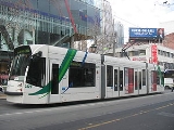
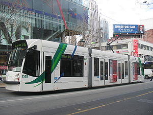
Operation
Route 6 is run from Malvern depot and is predominantly run with Z classZ class Melbourne tram
The Z class are a single-unit, bogie tram that operates in Melbourne, Australia. They were built by Comeng, a manufacturing company in Dandenong, Victoria, Australia.-History:...
and D1 class trams.
A truncated, off-peak version of route 6 exists as route 7. This route also begins at the University of Melbourne, but ends at Glenferrie Road at Malvern Town Hall
Malvern Town Hall
Stonnington City Centre is the former town hall of the municipality of Malvern in the state of Victoria, Australia. It is the seat of the Local Government Area of the City of Stonnington....
. It only operates in the direction away from the city.