
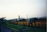
Meghna Bridge
Encyclopedia
Meghna Bridge is a road bridge in Bangladesh
. It was built by assistance of Japan
and officially named Japan Bangladesh Friendship Bridge 1, but it is popularly known as Meghna Bridge. According to a study conducted in 2004 by the Embassy of Japan in Bangladesh, residents living around the Meghna Bridge recognized several positive impacts after the construction of the bridge.
across the Meghna River
, which is one of the major rivers in the country. The bridge is located along the Dhaka Chittagong Highway. The geographic coordinate
of the Meghna Bridge is 23°36.162′N 90°36.991′E.
. It was constructed by the Nippon Koei Co. Ltd., (an independent engineering consulting firm in Japan that has been involved in projects in more than 80 countries). The bridge was opened on February 1, 1991. A total of $7.9 billion was spent on the construction. Meghna Bridge is the single largest project with Japanese assistance in the world.
In 2005, the bridge underwent extensive repair because the expansion joint
s of the bridge were damaged due to the lack of appropriate maintenance.
and girder bridge
. It is 900 metre in length and 9.2 metre in width. The bridge has thirteen spans
. Two among the individual spans are of 24.25 metre in length each, one is of 48.3 metre in length, nine spans are of 87 metre in length each and the length of the rest is 18.2 metre. The carriage way of the bridge is 7.2 metre. The foundations are supported on RCC caissons
and piles
. Piled foundation of abutment
s are buried. RCC caissons which are used as foundation under the piers
are also buried. Both abutments and the piers of the bridge are RCC solid type. The piers of the bridge are hexagonal. Each pier is of 11 metre in length and 3.2 metre in width.
The wing walls of the bridge are of RCC and are fixed with abutments and have no weep hole
s. Railing type of the bridge is of R.C.C post and steel rail. The bridge has 0.8 metre wide sidewalk
at both sides. Meghna Bridge also has infrastructure of drainage
.
and of National Highway No. 1 significantly increased after the opening of the Meghna Bridge. In April 1997, an average of 10,149 vehicles of all types used the bridge in each 24 hours while March 2004 saw 9,704 vehicles per day. The reason behind this fall in traffic volume is attributed to increase in toll rate in 2002 and seasonal fluctuations. Below is a comparison of vehicles using the bridge per day in April 1997 and March 2004:
The survey conducted in 2004 by the Embassy of Japan in Bangladesh found that a majority of the users of the bridge believe that the construction of the Meghna Bridge improved the life of the people living near it and the surrounding area of the bridge has been urbanized
. The people surveyed opined that the number of traffic blockage caused by bad weather has been decreased since the construction. The survey also found that 42% of the trucks using Meghna Bridge transport goods between Dhaka and Chittagong
.
Bangladesh
Bangladesh , officially the People's Republic of Bangladesh is a sovereign state located in South Asia. It is bordered by India on all sides except for a small border with Burma to the far southeast and by the Bay of Bengal to the south...
. It was built by assistance of Japan
Japan
Japan is an island nation in East Asia. Located in the Pacific Ocean, it lies to the east of the Sea of Japan, China, North Korea, South Korea and Russia, stretching from the Sea of Okhotsk in the north to the East China Sea and Taiwan in the south...
and officially named Japan Bangladesh Friendship Bridge 1, but it is popularly known as Meghna Bridge. According to a study conducted in 2004 by the Embassy of Japan in Bangladesh, residents living around the Meghna Bridge recognized several positive impacts after the construction of the bridge.
Location
Meghna Bridge is 40 km southeast of DhakaDhaka
Dhaka is the capital of Bangladesh and the principal city of Dhaka Division. Dhaka is a megacity and one of the major cities of South Asia. Located on the banks of the Buriganga River, Dhaka, along with its metropolitan area, had a population of over 15 million in 2010, making it the largest city...
across the Meghna River
Meghna River
The Meghna River is an important river in Bangladesh, one of the three that forms the Ganges Delta, the largest on earth fanning out to the Bay of Bengal. Being a part of the Surma-Meghna River System, Meghna is formed inside Bangladesh by the joining of different rivers originaing from the hilly...
, which is one of the major rivers in the country. The bridge is located along the Dhaka Chittagong Highway. The geographic coordinate
Geographic coordinate system
A geographic coordinate system is a coordinate system that enables every location on the Earth to be specified by a set of numbers. The coordinates are often chosen such that one of the numbers represent vertical position, and two or three of the numbers represent horizontal position...
of the Meghna Bridge is 23°36.162′N 90°36.991′E.
History
Meghna Bridge was built with the financial help from the Government of JapanGovernment of Japan
The government of Japan is a constitutional monarchy where the power of the Emperor is very limited. As a ceremonial figurehead, he is defined by the 1947 constitution as "the symbol of the state and of the unity of the people". Power is held chiefly by the Prime Minister of Japan and other elected...
. It was constructed by the Nippon Koei Co. Ltd., (an independent engineering consulting firm in Japan that has been involved in projects in more than 80 countries). The bridge was opened on February 1, 1991. A total of $7.9 billion was spent on the construction. Meghna Bridge is the single largest project with Japanese assistance in the world.
In 2005, the bridge underwent extensive repair because the expansion joint
Expansion joint
An expansion joint or movement joint is an assembly designed to safely absorb the heat-induced expansion and contraction of various construction materials, to absorb vibration, to hold certain parts together, or to allow movement due to ground settlement or earthquakes...
s of the bridge were damaged due to the lack of appropriate maintenance.
Architecture
Meghna Bridge is a cantileverCantilever bridge
A cantilever bridge is a bridge built using cantilevers, structures that project horizontally into space, supported on only one end. For small footbridges, the cantilevers may be simple beams; however, large cantilever bridges designed to handle road or rail traffic use trusses built from...
and girder bridge
Girder bridge
A girder bridge, in general, is a bridge built of girders placed on bridge abutments and foundation piers. In turn, a bridge deck is built on top of the girders in order to carry traffic. There are several different subtypes of girder bridges:...
. It is 900 metre in length and 9.2 metre in width. The bridge has thirteen spans
Span (architecture)
Span is the distance between two intermediate supports for a structure, e.g. a beam or a bridge.A span can be closed by a solid beam or of a rope...
. Two among the individual spans are of 24.25 metre in length each, one is of 48.3 metre in length, nine spans are of 87 metre in length each and the length of the rest is 18.2 metre. The carriage way of the bridge is 7.2 metre. The foundations are supported on RCC caissons
Caisson (engineering)
In geotechnical engineering, a caisson is a retaining, watertight structure used, for example, to work on the foundations of a bridge pier, for the construction of a concrete dam, or for the repair of ships. These are constructed such that the water can be pumped out, keeping the working...
and piles
Deep foundation
A deep foundation is a type of foundation distinguished from shallow foundations by the depth they are embedded into the ground. There are many reasons a geotechnical engineer would recommend a deep foundation over a shallow foundation, but some of the common reasons are very large design loads, a...
. Piled foundation of abutment
Abutment
An abutment is, generally, the point where two structures or objects meet. This word comes from the verb abut, which means adjoin or having common boundary. An abutment is an engineering term that describes a structure located at the ends of a bridge, where the bridge slab adjoins the approaching...
s are buried. RCC caissons which are used as foundation under the piers
Pier (architecture)
In architecture, a pier is an upright support for a superstructure, such as an arch or bridge. Sections of wall between openings function as piers. The simplest cross section of the pier is square, or rectangular, although other shapes are also common, such as the richly articulated piers of Donato...
are also buried. Both abutments and the piers of the bridge are RCC solid type. The piers of the bridge are hexagonal. Each pier is of 11 metre in length and 3.2 metre in width.
The wing walls of the bridge are of RCC and are fixed with abutments and have no weep hole
Weep hole
Weep holes or "weeper holes" are small openings left in the outer wall of masonry construction as an outlet for water inside a building to move outside the wall and evaporate. The term was coined by archaeologist C. Leonard Woolley after finding evidence of weep holes in ziggurats...
s. Railing type of the bridge is of R.C.C post and steel rail. The bridge has 0.8 metre wide sidewalk
Sidewalk
A sidewalk, or pavement, footpath, footway, and sometimes platform, is a path along the side of a road. A sidewalk may accommodate moderate changes in grade and is normally separated from the vehicular section by a curb...
at both sides. Meghna Bridge also has infrastructure of drainage
Drainage
Drainage is the natural or artificial removal of surface and sub-surface water from an area. Many agricultural soils need drainage to improve production or to manage water supplies.-Early history:...
.
Economic impact
Traffic volumes across the Meghna RiverMeghna River
The Meghna River is an important river in Bangladesh, one of the three that forms the Ganges Delta, the largest on earth fanning out to the Bay of Bengal. Being a part of the Surma-Meghna River System, Meghna is formed inside Bangladesh by the joining of different rivers originaing from the hilly...
and of National Highway No. 1 significantly increased after the opening of the Meghna Bridge. In April 1997, an average of 10,149 vehicles of all types used the bridge in each 24 hours while March 2004 saw 9,704 vehicles per day. The reason behind this fall in traffic volume is attributed to increase in toll rate in 2002 and seasonal fluctuations. Below is a comparison of vehicles using the bridge per day in April 1997 and March 2004:
| Vehicle | Truck | Bus | Light Vehicle | Motorcycle | Total |
|---|---|---|---|---|---|
| April 1997 | 4,674 | 3,396 | 1,796 | 283 | 10,149 |
| March 2004 | 4,310 | 3,887 | 1,030 | 477 | 9,704 |
The survey conducted in 2004 by the Embassy of Japan in Bangladesh found that a majority of the users of the bridge believe that the construction of the Meghna Bridge improved the life of the people living near it and the surrounding area of the bridge has been urbanized
Urbanization
Urbanization, urbanisation or urban drift is the physical growth of urban areas as a result of global change. The United Nations projected that half of the world's population would live in urban areas at the end of 2008....
. The people surveyed opined that the number of traffic blockage caused by bad weather has been decreased since the construction. The survey also found that 42% of the trucks using Meghna Bridge transport goods between Dhaka and Chittagong
Chittagong
Chittagong ) is a city in southeastern Bangladesh and the capital of an eponymous district and division. Built on the banks of the Karnaphuli River, the city is home to Bangladesh's busiest seaport and has a population of over 4.5 million, making it the second largest city in the country.A trading...
.