
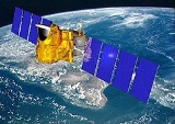
Megha-Tropiques Mission
Encyclopedia
Megha-Tropiques is a satellite
mission to study the water cycle
in the tropical atmosphere in the context of climate change A collaborative effort between Indian Space Research Organisation (ISRO) and French Centre National d’Etudes Spatiales (CNES
), Megha-Tropiques was successfully deployed into orbit by a PSLV rocket in October 2011.
Megha-Tropiques was initially scrapped in 2003, but later revived in 2004 after India increased its contribution and overall costs were lowered. With the progress made by GEWEX (Global Energy and Water Cycle Experiment), Megha-Tropiques is designed to understand tropical meteorological and climatic processes, by obtaining reliable statistics on the water and energy budget of the tropical atmosphere. Megha-Tropiques complements other data in the current regional monsoon projects such as MAHASRI and the completed GAME project. Megha-Tropiques also seeks to describe the evolution of major tropical weather systems. The focus will be the repetitive measurement of the tropics.
), would complement other research of the Global Precipitation Measurement missionADWAIH.
--2.90.43.103 (talk) 09:43, 14 October 2011 (UTC)
through its Polar Satellite Launch Vehicle (PSLV-C18) on October 12, 2011. The PSLV-C18 was launched at 11:00 am on October 12, 2011 from the first launch pad of the Satish Dhawan Space Centre (SHAR) located in Sriharikota
, Andhra Pradesh
. The satellite was placed in orbit along with three micro-satellites: the 10.9 kg SRMSAT built by the SRM University, Chennai, the 3 kg remote sensing satellite Jugnu
from the Indian Institute of Technology Kanpur(IIT Kanpur) and the 28.7 kg VesselSat-1 of Luxembourg
to locate ships on high seas.
Satellite
In the context of spaceflight, a satellite is an object which has been placed into orbit by human endeavour. Such objects are sometimes called artificial satellites to distinguish them from natural satellites such as the Moon....
mission to study the water cycle
Water cycle
The water cycle, also known as the hydrologic cycle or H2O cycle, describes the continuous movement of water on, above and below the surface of the Earth. Water can change states among liquid, vapor, and solid at various places in the water cycle...
in the tropical atmosphere in the context of climate change A collaborative effort between Indian Space Research Organisation (ISRO) and French Centre National d’Etudes Spatiales (CNES
CNES
The is the French government space agency . Established under President Charles de Gaulle in 1961, its headquarters are located in central Paris and it is under the supervision of the French Ministries of Defence and Research...
), Megha-Tropiques was successfully deployed into orbit by a PSLV rocket in October 2011.
Megha-Tropiques was initially scrapped in 2003, but later revived in 2004 after India increased its contribution and overall costs were lowered. With the progress made by GEWEX (Global Energy and Water Cycle Experiment), Megha-Tropiques is designed to understand tropical meteorological and climatic processes, by obtaining reliable statistics on the water and energy budget of the tropical atmosphere. Megha-Tropiques complements other data in the current regional monsoon projects such as MAHASRI and the completed GAME project. Megha-Tropiques also seeks to describe the evolution of major tropical weather systems. The focus will be the repetitive measurement of the tropics.
Design
Primarily Megha-Tropiques provides instruments that allow simultaneously observation of 3 interrelated components of the atmospheric engine: water vapor, condensed water (clouds and precipitations), and radiative fluxes. Secondarily is to facilitate the repetitive sampling of the inter-tropical zone over long periods of time. Finally a microwave radiometer, Multi-frequency Microwave Scanning Radiometer (MADRASSpecial Sensor Microwave/Imager
The special sensor microwave/imager is a seven-channel, four-frequency, linearly polarized passive microwave radiometer system. It is flown on board the United States Air Force Defense Meteorological Satellite Program Block 5D-2 satellites. The instrument measures surface/atmospheric microwave...
), would complement other research of the Global Precipitation Measurement missionADWAIH.
--2.90.43.103 (talk) 09:43, 14 October 2011 (UTC)
Payload
Instruments fulfill a complementary role to other on geostationary satellites. In this, microwave instruments are essential.- Microwave Analysis and Detection of Rain and Atmospheric Structures (MADRAS) is a microwaveMicrowaveMicrowaves, a subset of radio waves, have wavelengths ranging from as long as one meter to as short as one millimeter, or equivalently, with frequencies between 300 MHz and 300 GHz. This broad definition includes both UHF and EHF , and various sources use different boundaries...
imager, with conical scanning (incidence angle 56°), close from the SSM/I and TMI concepts. The main aim of the mission being the study of cloudCloudA cloud is a visible mass of liquid droplets or frozen crystals made of water and/or various chemicals suspended in the atmosphere above the surface of a planetary body. They are also known as aerosols. Clouds in Earth's atmosphere are studied in the cloud physics branch of meteorology...
systems, a frequency has been added (150 GHz) in order to study the high level ice cloudIce cloudThe term ice cloud has been used to describe clouds of carbon dioxide on Mars. Such clouds can be sufficiently large and dense to cast shadows on the Martian surface. Clouds of water ice also occur on Mars.Clouds on Earth can contain ice particles....
s associated with the convective systems, and to serve as a window channel relative to the sounding instrument at 183 GHz.
- Sounder for Probing Vertical Profiles of Humidity (SAPHIR) is a sounding instrument with 6 channels near the absorption band of water vaporWater vaporWater vapor or water vapour , also aqueous vapor, is the gas phase of water. It is one state of water within the hydrosphere. Water vapor can be produced from the evaporation or boiling of liquid water or from the sublimation of ice. Under typical atmospheric conditions, water vapor is continuously...
at 183 GHz. These channels provide relatively narrow weighting functions from the surface to about 10 km, allowing retrieving water vapor profiles in the cloud free troposphereTroposphereThe troposphere is the lowest portion of Earth's atmosphere. It contains approximately 80% of the atmosphere's mass and 99% of its water vapor and aerosols....
. The scanning is cross-track, up to an incidence angle of 50°. The resolution at nadir is of 10 km.
- Scanner for Radiation Budget (ScaRaB) is a scanning radiative budget instrument, which has already been launched twice on Russian satellites. The basic measurements of ScaRaB are the radiances in two wide channels, a solar channel (0.2 - 4 µm), and a total channel (0.2 - 200 µm), allowing to derive longwave radiances. The resolution at nadir will be 40 km from an orbit at 870 km. The procedures of calibration and processing of the data in order to derive fluxes from the original radiances have been set up and tested by CNESCNESThe is the French government space agency . Established under President Charles de Gaulle in 1961, its headquarters are located in central Paris and it is under the supervision of the French Ministries of Defence and Research...
and LMD.
- Radio Occultation Sensor for Vertical Profiling of Temperature and Humidity (ROSA) procured from Italy for vertical profiling of temperature and humidity.
Launch
The Megha-Tropiques satellite was successfully placed in an 867 km orbit with an inclination of 20 degrees to the equator by the Indian Space Research OrganisationIndian Space Research Organisation
The Indian Space Research Organisation is an independent Indian governmental agency established in 1969 for the research and development of vehicles and activities for the exploration of space within and outside of Earth’s atmosphere. Headquartered in Bangalore...
through its Polar Satellite Launch Vehicle (PSLV-C18) on October 12, 2011. The PSLV-C18 was launched at 11:00 am on October 12, 2011 from the first launch pad of the Satish Dhawan Space Centre (SHAR) located in Sriharikota
Sriharikota
Sriharikota is a barrier island off the coast of the southern state of Andhra Pradesh in India. It houses India's only satellite launch centre in the Satish Dhawan Space Centre and is used by the Indian Space Research Organisation to launch satellites using multi-stage rockets such as the Polar...
, Andhra Pradesh
Andhra Pradesh
Andhra Pradesh , is one of the 28 states of India, situated on the southeastern coast of India. It is India's fourth largest state by area and fifth largest by population. Its capital and largest city by population is Hyderabad.The total GDP of Andhra Pradesh is $100 billion and is ranked third...
. The satellite was placed in orbit along with three micro-satellites: the 10.9 kg SRMSAT built by the SRM University, Chennai, the 3 kg remote sensing satellite Jugnu
Jugnu (satellite)
Jugnu , is an Indian technology demonstration and remote sensing satellite which will be operated by the Indian Institute of Technology Kanpur. It is a nanosatellite which will be used to provide data for agriculture and disaster monitoring. It is a spacecraft, which measures in length by in...
from the Indian Institute of Technology Kanpur(IIT Kanpur) and the 28.7 kg VesselSat-1 of Luxembourg
Luxembourg
Luxembourg , officially the Grand Duchy of Luxembourg , is a landlocked country in western Europe, bordered by Belgium, France, and Germany. It has two principal regions: the Oesling in the North as part of the Ardennes massif, and the Gutland in the south...
to locate ships on high seas.