
Marion Township, Boone County, Indiana
Encyclopedia
Marion Township is one of twelve townships
in Boone County, Indiana
. As of the 2000 census
, its population was 1,359.
Township (United States)
A township in the United States is a small geographic area. Townships range in size from 6 to 54 square miles , with being the norm.The term is used in three ways....
in Boone County, Indiana
Boone County, Indiana
As of the census of 2000, there were 46,107 people, 17,081 households, and 12,810 families residing in the county. The population density was 109 people per square mile . There were 17,929 housing units at an average density of 42 per square mile...
. As of the 2000 census
United States Census, 2000
The Twenty-second United States Census, known as Census 2000 and conducted by the Census Bureau, determined the resident population of the United States on April 1, 2000, to be 281,421,906, an increase of 13.2% over the 248,709,873 persons enumerated during the 1990 Census...
, its population was 1,359.
Geography
Marion Township covers an area of 45.98 square miles (119.1 km²); 0.01 square mile (0.0258998811 km²) (0.02 percent) of this is water.Adjacent townships
- CenterCenter Township, Boone County, IndianaCenter Township is one of twelve townships in Boone County, Indiana. As of the 2000 census, its population was 17,102.-Unincorporated towns:* Brendan Wood* Elmwood* Hazel College* Northfield Village* Stringtown...
(southwest) - ClintonClinton Township, Boone County, IndianaClinton Township is one of twelve townships in Boone County, Indiana. As of the 2000 census, its population was 892.-Adjacent townships:* Center * Marion * Washington * Jackson Township, Clinton County...
(west) - UnionUnion Township, Boone County, IndianaUnion Township is one of twelve townships in Boone County, Indiana. As of the 2000 census, its population was 2,014.-Geography:Union Township covers an area of ; of this is water.-Unincorporated towns:* Big Springs* Gadsden* Northfield...
(south) - Adams Township, Hamilton CountyAdams Township, Hamilton County, IndianaAdams Township is one of nine townships in Hamilton County, Indiana, USA. As of the 2000 census, its population was 4,892.-Geography:Adams Township covers an area of...
(east) - Kirklin Township, Clinton CountyKirklin Township, Clinton County, IndianaKirklin Township is one of fourteen townships in Clinton County, Indiana. As of the 2000 census, its population was 1,370.-History:The township was organized in 1837 from a piece of Jackson Township and named for Nathan Kirk, a local pioneer and the first settler in the eastern half of the county...
(northwest) - Sugar Creek Township, Clinton CountySugar Creek Township, Clinton County, IndianaSugar Creek Township is one of fourteen townships in Clinton County, Indiana. As of the 2000 census, its population was 486. The township is named for the stream that flows southwest through it.-History:...
(north) - Washington Township, Hamilton CountyWashington Township, Hamilton County, IndianaWashington Township is one of nine townships in Hamilton County, Indiana, USA. As of the 2000 census, its population was 18,358. In 2007, the township had 29,361 residents...
(southeast)
Major highways
-
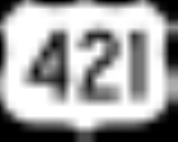
 U.S. Route 421U.S. Route 421U.S. Route 421 is a spur route of U.S. 21. It runs for from Michigan City, Indiana, at U.S. 20, to Fort Fisher in North Carolina. The highway goes through the cities of Indianapolis, Indiana, Lexington, Kentucky, Boone, North Carolina, Winston-Salem, North Carolina, Greensboro, North Carolina and...
 -
 Indiana State Road 38Indiana State Road 38State Road 38 in the U.S. State of Indiana serves as a connection between Lafayette in the west and Richmond in the east.-Route description:State Road 38 begins in Lafayette with State Road 25 and U.S. Route 52. There is an interchange with Interstate 65 at exit 168. It proceeds east-southeast...
 -
 Indiana State Road 47Indiana State Road 47State Road 47 in the U.S. state of Indiana is a state highway in west-central and central Indiana. Although State Road 47 is signed as a north–south highway, it runs more east–west.-Route description:...