
.gif)
M6 motorway (Ireland)
Encyclopedia
The M6 motorway is a motorway in Ireland, which runs (together with the M4) from Dublin to Galway
. The M6 extends from its junction with the M4 at Kinnegad
all the way west to the outskirts of Galway City, but the Athlone bypass and the approach to Galway city - while of dual carriageway standard - have not been designated motorway and are still signed as N6. The motorway was officially completed and opened to traffic on 18 December 2009, and was the first city-to-city direct major inter-urban route to be completed in Ireland. The M6 and M4, which form the Galway
-Dublin route, consist of a grade-separated 2+2 dual carriageway road with a top speed limit of 120 km/h. At approximately 144 km (90 mi), the M6 is the third longest motorway in the state.
, the M6 motorway diverges from the M4 at a restricted access junction. From here it proceeds westward, passing through counties Westmeath, Offaly, Roscommon
and Galway
before terminating just east of Galway City.
In chronological order, the various sections opened as follows (status on opening in brackets):
From 24 September 2008, motorway regulations were applied from Kinnegad to the eastern end of the Athlone bypass. . The Kinnegad-Athlone scheme was signed as a motorway (and numbered "M6"). Its road markings
were already appropriate to a motorway prior to the change in designation coming into effect; however, motorway regulations were not in force and the speed limit
was 100 km/h until 24 September of that year.
HQDC to motorway standard and was redesignated a motorway on 28 August 2009. Prior to this date, the scheme was subject to a reduced speed limit of 100 km/h. The central barrier on this road is a traditional metal barrier rather than the Concrete step barrier
s, which have become standard on all new dual-carriageways in the Republic of Ireland and UK in recent years. The Athlone to Ballinasloe scheme was built by SIAC-Willis JV.
scheme, and opened under motorway restrictions.
This scheme was a matter of some controversy at its planning stage. The environmental agency An Taisce
claimed that the National Roads Authority
's planned route would be "particularly destructive" in passing the site of the 17th-century Battle of Aughrim
The decision to toll the route is also controversial, as the M4 motorway to/from Dublin, which connects with the N6/M6 route, is also tolled. This is effect meant that motorists would have to pay two tolls when driving between Dublin and Galway. It was pointed out, however, that this corresponds with the Authority's plan to have two tolls on each of the main interurban routes.
The new section of N6/M6 between Ballinasloe and Galway was also quite unusual in another way: Unlike most national road upgrade projects in Ireland, the new route differed significantly from that of the original N6. The new route runs roughly east-west between the two destinations, rather than dipping south to Loughrea
, as the former alignment N6 did. The N56
was extended from Loughrea to the new M6 was constructed to cater for this change. The altered nature of the route also meant that the town of Athenry
was situated close to a national primary route for the first time.
As an emergency measure to restore access from Dublin to Galway after severe flooding at Craughwell on Friday 20 November 2009, an incomplete section of this scheme between Loughrea and Galway Clinic (Doughiska) was opened temporarily.
There are two junction numbering schemes on the N6 route. The M6 junction numbers below are used on the Kinnegad-Athlone section. The Athlone bypass has a separate numbering scheme (J1-J6) but this is likely to be renumbered.
& 17 Athenry
. Hence there is no toll payable to travel between the eastern end of the motorway and Loughrea and also between Athenry and the western end at Galway city. Tolls may be paid by cash, credit card or through the use of an electronic tag.
(NRA) has planned the construction Motorway Service Areas at approximately 60 kilometre intervals along each of Ireland's interurban routes. Under this plan, the M6 will have one such area. It will be located just east of Athlone (see here, p. 25). The EIS for the M6 Athlone Motorway Service Area
is now available at the NRA website (scroll down to the bottom here).
Galway
Galway or City of Galway is a city in County Galway, Republic of Ireland. It is the sixth largest and the fastest-growing city in Ireland. It is also the third largest city within the Republic and the only city in the Province of Connacht. Located on the west coast of Ireland, it sits on the...
. The M6 extends from its junction with the M4 at Kinnegad
Kinnegad
Kinnegad or Kinagad is a town in County Westmeath, Ireland. It is near the border with County Meath, at the junction of the N6 and the N4 - two of Ireland's main east-west roads...
all the way west to the outskirts of Galway City, but the Athlone bypass and the approach to Galway city - while of dual carriageway standard - have not been designated motorway and are still signed as N6. The motorway was officially completed and opened to traffic on 18 December 2009, and was the first city-to-city direct major inter-urban route to be completed in Ireland. The M6 and M4, which form the Galway
Galway
Galway or City of Galway is a city in County Galway, Republic of Ireland. It is the sixth largest and the fastest-growing city in Ireland. It is also the third largest city within the Republic and the only city in the Province of Connacht. Located on the west coast of Ireland, it sits on the...
-Dublin route, consist of a grade-separated 2+2 dual carriageway road with a top speed limit of 120 km/h. At approximately 144 km (90 mi), the M6 is the third longest motorway in the state.
Route
Near KinnegadKinnegad
Kinnegad or Kinagad is a town in County Westmeath, Ireland. It is near the border with County Meath, at the junction of the N6 and the N4 - two of Ireland's main east-west roads...
, the M6 motorway diverges from the M4 at a restricted access junction. From here it proceeds westward, passing through counties Westmeath, Offaly, Roscommon
Roscommon
Roscommon is the county town of County Roscommon in Ireland. Its population at the 2006 census stood at 5,017 . The town is located near the junctions of the N60, N61 and N63 roads.-History:...
and Galway
Galway
Galway or City of Galway is a city in County Galway, Republic of Ireland. It is the sixth largest and the fastest-growing city in Ireland. It is also the third largest city within the Republic and the only city in the Province of Connacht. Located on the west coast of Ireland, it sits on the...
before terminating just east of Galway City.
History
The present-day M6 was constructed in five stages between 2005 and late 2009. Some of the sections which now form part of the M6 were initially opened as dual-carriageway and previously formed part of the N6, while other sections were opened as motorway.In chronological order, the various sections opened as follows (status on opening in brackets):
- Kinnegad-Tyrellspass (5 December 2006, as dual carriageway);
- Tyrellspass-Kilbeggan (16 May 2007, as dual carriageway);
- Kilbeggan-Athlone (16 July 2008, as dual carriageway);
- Athlone-Ballinasloe (23 July 2009, as motorway);
- Ballinasloe-Galway (18 December 2009, as motorway).
Kinnegad-Athlone
From 24 September 2008, motorway regulations were applied from Kinnegad to the eastern end of the Athlone bypass. . The Kinnegad-Athlone scheme was signed as a motorway (and numbered "M6"). Its road markings
Road surface marking
Road surface marking is any kind of device or material that is used on a road surface in order to convey official information. They can also be applied in other facilities used by vehicles to mark parking spaces or designate areas for other uses....
were already appropriate to a motorway prior to the change in designation coming into effect; however, motorway regulations were not in force and the speed limit
Speed limit
Road speed limits are used in most countries to regulate the speed of road vehicles. Speed limits may define maximum , minimum or no speed limit and are normally indicated using a traffic sign...
was 100 km/h until 24 September of that year.
Athlone-Ballinasloe
Construction of this 19-km section of road commenced on 3 September, 2007 and opened to traffic on 23 July 2009. It was built as a grade separatedGrade separation
Grade separation is the method of aligning a junction of two or more transport axes at different heights so that they will not disrupt the traffic flow on other transit routes when they cross each other. The composition of such transport axes does not have to be uniform; it can consist of a...
HQDC to motorway standard and was redesignated a motorway on 28 August 2009. Prior to this date, the scheme was subject to a reduced speed limit of 100 km/h. The central barrier on this road is a traditional metal barrier rather than the Concrete step barrier
Concrete step barrier
A concrete step barrier is a safety barrier used on the central reservation of motorways and dual carriageways as an alternative to the standard steel crash barrier.The barrier has contained all vehicles up to 13.5 tonnes.-United Kingdom:...
s, which have become standard on all new dual-carriageways in the Republic of Ireland and UK in recent years. The Athlone to Ballinasloe scheme was built by SIAC-Willis JV.
Ballinasloe-Galway
Construction of this 56-km section of M6 began in 2007. This section lies between the town of Ballinasloe and Galway City, running between junctions 14 and 20 on the M6 corridor. The road is a tolled Public-private partnershipPublic-private partnership
Public–private partnership describes a government service or private business venture which is funded and operated through a partnership of government and one or more private sector companies...
scheme, and opened under motorway restrictions.
This scheme was a matter of some controversy at its planning stage. The environmental agency An Taisce
An Taisce
An Taisce , also known as the National Trust for Ireland, was established in 1948 with a similar mission to that of the National Trust in England, Wales and Northern Ireland...
claimed that the National Roads Authority
National Roads Authority
The National Roads Authority is a state body in the Republic of Ireland, responsible for the national road network. The NRA was established as part of the Roads Act 1993 and commenced operations on 23 December 1993 in accordance with S.I. 407 of 1993.County councils remain responsible for local...
's planned route would be "particularly destructive" in passing the site of the 17th-century Battle of Aughrim
Battle of Aughrim
The Battle of Aughrim was the decisive battle of the Williamite War in Ireland. It was fought between the Jacobites and the forces of William III on 12 July 1691 , near the village of Aughrim in County Galway....
The decision to toll the route is also controversial, as the M4 motorway to/from Dublin, which connects with the N6/M6 route, is also tolled. This is effect meant that motorists would have to pay two tolls when driving between Dublin and Galway. It was pointed out, however, that this corresponds with the Authority's plan to have two tolls on each of the main interurban routes.
The new section of N6/M6 between Ballinasloe and Galway was also quite unusual in another way: Unlike most national road upgrade projects in Ireland, the new route differed significantly from that of the original N6. The new route runs roughly east-west between the two destinations, rather than dipping south to Loughrea
Loughrea
Loughrea is a town in County Galway, Ireland. The town lies north of a range of wooded hills, the Slieve Aughty Mountains.The town expanded in recent years as it increasingly becomes a commuter town for the city of Galway.- Name :...
, as the former alignment N6 did. The N56
N56 road (Ireland)
The N56 road is a national secondary road in Ireland that runs from Donegal town to Letterkenny. As originally designated, it included the section of the N13 between Stranorlar and Letterkenny, forming a circular route including parts of the N15....
was extended from Loughrea to the new M6 was constructed to cater for this change. The altered nature of the route also meant that the town of Athenry
Athenry
Athenry is a town in County Galway, Ireland. It lies east of Galway city, and one of the attractions of the town is its medieval castle. The town is also well-known by virtue of the song "The Fields of Athenry".-History:...
was situated close to a national primary route for the first time.
As an emergency measure to restore access from Dublin to Galway after severe flooding at Craughwell on Friday 20 November 2009, an incomplete section of this scheme between Loughrea and Galway Clinic (Doughiska) was opened temporarily.
Junctions
There are two junction numbering schemes on the N6 route. The M6 junction numbers below are used on the Kinnegad-Athlone section. The Athlone bypass has a separate numbering scheme (J1-J6) but this is likely to be renumbered.
 |
|||
| Westbound exit | Junction | Eastbound exit | |
Start of motorway (M4  ) ) |
|
The EAST (M4 ) - Dublin, Kinnegad Kinnegad Kinnegad or Kinagad is a town in County Westmeath, Ireland. It is near the border with County Meath, at the junction of the N6 and the N4 - two of Ireland's main east-west roads... , Leixlip Leixlip -Politics:Since 1988 Leixlip has had a nine member Town Council , headed by a Cathaoirleach , which has control over many local matters, although it is limited in that it is not also a planning authority... , Lucan |
|
| Kinnegad Kinnegad Kinnegad or Kinagad is a town in County Westmeath, Ireland. It is near the border with County Meath, at the junction of the N6 and the N4 - two of Ireland's main east-west roads... (R446 R446 road The R446 road is one of Ireland's newest regional roads, having been classified following the opening in 2006 of the N6 High Quality Dual Carriageway which by-passes the old route.... ) |
|
Kinnegad Kinnegad Kinnegad or Kinagad is a town in County Westmeath, Ireland. It is near the border with County Meath, at the junction of the N6 and the N4 - two of Ireland's main east-west roads... (R446 R446 road The R446 road is one of Ireland's newest regional roads, having been classified following the opening in 2006 of the N6 High Quality Dual Carriageway which by-passes the old route.... ) Sligo Sligo Sligo is the county town of County Sligo in Ireland. The town is a borough and has a charter and a town mayor. It is sometimes referred to as a city, and sometimes as a town, and is the second largest urban area in Connacht... , Westport Westport, County Mayo Westport is a town in County Mayo, Ireland. It is situated on the west coast at the south-east corner of Clew Bay, an inlet of the Atlantic Ocean.... (N4) Enfield Enfield, County Meath Enfield or Innfield is a town in south County Meath, Ireland, situated between Kilcock and Kinnegad and very close to the border with County Kildare... (R148 R148 road The R148 road is one of Ireland's regional roads which was classified following the opening of a by-passed national primary road.The section of the old N4 which has been by-passed by the M4 motorway was reclassified R148. The R148 runs from Dublin to Kinnegad in County Westmeath.The road is long... ) |
|
| Rochfordbridge, Milltownpass Milltownpass Milltownpass is a village in County Westmeath, Ireland. It is located in the south of the county on the R446 regional road formerly the N6 national primary route. The old route was replaced by a dual-carriageway in 2006, bypassing the village. Milltownpass is the second largest village in the... (R446 R446 road The R446 road is one of Ireland's newest regional roads, having been classified following the opening in 2006 of the N6 High Quality Dual Carriageway which by-passes the old route.... ) |
 |
Rochfordbridge, Milltownpass Milltownpass Milltownpass is a village in County Westmeath, Ireland. It is located in the south of the county on the R446 regional road formerly the N6 national primary route. The old route was replaced by a dual-carriageway in 2006, bypassing the village. Milltownpass is the second largest village in the... (R446 R446 road The R446 road is one of Ireland's newest regional roads, having been classified following the opening in 2006 of the N6 High Quality Dual Carriageway which by-passes the old route.... ) |
|
| Tyrrellspass Tyrrellspass Tyrrellspass is a Georgian village in County Westmeath, Ireland. It is located 81 km from Dublin and is situated in the south of the county on the R446 road. Tyrrellspass won the Irish Tidy Towns Competition in 1969.-History:... , Mullingar Mullingar Mullingar is the county town of County Westmeath in Ireland. The Counties of Meath and Westmeath Act of 1542, proclaimed Westmeath a county, separating it from Meath. Mullingar became the administrative centre for County Westmeath... (N52 N52 road (Ireland) The N52 road is a national secondary road in Ireland. It links the M7 motorway from just south of Nenagh, County Tipperary to the M1 motorway north of Dundalk in County Louth.The road is long.-Quality of Road:... ) |
 |
Tyrrellspass Tyrrellspass Tyrrellspass is a Georgian village in County Westmeath, Ireland. It is located 81 km from Dublin and is situated in the south of the county on the R446 road. Tyrrellspass won the Irish Tidy Towns Competition in 1969.-History:... , Mullingar Mullingar Mullingar is the county town of County Westmeath in Ireland. The Counties of Meath and Westmeath Act of 1542, proclaimed Westmeath a county, separating it from Meath. Mullingar became the administrative centre for County Westmeath... (N52 N52 road (Ireland) The N52 road is a national secondary road in Ireland. It links the M7 motorway from just south of Nenagh, County Tipperary to the M1 motorway north of Dundalk in County Louth.The road is long.-Quality of Road:... ) |
|
| Tullamore Tullamore Tullamore is a town in County Offaly, in the midlands of Ireland. It is Offaly's county town and the centre of the district.Tullamore is an important commercial and industrial centre in the region. Major international employers in the town include 'Tyco Healthcare' and 'Boston Scientific'. In... , Kilbeggan Kilbeggan -Geography:Kilbeggan is situated on the River Brosna, in the south of County Westmeath. It lies southeast of Lough Ennell, north of the boundary with County Offaly, about 9 kilometres north of Tullamore. Kilbeggan is surrounded by the gently rolling Esker Riada, the linear sand hills that stretch... (N52 N52 road (Ireland) The N52 road is a national secondary road in Ireland. It links the M7 motorway from just south of Nenagh, County Tipperary to the M1 motorway north of Dundalk in County Louth.The road is long.-Quality of Road:... ) |
 |
Tullamore Tullamore Tullamore is a town in County Offaly, in the midlands of Ireland. It is Offaly's county town and the centre of the district.Tullamore is an important commercial and industrial centre in the region. Major international employers in the town include 'Tyco Healthcare' and 'Boston Scientific'. In... , Kilbeggan Kilbeggan -Geography:Kilbeggan is situated on the River Brosna, in the south of County Westmeath. It lies southeast of Lough Ennell, north of the boundary with County Offaly, about 9 kilometres north of Tullamore. Kilbeggan is surrounded by the gently rolling Esker Riada, the linear sand hills that stretch... (N52 N52 road (Ireland) The N52 road is a national secondary road in Ireland. It links the M7 motorway from just south of Nenagh, County Tipperary to the M1 motorway north of Dundalk in County Louth.The road is long.-Quality of Road:... ) |
|
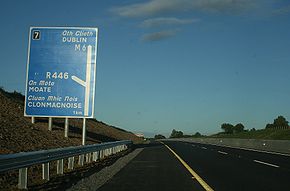
| Moate Moate Moate is a town in County Westmeath, Ireland.The name An Móta is derived from the term motte-and-bailey as the Normans built an example of this type of fortification here. The earthwork is still visible behind the buildings on the main street.... (N80 N80 road (Ireland) The N80 road is a national secondary road in Ireland that runs southeastwards from its junction with the N52 and R443 in the town of Tullamore in County Offaly, to the N11 at Ballynahallin, just north of Enniscorthy in County Wexford, a distance of 116 km... ) |
 |
Moate Moate Moate is a town in County Westmeath, Ireland.The name An Móta is derived from the term motte-and-bailey as the Normans built an example of this type of fortification here. The earthwork is still visible behind the buildings on the main street.... (N80 N80 road (Ireland) The N80 road is a national secondary road in Ireland that runs southeastwards from its junction with the N52 and R443 in the town of Tullamore in County Offaly, to the N11 at Ballynahallin, just north of Enniscorthy in County Wexford, a distance of 116 km... ) |
|
| Moate Moate Moate is a town in County Westmeath, Ireland.The name An Móta is derived from the term motte-and-bailey as the Normans built an example of this type of fortification here. The earthwork is still visible behind the buildings on the main street.... (R446 R446 road The R446 road is one of Ireland's newest regional roads, having been classified following the opening in 2006 of the N6 High Quality Dual Carriageway which by-passes the old route.... ) |
 |
Moate Moate Moate is a town in County Westmeath, Ireland.The name An Móta is derived from the term motte-and-bailey as the Normans built an example of this type of fortification here. The earthwork is still visible behind the buildings on the main street.... (R446 R446 road The R446 road is one of Ireland's newest regional roads, having been classified following the opening in 2006 of the N6 High Quality Dual Carriageway which by-passes the old route.... ) |
|
| Athlone (R446 R446 road The R446 road is one of Ireland's newest regional roads, having been classified following the opening in 2006 of the N6 High Quality Dual Carriageway which by-passes the old route.... ) End of motorway |
 |
Start of motorway | |
 |
|||
| Westbound exits | Junction | Eastbound exits | |
| |
Athlone (R446 R446 road The R446 road is one of Ireland's newest regional roads, having been classified following the opening in 2006 of the N6 High Quality Dual Carriageway which by-passes the old route.... ) |
||
| Athlone |  |
Athlone | |
| Athlone (N55 N55 road (Ireland) The N55 road is a national secondary road in Ireland linking Athlone on the River Shannon in the centre of the country to Cavan town.-Route:... ) |
 |
Athlone (N55 N55 road (Ireland) The N55 road is a national secondary road in Ireland linking Athlone on the River Shannon in the centre of the country to Cavan town.-Route:... ) |
|
| Athlone | |
Athlone | |
| Athlone (N61 N61 road (Ireland) The N61 road is a national secondary road in County Roscommon, Ireland, linking the N4, N5 and N6 national primary roads.-Route:Starting at Athlone , the road goes Northwards to Knockcroghery, Roscommon, Tulsk , and ends just North of Boyle at the N4.... ) |
 |
Athlone (N61 N61 road (Ireland) The N61 road is a national secondary road in County Roscommon, Ireland, linking the N4, N5 and N6 national primary roads.-Route:Starting at Athlone , the road goes Northwards to Knockcroghery, Roscommon, Tulsk , and ends just North of Boyle at the N4.... ) |
|
| Athlone (R446 R446 road The R446 road is one of Ireland's newest regional roads, having been classified following the opening in 2006 of the N6 High Quality Dual Carriageway which by-passes the old route.... ) |
 |
Athlone (R446 R446 road The R446 road is one of Ireland's newest regional roads, having been classified following the opening in 2006 of the N6 High Quality Dual Carriageway which by-passes the old route.... ) |
|
| |
|||
| Westbound exit | Junction | Eastbound exit | |
| Ballinasloe (R357 R357 road The R357 road is a regional road in Ireland linking Athleague, County Roscommon and Blue Ball, County Offaly. It passes Ballinasloe, County Galway, crosses the River Shannon at Shannonbridge passes through Cloughan, County Offaly and then through the cutaway peatlands of Boora Bog to Blue Ball... ) |
 |
Ballinasloe (R357 R357 road The R357 road is a regional road in Ireland linking Athleague, County Roscommon and Blue Ball, County Offaly. It passes Ballinasloe, County Galway, crosses the River Shannon at Shannonbridge passes through Cloughan, County Offaly and then through the cutaway peatlands of Boora Bog to Blue Ball... ) |
|
| Ballinasloe (R446 R446 road The R446 road is one of Ireland's newest regional roads, having been classified following the opening in 2006 of the N6 High Quality Dual Carriageway which by-passes the old route.... ) |
 |
Ballinasloe (R446 R446 road The R446 road is one of Ireland's newest regional roads, having been classified following the opening in 2006 of the N6 High Quality Dual Carriageway which by-passes the old route.... ) |
|
| Kiltullagh, Loughrea Loughrea Loughrea is a town in County Galway, Ireland. The town lies north of a range of wooded hills, the Slieve Aughty Mountains.The town expanded in recent years as it increasingly becomes a commuter town for the city of Galway.- Name :... |
 |
Kiltullagh, Loughrea Loughrea Loughrea is a town in County Galway, Ireland. The town lies north of a range of wooded hills, the Slieve Aughty Mountains.The town expanded in recent years as it increasingly becomes a commuter town for the city of Galway.- Name :... |
|
| Athenry Athenry Athenry is a town in County Galway, Ireland. It lies east of Galway city, and one of the attractions of the town is its medieval castle. The town is also well-known by virtue of the song "The Fields of Athenry".-History:... (R348 R348 road File:R348roadIreland.JPG|thumb|300px|Sign on the R348 regional road poly 544 504 532 728 1092 740 1108 672 1168 640 1140 592 1048 580 1060 500 Ballinasloepoly 560 764 528 824 532 920 1064 924 1064 856 996 828 1016 768 Kilconnell... ) |
 |
Athenry Athenry Athenry is a town in County Galway, Ireland. It lies east of Galway city, and one of the attractions of the town is its medieval castle. The town is also well-known by virtue of the song "The Fields of Athenry".-History:... (R348 R348 road File:R348roadIreland.JPG|thumb|300px|Sign on the R348 regional road poly 544 504 532 728 1092 740 1108 672 1168 640 1140 592 1048 580 1060 500 Ballinasloepoly 560 764 528 824 532 920 1064 924 1064 856 996 828 1016 768 Kilconnell... ) |
|
| |
|||
| Oranmore Oranmore Oranmore is a village in County Galway on the outskirts of Galway city in Ireland. With its major housing developments, Oranmore is rapidly becoming a part of Galway's commuter or suburban belt... (N18) |
 |
Oranmore Oranmore Oranmore is a village in County Galway on the outskirts of Galway city in Ireland. With its major housing developments, Oranmore is rapidly becoming a part of Galway's commuter or suburban belt... (N18) |
|
| Galway Galway Galway or City of Galway is a city in County Galway, Republic of Ireland. It is the sixth largest and the fastest-growing city in Ireland. It is also the third largest city within the Republic and the only city in the Province of Connacht. Located on the west coast of Ireland, it sits on the... (R446 R446 road The R446 road is one of Ireland's newest regional roads, having been classified following the opening in 2006 of the N6 High Quality Dual Carriageway which by-passes the old route.... ) |
 |
Galway Galway Galway or City of Galway is a city in County Galway, Republic of Ireland. It is the sixth largest and the fastest-growing city in Ireland. It is also the third largest city within the Republic and the only city in the Province of Connacht. Located on the west coast of Ireland, it sits on the... (R446 R446 road The R446 road is one of Ireland's newest regional roads, having been classified following the opening in 2006 of the N6 High Quality Dual Carriageway which by-passes the old route.... ) |
|
| (in planning) |
|||
| Westbound exit | Junction | Eastbound exit | Completion |
| Galway Galway Galway or City of Galway is a city in County Galway, Republic of Ireland. It is the sixth largest and the fastest-growing city in Ireland. It is also the third largest city within the Republic and the only city in the Province of Connacht. Located on the west coast of Ireland, it sits on the... (N84 N84 road (Ireland) The N84 road is a national secondary road in Ireland. It is a major route in the West connecting Galway city with Castlebar. The route is of poor quality with a few short good sections in County Mayo between Ballintubber and Ballinrobe. Ballinrobe has become a bottleneck on the route in recent... ) |
 |
Galway Galway Galway or City of Galway is a city in County Galway, Republic of Ireland. It is the sixth largest and the fastest-growing city in Ireland. It is also the third largest city within the Republic and the only city in the Province of Connacht. Located on the west coast of Ireland, it sits on the... (N84 N84 road (Ireland) The N84 road is a national secondary road in Ireland. It is a major route in the West connecting Galway city with Castlebar. The route is of poor quality with a few short good sections in County Mayo between Ballintubber and Ballinrobe. Ballinrobe has become a bottleneck on the route in recent... ) |
|
| Galway Galway Galway or City of Galway is a city in County Galway, Republic of Ireland. It is the sixth largest and the fastest-growing city in Ireland. It is also the third largest city within the Republic and the only city in the Province of Connacht. Located on the west coast of Ireland, it sits on the... (N59 N59 road (Ireland) The N59 road is a national secondary road in Ireland. It commences in County Sligo, south of Sligo Town at the Belladrehid interchange with the N4 north of Ballysadare. The route circles around the west of Ireland, passing west from Sligo into County Mayo and through Ballina. The N59 continues... ) |
 |
Galway Galway Galway or City of Galway is a city in County Galway, Republic of Ireland. It is the sixth largest and the fastest-growing city in Ireland. It is also the third largest city within the Republic and the only city in the Province of Connacht. Located on the west coast of Ireland, it sits on the... (N59 N59 road (Ireland) The N59 road is a national secondary road in Ireland. It commences in County Sligo, south of Sligo Town at the Belladrehid interchange with the N4 north of Ballysadare. The route circles around the west of Ireland, passing west from Sligo into County Mayo and through Ballina. The N59 continues... ) |
|
| End of N6 with R336 R336 road The R336 road is a regional road in Ireland. Heading west the route connects the city of Galway to An Cheathrú Rua through Casla. From Casla the route proceeds north, further into Connemara, passing through Screeb and crossing the N59 at Maam Cross... |
|||
Tolls
Although the M6 is a tolled motorway, there is only a single toll plaza, located at Cappataggle, between junctions 16 LoughreaLoughrea
Loughrea is a town in County Galway, Ireland. The town lies north of a range of wooded hills, the Slieve Aughty Mountains.The town expanded in recent years as it increasingly becomes a commuter town for the city of Galway.- Name :...
& 17 Athenry
Athenry
Athenry is a town in County Galway, Ireland. It lies east of Galway city, and one of the attractions of the town is its medieval castle. The town is also well-known by virtue of the song "The Fields of Athenry".-History:...
. Hence there is no toll payable to travel between the eastern end of the motorway and Loughrea and also between Athenry and the western end at Galway city. Tolls may be paid by cash, credit card or through the use of an electronic tag.
Motorway redesignations affecting the M6
At present, the M6 motorway leads into the non-motorway Athlone bypass and continues again west of the bypass to Galway. Subject to improvements, the Athlone Bypass may yet come under motorway regulations and be incorporated into the rest of the M6 route.Proposed Motorway Service Area
The National Roads AuthorityNational Roads Authority
The National Roads Authority is a state body in the Republic of Ireland, responsible for the national road network. The NRA was established as part of the Roads Act 1993 and commenced operations on 23 December 1993 in accordance with S.I. 407 of 1993.County councils remain responsible for local...
(NRA) has planned the construction Motorway Service Areas at approximately 60 kilometre intervals along each of Ireland's interurban routes. Under this plan, the M6 will have one such area. It will be located just east of Athlone (see here, p. 25). The EIS for the M6 Athlone Motorway Service Area
Rest area
A rest area, travel plaza, rest stop, or service area is a public facility, located next to a large thoroughfare such as a highway, expressway, or freeway at which drivers and passengers can rest, eat, or refuel without exiting on to secondary roads...
is now available at the NRA website (scroll down to the bottom here).
See also
- Roads in IrelandRoads in IrelandThe island of Ireland, comprising Northern Ireland and the Republic of Ireland, has an extensive network of tens of thousands of kilometres of public roads, usually surfaced. These roads have been developed and modernised over centuries, from trackways suitable only for walkers and horses, to...
- Motorways in Ireland
- National primary roadNational primary roadA national primary road is a road classification in the Republic of Ireland. National primary roads form the major routes between the major urban centres. There are over 2,700km of national primary roads. This category of road has the prefix "N" followed by one or two digits...
- National secondary roadNational secondary roadA national secondary road is a category of road in Ireland. These roads form an important part of the national route network, but are secondary to the main arterial routes which are classified as national primary roads. National secondary roads are designated with route numbers higher than those...
- Regional roadRegional roadA regional road in Ireland is a class of road not forming a major route , but nevertheless forming a link in the national route network. There are over 11,600 kilometres of regional roads. Regional roads are numbered with three digit route numbers, prefixed by "R" A regional road in Ireland is a...
External links
- Roads Act 1993 (Classification of National Roads) Order 2006 – Department of TransportDepartment of Transport (Ireland)The Department of Transport, Tourism and Sport is a department of the Government of Ireland that is responsible for transport policy and overseeing transport services and infrastructure. The Department is led by the Minister for Transport, Tourism and Sport who is assisted by two Ministers of State...
- Scheme Activity 2006 – National Roads AuthorityNational Roads AuthorityThe National Roads Authority is a state body in the Republic of Ireland, responsible for the national road network. The NRA was established as part of the Roads Act 1993 and commenced operations on 23 December 1993 in accordance with S.I. 407 of 1993.County councils remain responsible for local...
(road projects under construction) - N6 Galway to Ballinasloe – Galway County Council
- N6 Ballinasloe to Athlone Dual Carriageway – Roscommon County Council
- NRA map of the Athlone – Kilbeggan section
- N6 Galway City Outer Bypass
- M6 Toll operator website