
.gif)
M-13 (Michigan highway)
Encyclopedia
M-13 is a 73.339 miles (118 km) north–south state trunkline highway
that runs through the Saginaw Bay
region of the US state of Michigan
. It runs from Interstate 69
(I-69) south of Lennon
to US Highway 23
(US 23) near Standish
. The southern section of the trunkline runs long a pair of county lines in a rural area dominated by farm fields. The highway directly connects the downtown areas of both Saginaw
and Bay City
. North of the latter city, the Lake Huron Circle Tour follows M-13 along the Saginaw Bay.
The original 1919 version of M-13 ran along the west side of the state, roughly replaced by what is now US 131
in 1926. The current highway was first designated by 1932 with the M-13 moniker. After a series of extensions in the 1930s, the highway ran from Lennon to Saginaw. Another set of expansions in the 1960s added roadways that previously carried US 23 all the way north to the Standish area. A related section of highway is numbered Connector M-13
, a connector route that was once part of US 23 in the Kawkawlin area.
–Shiawassee
county line. The highway follows County Line Road north into the village where it follows Sheridan Avenue through town, including a crossing of the of the Huron and Eastern Railway
North of Lennon, the trunkline intersects M-21
and continues along the county line through fields. Northeast of New Lothrop
, M-13 moves from the Genesee–Shiawassee county line to the Genesee–Saginaw
county line. Near Montrose
, the highway intersects M-57
before passing into woodlands while crossing fully into Saginaw County.
M-13 angles to the northwest briefly before returning to a due north course along E Road. The highway crosses the Flint River
in another area of farm fields. As the road approaches Saginaw, it crosses the Cass River
and runs to the east of it as it merges with the Shiawassee River
and the Tittabawassee River
to form the Saginaw River
. M-13 follows Washington Avenue in the city of Saginaw inland from, but parallel to, the Saginaw River through downtown. The trunkline intersects M-46
, which follows Rust Avenue, and passes Hoyt Park. Washington Avenue runs by the campus of St. Mary's of Michigan Medical Center
. As the highway passes out of downtown, it crosses or runs along side lines of the Saginaw Bay Southern
and Lake State
railways.
 Running immediately next to the river, M-13 meets I-75/US 23 at that freeway's exit 153 just southeast of the Zilwaukee Bridge
. The highway runs along Bay City Road as it continues to follow the Saginaw River through the Crow Island State Game Area. On the south side of Bay City, the name changes to River Road. M-13 passes the James Clements Municipal Airport
and transitions to follow Broadway Street into downtown. At Lafayette Street, M-13 turns west and merges with M-84
. The two highways run concurrently
across the Saginaw River on the Lafayette Avenue Bridge
. The structure's two spans connect the riverbanks with the Middle Ground Island in the center. West of the bridge, M-13/M-84 follows Salzburg Avenue to the intersection with Euclid Avenue. At that location, M-13 turns north along Euclid Avenue, which runs along the western city line. M-13 meets the 2 one-way streets
that carry M-25
and the I-75 business spur at the intersections with Thomas and Jenny streets. From this intersection on, M-13 forms a part of the Lake Huron Circle Tour. Farther north, the highway turns northwesterly on Huron Road; Euclid Avenue continues north as M-247
.
As the trunkline heads away from Bay City, it runs parallel to the Lake State Railway again. M-13 intersects the northern end of its connector route
before Huron Road crosses the Kawkawlin River
. The highway runs through the community of the same name on the north side of the river. M-13 and Huron Road continue north across mixed agricultural and forest land as they pass through the communities of Linwood
and Pinconning
. South of Standish in Arenac County
, M-13 meets the northern end of the US 23 freeway and terminates.
M-13 is maintained by the Michigan Department of Transportation
(MDOT) like other state highways in Michigan. As a part of these maintenance responsibilities, the department tracks the volume of traffic that uses the roadways under its jurisdiction. These volumes are expressed using a metric called annual average daily traffic
, which is a statistical calculation of the average daily number of vehicles on a segment of roadway. MDOT's surveys in 2009 showed that the highest traffic levels along M-13 were the 28,242 vehicles daily north of the M-25 junction in Bay City; the lowest counts were the 3381 vehicles per day south of the I-75/US 23 interchange near Saginaw. The only sections of M-13 that have been listed on the National Highway System
(NHS) are along the M-84 concurrency and Euclid Avenue south of Wilder Road in the Bay City area. The NHS is a network of roads important to the country's economy, defense, and mobility.
, US 12
, the pre-freeway US 131, M-113
, M-186
, US 131, US 31
and M-119
between the Indiana state line south of Mottville to Harbor Springs
. When the United States Numbered Highway System was created on November 11, 1926, US 131 replaced M-13 from the state line north to Fife Lake
; from Fife Lake north to Harbor Springs, the highway was redesignated M-131.
and M-21 through Lennon. By the middle of 1936, the highway had been extended northward to end at a junction with M-46 in Saginaw. The entire trunkline was paved in the middle of 1939. Later the next year, the section in Saginaw was extended a bit farther along Washington Avenue to end at a junction with US 10
and US 23. A section of the then-M-78 freeway (now I-69) opened between 1958 and 1960; when this freeway opened, M-13 was truncated northwards slightly in the Lennon area to end at the new highway. The first section of the US 23 freeway around Bay City opened in late 1960 or early 1961. When it opened, MSHD extended M-13 along the former route of US 23 from the northside of Saginaw into Bay City to the end of the freeway at Kawkawlin. The I-75/US 23 freeway north of the Kawkawlin area to Standish opened in 1967, and M-13 is shown on maps following US 23's former route through Linwood and Pinconning after the change. The routing of M-13 has stayed the same since.
Michigan Highway System
The Michigan State Trunkline Highway System is made up of all the highways designated as Interstates, U.S. Highways and State Highways in the US state of Michigan. The system is maintained by the Michigan Department of Transportation and comprises of trunklines in all 83 counties of Michigan on...
that runs through the Saginaw Bay
Saginaw Bay
Saginaw Bay is a bay within Lake Huron located on the eastern side of the U.S. state of Michigan. It forms the space between Michigan's Thumb region and the rest of the Lower Peninsula of Michigan. Saginaw Bay is in area...
region of the US state of Michigan
Michigan
Michigan is a U.S. state located in the Great Lakes Region of the United States of America. The name Michigan is the French form of the Ojibwa word mishigamaa, meaning "large water" or "large lake"....
. It runs from Interstate 69
Interstate 69 in Michigan
Interstate 69 is a part of the Interstate Highway System that currently runs from Indianapolis, Indiana, to the US–Canadian border at Port Huron, Michigan. In Michigan, it is a state trunkline highway that enters the state south of Coldwater and passes through the cities of Lansing and Flint...
(I-69) south of Lennon
Lennon, Michigan
Lennon is a village in the U.S. state of Michigan. The population was 517 at the 2000 census. The village is situated on M-13, the boundary between Venice Township in Shiawassee County and Clayton Township in Genesee County and is partially in both....
to US Highway 23
U.S. Route 23 in Michigan
US Highway 23 is a United States Numbered Highway that runs from Jacksonville, Florida to Mackinaw City, Michigan. In the US state of Michigan, it is a major north–south state trunkline highway that runs through the Lower Peninsula...
(US 23) near Standish
Standish, Michigan
Standish is a city in the U.S. state of Michigan. As of the 2000 census, the city population was 1,581. It is the county seat of Arenac County.The town was platted by John D. Standish in 1871...
. The southern section of the trunkline runs long a pair of county lines in a rural area dominated by farm fields. The highway directly connects the downtown areas of both Saginaw
Saginaw, Michigan
Saginaw is a city in the U.S. state of Michigan and the seat of Saginaw County. The city of Saginaw was once a thriving lumber town and manufacturing center. Saginaw and Saginaw County lie in the Flint/Tri-Cities region of Michigan...
and Bay City
Bay City, Michigan
Bay City is a city in the U.S. state of Michigan located near the base of the Saginaw Bay on Lake Huron. As of the 2010 census, the city's population was 34,932, and is the principal city of the Bay City Metropolitan Statistical Area, which is included in the Saginaw-Bay City-Saginaw Township North...
. North of the latter city, the Lake Huron Circle Tour follows M-13 along the Saginaw Bay.
The original 1919 version of M-13 ran along the west side of the state, roughly replaced by what is now US 131
U.S. Route 131
US Highway 131 is a north–south United States Highway, of which all but 0.67 miles of its 266.82 miles are within the state of Michigan. The highway starts in rural Indiana south of the state line as a state road connection to the Indiana Toll Road...
in 1926. The current highway was first designated by 1932 with the M-13 moniker. After a series of extensions in the 1930s, the highway ran from Lennon to Saginaw. Another set of expansions in the 1960s added roadways that previously carried US 23 all the way north to the Standish area. A related section of highway is numbered Connector M-13
M-13 Connector (Michigan highway)
M-13 Connector is a state trunkline highway running connecting Interstate 75/US Highway 23 to M-13 near the community of Kawkawlin, just north of Bay City. The Michigan Department of Transportation internally calls the road Connector 13...
, a connector route that was once part of US 23 in the Kawkawlin area.
Route description
M-13 starts at its junction with I-69 near the village of Lennon along the GeneseeGenesee County, Michigan
-Interstates:* I-69* I-75* I-475-Michigan State Trunklines:* M-13* M-15* M-21* M-54* M-57-Demographics:As of the census of 2000, there were 436,141 people, 169,825 households, and 115,990 families residing in the county. The population density was 682 people per square mile . There were 183,630...
–Shiawassee
Shiawassee County, Michigan
-Transportation:-Demographics:As of the census of 2000, there were 71,687 people, 26,896 households, and 19,849 families residing in the county. The population density was 133 people per square mile . There were 29,087 housing units at an average density of 54 per square mile...
county line. The highway follows County Line Road north into the village where it follows Sheridan Avenue through town, including a crossing of the of the Huron and Eastern Railway
Huron and Eastern Railway
Huron and Eastern Railway is a short line railroad operating of track in The Thumb of the lower peninsula of Michigan. It is one of many shortlines owned by Rail America, and was the first railroad owned by the conglomerate....
North of Lennon, the trunkline intersects M-21
M-21 (Michigan highway)
M-21 is an east–west state trunkline highway in the US state of Michigan connecting the cities of Grand Rapids and Flint. The highway passes through rural farming country and several small towns along its course through the Lower Peninsula...
and continues along the county line through fields. Northeast of New Lothrop
New Lothrop, Michigan
New Lothrop is a village in Hazelton Township, Shiawassee County in the U.S. state of Michigan. The population was 603 at the 2000 census.-Geography:According to the United States Census Bureau, the village has a total area of , all land.-Demographics:...
, M-13 moves from the Genesee–Shiawassee county line to the Genesee–Saginaw
Saginaw County, Michigan
-Demographics:As of the census of 2000, there were 210,039 people, 80,430 households, and 55,818 families residing in the county. The population density was 260 people per square mile . There were 85,505 housing units at an average density of 106 per square mile...
county line. Near Montrose
Montrose, Michigan
Montrose is a city in Genesee County in the U.S. state of Michigan. The population was 1,619 at the 2000 census. The city is situated within Montrose Township, but is politically independent.- History :...
, the highway intersects M-57
M-57 (Michigan highway)
M-57 is an east–west state trunkline highway in the US state of Michigan. The highway connects US Highway 131 near Rockford on the west end to M-15 near Otisville in the Lower Peninsula. In between, the mostly rural highway passes through farmland and connects several highways and smaller towns...
before passing into woodlands while crossing fully into Saginaw County.
M-13 angles to the northwest briefly before returning to a due north course along E Road. The highway crosses the Flint River
Flint River (Michigan)
The Flint River is a river in the Flint/Tri-Cities region of Michigan in the United States. It flows through the city of Flint and the counties of Genesee, Lapeer and Saginaw.- Course :...
in another area of farm fields. As the road approaches Saginaw, it crosses the Cass River
Cass River
The Cass River is a river in the Thumb region of the U.S. state of Michigan. It drains large portions of Sanilac and Tuscola counties and smaller portions of Genesee, Huron, Lapeer, and Saginaw counties....
and runs to the east of it as it merges with the Shiawassee River
Shiawassee River
The Shiawassee River in the U.S. state of Michigan is long and generally flows in a northerly direction. It merges together with the Flint River, the Cass River and the Tittabawassee River to form the Saginaw River, which drains into the Saginaw Bay of Lake Huron.-Description:Supporting...
and the Tittabawassee River
Tittabawassee River
The Tittabawassee River is a stream which flows in a generally southeasterly direction through the Lower Peninsula of the U.S. state of Michigan. The river begins at Secord Lake in Clement Township, at the confluence of the East Branch and the Middle Branch...
to form the Saginaw River
Saginaw River
The Saginaw River is a river in the U.S. state of Michigan. It is formed by the confluence of the Tittabawassee and Shiawassee rivers southwest of Saginaw. It flows northward into the Saginaw Bay of Lake Huron just northeast of Bay City. The watershed area is .The river is an important shipping...
. M-13 follows Washington Avenue in the city of Saginaw inland from, but parallel to, the Saginaw River through downtown. The trunkline intersects M-46
M-46 (Michigan highway)
M-46 is an east–west state trunkline highway in the US state of Michigan between Muskegon and Port Sanilac, terminating near Lake Michigan and Lake Huron on each end. Except for the north–south segment that corresponds with the US Highway 131 freeway between Cedar Springs and Howard City, M-46 is...
, which follows Rust Avenue, and passes Hoyt Park. Washington Avenue runs by the campus of St. Mary's of Michigan Medical Center
St. Mary's of Michigan Medical Center
St. Mary's of Michigan Medical Center is a hospital in Saginaw, Michigan. St. Mary's is a subsidiary of Ascension Health, and is a teaching affiliate of the Michigan State University College of Human Medicine. The American College of Surgeons verified the emergency department as a level II trauma...
. As the highway passes out of downtown, it crosses or runs along side lines of the Saginaw Bay Southern
Saginaw Bay Southern Railway
Saginaw Bay Southern is a shortline railroad operating in the lower peninsula of Michigan. It interchanges with the Lake State Railway, CSX, the Huron and Eastern Railway, Saginaw Valley Railway, and the Mid-Michigan Railroad...
and Lake State
Lake State Railway
Lake State Railway is a railroad operating in the northeast quadrant of the Lower Peninsula of Michigan. The railroad moves large quantities of aggregate and limestone....
railways.
Zilwaukee Bridge
The Zilwaukee Bridge is a high-level, segmental concrete bridge spanning the Saginaw River in Zilwaukee, Michigan, approximately north of Saginaw, Michigan, United States. The current eight-lane structure, completed in 1988, is the second such bridge at this location, replacing a four-lane bascule...
. The highway runs along Bay City Road as it continues to follow the Saginaw River through the Crow Island State Game Area. On the south side of Bay City, the name changes to River Road. M-13 passes the James Clements Municipal Airport
James Clements Municipal Airport
James Clements Municipal Airport is a public airport located three miles south of the central business district of Bay City, in Bay County, Michigan, United States. This airport is publicly owned by Bay City....
and transitions to follow Broadway Street into downtown. At Lafayette Street, M-13 turns west and merges with M-84
M-84 (Michigan highway)
M-84 is a state trunkline highway in the Lower Peninsula of the US state of Michigan. It was originally part of M-47 until that road was relocated onto what was formerly US 10 from Saginaw Township to east of Midland...
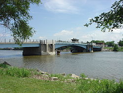
. The two highways run concurrently
Concurrency (road)
A concurrency, overlap, or coincidence in a road network is an instance of one physical road bearing two or more different highway, motorway, or other route numbers...
across the Saginaw River on the Lafayette Avenue Bridge
Lafayette Avenue Bridge
The Lafayette Avenue Bridge is a set of two small bridges located in Bay City, Michigan. It carries M-13 and M-84 over the Saginaw River. It is maintained by the Michigan Department of Transportation, and is the oldest of four drawbridges in Bay City....
. The structure's two spans connect the riverbanks with the Middle Ground Island in the center. West of the bridge, M-13/M-84 follows Salzburg Avenue to the intersection with Euclid Avenue. At that location, M-13 turns north along Euclid Avenue, which runs along the western city line. M-13 meets the 2 one-way streets
One-way traffic
One-way traffic is traffic that moves in a single direction. A one-way street is a street either facilitating only one-way traffic, or designed to direct vehicles to move in one direction.-General signs:...
that carry M-25
M-25 (Michigan highway)
M-25 is a state trunkline highway in the US state of Michigan. The route follows an arc-like shape closely along the Lake Huron shore of the Thumb in the eastern Lower Peninsula between Port Huron and Bay City. It serves the lakeshore resorts along Lake Huron and Saginaw Bay and generally lies...
and the I-75 business spur at the intersections with Thomas and Jenny streets. From this intersection on, M-13 forms a part of the Lake Huron Circle Tour. Farther north, the highway turns northwesterly on Huron Road; Euclid Avenue continues north as M-247
M-247 (Michigan highway)
M-247 is a north–south state trunkline highway in the US state of Michigan, connecting M-13 to the Bay City Recreation Area, entirely within Bangor Township. As a state trunkline, M-247 runs north from M-13 before turning to access the park, a distance of . The highway carries just over...
.
As the trunkline heads away from Bay City, it runs parallel to the Lake State Railway again. M-13 intersects the northern end of its connector route
M-13 Connector (Michigan highway)
M-13 Connector is a state trunkline highway running connecting Interstate 75/US Highway 23 to M-13 near the community of Kawkawlin, just north of Bay City. The Michigan Department of Transportation internally calls the road Connector 13...
before Huron Road crosses the Kawkawlin River
Kawkawlin River
The Kawkawlin River is a stream in the U.S. state of Michigan that flows into Saginaw Bay of Lake Huron at , approximately west of the mouth of the Saginaw River....
. The highway runs through the community of the same name on the north side of the river. M-13 and Huron Road continue north across mixed agricultural and forest land as they pass through the communities of Linwood
Linwood, Michigan
Linwood is a small unincorporated community in the northern portion of Bay County in the U.S. state of Michigan. The community is on the boundary between Fraser Township on the north and Kawkawlin Township on the south. M-13 passes to the west and the Saginaw Bay of Lake Huron is on the east...
and Pinconning
Pinconning, Michigan
Pinconning is a city in Bay County in the U.S. state of Michigan. The population was 1,386 at the 2000 census. It is included in the Bay City, Michigan Metropolitan Statistical Area....
. South of Standish in Arenac County
Arenac County, Michigan
-Demographics:As of the 2000 census, there were 17,269 people, 6,710 households, and 4,717 families residing in the county. The population density was 47 people per square mile . There were 9,563 housing units at an average density of 26 per square mile...
, M-13 meets the northern end of the US 23 freeway and terminates.
M-13 is maintained by the Michigan Department of Transportation
Michigan Department of Transportation
The Michigan Department of Transportation is a constitutional government agency in the US state of Michigan. The primary purpose of MDOT is to maintain the Michigan State Trunkline Highway System which includes all Interstate, US and state highways in Michigan with the exception of the Mackinac...
(MDOT) like other state highways in Michigan. As a part of these maintenance responsibilities, the department tracks the volume of traffic that uses the roadways under its jurisdiction. These volumes are expressed using a metric called annual average daily traffic
Annual average daily traffic
Average Annual daily traffic, abbreviated AADT, is a measure used primarily in transportation planning and transportation engineering. It is the total volume of vehicle traffic of a highway or road for a year divided by 365 days. AADT is a useful and simple measurement of how busy the road is...
, which is a statistical calculation of the average daily number of vehicles on a segment of roadway. MDOT's surveys in 2009 showed that the highest traffic levels along M-13 were the 28,242 vehicles daily north of the M-25 junction in Bay City; the lowest counts were the 3381 vehicles per day south of the I-75/US 23 interchange near Saginaw. The only sections of M-13 that have been listed on the National Highway System
National Highway System (United States)
The National Highway System is a network of strategic highways within the United States, including the Interstate Highway System and other roads serving major airports, ports, rail or truck terminals, railway stations, pipeline terminals and other strategic transport facilities.Individual states...
(NHS) are along the M-84 concurrency and Euclid Avenue south of Wilder Road in the Bay City area. The NHS is a network of roads important to the country's economy, defense, and mobility.
Previous designation
When the state highway system was first signed in 1919, M-13 followed the general path of the modern US 131. The highway specifically ran along what is now M-103M-103 (Michigan highway)
M-103 is a state trunkline highway entirely within St. Joseph County in the southwestern region of the U.S. state of Michigan. The trunkline runs between U.S. Highway 12 in Mottville and the Indiana state line along undivided highway near the St. Joseph River. With the connection to State Road 15...
, US 12
U.S. Route 12 in Michigan
US Highway 12 is a US Highway that runs from Aberdeen, Washington to Detroit, Michigan. In the US state of Michigan it runs for . Previous to the creation of Interstate Highways in Michigan, US 12 ran along Michigan Avenue between Kalamazoo and Detroit, a highway corridor now served by I-94...
, the pre-freeway US 131, M-113
M-113 (Michigan highway)
M-113 is a state trunkline highway in the US state of Michigan that runs from US Highway 131 in Walton Junction to M-37 near Kingsley. It was designated on November 21, 1927. The stretch of M-113 from Walton Junction to M-186 was originally part of US 131.-Route description:M-113 starts west...
, M-186
M-186 (Michigan highway)
M-186, is a state trunkline highway in the U.S. state of Michigan. It functions as a connector highway wholly contained in Grand Traverse County, which is located in the northwestern Lower Peninsula. The western terminus is at M-113 east of Kingsley and the eastern terminus is at U.S. Highway 131 ...
, US 131, US 31
U.S. Route 31 in Michigan
US Highway 31 is a part of the United States Numbered Highway System that runs from Alabama, to the Upper Peninsula of the US state of Michigan. In Michigan, it is a state trunkline highway that runs from the Indiana–Michigan state line at Bertrand Township to its terminus at Interstate 75 south...
and M-119
M-119 (Michigan highway)
The current highway was designated in 1979, replacing the former route of M-131; the routing has remained unchanged since. This section of highway had been part of M-13 on July 1, 1919, when the state trunkline highway system debuted...
between the Indiana state line south of Mottville to Harbor Springs
Harbor Springs, Michigan
Harbor Springs is a city and resort community in Emmet County in the U.S. state of Michigan. The population was 1,567 at the 2000 census.Harbor Springs is in a sheltered bay on the north shore of the Little Traverse Bay on Lake Michigan. The Little Traverse Lighthouse is a historic lighthouse on...
. When the United States Numbered Highway System was created on November 11, 1926, US 131 replaced M-13 from the state line north to Fife Lake
Fife Lake, Michigan
Fife Lake is a village in Grand Traverse County in the U.S. state of Michigan. As of the 2000 census, the village population was 466.The village is situated within Fife Lake Township near the junction of U.S...
; from Fife Lake north to Harbor Springs, the highway was redesignated M-131.
Current highway
The Michigan State Highway Department (MSHD) used the M-13 designation for a highway at the end of 1932 that that connected M-78M-78 (Michigan highway)
M-78 is a state trunkline highway in the US state of Michigan. The western terminus is the intersection with M-66 north of Battle Creek in Pennfield Township. The roadway runs through rural farmland and the community of Bellevue as it approaches its eastern terminus at an interchange with...
and M-21 through Lennon. By the middle of 1936, the highway had been extended northward to end at a junction with M-46 in Saginaw. The entire trunkline was paved in the middle of 1939. Later the next year, the section in Saginaw was extended a bit farther along Washington Avenue to end at a junction with US 10
U.S. Route 10 in Michigan
US Highway 10 is a part of the United States Numbered Highway System that runs from West Fargo, North Dakota, to the Lower Peninsula of the US state of Michigan. The highway enters the state on the SS Badger crossing Lake Michigan at Ludington and ends at Bay City.US 10 was created as part of...
and US 23. A section of the then-M-78 freeway (now I-69) opened between 1958 and 1960; when this freeway opened, M-13 was truncated northwards slightly in the Lennon area to end at the new highway. The first section of the US 23 freeway around Bay City opened in late 1960 or early 1961. When it opened, MSHD extended M-13 along the former route of US 23 from the northside of Saginaw into Bay City to the end of the freeway at Kawkawlin. The I-75/US 23 freeway north of the Kawkawlin area to Standish opened in 1967, and M-13 is shown on maps following US 23's former route through Linwood and Pinconning after the change. The routing of M-13 has stayed the same since.