
List of plantations
Encyclopedia
This is a list of plantation
s and/or plantation houses in the United States of America that are National Memorials, National Historic Landmark
s, listed on the National Register of Historic Places
or other heritage register, or are otherwise significant for their history, association with significant events or people, or their architecture and design.
Plantation
A plantation is a long artificially established forest, farm or estate, where crops are grown for sale, often in distant markets rather than for local on-site consumption...
s and/or plantation houses in the United States of America that are National Memorials, National Historic Landmark
National Historic Landmark
A National Historic Landmark is a building, site, structure, object, or district, that is officially recognized by the United States government for its historical significance...
s, listed on the National Register of Historic Places
National Register of Historic Places
The National Register of Historic Places is the United States government's official list of districts, sites, buildings, structures, and objects deemed worthy of preservation...
or other heritage register, or are otherwise significant for their history, association with significant events or people, or their architecture and design.
| Color key | Historic register listing |
|---|---|
| National Historic Landmark | |
| National Register of Historic Places | |
| National Historic Site | |
| Not listed | |
Arkansas
| NRHP reference number | Name | Image | Date designated | Locality | County | Notes |
|---|---|---|---|---|---|---|
| 75000397 | Dortch Plantation Dortch Plantation Dortch Plantation, also known as William P. Dortch House or Marlsgate, is located near Scott, Arkansas. A portion of the current site, with building built in 1904, was listed on the National Register of Historic Places in 1975... |
Scott Scott, Arkansas Scott is a census-designated place in Lonoke and Pulaski counties in the central part of the U.S. state of Arkansas. The population was 72 at the 2010 census... 34.71528°N 92.05361°W |
Lonoke | Built 1904 | ||
| 74000466 | Lakeport Plantation | Shives 33.25667°N 91.15528°W |
Chicot Chicot County, Arkansas Chicot County is a county located in the U.S. state of Arkansas. As of 2010, the population is 11,800. The county seat is Lake Village. Chicot County is Arkansas's tenth county, formed on October 25, 1823, and named after Point Chicot on the Mississippi River.Landmarks around the county include... |
Built 1850 | ||
| 99000044 | Land's End Plantation Land's End Plantation (Scott, Arkansas) The Land's End Plantation in Scott, Arkansas, also known as James Robert Alexander House was listed on the National Register of Historic Places in 1999.... |
Scott Scott, Arkansas Scott is a census-designated place in Lonoke and Pulaski counties in the central part of the U.S. state of Arkansas. The population was 72 at the 2010 census... 34.89333°N 92.11889°W |
Pulaski | Built 1925 | ||
| 77000254 | Morrison Plantation | Saginaw 34.27°N 92.94722°W |
Hot Spring | Built 1854 | ||
| 03001451 | Rosedale | Arkadelphia Arkadelphia, Arkansas Arkadelphia is a city in Clark County, Arkansas, United States. According to 2005 Census Bureau estimates, the population of the city was 10,548. The city is the county seat of Clark County. The city is situated at the foothills of the Ouachita Mountains. Two universities, Henderson State... 34.161389°N 93.101944°W |
Clark Clark County, Arkansas Clark County is a county located in the U.S. state of Arkansas. As of 2010, the population was 22,995. The county seat is Arkadelphia.The Arkadelphia Micropolitan Statistical Area includes all of Clark County.-Geography:... |
Built 1860 |
Delaware
| NRHP reference number | Name | Image | Date designated | Locality | County | Notes |
|---|---|---|---|---|---|---|
| 70000170 | Aspendale Aspendale (Kenton) Aspendale, near Kenton, Delaware, is a house and small plantation that has survived intact since the late 18th century. At least at the time of its landmarking in 1970, it was one of few houses built before 1800 that was continuously owned by the same family... |
,_kenton_vicinity,_(kent_county,_delaware).jpg) |
Kenton Kenton, Delaware Kenton is a town in Kent County, Delaware, United States. It is part of the Dover, Delaware Metropolitan Statistical Area. The population was 261 at the 2010 census.-Geography:Kenton is located at .... 39.10278°N 75.44944°W |
Kent Kent County, Delaware Kent County is a county located in the central part of the U.S. state of Delaware. It is coextensive with the Dover, Delaware, Metropolitan Statistical Area. As of 2010 the population was 162,310, a 28.1% increase over the previous decade. The county seat is Dover, the state capital... |
Built 1773 | |
| 74000602 | Hagley Jacob Broom House Jacob Broom House, also known as Hagley, is a site significant for its association with Jacob Broom. It is on the Brandywine Creek in Delaware, in fact about 1/4 mile off. It was sold to the du Pont family.... |
Montchanin Montchanin, Delaware Montchanin is an unincorporated community in New Castle County, Delaware, United States. The community was named for Anne Alexandrine de Montchanin, mother of Pierre Samuel du Pont de Nemours. The Jacob Broom House, a National Historic Landmark, is located there.... 39.78422°N 75.66222°W |
New Castle New Castle County, Delaware New Castle County is the northernmost of the three counties of the U.S. state of Delaware. As of 2010 its population was 538,479, an increase of 7.6% over the previous decade. The county seat is Wilmington. The center of population of Delaware is located in New Castle County, in the town of... |
Built 1795 | ||
| 72000292 | Lombardy Hall Lombardy Hall Lombardy Hall was the home of Gunning Bedford, Jr., a delegate to the constitutional convention and a signer of the U.S. constitution.It was declared a National Historic Landmark in 1974.... |
Wilmington Wilmington, Delaware Wilmington is the largest city in the state of Delaware, United States, and is located at the confluence of the Christina River and Brandywine Creek, near where the Christina flows into the Delaware River. It is the county seat of New Castle County and one of the major cities in the Delaware Valley... 39.77949°N 75.54472°W |
New Castle New Castle County, Delaware New Castle County is the northernmost of the three counties of the U.S. state of Delaware. As of 2010 its population was 538,479, an increase of 7.6% over the previous decade. The county seat is Wilmington. The center of population of Delaware is located in New Castle County, in the town of... |
Built 1682 | ||
| 66000258 | Poplar Hall John Dickinson House The John Dickinson House, generally known as Poplar Hall, is located on the John Dickinson Plantation, a property owned by the State of Delaware and open to the public as a museum by the Delaware Division of Historical and Cultural Affairs... |
Dover Dover, Delaware The city of Dover is the capital and second largest city in the U.S. state of Delaware. It is also the county seat of Kent County, and the principal city of the Dover, Delaware Metropolitan Statistical Area, which encompasses all of Kent County. It is located on the St. Jones River in the Delaware... 39.10277°N 75.44944°W |
Kent Kent County, Delaware Kent County is a county located in the central part of the U.S. state of Delaware. It is coextensive with the Dover, Delaware, Metropolitan Statistical Area. As of 2010 the population was 162,310, a 28.1% increase over the previous decade. The county seat is Dover, the state capital... |
Built 1740 | ||
| 73000524 | Stonum Stonum Stonum, also called Stoneham or the George Read House, was the home of George Read, a signer of the Declaration of Independence. His advocacy enabled Delaware to become the first state ratifying the declaration... |
.jpg) |
New Castle New Castle, Delaware New Castle is a city in New Castle County, Delaware, six miles south of Wilmington, situated on the Delaware River. In 1900, 3,380 people lived here; in 1910, 3,351... 39.66022°N 75.57602°W |
New Castle New Castle County, Delaware New Castle County is the northernmost of the three counties of the U.S. state of Delaware. As of 2010 its population was 538,479, an increase of 7.6% over the previous decade. The county seat is Wilmington. The center of population of Delaware is located in New Castle County, in the town of... |
Built 1750 |
Florida
| NRHP reference number | Name | Image | Date designated | Locality | County | Notes |
|---|---|---|---|---|---|---|
| 02000606 | Bannerman Plantation Bannerman Plantation Bannerman Plantation was a small plantation of approximately and located in northwest Leon County, Florida, just north of the old unincorporated community of Meridian and west-northwest of Lake Iamonia. Bannerman Plantation was established by Charles Bannerman and known to be in existence in... |
 |
Tallahassee Tallahassee, Florida Tallahassee is the capital of the U.S. state of Florida. It is the county seat and only incorporated municipality in Leon County, and is the 128th largest city in the United States. Tallahassee became the capital of Florida, then the Florida Territory, in 1824. In 2010, the population recorded by... 30.64500°N 84.27889°W |
Leon Leon County, Florida Leon County is a county located in the state of Florida, named after the Spanish explorer Juan Ponce de León. At the 2010 Census, the population was 275,487. The county seat of Leon County is Tallahassee which also serves as the state capital. The county seat is home to two of Florida's major... |
Built 1852 | |
| 99000712 | Blackwood-Harwood Plantations Blackwood-Harwood Plantations Cemetery The Blackwood-Harwood Plantations Cemetery is a historic cemetery in Tallahassee, Florida, United States. It is located northeast of the junction of State Road 263 and I-10. On October 6, 1999, it was added to the U.S. National Register of Historic Places.... |
Tallahassee Tallahassee, Florida Tallahassee is the capital of the U.S. state of Florida. It is the county seat and only incorporated municipality in Leon County, and is the 128th largest city in the United States. Tallahassee became the capital of Florida, then the Florida Territory, in 1824. In 2010, the population recorded by... 30.48694°N 84.35027°W |
Leon Leon County, Florida Leon County is a county located in the state of Florida, named after the Spanish explorer Juan Ponce de León. At the 2010 Census, the population was 275,487. The county seat of Leon County is Tallahassee which also serves as the state capital. The county seat is home to two of Florida's major... |
1830s | ||
| 70000185 | Bulow Plantation Ruins Bulow Plantation Ruins Historic State Park Bulow Plantation Ruins State Historic Park is a Florida State Park in Flagler Beach, Florida. It is three miles west of Flagler Beach on CR 2001, south of SR 100, and contains the ruins of an ante-bellum plantation. The original plantation was begun in 1821, growing indigo, cotton, rice, and sugar... |
Flagler Beach Flagler Beach, Florida Flagler Beach is a city in Flagler and Volusia counties in the U.S. state of Florida. The population was 4,954 at the 2000 census, with an estimated population of 5,228 in 2004.Flagler Beach is part of the Palm Coast Metropolitan Statistical Area... 29.43611°N 81.14111°W |
Flagler Flagler County, Florida Flagler County was created in 1917 from portions of Saint Johns and Volusia counties. It was named for Henry Morrison Flagler, a famous railroad builder who built the Florida East Coast Railway. Bunnell is the county seat of Flagler County.... |
Built 1821, destroyed 1836 during Second Seminole War Second Seminole War The Second Seminole War, also known as the Florida War, was a conflict from 1835 to 1842 in Florida between various groups of Native Americans collectively known as Seminoles and the United States, part of a series of conflicts called the Seminole Wars... |
||
| 02000002 | Burn Brae Plantation-Krueger House Burn Brae Plantation-Krueger House The Burn Brae Plantation-Krueger House is an historic house in Stuart, Martin County, Florida. It is located at 1170 South East Ocean Boulevard. On February 14, 2002, it was added to the U.S... |
Stuart Stuart, Florida Stuart is the only incorporated city of Martin County, Florida, on Florida's Treasure Coast. The population was 14,633 at the 2000 census. As of 2007, the population recorded by the U.S. Census Bureau is 15,964.... |
Martin Martin County, Florida Martin County is a county in the U.S. state of Florida. As of 2000, the population was 126,731. The U.S. Census Bureau 2008 estimate for the county is 138,660. Its county seat is Stuart, Florida.- History :... |
|||
| 73000606 | Dunlawton Plantation and Sugar Mill Dunlawton Plantation and Sugar Mill The Dunlawton Plantation and Sugar Mill was a plantation that was destroyed by the Seminoles at the beginning of the Second Seminole War. The ruins are located west of Port Orange, Florida off Nova Road.On August 28, 1973, it was added to the U.S... |
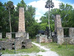 |
Port Orange Port Orange, Florida Port Orange is a city in Volusia County, Florida, United States. In 2006, the U.S. Census Bureau estimated the city's population as 52,793. The city is part of the Deltona-Daytona Beach-Ormond Beach, Florida Metropolitan Statistical Area; the metropolitan area's 2006 population was estimated at... |
Volusia Volusia County, Florida Volusia County is a county located in the state of Florida. The U.S. Census Bureau 2010 official county's population was 494,593 . Its county seat is DeLand, and its most populous city is currently Deltona.... |
||
| 02000836 | Killearn Plantation Archeological and Historic District | 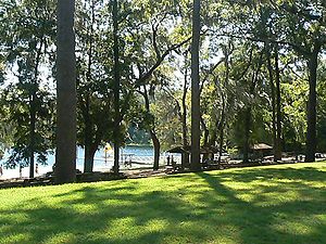 |
Tallahassee Tallahassee, Florida Tallahassee is the capital of the U.S. state of Florida. It is the county seat and only incorporated municipality in Leon County, and is the 128th largest city in the United States. Tallahassee became the capital of Florida, then the Florida Territory, in 1824. In 2010, the population recorded by... |
Leon Leon County, Florida Leon County is a county located in the state of Florida, named after the Spanish explorer Juan Ponce de León. At the 2010 Census, the population was 275,487. The county seat of Leon County is Tallahassee which also serves as the state capital. The county seat is home to two of Florida's major... |
||
| 70000182 | Kingsley Plantation Kingsley Plantation Kingsley Plantation is the site of a former estate in Jacksonville, Florida, that was named for an early owner, Zephaniah Kingsley, who spent 25 years there. It is located at the northern tip of Fort George Island at Fort George Inlet, and is part of the Timucuan Ecological and Historic Preserve... |
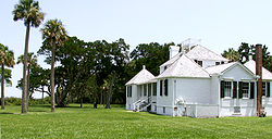 |
Jacksonville Jacksonville, Florida Jacksonville is the largest city in the U.S. state of Florida in terms of both population and land area, and the largest city by area in the contiguous United States. It is the county seat of Duval County, with which the city government consolidated in 1968... |
Duval Duval County, Florida Duval County is a county located in the U.S. state of Florida. As of 2010, the population was 864,263. Its county seat is Jacksonville, with which the Duval County government has been consolidated since 1968... |
||
| Kinhega Lodge Kinhega Lodge Kinhega Lodge was a hunting and fishing plantation located in northern Leon County, Florida, United States on Lake Iamonia.From the 1830s through 1866 the land was part of the cotton plantation known as Water Oak Plantation owned by Richard Bradford.... |
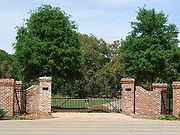 |
Tallahassee Tallahassee, Florida Tallahassee is the capital of the U.S. state of Florida. It is the county seat and only incorporated municipality in Leon County, and is the 128th largest city in the United States. Tallahassee became the capital of Florida, then the Florida Territory, in 1824. In 2010, the population recorded by... vicinity |
Leon Leon County, Florida Leon County is a county located in the state of Florida, named after the Spanish explorer Juan Ponce de León. At the 2010 Census, the population was 275,487. The county seat of Leon County is Tallahassee which also serves as the state capital. The county seat is home to two of Florida's major... |
|||
| 73000582 | Lyndhurst Plantation Lyndhurst Plantation The Lyndhurst Plantation is a historic plantation in Monticello, Florida. It is located 15 miles northeast of Monticello, off Ashville Road. On April 2, 1973, it was added to the U.S. National Register of Historic Places.-References and external links:* at... |
Monticello Monticello, Florida Monticello is a city in Jefferson County, Florida, United States. The population was 2,533 at the 2000 census. As of 2004, the population recorded by the U.S. Census Bureau is 2,572. It is the county seat of Jefferson County... |
Jefferson Jefferson County, Florida Jefferson County is a county located in the U.S. state of Florida. As of 2000, the population is 12,902. The U.S. Census Bureau 2005 estimate for the county is 14,490 . Its county seat is Monticello, Florida.... |
|||
| 04000142 | Mala Compra Plantation Archeological Site Mala Compra Plantation Archeological Site The Mala Compra Plantation Archeological Site is an archaeological site in Palm Coast, Florida. It is located west of the intersection of North Oceanshore Boulevard and Mala Compra Drive. On March 5, 2004, it was added to the U.S... |
Palm Coast Palm Coast, Florida Palm Coast is a city in Flagler County, Florida. As of the 2010 census, the population was 75,180; it is the most populous city or town in Flagler County. Palm Coast is a principal town of the Palm Coast, Florida Metropolitan Statistical Area, designated in 2007... |
Flagler Flagler County, Florida Flagler County was created in 1917 from portions of Saint Johns and Volusia counties. It was named for Henry Morrison Flagler, a famous railroad builder who built the Florida East Coast Railway. Bunnell is the county seat of Flagler County.... |
|||
| Oaklawn Plantation | Tallahassee Tallahassee, Florida Tallahassee is the capital of the U.S. state of Florida. It is the county seat and only incorporated municipality in Leon County, and is the 128th largest city in the United States. Tallahassee became the capital of Florida, then the Florida Territory, in 1824. In 2010, the population recorded by... vicinity |
Leon Leon County, Florida Leon County is a county located in the state of Florida, named after the Spanish explorer Juan Ponce de León. At the 2010 Census, the population was 275,487. The county seat of Leon County is Tallahassee which also serves as the state capital. The county seat is home to two of Florida's major... |
||||
| 72000311 | Red Bank Plantation Red Bank Plantation The Red Bank Plantation is a historic plantation in Jacksonville, Florida. It is located at 1230 Greenridge Road. The two story brick house was built in 1854. On October 18, 1972, it was added to the U.S. National Register of Historic Places.... |
Jacksonville Jacksonville, Florida Jacksonville is the largest city in the U.S. state of Florida in terms of both population and land area, and the largest city by area in the contiguous United States. It is the county seat of Duval County, with which the city government consolidated in 1968... |
Duval Duval County, Florida Duval County is a county located in the U.S. state of Florida. As of 2010, the population was 864,263. Its county seat is Jacksonville, with which the Duval County government has been consolidated since 1968... |
|||
| Rose Hill Plantation Rose Hill Plantation Rose Hill Plantation was a moderate sized quail hunting plantation established by Ralph Nicholson in 1950 and located in Leon County, Florida, United States.... |
Tallahassee Tallahassee, Florida Tallahassee is the capital of the U.S. state of Florida. It is the county seat and only incorporated municipality in Leon County, and is the 128th largest city in the United States. Tallahassee became the capital of Florida, then the Florida Territory, in 1824. In 2010, the population recorded by... vicinity |
Leon Leon County, Florida Leon County is a county located in the state of Florida, named after the Spanish explorer Juan Ponce de León. At the 2010 Census, the population was 275,487. The county seat of Leon County is Tallahassee which also serves as the state capital. The county seat is home to two of Florida's major... |
||||
| 89000240 | Tall Timbers Plantation | Tallahassee Tallahassee, Florida Tallahassee is the capital of the U.S. state of Florida. It is the county seat and only incorporated municipality in Leon County, and is the 128th largest city in the United States. Tallahassee became the capital of Florida, then the Florida Territory, in 1824. In 2010, the population recorded by... |
Leon Leon County, Florida Leon County is a county located in the state of Florida, named after the Spanish explorer Juan Ponce de León. At the 2010 Census, the population was 275,487. The county seat of Leon County is Tallahassee which also serves as the state capital. The county seat is home to two of Florida's major... |
Hawaii
| NRHP reference number | Name | Image | Date designated | Locality | County | Notes |
|---|---|---|---|---|---|---|
| 93000774 | Kilauea Plantation Head Bookkeeper's House | Kīlauea Kilauea, Hawaii Kīlauea, on the Island of Kauai, shares the name of the active volcano, Mt. Kilauea. The name literally translates to "spewing" or '"much spreading" in Hawaiian. Kilauea, the town, is a census-designated place in Kauai County, Hawaii, United States.... |
Kauaʻi Kauai County, Hawaii Kauai County is a county located in the U.S. state of Hawaii. It consists of the islands of Kauai, Niihau, Lehua, and Kaula, in the state of Hawaii. As of 2000 Census the population was 58,463... |
|||
| 93000775 | Kilauea Plantation Head Luna's House | Kīlauea Kilauea, Hawaii Kīlauea, on the Island of Kauai, shares the name of the active volcano, Mt. Kilauea. The name literally translates to "spewing" or '"much spreading" in Hawaiian. Kilauea, the town, is a census-designated place in Kauai County, Hawaii, United States.... |
Kauaʻi Kauai County, Hawaii Kauai County is a county located in the U.S. state of Hawaii. It consists of the islands of Kauai, Niihau, Lehua, and Kaula, in the state of Hawaii. As of 2000 Census the population was 58,463... |
|||
| 93000777 | Kilauea Plantation Manager's House | Kīlauea Kilauea, Hawaii Kīlauea, on the Island of Kauai, shares the name of the active volcano, Mt. Kilauea. The name literally translates to "spewing" or '"much spreading" in Hawaiian. Kilauea, the town, is a census-designated place in Kauai County, Hawaii, United States.... |
Kauaʻi Kauai County, Hawaii Kauai County is a county located in the U.S. state of Hawaii. It consists of the islands of Kauai, Niihau, Lehua, and Kaula, in the state of Hawaii. As of 2000 Census the population was 58,463... |
|||
| 66000296 | Old Sugar Mill of Koloa Old Sugar Mill of Koloa The Old Sugar Mill of Kōloa was part of the first commercially successful sugar plantation in Hawaii, which was founded in Kōloa in 1835 by Ladd & Company. This was the beginning of what would become Hawaii's largest industry. The building was designated a National Historic Landmark on December... |
Kōloa Koloa, Hawaii Kōloa is a census-designated place in Kauai County, Hawaii, United States. The population was 1,942 at the 2000 census. Kōloa is often incorrectly translated as native duck, which is the correct translation for the similar-looking koloa . Kōloa has no known translation... 21.90972°N 159.46916°W |
Kauaʻi Kauai County, Hawaii Kauai County is a county located in the U.S. state of Hawaii. It consists of the islands of Kauai, Niihau, Lehua, and Kaula, in the state of Hawaii. As of 2000 Census the population was 58,463... |
Kentucky
| NRHP reference number | Name | Image | Date designated | Locality | County | Notes |
|---|---|---|---|---|---|---|
| 83002891 | Alexander Plantation House | Midway Midway, Kentucky Midway is a city in Woodford County, Kentucky, United States. Its population was 1,620 at the 2000 census. It is located midway between Frankfort and Lexington along the single-track railroad between them. It is part of the Lexington-Fayette Metropolitan Statistical Area. The town is home to a... |
||||
| 66000357 | Ashland | 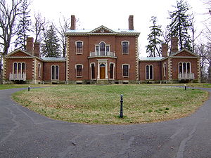 |
Lexington Lexington, Kentucky Lexington is the second-largest city in Kentucky and the 63rd largest in the US. Known as the "Thoroughbred City" and the "Horse Capital of the World", it is located in the heart of Kentucky's Bluegrass region... 38.02861°N 84.48000°W |
Fayette Fayette County, Kentucky Fayette County is a county located in the U.S. state of Kentucky. The population was 295,083 in the 2010 Census. Its territory, population and government are coextensive with the city of Lexington, which also serves as county seat.... |
||
| 93000045 | Coleman-Desha Plantation | Cynthiana | ||||
| 83002668 | Fishpool Plantation | Louisville Louisville, Kentucky Louisville is the largest city in the U.S. state of Kentucky, and the county seat of Jefferson County. Since 2003, the city's borders have been coterminous with those of the county because of a city-county merger. The city's population at the 2010 census was 741,096... |
||||
| 71000347 | Locust Grove Historic Locust Grove Historic Locust Grove is a 55-acre 18th century farm site and National Historic Landmark situated in eastern Jefferson County, Kentucky . The site is presently owned by the Louisville Metro government, and operated as a historic interpretive site by Historic Locust Grove, Inc.The main feature on... |
Louisville Louisville, Kentucky Louisville is the largest city in the U.S. state of Kentucky, and the county seat of Jefferson County. Since 2003, the city's borders have been coterminous with those of the county because of a city-county merger. The city's population at the 2010 census was 741,096... 38.28706°N 85.66192°W |
Jefferson Jefferson County, Kentucky As of the census of 2000, there were 693,604 people, 287,012 households, and 183,113 families residing in the county. The population density was . There were 305,835 housing units at an average density of... |
|||
| 66000359 | Springfield Zachary Taylor House The Zachary Taylor House, also known as Springfield, was the boyhood home of the twelfth President of the United States, Zachary Taylor. Located in Louisville, Kentucky, Taylor lived there from 1790 to 1808, held his marriage there in 1810, and returned there periodically the rest of his... |
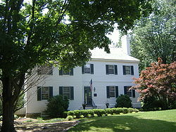 |
Louisville Louisville, Kentucky Louisville is the largest city in the U.S. state of Kentucky, and the county seat of Jefferson County. Since 2003, the city's borders have been coterminous with those of the county because of a city-county merger. The city's population at the 2010 census was 741,096... 38.27917°N 85.64722°W |
Jefferson Jefferson County, Kentucky As of the census of 2000, there were 693,604 people, 287,012 households, and 183,113 families residing in the county. The population density was . There were 305,835 housing units at an average density of... |
Maryland
| NRHP reference number | Name | Image | Date designated | Locality | County | Notes |
|---|---|---|---|---|---|---|
| 71000376 | Doughoregan Manor Doughoregan Manor Doughoregan Manor is a mansion located on Manor Lane near Ellicott City, Maryland, USA. It was designated a National Historic Landmark on November 11, 1971.-History:... |
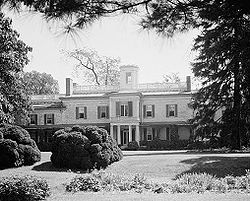 |
Ellicott City Ellicott City, Maryland Ellicott City is an unincorporated community and census-designated place in Howard County, Maryland, United States. It is part of the Baltimore-Washington Metropolitan Area. The population was 65,834 at the 2010 census. It is the county seat of Howard County... 39.27667°N 76.89306°W |
Howard Howard County, Maryland -2010:Whereas according to the 2010 U.S. Census Bureau:*62.2% White*17.5% Black*0.3% Native American*14.4% Asian*0.0% Native Hawaiian or Pacific Islander*3.6% Two or more races*2.0% Other races*5.8% Hispanic or Latino -2000:... |
||
| 72001595 | Habre-de-venture Thomas Stone National Historic Site The Thomas Stone National Historic Site, also known as Habre de Venture or Thomas Stone House, is a United States National Historic Site located about 25 miles south of Washington D.C. in Charles County, Maryland. The site was established to protect the home and property of Thomas Stone, one of... |
 |
Port Tobacco 38.52871°N 77.03155°W |
Charles Charles County, Maryland Charles County is a county in the south central portion of the U.S. state of Maryland.As of 2010, the population was 146,551. Its county seat is La Plata. This county was named for Charles Calvert , third Baron Baltimore.... |
||
| 70000853 | His Lordship's Kindness His Lordship's Kindness His Lordship's Kindness was built in the 1780s for Prince Georges County planter Robert Darnall near Clinton, Maryland. The five-part Georgian mansion, also known as Poplar Hill, retains a number of subsidiary buildings including a slave's hospital and a dovecote.-History:Colonel Henry Darnall was... |
_(rosaryville_vicinity),_clinton_(prince_georges_county,_maryland).jpg) |
Rosaryville Rosaryville, Maryland Rosaryville is an unincorporated area and census-designated place in Prince George's County, Maryland, United States beside U.S. Highway 301. The population was 12,322 at the 2000 census, including housing developments and rural open space. It was named for a local Roman Catholic church... 38.77889°N 76.84278°W |
Prince George's Prince George's County, Maryland Prince George's County is a county located in the U.S. state of Maryland, immediately north, east, and south of Washington, DC. As of 2010, it has a population of 863,420 and is the wealthiest African-American majority county in the nation.... |
||
| 75000926 | Magnolia Plantation Magnolia Plantation (Knoxville, Maryland) Magnolia Plantation, also known as the Boteler-Holder Farm, is a historic home located at Knoxville, Washington County, Maryland, United States. It is a 2-story, five-bay-wide house built about 1835, with a -story three-bay rear addition, set on finely coursed local fieldstone foundations... |
Knoxville Knoxville, Maryland Knoxville is an unincorporated community in Washington County, Maryland, United States.-References:... |
Washington Washington County, Maryland Washington County is a county located in the western part of the U.S. state of Maryland, bordering southern Pennsylvania to the north, northern Virginia to the south, and the Eastern Panhandle of West Virginia to the south and west. As of the 2010 Census, its population is 147,430... |
|||
| 70000852 | Montpelier |  |
Laurel Laurel, Maryland Laurel is a city in northern Prince George's County, Anne Arundel County, and Howard County, Maryland, United States, located midway between Washington, D.C. and Baltimore. Incorporated in 1870, the city maintains a historic district including its Main Street... 39.06491°N 76.84503°W |
Prince George's Prince George's County, Maryland Prince George's County is a county located in the U.S. state of Maryland, immediately north, east, and south of Washington, DC. As of 2010, it has a population of 863,420 and is the wealthiest African-American majority county in the nation.... |
||
| 70000860 | Mount Clare Mount Clare (Maryland) Mount Clare is the oldest Colonial-era structure in Baltimore, Maryland, United States. The Georgian style plantation house exhibits a somewhat altered five-part plan... |
.jpg) |
Baltimore 39.27897°N 76.64293°W |
Independent city Independent city An independent city is a city that does not form part of another general-purpose local government entity. These type of cities should not be confused with city-states , which are fully sovereign cities that are not part of any other sovereign state.-Historical precursors:In the Holy Roman Empire,... |
||
| 84001874 | Pomfret Plantation Pomfret Plantation Pomfret Plantation is a historic home located at Marion, Somerset County, Maryland, United States. It is a two-story, four room plan gable roofed frame house constructed between 1810 and 1830. A two-story hyphen joins an early-19th century kitchen wing to the main block. The property also includes... |
Marion | Somerset Somerset County, Maryland -2010:Whereas according to the 2010 U.S. Census Bureau:*53.5% White*42.3% Black*0.3% Native American*0.7% Asian*0.0% Native Hawaiian or Pacific Islander*1.7% Two or more races*1.5% Other races*3.3% Hispanic or Latino -2000:... |
|||
| 73002166 | Riversdale Mansion Riversdale (Maryland) Riversdale, also known as the Calvert Mansion, is a five-part, large-scale late Georgian mansion with superior Federal interior, built between 1801 and 1807. Also known as Baltimore House, Calvert Mansion or Riversdale Mansion, it is located at 4811 Riverdale Road in Riverdale Park, Maryland... |
 |
Riverdale Riverdale Park, Maryland Riverdale Park is a town in Prince George's County, Maryland, United States. The population was 6,690 at the 2000 census.-Geography:Riverdale Park is located at .... 38.96024°N 76.93181°W |
Prince George's Prince George's County, Maryland Prince George's County is a county located in the U.S. state of Maryland, immediately north, east, and south of Washington, DC. As of 2010, it has a population of 863,420 and is the wealthiest African-American majority county in the nation.... |
||
| 75000919 | Salisbury Plantation Salisbury Plantation (Westover, Maryland) Salisbury Plantation is a historic home located at Westover, Somerset County, Maryland. It has two principal sections: a 19th-century, two-story plus attic clapboard section whose roof ridge runs east to west, and a first-quarter-18th-century -story brick section with its ridge running north to... |
Westover Westover, Maryland Westover is an unincorporated community in Somerset County, Maryland, United States. It is located on Maryland Route 413 near its terminus at U.S. Route 13. The small community is home to many important services in Somerset County.... |
Somerset Somerset County, Maryland -2010:Whereas according to the 2010 U.S. Census Bureau:*53.5% White*42.3% Black*0.3% Native American*0.7% Asian*0.0% Native Hawaiian or Pacific Islander*1.7% Two or more races*1.5% Other races*3.3% Hispanic or Latino -2000:... |
|||
| 90000608 | Sion Hill Sion Hill Sion Hill is a National Historic Landmark in Havre de Grace, Maryland, notable as an example of high-style Federal architecture and as the home a family of prominent officers of the United States Navy.... |
.jpg) |
Havre De Grace Havre de Grace, Maryland Havre de Grace is a city in Harford County, Maryland, United States. Located at the mouth of the Susquehanna River and the head of the Chesapeake Bay, Havre de Grace is named after the port city of Le Havre, France, which was first named Le Havre de Grâce, meaning in French "Harbor of Grace." As... 39.56484°N 76.12856°W |
Harford Harford County, Maryland Harford County is a county in the U.S. state of Maryland. In 2010, its population was 244,826. Its county seat is Bel Air. Harford County forms part of the Baltimore-Washington Metropolitan Area.-History:... |
||
| 72001487 | Sotterley | Hollywood Hollywood, Maryland Hollywood is an unincorporated community located within St. Mary's County, Maryland. It was named in 1867, when a storeowner at Thompson's General Store near the Uniontown section of Hollywood required a name for the post office inside the store... |
St. Mary's | |||
| 72001487 | Sotterley Sotterley (St. Mary's County, Maryland) Sotterley Plantation is a landmark plantation home located at 44300 Sotterley Lane in Hollywood, St. Mary's County, Maryland, United States. It is a long -story, nine-bay frame building, covered with wide, beaded clapboard siding and wood shingle roof, overlooking the Patuxent River... |
.jpg) |
Hollywood Hollywood, Maryland Hollywood is an unincorporated community located within St. Mary's County, Maryland. It was named in 1867, when a storeowner at Thompson's General Store near the Uniontown section of Hollywood required a name for the post office inside the store... 38.37972°N 76.53889°W |
St. Mary's | ||
| 70000261 | Tulip Hill Tulip Hill Tulip Hill is a plantation house that was built between 1755 and 1756 one mile from Galesville in Anne Arundel County in the Province of Maryland. Tulip Hill was built before the American War of Independence.... |
.jpg) |
Galesville Galesville, Maryland Galesville, Maryland is an unincorporated town in Anne Arundel County, Maryland. It is located at 38°50'35" North 076°32'37" West.-History:... 38.85083°N 76.55056°W |
Anne Arundel Anne Arundel County, Maryland Anne Arundel County is a county located in the U.S. state of Maryland. It is named for Anne Arundell , a member of the ancient family of Arundells in Cornwall, England and the wife of Cæcilius Calvert, 2nd Baron Baltimore. Its county seat is Annapolis, which is also the capital of the state... |
||
| 70000854 | West St. Mary's Manor West St. Mary's Manor West St. Mary's Manor is an early Colonial-era house built between 1700 and 1730. The 1-1/2 story brick and frame house is located near St. Mary's City, Maryland , and is an example of a William and Mary-era country house, representing a transition from early one and two-room plans to a more... |
 |
Drayden Drayden, Maryland Drayden is an unincorporated community in St. Mary's County, Maryland, United States. West St. Mary's Manor was listed on the National Register of Historic Places in 1970. Porto Bello was listed in 1972.-References:... 38.18318°N 76.44875°W |
St. Mary's | ||
| 66000387 | Whitehall | .jpg) |
Annapolis Annapolis, Maryland Annapolis is the capital of the U.S. state of Maryland, as well as the county seat of Anne Arundel County. It had a population of 38,394 at the 2010 census and is situated on the Chesapeake Bay at the mouth of the Severn River, south of Baltimore and about east of Washington, D.C. Annapolis is... 39.00453°N 76.42895°W |
Anne Arundel Anne Arundel County, Maryland Anne Arundel County is a county located in the U.S. state of Maryland. It is named for Anne Arundell , a member of the ancient family of Arundells in Cornwall, England and the wife of Cæcilius Calvert, 2nd Baron Baltimore. Its county seat is Annapolis, which is also the capital of the state... |
||
| 70000264 | Wye Plantation Wye House Wye House is a large Southern frame plantation house located in Talbot County, Maryland, seven miles northwest of Easton. It was listed for preservation on the National Register of Historic Places in 1970.-History:... |
 |
Easton Easton, Maryland Easton, founded 1710, is a town within the Easton District of Talbot County, Maryland, United States. The population was 11,708 at the 2000 census, and 14,677 according to current July 2008 census estimates. It is the county seat of Talbot County. The primary ZIP Code is 21601, and the... 38.85344°N 76.16834°W |
Talbot Talbot County, Maryland -2010:Whereas according to the 2010 U.S. Census Bureau:*81.4% White*12.8% Black*0.2% Native American*1.2% Asian*0.1% Native Hawaiian or Pacific Islander*1.6% Two or more races*2.7% Other races*5.5% Hispanic or Latino -2000:... |
Missouri
| NRHP reference number | Name | Image | Date designated | Locality | County | Notes |
|---|---|---|---|---|---|---|
| 79003205 | White Haven Ulysses S. Grant National Historic Site Ulysses S. Grant National Historic Site is a United States National Historic Site located 10 miles southwest of Downtown St. Louis, Missouri within the municipality of Grantwood Village. The site, also known as White Haven, commemorates the life, military career, and Presidency of Ulysses S. Grant... |
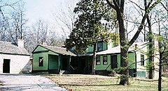 |
Grantwood Village Grantwood Village, Missouri Grantwood Village is a village in St. Louis County, Missouri, United States. The population was 863 at the 2010 census.-Geography:Grantwood Village is located at .... 38.55111°N 90.35194°W |
St. Louis St. Louis County, Missouri St. Louis County is a county located in the U.S. state of Missouri. Its county seat is Clayton. St. Louis County is part of the St. Louis Metro Area wherein the independent City of St. Louis and its suburbs in St. Louis County, as well as the surrounding counties in both Missouri and Illinois all... |
Oklahoma
| NRHP reference number | Name | Image | Date designated | Locality | County | Notes |
|---|---|---|---|---|---|---|
| 70000530 | Murrell Home Murrell Home The Murrell Home, also known as the George M. Murrell Home, is a historic home and museum in Park Hill, near Tahlequah, Oklahoma. It was built in 1845, the building starting in 1844, and was most likely constructed least in part by slaves. It is one of only a few antebellum houses that have... |
Park Hill Park Hill, Oklahoma Park Hill is a census-designated place in southwestern Cherokee County, Oklahoma in the United States. The population was 3,936 at the 2000 census. It lies near Tahlequah, east of the junction of U.S. Route 62 and State Highway 82.-History:... 35.84735°N 94.96418°W |
Cherokee Cherokee County, Oklahoma Cherokee County is a county located in the U.S. state of Oklahoma. As of 2000, the population was 42,521. Its county seat is Tahlequah.Cherokee County was established in 1907.-Geography:... |
Tennessee
| NRHP reference number | Name | Image | Date designated | Locality | County | Notes |
|---|---|---|---|---|---|---|
| 75001741 | Beechwood Hall | 1975 | Newport Newport, Tennessee Newport is a city in Cocke County, Tennessee, United States. The population was 7,242 at the 2000 census. It is the county seat of Cocke County.-Geography:... |
Cocke | Constructed in 1803 | |
| 69000177 | Belle Meade Plantation Belle Meade Plantation Belle Meade Plantation, located in Belle Meade, Tennessee, is an historic plantation mansion whose grounds now function as a museum.-History:... |
 |
Belle Meade Belle Meade, Tennessee Belle Meade is a city in Davidson County, Tennessee, United States, within Nashville.-Overview:In 1963, it was absorbed into the metropolitan government of Nashville-Davidson County, however, it retains its independent city status, and its residents pay taxes both to the Metro government and to the... |
Davidson Davidson County, Tennessee Davidson County is a county located in the U.S. state of Tennessee. As of 2010, the population was 626,681. Its county seat is Nashville.In 1963, the City of Nashville and the Davidson County government merged, so the county government is now known as the "Metropolitan Government of Nashville and... |
||
| 75001780 | Brabson's Ferry Plantation Brabson's Ferry Plantation Brabson's Ferry Plantation is a Pioneer Century farm and former antebellum plantation near the U.S. city of Sevierville, Tennessee. Located at what was once a strategic crossing of the French Broad River, by 1860 the plantation had become one of the largest in East Tennessee, and one of the few in... |
Sevierville Sevierville, Tennessee Sevierville is a city in Sevier County, Tennessee, located in the Southeastern United States. Its population was 11,757 at the 2000 United States Census; in 2004 the estimated population was 14,101. Sevierville is the county seat of Sevier County, Tennessee.... |
Sevier Sevier County, Tennessee Sevier County is a county of the state of Tennessee, United States. Its population was 71,170 at the 2000 United States Census. It is included in the Sevierville, Tennessee, Micropolitan Statistical Area, which is included in the Knoxville-Sevierville-La Follette, TN Combined Statistical Area. The... |
|||
| 73001857 | Carnton Carnton Carnton is a historic plantation house and museum in Franklin in Williamson County, Tennessee. Carnton is the setting for the novel The Widow of the South, by author Robert Hicks... |
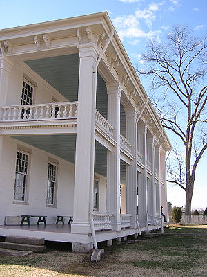 |
Franklin Franklin, Tennessee Franklin is a city within and the county seat of Williamson County, Tennessee, United States. The population was 62,487 as of the 2010 census Franklin is located approximately south of downtown Nashville.-History:... |
Williamson Williamson County, Tennessee Williamson County is a county in the U.S. state of Tennessee. As of 2010 US Census, the population was 183,182. The County's seat is Franklin, and it is part of the Nashville-Davidson–Murfreesboro–Franklin Metropolitan Statistical Area. The county is named after Hugh Williamson, a... |
||
| 75002162 | Fairvue Isaac Franklin Plantation Isaac Franklin Plantation, also known as Fairvue, is an antebellum plantation house in Gallatin, Tennessee.Fairvue Plantation was built in 1832 by Isaac Franklin . Franklin retired to be a planter after a successful career as a partner in the largest slave-trading firm in the South prior to the... |
Gallatin Gallatin, Tennessee Gallatin is a city in and the county seat of Sumner County, Tennessee, United States, along a navigable tributary of the Cumberland River. The population was 23,230 at the 2000 census. Named for U.S... |
Sumner Sumner County, Tennessee Sumner County is a county located in the U.S. state of Tennessee. As of 2000, the population was 130,449. Its county seat is Gallatin, but its largest town is Hendersonville... |
|||
| 66000722 | The Hermitage The Hermitage (Nashville, Tennessee) The Hermitage is a historical plantation and museum located in Davidson County, Tennessee, USA, east of downtown Nashville. The plantation was owned by Andrew Jackson, the seventh President of the United States, from 1804 until his death at the Hermitage in 1845. Jackson only lived at the property... |
Nashville Nashville, Tennessee Nashville is the capital of the U.S. state of Tennessee and the county seat of Davidson County. It is located on the Cumberland River in Davidson County, in the north-central part of the state. The city is a center for the health care, publishing, banking and transportation industries, and is home... 36.21497°N 86.61297°W |
Davidson Davidson County, Tennessee Davidson County is a county located in the U.S. state of Tennessee. As of 2010, the population was 626,681. Its county seat is Nashville.In 1963, the City of Nashville and the Davidson County government merged, so the county government is now known as the "Metropolitan Government of Nashville and... |
|||
| 75001795 | Northcutt Plantation | McMinnville McMinnville, Tennessee McMinnville is the largest city in and the county seat of Warren County, Tennessee, United States. The population was 13,605 at the 2010 census... |
||||
| 71000825 | Rattle and Snap Rattle and Snap Rattle and Snap is a Greek Revival mansion near Columbia, Tennessee.It was built in 1845 by George W. Polk, a relative of president James K. Polk... |
Columbia Columbia, Tennessee Columbia is a city in Maury County, Tennessee, United States. The 2008 population was 34,402 according to U.S. Census Bureau estimates. It is the county seat of Maury County.... 35.56056°N 87.15333°W |
Maury | |||
| 75001781 | Rose Glen Rose Glen (Sevierville, Tennessee) Rose Glen was an antebellum plantation in Sevier County, in the U.S. state of Tennessee. At its height, Rose Glen was one of the largest and most lucrative farms in Sevier County, and one of the most productive in East Tennessee... |
Sevierville Sevierville, Tennessee Sevierville is a city in Sevier County, Tennessee, located in the Southeastern United States. Its population was 11,757 at the 2000 United States Census; in 2004 the estimated population was 14,101. Sevierville is the county seat of Sevier County, Tennessee.... |
Sevier Sevier County, Tennessee Sevier County is a county of the state of Tennessee, United States. Its population was 71,170 at the 2000 United States Census. It is included in the Sevierville, Tennessee, Micropolitan Statistical Area, which is included in the Knoxville-Sevierville-La Follette, TN Combined Statistical Area. The... |
|||
| 69000180 | Ramsey House | 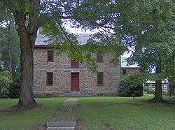 |
Knoxville Knoxville, Tennessee Founded in 1786, Knoxville is the third-largest city in the U.S. state of Tennessee, U.S.A., behind Memphis and Nashville, and is the county seat of Knox County. It is the largest city in East Tennessee, and the second-largest city in the Appalachia region... |
Knox Knox County, Tennessee Knox County is a county in the U.S. state of Tennessee. Its 2007 population was estimated at 423,874 by the United States Census Bureau. Its county seat is Knoxville, as it has been since the creation of the county. The county is at the geographical center of the Great Valley of East Tennessee... |
||
| 75001785 | Wheatlands Wheatlands (Sevierville, Tennessee) Wheatlands was an antebellum plantation in Sevier County, in the U.S. state of Tennessee. The plantation's surviving structures— which include the plantation house, a storage shed, and smokehouse— have been placed on the National Register of Historic Places... |
Sevierville Sevierville, Tennessee Sevierville is a city in Sevier County, Tennessee, located in the Southeastern United States. Its population was 11,757 at the 2000 United States Census; in 2004 the estimated population was 14,101. Sevierville is the county seat of Sevier County, Tennessee.... |
Sevier Sevier County, Tennessee Sevier County is a county of the state of Tennessee, United States. Its population was 71,170 at the 2000 United States Census. It is included in the Sevierville, Tennessee, Micropolitan Statistical Area, which is included in the Knoxville-Sevierville-La Follette, TN Combined Statistical Area. The... |
|||
| 09000538 | White Plains | Algood Algood, Tennessee Algood is a town in Putnam County, Tennessee, United States. The population was 2,942 at the 2000 census. It is part of the Cookeville, Tennessee Micropolitan Statistical Area.-History:... |
Putnam Putnam County, Tennessee Putnam County is a county located in the U.S. state of Tennessee. As of 2000, the population was 62,315, a 21 percent increase from 1990. The was 72,321, an increase of 16.1% since 2000... |
Texas
| NRHP reference number | Name | Image | Date designated | Locality | County | Notes |
|---|---|---|---|---|---|---|
| 80004081 | Durazno Plantation | Jones Creek | ||||
| 69000209 | Freeman Plantation House | Jefferson | ||||
| 77001474 | William Garrett Plantation House | San Augustine | ||||
| 71000971 | Hatfield Plantation | Brenham Brenham, Texas Brenham is a city in east-central Texas in Washington County, Texas, United States, with a population of 16,147 according to the 2009 census. It is the county seat of Washington County... |
Washington | |||
| 71000970 | Liendo Plantation Liendo Plantation Liendo Plantation is an historic cotton plantation in Waller County, Texas, United States. It was added to the National Register of Historic Places on June 21, 1971.In 1936, Liendo was designated Recorded Texas Historic Landmark number 9396... |
Hempstead Hempstead, Texas Hempstead is a city in Waller County, Texas, United States. The community, located at the junctions of U.S. Highway 290, Texas State Highway 6, and Texas State Highway 159, is around fifty miles northwest of Downtown Houston. The population was 4,691 at the 2000 census. It is the county seat of... |
Waller | |||
| 75001961 | Old Brulay Plantation | Brownsville | ||||
| 83003084 | Col. Elijah Sterling Clack Robertson Plantation | Salado | ||||
| 80004082 | Varner-Hogg Plantation | 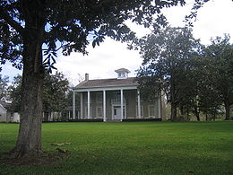 |
West Columbia West Columbia, Texas West Columbia is a city in Brazoria County in the U.S. state of Texas within 50 miles of Eastern Columbia. The population was 4,255 at the 2000 census.... |
Brazoria Brazoria County, Texas Brazoria County[p] is a county in the U.S. state of Texas, located on the Gulf Coast within the Houston–Sugar Land–Baytown metropolitan area. Regionally, parts of the county are within the extreme southern-most fringe of the regions locally known as Southeast Texas. Brazoria County is among a... |
U.S. Virgin Islands
| NRHP reference number | Name | Image | Date designated | Locality | County | Notes |
|---|---|---|---|---|---|---|
| 81000089 | Brown Bay Plantation Historic District | Brown Bay | ||||
| 78000269 | Cinnamon Bay Plantation Cinnamon Bay Plantation Cinnamon Bay Plantation is an approximately property situated on the north central coast of Saint John in the United States Virgin Islands adjacent to Cinnamon Bay. The land, part of Virgin Islands National Park, was added to the United States National Register of Historic Places on July 11, 1978... |
Cruz Bay Cruz Bay, United States Virgin Islands Cruz Bay is the main town on the island of Saint John in the United States Virgin Islands. According to the 2000 Census, Cruz Bay has a population of 2,743 people.... |
Saint John Saint John, U.S. Virgin Islands Saint John is an island in the Caribbean Sea and a constituent district of the United States Virgin Islands , an unincorporated territory of the United States. St... |
|||
| 76002217 | Estate Carolina Sugar Plantation | Coral Bay | ||||
| 81000094 | Hermitage Plantation Historic District | Hurricane Hole | ||||
| 78000271 | Lameshur Plantation | Cruz Bay | ||||
| 81000093 | Rustenberg Plantation South Historic District | Cinnamon Bay | ||||
| 76001867 | Tutu Plantation House | Charlotte Amalie |
West Virginia
| NRHP reference number | Name | Image | Date designated | Locality | County | Notes |
|---|---|---|---|---|---|---|
| 95001322 | Altona Altona (West Virginia) Altona, near Charles Town, West Virginia, is a historic farm with an extensive set of subsidiary buildings. The original Federal style house was built in 1793 by Revolutionary War officer Abraham Davenport on land purchased from Charles Washington. The house was expanded by Abraham's son, Colonel... |
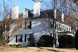 |
Charles Town Charles Town, West Virginia Charles Town is a city in and the county seat of Jefferson County, West Virginia, United States. The population was 2,907 at the 2000 census. Due to its similar name, travelers have sometimes confused this city with the state's capital, Charleston.-History:... 39°17′24"N 77°52′57"W |
Jefferson Jefferson County, West Virginia Jefferson County is a county located in the U.S. state of West Virginia. As of 2010, the population was 53,498. Its county seat is Charles Town... |
||
| 73001914 | Beall-Air Beall-Air Beall-Air, also known as the Colonel Lewis William Washington House, is a two-story stuccoed brick house in classical revival style near Halltown, West Virginia... |
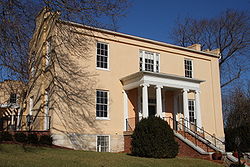 |
Halltown Halltown, West Virginia Halltown is an unincorporated community along Flowing Springs Run in Jefferson County, West Virginia, USA. Halltown is located off of US 340 on West Virginia Route 230 between Charles Town and Bolivar. A few houses, a fork in the road, a tiny post office, and the large Halltown Paper Plant are the... 39°18′55"N 77°48′44"W |
Jefferson Jefferson County, West Virginia Jefferson County is a county located in the U.S. state of West Virginia. As of 2010, the population was 53,498. Its county seat is Charles Town... |
||
| 84003588 | Belvedere Belvedere (West Virginia) Belvedere, also known as Belvidere, was built near Charles Town, West Virginia by Magnus Tate II in 1807. The Federal style mansion is situated at the end of a tree-lined driveway and commands a sweeping view of the Blue Ridge Mountains.... |
Charles Town Charles Town, West Virginia Charles Town is a city in and the county seat of Jefferson County, West Virginia, United States. The population was 2,907 at the 2000 census. Due to its similar name, travelers have sometimes confused this city with the state's capital, Charleston.-History:... 39°17′5"N 77°50′43"W |
Jefferson Jefferson County, West Virginia Jefferson County is a county located in the U.S. state of West Virginia. As of 2010, the population was 53,498. Its county seat is Charles Town... |
|||
| 87000486 | Beverley Beverley (West Virginia) Beverley, also known as Bullskin, is a farm near Charles Town, West Virginia that has been a working agricultural unit since 1750. The narrow lane that leads from U.S. Route 340 to the Beverley complex was, in the 18th and 19th centuries a toll road. The main house was built about 1800 by... |
Charles Town Charles Town, West Virginia Charles Town is a city in and the county seat of Jefferson County, West Virginia, United States. The population was 2,907 at the 2000 census. Due to its similar name, travelers have sometimes confused this city with the state's capital, Charleston.-History:... 39°15′3"N 77°53′34"W |
Jefferson Jefferson County, West Virginia Jefferson County is a county located in the U.S. state of West Virginia. As of 2010, the population was 53,498. Its county seat is Charles Town... |
|||
| 82004319 | Blakeley Blakeley (West Virginia) Blakeley, near Charles Town, West Virginia is also known as the Washington - Chew - Funkhouser House, and was built in 1820 by John Augustine Washington II, great-nephew of George Washington and son of John Augustine Washington. It is a contemporary of its neighbor, Claymont Court, built across... |
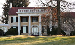 |
Charles Town Charles Town, West Virginia Charles Town is a city in and the county seat of Jefferson County, West Virginia, United States. The population was 2,907 at the 2000 census. Due to its similar name, travelers have sometimes confused this city with the state's capital, Charleston.-History:... 39°15′36"N 77°54′22"W |
Jefferson Jefferson County, West Virginia Jefferson County is a county located in the U.S. state of West Virginia. As of 2010, the population was 53,498. Its county seat is Charles Town... |
||
| 99001397 | Boidstones Place Boidstones Place Boidstones Place, also called Greenbrakes and Fountain Rock, was built in 1766 by Thomas Boydston near Shepherdstown, West Virginia on land he was granted by Thomas Fairfax, 6th Lord Fairfax of Cameron... |
Shepherdstown Shepherdstown, West Virginia Shepherdstown is a town in Jefferson County, West Virginia, United States, located along the Potomac River. It is the oldest town in the state, having been chartered in 1762 by Colonial Virginia's General Assembly. Since 1863, Shepherdstown has been in West Virginia, and is the oldest town in... 39°28′11"N 77°48′6"W |
Jefferson Jefferson County, West Virginia Jefferson County is a county located in the U.S. state of West Virginia. As of 2010, the population was 53,498. Its county seat is Charles Town... |
|||
| 74002004 | Cedar Lawn Cedar Lawn Cedar Lawn, also known as Berry Hill and Poplar Hill, is one of several houses built near Charles Town, West Virginia for members of the Washington family. Cedar Lawn was built in 1825 for John Thornton Augustine Washington, George Washington's grand-nephew. The property was originally part of... |
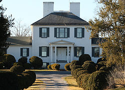 |
Charles Town Charles Town, West Virginia Charles Town is a city in and the county seat of Jefferson County, West Virginia, United States. The population was 2,907 at the 2000 census. Due to its similar name, travelers have sometimes confused this city with the state's capital, Charleston.-History:... 39°17′6"N 77°55′22"W |
Jefferson Jefferson County, West Virginia Jefferson County is a county located in the U.S. state of West Virginia. As of 2010, the population was 53,498. Its county seat is Charles Town... |
||
| 03000346 | Christian Allemong House Christian Allemong House The Christian Allemong House, also known as the Amos Janney House, is located near Summit Point, West Virginia. The house was built circa 1830 in the Georgian style with Greek Revival detailing. The house was owned by Amos Janney from 1848 to 1868... |
Summit Point Summit Point, West Virginia Summit Point is an unincorporated community in Jefferson County in the U.S. state of West Virginia. It lies along the Baltimore and Ohio Railroad at the intersection of West Virginia Secondary Route 1 and Summit Point Pike. According to the 2000 census, the Summit Point community has a population... 39°14′14"N 77°58′43"W |
Jefferson Jefferson County, West Virginia Jefferson County is a county located in the U.S. state of West Virginia. As of 2010, the population was 53,498. Its county seat is Charles Town... |
|||
| 73001908 | Claymont Court Claymont Court Claymont Court or simply Claymont is a Georgian style brick mansion, the grandest of several built near Charles Town, West Virginia for members of the Washington family. The current house was built in 1840 by Bushrod Corbin Washington, grand-nephew of George Washington, to replace a house that was... |
Charles Town Charles Town, West Virginia Charles Town is a city in and the county seat of Jefferson County, West Virginia, United States. The population was 2,907 at the 2000 census. Due to its similar name, travelers have sometimes confused this city with the state's capital, Charleston.-History:... 39°16′7"N 77°54′21"W |
Jefferson Jefferson County, West Virginia Jefferson County is a county located in the U.S. state of West Virginia. As of 2010, the population was 53,498. Its county seat is Charles Town... |
|||
| 73001917 | Cold Spring Cold Spring (Shepherdstown, West Virginia) Cold Spring is a house near Shepherdstown, West Virginia, childhood home to two United States Representatives. The house was built by Edward Lucas III and his son, Robert in 1793. It is a two-story house of coursed ashlar stone masonry.... |
Shepherdstown Shepherdstown, West Virginia Shepherdstown is a town in Jefferson County, West Virginia, United States, located along the Potomac River. It is the oldest town in the state, having been chartered in 1762 by Colonial Virginia's General Assembly. Since 1863, Shepherdstown has been in West Virginia, and is the oldest town in... 39°23′48"N 77°49′5"W |
Jefferson Jefferson County, West Virginia Jefferson County is a county located in the U.S. state of West Virginia. As of 2010, the population was 53,498. Its county seat is Charles Town... |
|||
| 80004431 | Edgewood Edgewood (Bunker Hill, West Virginia) Edgewood, also known as the John Boyd House, is a historic home located at Bunker Hill, Berkeley County, West Virginia. It was built in 1839 and is a two story, five bay, brick dwelling with a gable roof in the Greek Revival style. The entrance features a semi-elliptical transom and sidelights. ... |
Bunker Hill Bunker Hill, West Virginia Bunker Hill is an unincorporated town in Berkeley County, West Virginia, United States located on Winchester Pike at its junction with West Virginia Secondary Route 26 south of Martinsburg. It is the site of the confluence of Torytown Run and Mill Creek, a tributary of Opequon Creek... 39°19′49"N 78°3′29"W |
Berkeley Berkeley County, West Virginia Berkeley County is a county located in the Eastern Panhandle region of the U.S. state of West Virginia. As of 2010, the population is 104,169, making it the second-most populous county in West Virginia, behind Kanawha... |
|||
| 73001918 | Elmwood Elmwood (Shepherdstown, West Virginia) Elmwood is a Federal style house near Shepherdstown, West Virginia. Located on land claimed in 1732 by Edward Lucas II, it was built in 1797 by his son, Edward Lucas III. During the Civil War the house was used as a field hospital. It remained in the Lucas family until 1948. -External links:*, at... |
Shepherdstown Shepherdstown, West Virginia Shepherdstown is a town in Jefferson County, West Virginia, United States, located along the Potomac River. It is the oldest town in the state, having been chartered in 1762 by Colonial Virginia's General Assembly. Since 1863, Shepherdstown has been in West Virginia, and is the oldest town in... 39°23′50"N 77°48′50"W |
Jefferson Jefferson County, West Virginia Jefferson County is a county located in the U.S. state of West Virginia. As of 2010, the population was 53,498. Its county seat is Charles Town... |
|||
| 73001918 | Fort Hill Fort Hill (Burlington, West Virginia) Fort Hill, also known as Fort Hill Farm, is a historic plantation home and national historic district located near Burlington, Mineral County, West Virginia. The district includes 15 contributing buildings, 1 contributing site, and 2 contributing structures... |
Burlington Burlington, West Virginia Burlington is an unincorporated census-designated place in Mineral County, West Virginia located along U.S. Route 50 where it crosses Pattersons Creek. As of the 2010 census, its population was 182. It is part of the Cumberland, MD-WV Metropolitan Statistical Area... 39°18′37"N 78°56′8"W |
Mineral Mineral County, West Virginia Mineral County is a county located in the U.S. state of West Virginia. It is part of the Cumberland, MD-WV Metropolitan Statistical Area. As of 2010, the population was 28,212. Its county seat is Keyser.-Ancient history:... |
|||
| 88002956 | Samuel Gwinn Plantation Samuel Gwinn Plantation The Samuel Gwinn Plantation is a historic plantation in Lowell, West Virginia. The main house was built in circa 1868, although the plantation was begun in the late 18th Century, with secondary structures, such as the meat curing house, dating to the 1770s. It was added to the National Register of... |
Lowell Lowell, West Virginia Lowell is an unincorporated community in Summers County, West Virginia, United States. Lowell is located on the Greenbrier River east of Hinton and southwest of Alderson. The community was first settled in 1770 and is the oldest community in Summers County.... 37°38′55"N 80°43′35"W |
Summers Summers County, West Virginia Summers County is a county located in the U.S. state of West Virginia. As of the 2010 census, the population was 13,927. Its county seat is Hinton. Summers County was created by an act of the West Virginia General Assembly on February 27, 1871 from parts of Fayette, Greenbrier, Mercer and Monroe... |
|||
| 73001912 | Happy Retreat Happy Retreat Happy Retreat is an historic property in Charles Town, West Virginia, which was originally owned and developed by Charles Washington, the youngest brother of George Washington and the founder of Charles Town.-History:Charles inherited land in the Shenandoah Valley upon the death of his older... |
 |
Charles Town Charles Town, West Virginia Charles Town is a city in and the county seat of Jefferson County, West Virginia, United States. The population was 2,907 at the 2000 census. Due to its similar name, travelers have sometimes confused this city with the state's capital, Charleston.-History:... 39°16′56"N 77°51′35"W |
Jefferson Jefferson County, West Virginia Jefferson County is a county located in the U.S. state of West Virginia. As of 2010, the population was 53,498. Its county seat is Charles Town... |
||
| 73001909 | Harewood Harewood (West Virginia) Harewood is one of several houses in the vicinity of Charles Town, West Virginia built for members of the Washington family. The house was designed by John Ariss for Samuel Washington in 1770. Washington moved from his farm on Chotank creek in Stafford County, Virginia to Harewood, accumulating ... |
 |
Charles Town Charles Town, West Virginia Charles Town is a city in and the county seat of Jefferson County, West Virginia, United States. The population was 2,907 at the 2000 census. Due to its similar name, travelers have sometimes confused this city with the state's capital, Charleston.-History:... 39°18′9"N 77°55′11"W |
Jefferson Jefferson County, West Virginia Jefferson County is a county located in the U.S. state of West Virginia. As of 2010, the population was 53,498. Its county seat is Charles Town... |
||
| 76001938 | Hazelfield Hazelfield Hazelfield, located near Shenandoah Junction, West Virginia is a historic farm, whose principal residence was built in 1815 for Ann Stephen Dandridge Hunter.-External links:*] ]... |
Shenandoah Junction Shenandoah Junction, West Virginia Shenandoah Junction is an unincorporated census-designated place in Jefferson County in the U.S. state of West Virginia's Eastern Panhandle. As of the 2010 census, Shenandoah Junction had a population of 703. It is located between Kearneysville and Charles Town off WV 9... 39°22′25"N 77°51′36"W |
Jefferson Jefferson County, West Virginia Jefferson County is a county located in the U.S. state of West Virginia. As of 2010, the population was 53,498. Its county seat is Charles Town... |
|||
| 11000556 | Hickory Grove | Romney Romney, West Virginia Romney is a city in and the county seat of Hampshire County, West Virginia, United States. The population was 1,940 at the 2000 census, while the area covered by the city's ZIP code had a population of 5,873. It is a city with a very historic background dating back to the 18th century... 39°19′29"N 78°46′50"W |
Hampshire Hampshire County, West Virginia Hampshire County is a county located in the U.S. state of West Virginia. As of 2010, the population was 23,964. Its county seat is Romney, West Virginia's oldest town . Hampshire County was created by the Virginia General Assembly on December 13, 1753, from parts of Frederick and Augusta counties ... |
|||
| 85003521 | Hillside Hillside (Charles Town, West Virginia) Hillside, also known as Little Elmington, is a 1½ story brick house near Charles Town, West Virginia dating to circa 1798–1800. The house possesses a striking two-story gallery supported by five large round columns. The property includes a rubblestone barn and spring house... |
Charles Town Charles Town, West Virginia Charles Town is a city in and the county seat of Jefferson County, West Virginia, United States. The population was 2,907 at the 2000 census. Due to its similar name, travelers have sometimes confused this city with the state's capital, Charleston.-History:... 39°15′47"N 77°52′5"W |
Jefferson Jefferson County, West Virginia Jefferson County is a county located in the U.S. state of West Virginia. As of 2010, the population was 53,498. Its county seat is Charles Town... |
|||
| 94000214 | Hopewell Hopewell (Millville, West Virginia) Hopewell, also known as Hopewell Mills and Hopewell Farm, was established around 1765 by William Little, Sr., who built grain and saw mills near the Shenandoah River. In 1827, William Little, Jr. sold the property to James Hite and Jacob Newcomer... |
Millville Millville, West Virginia Millville is an unincorporated town on the Shenandoah River in Jefferson County, West Virginia, USA. According to the Geographic Names Information System, Millville has also been known as Keye's Switch, Keyes Switch, and Milville.... 39°16′4"N 77°47′36"W |
Jefferson Jefferson County, West Virginia Jefferson County is a county located in the U.S. state of West Virginia. As of 2010, the population was 53,498. Its county seat is Charles Town... |
|||
| 84003476 | Lick Run Plantation Lick Run Plantation Lick Run Plantation is a historic home and related outbuildings located at Bedington, Berkeley County, West Virginia. The complex consists of a two story stone dwelling, stone kitchen, and stone barn and corn crib. They were built after 1770. Also on the property are a log house built before... |
Bedington Bedington, West Virginia Bedington is an unincorporated hamlet on Hoke Run, near its confluence with Opequon Creek, in Berkeley County, West Virginia. It is located east of Hainesville on County Route 5. According to the Geographic Names Information System, Bedington has also been known as Beddington, Bedenton, and The Lick.... 39°31′10"N 77°54′2"W |
Berkeley Berkeley County, West Virginia Berkeley County is a county located in the Eastern Panhandle region of the U.S. state of West Virginia. As of 2010, the population is 104,169, making it the second-most populous county in West Virginia, behind Kanawha... |
|||
| 80004408 | Maidstone Manor Maidstone Manor Farm Maidstone Manor Farm, also known as William R. Leigh House, is a national historic district located near Hedgesville, Berkeley County, West Virginia. It encompasses a historic farm with three contributing buildings and one contributing site, the site of a slave cabin. The manor house is a two... |
Hedgesville Hedgesville, West Virginia Hedgesville is a town in Berkeley County in the U.S. state of West Virginia's Eastern Panhandle. The population was 240 at the 2000 census. The Town of Hedgesville was laid out in 1832 along the old Warm Springs Road and named for the prominent local Hedges family... 39°35′14"N 77°54′32"W |
Berkeley Berkeley County, West Virginia Berkeley County is a county located in the Eastern Panhandle region of the U.S. state of West Virginia. As of 2010, the population is 104,169, making it the second-most populous county in West Virginia, behind Kanawha... |
|||
| 04000311 | Maidstone-on-the-Potomac Maidstone-on-the-Potomac Maidstone-on-the-Potomac is a historic house and farm near Falling Waters, West Virginia. Located on the Potomac River immediately opposite Williamsport, Maryland, the property consists of a tract with a main house dating from c. 1741... |
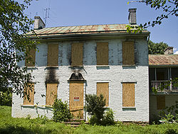 |
Falling Waters Falling Waters, West Virginia Falling Waters is an unincorporated census-designated place on the Potomac River in Berkeley County, West Virginia. It is located along Williamsport Pike north of Martinsburg. According to the 2010 census, Falling Waters has a population of 876.... 39°35′59"N 77°50′21"W |
Berkeley Berkeley County, West Virginia Berkeley County is a county located in the Eastern Panhandle region of the U.S. state of West Virginia. As of 2010, the population is 104,169, making it the second-most populous county in West Virginia, behind Kanawha... |
||
| 86000777 | The Meadows The Meadows (Moorefield, West Virginia) The Meadows in Moorefield, West Virginia is a building from 1850. It was listed on the National Register of Historic Places in 1986.-References:... |
Moorefield Moorefield, West Virginia Moorefield is a town in Hardy County, West Virginia, USA. Moorefield is the county seat of Hardy County. It was originally chartered in 1777 and named for Conrad Moore, who owned the land upon which the town was laid out... 39°5′9"N 78°57′20"W |
Hardy Hardy County, West Virginia As of the census of 2000, there were 12,669 people, 5,204 households, and 3,564 families residing in the county. The population density was 22 people per square mile . There were 7,115 housing units at an average density of 12 per square mile... |
|||
| 93000616 | Media Media Farm Media Farm is a farm complex near Charles Town, West Virginia that dates to 1780, and has remained in the same family ever since. The property was acquired by Charles Yates, an English immigrant, from Thomas Rutherford. In the twentieth century, author Julia McDonald Davis spent her childhood... |
Shenandoah Junction Shenandoah Junction, West Virginia Shenandoah Junction is an unincorporated census-designated place in Jefferson County in the U.S. state of West Virginia's Eastern Panhandle. As of the 2010 census, Shenandoah Junction had a population of 703. It is located between Kearneysville and Charles Town off WV 9... 39°19′46"N 77°50′32"W |
Jefferson Jefferson County, West Virginia Jefferson County is a county located in the U.S. state of West Virginia. As of 2010, the population was 53,498. Its county seat is Charles Town... |
|||
| 73001904 | Mill Island Mill Island (Moorefield, West Virginia) Mill Island, also known as the Seymour Family House, is a historic home located near Moorefield, Hardy County, West Virginia. The original brick cottage was built in 1798. In 1840, a two story, brick Greek Revival style mansion was appended. The 3 1/2 story building features a one bay, temple style... |
Moorefield Moorefield, West Virginia Moorefield is a town in Hardy County, West Virginia, USA. Moorefield is the county seat of Hardy County. It was originally chartered in 1777 and named for Conrad Moore, who owned the land upon which the town was laid out... 39°2′22"N 78°57′38"W |
Hardy Hardy County, West Virginia As of the census of 2000, there were 12,669 people, 5,204 households, and 3,564 families residing in the county. The population density was 22 people per square mile . There were 7,115 housing units at an average density of 12 per square mile... |
|||
| 73001916 | Prato Rio Prato Rio Prato Rio, also known as Hopewell, near Leetown, West Virginia, was the home of General Charles Lee of the Continental Army, for whom Leetown is named. Lee lived there from 1774 to his death in 1782. The property was originally acquired in 1731 by Han Yost Heydt , who built a log cabin on the... |
Leetown Leetown, West Virginia Leetown is an unincorporated town in Jefferson County in the U.S. state of West Virginia. It lies along West Virginia Secondary Route 1 at its junction with Leetown Pike.... 39°20′49"N 77°56′12"W |
Jefferson Jefferson County, West Virginia Jefferson County is a county located in the U.S. state of West Virginia. As of 2010, the population was 53,498. Its county seat is Charles Town... |
|||
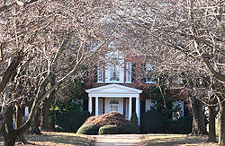
| 73001911 | Richwood Hall Richwood Hall Richwood Hall, also known as Richwoods, is a house near Charles Town, West Virginia. The lands once belonged to George Washington, who received them from Thomas Fairfax, 6th Lord Fairfax of Cameron and subsequently gave to his brother, Samuel Washington. It was Samuel's son, Lawrence Augustine... |
 |
Charles Town Charles Town, West Virginia Charles Town is a city in and the county seat of Jefferson County, West Virginia, United States. The population was 2,907 at the 2000 census. Due to its similar name, travelers have sometimes confused this city with the state's capital, Charleston.-History:... 39°17′32"N 77°55′51"W |
Jefferson Jefferson County, West Virginia Jefferson County is a county located in the U.S. state of West Virginia. As of 2010, the population was 53,498. Its county seat is Charles Town... |
||
| 01001328 | Ridgedale Washington Bottom Farm Washington Bottom Farm is a 19th century Greek Revival plantation house and farm on a plateau overlooking the South Branch Potomac River north of Romney, West Virginia, United States. The populated area adjacent to Washington Bottom Farm is known as Ridgedale... |
Springfield Springfield, West Virginia Springfield is an unincorporated census-designated place in northwestern Hampshire County in the U.S. state of West Virginia. As of the 2010 census, Springfield had a population of 477. Springfield is located north of Romney along West Virginia Route 28 at its junction with Green Spring Road and... 39°24′49"N 78°44′19"W |
Hampshire Hampshire County, West Virginia Hampshire County is a county located in the U.S. state of West Virginia. As of 2010, the population was 23,964. Its county seat is Romney, West Virginia's oldest town . Hampshire County was created by the Virginia General Assembly on December 13, 1753, from parts of Frederick and Augusta counties ... |
|||
| 82004320 | Rion Hall Rion Hall Rion Hall is a late Federal style house near Halltown, West Virginia. Built in 1836, it consists of a three-story brick house with a two-story kitchen wing connected by a wood hyphen. The house was used as a headquarters for General Philip H. Sheridan during the American Civil War.The house was... |
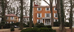 |
Halltown Halltown, West Virginia Halltown is an unincorporated community along Flowing Springs Run in Jefferson County, West Virginia, USA. Halltown is located off of US 340 on West Virginia Route 230 between Charles Town and Bolivar. A few houses, a fork in the road, a tiny post office, and the large Halltown Paper Plant are the... 39°18′4"N 77°49′2"W |
Jefferson Jefferson County, West Virginia Jefferson County is a county located in the U.S. state of West Virginia. As of 2010, the population was 53,498. Its county seat is Charles Town... |
||
| 95000418 | Snow Hill Jefferson County Alms House The Jefferson County Alms House, also known as Snow Hill Farm, located near Leetown, West Virginia, is an historic Federal style house. Snow Hill was built circa 1813 for John Hurst, son of James Hurst, a prosperous local landowner. In 1857, Snow Hill was purchased from the Hurst family for use... |
Leetown Leetown, West Virginia Leetown is an unincorporated town in Jefferson County in the U.S. state of West Virginia. It lies along West Virginia Secondary Route 1 at its junction with Leetown Pike.... 39°20′7"N 77°54′30"W |
Jefferson Jefferson County, West Virginia Jefferson County is a county located in the U.S. state of West Virginia. As of 2010, the population was 53,498. Its county seat is Charles Town... |
|||
| 80004021 | Sycamore Dale Sycamore Dale Sycamore Dale is a 19th-century Greek Revival plantation home overlooking the South Branch Potomac River southwest of Romney, West Virginia. Sycamore Dale is one of several historic estates along South Branch River Road... |
Romney Romney, West Virginia Romney is a city in and the county seat of Hampshire County, West Virginia, United States. The population was 1,940 at the 2000 census, while the area covered by the city's ZIP code had a population of 5,873. It is a city with a very historic background dating back to the 18th century... 39°20′15"N 78°46′24"W |
Hampshire Hampshire County, West Virginia Hampshire County is a county located in the U.S. state of West Virginia. As of 2010, the population was 23,964. Its county seat is Romney, West Virginia's oldest town . Hampshire County was created by the Virginia General Assembly on December 13, 1753, from parts of Frederick and Augusta counties ... |
|||
| 72001288 | Traveller's Rest | .jpg) |
Kearneysville Kearneysville, West Virginia Kearneysville is an unincorporated community in Jefferson County in the U.S. state of West Virginia's Eastern Panhandle. According to the 2000 census, Kearneysville and its surrounding community has a population of 6,716... 39.38806°N 77.90083°W |
Jefferson Jefferson County, West Virginia Jefferson County is a county located in the U.S. state of West Virginia. As of 2010, the population was 53,498. Its county seat is Charles Town... |
||
| 84003594 | Vinton Jacks-Manning Farm The Jacks-Manning Farm, also known as the Vinton Farm was built around 1840 for Robert Jacks near Charles Town, West Virginia, in the Greek Revival style. Jacks had married Julia Davenport, a member of a prominent Jefferson County family. Their daughter, Rebecca Jacks, married Thomas J. Manning,... |
Charles Town Charles Town, West Virginia Charles Town is a city in and the county seat of Jefferson County, West Virginia, United States. The population was 2,907 at the 2000 census. Due to its similar name, travelers have sometimes confused this city with the state's capital, Charleston.-History:... 39°16′8"N 77°51′38"W |
Jefferson Jefferson County, West Virginia Jefferson County is a county located in the U.S. state of West Virginia. As of 2010, the population was 53,498. Its county seat is Charles Town... |
|||
| Wappocomo Wappocomo (plantation) Wappocomo is a late 18th-century Georgian mansion overlooking the South Branch Potomac River north of Romney, West Virginia, United States. Wappocomo lies along West Virginia Route 28 and the South Branch Valley Railroad... |
Romney Romney, West Virginia Romney is a city in and the county seat of Hampshire County, West Virginia, United States. The population was 1,940 at the 2000 census, while the area covered by the city's ZIP code had a population of 5,873. It is a city with a very historic background dating back to the 18th century... |
Hampshire Hampshire County, West Virginia Hampshire County is a county located in the U.S. state of West Virginia. As of 2010, the population was 23,964. Its county seat is Romney, West Virginia's oldest town . Hampshire County was created by the Virginia General Assembly on December 13, 1753, from parts of Frederick and Augusta counties ... |

