

List of municipal flags of Kanto region
Encyclopedia
This page lists the municipal flags of Kantō region, Japan. It is a part of the List of Japanese municipal flags, which is split into regions
due to its size.
Regions of Japan
The regions of Japan are not official administrative units, but have been traditionally used as the regional division of Japan in a number of contexts...
due to its size.
 Ibaraki Prefecture
| Flag | Chikusei Chikusei, Ibaraki is a city located in Ibaraki, Japan. The city was founded March 28, 2005 from the merger of the towns of Akeno, Kyōwa and Sekijō, and the old city of Shimodate, all from the Makabe District, .... |
|---|---|
| Hitachi Hitachi, Ibaraki is a city located on the Pacific Ocean in Ibaraki Prefecture, Japan. Its name could be directly translated as "sunrise", but probably more appropriately adapted to "prosperous wealth" .-Demographics:... |
|
| |Hitachinaka Hitachinaka, Ibaraki is a city located in Ibaraki prefecture, Japan.As of 2008, the city has an estimated population of 155,354 and a population density of 1,570 persons per km²... |
|
| |Kamisu Kamisu, Ibaraki is a city located in Ibaraki Prefecture, Japan.Kamisu was a town but proclaimed city on August 1, 2005, when it merged with the town of Hasaki, from Kashima District.... |
|
| |Kashima Kashima, Ibaraki is a port city located in Ibaraki Prefecture, Japan.As of October 1, 2010, the city has an estimated population of 66,249 and a population density of 708.02 persons per km². The total area is 93.57 km². Kashima was formerly a town in Kashima District and became a city after merging with the... |
|
| |Koga Koga, Ibaraki is a city located in Ibaraki, Japan.-Old City of Koga:The city has its origins in the Tokugawa period when a castle was built in the 16th century at the river crossing point and a town sprang up around it. The site of the castle is still visible near Koga 1st elementary school. The modern city was... |
|
| Mito Mito, Ibaraki is the capital of Ibaraki Prefecture, Japan and has a central location, moderately offset towards the coast in that prefecture. As of 2005, the city has an estimated population of 263,748 and a total area is 217.45 km², giving a population density of 1,212.91 persons per km²... |
|
| |Toride Toride, Ibaraki is a city located in Ibaraki, Japan.As of March 1, 2008 , the city has an estimated population of 109,926 and the density of 1,570 persons per km². The total area is 69.96 km².... |
|
| Tsuchiura Tsuchiura, Ibaraki is a city located in Ibaraki prefecture, in Japan. It is situated along the western shores of Lake Kasumigaura, the second largest lake in Japan. Tokyo city lies about 60 km to the south, and Tsukuba science city borders Tsuchiura to the west.-Demographics:... |
|
| |Tsukuba Tsukuba, Ibaraki is a city located in Ibaraki Prefecture, Japan. It is known as the location of the , a planned city developed in the 1960s.As of 2008, the city has an estimated population of 207,394 and a population density of 730 persons per km². Its total area is 284.07 km².Mount Tsukuba, particularly well-known... |
 Tochigi Prefecture
| Flag | Ashikaga Ashikaga, Tochigi is a city located in Tochigi Prefecture, Japan. Ashikaga is located north of Tokyo.As of April 1, 2011, the city has an estimated population of 153,766, with a household number of 59,219, and a density of 864.73 persons per km²... |
|---|---|
| Kanuma Kanuma, Tochigi is a city located in Tochigi, Japan.As of 2010, the city has an estimated population of 102,825 and the density of 210 persons per km². The total area is 490.62 km²... |
|
| Nasushiobara Nasushiobara, Tochigi is a city located in northern Tochigi Prefecture, Japan. Nasushiobara is the northernmost city in the Kantō region of Japan, bordering Fukushima Prefecture to the north, as well as nationally famous Nikkō City and the town of Nasu within Tochigi.... |
|
| Nikkō Nikko, Tochigi is a city in the mountains of Tochigi Prefecture, Japan. Approximately 140 km north of Tokyo and 35 km west of Utsunomiya, the capital of Tochigi Prefecture, it is a popular destination for Japanese and international tourists... |
|
| Oyama Oyama, Tochigi is a city in Tochigi Prefecture, Japan.As April 1, 2011, the city has an estimated population of 163,954, with 62,714 households, and a population density of 955.39 persons per km²... |
|
| Utsunomiya Utsunomiya, Tochigi is the capital and most populous city of Tochigi Prefecture, Japan. In October 2010 the city had an estimated population of 510,416 and a population density of 1,224.49 people per square kilometer. The total area is 416.84 km². had a population of 888,005 in the 2000 Census... |
 Gunma Prefecture
| Flag | Isesaki Isesaki, Gunma is a city located in Gunma, Japan. The current population is 211,021, with 80,638 households. A small city located near the geographic center of Japan's main island of Honshū, Isesaki is the fourth largest city in Gunma Prefecture and it is one of the growing cities within Gunma Prefecture... |
|---|---|
 |
Kiryū Kiryu, Gunma is a city in Gunma, Japan, near the cities of Ōta and Ashikaga. Incorporated on March 1, 1921, Kiryū is considered both a city and part of the Greater Tokyo Metropolitan Area, although it is still widely thought of as a rural area... |
 |
Maebashi Maebashi, Gunma is the capital city of Gunma Prefecture, Japan.The city was founded on April 1, 1892, by the samurai Makuba Kawai.On December 5, 2004 the town of Ōgo, and the villages of Kasukawa and Miyagi, all from Seta District, were merged into Maebashi.... |
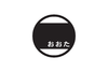 |
Ōta Ota, Gunma is a city 50 miles northwest of Tokyo, in eastern Gunma prefecture, Japan. This city is located between the Tone and Watarase rivers. As a result, the new city reached a total population of 219,789, making it the third most populous city in Gunma.... |
 |
Takasaki Takasaki, Gunma is a city located in Gunma Prefecture, Japan.The city was founded on April 1, 1900.Takasaki is a regional transportation hub because its train station is the junction of several rail lines as well as a Shinkansen stop.... |
 Saitama Prefecture
| Flag | Ageo Ageo, Saitama is a city located in Saitama, Japan.As of December 1, 2010, the city has an estimated population of 227,127 and the density of 4,986.32 persons per km². The total area is 45.55 km². It is twinned with Ueda, Nagano.- History :... |
|---|---|
| |Asaka Asaka, Saitama is a city in Saitama Prefecture, Japan. It was named in 1932 after Prince Asaka who was an honorary chairman of the Tokyo Golf Club, which relocated to the area at that time. Asaka town became a city on March 15, 1967.... |
|
 |
Chichibu Chichibu, Saitama is a city in Saitama, Japan. As of April 1, 2011, the city has an estimated population of 68,701, with a household number of 26,230. The total area is 577.69 km².... |
| |Fujimi Fujimi, Saitama is a city located in Saitama Prefecture, Japan.As of March 31, 2011, the city has an estimated population of 107,459 and a population density of approximately 5,454.77 persons per km²... |
|
| |Fujimino Fujimino, Saitama is a city located in Saitama, Japan, about 30 km from central Tokyo. The city is surrounded by Kawagoe, Fujimi, and Miyoshi.The city is served by Kami-Fukuoka Station, about 35 minutes on the Tōbu Tōjō Line from Ikebukuro Station in Tokyo... |
|
| |Fukaya Fukaya, Saitama is a city located in the north of Saitama Prefecture, Japan. In the Edo era, it was an inn-town on the Nakasendō , and grew during this period. It is in the prefecture's leading agricultural area, and claim's to be the biggest producer of leeks in Japan. Fukaya negi are famous. Shibusawa Eiichi,... |
|
| Higashimatsuyama Higashimatsuyama, Saitama is a city located in Saitama Prefecture, Japan.As of April 1, 2011, the city has an estimated population of 89,647 and a population density of 1,372.22 persons per km²... |
|
| |Iruma Iruma, Saitama is a city in Saitama Prefecture, Japan, near Tokyo.As of 2010, the city has an estimated population of 149,269 and a population density of 3,340 persons per km². The total area is 44.74 km². The city consists of 6 areas, Toyooka, Kaneko, Higashikaneko, Fujisawa, Miyadera-Nihongi, and... |
|
 |
Kasukabe Kasukabe, Saitama is a city in eastern Saitama, Japan, approximately north of Tokyo. It was formerly located in Kitakatsushika and Minamisaitama districts. Kasukabe once prospered as part of the Nikkō Kaidō highway, an important trade route that linked Edo with Nikkō.-Overview:... |
 |
Kawagoe Kawagoe, Saitama is a city located in Saitama Prefecture, Japan, and is about a 30-minute train ride from Ikebukuro in Tokyo.As of July 1, 2011, the city has an estimated population of 343,926... |
 |
Kawaguchi Kawaguchi, Saitama is a city located in Saitama Prefecture, Japan. The city was founded on April 1, 1933.As of January 1, 2011, the city has an estimated population of 517,171, the second largest in Saitama Prefecture after Saitama, and a population density of 9,276.61 persons per km². The total area is 55.75 km²... |
 |
Kōnosu |
 |
Koshigaya Koshigaya, Saitama is a city located in Saitama Prefecture, Japan.As of 2010, the city has an estimated population of 325,074 and a population density of 5,390 persons per km². The total area is 60.31 km².... |
 |
Kumagaya Kumagaya, Saitama is a city in Saitama Prefecture, Japan.As of 2010, the city has an estimated population of 203,089 . The total area is 159.88 km². The city is one of the biggest in northern Saitama Prefecture. It is the administrative, business and commercial centre in northern Saitama Prefecture. Eight... |
| |Misato City | |
| |Niiza Niiza, Saitama is a city located in Saitama Prefecture, Japan, and is essentially a suburb of the Tokyo conurbation. Niiza is located at the southernmost part of Saitama. As of 2010, the city has an estimated population of 159,741 and a population density of 7,010 persons per km²... |
|
 |
Saitama Saitama, Saitama ' is the capital and the most populous city of Saitama Prefecture in Japan, situated in the south-east of the prefecture. Its area incorporates the former cities of Urawa, Ōmiya, Yono and Iwatsuki. It is a city designated by government ordinance... |
| |Sakado Sakado, Saitama is a city located in Saitama Prefecture, Japan.As of 1 July 2009, the city has an estimated population of 100,942 . The total area is 40.97 km².The town of Sakado was upgraded to city status on 1 September 1976.-Adjoining cities and towns:... |
|
 |
Sayama Sayama, Saitama , formerly known as Irumagawa, is a city located in Saitama, Japan. Sayama translates as "sitting on a mountain”. The city was founded on July 1, 1954.... |
 |
Sōka Soka, Saitama is a city located in Saitama, Japan.As of October 1, 2010, the city has an estimated population of 243,111 and the density of 8,866.19 persons per km²... |
| |Toda Toda, Saitama is a city located in Saitama, Japan. The city is located beside the Arakawa river which separates it from Tokyo. The Sasame river also flows through the city before joining the Arakawa.-History:... |
|
 |
Tokorozawa Tokorozawa, Saitama is a city in Saitama, Japan. It is located in the central part of the Musashino plain, about 30 km west of downtown Tokyo. Tokorozawa can be considered part of the greater Tokyo area; its proximity to the latter and lower housing costs make it a popular bedroom community.-Location:Tokorozawa... |
 |
Warabi Warabi, Saitama is a city located in Saitama, Japan. Warabi is the name of a bracken. The city was founded on April 1, 1959.As of 2003, the city has an estimated population of 71,034 and a density of 13,928.24 persons per km². The total area is 5.10 km²... |
 Chiba Prefecture
| Flag | Abiko Abiko, Chiba is a city located in northern Chiba Prefecture, Japan. As of February 2011, the town had an estimated population of 134,154 and a population density of 3110 persons per km²... |
|---|---|
 |
Chiba Chiba, Chiba is the capital city of Chiba Prefecture, Japan. It is located approximately 40 km east of the center of Tokyo on Tokyo Bay. Chiba City became a government designated city in 1992. Its population as of 2008 is approximately 960,000.... |
 |
Chōshi Choshi, Chiba is a city located on the Pacific Ocean coast of Chiba Prefecture, Japan. It is the easternmost city in the Greater Tokyo Area. The easternmost point in the Greater Tokyo Area is Cape Inubō.... |
 |
Funabashi Funabashi, Chiba is a city located in northwestern Chiba Prefecture, Japan. As of February 2011, the city had an estimated population of 609,157 and a population density of 7110 persons per km². The total area was 85.64 km². It is the 7th most populous city in Greater Tokyo.... |
| |Ichihara Ichihara, Chiba is a city located in Chiba Prefecture, Japan. As of August 2010, the city has an estimated population of 279,080, with a population density of 758 persons per km². The total area of Ichihara was 368.20 km²... |
|
 |
Ichikawa Ichikawa, Chiba is a city located in northwest Chiba, Japan, approximately 20 kilometers from the center of Tokyo. The city was founded on November 3, 1934. As of January 1, 2011, the city has an estimated population of 474,586 and a density of 8,259.42 persons per km². The total area is 57.46 km²... |
| |Kamagaya Kamagaya, Chiba is a city located in northern Chiba Prefecture, Japan. As of February 2011, the city had an estimated population of 108,142 and a population density of 5120 persons per km²... |
|
 |
Kashiwa Kashiwa, Chiba is a city located in northern Chiba Prefecture, Japan. As of February 2011, the city had an estimated population of 404,820 and a population density of 3520 persons per km²... |
| |Kimitsu Kimitsu, Chiba is a city located in Chiba, Japan. As of September 2010, the city had an estimated population of 88,661 and a population density of 278 persons per km². The total area was 318.83 km².-Geography:... |
|
 |
Kisarazu Kisarazu, Chiba is a city located in Chiba, Japan. As of September 2010, Kisarazu has an estimated population of 126,906 and a density of 915 persons per km². The total area was 138.73 km².... |
 |
Matsudo Matsudo, Chiba is a city located in northern Chiba Prefecture, Japan. As of February 2011, the city had an estimated population of 484,578 and a population density of 7900 persons per km²... |
| |Mobara Mobara, Chiba is a city located in Chiba Prefecture, Japan. As of September 2010, the city has an estimated population of 92,449 and a population density of 924 persons per km². The total area is 100.01 km².-Geography:... |
|
 |
Nagareyama Nagareyama, Chiba is a city located in northern Chiba Prefecture, Japan. As of February 2011, the town had an estimated population of 164,683 and a population density of 4670 persons per km²... |
 |
Narashino Narashino, Chiba is a city located in northern Chiba, Japan. As of February 2011, the city had an estimated population of 164,809 and a population density of 7850 persons per km². The total area was 20.99 km².-Geography:... |
| |Narita Narita, Chiba is a city located in Chiba Prefecture, Japan. It is the site of Narita International Airport, the main international airport serving the Greater Tokyo Area.... |
|
 |
Noda Noda, Chiba is a city located in the far northwestern corner Chiba Prefecture, Japan. As of February 2011, the city had an estimated population of 155,431 and a population density of 1500 persons per km²... |
 |
Sakura Sakura, Chiba is a city located in northern Chiba Prefecture, Japan. As of February 2011, the city had an estimated population of 172,176 and a population density of 1660 persons per km². The total area was 103.59 km².-Geography:... |
 |
Tateyama Tateyama, Chiba is a city located in Chiba Prefecture, Japan. As of September 2010, the city had an estimated population of 49,315 and the population density of 447 persons per km². The total area was 110.21 km²... |
| |Urayasu Urayasu, Chiba is a city located in the far western corner of northern Chiba Prefecture, Japan. As of February 2011, the city had an estimated population of 164,822 and a population density of 9530 persons per km²... |
|
 |
Yachiyo Yachiyo, Chiba is a city located in northern Chiba Prefecture, Japan. As of August 2011, the town had an estimated population of 193,262 and a population density of 3769 persons per km²... |
 Tokyo MetropolisTokyo, ; officially , is one of the 47 prefectures of Japan. Tokyo is the capital of Japan, the center of the Greater Tokyo Area, and the largest metropolitan area of Japan. It is the seat of the Japanese government and the Imperial Palace, and the home of the Japanese Imperial Family...
| Flag | Adachi Adachi, Tokyo is one of the Special wards of Tokyo, Japan. It is located north of the heart of Tokyo. The ward consists of two separate areas: a small strip of land between the Sumida River and Arakawa River and a larger area north of the Arakawa River... |
|---|---|
| Akishima Akishima, Tokyo is a city located in the western end of Tokyo Metropolis, Japan. As of 2010, the city has an estimated population of 112,521 and a population density of 6,490 persons per km²... |
|
| Aogashima | |
 |
Arakawa Arakawa, Tokyo is a special ward located in Tokyo, Japan. The ward takes its name from the river, the Arakawa, though the Arakawa River does not run through or touch the ward. Its neighbors are the wards of Adachi, Kita, Bunkyo, Taito and Sumida. In English, the ward calls itself Arakawa City.Arakawa has... |
 |
Bunkyō Bunkyo, Tokyo is one of the 23 special wards of Tokyo, Japan. Situated in the middle of the ward area, Bunkyō is a residential and educational center. Beginning in the Meiji period, literati like Natsume Sōseki, as well as scholars and politicians have lived there... |
 |
Chiyoda Chiyoda, Tokyo is one of the 23 special wards in central Tokyo, Japan. In English, it is called Chiyoda ward. As of October 2007, the ward has an estimated population of 45,543 and a population density of 3,912 people per km², making it by far the least populated of the special wards... |
 |
Chōfu Chofu, Tokyo is a city located in the western end of Tokyo Metropolis, Japan. As of 2010, the city has an estimated population of 224,878 and a population density of 10,440 persons per km². The total area was 21.53 km². Tokyo Stadium in Chōfu hosts soccer games for two J. League teams: F.C... |
 |
Chūō Chuo, Tokyo is one of the 23 special wards that form the heart of Tokyo, Japan. The ward refers to itself as Chūō City in English.Its Japanese name literally means "Central Ward," and it is historically the main commercial center of Tokyo, although Shinjuku has risen to challenge it since the end of World War II... |
 |
Edogawa Edogawa, Tokyo is one of the 23 special wards of Tokyo, Japan. It takes its name from the river that runs from north to south along the eastern edge of the ward. In English, it uses the name Edogawa City.... |
 |
Fuchū Fuchu, Tokyo is a city located in western Tokyo Metropolis, Japan. As of 2010, the city has an estimated population of 255,394 and a population density of 8,700 persons per km². The total area was 29.34 km²... |
 |
Hachijō Hachijo, Tokyo is a town located in Hachijō Subprefecture, Tokyo, Japan. Electric power for the town is provided by a geothermal power station and by a wind farm.-Geography:... |
 |
Hachiōji Hachioji, Tokyo is a city located in Tokyo, Japan, about 40 kilometers west of the center of the special wards of Tokyo.As of January 1, 2010, the city has an estimated population of 551,901 and a population density of 2,962.27/km². The total area is 186.31 km². It is the eighth largest city in the... |
| |Higashikurume Higashikurume, Tokyo is a city located in western Tokyo Metropolis, Japan. As of 2010, the city has an estimated population of 116,006 and a population density of 8,980 persons per km²... |
|
| |Higashimurayama Higashimurayama, Tokyo is a city located in the western end of Tokyo Metropolis, Japan. As of 2010, the city has an estimated population of 151,279 and a population density of 8,810 persons per km²... |
|
| |Hino Hino, Tokyo is a city located in central Tokyo Metropolis, Japan. As of 2010, the city has an estimated population of 182,092 and a population density of 6,610 persons per km². The total area was 27.53 km².-Geography:... |
|
 |
Itabashi Itabashi, Tokyo is one of the 23 special wards of Tokyo, Japan. In English, it calls itself Itabashi City. Itabashi has sister-city relations with Burlington, Ontario in Canada; Shijingshan District in Beijing, People's Republic of China; and Bologna in Italy.... |
 |
Katsushika Katsushika, Tokyo is one of the special wards of Tokyo, Japan. It lies in the northeast of the ward area. The ward calls itself Katsushika City in English.As of 2008, the ward has an estimated population of 429,289 and a density of 12,600 people per km²... |
 |
Kita Kita, Tokyo is one of the special wards of Tokyo, Japan. In English, it calls itself the City of Kita .As of 2008, the ward has an estimated population of 332,140 and a population density of 16,140 persons per km². The total area is 20.59 km².-Geography:... |
 |
Kodaira Kodaira, Tokyo Kodaira redirects here. For the mathematician, see Kunihiko Kodaira. is a city located in the western region of Tokyo, Japan.The city has an estimated population of 180,049 with 82,179 households and a population density of 8,800.05 persons per km² as of July 1, 2011... |
 |
Koganei Koganei, Tokyo is a city located in Tokyo, Japan. As of July 1, 2011, the city has an officially registered population of 116,055 with 56,296 households and a population density of 10,243.16 persons per km²... |
 |
Kokubunji Kokubunji, Tokyo is a city in Tokyo, Japan.As of 1 June 2008, the city has an estimated population of 117,335 . The total area is 11.48 km²... |
 |
Kōtō Koto, Tokyo is one of the 23 special wards of Tokyo, Japan. As of 2008, the ward has an estimated population of 442,271 and a population density of 11,070 persons per km². The total area is 39.48 km². The ward refers to itself as Kōtō City in English.... |
| |Kōzushima Kōzushima, Tokyo is a village located in Ōshima Subprefecture, Tokyo, Japan.-Geography:Kōzushima Village covers the islands of Kōzushima, one of the northern islands in the Izu archipelago in the Philippine Sea, south of central Tokyo... |
|
 |
Machida Machida, Tokyo is a city located in the western part of the greater metropolis of Tokyo, Japan. The city was founded on February 1, 1958.As of October 1, 2010, the city has an estimated population of 424,669 and a population density of 5,928.65 persons per km². The total area is 71.63 km²... |
 |
Meguro Meguro, Tokyo is one of the 23 special wards of Tokyo, Japan. It calls itself Meguro City in English.Meguro hosts fifteen foreign embassies and consulates. One of Tokyo's most exclusive residential neighborhoods is located in Meguro.... |
| |Mikurajima Mikurajima, Tokyo is a village located in Miyake Subprefecture, Tokyo, Japan. It has a population of only 271 people.-Geography:Mikurajima Village covers the inhabited island of Mikurajima, one of the northern islands in the Izu archipelago in the Philippine Sea, south of Tokyo and south-southeast of... |
|
 |
Minato Minato, Tokyo is one of the 23 special wards of Tokyo, Japan. As of 1 March 2008, it had an official population of 217,335 and a population density of 10,865 persons per km². The total area is 20.34 km².Minato hosts 49 embassies... |
 |
Mitaka Mitaka, Tokyo is a city located in Tokyo, Japan. As of 1 November 2010, the city has an estimated population of 176,737. The total area is 16.50 km² and is about 50 – 55 meters above sea level... |
| |Miyake | |
 |
Musashino Musashino, Tokyo is a city located in Tokyo, Japan.As of October 1, 2010, the city has an estimated population of 137,222 and a population density of 12,788.63 persons per km². The total area is 10.73 km².The city was founded on November 3, 1947... |
 |
Nakano Nakano, Tokyo is one of the 23 special wards of Tokyo, Japan. In English, it calls itself Nakano City .As of April 1, 2011, the ward has an estimated population of 311,690 with a household number of 176,936 and a density of 19,992.94 persons per km². The total area is 15.59 km².-Geography:Five special wards... |
 |
Nerima Nerima, Tokyo is one of the 23 special wards of Tokyo, Japan. In English, it calls itself Nerima City.As of August 1, 2007, the ward has an estimated population of 703,005 , and a density of 14,443 persons per km². 12,897 foreign residents are registered in the ward. 18.4% of the ward's population is over the... |
| |Niijima Niijima, Tokyo is a volcanic Japanese island in the Philippine Sea, administered by Tokyo Metropolitan Government. It is one of the Izu Seven Islands group of the seven northern islands of the Izu archipelago, and is located approximately south of Tōkyō and south of Shimoda Shizuoka Prefecture... |
|
 |
Nishitōkyō |
 |
Ogasawara Ogasawara, Tokyo is a village in Ogasawara Subprefecture, Tokyo, Japan, that governs the Bonin Islands, Volcano Islands and three remote islands .-Geography:... |
 |
Okutama Okutama, Tokyo is a town in Nishitama District, Tokyo. As of August 1, 2007, the town had a population of 6712 people, of which 3280 were men and 3432 were women. With an area of 225.63 km², it is the largest community in Tokyo. Mount Kumotori, Tokyo's highest peak at 2017 m, divides Okutama from the... |
 |
Ōme Ome, Tokyo is a city located in Tokyo, Japan.As of October 1, 2010, the city has an estimated population of 139,932 and a density of 1,355.14 persons per km². The total area is 103.26 km².The characters 青梅 literally mean blue ume, or Japanese apricot.... |
| Ōshima Izu Oshima is a volcanic island in the Izu Islands and administered by the Tokyo Metropolitan government, Japan, lies about 100 km south of Tokyo, 22 km east of the Izu Peninsula and 36 km southwest of Bōsō Peninsula. serves as the local government of the island... |
|
 |
Ōta Ota, Tokyo is one of the 23 Special wards of Tokyo, Japan.As of May 1, 2011, the ward has an estimated population of 676,458, with 348,492 households, and a population density of 11,376.69 persons per km²... |
 |
Setagaya Setagaya, Tokyo is one of the 23 special wards of Tokyo in Japan. It is also the name of a neighborhood within the ward. The ward calls itself the City of Setagaya in English... |
 |
Shibuya Shibuya, Tokyo is one of the 23 special wards of Tokyo, Japan. As of 2008, it has an estimated population of 208,371 and a population density of 13,540 persons per km². The total area is 15.11 km².... |
 |
Shinagawa Shinagawa, Tokyo is one of the 23 special wards of Tokyo, Japan. In English, it is called Shinagawa City. The ward is home to nine embassies.As of 2008, the ward has an estimated population of 344,461 and a density of 15,740 persons per km². The total area is 22.72 km².... |
 |
Shinjuku Shinjuku, Tokyo is one of the 23 special wards of Tokyo, Japan. It is a major commercial and administrative center, housing the busiest train station in the world and the Tokyo Metropolitan Government Building, the administration center for the government of Tokyo.As of 2008, the ward has an estimated population... |
 |
Suginami Suginami, Tokyo is one of the 23 special wards of Tokyo, Japan. In English, it calls itself Suginami City.As of April 1, 2011, the ward has an estimated population of 538,703, with 301,277 households, and a density of 15,834.39 persons per km². The total area is 34.02 km².-Geography:Suginami occupies the... |
 |
Sumida Sumida, Tokyo is one of the 23 special wards of Tokyo, Japan. It calls itself Sumida City in English.As of 2008, the ward has an estimated population of 240,296 and a density of 17,480 persons per km²... |
 |
Tachikawa Tachikawa, Tokyo is a city located in western Tokyo, Japan.As of February 1, 2010, the city has an estimated population of 178,064 and the density of 7,303.69 people per km². The total area is 24.38 km²... |
 |
Taitō Taito, Tokyo is one of the 23 special wards of Tokyo, Japan. In English, it calls itself Taito City.As of April 1, 2011, the ward has an estimated population of 168,909, with 94,908 households, and a population density of 16,745.86 persons per km². The total area is 10.08 km².-History:The ward was founded... |
 |
Tama Tama, Tokyo is a municipality classified as a city, located in Tokyo, Japan.Its southern half forms part of the Tama New Town project, Japan's largest residential development, constructed in the 1970s.... |
| |Toshima Village Toshima Island , a volcanic island in the Izu Islands and administered by the Tokyo Metropolitan government, Japan, lies south of Tokyo and east of the Izu Peninsula, Shizuoka prefecture. Toshima forms part of the Fuji-Hakone-Izu National Park. serves as the local government of the island.The island, at... |
|
| Toshima Ward |
 Kanagawa Prefecture
| Flag | Atsugi Atsugi, Kanagawa is a city located in central Kanagawa Prefecture, Japan. As of 2010, the city has an estimated population of 225,622 and a population density of 2,410 persons per km². The total area was 93.83 km²... |
|---|---|
 |
Chigasaki Chigasaki, Kanagawa is a city located in central, Kanagawa Prefecture, Japan. As of 2010, the city had an estimated population of 234,400 and a density of 6,540 persons per km²... |
 |
Ebina Ebina, Kanagawa is a city located in central Kanagawa Prefecture, Japan. As of 2010, the town has an estimated population of 127,062 and a density of 4,800 persons per km². The total area is 26.48 km².-Geography:... |
 |
Fujisawa Fujisawa, Kanagawa is a city located in Kanagawa, Japan. As of 2010, the city had an estimated population of 407,731 and a population density of 5,870 people per km². The total area is 69.51 km²-Geography:... |
 |
Hadano Hadano, Kanagawa is a city in west-central Kanagawa Prefecture, Japan. As of February 2010, Hadano has an estimated population of 170,293 and a population density of 1,640 persons per km²; it had a total area of 103.61 km².-Geography:... |
 |
Hakone Hakone, Kanagawa is a town in Ashigarashimo District in Kanagawa Prefecture, Japan. As of 2010, the town had an estimated population of 13,339 and a density of 144 persons per km². The total area was 92.82 km².-Geography:... |
 |
Hiratsuka Hiratsuka, Kanagawa is a city located in Kanagawa Prefecture, Japan. As of 2010, the city had an estimated population of 259,991 and the density of 3,830 persons per km²... |
 |
Isehara Isehara, Kanagawa is a city located in central Kanagawa Prefecture, Japan. As of 2010, Isehara had an estimated population of 100,976 and a density of 1,820 persons per km². The total area was 55.52 km². There is School of Medicine, Tokai University.-Geography:... |
 |
Kamakura Kamakura, Kanagawa is a city located in Kanagawa Prefecture, Japan, about south-south-west of Tokyo. It used to be also called .Although Kamakura proper is today rather small, it is often described in history books as a former de facto capital of Japan as the seat of the Shogunate and of the Regency during the... |
 |
Kawasaki Kawasaki, Kanagawa is a city located in Kanagawa Prefecture, Japan, between Tokyo and Yokohama. It is the 9th most populated city in Japan and one of the main cities forming the Greater Tokyo Area and Keihin Industrial Area.... |
 |
Odawara Odawara, Kanagawa is a city located in western Kanagawa Prefecture, Japan. As of 2010, the city had an estimated population of 198,466 with a population density of 1,740 persons per km² . The total area was .-Geography:... |
 |
Sagamihara Sagamihara, Kanagawa is a city located in north central Kanagawa Prefecture, bordering Tokyo, Japan. It is the third most populous city in the prefecture, after Yokohama and Kawasaki, and the fifth most populous suburb of Greater Tokyo. Its northern neighbor is Machida, with which a cross-prefectural merger has been... |
 |
Yamato Yamato, Kanagawa is a city located in central Kanagawa Prefecture, Japan. As of 2010, the city had an estimated population of 225,866 and a density of 8,320 persons per km². The total area was 27.06 km².-Surrounding municipalities:*Zama*Fujisawa*Ebina*Sagamihara*Ayase... |
| Yokohama Yokohama is the capital city of Kanagawa Prefecture and the second largest city in Japan by population after Tokyo and most populous municipality of Japan. It lies on Tokyo Bay, south of Tokyo, in the Kantō region of the main island of Honshu... |
|
 |
Yokosuka Yokosuka, Kanagawa is a city located in Kanagawa, Japan. As of 2010, the city had an estimated population of 419,067 and a population density of 4,160 people per km². It covered an area of 100.62 km²... |
 |
Zama Zama, Kanagawa is a city located in central Kanagawa Prefecture, Japan. The city is also home to the United States' Camp Zama Army base. As of 128,989, the city had an estimated population of 128,989 and a density of 7,320 persons per km². The total area was 17.58 km².... |