
List of Maine State Routes
Encyclopedia
In the state of Maine
, the Maine Department of Transportation
(MaineDOT) has a system of numbered highways, defined by as the "connected main highways throughout the state which primarily serve arterial or through traffic." As of 2006, 22,236 miles of roadway are included in the highway system, including Interstate highways, U.S. Routes, state highway
s, and other urban and rural local roads.
and, as such, receive some degree of federal funding. All of these highways are freeways and are built under set standards for roadway design.
and U.S. Route 2
.
These routes are generally maintained and funded in the same manner as state routes, with these responsibilities falling to the MaineDOT.
 State routes in Maine are numbered and signed by the state, and by extension are also generally maintained and funded by the state, except in areas designated as "urban compact areas," defined by MaineDOT as "those in which the population according to the last United States census exceeds 7,500 inhabitants. Urban compact municipalities are also those in which the population according to the last United States census is less than 7,500 inhabitants but more than 2,499 inhabitants, and in which the ratio of people whose place of employment is in a given municipality to employed people residing in that same municipality according to the last United States census is 1.0 or greater." In this case, the section of road is the responsibility of the municipality.
do.
 Maine's current state highway shield is a simple black-numeral-on-white-box design, identical to Massachusetts' state route shield design. Square shields are used for one- and two- digit routes, and elongated shields are used for three-digit routes and their alternate routes. Maine has three business state routes, Route 25 Business, indicated by a 'Business' shield complementing the Route 25 shield; Route Business 15 through Bangor and Brewer; and Route Business 137 through Waterville. Maine also has one truck route, Route 228 Truck, which is indicated by a 'Truck' shield complementing the Route 228 shield.
 Maine uses standard shields for U.S. Routes, a white six-point shield on a black border. Square shields are used for U.S. Routes 1, 1A, 2, and 2A, while elongated shields are used for U.S. Routes 201, 201A, 202, and 302. Maine also has two business U.S. Routes, indicated by banners complementing the corresponding route shields. Maine also has a U.S. Route 1 Bypass, indicated in the same way, with a bypass shield.
.svg.png) Maine uses standard-size Interstate shields on its Interstate Highways. Many of Maine's Interstate shields contain the state name, and others do not. I-95 shields on the Maine Turnpike are generally accompanied by Maine Turnpike shields. The Falmouth Spur, designated I-495 in 2004, is unsigned.
Maine uses standard-size Interstate shields on its Interstate Highways. Many of Maine's Interstate shields contain the state name, and others do not. I-95 shields on the Maine Turnpike are generally accompanied by Maine Turnpike shields. The Falmouth Spur, designated I-495 in 2004, is unsigned.
enter Maine. NH Route 113B is a loop of Maine's Route 113, which enters New Hampshire.
Maine
Maine is a state in the New England region of the northeastern United States, bordered by the Atlantic Ocean to the east and south, New Hampshire to the west, and the Canadian provinces of Quebec to the northwest and New Brunswick to the northeast. Maine is both the northernmost and easternmost...
, the Maine Department of Transportation
Maine Department of Transportation
The Maine Department of Transportation, also known as MaineDOT, is the bureaucratic office of the state government charged with the regulation and maintenance of roads and other public infrastructure in the state of Maine. MaineDOT reports on the adequacy of roads, highways, and bridges in Maine...
(MaineDOT) has a system of numbered highways, defined by as the "connected main highways throughout the state which primarily serve arterial or through traffic." As of 2006, 22,236 miles of roadway are included in the highway system, including Interstate highways, U.S. Routes, state highway
State highway
State highway, state road or state route can refer to one of three related concepts, two of them related to a state or provincial government in a country that is divided into states or provinces :#A...
s, and other urban and rural local roads.
Interstate Highways
Maine has one primary Interstate highway, I-95, within its borders, as well as four of its spurs: I-195, I-295, I-395, and I-495 (which is unsigned). All Interstate highways in Maine are part of the National Highway SystemNational Highway System (United States)
The National Highway System is a network of strategic highways within the United States, including the Interstate Highway System and other roads serving major airports, ports, rail or truck terminals, railway stations, pipeline terminals and other strategic transport facilities.Individual states...
and, as such, receive some degree of federal funding. All of these highways are freeways and are built under set standards for roadway design.
U.S. Numbered Highways
Maine contains two primary U.S. numbered highways: U.S. Route 1U.S. Route 1
U.S. Route 1 is a major north–south U.S. Highway that serves the East Coast of the United States. It runs 2,377 miles from Fort Kent, Maine at the Canadian border south to Key West, Florida. U.S. 1 generally parallels Interstate 95, though it is significantly farther west between...
and U.S. Route 2
U.S. Route 2
U.S. Route 2 is an east–west U.S. Highway spanning across the northern continental United States. US 2 consists of two segments connected by various roadways in southern Canada...
.
- U.S. Route 1 has a bypass and business
 U.S. Route 1 Business (Maine)U.S. Route 1 Business is a business route of U.S. Route 1 in southeastern Maine. It directly serves the towns of Newcastle and Damariscotta, which US-1 bypasses.-Route description:...
route, as well as several U.S. Route 1A alternates, one of which has its own (unsigned) business route as well. US-1 also has a "child" route, the intrastate U.S. Route 201U.S. Route 201U.S. Route 201 is a spur of U.S. Route 1 in the U.S. state of Maine. US 201 begins in Brunswick. It follows the Kennebec River from Gardiner, Maine, to The Forks where it pulls away from the town and runs into the north woods. Route 201 ends in Sandy Bay Township, where it enters Quebec, Canada at...
, a spur route north to the Canadian border which also has its own alternate, U.S. Route 201AU.S. Route 201AU.S. Route 201 Alternate, signed as U.S. Route 201A, is a long alternate route of U.S. Route 201. The route, itself a former alignment of its parent, connects to US-201 in the towns of Skowhegan and Solon, running a loop to the west of its parent...
. - U.S. Route 2 has two U.S. Route 2A alternate, as well as two child routes: U.S. Route 202
 U.S. Route 202U.S. Route 202 is a highway stretching from Delaware to Maine, also passing through the states of Pennsylvania, New Jersey, New York, Connecticut, Massachusetts, and New Hampshire....
, a southwestern spur, and U.S. Route 302U.S. Route 302U.S. Route 302 is a spur of U.S. Route 2. It currently runs 171 miles north from Portland, Maine, at U.S. Route 1, to Montpelier, Vermont, at US 2...
, a western loop connecting US-1 in PortlandPortland, MainePortland is the largest city in Maine and is the county seat of Cumberland County. The 2010 city population was 66,194, growing 3 percent since the census of 2000...
to US-2 in Montpelier, VermontMontpelier, VermontMontpelier is a city in the U.S. state of Vermont that serves as the state capital and the shire town of Washington County. As the capital of Vermont, Montpelier is the site of the Vermont State House, seat of the legislative branch of Vermont government. The population was 7,855 at the 2010...
.
These routes are generally maintained and funded in the same manner as state routes, with these responsibilities falling to the MaineDOT.
State Routes
State-aid highways
State-aid highways are roads chosen by the local municipality which serve as links between other state routes. Winter snow removal is the responsibility of the municipality, while other maintenance and funding is handled by the state, with the exception of urban compact areas.Townways
Townways in Maine are classified as all highways that do not fall into one of the preceding categories. These roads are chosen, funded, and maintained by the towns, or the county in unorganized areas. The vast majority of highways in the state fall under this category. These also represent the closest thing to county roads in the state, as Maine does not have signed county roads as other states such as New YorkNew York
New York is a state in the Northeastern region of the United States. It is the nation's third most populous state. New York is bordered by New Jersey and Pennsylvania to the south, and by Connecticut, Massachusetts and Vermont to the east...
do.
State Routes
U.S. Highways
Interstate Highways
List of routes
| 1-90 | 91-139 | 140-189 | 190-238 | Former Routes |
|---|---|---|---|---|
U.S. Route 1
U.S. Route 1A
U.S. Route 2U.S. Route 2 (Maine) In the U.S. state of Maine, U.S. Route 2 is a principal east–west route through the central portion of the state.-Route description:After crossing the New Hampshire state line in Gilead, Route 2 continues to follow the Androscoggin River, turning north in Bethel...  U.S. Route 2A U.S. Route 2A State Route 3 State Route 3Maine State Route 3 State Route 3 is part of Maine's system of numbered state highways, running from Interstate 95 exit 113 in Augusta to an intersection with Route 102 in the village of Somesville in the town of Mount Desert, on Mount Desert Island...  State Route 4 State Route 4Maine State Route 4 State Route 4 is part of Maine's system of numbered state highways, running from the New Hampshire border in South Berwick to Haines Landing on Mooselookmeguntic Lake in the town of Rangeley...  State Route 4A State Route 4A State Route 5 State Route 5Maine State Route 5 State Route 5 is part of Maine's system of numbered state highways, running from the an intersection with Route 9 in Old Orchard Beach, to an intersection with Route 120 in Andover. Route 5 is long....  State Route 6 State Route 6Maine State Route 6 State Route 6 is part of Maine's system of numbered state highways, running from the Quebec border in Sandy Bay Township, to the New Brunswick border in Vanceboro. Route 6 is long and is the only highway in the state to both begin and end at the Canadian border.Most of Route 6 runs concurrently...  State Route 7 State Route 7Maine State Route 7 State Route 7 is part of Maine's system of numbered state highways, running from an interchange with U.S. 1 in Belfast, to an intersection with Route 15 in Dover-Foxcroft. Route 7 is long....  State Route 8 State Route 8Maine State Route 8 State Route 8 is part of Maine's system of numbered state highways, running from U.S. Route 201 at Memorial Circle in Augusta, to an intersection with U.S. Route 201 in Solon. Route 8 is long....  State Route 9 State Route 9Maine State Route 9 State Route 9 is a numbered state highway in Maine, running from the New Hampshire border at Berwick in the west to the Canadian border with New Brunswick at Calais in the east. State Route 9 runs a total of .-Route description:... State Route 9A State Route 9B State Route 9BMaine State Route 9B State Route 9B is a short state highway in southern Maine. It begins in the west at an intersection with State Route 9, serving as a southern spur of the highway, to U.S. Route 1 near Wells Beach.-Route description:...  State Route 10 State Route 10Maine State Route 10 State Route 10 is a numbered state highway in Maine, running from a junction with U.S. Route 1 in Presque Isle to a junction with U.S. Route 1A in Easton; a distance of . Along with U.S. Route 1A between Easton and Mars Hill, it comprises a former route of U.S...  State Route 11 State Route 11 State Route 11A State Route 11A State Route 15 State Route 15Maine State Route 15 State Route 15 is a numbered state highway in Maine, United States. Route 15 runs over from Stonington in the south to Jackman in the north.-Route description:...
 State Route 16 State Route 16 State Route 17 State Route 17 State Route 22 State Route 22Maine State Route 22 State Route 22 is a state highway located in southwestern Maine. It serves the western suburbs of Portland, running from Maine State Route 35 in Buxton east into the city, where it ends at Maine State Route 77....  State Route 23 State Route 23 State Route 24 State Route 24 State Route 25 State Route 25
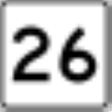
 State Route 26 State Route 26Maine State Route 26 State Route 26 is a 96.7 mile-long state highway in southwestern Maine. It was first commissioned in 1925, as part of the New England road marking system. Route 26 in Maine, as well as New Hampshire and the short stub in Vermont, covers the route of the old New England Interstate Route 26...  State Route 26A State Route 26AMaine State Route 26A State Route 26A is Maine's newest state highway, designated in 2006. It is a short bypass of State Route 26, running in the town of Gray. It was built to alleviate congestion in the downtown area from traffic bound north on Route 26 from the nearby Maine Turnpike Exit 63 interchange.-Concurrency...  State Route 27 State Route 27Maine State Route 27 State Route 27 is part of Maine's system of numbered state highways, running from the village of Newagen in Southport to the Canadian Border in Coburn Gore...  State Route 32 State Route 32 State Route 35 State Route 35Maine State Route 35 Maine State Route 35 runs the course of western Maine, from Bethel to Kennebunk. It passes through Oxford, Cumberland and York Counties. It is known in its lower sections for both its unusually windy course as well as its notoriously poor paving, as a result of winter frost heaves. Its northern...  State Route 37 State Route 37Maine State Route 37 State Route 37 is part of Maine's system of numbered state highways. It runs from an intersection with State Route 117 in North Bridgton to an intersection with State Route 118 in East Waterford. The route is also known as North Bridgton Road. A portion of the route is cosigned with State Route...  State Route 41 State Route 41 State Route 43 State Route 43 State Route 46 State Route 46 State Route 52 State Route 52 State Route 69 State Route 69 State Route 73 State Route 73Maine State Route 73 State Route 73 is part of Maine's system of numbered state highways. It runs from an intersection with State Route 131 in St. George to an intersection with U.S. 1 in Rockland. The route is also known as Seal Harbor Road , Spruce Head Road , Elm Street , and Weskeag Road, Ingraham Drive and...  State Route 77 State Route 77 State Route 85 State Route 85Maine State Route 85 State Route 85 is a short north-south state highway in southern Maine. It is a minor route connecting U.S. Route 302 and State Route 35 in Raymond to State Route 11 in Casco. Locally, it is known as "Webbs Mills Road," for it terminus is located in Webbs Mills Village, which is a small area in Casco...  State Route 86 State Route 86 State Route 88 State Route 88Maine State Route 88 State Route 88 is a state highway in southern Maine, United States. It runs south to north for just over miles, from U.S. Route 1 in Falmouth to U.S. Route 1 in Yarmouth. It runs to the east of Route 1, and its speed limit is 35 mph, whereas that of Route 1 is 45-50 mph north of Bucknam...  State Route 89 State Route 89Maine State Route 89 State Route 89 is part of Maine's system of numbered state highways. It runs from an intersection with State Route 161 in Caribou to an intersection with U.S. 1A in Limestone. The route is also known as Access Highway and Foster Avenue .The road was designated as a service route for the now...  State Route 90 State Route 90 |
 State Route 91 State Route 91Maine State Route 91 State Route 91 is a short state highway in southwestern Maine. It runs west to east for just under , connecting the towns of South Berwick and York.-Junction list:...  State Route 92 State Route 92 State Route 93 State Route 93 State Route 94 Interstate 95 State Route 94 Interstate 95
 State Route 96 State Route 96 State Route 97 State Route 97Maine State Route 97 State Route 97 is part of Maine's system of numbered state highways. It runs from an intersection with State Route 220 in Friendship to an intersection with U.S. 1 in Warren. The route is also known as Main Street and Cushing Road ....  State Route 98 State Route 98Maine State Route 98 State Route 98 is a short state highway in southeastern Maine. It is a 2.8-mile connection between the city of Saco and Old Orchard Beach.-History:...  State Route 99 State Route 99Maine State Route 99 State Route 99 is part of Maine's system of numbered state highways. It runs from an intersection with State Route 9A in Kennebunk to an intersection with State Route 109 in Sanford. The route is also known as Cat Mousam Road , Webber Hill Road, and Kennebunk Road . Route 99 also passes by...  State Route 100 State Route 100 State Route 100A State Route 100A State Route 101 State Route 101Maine State Route 101 State Route 101 is a short state highway in extreme southern Maine. It follows a southeast-northwest trajectory, signed as south–north. Route 101 begins at an intersection with U.S...  State Route 102 State Route 102Maine State Route 102 State Route 102 is a north-south state highway located on Mount Desert Island in eastern Maine. As of 2007, its southern terminus is located at an intersection with State Route 102A in Tremont on the southern part of the island...  State Route 102A State Route 102A State Route 103 State Route 103Maine State Route 103 State Route 103 is a long state highway in extreme southern Maine. The route is signed east–west, but forms a half-loop, with most of its eastern segment skirting the Piscataqua River and the state border with New Hampshire.-Route description:...  State Route 104 State Route 104 State Route 105 State Route 105Maine State Route 105 State Route 105 is a highway in the south-central part of the U.S. state of Maine. SR-105 begins in Augusta at Cony Circle where it junctions with U.S. Route 201 and continues east approximately until it terminates at U.S. 1 in Camden. It is regarded as one of the most scenic drives in Maine....  State Route 106 State Route 106 State Route 107 State Route 107 State Route 108 State Route 108 State Route 109 State Route 109 State Route 110 State Route 110Maine State Route 110 State Route 110 is a short state highway in southwestern Maine, located entirely within the town of Newfield. Route 110 begins in the west at the New Hampshire state line less than a half-mile from New Hampshire Route 153, which connects via unnumbered Stevens Corner Road...  State Route 111 State Route 111 State Route 112 State Route 112Maine State Route 112 State Route 112 is part of Maine's system of numbered state highways, running from U.S. Route 1 in Saco to Route 114 in Gorham.From its southern terminus in Saco, Route 112 runs north, concurrent with Route 5 for 0.4 miles. Route 112 then continues into Buxton where it eventually intersects with...  State Route 113 State Route 113Maine State Route 113 State Route 113 is a state highway in southwestern Maine . It runs from an intersection with Maine State Route 25 in Standish north to the town of Gilead, where it ends at U.S. Route 2 near the New Hampshire border...  State Route 114 State Route 114 State Route 115 State Route 115Maine State Route 115 State Route 115 is a state highway in southern Maine, United States. It runs west to east for just over miles, from U.S. Route 302/State Route 35 in North Windham to State Route 88 in Yarmouth.-Route:...  State Route 116 State Route 116 State Route 117 State Route 117Maine State Route 117 State Route 117 is part of Maine's system of numbered state highways, running from Route 112 in Saco to Route 219 in Turner.- Route description :...  State Route 118 State Route 118Maine State Route 118 State Route 118 is a long state highway in southern Maine. It runs east–west between the towns of Waterford and Norway.-Route description:...  State Route 119 State Route 119 State Route 120 State Route 120 State Route 121 State Route 121Maine State Route 121 State Route 121 is a 35.76-mile state highway in southern Maine. It begins at an intersection with U.S. Route 302 and Maine State Route 35 in Raymond and ends in Auburn...  State Route 122 State Route 122Maine State Route 122 State Route 122 is a short state highway in southern Maine. It runs west to east, from State Route 26 in Poland to U.S. Route 202/State Route 4/State Route 100 in Auburn.-Route description:...  State Route 123 State Route 123 State Route 124 State Route 124 State Route 125 State Route 125 State Route 126 State Route 126 State Route 127 State Route 127 State Route 128 State Route 128 State Route 129 State Route 129 State Route 130 State Route 130 State Route 131 State Route 131 State Route 132 State Route 132 State Route 133 State Route 133 State Route 134 State Route 134 State Route 135 State Route 135 State Route 136 State Route 136Maine State Route 136 State Route 136 is a numbered state highway in Maine, United States. It begins with Route 125 at the junction of U.S. 1 in Freeport, and travels to Auburn...  State Route 137 State Route 137Maine State Route 137 State Route 137 is a route that runs west to east that begins at the intersection of US 2 in East Mercer and covers a large expanse of land, ending in the city of Belfast at SR 3....
 State Route 138 State Route 138 State Route 139 State Route 139 |
 State Route 140 State Route 140 State Route 141 State Route 141 State Route 142 State Route 142 State Route 143 State Route 143 State Route 144 State Route 144 State Route 145 State Route 145Maine State Route 145 State Route 145 is part of Maine's system of numbered state highways. It runs from an intersection with State Route 4 in Strong to an intersection with State Route 142 near Kingfield. The route is also known as Maine Street in Strong....  State Route 146 State Route 146 State Route 148 State Route 148 State Route 149 State Route 149 State Route 150 State Route 150 State Route 151 State Route 151 State Route 152 State Route 152 State Route 153 State Route 153Maine State Route 153 State Route 153 is part of Maine's system of numbered state highways. It runs from an intersection with State Route 16 to an intersection with Smith Lane near Sebec Lake in Dover-Foxcroft. The route is also known as Greeley's Landing Road....  State Route 154 State Route 154 State Route 155 State Route 155 State Route 156 State Route 156 State Route 157 State Route 157 State Route 158 State Route 158Maine State Route 158 State Route 158 is part of Maine's system of numbered state highways. It runs from an intersection with I-95 to an intersection with U.S. 2 in Sherman. The route is also known as Main Street and Woodbridge Corner Road....  State Route 159 State Route 159 State Route 160 State Route 160 State Route 161 State Route 161Maine State Route 161 State Route 161 is part of Maine's system of numbered state highways. It runs from Fort Fairfield to Allagash. It begins at an intersection with U.S. 1A in Fort Fairfield, and deadends at the St. John River west of Allagash.....  State Route 162 State Route 162 State Route 163 State Route 163 State Route 164 State Route 164Maine State Route 164 State Route 164 is part of Maine's system of numbered state highways. It runs from Presque Isle to Caribou. It begins at an intersection with U.S. 1 just north of Presque Isle, and ends at a junction of State Route 161 and U.S. Route 1 in Caribou...  State Route 166 State Route 166 State Route 166A State Route 166A State Route 167 State Route 167Maine State Route 167 State Route 167 is part of Maine's system of numbered state highways. It runs from an intersection with U.S. 1 in Presque Isle to a junction with NB 190 at the Canadian border....  State Route 168 State Route 168Maine State Route 168 State Route 168 is part of Maine's system of numbered state highways. It runs from an intersection with U.S. 2 in Winn to an intersection with State Route 6 in Lee....  State Route 169 State Route 169 State Route 170 State Route 170 State Route 171 State Route 171Maine State Route 171 State Route 171 is part of Maine's system of numbered state highways. It runs from an intersection with State Route 169 in Prentiss to an intersection with U.S. 2A in Reed Plantation. Route 171 travels through the town of Wytopitlock....  State Route 172 State Route 172 State Route 173 State Route 173 State Route 174 State Route 174 State Route 175 State Route 175 State Route 176 State Route 176 State Route 177 State Route 177 State Route 178 State Route 178 State Route 179 State Route 179 State Route 180 State Route 180 State Route 181 State Route 181 State Route 182 State Route 182 State Route 183 State Route 183 State Route 184 State Route 184 State Route 185 State Route 185 State Route 186 State Route 186Maine State Route 186 State Route 186 is a state highway in south central Maine. The highway serves the town of Gouldsboro, running in a half-loop from U.S. Route 1, south and east along the southern coast near Frenchman Bay, and then returning to US-1....  State Route 187 State Route 187 State Route 188 State Route 188 State Route 189 State Route 189Maine State Route 189 State Route 189 is a numbered state highway in Maine, running from U.S. Route 1 in Whiting in the west to the Canadian border at Lubec in the east. In Lubec the route crosses the Franklin Delano Roosevelt Bridge when entering Campobello Island, New Brunswick... |
 State Route 190 State Route 190 State Route 191 State Route 191 State Route 192 State Route 192Maine State Route 192 State Route 192 is part of Maine's system of numbered state highways. It runs from an intersection with U.S. 1 in Machias to an intersection with State Route 9 in Wesley. The route is also known as Northfield Road....  State Route 193 State Route 193Maine State Route 193 State Route 193 is part of Maine's system of numbered state highways. It runs from an intersection with State Route 9 in Beddington to an intersection with U.S. 1 near Cherryfield. Route 193 originally ran between East Eddington and East Holden. The original route was renumbered State Route...  State Route 194 State Route 194Maine State Route 194 State Route 194 is a numbered state highway in the U.S. state of Maine. The route runs runs from an intersection with State Route 27 in Pittston to an intersection with State Route 218 in North Newcastle, a village of Newcastle... .svg.png) Interstate 195 Interstate 195Interstate 195 (Maine) Interstate 195, also known as the Saco Industrial Spur, is a short auxiliary Interstate Highway running convert in eastern York County, Maine. The highway, located entirely in the city of Saco, is a nominally east–west route that provides access to Downtown Saco and the resort town of Old Orchard...  State Route 195 State Route 195Maine State Route 195 State Route 195 is part of Maine's system of numbered state highways. It runs from an intersection with State Route 186 in Prospect Harbor to an intersection with U.S. 1 near West Gouldsboro....  State Route 196 State Route 196Maine State Route 196 State Route 196 is a state highway in the U.S. state of Maine. It connects Lewiston to Brunswick, following the valley of the Androscoggin River. ME 196 begins at a junction with US Route 1, which is a recent re-alignment change...  State Route 197 State Route 197 State Route 198 State Route 198 State Route 199 State Route 199 State Route 200 State Route 200 U.S. Route 201 U.S. Route 201 U.S. Route 201A U.S. Route 201A U.S. Route 202 U.S. Route 202 State Route 204 State Route 204 State Route 205 State Route 205 State Route 206 State Route 206 State Route 207 State Route 207 State Route 208 State Route 208 State Route 209 State Route 209 State Route 210 State Route 210Maine State Route 210 State Route 210 is part of Maine's system of numbered state highways. It runs in a loop from the intersection of U.S. Route 1/State Route 164 northeast and back around to U.S. 1 within Presque Isle. The route was originally designated in 1925, and ran between Fryeburg and North Waterford. During...  State Route 212 State Route 212 State Route 213 State Route 213 State Route 214 State Route 214 State Route 215 State Route 215 State Route 216 State Route 216 State Route 218 State Route 218 State Route 219 State Route 219 State Route 220 State Route 220 State Route 221 State Route 221 State Route 222 State Route 222 State Route 223 State Route 223 State Route 224 State Route 224 State Route 225 State Route 225Maine State Route 225 State Route 225 is a route that runs almost entirely through the town of Rome, Maine. It begins at the intersection of State Route 27 in Rome, and is the main road for the town...  State Route 226 State Route 226 State Route 227 State Route 227 State Route 228 State Route 228Maine State Route 228 State Route 228 is part of Maine's system of numbered state highways. It runs from Washburn to Caribou. It begins at an intersection with State Route 164 in downtown Washburn, and ends at an intersection of State Route 161 in Caribou...  State Route 229 State Route 229Maine State Route 229 State Route 229 is a short state highway in northeastern Maine. The state highway begins at an intersection with U.S. Route 1A in the town of Limestone and runs eastward to the Canadian border, where it crosses into New Brunswick and becomes New Brunswick Route 375.- Route description :State...  State Route 230 State Route 230 State Route 231 State Route 231 State Route 232 State Route 232 State Route 233 State Route 233 State Route 234 State Route 234 State Route 235 State Route 235 State Route 236 State Route 236Maine State Route 236 State Route 236, also known as the Dow Highway, is a long state highway in southwestern Maine. It runs from south to north, from an intersection with State Route 103 in Kittery to an intersection with State Route 9 in Berwick, just east of the border with New Hampshire.-Route description:The...  State Route 237 State Route 237 State Route 238 State Route 238Maine State Route 238 State Route 238 is a long state highway in southern Maine, located on Southport Island southwest of Boothbay Harbor. The short highway traverses the eastern edge of the island, serving as an alternate to State Route 27, which runs roughly parallel on the western side of the island.Designated in... .svg.png) Interstate 295 Interstate 295Interstate 295 (Maine) Interstate 295 is a -long connector in the U.S. state of Maine from I-95 in Scarborough to I-95 in West Gardiner.-Route description:...  U.S. Route 302 U.S. Route 302.svg.png) Interstate 395 Interstate 395Interstate 395 (Maine) Interstate 395 is a 4.99-mile long Auxiliary Interstate Highway in the Bangor, Maine area. The western terminus of the route is at a cloverleaf interchange with Interstate 95 near downtown Bangor, where I-395 continues west as U.S. Route 2 and State Route 100. The eastern terminus is at U.S... .svg.png) Interstate 495 Interstate 495Interstate 495 (Maine) Interstate 495 is the unsigned designation for the Falmouth Spur, a short freeway connecting Interstate 95 with Interstate 295 and U.S. Route 1 north of Portland, Maine, United States. As part of the Maine Turnpike, the main line of which carries Interstate 95, I-495 is a toll road. The spur has... (Falmouth Spur-unsigned)
|
 State Route 5A State Route 5A State Route 18 State Route 18 State Route 35A State Route 35A State Route 43A State Route 43A State Route 95 State Route 95 State Route 147 State Route 147 State Route 165 State Route 165 State Route 172A State Route 172A State Route 203 State Route 203 State Route 201 State Route 201U.S. Route 201 U.S. Route 201 is a spur of U.S. Route 1 in the U.S. state of Maine. US 201 begins in Brunswick. It follows the Kennebec River from Gardiner, Maine, to The Forks where it pulls away from the town and runs into the north woods. Route 201 ends in Sandy Bay Township, where it enters Quebec, Canada at...
 State Route 211 State Route 211 State Route 217 State Route 217Maine State Route 217 State Route 217 was a short state highway in Maine, serving as a connection to the Sebasco Harbor Resort in Phippsburg. It was first designated in 1928, and had maintained its alignment since. Between January and March 2007, all signage for the highway was removed....   SR 228 Truck SR 228 Truck New England Route 1 New England Route 1 New England Route 9 New England Route 9 New England Route 11 New England Route 11 New England Route 15 New England Route 15 New England Route 18 New England Route 18 New England Route 19 New England Route 19 New England Route 20 New England Route 20 New England Route 24 New England Route 24 New England Route 25 New England Route 25 New England Route 26 New England Route 26 |


Routes crossing state borders
New Hampshire Route 113B and New Hampshire Route 153New Hampshire Route 153
New Hampshire Route 153 is a long secondary north–south highway in Strafford and Carroll counties in the eastern portion of the U.S. state of New Hampshire. The road runs from Farmington north to Conway....
enter Maine. NH Route 113B is a loop of Maine's Route 113, which enters New Hampshire.