

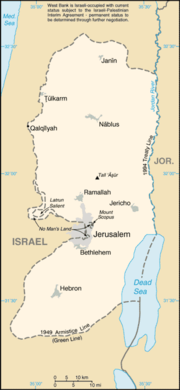
List of East Jerusalem locations
Encyclopedia
List of locations in Jerusalem sometimes described by the term East Jerusalem
:
 The following locations were included within the borders of the Israeli municipality after its expansion following the 1967 Six-Day War
, formalised in the 1980 Israeli Jerusalem Law
.
East Jerusalem
East Jerusalem or Eastern Jerusalem refer to the parts of Jerusalem captured and annexed by Jordan in the 1948 Arab-Israeli War and then captured and annexed by Israel in the 1967 Six-Day War...
:
Locations in Jordanian municipality (1949-1967)
The following locations were included within the borders of the Jordanian municipality in the eastern part of the city between 1949 and 1967.- American Colony
- Bab a-ZaharaBab a-ZaharaBab a-Zahara is an Arab neighborhood in East Jerusalem, north of the Old City and South of Salaheddin Street. It is bordered by the Herod's Gate and Damascus Gate on its south, and the American Colony and Sheikh Jarrah to the north, Bar Lev Street and Mea She'arim to the west, and Wadi Joz to the...
- Old City of Jerusalem
- Armenian QuarterArmenian QuarterThe Armenian Quarter is one of the four quarters of the Old City of Jerusalem. The Armenian Quarter is the smallest of the four quarters, with the smallest number of residents....
- Christian QuarterChristian QuarterThe Christian Quarter is one of the four quarters of the ancient, walled Old City of Jerusalem, the other three being the Jewish Quarter, the Muslim Quarter and the Armenian Quarter...
- Jewish Quarter
- Muslim QuarterMuslim QuarterThe Muslim Quarter is one of the four quarters of the ancient, walled Old City of Jerusalem. It covers 31 hectares of the northeastern sector of the Old City. The quarter is the largest and most populous and extends from the Lions' Gate in the east, along the northern wall of the Temple Mount in...
- Armenian Quarter
- Sheikh JarrahSheikh JarrahSheikh Jarrah is a predominantly Palestinian neighborhood in East Jerusalem on the road to Mount Scopus.-History:Sheikh Jarrah was established on the slopes of Mount Scopus, taking its name from the tomb of Sheikh Jarrah. The tomb, dated to 1201, is the burial place of Husam al-Din al-Jarrahi, an...
- Silwan (added in Jordan's 1961 municipal expansion)
- Wadi al-JozWadi Al-JozWadi al-Joz , also Wadi Joz, , is an Arab neighborhood in East Jerusalem, located at the head of the Kidron Valley, north of the Old City. The population of Wadi Joz is 13,000....
Locations in expanded Jerusalem municipality (1967-present)
Six-Day War
The Six-Day War , also known as the June War, 1967 Arab-Israeli War, or Third Arab-Israeli War, was fought between June 5 and 10, 1967, by Israel and the neighboring states of Egypt , Jordan, and Syria...
, formalised in the 1980 Israeli Jerusalem Law
Jerusalem Law
The Jerusalem Law is a common name of Basic Law: Jerusalem, Capital of Israel passed by the Knesset on July 30, 1980 .It began as a private member's bill proposed by Geula Cohen, whose original text stated that "the integrity and unity of greater Jerusalem in its boundaries after the Six-Day War...
.
- A-TurA-TurAt-Tur is an Arab neighborhood on the Mount of Olives approximately 1 km east of the Old City of Jerusalem. At-Tur is situated in East Jerusalem, which was annexed by Israel after the Six-Day War in 1967....
- Beit HaninaBeit HaninaBeit Hanina is a Palestinian neighborhood in East Jerusalem on the road to Ramallah. It is bordered by Hizma to the east, Shuafat to the south, Beit Iksa and Nabi Samwil to the west, and Bir Nabala, al-Jib, Kafr Aqab and ar-Ram to the north. The total area of Beit Hanina is 20 sq. kilometers...
- Beit SafafaBeit SafafaBeit Safafa is an Arab neighborhood in south Jerusalem midway between the Jerusalem neighborhoods of Patt and Gilo, on the outskirts of Bethlehem. Beit Safafa had a population of 5,463 in 2000. It covers an area of 1,577 dunams.-History:...
- Jabel MukaberJabel MukaberJabel Mukaber is a predominantly Arab neighborhood in southern East Jerusalem. It is bordered by Armon HaNetziv to the west, Abu Tor and Silwan to the north and Sur Baher to the south...
- Jebel Batan al-Hawa
- Kafr 'AqabKafr 'AqabKafr 'Aqab is the northernmost Palestinian Arab neighborhood in East Jerusalem. It is located just south of the West Bank city of al-Bireh, 13 kilometers North of Jerusalem in the central West Bank. According to the Palestinian Central Bureau of Statistics, the neighborhood had a population of...
- Ras al-AmudRas al-AmudRas al-Amud is a Palestinian neighborhood in East Jerusalem, located southeast of the Old City, overlooking Silwan to the south, Abu Dis and al-Eizariya to the east, and the Temple Mount to the north...
- Sawahra al-Arbiya
- Sharafat
- ShuafatShuafatShu'fat , also Shuafat and Sha'fat, is a Palestinian Arab neighborhood of East Jerusalem, forming part of north-eastern Jerusalem. Located on the old Jerusalem-Ramallah road about three miles north of the Old City, Shuafat has a population of 35,000 residents...
- Sur BaherSur BaherSur Baher is an Arab neighborhood on the southeastern outskirts of Jerusalem. It is located southeast of Talpiot and north of the Har Homa neighborhood, down the hill from Kibbutz Ramat Rachel...
- Umm TubaUmm TubaUmm Tuba is an Arab neighborhood in East Jerusalem near Sur Baher, northeast of Bethlehem, with a population of 4,000. After the 1967 Six-Day War, Umm Tuba was incorporated into the municipal district of Jerusalem...
External links
- B'Tselem - The Separation Barrier. Article with link to large PDF map of the West Bank that shows details of Jerusalem and surroundings.