
Lincoln County, Nevada
Encyclopedia

U.S. state
A U.S. state is any one of the 50 federated states of the United States of America that share sovereignty with the federal government. Because of this shared sovereignty, an American is a citizen both of the federal entity and of his or her state of domicile. Four states use the official title of...
of Nevada
Nevada
Nevada is a state in the western, mountain west, and southwestern regions of the United States. With an area of and a population of about 2.7 million, it is the 7th-largest and 35th-most populous state. Over two-thirds of Nevada's people live in the Las Vegas metropolitan area, which contains its...
. As of the 2000 census, the population was 4,165. Its county seat
County seat
A county seat is an administrative center, or seat of government, for a county or civil parish. The term is primarily used in the United States....
is Pioche
Pioche, Nevada
-External links:*...
.
History
Lincoln County was established in 1866 after Nevada moved its state line eastward and southward at the expense of UtahUtah
Utah is a state in the Western United States. It was the 45th state to join the Union, on January 4, 1896. Approximately 80% of Utah's 2,763,885 people live along the Wasatch Front, centering on Salt Lake City. This leaves vast expanses of the state nearly uninhabited, making the population the...
and Arizona
Arizona
Arizona ; is a state located in the southwestern region of the United States. It is also part of the western United States and the mountain west. The capital and largest city is Phoenix...
territories. It is named after Abraham Lincoln
Abraham Lincoln
Abraham Lincoln was the 16th President of the United States, serving from March 1861 until his assassination in April 1865. He successfully led his country through a great constitutional, military and moral crisis – the American Civil War – preserving the Union, while ending slavery, and...
, the 16th President of the United States
President of the United States
The President of the United States of America is the head of state and head of government of the United States. The president leads the executive branch of the federal government and is the commander-in-chief of the United States Armed Forces....
. Original legislation called for the creation of a "Stewart County", after Nevada Senator William M. Stewart
William M. Stewart
William Morris Stewart was an American lawyer and politician.-Biography:Stewart was born in Wayne County, New York. As a child he moved with his parents to Trumbull County, Ohio. As a young man he was a mathematics teacher in Ohio. In 1849 he began attending Yale University but left in 1850 to...
, but this was later changed in a substitute bill. Crystal Springs
Crystal Springs, Nevada
Crystal Springs is a ghost town in the Pahranagat Valley region of Lincoln County, Nevada. The ghost town is located at the junction of SR 318 and SR 375, also known as the Extraterrestrial Highway. It is a popular destination for passersby who want to visit the towns of Hiko and Rachel...
was the county's first seat
County seat
A county seat is an administrative center, or seat of government, for a county or civil parish. The term is primarily used in the United States....
in 1866, followed by Hiko
Hiko, Nevada
Hiko, Nevada, is a small, agrarian community of the Tonopah Basin on State Route 318 in Lincoln County, Nevada. At one time Hiko was the county seat, and a few hundred residents lived nearby, due largely to silver mines in the area...
in 1867, and Pioche
Pioche, Nevada
-External links:*...
in 1871.
Lincoln County initially included the town of Las Vegas
Las Vegas, Nevada
Las Vegas is the most populous city in the U.S. state of Nevada and is also the county seat of Clark County, Nevada. Las Vegas is an internationally renowned major resort city for gambling, shopping, and fine dining. The city bills itself as The Entertainment Capital of the World, and is famous...
. However, Clark County, Nevada
Clark County, Nevada
-Demographics:As of the census of 2000, there were 1,375,765 people, 512,253 households, and 339,693 families residing within the MSA. The racial makeup of the MSA was 71.6% White , 9.1% Black, 5.7% Asian, 0.8% American Indian and 12.8% of other or mixed race. 22.0% were Hispanic of any race...
, including Las Vegas, was separated from Lincoln County effective July 1, 1908, by act of the Nevada Legislature.
Area 51
Area 51
Area 51 is a military base, and a remote detachment of Edwards Air Force Base. It is located in the southern portion of Nevada in the western United States, 83 miles north-northwest of downtown Las Vegas. Situated at its center, on the southern shore of Groom Lake, is a large military airfield...
is in Lincoln County, and the county sheriff acts in proxy for the perimeter security forces.
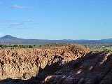
Geography
According to the U.S. Census BureauUnited States Census Bureau
The United States Census Bureau is the government agency that is responsible for the United States Census. It also gathers other national demographic and economic data...
, the county has a total area of 10,637 square miles (27,549 km²), of which 10,634 square miles (27,541 km²) is land and 3 square miles (8 km²) (0.03%) is water. While only the third largest county by area in the State of Nevada
Nevada
Nevada is a state in the western, mountain west, and southwestern regions of the United States. With an area of and a population of about 2.7 million, it is the 7th-largest and 35th-most populous state. Over two-thirds of Nevada's people live in the Las Vegas metropolitan area, which contains its...
, it is seventh largest county in area in the entire United States
United States
The United States of America is a federal constitutional republic comprising fifty states and a federal district...
, not including boroughs and census areas in Alaska
Alaska
Alaska is the largest state in the United States by area. It is situated in the northwest extremity of the North American continent, with Canada to the east, the Arctic Ocean to the north, and the Pacific Ocean to the west and south, with Russia further west across the Bering Strait...
.
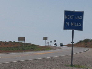
Major highways
 U.S. Route 93
 State Route 318Nevada State Route 318State Route 318 runs from U.S. Route 93 at Crystal Springs, Nevada north to a location on U.S. Route 6 approximately southwest of Ely. It is often used as a shortcut between Ely and Las Vegas....
 State Route 319Nevada State Route 319State Route 319 is a state highway in Lincoln County, Nevada, USA. The route connects the town of Panaca to Modena, Utah. SR 319 has been part of the state highway system since at least 1932, and was part of the longer State Route 25 prior to the late 1970s.-Route description:State Route 319...
 State Route 375Nevada State Route 375State Route 375 is a state highway in south-central Nevada in the United States. The highway stretches from State Route 318 at Crystal Springs northwest to U.S. Route 6 at Warm Springs. The route travels through mostly unoccupied desert terrain, with much of its alignment paralleling the...
Adjacent counties
- White Pine CountyWhite Pine County, NevadaWhite Pine County is a county located in the U.S. state of Nevada. Its population at the 2010 census was 10,030. Its county seat is Ely. It is the home of Great Basin National Park...
- north - Nye CountyNye County, Nevada-National protected areas:* Ash Meadows National Wildlife Refuge* Death Valley National Park * Humboldt-Toiyabe National Forest * Spring Mountains National Recreation Area -Demographics:...
- west - Clark CountyClark County, Nevada-Demographics:As of the census of 2000, there were 1,375,765 people, 512,253 households, and 339,693 families residing within the MSA. The racial makeup of the MSA was 71.6% White , 9.1% Black, 5.7% Asian, 0.8% American Indian and 12.8% of other or mixed race. 22.0% were Hispanic of any race...
- south - Mohave County, ArizonaMohave County, ArizonaMohave County is located in the northwestern corner of the U.S. state of Arizona. As of the 2010 census, its population was 200,186, an increase of 45,154 people since the 2000 census count of 155,032. The county seat is Kingman...
- southeast - Washington County, UtahWashington County, UtahAs of the census of 2000, there were 90,354 people, 29,939 households, and 23,442 families residing in the county. The population density was 37 people per square mile . There were 36,478 housing units at an average density of 15 per square mile...
- east - Iron County, UtahIron County, UtahAs of the census of 2000, there were 33,779 people, 10,627 households, and 8,076 families residing in the county. The population density was 10 people per square mile . There were 13,618 housing units at an average density of 4 per square mile...
- east - Beaver County, UtahBeaver County, UtahAs of the census of 2010, there were 6,629 people, 2,265 households, and 1,697 families residing in the county. The population density was 2.56 people per square mile . There were 2,908 housing units at an average density of 1.12 per square mile...
- east - Millard County, UtahMillard County, UtahMillard County is a county located in the U.S. state of Utah. In 2010, its population was 12,420. It was named for Millard Fillmore, thirteenth President of the United States. Its county seat is Fillmore and the largest city is Delta.-Geography:...
- northeast
National protected areas
- Desert National Wildlife RefugeDesert National Wildlife RefugeThe Desert National Wildlife Range is a protected wildlife refuge, administered by the U.S. Fish and Wildlife Service, located north of Las Vegas, Nevada, in northwestern Clark and southwestern Lincoln counties, with much of its land area lying within the southeastern section of the Nevada Test and...
(part) - Humboldt National Forest (part)
- Pahranagat National Wildlife RefugePahranagat National Wildlife RefugeThe Pahranagat National Wildlife Refuge is a protected wildlife refuge, located at the southern end of the Pahranagat Valley and administered by the U.S. Fish and Wildlife Service. It is situated north of Las Vegas, Nevada in Lincoln County, Nevada...
Education
Public schools in Lincoln County are under the Lincoln County School District. The schools are:- Pioche Elementary School
- Caliente Elementary School
- Pahranagat Valley Elementary School
- Panaca Elementary School
- Meadow Valley Middle School
- Pahranagat Valley Middle School
- Lincoln County High School
- C. O. Bastian High School
- Pahranagat Valley High School
Lincoln County School District along with Coyote Springs developers are planning large numbers of new schools within development which will double the growth of Lincoln County School District over 50 built out of the new city.
Demographics
As of the censusCensus
A census is the procedure of systematically acquiring and recording information about the members of a given population. It is a regularly occurring and official count of a particular population. The term is used mostly in connection with national population and housing censuses; other common...
of 2000, there were 4,165 people, 1,540 households, and 1,010 families residing in the county. The population density
Population density
Population density is a measurement of population per unit area or unit volume. It is frequently applied to living organisms, and particularly to humans...
was less than one person per square mile (and thus less than 1/km²). There were 2,178 housing units at an average density of 0 per square mile (0/km²). The racial makeup of the county was 91.50% White
Race (United States Census)
Race and ethnicity in the United States Census, as defined by the Federal Office of Management and Budget and the United States Census Bureau, are self-identification data items in which residents choose the race or races with which they most closely identify, and indicate whether or not they are...
, 1.78% Black
Race (United States Census)
Race and ethnicity in the United States Census, as defined by the Federal Office of Management and Budget and the United States Census Bureau, are self-identification data items in which residents choose the race or races with which they most closely identify, and indicate whether or not they are...
or African American
Race (United States Census)
Race and ethnicity in the United States Census, as defined by the Federal Office of Management and Budget and the United States Census Bureau, are self-identification data items in which residents choose the race or races with which they most closely identify, and indicate whether or not they are...
, 1.75% Native American
Race (United States Census)
Race and ethnicity in the United States Census, as defined by the Federal Office of Management and Budget and the United States Census Bureau, are self-identification data items in which residents choose the race or races with which they most closely identify, and indicate whether or not they are...
, 0.34% Asian
Race (United States Census)
Race and ethnicity in the United States Census, as defined by the Federal Office of Management and Budget and the United States Census Bureau, are self-identification data items in which residents choose the race or races with which they most closely identify, and indicate whether or not they are...
, 0.02% Pacific Islander
Race (United States Census)
Race and ethnicity in the United States Census, as defined by the Federal Office of Management and Budget and the United States Census Bureau, are self-identification data items in which residents choose the race or races with which they most closely identify, and indicate whether or not they are...
, 2.69% from other races
Race (United States Census)
Race and ethnicity in the United States Census, as defined by the Federal Office of Management and Budget and the United States Census Bureau, are self-identification data items in which residents choose the race or races with which they most closely identify, and indicate whether or not they are...
, and 1.92% from two or more races. 5.31% of the population were Hispanic
Race (United States Census)
Race and ethnicity in the United States Census, as defined by the Federal Office of Management and Budget and the United States Census Bureau, are self-identification data items in which residents choose the race or races with which they most closely identify, and indicate whether or not they are...
or Latino
Race (United States Census)
Race and ethnicity in the United States Census, as defined by the Federal Office of Management and Budget and the United States Census Bureau, are self-identification data items in which residents choose the race or races with which they most closely identify, and indicate whether or not they are...
of any race.
According to the 2000 census the five largest ancestry groups in Lincoln County are English
English American
English Americans are citizens or residents of the United States whose ancestry originates wholly or partly in England....
(21%), German
German American
German Americans are citizens of the United States of German ancestry and comprise about 51 million people, or 17% of the U.S. population, the country's largest self-reported ancestral group...
(18%), Irish
Irish American
Irish Americans are citizens of the United States who can trace their ancestry to Ireland. A total of 36,278,332 Americans—estimated at 11.9% of the total population—reported Irish ancestry in the 2008 American Community Survey conducted by the U.S. Census Bureau...
(11%), Mexican
Mexican American
Mexican Americans are Americans of Mexican descent. As of July 2009, Mexican Americans make up 10.3% of the United States' population with over 31,689,000 Americans listed as of Mexican ancestry. Mexican Americans comprise 66% of all Hispanics and Latinos in the United States...
(4%) and Italian
Italian American
An Italian American , is an American of Italian ancestry. The designation may also refer to someone possessing Italian and American dual citizenship...
(4%).
There were 1,540 households out of which 29.00% had children under the age of 18 living with them, 56.20% were married couples
Marriage
Marriage is a social union or legal contract between people that creates kinship. It is an institution in which interpersonal relationships, usually intimate and sexual, are acknowledged in a variety of ways, depending on the culture or subculture in which it is found...
living together, 7.90% had a female householder with no husband present, and 34.40% were non-families. 31.30% of all households were made up of individuals and 16.10% had someone living alone who was 65 years of age or older. The average household size was 2.48 and the average family size was 3.15.
In the county the population was spread out with 30.10% under the age of 18, 6.00% from 18 to 24, 21.90% from 25 to 44, 25.90% from 45 to 64, and 16.20% who were 65 years of age or older. The median age was 39 years. For every 100 females there were 107.90 males. For every 100 females age 18 and over, there were 108.20 males.
The median income for a household in the county was $31,979, and the median income for a family was $45,588. Males had a median income of $40,048 versus $23,571 for females. The per capita income
Per capita income
Per capita income or income per person is a measure of mean income within an economic aggregate, such as a country or city. It is calculated by taking a measure of all sources of income in the aggregate and dividing it by the total population...
for the county was $17,326. About 11.50% of families and 16.50% of the population were below the poverty line, including 19.60% of those under age 18 and 17.40% of those age 65 or over.
Cities and towns
- PiochePioche, Nevada-External links:*...
(county seat) - CalienteCaliente, NevadaCaliente , formerly known as Culverwell and Calientes is a town in Lincoln County, Nevada, United States. Its elevation is 4,300 feet . The population was 1,123 at the 2000 census...
- CarpCarp, NevadaCarp, Nevada is an unincorporated community in Lincoln County, Nevada, United States located south of Caliente. It sits on the Meadow Valley Wash, which empties into Lake Mead....
- HikoHiko, NevadaHiko, Nevada, is a small, agrarian community of the Tonopah Basin on State Route 318 in Lincoln County, Nevada. At one time Hiko was the county seat, and a few hundred residents lived nearby, due largely to silver mines in the area...
- PanacaPanaca, NevadaPanaca is a town in eastern Lincoln County, Nevada, on State Route 319, about 1 mile east of U.S. Route 93, near the border with Utah. Its elevation is 4,729 feet .-History:...
- RachelRachel, NevadaRachel is an unincorporated portion of Lincoln County, Nevada. As the closest habitation to the Nellis Air Force Range and Area 51, Rachel enjoys a modest celebrity, particularly among aviation enthusiasts and UFO hunters....
- AlamoAlamo, NevadaAlamo is an unincorporated community in Lincoln County, Nevada, United States, about north of Las Vegas. Its elevation is 3,449 feet . It is named after the Spanish word for "poplar" due to the presence of that type of tree. Founded in 1901, Alamo lies in the Pahranagat Valley. Its economy is...
- Ash SpringsAsh Springs, NevadaAsh Springs is a town in the Pahranagat Valley of Lincoln County, Nevada. The town's principal industry is ranching. The town is home to naturally occurring hot springs....
- UrsineUrsine, NevadaUrsine is an unincorporated community in Lincoln County, Nevada, United States....
- BarclayBarclay, NevadaBarclay is a town in Lincoln County, Nevada, United States. Originally a Mormon settlement in the 19th century, it has few residents and appears on several ghost town lists...
- ElginElgin, NevadaElgin is a ghost town located between Caliente and Carp, Nevada. Originally a railroad town, it is now the home of a one-room schoolhouse, which has been in use from 1922 to 1967...
- Pony SpringsPony Springs, NevadaPony Springs is an unincorporated community in Lincoln County, Nevada, United States. It has an elevation of 6,155 feet and is in the Pacific time zone . Pony Springs is located along U.S. Route 93.-External links:*...
Planned developments
- Coyote SpringsCoyote Springs, NevadaCoyote Springs, Nevada, is a master-planned community being developed in Lincoln County and Clark County, Nevada, by developer and attorney-lobbyist Harvey Whittemore and Pardee Homes.-Current development:...
-- a proposed community for 240,000 people.
See also
- Fortification Range WildernessFortification Range WildernessFortification Range Wilderness is a wilderness area in Lincoln County, in the U.S. state of Nevada. The Wilderness lies approximately southeast of the town of Ely and is administered by the U.S. Bureau of Land Management....
- National Register of Historic Places listings in Lincoln County, Nevada
- South Egan Range WildernessSouth Egan Range WildernessSouth Egan Range Wilderness is a wilderness area in Lincoln, White Pine, and Nye Counties in the U.S. state of Nevada. Located in the Egan Range approximately two miles east of the town of Lund, the Wilderness was created by the "White Pine County Conservation, Recreation and Development Act of...
- Weepah Spring WildernessWeepah Spring WildernessWeepah Spring Wilderness is a wilderness area in Lincoln and Nye Counties, in the U.S. state of Nevada. The Wilderness lies approximately south of the town of Alamo and is administered by the U.S. Bureau of Land Management....