
Lighthouses in Canada
Encyclopedia
This is a list of lighthouse
s in Canada
.
Sources:
Sources:
Sources:
Lighthouse
A lighthouse is a tower, building, or other type of structure designed to emit light from a system of lamps and lenses or, in older times, from a fire, and used as an aid to navigation for maritime pilots at sea or on inland waterways....
s in Canada
Canada
Canada is a North American country consisting of ten provinces and three territories. Located in the northern part of the continent, it extends from the Atlantic Ocean in the east to the Pacific Ocean in the west, and northward into the Arctic Ocean...
.
British Columbia
- Addenbroke Island Lightstation
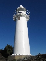
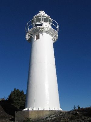
- Boat BluffBoat BluffBoat Bluff lighthouse is located near Klemtu on the scenic south end of Sarah Island in Tolmie Channel on the Inside Passage of British Columbia. The lighthouse was established in 1907. The skeleton tower is 24 feet high giving it a focal plane 38 feet above sea level. The station is still staffed...
lighthouse - Bonilla Island Lightstation
- Brockton PointBrockton PointBrockton Point is located in Vancouver harbour at the east end of Stanley Park. It is named after Francis Brockton. Brockton Point Lighthouse, an automated light, is located at the point....
Lightstation - Cape Beale LightstationCape Beale LightstationCape Beale Lightstation is a manned lighthouse on Vancouver Island in British Columbia., Canada.-History:The lighthouse was built in 1874 and its focal plane is 51 meters above sea level. The present tower was built in 1958 and marks the entrance to Barkley Sound. It is 10 metres tall...
- Cape Mudge lighthouse
- Cape Scarlett Lightstation
- Cape ScottCape Scott Provincial ParkCape Scott Provincial Park is a provincial park located at the cape of the same name, which is the northwestern tip of Vancouver Island, British Columbia, Canada. First established in 1973 with c. of area, later boundary revisions form an area of 22,290 ha...
lighthouse - Chatham Point lighthouse
- Chrome Island Lightstation
- Discovery Island LightDiscovery Island LightIn 1886 the Discovery Island Lighthouse was built on Pandora Hill which is the highest point on Discovery Island in the province of British Columbia, Canada. The government appointed Richard Brinn to be the first lighthouse keeper. His daughter Mary Ann Croft assisted him...
- Egg Island Lightstation
- Entrance Island Lightstation
- Estevan PointEstevan PointEstevan Point is a lighthouse located on the headland of the same name on the Hesquiat Peninsula on the west coast of Vancouver Island, Canada....
Lighthouse - Fisgard Lighthouse
- Gallows Point Light
- Green Island Lightstation
- Holland Rock Lightstation
- Ivory IslandIvory IslandIvory Island Lightstation is located 14 miles northwest of Bella Bella on the junction of Seaforth Channel and Milbanke Sound on the Inside Passage of British Columbia....
Lightstation - Langara Light
- Lennard Island Lightstation
- Nootka Lighthouse
- Pachena Point LighthousePachena Point LighthousePachena Point Lighthouse is located on Vancouver Island, approximately 12 km south of Bamfield, British Columbia, in Pacific Rim National Park. The octagonal wooden tower is maintained by the Canadian Coast Guard who employ lighthouse keepers at the station.-External links:* *...
- Pine Island Lightstation
- Point AtkinsonLighthouse ParkLighthouse Park is a popular park in West Vancouver, Canada. Its area is about 75 hectares and it is almost completely covered with rugged, virgin rainforest. At the southermost tip of the peninsula is Point Atkinson with an impressive landmark lighthouse built in 1914 on granite boulders jutting...
Lighthouse - Pointer Island Lightstation
- Race Rocks LighthouseRace Rocks LighthouseRace Rocks Light is one of two lighthouses that were built on the west coast of Canada, financed by the British Government and illuminated in 1860. It is the only lighthouse on that coast built of rock, purportedly quarried in Scotland, and topped with sandstone quarried on Gabriola Island...
- Roberts Bank Light
- Sands Head Light
- Sisters Island Lightstation
- Sheringham Point LighthouseSheringham Point LighthouseSheringham Point Lighthouse is located on Vancouver Island, British Columbia, near the community of Shirley. Built in 1912, it is still used for navigation....
- Trial IslandsTrial Islands, British ColumbiaThe Trial Islands are a group of islands located off the south-eastern tip of Vancouver Island off Victoria, part of the municipality of Oak Bay...
Lightstation - Triple Island Lightstation
- Triangle Island Lightstation
Sources:
Labrador
- Belle Isle NortheastBelle Isle NortheastBelle Isle Northeast Light is a 27 metres tall, 12-sided flying buttress lighthouse located on Belle Isle, Newfoundland, which was built in 1905. It is one of three lighthouses on the island and was maintained by the Canadian Government despite the fact that Newfoundland didn't join confederation...
- Belle Isle South End Upper
- Belle Isle South End Lower
- Camp Islands
- Double Island
- Point Amour
- St. Modeste Island
Newfoundland Atlantic Coast
- Bacalhao Island
- Baccalieu IslandBaccalieu IslandBaccalieu Island is a 5 km² uninhabited island at the northern extremities of Conception Bay near the community of Red Head Cove, Canada. It is separated from the island of Newfoundland by Baccalieu Tickle, a small strait and an abundant fishing ground....
- Baccalieu Island Southwest Point
- Bay BullsBay Bulls, Newfoundland and LabradorBay Bulls is a small fishing community in the province of Newfoundland and Labrador, Canada.-Geography:Located in sheltered bay it has been home to many fishermen and a strategic location in early times as it is located just a few miles from the capital, St. John's.-History:Bay Bulls first appears...
(Bull Head) - Bell IslandBell IslandBell Island is a Canadian island located off Newfoundland's Avalon Peninsula in Conception Bay.Measuring 9 km in length and 3 km in width, Bell Island has an area of 34 km²...
- BrigusBrigus, Newfoundland and LabradorBrigus is a small fishing community located in Conception Bay, Newfoundland and Labrador, Canada. Brigus was home to Captain Bob Bartlett and the location of his residence Hawthorne Cottage....
- Cabot Islands (Bonavista Bay)
- Cape BauldCape BauldCape Bauld is a headland located at the northeasternmost point of Great Northern Peninsula on the island of Newfoundland in the Canadian province of Newfoundland and Labrador....
- Cape BonavistaCape BonavistaCape Bonavista is a headland located on the east coast of the island of Newfoundland in the Canadian province of Newfoundland and Labrador.It is located at the northeastern tip of the Bonavista Peninsula, which separates Trinity Bay to the south from Bonavista Bay to the north.The nearby town of...
- Cape NormanCape NormanCape Norman is a barren, limestone headland located at the northernmost point of insular Newfoundland in the Canadian province of Newfoundland and Labrador....
- Cape RaceCape RaceCape Race is a point of land located at the southeastern tip of the Avalon Peninsula on the island of Newfoundland, Canada. Its name is thought to come from the original Portuguese name for this cape, "Raso", or "bare"...
- Cape SpearCape SpearCape Spear, located on the Avalon Peninsula near St. John's, Newfoundland, is the easternmost point in North America , excluding Greenland and the portions of Alaska west of the 180th parallel of longitude . Cape Spear is close to Blackhead, an amalgamated area of the City of St. John's, about...
- Cape St. Francis (Canada)Cape St. Francis (Canada)The Headland of Cape St. Francis is outer extremity marking the boundary of Conception Bay on the Avalon Peninsula of the island of Newfoundland in the Canadian province of Newfoundland and Labrador....
- ConcheConche, Newfoundland and LabradorConche is a community with on the Northern Peninsula of Newfoundland and Labrador, Canada. The population in 2006 was 225.- The Community :...
(Silver Point) - Ferryland Head
- Fort Amherst
- Fox Point (Fishing Point)
- Green IslandGreen Island (Catalina), NewfoundlandGreen Island is located in eastern Newfoundland off the east coast of the Bonavista Peninsula near the entrance to Catalina Harbour. The nearest town is Port Union....
(Catalina) - Green Point (Bay Roberts)
- Gull IslandGull Island, Newfoundland and LabradorGull Island is a small fishing community on the north side of Newfoundland Island, in the Province of Newfoundland and Labrador, Canada.It is built by Conception Bay on the Bay de Verde Peninsula, bound on the north by Burnt Point and on the south by Northern Bay. Gull Island was named for the...
(Cape John) - Hant's Harbour
- Heart's ContentHeart's Content, Newfoundland and LabradorHeart's Content is an incorporated town in Trinity Bay on the Bay de Verde Peninsula of Newfoundland and Labrador, Canada. The natural harbour that makes up the town is located on the east side of Trinity Bay and it is built along the northeast side and the southeast base of this...
- Kings Cove Head
- Little Denier Island
- Long Island East End
- Long Point (Twillingate)
- Manuel Island
- Offer Wadham Island
- Peckford Island
- Puffin IslandPuffin Island (Baccalieu Tickle), Newfoundland and LabradorPuffin Island is a small island in Newfoundland and Labrador, Canada, in a navigation channel called Baccalieu Tickle and just off the coast of Baccalieu Island. The island is an ecological reserve for its population of Atlantic Puffin...
- Random Head Harbour
- Surgeon Cove Point
- Westport Cove
Newfoundland South Coast
- Cape PineCape PineThe Headland of Cape Pine is the point of land marking the boundary of Trepassey Bay on the Avalon Peninsula of the island of Newfoundland in the Canadian province of Newfoundland and Labrador....
- Cape RayCape RayCape Ray is a headland located at the southwestern extremity of the island of Newfoundland in the Canadian province of Newfoundland and Labrador....
- Cape St. Mary'sCape St. Mary'sThe headland of Cape St. Mary's is located at the southern tip of the south-western arm of the Avalon Peninsula of the island of Newfoundland in the Canadian province of Newfoundland and Labrador.Cape St...
- Channel Head
- Colombier Islands
- Dawson Point
- GarnishGarnish, Newfoundland and LabradorGarnish, a town located on the west coast of the Burin Peninsula, is known for its lumbering and lobstering operations. It is 19 miles north west of Grand Banks. The Way Office was established in 1852 and the first Waymaster was Henry Campe. In 2006 the town had a population of 578.-External links:**...
- Grand Bank (East Pier)
- Green IslandGreen Island (Fortune), Newfoundlandthumb|Green Island from [[Saint Pierre island]] . Iceberg and Newfoundland in background. Taken May 14, 2008.thumb|Another shot of Green Island from the north of [[Saint Pierre island]]. Taken May 14, 2008....
- Little Burin Island
- Long Island
- Northwest Head (Ramea)
- Point Verde
- Powles Head
- Rose Blanche
- St. Jacques Island
- Boar Island (Burgeo)
Newfoundland West Coast
- Broad Cove Point Range Front
- Broad Cove Point Range Rear
- Cape Anguille Lighthouse
- Cow Head
- Flowers Cove
- Harbour PointHarbour PointHarbour Point is a point separating Leith and Stromness Harbors, in Stromness Bay, South Georgia. This descriptive name was in use as early as 1920 and was probably applied by whalers operating from Stromness Bay....
(Sandy Point) - Keppel Island
- Lobster Cove Head
- New Férolle Peninsula
- Pointe Riche
- South Head
- Woody Point
Nova Scotia
- Sambro Island LighthouseSambro Island LighthouseSambro Island Lighthouse is a landfall lighthouse located at the entrance to Halifax Harbour, Nova Scotia, on an island near the community of Sambro in the Halifax Regional Municipality...
- Louisbourg LightLouisbourg LightLouisbourg Lighthouse is a historic Canadian lighthouse at Louisbourg, Nova Scotia, and is the site of the first lighthouse in Canada.-The first light:...
- Sable IslandSable IslandSable Island is a small Canadian island situated 300 km southeast of mainland Nova Scotia in the Atlantic Ocean. The island is a year-round home to approximately five people...
lighthouse - Peggys CovePeggys Cove, Nova ScotiaPeggys Cove is one of the busiest tourist attractions in Nova Scotia and is a prime attraction on the Lighthouse Trail scenic drive. The community's famous lighthouse marks the eastern entrance of St. Margarets Bay and is officially known as the Peggys Point Lighthouse.Peggys Cove has a classic...
lighthouse - Cape Forchu lighthouse
- Cape North LighthouseCape North LighthouseThe Cape North Lighthouse is a cylindrical lighthouse tower with a red and white checkerboard pattern that stood at Money Point, near Cape North, Cape Breton from 1908 to 1980. While originally installed at Cape Race, Newfoundland, this tower is most commonly referred to as the Cape North Lighthouse...
, in use from 1908 to 1980. - Five IslandsFive Islands, Nova ScotiaFive Islands is a rural community in Colchester County Nova Scotia with a population of 300 located on the north shore of the Minas Basin, home of the highest tides in the world...
lighthouse, in use from 1914 to 1993. - Bass RiverBass River, Nova ScotiaBass River is an unincorporated rural community in western Colchester County, north-central Nova Scotia, in the Maritimes of Canada.-Location:...
lighthouse, in use from 1908 to the 1980s. - Cape George Point Lighthouse Located in Antigonish County.
- Grand Harbour Lighthouse Located on Ross Island.
Sources:
Ontario
- Beausoleile Island Light
- Big Tub Light, Tobermory, OntarioTobermory, OntarioTobermory is a small community located at the northern tip of the Bruce Peninsula in the municipality of Northern Bruce Peninsula, Ontario, Canada. It is 300 km northwest of Toronto...
- Brebeuf Island Light
- Burlington Canal Front Range Light
- Burlington Canal Rear Range Light
- Byng Inlet Range Lights
- Cabot Head Light
- Cape Crocker Light
- Chantry Island Light
- Christian Island Light
- Cove Island Light
- Erieau East Pier Light
- Fleet Street LighthouseFleet Street LighthouseThe Queen's Wharf Lighthouse is located at Fleet Street just east of the Princes' Gates at the Exhibition Place Grounds in Toronto. The octagonal building was originally part of a pair of lighthouses built in 1861 at Queen's Wharf, replacing an earlier lighthouse originally built in 1838...
in TorontoTorontoToronto is the provincial capital of Ontario and the largest city in Canada. It is located in Southern Ontario on the northwestern shore of Lake Ontario. A relatively modern city, Toronto's history dates back to the late-18th century, when its land was first purchased by the British monarchy from...
, aka Queen's Wharf - Gibraltar Point LighthouseGibraltar Point LighthouseThe Gibraltar Point Lighthouse is a lighthouse located on the Toronto Islands in Toronto, Ontario. Completed in 1808, it is the oldest existing lighthouse on the Great Lakes.- History :...
on the Toronto IslandsToronto IslandsThe Toronto Islands are a chain of small islands in the city of Toronto, Ontario. Comprising the only group of islands in the western part of Lake Ontario, the Toronto Islands are located just offshore from the city centre, and provide shelter for Toronto Harbour... - Ile Parisienne LighthouseIle ParisienneIle Parisienne is a remote, undeveloped Canadian island located in the middle of Whitefish Bay. Its light station serves as a critical aid to navigation on a major shipping lane in Lake Superior. The light tower was listed on the Canadian Register of Historic Places in 1991...
, Whitefish BayWhitefish BayWhitefish Bay is a large bay on the eastern end of the southern shore of Lake Superior between Michigan and Ontario. It begins in the north and west at Whitefish Point in Michigan, about 10 miles north of Paradise, Michigan and ends at the St. Marys River at Sault Ste. Marie on the southeast...
, Lake SuperiorLake SuperiorLake Superior is the largest of the five traditionally-demarcated Great Lakes of North America. It is bounded to the north by the Canadian province of Ontario and the U.S. state of Minnesota, and to the south by the U.S. states of Wisconsin and Michigan. It is the largest freshwater lake in the... - Kincardine Lighthouse, Kincardine, OntarioKincardine, OntarioThe Municipality of Kincardine is located on the shores of Lake Huron in the County of Bruce in the province of Ontario, Canada. It has a population of 12,000, and covers an area of 580 square kilometres...
- Long Point Lighthouse, Long Point, Ontario (built in 1917, is the third Long Point Light, replaced the 1843 light, which in turn replaced the 1830 light)
- Mohawk Island Light, on Mohawk IslandMohawk IslandMohawk Island is a small island in Lake Erie in the province of Ontario, Canada. It was formerly known as Gull Island. The island contains the ruins of the Gull Island Lighthouse, built in 1848 and decommissioned in 1969. It is located close to the shore of Rock Point Provincial Park.Currently, no...
, OntarioOntarioOntario is a province of Canada, located in east-central Canada. It is Canada's most populous province and second largest in total area. It is home to the nation's most populous city, Toronto, and the nation's capital, Ottawa....
(formerly called Gull Island) - Nine Mile Point on Simcoe IslandSimcoe IslandSimcoe Island is a small island in Lake Ontario, just off Wolfe Island, close to Kingston, Ontario, and Amherst Island. The island in almost completely farmland and can be reached by ferry from Wolfe Island...
- Old Cut Lighthouse on Long Point (inactive)
- Prescott Breakwater Light in Prescott, OntarioPrescott, OntarioPrescott is a town of approximately 4,180 people on the north shore of the Saint Lawrence River in Leeds and Grenville United Counties, Ontario, Canada. The Ogdensburg-Prescott International Bridge, 5 km east of Prescott in Johnstown, connects it with Ogdensburg, New York...
- Prince Edward Point in Prince Edward County, OntarioPrince Edward County, OntarioPrince Edward County is a single-tier municipality and a census division of the Canadian province of Ontario.-Geography:Prince Edward County is located in Southern Ontario on a large irregular headland or littoral at the eastern end of Lake Ontario, just west of the head of the St. Lawrence River...
- Queen's Wharf, see Fleet Street LighthouseFleet Street LighthouseThe Queen's Wharf Lighthouse is located at Fleet Street just east of the Princes' Gates at the Exhibition Place Grounds in Toronto. The octagonal building was originally part of a pair of lighthouses built in 1861 at Queen's Wharf, replacing an earlier lighthouse originally built in 1838...
- Toronto Harbour LightToronto Harbour LightThe Toronto Harbour Light is an automated lighthouse at Vicki Keith Point on the Leslie Street Spit in Toronto, Ontario. It is one of three lighthouses in Toronto and the only active one in the city.-Construction:...
at Tommy Thompson Park in TorontoTorontoToronto is the provincial capital of Ontario and the largest city in Canada. It is located in Southern Ontario on the northwestern shore of Lake Ontario. A relatively modern city, Toronto's history dates back to the late-18th century, when its land was first purchased by the British monarchy from... - Windmill Point LightBattle of the Windmill National Historic SiteBattle of the Windmill National Historic Site marks the site of the November 1838 Battle of the Windmill, fought around a grist windmill near Prescott, Ontario, Canada. In 1873, the original grist windmill was converted into a lighthouse by the Canadian Department of Marine...
(best known because of the Battle of the WindmillBattle of the WindmillThe Battle of the Windmill was a battle fought in November 1838 in the aftermath of the Upper Canada Rebellion. Loyalist forces of the Upper Canadian government defeated an invasion attempt by Hunter Patriot insurgents based in the United States.-Background:...
) - Port Burwell Lighthouse, Port Burwell- Canada's oldest wooden lighthouse
- Presqui'le Lighthouse
Sources:
Quebec
- Pointe-au-Père lighthousePointe-au-Père lighthouseThe 3rd Pointe-Au-Père lighthouse was built in 1909 in the city of Pointe-au-Père, near Rimouski, Quebec, Canada. This city was well known in naval circles as the location of the pilot station for the Bas-Saint-Laurent zone....
, in use from 1908 to 1975 - Cap-des-Rosiers, tallest lighthouse in Canada: 37 M
See also
- History of lighthouses in Canada
- List of lighthouses and lightvessels
- LightvesselLightvesselA lightvessel, or lightship, is a ship which acts as a lighthouse. They are used in waters that are too deep or otherwise unsuitable for lighthouse construction...
- Lighthouses in the United StatesLighthouses in the United StatesThis is a list of lighthouses in the United States. The United States has had approximately a thousand lights as well as light towers, range lights, and pier head lights...