
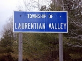
Laurentian Valley, Ontario
Encyclopedia
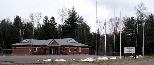
Laurentian Valley is an incorporated township in Renfrew County in eastern
Ontario
, Canada
. It borders on the Ottawa River
, the city of Pembroke
and the town of Petawawa
.
This township was created on January 1, 2000 from the former townships of Stafford-Pembroke and Alice and Fraser.
, Kathmae Siding, Locksley, Lower Stafford, Micksburg, Pleasant View, Shady Nook, Stonebrook and Trautrim Subdivision.
:
Population trend:
Eastern Ontario
Eastern Ontario is a subregion of Southern Ontario in the Canadian province of Ontario which lies in a wedge-shaped area between the Ottawa River and St. Lawrence River...
Ontario
Ontario
Ontario is a province of Canada, located in east-central Canada. It is Canada's most populous province and second largest in total area. It is home to the nation's most populous city, Toronto, and the nation's capital, Ottawa....
, Canada
Canada
Canada is a North American country consisting of ten provinces and three territories. Located in the northern part of the continent, it extends from the Atlantic Ocean in the east to the Pacific Ocean in the west, and northward into the Arctic Ocean...
. It borders on the Ottawa River
Ottawa River
The Ottawa River is a river in the Canadian provinces of Ontario and Quebec. For most of its length, it now defines the border between these two provinces.-Geography:...
, the city of Pembroke
Pembroke, Ontario
Pembroke is a city in the province of Ontario, Canada, at the confluence of the Muskrat River and the Ottawa River in the Ottawa Valley...
and the town of Petawawa
Petawawa, Ontario
Petawawa is a town located in eastern portion of Southern Ontario. Situated in the Ottawa Valley, with a population of 14,651 . Petawawa is the most populous municipality in Renfrew County.-Geography:...
.
This township was created on January 1, 2000 from the former townships of Stafford-Pembroke and Alice and Fraser.
Communities
The township comprises the communities of Alice, Cotnam Island, Davis Mills, Fairview, Forest Lea, French Settlement, Gorr Subdivision, Government Road, Greenwood, Hiam, Huckabones Corners, IndianIndian, Ontario
Indian is an unincorporated place and former railway point in the incorporated township of Laurentian Valley in Renfrew County, eastern Ontario, Canada...
, Kathmae Siding, Locksley, Lower Stafford, Micksburg, Pleasant View, Shady Nook, Stonebrook and Trautrim Subdivision.
Demographics
According to the Canada 2006 CensusCanada 2006 Census
The Canada 2006 Census was a detailed enumeration of the Canadian population. Census day was May 16, 2006. The next census following will be the 2011 Census. Canada's total population enumerated by the 2006 census was 31,612,897...
:
- Population: 9,265
- % Change (2001-2006): 6.1
- Total Private Dwellings: 3,506
- Area (km².): 552.44
- Density (persons per km².): 16.8
Population trend:
- Population in 2006: 9265
- Population in 2001: 8733
- Population in 1996: 8978 (combined figure for former townships)
Budget
For the 2010-2011 fiscal year, the township will spend .